This document presents a case study evaluating the impacts of integrating small-scale greenspace into an urban alleyway in Downtown Los Angeles called Harlem Place. The authors developed conceptual models for five ecosystem services and created six design scenarios for Harlem Place to illustrate how interstitial greenspace could impact those services. Their results found that permeable pavement and bioswales had the greatest impact on mitigating stormwater issues, while tree planting most improved air quality and microclimate locally. The conceptual models and case study aim to help communities understand how to design small-scale greenspace projects that provide local benefits while also addressing regional environmental issues.
1. Evaluating the Impacts of Small-Scale Greenspace:
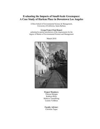
A Case Study of Harlem Place in Downtown Los Angeles
A Bren School of Environmental Science & Management,
University of California, Santa Barbara
Group Project Final Report
submitted in partial satisfaction of the requirements for the
degree of Master of Environmental Science and Management
March 2010
Project Members:
Theresa Morgan
Kathryn Riley
Rebecca Tannebring
Leanne Veldhuis
Faculty Advisor:
Christina Tague
2.
3. Evaluating the Impacts of Small-Scale Greenspace:
A Case Study of Harlem Place in Downtown Los Angeles
As the authors of this Group Project report, we are proud to archive this report on the
Bren School‘s website such that the results of our research are available for all to
read. Our signatures on the document signify our joint responsibility to fulfill the
archiving standards set by the Bren School of Environmental Science & Management.
______________________________________________________
Theresa Morgan
______________________________________________________
Kathryn Riley
______________________________________________________
Rebecca Tannebring
______________________________________________________
Leanne Veldhuis
The mission of the Bren School of Environmental Science & Management is to
produce professionals with unrivaled training in environmental science and
management who will devote their unique skills to the diagnosis, assessment,
mitigation, prevention, and remedy of the environmental problems of today and the
future. A guiding principal of the School is that the analysis of environmental
problems requires quantitative training in more than one discipline and an awareness
of the physical, biological, social, political, and economic consequences that arise
from scientific or technological decisions.
The Group Project is required of all students in the Master of Environmental Science
and Management (MESM) Program. It is a four-quarter activity in which small
groups of students conduct focused, interdisciplinary research on the scientific,
management, and policy dimensions of a specific environmental issue. This Final
Group Project Report is authored by MESM students and has been reviewed and
approved by:
____________________________________________
Christina Tague
March 2010
4.
5. March 2010
Acknowledgements
We would first like to thank our advisor, Professor Christina Tague, not only for her
patience, thoughtful advice and experience, but also her enthusiasm for our topic and
willingness to read-and reread-the multiple iterations of our drafts and presentations.
We would also like to thank our clients Ashley Zarella-Hand and Gunnar Hand with
the Downtown Los Angeles Neighborhood Council. Without their dedication and
hard work to develop a greening strategy for their community in Los Angeles, and the
enthusiastic stakeholders they connected us with, our project and research aims may
never have gotten off the ground.
We would also like to thank the many experts and professors who also provided
guidance for our project, including Dr. Joe McFadden and Dr. Arturo Keller, as well
as Dr. Stephanie Pincetl, Dr. David Nowak, and Dr. Jennifer Wolch. We would also
like to thank the many design and planning professionals who volunteered their time
to help us brainstorm designs and create compelling visuals. In particular, thanks to
Josh Segal and the AECOM Design + Planning team for hosting a design workshop
for our project, as well as Lauren Takeda, Stewart Patterson and Jason Wickert for
their valuable contributions.
v
6. Abstract
The ecological, economic, and social impacts of greenspace have been studied
extensively. Currently, however, no comprehensive model exists that provides both a
conceptual framework for how to approach greenspace projects on a small-scale, and
demonstrates how to assess the impacts of small parcels of urban greenspace on
relevant ecosystem services. We used Harlem Place, an alley in Downtown Los
Angeles, as a case study to assess the ecological and social impacts of integrating
small-scale greenspace into an urban setting where open space is severely limited.
Using literature reviews, expert opinion, and modeling, we developed conceptual
models for five urban environmental issues that communicate key design
considerations and important constraints and tradeoffs to consider when attempting to
maximize ecosystem services on local and regional scales. We designed six
greenspace scenarios to illustrate the application of our conceptual models to evaluate
impacts of interstitial greenspace on urban ecosystems. Permeable pavement and
bioswales had the greatest impact on mitigating stormwater issues on a regional level.
Benefits of greenspace affecting the immediate neighborhood were related to
microclimate and livability. Our results serve to build a foundation for a long-term
greening strategy and outreach tool for our client, the Downtown LA Neighborhood
Council’s Sustainability Committee.
vi
7. Executive Summary
I. Project Background and Significance
Currently, more humans live in urban environments than any other land use type, and
this trend is accelerating. Urban greenspace was historically planned to exist as large
parks in distinct settings within a city to provide respite for city residents. With
increasing human-dominated land use, there is a decline in available undeveloped
land to provide natural amenities and environmental services. A new trend in urban
planning is to consider integrating greenspace into the already existing fabric of our
city layouts. Instead of serving only as a recreational destination, greenspace can be
designed and planned to increase walkability and aesthetic appeal throughout a city.
Many cities, including Los Angeles, are facing problems associated with lack of open
space and lack of ecosystem services that are provided by greenspace. Specifically,
Downtown L.A. has a high proportion of commuters, resulting in problems of
increased commuter miles, vehicular air pollution, and little sense of community
ownership. However, as shown by a 20% increase in the residential population since
2007, the area is experiencing a shift whereby the demand for mixed-use living within
the Downtown core is increasing. With only 30% of Los Angeles residents living
within walking distance of a nearby park (Sherer, 2003), there is a clear need for
more open spaces and natural amenities in the Downtown.
In addition to providing aesthetic appeal, urban greenspaces have the potential to
provide ecosystem services, which can mitigate urban environmental and human
health problems. Generally, there is little debate that greenspace provides ecosystem
services. However, it is challenging to pinpoint the specific impacts of a greenspace
design for a particular location, climate, and group of stakeholders. Furthermore,
while much research has been conducted to quantify the impacts of larger scale
greenspace areas, there is a lack of information on the effects of redeveloping smaller,
interstitial areas. Currently, no comprehensive model exists that provides both a
conceptual framework for how to best approach small-scale greenspace projects, and
an assessment of the impacts of small parcels of urban greenspace on relevant
ecosystem services. Our work in these areas will assist our client, the Sustainability
Committee for the Downtown Los Angeles Neighborhood Council, in creating a
long-term greening strategy for Downtown L.A.
The Sustainability Committee works with local stakeholders to understand and
articulate the needs of the community, but lacks information on the potential value of
small-scale greenspace in order to convey its importance and mobilize support. Based
on input from our client and Downtown L.A. residents, we chose to use Harlem
Place, an alleyway in Downtown L.A., as a case study to demonstrate how to quantify
the ecosystem services impacts of small-scale greenspace on a site-specific basis.
vii
8. To improve knowledge of small-scale greenspace, our project completed the
following goals:
o Developed conceptual models for five urban environmental issues to
communicate key design considerations and important constraints and
tradeoffs to consider when trying to maximize ecosystem services on local
and regional scales.
o Created six greenspace design scenarios for Harlem Place in order to illustrate
the application of conceptual models and to evaluate the impacts of interstitial
greenspace on ecosystem services.
Our conceptual models play a critical role in providing local communities and
municipalities with tools to rethink how greenspace can be utilized on the small-scale.
This is done first by recognizing an issue that needs to be addressed, such as
stormwater management. Second, the conceptual models highlight an ecosystem
service, such as flood control, to mitigate the issue. Third, the models illustrate how
implementing various design features, such as permeable pavers or vegetation, will
allow for the desired ecosystem service. Finally, the models provide constraints
associated with each issue and design feature, to reveal possible limitations, and
maintenance needs to ensure a greenspace design operates as intended.
II. Harlem Place as a Case Study: Approach & Assessment
Design Scenarios
We created six different greenspace design scenarios for Harlem Place and measured
the impacts on five ecosystem services: air quality, stormwater runoff and water
quality, urban heat island mitigation, carbon dioxide mitigation, and livability.
Quantitative Models
Currently, no single model or software exists to measure the impacts of ecosystem
services on a small-scale. Therefore, we used a combination of iTree Streets and L-
THIA, coupled with our own calculations and a literature review to fill knowledge
gaps. To quantify air particulate capture, building energy loads, and carbon
sequestration, we used the iTree Streets model developed by the US Forest Service to
measure the effects of urban street trees. iTree quantifies the deposition of air
pollutants onto tree leaves for each tree species built into the model. To quantify
stormwater runoff in Harlem Place, we used L-THIA, a long-term hydrologic impact
assessment model, created by Purdue University, the U.S. EPA, and the Indian Creek
Watershed Alliance. We calculated the effects of variations in permeable pavers,
vegetation, and greenwalls on stormwater runoff in each of our six design scenarios.
After running iTree and L-THIA, information gaps still existed when measuring
impacts of interstitial greenspace. Therefore, we used literature review to fill these
knowledge gaps and cross-reference our findings.
viii
9. III. Results and Conceptual Models
Local vs. Regional Impacts
Ecosystem services can be both social and biophysical in nature, and impacts will
differ between local and regional scales. At a regional scale, the impact of greening a
single alley is negligible. However, the aggregate effects of interstitial greenspace can
be significant. In Los Angeles, stormwater management and air quality are issues of
regional concern. For example, urban runoff and water quality affect the Santa
Monica Bay and the watersheds of L.A., but can be addressed via smaller, local
projects if many redevelopments occur throughout the region. Small-scale greenspace
can also have impacts on air quality. Again, however, it is the cumulative effects of
many interstitial greenspace projects that will result in measurable improvements in
air quality. Harlem Place is in compliance with three major air pollutants, SO2, NO2,
and PM10, but does not meet EPA standards for ozone, despite greening the alleyway.
Therefore, addressing air quality in L.A. via small-scale greenspace may not be the
most effective use of resources.
At a local scale, we used our client‘s survey to determine that Harlem Place residents
are primarily concerned with livability (i.e., 20% of residents are concerned with
appearance and trash/litter) in the immediate vicinity of their neighborhood.
However, when asked to rate their level of concern from low to high for issues such
as reduction in stormwater runoff and pollutions, air quality, and microclimate, more
residents rated air quality(73%) and access to recreational park space (77%) as a high
concern. Although residents rated ecological functions (e.g., air quality) as a high
concern, the reality is that residents are more concerned with the aesthetics when
considering the impacts of greenspace specific to Harlem Place. Additionally,
livability is much more difficult to quantify than reductions in stormwater and air
pollution. Affording people the opportunity to relax and walk within an aesthetically
pleasing space can increase use, thereby increasing safety and community interaction,
and perhaps build support for more projects to achieve biophysical results on a larger
regional scale. Generally, we found that stormwater and air quality were the most
easily quantifiable ecosystem services in Harlem Place, but residents expressed more
concern about air quality than stormwater.
Community or regional concerns, in addition to community input and political
support will dictate which ecosystem services are valued by stakeholders. Designs for
small-scale greenspace can be optimized to improve specific ecosystem services;
however, there are tradeoffs in meeting the priorities of both the local and regional
stakeholders. Thus, greenspace design needs to be tailored to the constraints of the
site and the needs of the stakeholders.
Role of Design Choices
When discussing interstitial greenspace, variations in design features result in
different impacts on ecosystem services. A comparison of our scenarios in Harlem
ix
10. Place revealed that permeable pavers and bioswales have a greater effect on reducing
stormwater runoff and increasing pollutant removal than do trees and shrubs. This
greater impact is due to the constrained amount of land available for vegetation
planting in alleyways. Design scenarios that incorporated greater amounts and
distribution of permeable pavements and bioswales can capture close to all
stormwater runoff in Harlem Place. Air pollution and microclimate was improved
most in designs that included various tree species, due to increased shading and
evapotranspiration. The urban heat island effect was the most difficult to model and
to quantify. Microclimate improvements by mitigating the urban heat island effect is
primarily a local impact that pedestrians will notice walking through the alleyway as
they experience cooler, more pleasant temperatures. From literature review, a
pedestrian walking under the immediate shade canopy of a tree can experience a
range of 4˚C to a 20˚C decrease in temperature during prime daylight hours.
Greenwalls can add an additional 2˚C cooling effect to the proximate area.
Spatial and regulatory constraints largely determine what types of small-scale
greenspace designs are feasible. Greenspace projects, such as Harlem Place, require
significant creativity in design to maximize impacts. Regulations in L.A. required our
project to maintain vehicle access to Harlem Place, which significantly reduced
available space for vegetation. Our physical site surveys and in-depth investigation of
regulatory constraints were critical to being creative and identifying underused areas,
such as nodes, that could be transformed into functional greenspace.
IV. Discussion & Concluding Thoughts
We used Harlem Place as a case study to create a tangible prototype that demonstrates
the potential impacts of greenspace integration in underutilized urban spaces. We
identified how to think about small-scale greenspace, how to quantify impacts that are
both measurable and intangible, and how to design a small-scale greenspace when
regulatory and spatial constraints are imposed. The conceptual models produced
through our work serve as a design framework to guide future greenspace projects
that require a tailored approach. While many of the impacts we modeled were local,
interstitial greenspace could have provide substantial regional improvements to
ecosystem services if similar projects were replicated throughout an entire region. As
urbanization continues to increase, small-scale greenspace will play a pivotal role in
providing healthy, livable urban environments. Quantification of the ecological
impacts will help build political and community support to create and maintain
sustainable urban greenspace projects. We recommend that in designing small-scale
greenspace projects, planning should consider both local and regional perspectives
and include community, policy, and professional stakeholders. Our project reveals the
approach necessary to rethink what urban greenspace can be and how to effectively
integrate the natural environment into the built environment.
x
11. Table of Contents
Acknowledgements ......................................................................................................v
Abstract ...................................................................................................................... vi
Executive Summary .................................................................................................. vii
I. Project Background and Significance.................................................................. vii
II. Harlem Place as a Case Study: Approach & Assessment ................................. viii
III. Results and Conceptual Models ......................................................................... ix
IV. Discussion & Concluding Thoughts ................................................................... x
Figures ...................................................................................................................... xiii
Tables ........................................................................................................................ xiii
INTRODUCTION AND PROJECT GOALS ...........................................................1
Is There Value in Small-Scale Greenspace Development? ...................................... 1
Project Goals ............................................................................................................. 1
1 Greenspace and Ecosystem Services .......................................................................2
1.1 Historical Role and Definition of Urban Greenspace ..................................... 2
1.2 General Ecosystem Services Provided by Greenspace ................................... 2
1.3 Current Knowledge Base of Urban Greenspace ............................................. 3
1.4 Value of Interstitial Greenspace...................................................................... 5
1.5 Need for Conceptual Framework .................................................................... 5
2 Downtown Los Angeles Overview ...........................................................................6
2.1 Current Greenspace Issues in Downtown Los Angeles .................................. 6
2.2 Political Climate and Support for Green Infrastructure .................................. 7
2.3 Client Need ..................................................................................................... 9
2.4 Overview of Case Study Site: Harlem Place Alley ........................................ 9
3 Methods Justification .............................................................................................11
3.1 Selecting Relevant Ecosystem Services........................................................ 11
3.2 Methodology for Vegetation Selection ......................................................... 12
4 Assessing Small-Scale Greenspace ........................................................................15
4.1 Models........................................................................................................... 15
4.2 Design Feature Options................................................................................. 17
4.3 Design Scenarios ........................................................................................... 20
4.4 General Constraints ....................................................................................... 23
4.5 Cost Considerations for Small-Scale Greenspace......................................... 27
xi
12. 5 Results and Conceptual Models ............................................................................33
5.1 Stormwater ........................................................................................................ 33
5.2 Urban Heat Island Effect .................................................................................. 47
5.3 Air Quality ........................................................................................................ 55
5.4 Mitigation of Carbon Dioxide Emissions ......................................................... 63
5.5 Livability ........................................................................................................... 66
6 Discussion ................................................................................................................75
6.1 Issues of Scale and Extrapolation to Regional Scale ........................................ 75
6.2 Summary of Results .......................................................................................... 76
6.3 Key Findings and Implications ......................................................................... 77
6.4 Broader Implications ......................................................................................... 78
7 Concluding Thoughts .............................................................................................81
8 References ................................................................................................................82
Appendix A: Images of Harlem Place Alley ............................................................93
Appendix B: iTree and L-THIA Model Guidance Documents .............................97
Appendix C: DLANC Survey Questions and Results ..........................................101
Appendix D: Harlem Place Physical Site Survey ..................................................104
xii
13. List of Figures
Figure 2.1: Map of Los Angeles Tree Canopy Cover .………………...........................7
Figure 2.2: Map of Harlem Place………………………………….............................10
Figure 4.1: Picture of Nodes.......………………………………….............................25
Figure 5.1: Conceptual Model for Stormwater …………..……….............................37
Figure 5.2: Percentage Pollutant Removal for Maximum Area Design………..……40
Figure 5.3: Reduction in Water Pollutant Concentration..…..…….…………………41
Figure 5.4: Percent Removal of Pollutants in Each Design Scenario……………….. 42
Figure 5.5: Runoff Reduction from Harlem Place………….......................................44
Figure 5.6: Conceptual Model for Urban Heat Island Effect ………………………..47
Figure 5.7: Urban Heat Island Profile. ……………………………………………….48
Figure 5.8: Urban Environment Albedos…………………………………………….50
Figure 5.9: Conceptual Model for Air Quality………………………………………55
Figure 5.10: Health Impacts of Air Pollution.........................................................….56
Figure 5.11: Deposition of Air Pollutants.......................................................……….59
Figure 5.12: EPA Air Quality Standards vs. Harlem Place Reductions……………..61
Figure 5.13: Conceptual Model for Mitigation of Carbon Dioxide Emissions...........63
Figure 5.14: Conceptual Model for Livabilty.……………………………………….67
Figure 5.15: Issues of Concern to Harlem Place Residents………………………….69
Figure 5.16: Rated Level of Concern………………………………………………...72
Figure 6.1: Sample of AECOM Visuals of Harlem Place Greenspace Design……...79
List of Tables
Table 3.1: Questions Used to Select Vegetation……………………………………..14
Table 3.2: Tree Species Selected…………………………………………………….15
Table 4.1: Summary of Cost Estimates………………………………………………20
Table 5.1: Pollutant Removal Capacity……………………………………………...40
Table 5.2: Runoff Leaving Harlem Place...………………………………………….44
Table 5.3: Stormwater Capture Potential….…………………………………………46
Table 5.4: Pollutant Reduction in Maximum Area Design Scenario…..…………….46
Table 5.5: Air Pollutant Reduction for Hackberry vs. Planetree….…………………60
Table 5.6: EPA Secondary Air Quality Standards..………………………………….61
Table 5.7: Carbon Sequestration Estimates………………………………………….66
Table 5.8: DLANC Survey Responses...…………………………………………….72
xiii
14. INTRODUCTION AND PROJECT GOALS
Is There Value in Small-Scale Greenspace Development?
The broad ecological, economic, and social impacts of urban greenspace have been
studied extensively. However, information regarding the impacts of small-scale, or
interstitial, greenspace in urban environments is limited. No comprehensive model
currently exists that provides both a conceptual framework for how to best approach
small-scale greenspace redevelopment projects and demonstrates how to assess the
relevant ecosystem service impacts of small parcels of urban greenspace. Our project
fills this gap in information by assessing the value of small parcels of greenspace on
both a local and regional scale.
Using Harlem Place, an alley in Downtown Los Angeles, as a case study, we
demonstrate how to create a tailored approach to quantify biophysical and social
impacts of small-scale greenspace. This conceptual framework serves to encourage
local communities and municipalities to rethink how greenspace can be integrated
into urban environments. Smaller localized impacts have the potential to create
significant effects in the immediate vicinity of a neighborhood in addition to
cumulative effects when implemented on a broader regional scale.
Project Goals
To improve knowledge of small-scale greenspace, our project seeks to:
o Develop conceptual models for five urban environmental issues to
communicate key design considerations and important constraints and
tradeoffs to consider when trying to maximize ecosystem services on local
and regional scales.
o Create six greenspace design scenarios for Harlem Place in order to illustrate
the application of conceptual models and to evaluate the impacts of interstitial
greenspace on ecosystem services.
1
15. 1 Greenspace and Ecosystem Services
1.1 Historical Role and Definition of Urban Greenspace
Urban centers have been planned without significant focus on integrating the natural
world into the built environment. Urban environments typically suffer from water
pollution, air pollution, and increased temperatures. Greenspace in urban areas can
provide basic environmental and social services that greatly impact the quality of life
of city residents. These services, defined as ―ecosystem services‖ provide
management of stormwater runoff, air quality, carbon sequestration, and temperature
regulation, in addition to human health, well-being, and aesthetically pleasing
surroundings. Traditionally, greenspace is defined as large, distinct open spaces. This
type of destination park land provides places for people to visit, but does not
incorporate ecological functioning into the immediate environment that people use on
a daily basis. A classic example of traditional greenspace is Central Park in New
York City, where numerous residents and visitors go to for nature in the city.
Greenspace provides places for social interaction, physical activity, and freedom of
expression. Research supports the evidence that greenspace not only provides
ecological function in cities, but also adds to the economic and livability aspects of
cities (Bolund & Hunhammar, 1999; Li et al., 2005; Matsuoka et al., 2008; Ridder et
al., 2004). Improving the environmental health and appeal of cities may reduce
suburban sprawl, promote greenspace development, reduce per capita natural
resource use in terms of transportation and building energy demands, and increase
community interaction.
Locations designated as greenspace tend to have large amounts of open space, ample
vegetation, and frequently have some type of recreation opportunity, such as a
playground or basketball court. Today, most cities are fully developed, with limited
space available to add new large parks or greenways. The use of interstitial, or small-
scale, greenspace has often been overlooked as a viable option for providing
greenspace and its respective ecosystem services. As a result, a new challenge for
urban planning is reincorporating smaller patches of greenspace into existing built
infrastructure.
1.2 General Ecosystem Services Provided by Greenspace
Ecosystem services are the benefits people derive from nature and are classified into
four general categories: provisioning (food, freshwater), regulating (climate
regulation, erosion, control), supporting (seed dispersal, primary production), and
cultural (cultural inspiration, recreational experience) services (Millennium
Ecosystem Assessment, 2005). Ecosystem functions include biotic, bio-chemical and
abiotic processes, all of which occur within and between ecosystems (Turner et al.,
2005; Brussard et al., 1998). Multiple ecosystem services can be provided from each
of these functions; de Groot et al. (2002) identifies a non-exhaustive list, identifying
approximately 32 ecosystem services, including biological, physical, aesthetic,
2
16. recreational and cultural. Cultural, psychological and other non-material benefits that
humans derive from contact with ecosystems contribute to human health and well-
being in urban settings (Butler & Oluoch-Kosura, 2006).
People rely on ecosystem services, both directly and indirectly, to enhance their
quality of life and provide the basic necessities of life—food, fiber, climate
regulation, and protection from contaminants However, humans have changed
ecosystems more rapidly and to a greater extent in the last 50 years than in any other
period in history (Rodriguez et al., 2006). This ecological degradation has resulted
from meeting the demands of human population growth for food, fresh water, timber,
fiber, and fuel. In the past, urban areas depended on surrounding rural land to provide
many of these ecosystem services. The growth of urban centers and subsequent
changes in the surrounding open space, however, makes it increasingly important for
cities to provide natural environments within their boundaries to supply residents with
basic ecosystem services. These services have a significant impact on the quality of
urban living, and should be considered in land-use planning and major development
plans (Bolund & Hunhammar, 1999). ―Green Cities‖ that successfully integrate
ecological functioning into the urban fabric provide clean air and water, pleasant
streets and parks, and minimize their ecological footprint. They are also resilient to
occurrences of natural disasters and encourage green behavior such as the use of
public transit (Kahn, 2006).
1.3 Current Knowledge Base of Urban Greenspace
Urban greenspace provides various social, economic, and ecological benefits,
including social interaction and community development (Balram & Dragi´cevi,
2005). Ecosystem services provided by greenspace, such as flood control, air
particulate capture, and climate regulation, have been studied extensively and their
general range of impacts are relatively well understood. For example, there is a great
deal of literature on street trees in cities. Urban forests absorb air pollution and
particulates (as much as 7000 dust particles/liter of air), block incoming solar
radiation (up to 95% in some areas), reduce building energy use by up to 50%, and
transpire 100 gallons of water each day of the growing season (equivalent to the
cooling effect of 5 air conditioners running for 20 hours) (Girling & Kellett, 2005).
Ecosystem services associated with livability and aesthetics have also been studied in
depth, but because they are not easily quantifiable and are highly dependent on
stakeholder interests, these services are usually discussed in economic or qualitative
terms. The availability of natural open space has been shown to promote social
interaction and increase sense of community (Kim & Kaplan, 2004). Stewart et al.
(2004) found that the presence of public or semi-public outdoor gathering places
promotes community identity. This study also found that by designing the space in a
manner that connects people with each other and to places of interest in their local
landscape, the desirable end-state of planning is more complete and opportunities for
community building are increased.
3
17. Urban planners increasingly recognize how spending time in urban green spaces has
the potential to reduce stress, alleviate headaches, and increase an overall sense of
balance (Hansmann et al., 2007). Open space encourages exercise, which increases
health and lowers the risk of disease, as well as alleviating anxiety and depression
(Sherer, 2003). A review of 16 years of Landscape and Urban Planning (LUP)
contributions analyzed studies addressing the issue of contact with nature in urban
settings and various ways that contact with nature contributes to improved quality of
life, ―even if the encounter is only a brief opportunity‖(Matsuoka & Kaplan, 2008
p.9). These studies illustrate the consistent message that urban residents greatly value
nearby natural environments in their community (Matsuoka & Kaplan, 2008). A
study by Schell (1999) suggests that urban planners, landscape architects, and citizen
groups should recognize these desires as they attempt to mitigate the loss of natural
landscape due to growing urbanization and sprawl.
Recently, governments, communities, and environmental organizations in many
developed nations have begun to recognize the importance of incorporating
greenspace into sustainability management plans. Ecologists also recognize the role
that complex urban ecosystems play in mitigating urban environmental problems and
improving quality of life in densely populated cities. Examples of greening projects
include New York‘s PlaNYC2030, developed to increase the quality of life for New
Yorkers and reduce GHG emissions by 30% (Schell, 1999). The plan ensures that all
residents live within a 10-minute walk of a park, brownfields are remediated, and
90% of waterways are open for recreational use. It also plans for 1800 miles of
bicycle lanes, one million tree plantings, and improved pedestrian movement (Schell,
1999). According to the PlaNYC2030 Progress Report, New York‘s sustainability
plan is on track and over two-thirds of the plan‘s initiatives are complete or on time
(2009).
Other examples reveal how green space can be tailored to meet specific local needs.
After widespread damage from El Nino mudslides in Bahia de Craquez, Ecuador, the
city declared itself an ―Ecological City.‖ With the help of the Planet Drum
Foundation, the city raised awareness of urban environmental issues and replanted the
barrio with native trees, using vegetation to reduce mudslide risk. The City of Bogota
implemented a 45-km greenway, as well as a network of integrated bicycle paths, and
citywide closures of selected roads during non-peak hours. In an arid, warm climate
similar to that of Los Angeles, the city of Melbourne removed pavement and designed
building facades to accommodate and engage pedestrians. As a result, the city
experienced a 40% increase in pedestrian traffic and witnessed increased jobs and
property values (Newman & Jennings, 2008).
4
18. 1.4 Value of Interstitial Greenspace
The ecological, economic, and social services provided by greenspaces, such as large
parks, trees, and Low Impact Development (LID) methods, have been studied
extensively in the academic arena. Existing studies, discuss greenspace concepts and
issues on a regional scale, yet few studies have looked at what the local impacts of
ecosystem services provided by greenspace. For example, the influence of greenspace
on biodiversity or stormwater runoff can occur at different spatial scales, both locally
and regionally. The impacts of small-scale greenspace are not well understood, but
could have a substantial effect if designed according to site specifics and if similar
projects were replicated throughout a region. Understanding the local effects of small
units of greenspace can lead to a more comprehensive approach to meeting regional
planning goals for sustainability.
We find it necessary to question what contribution local environmental impacts have
on the regional scale. In other words, how do you determine if there is value in small-
scale, interstitial greenspace redevelopment projects in dense, urban areas? Who
stands to benefit? With limited space for greenspace development in cities, the
environmental and social impacts of small-scale greenspace merit a more in-depth
analysis, especially if the cumulative effects of localized greenspaces may be
significant to policymakers on a regional scale. Although direct ecological impacts
may vary, the aesthetic and social value of nature interspersed in urban areas can
reverberate throughout the entire local community. Future planners and community
residents will need to reconsider what greenspace can look like in compact cities and
begin to integrate more of the natural environment back into the built environment.
1.5 Need for Conceptual Framework
Generally, there is little debate that greenspace provides valuable ecosystem services.
However, this issue becomes more challenging when a greenspace design is targeted
in a micro scale and specified for a particular location and climate. The effectiveness
of a bioswale or tree in one location may vary greatly from the impacts in another
city. This can have enormous consequences when attempting to accurately evaluate
the impacts of greenspace redevelopment. Literature reviews, theoretical models, and
even field data are typically the basis for most greenspace project assessments.
Unfortunately, it is difficult to translate this general knowledge about large-scale
greenspace into information that is valuable for a particular project site, and even
more so when that site only covers only a small parcel of land. Furthermore, even if
well-known data exists for a particular component of greenspace, there still exists a
great deal of uncertainty in the literature and existing models.
Therefore, determining the optimal design for smaller-scale projects requires a more
tailored approach. A conceptual framework is needed to address the challenges
involved with applying general knowledge of greenspace impacts to specific small-
scale greenspace projects. Creating conceptual frameworks for ecosystem services is
one of the main goals of our project. While our conceptual models have been made
5
19. with Downtown Los Angeles as a template, the ideas behind the models are
transferable to any urban setting. Additionally, this framework provides local
governments, planners, and community organizations with a roadmap for increasing
urban greenspace and enabling goal-driven greenspace designs to achieve maximum
benefits.
2 Downtown Los Angeles Overview
2.1 Current Greenspace Issues in Downtown Los Angeles
With only 30% of Los Angeles residents living within a ¼ mile of a park there is
clearly a need for more open spaces Downtown (Sherer, 2003). Other cities, such as
Boston and New York, provide parks that enable 80-90% of its residents to be within
¼ mile of open space. Having already developed into a dense urban center, it would
be difficult for L.A to find space for large parks. Furthermore, ―given that Los
Angeles also faces an extreme housing shortage, especially of affordable housing,
designating land for park development often represents an unacceptable trade-off
between scarce housing and park provision‖ (Pincetl, 2005, p. 368). For this reason,
greenspace as a small-scale entity integrated into the building infrastructure of the
Downtown could be a workable compromise between the need for housing and the
desire for parks.
Downtown Los Angeles is an urban area with many environmental and livability
issues. The Downtown is an area with ten times as many workers as residents,
resulting in problems of increased commuter miles, little sense of community
ownership, and lack of large public greenspace. Since 2007, however, a 20% increase
in the Downtown residential population shows that this commuter trend may be
reversing and more people are choosing to live in the city (Zarella, 2009). This influx
of new residents exacerbates the existing environmental and social issues in the area.
Downtown Los Angeles residents do not have much access to traditional greenspace.
As seen in Figure 2.1, tree canopy cover in Downtown L.A. (area 52) is less than
10%, demonstrating an overall lack of vegetation. Therefore, utilization of greenspace
on a small scale has the potential to provide the ecosystem services in Downtown Los
Angeles typically obtained from large urban parks. Integrating multifunctional
greenspaces into existing urban infrastructure increases the livability of densely
populated urban areas by providing recreational space, ecosystem services, and
aesthetic appeal.
6
20. Figure 2.1 Tree cover canopy map of Los Angeles County. Area 52 signifies Downtown L.A.
Note that the Downtown is in the lowest bracket of canopy cover percentage, or < 10%.
Source: USDA Forest Service, 2006
2.2 Political Climate and Support for Green Infrastructure
The political climate of L.A. is increasingly receptive to open space initiatives, as
demonstrated by the recent passage of several progressive city ordinances. L.A.‘s
long-term General Plan developed by the Department of City Planning, includes a
chapter on open space and conservation, demonstrating a commitment to reconciling
the inherent conflict between development pressure and open space conservation
(Envicom Corporation, 1995) Early strides made towards open space conservation
include the 1992 passage of Proposition A, which allocated $550 million for parks
($126 million of which designated specifically for L.A. city parks), and the passage of
7
21. Proposition K in 1996, a park bond worth $750 million for L.A. county and $25
million annually for the next 25 years (―Proposition 40,‖ 2008).
More advances for open space conservation came in 2002 with the passage of
Proposition 40 (the CA Clean Water, Clean Air, Safe Neighborhood Parks, and
Coastal Protection Act), which provided $1.186 million to CA State Parks, with $956
million towards local parks. In May 2007, the L.A. Board of Public Works (BPW)
adopted its Green Streets Initiative, ―to promote, advance and evaluate the
implementation and design of streets and parking lots to maximize capture and
infiltration of urban runoff and to increase nature services and community
beautification benefits‖ (Daniels, 2008, pg. 7). The Green Streets Initiative sought to
proactively handle water quality issues in the city, but also acknowledge the various
impacts of green streets, such as decreased urban heat island effect and aesthetic
improvements for the city. The Green Streets Initiative Committee is currently
identifying pilot projects, sourcing funding options, creating design criteria for green
streets, and synthesizing knowledge from experts and academics (Daniels, 2008).
The City Council motioned for the creation of a feasibility report for implementing a
Green Alley Program on January 15, 2008. The Green Alleys Program would be
similar to an existing program in Chicago, which retrofits alleyways with green
design features and permeable pavement to reduce stormwater runoff and create
aesthetically appealing neighborhoods. In October 2008, the BPW produced the
requested feasibility study, which stated that more than 900 miles of alleyways exist,
widely distributed across L.A., which could be utilized for the Green Alley Program.
This supplements a March 2008 study which found that ―nearly 40% of L.A. County's
needs for cleaning polluted runoff could be met by implementing low impact
development (LID) projects on existing public lands‖ (Daniels, 2008, p. 4). L.A. is
beginning to recognize the value of ecosystem services, and is becoming increasingly
committed to the idea of open space conservation, not just for environmental reasons
but for social and aesthetic as well (Daniels, 2008).
Currently, a prominent tree planting initiative in L.A. is the Million Trees L.A.
project (Daniels, 2008). This project performed a tree canopy analysis in L.A. to
identify areas that are lacking in canopy cover. It also quantified future benefits
associated with planting one million trees. A Canopy Cover Assessment Final Report
was submitted as an overview of the project and includes an overview of the history
of L.A.‘s urban development and the Initiative, as well as the cost and benefits of
urban forests.
Recent California programs and legislation such as SB375 provide additional context
and political force behind the value of urban greenspace. SB375 discourages urban
sprawl as part of a larger effort to decrease California‘s GHG emissions by requiring
that the Air Resources Board develop curbing targets for passenger vehicles, largely
driven by urban sprawl (Geiselman, 2008). GHG emissions can be mitigated by
8
22. transit-oriented development, transforming commercial corridors into mixed-use
communities, expanded transit opportunities, and urban infill projects. Metropolitan
planning organizations, together with their member cities and counties, will create
sustainable community strategies that incorporate these greenspace trends.
2.3 Client Need
Our client, the Sustainability Committee for the Downtown Los Angeles
Neighborhood Council (DLANC) was recently awarded an American Institute of
Architects Sustainable Design Assessment Team grant to create a long-term greening
strategy for Downtown L.A. This strategy will address urban livability, equitable
development, resource efficiency, and community empowerment. The DLANC works
closely with local residents and businesses to understand and articulate the needs of
the community, but lacks information on the amount and types of environmental
impacts of smaller patches of greenspace in both quantitative and qualitative terms.
With this information, the DLANC could better convey the importance of small-scale
greenspace and mobilize support. Our project provides this information and assesses
the specific impacts of redeveloping the Harlem Place alleyway, one of the many
potential greenspace projects that the Sustainability Committee has identified
Downtown.
2.4 Overview of Case Study Site: Harlem Place Alley
Using literature reviews, expert opinion, and a combination of existing models, our
project evaluates the impact of implementing greenspace on a micro scale. Our study
site, known as Harlem Place, is a seven-block service alleyway that runs through
historic Downtown Los Angeles. We used Harlem Place as a demonstration project to
provide the Downtown community with a visualization of what greening in Harlem
Place could look like, in addition to what services it could provide to the community.
Figure 2.2 shows a map of Harlem Place in the L.A. Downtown Historic District.
Harlem Place runs parallel between S. Spring St. and S. Main St., and is between W.
2nd and W. 7th St. Images of Harlem Place are available in Appendix A.
9
23. Figure 2.2 Map of Harlem Place in the Los Angeles Downtown Historic District
Source: Google Earth, 2009
10
24. 3 Methods Justification
3.1 Selecting Relevant Ecosystem Services
An important step in our project was to determine which ecosystem services would be
relevant to quantify for small-scale greenspace projects like our case study, Harlem
Place. In our initial research, we focused on literature reviews of ecosystem services
provided by urban greenspace and focused on those that impact both the local
environment and human community, but could possibly be provided with interstitial
greenspace. We considered both the climate of L.A., in addition to what issues were
of highest concern to stakeholders associated with an interstitial greenspace
redevelopment. Using these considerations we addressed the following ecosystem
service issues:
1. Stormwater runoff and water pollution
2. Air quality
3. Urban heat island mitigation
4. Mitigation of carbon dioxide emissions
5. Livability
Urban areas typically benefit from the ecosystems services provided by nature outside
of city limits, but these urban areas can also greatly benefit when the services are
provided internally (Bolund & Hunhammar, 1999). Ecosystem services include
stormwater infiltration, groundwater recharge, flood control, lower temperatures in
the urban microclimate, reduced building energy demand, and improved air quality.
These services can be achieved by implementing design features such as vegetation
and permeable pavements. Ecosystem services associated with livability are more
difficult to quantify and categorize, but include benefits related to improving
livability, such as increased pedestrian activity, improved public health, increased
property values, stronger sense of community, and aesthetically pleasing
surroundings. These ecosystem services can be provided via effective, creative
greenspace designs, such as greenspace connectivity, wide traffic-calming sidewalks,
and creation of common open space.
Urban tree plantings and other Low Impact Development (LID) techniques have been
studied extensively and are relatively well understood. We focused specifically on
existing greenspace studies relevant to Southern California. For example, an NRDC
and UCSB analysis found that implementing LID practices, such as rainwater
harvesting and capture, and water infiltration into the ground at new and redeveloped
residential and commercial properties in urban southern California could increase
local water supplies by up to 405,000 acre-feet (af) of water per year by 2030. This
volume equals about two-thirds of the amount of water used annually by the entire
City of Los Angeles (Garrison et al., 2009).
11
25. We also sought out expert opinion on which ecosystem services would be best to
assess for our project. We conducted discussions and interviews with highly esteemed
professionals, including Dr. Stephanie Pincetl, Director of UCLA‘s Center on People
and the Environment; Dr. Jennifer Wolch, Dean of UC Berkeley‘s College of
Environmental Design and former Director of the Center for Sustainable Cities at the
University of Southern California who headed the Green Vision Plan for 21st Century
Southern California; Dr. Dave Nowak, Project Leader and Research Forester for the
US Forest Service; and Christina Tague and Dr. Robert Wilkinson, professors at the
Bren School of Environmental Science and Management, University of California,
Santa Barbara. Christina Tague specializes in hydrology and ecosystem processes and
Robert Wilkinson specializes in water policy, climate change, and environmental
policy issues. Each of these academic and professional experts provided valuable
insight regarding the role of greenspace in urban environments, and which ecosystem
services would be most relevant to L.A.‘s climate and group of stakeholders. We used
them as a foundation for determining relevant ecosystem services and the respective
models to assess impacts in Harlem Place.
3.2 Methodology for Vegetation Selection
Vegetation is one key component of transforming Harlem Place into a viable
greenspace. Our alleyway’s primary vegetation design features include trees, shrubs,
and greenwalls. Choosing appropriate trees for the alleyway was an important part of
maximizing the ecosystem service potential of the greenspace, as well as satisfying
City of Los Angeles requirements for urban tree plantings. We narrowed our selection
of trees using the iTree model species selector, and various tree selection guides
(McPherson 2008; Los Angeles Department of Water and Power, 2005) for
California. Table 3.1 outlines questions we considered essential to determine the
tradeoffs involved when selecting different tree species.
12
26. Questions used to determine tradeoffs in selecting vegetation
1. Will the roots of the species warp the pavement or sidewalk?
2. What amount of maintenance will the species require to thrive in L.A. (e.g.,
pruning, leaf loss and collection, etc)?
3. What amount of irrigation will the species require to thrive in L.A.?
4. Is the species too tall or have too narrow of a canopy to provide significant
shading for pedestrians?
5. Will the species reach a height to provide sufficient shading to building
roofs?
6. Is the species prone or sensitive to damage from daily alley usage by people
or vehicles that will prevent the vegetation from thriving?
7. Is the species too small to be effectual or aesthetically pleasing?
8. Are the shrubs too tall that they pose a safety hazard for pedestrians walking
by them?
9. Will enough space be available in the alleyway to plant the greenwall base
into the ground?
Table 3.1 Questions we used to determine tradeoffs in selecting vegetation species to use in iTree to
model air quality and stormwater runoff
Using the answers to the above questions, we selected low maintenance trees that
have a tolerance for heat and drought, an affinity for sandy loam type A soils, and
trees of an appropriate size for a narrow alleyway with substantial shading capacity
and habitat potential for birds. From these trees, we chose five tree species that had
the highest ecosystem service ratings from iTree’s Air Quality parameter (Table
3.2).We also considered iTree’s Stormwater parameter – however, as iTree only
quantifies interception and not absorption from the soil, this parameter was weighed
less than Air Quality.
13
27. 3.2.1 Five Tree Species Selected
Table 3.2 Five tree species selected to use in iTree and design scenarios
14
28. 4 Assessing Small-Scale Greenspace
4.1 Models
Currently, no one model or software exists to measure the impacts of our ecosystem
services on a small scale. Therefore, we used a combination of credible available
models such as iTree Streets and L-THIA, coupled with our own calculations and a
literature review to fill knowledge gaps.
4.1.1 L-THIA
Overview and Background of L-THIA
L-THIA, a long-term hydrologic impact assessment model, is a model used to
measure the volume of runoff from different land use types, and was developed by
Purdue University, the U.S. EPA, and the Indian Creek Watershed Alliance (Engel et
al., 2004). L-THIA is based on computations of daily runoff obtained from climate
records including 30 years of precipitation data, soil data, Curve Number values, and
land uses. While L-THIA was initially used to assess the impact of land use change
on groundwater recharge, as well as the impact of suburbanization on runoff, it has
evolved to be applicable for town planning and coastal management as well as
analysis of urban sprawl development and their respective impacts for different U.S.
climate regions. L-THIA has also been used to determine the apportionment of costs
under a fee system for drainage management maintenance costs.
L-THIA is an analysis tool suited to estimate changes in runoff, recharge and
nonpoint source pollution due to past or potential land use changes. L-THIA is
capable of providing runoff depths and runoff volumes for its built-in land use types.
Land uses are categorized into: Commercial, Industrial, Residential, Open Spaces,
Parking/Paved Spaces, Water/Wetlands, Grass/Pasture, Agricultural, Forest, and
Custom Land Use. If a land use type is not available within the model, the user can
custom design a land use type by entering the Curve Number that applies to the land-
use.
L-THIA also uses built-in event mean concentration (EMC) values for common non-
point source pollutant data (Engel et al., 2004). By multiplying runoff depth for each
land use by the area of the site and the appropriate EMC value, one can calculate the
net non-point source (NPS) loads (See Appendix B). For each NPS pollutant, the total
load divided by runoff volume during a storm event yields the EMC (Baird and
Jennings, 1996).
The outputs from L-THIA include long-term average annual runoff for a land use
configuration focused on average impact. Thus, a limitation of L-THIA is its inability
to measure an extreme year or intense storm event. This is a significant consideration
for our project as typical rain events in Los Angeles are sporadic, within a short rainy
15
29. season (Ackerman & Weisberg, 2003). In addition, L-THIA models use flow
averages to determine EMC, which does not correspond to the first flush of pollutants
in a storm event; this first flush will have a higher proportion of pollutants than the
average. Additional research is needed to improve EMC estimates based on EMC
concentrations varying over the duration of a storm event (Engel et al., 2004).
Supplementary information regarding how our project tailors L-THIA inputs to
Harlem Place, as well as the hydrology and mathematics behind the L-THIA model,
can be found in Appendix B: iTree and L-THIA Model Guidance Documents.
4.1.2 iTree Streets
Overview and Background of iTree
iTree Streets is a model used to measure the impacts of urban street trees on
ecosystem services that commonly occur in cities. It was developed by a team of
researchers at the Center for Urban Forest Research in Davis, CA, run by the US
Forest Service‘s Pacific Southwest (PSW) Research Station. The iTree Streets (iTree)
application was conceived and developed by Greg McPherson, Scott Maco, and Jim
Simpson. James Ho programmed STRATUM, the Street Tree Resource Analysis
Tool for Urban Forests model, an earlier version of the iTree model. The numerical
models used by iTree to calculate tree benefit data are based on years of research by
Drs. McPherson, Simpson, and Qingfu Xiao of UC Davis (McPherson et al. 2008).
References of city data on tree growth and geographic variables were developed
under the direction of Paula Peper, Kelaine Vargas, and Shelley Gardner. Revisions
for iTree Streets versions were carried out by members of The Davey Institute, including
Scott Maco, David Ellingsworth, Michael Kerr, Lianghu Tian and Al Zelaya based on
newly available research from PSW and feedback from actual iTree users. The
manual was edited and designed by Kelaine Vargas. iTree Streets is available for
download online at http://www.itreetools.org/street_trees/introduction_step1.shtm.
iTree‘s predecessor, STRATUM, uses tree growth and benefit models for
predominant urban tree species in 17 national climate zones. Users import data
collected in a sample or complete inventory and input community specific
information (e.g., program management costs, city population, and price of residential
electricity) to customize the benefit-cost data. STRATUM uses this information to
calculate:
1. the resource's structure (species composition, extent and diversity)
2. function (the environmental & aesthetic benefits trees afford the community)
3. value (the annual monetary value of the benefits provided and costs accrued)
4. resource management needs (evaluations of diversity, canopy cover, and
pruning needs).
The iTree Streets model quantifies air pollution particulate capture as a function of
leaf dry-deposition. Trees can uptake gaseous air pollution such as nitrogen dioxide
(NO2), ozone (O3), and sulfur dioxide (SO2) through the leaf stomata, where the gases
16
30. then diffuse into cells or are absorbed by water to form acids (Nowak, 2006). Many
airborne particles such as PM10 are removed from the ambient air via interception by
tree leaf surfaces, where they are temporarily stored until the particles are washed off
by rain or dropped to the ground when the leaf falls off the tree. Because of this,
while deposition removes particles from the air, it is considered an impermanent
capture solution for air pollution. Urban trees have the greatest impact on NO2, O3,
and SO2 during the daytime of the in-leaf season when trees are transpiring water.
Particulate matter removal occurs both day and night at any time of the year when
particles are intercepted by leaf and bark surfaces.
iTree ranks air pollution deposition of tree species based on various leaf and crown
characteristics (Nowak, 2008). It is assumed that dense and finely textured crowns
with complex, small, and rough leaves will capture and retain more air particles than
trees with open crowns and large, smooth leaves. Ultimately, six characteristics were
assessed: crown density, crown texture, leaf complexity, leaf size, leaf surface
roughness, and leaf margins. Using these characteristics, the iTree team incorporated
particle deposition rates and average deposition velocities to rank the tree species in
the model, particularly for PM10 capture. NO2, O3, and SO2 removal are more related
to evapotranspiration. Thus, the transpiration rates of each species and the leaf area
index, as well as average pollutant fluxes from various US cities were used to
calculate pollutant removal rates for the tree species.
For the Harlem Place case study, our project used iTree to measure air pollution
particulate capture, carbon sequestration, and reduction in building energy loads from
the selected tree species. For a step-by-step guide on how we programmed iTree for
our specific needs for Harlem Place, please see Appendix B: iTree and L-THIA
Model Guidance Documents.
4.2 Design Feature Options
Vegetated Swale or Bioswale
A vegetated swale, or bioswale, is an LID feature employed to partially treat water
runoff quality, slow and retain runoff flow, and direct runoff water. Swales are
essentially ditches, or linear open-channels with a minimum 1-3 feet excavated depth
and maximum 5% slope. Bioswales include bioretention media to increase water
retention, infiltration and water pollution removal capacity. Benefits of bioswales
include increased localized water infiltration, groundwater recharge, and avoided
water conveyance infrastructure. Bioswales can also provide multifunctional spaces
for biodiversity and aesthetic enhancement. This design option can be used in
industrial, commercial, and residential areas; common site areas within these
categories include highway medians, roadsides, and parking lots (Florida Field Guide,
2008). In areas where enhanced infiltration is desired, the bioswale can be provided
with additional gravel, pervious substrate, or underdrain beneath the swale (Fairfax
County Virginia, 2005). For sloped sites or areas receiving intense rainfall, swales
17
31. can be fitted with check dams or blocks, to slow water flow and increase residence
time in the swale. For maintenance, bioswales must be inspected and amended to
ensure vegetative cover density and health, prevent erosion, and ensure hydrological
functioning of the channel. Specifically, bioswales may require mowing and
sediment, debris, or litter removal. It is generally assumed that bioswales have a
twenty-five year lifespan before replacement is necessary (Fairfax County Virginia,
2005).
Rain Cisterns
Rain cisterns are large-scale storage tanks designed to capture runoff water from a
designated catchment area; the area is often the rooftop of a large commercial or
industrial site. Cisterns are most commonly employed to either reduce the stormwater
runoff load from a site or to provide a source of non-potable water for landscaping
irrigation or other non-potable use. Cistern sizes vary depending upon the local
rainfall characteristics and water demand (Florida Field Guide, 2008). Surface pumps
are generally needed in larger scale irrigation systems. Cisterns should be cleaned
annually and inspected to ensure seals are upholding to prevent insect infestation.
Greenwalls
Greenwalls are wall systems composed of either ―cascading groundcovers‖ or vertical
climbing plants growing on and supported by either a freestanding structure, or
structural installation on the building façade. The structural support can be a screen,
trellis, or cable system. Generally, plants are rooted in the soil space below the
structure or in planters affixed to the support structure. Greenwalls are commonly
used to reduce the urban heat island effect, buffer buildings from sound, increase
aesthetic appeal, and offer cooling via shade and evapotranspiration. These cooling
effects can reduce building air conditioning and associated energy demands (Sharp,
2007). Greenwall maintenance follows typical plant care, including watering and
pruning.
Permeable Paving
Permeable paving describes a category of paving techniques and materials for surface
walkways, roads and parking lots that enables the passage or infiltration of air and
water through the paving layer. Types of permeable paving include porous concrete
or asphalt, grass pavers, paving bricks, and permeable interlocking concrete pavers
(PICPs). Depending upon the intended use of the site, different pavers can offer more
support for heavier loads and traffic flow. Permeable paving installations are
predominantly used to reduce stormwater runoff flow, recharge groundwater,
improve water quality, and improve proximate urban tree planting health by enabling
water and air flow to soils (Brattebo & Booth, 2003). The capacity for the system to
18
32. infiltrate water depends largely on the characteristics of the sub-grade soil, or the
aggregate installed (Low Impact Development Center, Inc., 2007).
To function as intended, the surface of permeable paving must kept free of sources of
clogging such as leaf litter and trash. Additionally, runoff laden with heavier loads of
clay particles commonly leads to clogging of the porous spaces. To increase the
pavers‘ lifespan and effectiveness, periodic vacuuming and low-pressure washing is
needed to clear out voids where materials accumulate. Street sweepers with vacuums,
brushes, and water ideally should be deployed quarterly over the course of a year.
Some studies evaluating performance of permeable pavers recommend that
permeably paved parking lots be maintained annually, at a minimum (Hunt &
Stevens, 2001). However, this frequency depends on local needs such as pollutant
load, use and surrounding vegetation, and sources of street litter.
When installing PICPs, all sites require some excavation. The extent of excavation
will depend largely on water table height, rainfall characteristics, intended water
volume retention, as well as characteristics of the sub-grade soils and downstream
drainage. Substantial aggregate can enable water infiltration for the full overland
runoff and temporary water storage load in a storm event. Excavation and aggregate
installation also allows improved control over pollutant capture and filtration. Over
time the system may require refilling of aggregate fill material following vacuuming
(Low Impact Development Center, Inc., 2007).
Typically, most designs assume some rate of diminishing infiltration capacity over
time due to dirt and debris accumulation, regardless of maintenance. There is some
decrease in water infiltration in the permeable paver system over time, in some cases
due to compaction or inconsistent paver construction technique. Other common
factors that decrease water flow include sub-soils with low permeability, inadequate
maintenance, and design flaws (EPA, 1999). A study investigating the relationship
between infiltration capacity and age of the permeable paver system for various land
uses and maintenance practices found that the most relevant stressors include traffic
and contaminant load, heat, and flow variations arising from surrounding
impermeable areas (James & von Landgsdorff, 2003).
19
33. 4.3 Design Scenarios
We designed six greenspace scenarios for Harlem Place in order to measure and
compare the impacts of interstitial greenspace. In each design scenario we varied the
type and extent of greenspace, such as permeable pavers, trees, greenwalls, and
bioswales, in order to isolate the impact of each design option. The extent of coverage
for different greenspace design features within the design scenarios are based on area
measurements we determined using a physical site surveys and aerial measurements
via Google Earth. All scenarios and their respective impacts are based on the
following areas:
total square footage of Harlem place is 46,464 square feet
total area of 2% of all parking areas is 3,765 square feet
total area of all nodes is 7,084 square feet.
total area of our site is considered to be the sum of these areas, 57,313 square
feet
As discussed in earlier sections, Harlem Place is a service alley in Downtown Los
Angeles and is two vehicle lane widths wide. To the best of our knowledge, access
through the alley by service vehicles on at least one side of the alley must remain
constant. As a result, options for greenspace redevelopment are limited. In order to
consider all opportunities, we considered the possibility that several owners of
commercial space and residential buildings along the alley may be willing to
participate in some form of greenspace initiative that would provide incentives for
converting parking lots or small, unused spaces (defined as ―nodes‖) to vegetated or
permeably paved areas. While conducting our site survey, we measured the average
size of existing spaces with trees or vegetation in parking lots and along private
buildings in the alley; the typical areas currently vegetated in a parking lot was 2% of
the total parking area. Due to the small size of unused ―nodes‖ we assumed all nodes
have the potential to be converted to vegetated spaces. The use of 2% of parking areas
and nodes are incorporated into our design scenarios.
4.3.1 Design Scenario Descriptions
Design 1: Maximum Area Design Scenario
The Maximum Area design represents the design with the most extent of permeable
pavement and vegetation, including trees and greenwalls. This design represents
potential impacts from maximizing permeable pavement, vegetation, greenwalls and
trees in Harlem Place. This scenario assumes that PICPs will be installed in the entire
length and width of the Harlem Place alley. In addition to a maximum amount of
permeable pavement, this scenario assumes 2% of each parking lot and 100% of
identified nodes in the alleyway would be converted to greenspace. Vegetation to be
used on 2% of parking lots includes trees and ground cover vegetation, such as
shrubs. Due to the small and varying size of each node, only vegetation such as
20
34. grasses and shrubs would be installed. We assume that greenwall plantings could
cover 25% of available wall area on one side of the alley. Assuming the greenwall
will be planted to cover 10 feet of the vertical surface of the building, the total
greenwall planting area will be 5,808 square feet. As Harlem Place runs northeast,
the greenwall will be planted on the northwest side, which receives more sunlight.
Assumptions for Vegetated spaces
For the Maximum Area design we assume 100% private property owner participation
in potential greenspace development incentive programs, which results in conversion
of 2% of parking areas and 100% of nodes to vegetated areas. Furthermore, per
advice from our client, Gunnar Hand, Senior Regional Planner at Los Angeles County
Department of Regional Planning, it is highly unlikely that tree planting or tree boxes
will be allowed in Harlem Place, due to city planting regulations. Although a business
in Harlem Place placed two tree box planters in the alley, the direction of city
planting regulations remains uncertain. Therefore, we assume that no vegetation can
be planted within the boundaries of the two-lane service alleyway.
The total linear feet available by utilizing 2% of the surface of parking lots in a strip
of land contiguous to Harlem Place is 1,126 linear feet. Using Seattle‘s urban tree
planting guide and Los Angeles-based organization TreePeople, which provides
standards that urban trees be planted in 5 foot planting strips, we assume each tree
planted will require 25 square feet of floor space for our design scenarios. To
determine the maximum number of trees which could be planted, granted the required
25 square feet for each tree, we divided the total linear feet available (1,126 linear
feet) by the average canopy diameter of trees used. The resulting number of trees able
to fit into this area is 45 trees, which would be distributed throughout the 2% of
parking areas. The remaining vegetated spaces within the 2% area will be planted
with grasses and small plantings. This area is 2,780 square feet [Net vegetated area of
3,906 sq. ft. minus area allocated for trees (45 trees times 25 sq. ft. each)].
Design 2: Only Nodes
The Only Nodes design represents the impact of installing vegetation features only
within the privately owned node spaces contiguous to Harlem Place; the entire length
of Harlem Place is left as is, paved entirely in impervious concrete. A total area of
7,084 square feet will be vegetated with selected grasses and shrubs. This scenario
addresses the issues that some or all parking lot owners may not be willing to convert
2% of parking areas to greenspace. There may be more flexibility for greenspace
development in the extra nodes spaces, which have no discernible current rental or
significant use value. This design feature quantifies potential impact of
redevelopment without the repaving of Harlem Place and thus will indicate how much
runoff can be reduced from the baseline conditions with some small pockets of
vegetation interspersed along the service alleyway. Design iterations will test the
effectiveness of vegetation types including grasses and small plantings, but not trees.
21
35. Design 3: Permeable Pavers and Nodes
This third design scenario represents the impacts of installing permeable pavement in
half the entire length of Harlem Place, in addition to installing vegetation, such as
grasses and shrubs, in 100% of the nodes. The remaining half of the alleyway would
remain as impervious concrete. As Harlem Place is a primary service road utilized by
small municipal garbage collection trucks which can degrade surfaces, certain types
of permeable pavers may not be optimal for the full width of the alleyway. While
PICPs may be used in spaces with low vehicle traffic and speeds, such as parking
lots, in these applications the blocks must be approximately 80 mm thick and can be
more costly. Thus, this design scenario allows for half of the width (equal to one
vehicle traffic lane) to be paved with more durable porous concrete or asphalt, and
one half be paved with PICPs for the area designated for pedestrian use and some
vehicular access.
Design 4: Permeable Pavers Only
The Permeable Pavers Only design assesses the effects of installing PICP in the entire
alleyway and quantifies potential impacts of redevelopment by only repaving Harlem
Place with permeable pavers. This single design feature will indicate the amount of
runoff and pollution that can be reduced from the baseline conditions by utilizing
minimal types of greenspace techniques. When compared to other designs, this design
will also demonstrate the impact that vegetation has on reducing runoff in Harlem
Place.
Design 5: 4% Permeable Pavers
Redeveloping 4% of the alleyway represents the impacts of installing the minimum
amount of permeable pavement required to be effective in infiltrating runoff. The
functionality of permeable pavement is based on soil infiltration rates, which range
from 0.78-1.18 inches/hour (FAO, 2010) in Los Angeles, CA, which has Type A,
sandy loam soil. Studies found that if percolation is more than 0.5 inches/hour, but
native soil is Hydrologic Soil Group A or B (>0.5 inch/hour), direct infiltration can
still be an effective strategy without soil amendments. However, based upon advice
from stormwater guideline literature, pervious areas should be at least, if not greater
than 4% of the project area (US EPA & Community Design and Architecture, 2005).
Thus, while Harlem Place is above this >0.5 inch threshold, to be conservative, we
assume that permeable surface area should be at a minimum, 4%. The 4% could be
distributed throughout the alleyway. Contiguous permeable pavement would be ideal;
however, the feasibility of this in Harlem Place is unknown.
22
36. Design 6: Bioswale
The Bioswale design scenario represents the impacts of installing alternative types of
vegetation, including a linear bioswale and greenwalls, throughout Harlem Place;
pavement will remain impervious concrete. As previously defined, a linear swale
functions to improve water quality and reduce peak runoff, which is accomplished by
providing a storage area for water and limiting the velocity in the swale. Greenwalls
function as a mechanism to improve particulate capture and impact urban heat island
effect by increasing local evapotranspiration and shading the building surface on
which they are affixed. A linear swale of five feet will be installed down the length of
Harlem place; greenwalls will be installed in the northwest side of the alley (to
maximize available sunlight) and will run up buildings 10 vertical feet. A width of
five feet was selected based upon existing bioswale project design guidelines. This
design will quantify and compare the impact of greenwalls and vegetated swales,
covering a net area of 11, 616 square feet.1
Design 7: Baseline
The Baseline scenario represents current conditions and serves as the control scenario
of Harlem Place. The extent of our full site project area and this baseline case
includes the Harlem Place two-lane alley, identified nodes, and 2% of parking lots,
with 100% of the total area paved, totaling 57,313 square feet. Baseline information
for Harlem Place is necessary to accurately assess and compare any greenspace
redevelopment.
4.4 General Constraints
4.4.1 Physical limitations to greenspace design
Dense urban development limits availability of expansive open spaces. This was a
major reason for focusing our project on the effects of interstitial greenspace, rather
than large urban parks. Increasingly, small-scale greenspace may be the only viable
option within cities, and potentially represents large areas of land when considered in
aggregate.
Not only are there biophysical constraints on space, there are also constraints from
existing infrastructure, both above-ground and subsurface. Above-ground
infrastructure includes entrances and exits to surrounding buildings and parking
garages, which will need to be accounted for in the final greenspace design.
Accessibility needs of occupants must be considered. For example, vegetation
1
Sizing for Linear Swale: Dedicated landscape space must be at least >/=4% of total impervious catchment area, based on
percolation rates of 5-10 inches/hour. Ideally, design guideline references suggest that linear swales should be 200-250 ft in
length for optimal 9-minute residence time. However, shorter swales are possible as long as they achieve a minimal residence
time of 5 minutes.
23
37. features such as bioswales should not block entrances unless covered by grates or
sections of walkways. Vegetation also requires solar access, which is highly
dependent on building shade. Other infrastructural constraints include existing
lighting fixtures and drainage pipes from rooftops, which would greatly increase the
volume of stormwater entering the greenspace during storm events. In Harlem Place,
there are several roof drains into the alleyway, but it was beyond the scope of our
project to model runoff from each of these drains. Subsurface infrastructure also
ultimately affects the range of design options available, particularly if excavation is
required. Underground piping, sewer lines, and building foundations may preclude
excavation for planting. Basements either beneath or proximate to the greenspace
may become prone to flooding if asphalt is replaced with permeable pavers or soil.
Local climate is another important physical constraint on greenspace redesign.
Temperature and rainfall dictate what types of vegetation are appropriate for a site. If
considering permeable pavers as a design feature, it is necessary to have a soil type
beneath the site that is both porous enough to allow for infiltration, but not so
unstable that it will not support the weight of pavers placed above. Furthermore, if
existing soil is contaminated it may be necessary to first remediate the site to
eliminate potentially hazardous pollutants. The topography of the site should also be
considered; sites on steeper inclines or sites that are so uneven as to not allow for
adequate drainage will likely require grading before construction begins.
Surrounding uses of the project site will largely impact its effect on the larger
community. In terms of increasing connectivity and walkability, the more integrated
the site is to other places of interest, the more it will increase foot traffic and benefit
local residents and businesses. For example, in Downtown L.A., construction is
already underway on the redevelopment of several existing surface parking lots into
the upcoming Spring Street Park, which is directly proximate to Harlem Place. If
Harlem Place was to be converted to greenspace, it would connect to Spring Street
Park, creating a pedestrian corridor through Historic Downtown and potentially
linking to more opportunities for small-scale greenspace. Population projections are
important for greenspace projects, because they indicate the potential amount of
future use of the space. Finally, future maintenance needs over the long-term provide
an additional constraint on greenspace redesign. Vegetation will require irrigation,
pruning, and possibly additional maintenance if tree roots break through sidewalk.
Additionally, permeable paving will require periodic cleaning to maintain infiltration
functionality.
Harlem Place
To understand the physical realities of our site, we visited Harlem Place and
conducted a physical site survey of the alley. We used the SPACES (Systematic
Pedestrian and Cycling Environmental Scan) surveys created by the USC Center for
Sustainable Cities, which are predominantly focused on physical site constraints and
24
38. opportunities of a given site location. The SPACES surveys are designed to provide
in-depth information on alley features, where ratings of physical characteristics,
locational attributes, aesthetic qualities, and safety related features contribute to
detailed composite physical descriptions of each alley (Seymour et al., 2007).
Using Google maps of Harlem Place and the alley auditing forms provided by the
SPACES survey, we were able to document walkway connections between the main
streets and sidewalks, entrance points from buildings, building heights, and parking
lot areas. This survey enabled us to identify constraints to the redevelopment of
Harlem Place, and where greenspace implementation was possible beyond the exact
boundaries of the primary service alleyway. For example, we were able to identify
additional opportunities for vegetation planting in the nodes, which are small, unused
spaces created by buildings that do not lie flush with the alley. Figure 4.1 provides an
example of what a node looks like.
Figure 4.1 Picture of Harlem Place between 2nd and 3rd Street. On the right is a node
space where the building is not flush with the alleyway. This can be an area for
vegetation and redevelopment.
We were also able to take note of utilities found in the alley, percentage of
impermeable surfaces, amounts of litter and graffiti, noise, visibility, and lighting.
This was a crucial first step in creating our design scenarios; by taking inventory of
25
39. what physical constraints existed in Harlem Place, we were able to envision what its
potential future could be.
4.4.2. Regulatory and Economic Constraints
When determining the design and implementation factors to consider for a greenspace
project, there are always regulatory and economic constraints specific to the site that
affect the range of possible design options. Local policies and zoning ordinances
largely dictate what can realistically be implemented in any greenspace project.
Cities may have limitations on what can be built on a site and certain sites might be
zoned for uses that conflict with the initial vision of the project. Of specific concern
for green alley retrofitting is vehicular access regulations. Harlem Place is primarily a
service road and alleyway, so although we considered limiting the roadway to one
lane, it was not feasible to close it off entirely because business and homes along the
alley still need service access in Harlem Place. This is site-specific, however, and
needs to be examined thoroughly on a case-by-case basis.
We conducted extensive literature review (Zarella, 2009; ―Proposition 40,‖ 2008;
Daniels, 2008; Berg, 2008) and worked with the DLANC to determine which
regulatory and economic constraints would apply to our design options for Harlem
Place. For example, it is not possible to plant trees in Harlem Place since it is a
service road, so we looked for opportunities adjacent to the alley where planting
would be feasible, which are the parking lots and node spaces mentioned in previous
sections. Another regulatory constraint for Harlem Place is gating. In L.A., it is
currently illegal to gate an alleyway. Therefore, this was not an option for our project.
In 2004, the California Supreme Court ruled that the Nuisance Alley Closure
Program, which aimed to prevent crime in alleyways by allowing residents to gate off
their alleyways, was in fact illegal and now the practice of alley gating is banned in
L.A. (Berg, 2008). However, other communities have worked to change local policies
to make them more favorable to greenspace projects. In 2007, Baltimore passed the
Alley Gating and Greening Ordinance, which allows residents to gate their alleyways
and implement beautification projects if 80% of the property owners abutting the
alley consent (Community Greens, 2009).
Zoning of proximate area designations are just as important as zoning regulations for
the site itself. Citizens interested in a greenspace project should contact their local
planning departments to acquire zoning maps of the site area to better understand
what kind of development can legally occur in the area. Other proximate zoning
considerations include right-of-ways and setback requirements. The majority of the
buildings along Harlem Place are currently zoned mixed use/residential, which means
that any redevelopment in Harlem Place will have significance to both residents and
business owners. There is even one restaurant that has primary frontage into Harlem
Place, suggesting that greening and increasing pedestrian activity through the alley
will have a significant impact on their customer base. Zoning also dictates other
26
40. allowable changes, such as vegetation, surface types, and width of each surface type
for the site. Harlem Place must maintain vehicular access, so at least half of the site
will likely remain a drivable surface. Other sites may have more or less stringent use
requirements that stakeholders need to consider in the creation of design scenarios.
An important question is whether the proposed greenspace location allows for public
or private access. Major access points where vehicles enter the alleyway need to be
included in the final design of a greenspace project. In Harlem Place, privately owned
buildings use the alley for service truck access, mainly for waste hauling and
vehicular access to adjacent parking structures. There are also intersections with main
roads and pedestrian walkways at the end of each block. Connections to roads and
public right of ways need to be included in the final design of a greenspace project.
Another critical consideration for implementation is ownership; is the space publicly
or privately owned? This will play an important role in what can actually be done on
the site, making owners particularly important stakeholders in the design process.
Cost of implementation is another especially pressing issue, and funding sources need
to be identified early on. Often, there are available public funds and grants that can be
applied to sustainable redevelopment projects. Other times, however, projects require
private investment. Identifying currently available funding sources for Harlem Place
is beyond the scope of our project, but is something that our client, the DLANC, is
actively working on. The DLANC will use the end results of our analysis to apply for
funding.
4.5 Cost Considerations for Small-Scale Greenspace
There are carbon, water, and economic cost considerations to any redevelopment
project. Understanding these costs is critical, as future “hidden” costs have the
potential to present serious trade-offs when evaluating the net impacts of greenspace
design. To provide a range of possible costs of key design features for our client, we
conducted a rough estimate of project costs for Harlem Place in terms of carbon,
economics, and water. While many of these costs stem from upfront construction and
material procurement, other costs will occur over the life of the project. For example,
removing any existing paving requires fossil fuel powered machinery and labor, and
thus incurs upfront energy and carbon costs. All new design feature materials, such as
permeable pavers, benches, vegetation and lighting, have embedded energy, water
and thus greenhouse gas emissions associated with the material harvesting,
cultivation, production, shipping and installation. Maintenance and repair costs occur
over the life of the project, as well as water costs for irrigation, if needed.
While there is a great deal of uncertainty associated with total upfront and life-cycle
costs, they should be considered as part of the net impact of a greenspace project.
While it was not within the scope of our project to assess the full life-cycle costs of
our greenspace prototypes, it is imperative to consider the trade-offs in design options
and how variations in design can affect overall cost of the project.
27
41. 4.5.1 Carbon Costs
The carbon cost of a greenspace redevelopment project can be substantial. Sources of
carbon emissions include machinery and labor for removing existing paving and the
preparation and regrading of the site. Additionally, the harvesting, production,
installation, construction, and maintenance of the pavers, as well as installation of
other LID features such as vegetated swales and greenwalls, have associated carbon
emissions. While iTree factors carbon costs in terms of maintenance and
decomposition rates of trees into the net carbon impact of each tree, the model does
not account for carbon costs associated with other types of vegetation (e.g., shrubs,
greenwalls).
Estimating the carbon implications of specific design elements in the absence of
complete life cycle assessment information is possible and extremely valuable when
designing a greenspace. For example, research indicates that PICPs are superior to
asphalt in terms of carbon emissions. As PICPs are modular units, individual blocks
can be removed for maintenance of below-street infrastructure or for PICP repair
more easily than a uniform asphalt paving. This reduces material use and labor,
thereby reducing financial and carbon costs. Additionally, PICPS are made of
concrete materials, which do not employ oil-based products for binders as does
porous asphalt. The composition of the PICP concrete can include cement substitutes
of such recycled waste material as silica fume, fly-ash, and slag which are also
recyclable at end-of-life (ICPI, 2008). Furthermore, since PICPS can be designed to
be more reflective than the surfaces they replace, and achieve a high Solar-
Reflectance Index, they can increase reflectivity of a site if they replace a darker
paver, and thereby reduce the urban heat island effect (Rose Paving, 2010). If
implemented on a large enough scale, this increased reflectivity in surface areas
around buildings can decrease air conditioning demand, thereby decreasing carbon
emissions. Carbon costs of design feature can be rated according to many variables,
such as material content, shipping distance, color, and end-of-life.
4.5.2 Economic Costs
Low Impact Development (LID)
Any greenspace redevelopment project will involve financial investment. Possible
costs include permitting, of existing pavement, installation and purchase of design
features, maintenance of the site, and hiring labor such as consultants, engineers, and
architects. Depending on the scope of the project, additional amenities, such as bike
racks, benches, tree grates, rain cisterns, and informational displays will add cost.
Contrary to general belief, often the construction of a site using low-impact,
sustainable design features results in lower costs to the community than if traditional,
higher impact designs had been used. A frequently cited EPA report shows 17 case
studies of LID projects, in which all but one resulted in cost savings when compared
28
42. to conventional development costs (EPA, 2007). The following is a brief discussion
regarding the primary design options that can be varied depending on an
organization’s financial budget. A summary of cost estimates can be seen in Table
4.1.
Table 4.1 Range of costs for Maximum Area and Bioswale design scenarios for purchase and installation of
permeable pavement, vegetation, greenwalls, and bioswales.
Pavers
Varying the type, amount, and distribution of permeable pavement in greenspace
designs can have dramatic effects on the total cost of the project. Assuming typical
pricing for installation of different pavers, we estimated the cost ranges for this aspect
of our project for our Maximum Area design scenario, as this scenario required the
greatest amount of permeable paver to be installed. Therefore, it is not surprising that
this scenario represents the most expensive design. The EPA estimates that the price
per square foot for PICPs, jointing, and bedding materials ranges from $4-$8 (EPA,
2009), which we based our estimate for the range of costs for permeable pavers in
Harlem Place. Using this cost estimate, the paving for the Maximum Area design
scenario with PICPs covering the 46,464 square feet of Harlem Place ranges in cost
from $185,850 - $371,710. A less expensive alternative, porous concrete, for the
Maximum Area scenario lowers the costs of pavers to a range of $92,920 -$302,010.
29
43. Vegetation
We estimated the cost of the vegetation for the Maximum Area design scenario using
figures from local nurseries in Los Angeles. Our low estimates for trees assumed
prices for a 48” tree box, while high estimate figures were obtained from average
pricing for 60” tree boxes. For context, a 48" tree box generally provides a “fairly
mature tree” that is 3-7 years old and between 10-30 feet tall (O’Connell, 2006). The
Maximum Area design calls for 45 trees and 180 shrubs to be installed along the
alley, which results in a cost ranging from $428,800 - $497,200.
Greenwalls
Using cost estimates provided by, Greenscreen, a popular greenwall infrastructure
company, our project estimated a high and low cost ranging from $20 - $12/square
foot for material and labor to install the metal grid on the building facades (2010).
Assuming 23,232 square feet of greenwall within our design, the greenwall could cost
between $278,700-371,700.
Bioswale
Based on figures found in literature review that bioswales cost $4.50-$8.40 per linear
foot for swales when vegetated for seed, and $15-$20 when vegetated for sod, we
selected a high and low estimate cost of $10 and $20 per linear foot (Azerbegi, 2009).
For the 5 foot wide and 2,232 foot long bioswale specified in the Bioswale design
scenario we estimate a cost range of $23,200 - $46,460
Case Study
To compare our cost findings and provide context to the financial cost of
redeveloping Harlem Place, we compared our Maximum Area design scenario to a
case study of a greyfield project with a similar scope. Clinton Beach Park is a
greyfield project redevelopment near Seattle, WA, which followed the Sustainable
Sites Initiative. This initiative is a collaboration effort to create performance
benchmarks for sustainable land design, construction and maintenance practices.
This case study and its documentation provide analysis data on permeable paver cost
and paving surface areas, as well as planting and maintenance costs per area. By
transferring this cost data per surface type and area to the corresponding type and area
specifications of the Maximum Area scenario in Harlem Place, we estimated that
grading and repaving could cost $192,000, while planting may cost $138,000.
Additional maintenance costs could reach $12,000 annually, resulting in a potential
total cost of approximately $340,500. For a closer comparison to Harlem Place,
adding the cost of the greenwall would yield an estimate of $714,210 (Henry, 2006).
30