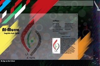
Al-Murra Logistics: Gateway to Egypt's New Economic Vision
•
16 recomendaciones•8,696 vistas


Recomendados
Más contenido relacionado
La actualidad más candente
La actualidad más candente (20)
Similar a Al-Murra Logistics: Gateway to Egypt's New Economic Vision
Similar a Al-Murra Logistics: Gateway to Egypt's New Economic Vision (20)
Último
Último (20)
Al-Murra Logistics: Gateway to Egypt's New Economic Vision
- 1. II III
- 2. IV V Contents *Chapter 1: Introduction 1.1 Introduction 2 1.2 city concept 2 1.3 history of development in Egypt 3 1.3 Our vision 4 1.4 Logistics, what? Why? 6 1.5 Hong Kong, Jabal Ali and Jubail 10 *chapter 2: the city site choose 2.1 The site 14 2.2 Theimportant considerations of site 14 2.3 National treasure 14 2.4Why Sinai? 15 2.5 site 1 17 2.6 site 2 24 2.6.1 site comparison 31 2.7 supposed site 36 city palning 2.8 land uses 38 2.9 land uses ratio 39 2.10 design phases 40 2.11 Roads network 43 2.12 visual image 44 2.13 swot analysis 45 2.14 The main concept 46 2.15 Vision: 48 2.16 Mission: 48 2.17 Objectives: 48 2.18 SUSTAINABILITY in the CBD 49 2.19 Kevin lynch visual elements 59 2.20 Future Extension Vision: 64 2.21 concept galley of the city 65 *Chapter 3: Design standards Adminstrative Districts 3.1.1 INTRODUCTION: 70 3.1.2 USERS : 72 3.1.3 SITE SELECTION: 72 3.1.4 DESIGN GUIDELINES: 73 3.1.5 ZOONING DIGRAM: 80 3.1.6 PROJECT ANALYSIS: 81 Banks THE HISTORY OF THE BANKS 99 THE TYPES OF BANKS : 100 Bank design standard: 103 Bank Guidelines: 105 Blanks BankS: 107 Important notes when designing: 107 PROJECT ANALYSIS: 108 Commercial Introduction 113 Brief History of the commercial centers 113 Users 114 Design standard 115 Projects analysis 136 Zonning 153 Industerial INTRODUCTION 154 USERS 155 SITE SELECTION 156 Structure planning and subdivision 157 Elements of industrial development 157 Layout of the Industrial Area 157 DESIGN GUIDELINES: 158 PROJECT ANALYSIS 164 Embassies INTRODUCTION: 175 USERS : 176 SITE SELECTION: 176 DESIGN CONSIDERATIONS: 177 DESIGN GUIDELINES: 177 PROJECT ANALYSIS: 186 Meuseums Introduction 194 Users 195 Design standard 195 Projects analysis 210 Zoning 221 Health care centers HELTH CARE CENTRES HISTORY 222 USERS : 223 most important factors 226 Demaraction 227 Types 227 Bed requirements 227 Designe rules 228 Similar projects 266 project sammery 284 Acadimic laps History of Scientific Research 285 USERS 286 Research Laboratory 287 Similar projects 299 Universites Introduction 309 Users 310 Design standard 311 Projects analysis 326 Sports centers Brief History 339 Users 340 Design standers 340 Analysis similar projects 360 Aqua sports Introduction 364 users 365 Design standards 365 Similar projects Analysis 379 Case Studies 388 Resorts and residential history 391 Users 392 Design standards 393 Project analysis 405 Zonning 417 *Chapter 4: Similar projects Jebal Ali intro 420 Developments of Jebel Ali 422 Jebel Ali port 428 Jebel Ali Industrial Area 430 Jebel Ali Freezone Authority (JAFZA) 433 Dubai World Central (DWC) 437 Palm Jebel Ali 443 Dubai Waterfront 445 Jebel Ali Golf Resort & Spa 448 Busan logistic city intro 449 urban character of Busan 450 Gimhae International Airport 454 Busan New Port 456 Busan-Jinhae Free Economic Zone 458 industrial and logistics complex 460 Building the East Busan Tourist Complex 462 Munhyeon Financial Complex 464 Jazan city intro 465 Jazan city 465 New King Abdullah Airport 473 Jazan Port 476 INVESTMENT ATTRACTIVENESS 477 The Education Area 477 The Health services Area 478 Residential Areas and Seafront District 478 Al-Sahan city intro 480 Table of contents
- 3. VI VII Dedication we are glad to didicate this work to our stuff at the architecture and urban planing department, faculty of enginnering, suez canal univeristy as a sign of Thanks for them headed by. Professor Dr / Essam El-Din Badran Assistant Professor of Urban Planning Department of Architecture and Environmental Planning, and Vice-Dean for graduate studies, University of the Suez Canal. Professor Dr / Muhammad Hassan Atwa Assistant Professor of Urban Planning Department of Architecture and Environmental Planning. Professor Dr / Mahmoud Fouad Mahmoud Assistant Professor of Urban Planning Department of Architecture and Environmental Planning, and head of Architecture and urban planing department, Faculty of engineering , University of the Suez Canal. Also we must thank a three persons meant us a lot the Present absents Dr/Usama Nassar, Dr/Moham- med Refaat and Dr/Ahmed Saleh. professor assistants at Department of Architecture and Urban Planning ,Faculty of Engineering, University of the Suez Canal, thank you for being not only our teachers but also our guidence. another special thanks to Arch/ Ahmed Helal & Arch/ Shimaa Ali. Teacher Assistant, Department of Ar- chitecture and Urban Planning ,Faculty of Engineering, University of the Suez Canal on although they know now words can give them thank they deserve. And last but not least we would like to thank our dear parents ,who have borne the burden physical and moral , and encourage them uninterrupted us, and without which this work was to be . Land Use and Structure 481 Developments of Al Sahan City 481 Landmarks of Qatar 482 Al sahan city Concept 483 Road Network of the site 484 landuse 485 Hamad International Airport 486 Grand Hayatt Doha resort & spa 487 *References 488
- 4. VIII IX
- 5. 2 3 1.1 Introduction For long time we had a dream a shared dream between all Egyptians that one day egypt will be back to it’s good days when egypt was the greatest country in world, will as it’s said dreams where made to be achived we decided that we will take the dream much further and start making studies for our vision of the starting point to the new egypt that we dream it will be better than ever. This book introduces our dream and our vision to AL-murra logistic hub that is a logistic hub in sinai as developed as dubai and Hong Kong, that one day will make the development dream come true at least partially in egypt. Intro. Development, power and international prestige. that was the day dream of all Egyptians only 32 year ago at last days of President Anwar El Sadat. Now Egyptians have one dream just to survive. It was a real hard 32 year science Mubarak ruled Egypt with simply no vision of development may be vision for destruc- tion and Wallow strategies for development that made Egypt go back to the dark ages just like ages before the revolution of 1952. Then it was January the 25th 2011 something had to stop and another had to begin. That was the last days of Mubarak his time is off a new hope should begin it was the resurrection of hope inside Egyptians. Now there is a dream for development. 1.2 city concept Al-Murra city eye on the future from the famous pharons eye sympole. the Eye is an anthropological symbol of restoration and popular wellness for pharons. from this concept we decided to use that sympole wishing to restore the good days of the egypt. the city was born from the soul of egyptian revolution so using the egyption flag colors with the grafiti art is the best way to express our dream. intro intro brief history of development in egypt fig.i.2.egyptian revolution 2011fig.i.1.president gamal abd el nasser after 1952 revolution fig.i.1.cocept for the logo 1.3 Brief history of development in Egypt 1.3.1The golden era That was the era after the revolution of 1952 when president Gamal Abd el-Naser well the democracy was bad no freedom but on the other hand Egypt was great. Egypt was strong enough to beat France, England and Israel in 1956, the high dam was built, Suez canal was nationalized, a lot of factories was built , good agricultural abilities and the most important that as a place to live in Egypt was great. 1.3.2 The setback That was the end of the golden era Israel won the war Egyptian army was beaten had to retreat and let Israel control whole Sinai that time all of the Egyptian budget turned to the war machine and there was no budget for anything even for feeding people . 1.3.3 The vision of El-Sadat Abd El-Naser died and now a new farsighted president took control it’s Anwar El-Sadat, in few years Israel is out and now it’s time again for devel- opment to take place in Egypt El-Sadat made a lot of development projects in Egypt even a full cites was created industrial and agriculture development till he was Assassinated. 1.3.4 The wallow time Mubarak came with promises to rule for only 10 years and a lot of development within those 10 years. But the fact is that he ruled 30 years not only he did not make that development he promised but also he ruined the projects of El-Sadat. One of those projects was Al-Salhya project was one of the best agriculture projects in Egypt. And off course there were tons of unfinished projects such as Shaequ Al Tafreaa, Sharqu AL awynat, Wady AL Technology and off course Terat Al Salam. And the finished ones were sold and Egyptians didn’t benefit anything from it such as Toshka Project. And that wallow strategies coasted Egypt about 79 billion Egyptian bound which made Egypt and Egyptians in a deep trouble and a continuous threat of Bankruptcy. intro fig.i.5.salheya project before and after mubarak fig.i.6.toshka project fig.i.4.The High dam
- 6. 4 5 1.3.5 The hope After the 25th January revolution a new hope was found by having a real democratic system real parties real elections even the first democratic experiment was not that successful at the parliament but having such a democratic system gives people a hope to live better life in a developed country. 1.3 Our vision Our vision is a logistic hub as powerful as Rotterdam, Hamburg, Jabal Ali and even Hong Kong lays over Suez Canal in Sinai. That logistic hub is based on both industrial and agricultural hubs in Sinai, also provid- ing ship maintenance and other logistic services. intro fig.i.7.development by president fig.i.8.elections after revolution fig.i.9.the day mubark stepped down intro
- 7. 6 7 1.4.1 Definition A Logistics Centre is the hub of a specific area where all the activities relating to transport,logistics and goods distribution – both for national and in- ternational transit – are carried out, on a commer- cial basis, by various operators. The operators may be either owners or tenants of the buildings or facilities (warehouses, distribu- tion centres, storage areas, offices, truck services, etc.) built there. In order to comply with free mar- ket rules, a Logistics Centre must be accessible to all companies involved in the activities set out above. A Logistics Centre must also be equipped with all the public facilities necessary to carrying out the above-mentioned operations. If possible, it should also include public services for the staff as well as users’ equipment. In order to encourage intermo- dal transport for goods handling, a Logistics Centre should preferably be served by a variety of trans- 1.4 Logistics, what? Why? Logistics can be classified as an enterprise plan- ning framework for material management, informa- tion, service and capital flows. Logistics when seen in the context of the modern day prevalent work environment also includes information that is com- plex in nature besides giving importance to all the communication and control system that are essen- tial for efficient working of the organization. Now a time logistics can be defined as having the right type of product or service at the right place, at the right time, for a right price and in the right condition. The birth of Logistics can be traced back to an- cient war times of Greek and Roman empires when military officers titled as ‘Logistikas’ were assigned the duties of providing services related to supply and distribution of resources. This was done to en- able the soldiers to move from their base position to a new forward position efficiently. logistics The real start of logistics in the modern history was at the ww2 when the united states of America’s fleet was defeated after pearl harbor the us army started to construct a new fleet based on a massive ships working as a floating logistic centers to provide the whole fleet with supplies far away from home at the pacific ocean. logistics logistics intro hong kong, jubail and jabal ali fig.i.11.logistic war ships fig.i.10.the logistikas helmet port methods (roads, rail, sea, inland waterways, air). It is vital that a Logistics Centre be managed as a single and neutral legal body (preferably by a Public-Private-Partnership) if synergy and commer- cial cooperation are to be ensured. 1.4.2 The most important elements The Logistics Centre concept is based on three important elements: 1. Territorial planning alongside infrastructure rationalization. Going back to the Logistics Centre definition at the top of the page is useful to a better understand- ing of this point. The Logistics Centre is a specific area where all the activities relating to transport, logistics and goods distribution, […], are carried out by various operators. 2. Transport quality. • decrease in the total transport costs • decrease in the total industrial costs • decrease in personnel costs • An increase in the transport operators total turnover. 3. Intermodality development • Offering very convenient transport and syner- gic solutions (rail/road/short-sea-shipping), • Using block shuttle trains on long-range jour- neys. 4. Location • Location is a key factor for all the transport operators whose main activity is moving freight • from one place to one another using different modes of transport. • Optimization – or rather reduction – of the delivery time to the final destination or to the • following passage of the logistics/transport chain is one of the elements that could make that important difference when a transport operator is being chosen. logistics fig.i.12.logistic transportation
- 8. 8 9 5. Activities It should be remembered that the activities re- ferred to in this point are exclusively specific to the company managing the Logistics Centre. 1.4.3 Defining infrastructure necessities • Road connections • Rail connections • Connections with ports 1.4.4 Defining the Logistics Centre layout • Customs infrastructures • Postal/bank/insurance services • Offices • Intermodal terminals • Warehouses • Other general services 1.4.5 Creating the general infrastructures, the warehouses and the integrated services The Logistics Centre management company is responsible for the construction of all the infra- structures, once layout planning and the business plan have been completed. 1.4.6 Land leasing to transport operators / Ware- house and office leasing / Sale of warehouses and offices The Logistics Centre management company is responsible for all the procedures regarding the leasing or selling activities. It sees to both the com- mercial/marketing and legal procedures. logistics fig.i.13.logistic cites places fig.i.14.logistic warehouse logistics fig.i.15.logistics flow chart fig.i.16.logistics jops salaries
- 9. 10 11 1.5 Hong Kong, Jabal Ali and Jubail These three cites has something in common the three cites are very developed, astonishing infra- structure, nice architecture, an environment to live in and of course tons of jobs and chances. Also an important thing is that nearly the three are not on that developed country except of Dubai (Jabal Ali). 1.5.1 China China was recorded that nearly 50% of popula- tion are beneath the Poverty line, living side to side with rice paddies with no services, bad infrastruc- ture even with bad educational facilities if existed. On the other hand Hong Kong and Shanghai have great infrastructure, good looking skyline, tons of jobs and very developed services that nearly no one is under the poverty line. 1.5.2 Saudi Arabia Saudi Arabia has bad infrastructure in most of its cities such as Eastern, Al Qassim and Najran that most of population don’t send their daughters to school and women nearly have no rights and edu- cational facilities is bad. In Jubail, Riyadh, Makkah and Al Madinah there is great services and infrastructure, good facilities and good environment. 1.5.3 Dubai (Jabal Ali) United Arab Emirates is a developed country but some counties are not developed as Dubai and Abu Dhabi even most of people don’t know what is the 7 counties they just know Dubai and Abu Dhabi they are the known places as they are the logistic centers of Emirates . HongKong,JabalAliand Jubail logistics10 fig.i.17.schools comparison Ajman& Dubai fig.i.20.Ajman& Dubai logistics fig.i.19.poor cites in chinafig.i.18.Hong Kong fig.i.21.Al-Ahsaa fig.i.22.Reyad
- 10. 1212 13
- 11. 1414 15 2.1 The site A city with such potential should have a special site where it can deliver a service for thousands of ships every year also as it’s connected to an industrial and agricultural hubs then the transportation and acces- sibility are very important. When it comes to logistics a lot of considerations are related to the site as accessibility and Varity of transportation also the acceptance of people living in the site and realizing the importance of the city. site studies 2.2 The most important considerations relating to site • Accessibility: have a lot of access roads and nearby terminals and cites • Strategic placing: the site should be unique and provide a service can’t be reached easily nearby • Varity: the site should provide various amount of abilities such as providing good sports facilities and tourism beside providing good abilities for logistics. 2.3Why Suez Canal territory? Suez Canal territory is the third territory in Egypt and considered as the resources territory as all kinds of resources are available such as mining, large waterfront, industrial zones, agriculture zones, large amount of unused land and of Corse the most important factor is strategic and historic place that makes it the most important trade passage in the world. The relation between the territory and the international trade movement makes it very impor- tant place when comes to logistics which can make Egypt in a very fast way one of the most developed countries in the world as happened in japan, Sin- gapore and Hong Kong as the territory has enough resources and good location for export/import abili- ties that makes it one of the best manufacturing location by importing resources and manufacturing it and exporting it. 2.3 National treasure The Suez Canal is considered as a national trea- sure for Egypt as it controls now 7% of the world trade which is a large number for a canal surround- ed by deserts with no services. One of the most important factors in Suez Canal is that the amount of trade and ships passing by it is expanding every year, in 2010 the total number of ships passed by Canal was 13987 ship and 4700 container mostly filled by oil and raw materials. the site important elemnts why sinai supposed sites site studies intro fig.s.1.sinai peninsula fig.s.2.suez canal 2.4Why Sinai? Sinai Peninsula has an area of 61,000 km2 apx. ,in another words 6% of Egypt total Area. It’s population exceeded 600,000 in 2010.The site of Sinai among the world is more like a linking ring between Asia and Africa extends as a triangle of Farah at base, Port said in North and Ras Muham- mad as head, this unique location made it the main entrance of Egypt in East. It extends between the two gulfs of the red sea ,Suez gulf and Aqaba gulf. But Sinai has limited renewable water resources, what makes it slow for development rates.Flood water is considered an important source although it happens irregular. In Sinai Peninsula there is a road network con- nects between its cities to make it easy to transfer among them and other cities all over Egypt. site studies intro fig.s.4 fig.s.3.government plans for suez canal territory
- 12. 1616 17 Also, there is a network of international roads which cross the Suez canal via Ahmed Hamdy tunnel near by Suez city or Elsalam Bridge near by Qantara. These roads end at commercial ports and touristic cities. Among the most important ports in Sinai, Nwebaa port in south and Arish port in North. These ports participate in transferring between Asia and Africa .the most important touristic cities are Sedr, Eltor, Sant catrin, Charmelsheikh, Dahab, Nwebaa, Taba, ElArish, and finally Rafah which is considered Egypt gate to the East. site studies intro fig.s.5.sinai airports fig.s.6.main roads in sinai fig.s.8.site 1 supposed sites 2.5 site 1 2.5.1 Overview The site was selected in Suez is an attempt to cover all the cities of the province, where the site is located at the beginning of the course of the navi- gation channel extended to the Gulf of Suez, where the site is located on the eastern side of the chan- nel corresponding to the western city of Suez Canal . The location has been selected to be the nu- cleus of large logistic abilites in suez canal territory depending on the touristic infrastructure already available , that will attract more tourists and gives the development a strong touristic accent. also the site has a large industerial abilites in suez and the port of suez that will be a big support for the logistic services. but the main trouble is that site is away from the agriculture powers of the territory which is con- sidered a large ability of the territory. overview site parameters site 1 land use accesibility advantages and disadvan- tages site 1 fig.s.7.bird eye for site fig.s.9.near by communites
- 13. 1818 19 2.5.2 Site parameters & borders Area = 8.5 km2(2100 Acres) perimeter = 10.9 Km Elevation difference = 10 m Slope = N/A site 1 fig.s.12.site ground sec. fig.s.10.site parms. fig.s.11.site diffrent views 2.5.3 Land use & Visual character the location has a strong character for it’s fasci- nating nature and touristic urbanism. Advantage of the site that is located on the Suez Canal and Gulf of Suez and also it gives a greater opportunity to exploit the coast without exposure to the waterway canal . The advantage of location and the nature of the land of desert, but overlooking the coast, which is given directly by air and mild nature of the witch, both configurations of the scenic mountain or the charming nature of the waters of the Gulf . site 1 fig.s.14.site nearby views fig.s.13.site landuse
- 14. 2020 21 2.5.4 Accessibility The site is located east of the canal for the city of Suez, where the access roads to the site is through the Ras Sidr - Shahid Ahmed Hamdy Tun- nel, Ras Sidr - Bitter Lakes and the site is accessed through this road after crossing the Channel by ferry (Ferry Namira 6 - Ferry Sarabium). or hanging bridges (ElSalam bridge- bridge Fardan) or expenditure (Shaheed Ahmed Hamdi Tunnel) , Or direct access through the airport of Ras Sidr, which away from the site distance of 38 km. site 1 fig.s.17.site acces roads fig.s.16.site nearby airportsfig.s.15.site roads 2.5.4 Accessibility Ports ElSuez port: 1.30 km from the site AlAdiabya port: 10.50 km from the site ElSokhna port: 37.00 km from the site ElTor port: 212.00 km from the site site 1 fig.s.18.nearby ports fig.s.19.nearby ports
- 15. 2222 23 2.5.5 Advantages and disadvantages The disAdvantages 1-The climate of the location is not relevant to some sports and the facilities need some technics to over come 2-the development in the north western coast may be obestacled by the presence of Suez port 3-The site soil and Geology may not be perfect, some parts need filling and motivation to be ready for super structures in the city. 4-far from the territorie’s agricultural centers. The Advantages 1-The site is located parallel to the line for the city of Suez, one of the charming cities within the territory ,so it’s merited with existing infrastruture 2-The location is advantageous as the nucleus of a new urban development of the city of Suez on the east . 3-the location is close to Ahmad Hamdy tun- nel which is considered an international passage to Sinai (only 11 km) 3-The location has advantageous nature of the charming surroundings of the North mountain scenery and proximity to tourist areas, such as our eyes of Moses and in the south coastal distinctive nature . 4-The site has two water facades, Allowing more potentials for tourism and water sports. site 1 fig.s.20.site 1 2.5.6 Surrounding Communities Suez a seaport town (population ca. 497,000) in north-eastern Egypt, located on the north coast of the Gulf of Suez, near the southern terminus of the Suez Canal, having the same boundaries as Suez governorate. It has two harbors, Port Ibrahim and Port Tawfiq, and extensive port facilities. Together they form a metropolitan area. Railway lines and highways connect the city with Cairo, Port Said and Ismailia. Suez has a petrochemi petro- chemical plant, and its oil refineries have pipelines carrying the finished product to Cairo. Suez is a way station for Muslim pilgrims travelling to and from Mecca. near by resources suez city and near by cities is known for it’s industerial and mining abilites, also the suez gulf filled with oil and natural gas stations that will sup- port the city and save money for spechial infra- structure. site 1 fig.s.25.natural gas station in the gulf fig.s.23.suez factories fig.s.21.steel manifuctring in suez fig.s.24.suez city shore fig.s.22.suez city
- 16. 2424 25 2.6 site 2 2.6.1 Overview The site is located on the eastern coast of the Suez Canal overlooking the great Bitter Lakes within the territory of the Suez Canal, where the aver- age location of the channel on the province, 40 km from the center of Ismailia, 36 km from the center of Suez and 128 from the center of Cairo Governor- ate . The location has real touristic potentials and good international accessibility via Elshaheed tun- nel or Elsalam bridge.it represents a chance to start an urban development nucleus in Sinai. The site is located in median place between suez canal territoy diffrent resources as it’s near to suez city and it’s industerial abilites alo near to the territory agriculture abilites and the mining abilites of mid sinai. the main trouble in the site is the soil as it’s not prepared to mega structures but it’s considered a good point for burrowing the marinas for the ports and tourism abilites. supposed sites overview site parameters site 2 land use accesibility advantages and disadvan- tages site 2 fig.s.27.bird eye for the site7= fig.s.28.nearby cites fig.s.26.bitter lakes 2.6.2 Site parameters & borders Area = 19 km2 (4694 Acres) premeter = 19.8 km Elevation difference = 10 m Slope = N/A site 2 fig.s.30.site ground sec fig.s.29.site parms.
- 17. 2626 27 2.6.3 Land use & Visual character The location has a strong character for it’s fasci- nating nature and touristic urbanism. Overlooks the site giving wider in the water far from the coast line of the navigation of vessels. the big advantage is that the site is near to the technologt vally project and the village of meet abo el koom that can support site’s infrastructure. The advantage of location may be clear ,over- looking the coast, which is given directly by air and mild nature of the witch, both configurations of the scenic mountain or the charming nature of the waters of the Gulf. site 2 fig.s.32.nearby vies fig.s.31.surrounding landuse 2.6.4 Accessibility The site is located east of the canal and is sur- rounded by one road Ras Sudr - Kantara East. that accessing the site through the various crossings of the channel and long the channel and bar, includ- ing ferries, such as infectious and contagious Sarabium yarns 6 and bridges such as bridge and bridge Mubarak Al Fardan and spending such as Shaheed Ahmed Hamdi Tunnel . Site directly related to Ras Sidr Airport, located in the eastern Gabn of the channel and Fayed Airport and Kibrit airport west of the canal . site 2 fig.s.35.acces roads fig.s.34.nearby airportsfig.s.33.site accesing road
- 18. 2828 29 2.6.4 Accessibility nearby ports damyetta port (130 km) portsaid port (94 km) suez port (52 km) Al adiabya port (60 km) site 2 fig.s.37.nearby ports fig.s.36.nearby ports 2.6.5 Advantages and disadvantages disadvantages 1-Lack of infrastructure, isolation from urban areas. 2-located in the east may make it difficult to each the site 3-Some parts are below water level, soil is not ready for mega structure projects advantages 1-The site is located mid-region to the territory, where the multiplicity of ways in passages leading to it . 2-The site is located directly on the bitter lakes, which offers the possibility to use water elements to the project without resorting to artificial lakes 3-The possibility of future extension along the strip parallel to the coast . 4-The location is advantageous nature of the witch of the surrounding mountainous areas and coastal waters surrounding. 5-the site is in median place berween all resorc- es of the territory. 6-the site has both costal and desert front to extend and also has a green buffer around it to prevent slums. site 2 fig.s.39.nearby citesfig.s.38.site advantages
- 19. 3030 31 2.6.6 Surrounding communities Fayed: A coastal city tracks Ismailia ,Arab Republic of Egypt , one of the most important touristic cities in Egypt, as it is the nearest resort from Cairo , lies about 120 km far only, making it the most popular one day resorts in Egypt . The area of the city Fayed 5322 square kilometers and includes a center and three villages, with a population of 81 thousand souls, and includes the local unit of the Centre and the city of Fayed, established in 1965, City Fayed mother and villages Sarabium and Abu Sultan and Varpo Kseverit and Alhawess. Fanara: fnara is the second of fayed villages in popu- lation, and contains some important touristic projects,including 18 beaches,2 hotels and 3 tourstic resorts. fig.s.41.surrounding communites fig.s.40.fanara city overview image Location 1 -Located in East North of Suez gulf, facing the gulf and Suez canal entrance .close to Suez city but not under it’s urban extent. -the nearest city is Suez in west, Ras sedr in south east. -A desert land ,with triangular shape degrading little up the sea level. the land is not at one level but needs slight processes of fill and dig. -Has a direct access to water from two facades Location 2 -Located in the east side of Suez canal, Sinai. Facing the greate bitter lakes. -The nearest city is Suez ,the nearest high way is Ras sedr Elqantara. -A desert land with muddy soil. partially iso- lated from developed areas. -Has direct access to water. -has median place in the suez canal territory. sites comparison overview site parameters land use accesibility unique advantages sites comparison
- 20. 3232 33 Site parameters & borders image Location 1 Area = 8.5 km2(2100 Acres) perimeter = 10.9 Km Elevation difference = 10 m Slope = N/A Location 2 Area = 19 km2 (4694 Acres) premeter = 19.8 km Elevation difference = 10 m Slope = N/A sites comparison accesibility image Location 1 ferdan brige 86 km nimra 6 ferry 76.5 km sarabeum ferry 63.7 km shahid ahmed hamdy tunnel 11.7 km Location 2 ferdan brige 47 km nimra 6 ferry 22 km sarabeum ferry 11 km shahid ahmed hamdy tunnel 58 km land use image Location 1 -the site has strong visual identity and rich visi- tor experience. -From east sand deserts, from west suez canal and suez city on the other side, from north and south there are desert extensions for the site Location 2 -The surrounding areas are farms and the lakes shore. No residential areas located near by the site. -also Farms can be seen on the opposite side of the canal, near Fnara. sites comparison
- 21. 3434 35 Unique Advatages image Location 1 -the nearest to Suez, a city with promising po- tentials and existing sports facilities -Closer to many touristic and historic sites like Uyon moses. and Siant Catren -Faces water via two sides,can extends along both the Suez gulf or Suez canal Location 2 -Charming direct facing on the greate bitter lakes -Open area along the coast line -A promising location as a development nucle- us in Sinai -The routes to the site are more like a great trip a long Sinai(Touristic merit) sites comparison comparisson site 1 site 2 Area 8 9.5 Accessibility 8.5 9 Visual character 8 7.5 Infrastructure 8.5 7.5 Land use 6 8 Extension potentials 9 7 Topography 6 7 Climate 7 8 Communities potentials 9 7.5 Soil qualifications 7.5 7.5 Natural shape & borders 8 8 Urban development 8 8.5 Building restrictions 7.5 7 International profile 7.5 7 Nearby resources 6 8 total score 7.6 7.8 full comparison result (supposed site)sites results sites comparison results fig.s.43.site 2fig.s.42.site 1
- 22. 3636 37 2.7 supposed site the site is located at the eastern side of suez canal at beautiful place at the greate bitter lackes. the site is in median place between aboth suez and ismailia city that makes it near to all resources in the suez canal territory as it’s near to minig places in sinai, oil and natural gas at suez and suez gulf, and near to the agriculture lands in ismailia and sharquea. sites comparison results fig.s.44.farms fig.s.45.sinai mines fig.s.46.site advantages fig.s.48.sinai minesfig.s.47.suez factoriesfig.s.46.natural gas at gulf
- 23. 3838 39 Alterntive 1 land use land use ratio design phses road network visual image swot analysis 2.8 land uses 2.9 land uses ratio
- 24. 4040 41 2.10 design phases phase 1 phase 2
- 25. 4242 43 phase 3 2.11 Roads network
- 26. 4444 45 2.12 visual image 2.13 swot analysis
- 27. 46 47 suggested development centers in sinai suggested point to start Alterntive 1 land use land use ratio design phses road network visual image swot analysis 2.14 The main concept of the Master planning The main concept of this master plan was originally based on the 3 suggested points of development through Egypt which are: • South Egypt • Suez canal region and north-Sinai zone • El-kharga oases and the suez cana region and north-sinai zone have many qualifications and potentials of development which are like mining, tourism, agriculture , strategic location of transportation means , etc etc etc And the main concept came from 2 certain suggested points of development due to Egypt master plan of 2050 and its development points and the 2 points are (Great bitter lakes and north Sinai zone) and each point of them have a radius of effect and each radius of those 2 points are having intersections with development abilites in suez canal territorydevelopment visions in egypt each other and from this intersection our CBD was created and surrounded by other functions and from here came out the main concept .
- 28. 48 49 Vision: Our vision is to create a Sustainable powerful logistic hub as Rotterdam, JabalAli and even Hong Kong lays over Suez Canal in Sinai, to make the maximum benefits of the Suez Canal, to be a center of economic development in Egypt. Mission: The strategy will be mainly based on the logistic services for the ships and also on ship maintenance. The economy will be increased by three means: 1st the industrial zone, 2nd the agricultural zone, 3rd the CBD and it will based mainly on tourism. Objectives: *creating a large transportation center which will contain different means of transports like land trans- port for logistic issues, and sea transport “terminal port”. *creating a large maintenance zone for ships. *There will be large industrial and agriculture extensions, based on the natural resources of Sinai. *The CBD will be a main tourist attraction in Egypt. city vision SUSTAINABILITY in the CBD The word “SUSTAINABILITY” has become popu- lar catch phrase in nineties. The emergence of the environmental movement has brought this concept to the forefront of environmental policy in this decade. According to this standpoint the concept of sustainability has been introduced to the project in several methods: • At the urban scale: 1- PV cells are installed at the lightning units and shades inthe streets . 2-Windmills are used to generate energy. 3- Turbines and reservoirs will be used to gener- ate energy from the lake ,and it will be used at the link between the suez canal and El murra lakes. 4-Geothermal energy will be also used to gener- ate energy and in heating issues at the residential areas. 5-The city design will provide natural shadings for all the streets. • At the buildings scale: 1- The buildings are designed and located to provide natural cooling systems . 2- The buildings are designed and located ac- cording to the sun to provide natural shadings for the interiors. 3- PV cells are installed at the roof of the build- ings to provide energy for the buildings. 4- Geothermal energy is used in heating the buildings at the winter. • The transportation: The city will contain pioneering public transpor- tation systems. The fossil fuels based vehicles will be reduced in the city. Compact networks of streets will encourage walking. sustinability ar urban scale wind power plant
- 29. 50 51 geothermal heating for houses Automated control system for vehicular guid- ance. • The recycling system:* The city will strive towards a zero waste objec- tive by using pioneer recycling strategies. • The research and development centers: There are several institutes concerned with sus- tainability and renewable energy issues. • The city will tend to be zero carbon and zero waste city ,and will be fully powered by renewable energy. Master Plan Development 1-First stage : It was just a simple application of the main concept idea which the 2 suggested points of development which located in Sinai and Bitter great lakes constituse the form of the city main spine which serving the whole city but it had some troubles like distribution of main elements of the city so we had to develop our look to the master plan 2-Second stage It’s a developed master plan the the first one and fixed lots of problems but made other prob- lems like the city is near a high way and levels of the streets are not correct although it made the spine of the city more clear to visitor and distrib- uted the elements of the city in an organized shape 3- third stage A whole revolutionary master plan which devel- oped our concept of the city and fixed lots of prob- lem but its problem was its too complicated to be understood easily and lots of exits and entrances 4- final stage It’s a development of the third stage to make the master plan suit our needs wiz out harming the distribution of the elements of the city and make it clear to visitor and fixed the complication which was obvious to us • Zoning study Our city consists of several main zones each zone consists of several elements and now we will clarify each zone and its elements: 1-Educational Zone and consists of (university- libraries complex ) 2-Sports Zone and consists of (stadiums-sports clubs – training stadiums) 3-Cultural Zone and consists of (Expo city – Op- era – media city ) 4- Residential Zone and consists of (residential districts for all levels of living standards) 5-Green area Zone and consists of (hi tech park – open landscape area) 6- Logestic city Adminstration and consists of ( information center – city management) 7- marine port zone and consists of (yacht port – public port – ships maintainance and services) 8- administration-commercial zone and consists of ( malls- admin buildings- banks complex-multi purpose towers )
- 30. 52 53
- 31. 54 55 9- tourist-residential zone and consists of (tourist villages- chalets-hotels ) 10- Recreational zone and consists of ( Aqua city- Amusement park ) 11-Research centres zone and consists of ( Space research centre- geological research centre-water research centre ) 12- Health care Zone and consists of ( General hospital - Neuropsychiatric Disorders hospital) • Main Entrances and Exits : In our master plan there are 2 main entrance and 2 main exits which are founded in the beginning and the end of the city distributed equally and there are some secondary entrances and exits which used for both functions • Zones Ratio to the whole city : The area of the city is 23299448.39 m2 is almost 5547.5 acres divided to 12 zones Residential zone 17.47% equal to 969.15 acres Admin-commercial Zone is 12.16 % equal to 674.576 acres Tourist-residential Zone is 6.85% equal to 381.85 acres Health care zone is 3.93% equal to 219.1 acres Sports zone is 4.87% equal to 271.48 acres Educational zone 5.77% equal to 321.65 acres Research centers zone is 4.79 % equal to 267.15 acres Recreational zone is 6.17 % equal to 343.95 acres Cultural zone is 10.33% equal to 575.85 acres Logestic city management zone is 1.58% equal to 88.08 acres Green area zone is 4.1% equal to 228.56 acres Marine ports zone is 8.81 % equal to 471.11 acres
- 32. 56 57
- 33. 58 59 Kevin lynch visual elements Kevin lynch elements are one of the most important thing that define the character of any city in the world and it consists of (Nodes-Paths-Districts-Edges-landmarks) and here is every point in detail • Landmark study: The project contains a main land mark which located in the main zone of the CBD ,and there’s also two land marks at the entrances and exits of the CBD ,which are expo-city and high -tech park
- 34. 60 61 • Paths study: This projects contains 4 levels of roads seprated to 1st level 100 m width road 2nd level 50 m width road 3rd level 40 m width road 4th level 30 m width road And those roads are meant to be in this shape to apply rules of road levels and contain heavy traffic at rush hours easily and direct the flow of the traffic smoothly • Nodes study: There are many nodes in this project which we can see at intersections of the streets and every nodes of them not like the other one and they differs from each other in the size and importance
- 35. 62 63 • District Study: This projects is based on 3 main districts distributed on linear shapes due to importance of the func- tions that each district contains • Edges Study: This projects is surrounded by 2 main edges natural edges which is the coast line of Bitter great lakes and artificial one which is High way which connects Elqantra shark and Ras sedr
- 36. 64 65 Future Extension Vision: Our vision to the future extension of this project is based on 2 main axes which are Coast axis and mid Sinai axis Coast axis is for main functions and vital ones that cant be put away from the CBD of the city but mid- sinai axis is for industrial future extension and agricultural future extension concept galley of the city
- 37. 66 67
- 38. 68 69
- 39. 70 71 Adminstration INTRODUCTION . Users. SITE SELECTION. DESIGN CONSIDERATIONS. DESIGN GUIDELINES . PROJECT ANALYSIS. 3.1.1 INTRODUCTION: In 1878 the Kentucky legislature severed the official connection between the Agricultural and Me- chanical College of Kentucky (later the University of Kentucky) and Kentucky University, a private sectarian school of which the A&M College had been a department. The resultant loss of the College’s first home on the Ashland-Woodlands campus necessitated the acquisition of a new tract of land on which to site the A&M buildings. The fifty-two-acre city park and old fairgrounds on Limestone Street, just south of the downtown portion of the city, were donated by the municipality of Lexington for this purpose. On this loca- tion were erected between 1880 and 1882 the independent College’s first structures -- a men’s dormitory (later named White Hall), the President’s house, the campus heating plant, and the Administration Build- ing. Designed by Architect H.P. McDonald, the build- ing was built of brick fashioned from campus clays and stone, at a cost of $81,000. It opened in 1882. A year previous, when funding for construction failed, President James Kennedy Patterson pledged his entire personal fortune as collateral against the money borrowed to complete the project. Solemn dedicatory ceremonies on February 15, 1882, which included White Hall and the President’s house, were attended by, among other notables, the Governor, Lieutenant Governor, and Speaker of the House of Representatives of the Commonwealth, and featured the Honorable Henry Watterson as Orator of the Day. In the early days of State College, the Main, or College Building, as it was then called, encom- passed the administrative operation and academic instruction of the institution in its entirety. Original- ly housed in the building were all campus offices, classrooms, and related facilities including: the Col- lege armory and the classrooms used by the Com- mandant of Cadets; a shop; the President’s Office (equipped with fireplaces and a classroom); a natu- ral history museum; two laboratories; the Normal, French, German, English, Mathematics, Classical, and Preparatory departments; an assembly room containing an organ; a smaller chapel (which was able to seat the entire student body, faculty, and staff); the headquarters of the Union Literary and Philosophian societies; and the Kentucky Geological Survey. Gracing the roof of the building was a tower crowned by a cupola, 157 feet in height. The cupola featured a clock (supposedly built by a professor) and a “captain’s walk”, and housed the local Weather Observatory. This structure was progres- sively dismantled and shortened or altered and after 1919 the roof of the edifice manifested the “flattened”, gabled appearance which characterized it until the recent fire. During the administration of President Henry Stites Barker (1911-17) a project to reconstruct the frontal faade of the three-story, Victorian-style building with the addition of stone pillars, was initi- ated and later abandoned. A post office and book- store were created in the basement in 1918 (both removed in 1925). A cafeteria was opened in 1919, which served the campus for ten years. In the spring of 1948, with the removal of the Ancient Languages and Political Science depart- ments to new quarters, the Administration Building for the first time housed only University administra- tive departments. These included the offices of the President, Vice President, Dean, Comptroller, Reg- Fig.A.H.1 :Administration Building circa 1905 istrar, Dean of Men, Dean of Women, the Informa- tion and Personnel offices, and the Public Relations Department. Interior renovations of the structure, varying in extent and scope, were carried out in 1929, 1939-40, and 1964. Fig.A.H.3 :Administration Building 1967 A fire on May 15, 2001, presumably ignited by a welding torch as repairs and renovations of the building’s guttering were in progress, destroyed its roof, gutted its second and third floors, and left the first floor and basement flooded and water-dam- aged. The University’s Board of Trustees on June 20 of that year approved a proposal to restore and reconstruct the building, and interior and exterior design planning began immediately Fig.A.H.2 :Administration Building circa 1920 Adminstration Adminstration
- 40. 72 73 3.1.2 USERS : 3.1.3 SITE SELECTION: The location of the urban administration cen- ter has the major impacts on the urban economic development, the layout structure, the road system plan and the organization of architectural esthet- ics space. So the location selected should be more forward-looking, and the center should be tiringly distributed in the city’s future prioritized region to come in line with the city’s master plan. This is because, in the citizens’ opinion, the government is the confidence guarantee, a commercial build- ing possibly goes bankrupt, but the administration building relatively is much safer. Only under the government’s construction, the infrastructure (wa- ter, electricity, road, gas etc.) and servicing facilities (hospital, school, posts and telecommunications, public security etc.) can form the high level in a short period in the newly developed area, this is what the developer would be unable to achieve. Site’s natural conditions: The administrative center is a important archi- tectural complex and urban space, so it should be built on a land with more superior physical geography condition. For example, the location should consider the geology topographical condition to avoid the disaster risk, and should not be on the land with excessively low topography to avoid the flood disaster. The suitable location should has sufficient space to use, and its slope and elevation difference is gentle, the bearing capacity of soil foundation is strong and its draining system is quite good in the region. The traditional Feng-Shui theory named the site selection for the public activity center as “The Acupoint Selection”, the administrative center is the Central Acupoint (is also called “Hall Acupoint”), and should be prioritize located in the south of mountain and the north of water with high to- pography. In this traditional Feng-Shui pattern of backing-mountain and facing-water, it is highly advantageous to form a good ecological and partial microclimate. Traffic conditions: A cardinal principle of the site selection is to establish the centre in a well communicational area. As an urban administration center, on the one hand, it should provide the service very con- veniently for the residents, on the other hand, it must avoid forming the traffic bottleneck in the local area. The centre is a place to be visited by the public, therefore it should be located beside the main city roads (or not far from the main roads), but should avoid the cross-boundary roads. It also should be close to the life main road and the mixing main road, but should not very close to the trans- portation main road.model of valuableland with a good Feng-Shui (Gao Shiming, 2006). Planning Considerations The application of the following considerations will assist the space plan- ner to attain functional effectiveness in the final layout : 1 . Employees performing close work should be in the best-lighted areas . Glaring surfaces which affect vision should be identified and corrected . 2 . Clothes lockers in an office layout are out of date and wasteful . Large rooms or open areas should be provided with hanging space for coats and shelves for hats, packages, and other material . Space not suitable for work stations should be used whenever possible . 3 . Heavy equipment generally should be placed against walls or columns in order to avoid floor overloading . 4 . Be safety conscious . Do not obstruct exits, corridors, or stairways . Comply with fire safety codes governing aisles, exits, etc . 5 . Where frequent interviews with the general public are required, as in personnel offices, the use of interview cubicles should be considered . Such cubicles need only be large enough for the in- terviewer, the applicant, and a small desk or table . 6 . In operations which require employees to work away from their office, with only infrequent visits there to file reports, ate ., consideration should be given to assigning two or more employees to each desk . Other considerations include the provision of 45-in . desks and the use of common work tables, with the assignment of file cabinet drawers to each employee in which to keep papers, etc . 3.1.4 DESIGN GUIDELINES: Private Offices The private office is the most controversial problem facing the space planner . The assignment of private offices and the type of partitioning to be used are issues to be settled by top management acting on the advice and recommendations of the space planner . Private offices should be assigned primarily for functional reasons, nature of work, visitor traffic, or for security reasons . When pri- vate offices are provided, they should be only large enough for the occupant to conduct his normal business with a reasonable degree of dignity The following are some of the factors requiring consideration prior to making the assignment : • Classification Grade The necessity for a private office cannot be directly related to the classification grade of the employee . Fig.A.S.4 : Recommended layouts for Private Offices Adminstration Adminstration
- 41. 74 75 • Supervisors in Open Specs Supervisors who are working with their employees, rather than planning for them, should generally be in the same room or open space with them . The supervisor may be separated from the balance of his section by a distance of several feet which permits a degree of privacy . Fig.A.S.4 : Recommended layouts for Private Offices • Prestige A frequent justification for a private office is to impress visiting representatives of industry, and the general public, with the importance or dignity of the official being contacted . Recent studies of of- fice planning in private industry tend to refute such a position . They show many highly paid employees housed in attractive open space . Moderately sized private offices are provided only for upper-echelon officials . The offices of many top executives of large, nationally known companies are less than 250 sq ft each . The provision of a private office, or too large a private office, for a Government official may give the taxpayers an adverse impression . • Security Requirements The space planner hears many reasons why people in Government need places where confiden- tial discussions can be held and a variety of sugges- tions as to how this should be accomplished . The private office is the most popular, if not always the most practical, solution . The Federal establishment undoubtedly has a greater problem in this respect than many branches of business . In addition to the security requirements, the Government is faced with privacy situations involv- ing investigative agencies and other activities which have occasion to inquire into the most confidential aspects of individuals’ personal lives and the opera- tions of business concerns. There is no question as to these persons’ entitlement to reasonable privacy regardless of whether they are summoned to the office, appear voluntarily to render assistance, or avail themselves of services offered by the agency . There are alter- natives, however, in determining the methods to be used to satisfy the various requirements Sizes of Private Offices It is desirable that private offices be a minimum of 100 sq ft and a maximum of 300 sq ft each in size, depending upon the requirements of the occupant . See sketches of most widely used private offices . Only in cases where it is necessary for the occupant to meet with delegations of 10 or more people at least once a day should the size approach 300 sq ft . For the average Government function, the private office should not exceed 200 sq ft Fig.A.S.5 : Recommended layouts for Private Offices Fig.A.S.4 : Recommended layouts for Private Offices • Semiprivate Offices: The semiprivate office is a room, ranging in size from 150 to 400 sq ft, occupied by two or more in- dividuals . These offices can be enclosed by ceiling- high, three-quarter-high, or bank-type partitions . Examples of semiprivate offices are shown. Because of the loss of flexibility introduced by the use of the partitions required to enclose these offices, the same rigid review given private offices should be employed . Generally, the need to house members of a work team or other groups of employees as- signed to a common teak is an acceptable justifica- tion for semiprivate Fig.A.S.5 : Recommended layouts for Private Offices Fig.A.S.9: Recommended layouts for Semiprivate Offices Adminstration Adminstration
- 42. 76 77 • General or Open Space: The following paragraphs describe some of the factors affecting good office layout in general or open space General: “General office space” refers to an open area occupied by a number of employees, supervisors, furnishings, equipment, and circulation area . Large open areas permit flexibility end effec- tive utilization, aid office communications, provide better light and ventilation, reduce space require- ments, make possible better flow of work, simplify supervision, and eliminate partition costs . In many cases, however, open-space housing for more than 50 persons should be subdivided either by use of file cabinets, shelving, railing, or low bank-type partitions . • Open-Area Work Stations The space allocated to these work stations is based on the furniture and equipment necessary to perform the work assigned as well as on circula- tion area . The space assigned to any specific work station may be increased due to special furniture and equipment requirements associated with the particular positioned • Circulation: This is the area required to conveniently permit ingress and egress to work stations . The size of an aisle should be governed by the amount of traffic it bears . The following standards with regard to internal circulation will be applied in space planning surveys : 1 . Aisles leading to main exits from areas which carry substantial traffic (main aisles) should be 60 in . wide . 2 . Aisles which carry a moderate amount of traf- fic (intermediate aisles) should be 48 in . wide . 3 . Aisles between rows of desks (secondary aisles) should be approximately 36 in . wide . • Conference Requirements: Conferences, meetings, and assemblies are an important part of Government operations . Since there is no established standard suggest- ing the number of conference rooms based on the number of people, the needs will vary widely among agencies or agency components, depending largely on the nature of their work . Whenever possible, the establishment of con- ference rooms should be based on need established from past records and experience, rather than on anticipated needs . Unnecessary conference space is often allowed because planning is not based on such records of demonstrated need . The space planner should always evaluate the utilization of existing conference rooms before recommending others • Conference Space in Private Offices VS . the Conference Room Conferences are best conducted in space designed for that purpose . Conference space should not be provided in private offices . In lieu of large offices, it is desirable to provide a conference room adjoining the office of a top official who holds a large number of conferences and nearby conference rooms for officials with more limited requirements . Separate conference rooms permit maximum utilization through scheduling at an appropriate level of man- agement . Where feasible, training and conference requirements should be pooled and conference space used as auxiliary office area for visitors . • Location of Conference Rooms The conference room should be centrally lo- cated to the users . Interior space, which is not the most desirable for office purposes, is well suited for conference use . This location eliminates out- side distraction and the need for window coverings during visual presentations . Access to conference rooms should be through corridors or through re- ception areas . • Sizes of Conference Rooms Conference rooms should be designed to ac- commodate average but not maximum attendance . Extra chairs can be used to achieve additional seat- ing . See illustrations of preferred layout of conference rooms of various sizes . Fig.A.S.10 : Recommended layouts for conference rooms. Adminstration Adminstration
- 43. 78 79 • Reception Areas and Visitor Control: Visitors receive their first impression of an orga- nization from the decor and layout of the reception area . It should be attractive, nest, businesslike, and above all, adequate to accommodate normal visitor traffic . An allowance of 10 sq ft for each visitor to be served may be used for space allocation . For example, if space is required for a total of five visi- tors at any given time, a total of 50 aq ft should be used in planning the space . Size, decor, and equip- ment will depend largely on the type and volume of visitor traffic • Storage Space Office space should not be used for bulk stor- age. Only working inventories of office supplies and other materials should be maintained in offices, preferably in standard supply cabinets . Secondary space, such as basement areas, should be used to locate supply operations . • Special Rooms Allowance: Depending on the type of business, offices will require rooms of a size matched to their use These will include : 1 . Reception room 2 . Waiting room 3 . Interviewing room 4 . Examination room 5 . Conference room 6 . Exhibit room 7 . Medical room 8 . Lunchroom Fig.A.S.11 : Recommended layouts for furniture . 9 . Employee lounge 10 . Rest room 11 . Mail room The more common rooms will have the following typical space allotments, based on their use by 15 . people Square feet Reception room . . . . . . . . . . . . . . . . .. . . . . . 400 Waiting or interviewing room . . . . . . . . . . . .. 200 Conference room . . . . . . . . . . . . . . . . . . . . . 500 Fig.A.S.12 : Corridor width based on requirements of human Fig.A.S.14 : Typical open office plan. . Fig.A.S.13 : Typical modular private office plan with secretarial area Adminstration Adminstration
- 44. 80 81 3.1.5 ZOONING DIGRAM: 3.1.6 PROJECT ANALYSIS: 3.1.6.1 Example 1:SIA Multi-Use Office Complex / FGMF Arquitectos: Architects: FGMF (Forte, Gimenes & Marcondes Ferras) Arquitectos Location: Brasília, Brazil Team: Fernando Forte, Lourenço Gimenes e Rodrigo Marcondes Ferraz Coordinator: Ana Paula Barbosa Architects: Carolina Matsumoto, Marina Almei- da e Fábio Pitta Trainees: Mayara Benegas Type of Construction: Multi-use Building Site Area: 37,000.00 m² Built Area: 85,000.00 m² Year: 2011 • Overview : The multi-use office complex proposed by FGMF (Forte, Gimenes & Marcondes Ferras) Arquitectos for this 32.000m² lot aims at creating not only a new architectural reference for the region, but also a new destination for the city. Adding three dif- ferent uses – retail, office buildings and modular offices – the new complex creates a landmark in the landscape, values the surroundings, and establishes a new shopping destination. More images and ar- chitects’ description after the break. Fig.A.S.17 : exterior shot Fig.A.S.16 : ZOONING DIGRAM Adminstration Adminstration
- 45. 82 83 Fig.A.S.17 : exterior shot Fig.A.S.18 : interior shot Fig.A.S.18 : interior shot Adminstration Adminstration
- 46. 84 85 Fig.A.S.21 : basement floor Fig.A.S.22: ground floor Exterior shot Fig.A.S.24: section (a-a) Adminstration Adminstration
- 47. 86 87 Fig.A.S.23: 2nd floor exterior shot 3.1.6.2 Example 2: Green Incubator / Plus Three Architecture Project Area: 3,085 sqm Structural Engineer: Capita Symonds Services Engineer: RPS Gregory Ecologist: E3 Ecology • Overview : One Trinity Green is a new, high-tech business centre for SMEs in the renewables sector. Forming Phase 1 of the Trinity South development in South Shields, the scheme redevelops and re- generates a brownfield site formerly occupied by an electron- ics factory which was one of the major employers in the town. The building is conceived as 3 contemporary, flexible, ‘Victo- rian’ warehouses each with a distinctive character but bound together by a singular ribbon of elevation and a range of shared social spaces. An elevated roof garden provides further amenity and further differentiates One Trinity Green from other similar ‘incubator’ developments. Each ‘warehouse’ benefits from exposed structure (for passive cooling), opening windows and a central winter garden (to aid cross ventilation) and a robust palette of materials (to mini- mise damage during tenant churn). The design concept seeks to address the social issues of multi- occupancy buildings by creating a clustered arrangement of studios and hybrid units and through the celebration of circula- tion space as a social amenity and interaction space. Completed in May 2012, One Trinity Green is one of the first in the region to achieve a BREEAM ‘Outstanding’ rating through a combination of simple, passive environmental techniques al- lied to a large array of roof-mounted, photovoltaic panels. The pre-construction BREEAM score was measured at 87.7% Fig.A.S.25: exterior shot Adminstration Adminstration
- 48. 88 89 Fig.A.S.25: exterior shot Fig.A.S.25: exterior shot Fig.A.S.29: model shot Fig.A.S.25: exterior shot Adminstration Adminstration
- 49. 90 91 Fig.A.S.38: detail handrail Fig.A.S.30: vertical zooning diagram Fig.A.S.30: vertical zooning diagram Fig.A.S.33: first floor plan Fig.A.S.35: roof floor plan Fig.A.S.32: ground floor plan Fig.A.S.34: second floor plan Adminstration Adminstration
- 50. 92 93 interior shot Fig.A.S.36: east elevationFig.A.S.37: atrium section interior shotinterior shot 3.1.6.3 Example 3: CDB Tower & Minsheng Finan- cial Tower Competition Proposal / Saraiva + Asso- ciados The project required the design of 2 office buildings – CBD Tower with 150 meters and Minsheng Finan- cial Tower with 100 meters. The concept proposes the creation of a landmark that gathers and communi- cates the power of Principles and Social Responsibilities. Fig.A.S.45: exterior shot Adminstration Adminstration
- 51. 94 95 Fig.A.S.46: exterior shot Fig.A.S.45: exterior shotFig.A.S.45: exterior shot Fig.A.S.46: exterior shot Fig.A.S.52: elevations Adminstration Adminstration
- 52. 96 97 Fig.A.S.51: sections Fig.A.S.49: mass development Fig.A.S.48: mass details adminsss (57).jpg Adminstration Adminstration
- 53. 98 99 Fig.A.S.50: mass plans Fig.A.S.49: mass development THE HISTORY OF THE BANKS The History of Banking begins with the first prototype banks of merchants of the ancient world, which made grain loans to farmers and traders who carried goods between cities. This began around 2000 BC in Assyria and Babylonia. Later, in ancient Greece and during the Roman Empire, lenders based in temples made loans and added two important innovations: they accepted deposits and changed money. Archaeology from this period in ancient China and India, also shows evidence of money lending activity . Banking, in the modern sense of the word, can be traced to medieval and early Renaissance Italy, to the rich cities in the north such as Florence, Venice and Genoa. The Bardi and Peruzzi families Banks THE HISTORY OF THE BANKS. BANKS Users. THE TYPES OF BANKS . Bank design standard. Similar projects. dominated banking in 14th century Florence, estab- lishing branches in many other parts of Europe. Per- haps the most famous Italian bank was the Medici bank, established by Giovanni Medici in 1397. The development of banking spread from northern Italy through Europe and a number of important innovations took place in Amsterdam during the Dutch Republic in the 16th century, and in London in the 17th century. During the 20th century, developments in telecommunications and computing caused major changes to banks opera- tions and let banks dramatically increase in size and geographic spread. The Late-2000s financial crisis caused many bank failures, including of some of the world’s largest banks, and much debate about egulation . bank Al-Ahly bank Al-Ahly Fig.B.H.1 : HISTORY OF THE BANKS Adminstration Banks
- 54. 100 101 THE TYPES OF BANKS : • Retail Banks • Commercial banks • Cooperative banks • Investment Banks • Specialized banks • Central banks Retail Banks: Retail banks provide basic banking services to individual consumers. Examples include savings banks, savings and loan associations, and recurring and fixed deposits. Products and services include safe deposit boxes, checking and savings account- ing, certificates of deposit (CDs), mortgages, per- sonal, consumer and car loans such as : • Barclays Bank • Blom Bank Egypt • CIB Bank • HSBC Bank Commercial Banks: Banking means accepting deposits of money from the public for the purpose of lending or invest- ment. Commercial Banks provide financial services to businesses, including credit and debit cards, bank accounts, deposits and loans, and secured and unsecured loans. Due to deregulation, commercial banks are also competing more with investment banks in money market operations, bond underwrit- ing, and financial advisory work. Commercial banks in modern capitalist societies act as financial inter- mediaries, raising funds from depositors and lend- ing the same funds to borrowers. The depositors’ claims against the bank, their deposits, are liquid, meaning banks are expected to redeem deposits on demand, instantly Banks’ claims against their borrowers are much less liquid, giving borrowers a much longer span of time to repay money owed banks. Because a bank cannot immediately reclaim money lent to borrow- ers, it may face bankruptcy if all its depositors show up on a given day to withdraw all their money Fig.B.S.5 : HSBC BankFig.B.S.4 : CIB Bank Fig.B.S.3 : Bloom Bank EgyptFig.B.S.2 : Barclays Bank • BEIJING -- China’s central bank decided on Tuesday to raise the deposit reserve requirement ratio of commercial banks to a record high of 15.5 percent, the second such move this year • Commercial Bank in Sri Lanka Offers SFIDA, Foreign Investment Deposit Accounts for Foreign and Sri Lankan Investors • Public Sector Banks: Public sectors banks are those in which the gov- ernment has a major stake and they usually need to emphasize on social objectives than on profitability • Private sector banks: Private sector banks are owned, managed and controlled by private promoters and they are free to operate as per market forces. Cooperative Banks: Cooperative Banks are governed by the provi- sions of State Cooperative Societies Act and meant essentially for providing cheap credit to their mem- bers. It is an important source of rural credit i.e., agricultural financing in India. Fig.B.S.7 : BEIJING - China’s central bank Fig.B.S.8 : Sri Lanka Fig.B.S.9 : Cooperative Bank Washington, NC Fig.B.S.6 : Case Study Bill Payments for Retail Banking Cus- Banks Banks
- 55. 102 103 Investment Banks: An investment bank is a financial institution that assists individuals, corporations and governments in raising capital by underwriting and/or acting as the client’s agent in the issuance of securities. An in- vestment bank may also assist companies involved in mergers and acquisitions, and provide ancillary services such as market making, trading of deriva- tives, fixed income instruments, foreign exchange, commodities, and equity securities. Investment banks aid companies in acquiring funds and they provide advice for a wide range of transactions. These banks also offer financial consulting services to companies and give advice on mergers and acquisitions and management of public assets Specialized Banks: Specialized banks are foreign exchange banks, industrial banks, development banks, export- import banks catering to specific needs of these Fig.B.S.10: Investment Banks unique activities. These banks provide financial aid to industries, heavy turnkey projects and foreign trade. Central Banks: Central banks are bankers’ banks, and these banks trace their history from the Bank of England. They guarantee stable monetary and financial policy from country to country and play an impor- tant role in the economy of the country. Typical functions include implementing monetary policy, managing foreign exchange and gold reserves, mak- ing decisions regarding official interest rates, acting as banker to the government and other banks, and regulating and supervising the banking industry. These banks buy government debt, have a mo- nopoly on the issuance of paper money, and often act as a lender of last resort to commercial banks. The term bank nowadays refers to these commer- cial banks. The Central bank of any country super- vises controls and regulates the activities of all the commercial banks of that country. It also acts as a government banker. It controls and coordinates currency and credit policies of any country. The Reserve Bank of India is the central bank of India. • The Bank of England (The Bank of England is the central bank for the whole of the United King- dom. It was established in 1694, as a private com- pany, to act as the English government’s banker. In 1734, the bank moved to new quarters in Thread- needle Street, where it still is Fig.B.S.10: Investment Banks Bank design standard: Fig.B.S.17:The Relationships of rooms in large banks Fig.B.S.18:The Relationships of rooms in large banks Fig.B.S.14: entrance diagramFig.B.S.13: customer circulation in large bank Banks Banks
- 56. 104 105 Fig.B.S.16:general zoning Fig.B.S.15:entrance diagram Bank Guidelines: • Open-plan layout Maximize potential for selling financial by re- locating counters and non-sales functions , wall, and floor space is released for displaying product literature and advertising material . Create personal contact space for dealing with financial products : allow for specialized, some- times, purpose- built , self-contained desks at which trained staff can deal face-to-face with customers Achieve an open , inviting and customer- friendly environment that brings the customer in easily makes each service easy to find and enables the customer to circulate throughout the bank com- fortably Are now a universal feature of modern high street banks and building societies . • Open-plan principles The idea of this is to bring staff and customers much closer together and build up customer loyalty Maximize space given over to customer : move ser- vice counters as close to perimeter walls as possible , reduce space for support staff and equipment Minimize space for processes and secure areas ( back office functions are increasingly being moved from branches and centralized ) • Safes and strong rooms: In terms of the components of the bank and its functions, we find that it is divided into (2 zones) first, a special customer services and the second special staff and services, and all entrances. • Elements of the Bank and the basic Frigate: 1- The main hall of the customers 2- The main offices of the Bank’s management and Accessories of meeting rooms, a library and reception halls 3- Staff offices 4- Cabinets save money and documents 5- Public services include dock for unloading and shipping money to and from the bank and under the supervision of guard rooms and lounges for workers with the necessary toilets then galleries mechanical devices, electrical private condition- ing Hawn E and water boilers and backup module to generate electricity in addition to the offices of receipt and delivery correspondence automatically Fig.B.S.19:General zoning Banks Banks
- 57. 106 107 offices and printing press with the necessary stores and workshops. Fig.B.S.21: Safes and strong rooms bnook20.pngFig.B.S.20: Safes and strong rooms Blanks BankS: 1- Entrance to the public: We must possess the security vacuum in terms of shape 2- Entrance hall 3- Elevators 4- Offices: The main element in the building, and allocated to the bank manager and senior staff to represent the center and compromise between different departments. 5- Conference Hall ( 150 m2) 6- Lecture Hall ( 150 m2) 7- Meeting Rooms ( 100 m2) 8- Library ( 50 m2) 9- Main hall meetings held official functions ( 150 m2) 10- Exhibition 11- Entrance workers 12- Machinery room 13- Entrance to the parking service 14- Cafeteria and Restaurant (200 m2) Important notes when designing: 1-Must be vertical Contact Group items and services in a vacuum transitional one. 2-Organic separation between public galleries deal and the main contact for movement building such separate cabinets clients from bank vaults in a way that the necessary security. 3- The vertical spatial extension of a deal with the public and overlapping with mezzanine office spaces Champions and public administration re- quired for this gym 4- Separation between different approaches to achieve functional efficiency and provide security for the building with the distribution of emergency escape exits and by separating the movement of ar- mored cars and banknotes and securities between dealers movement Examples banks worldwide Fig.B.S.22: ABSA Bank, South Africa Fig.B.S.22: ABSA Bank, South Africa Fig.B.S.22: ABSA Bank, South Africa Fig.B.S.28: Arab Banking Corporation Banks Banks
- 58. 108 109 PROJECT ANALYSIS: Example 1: Saxo Bank 3XN Architect: 3XN Engineer: Rambøll Address: Philip Heymans Allé, 2900 Hellerup, Denmark Client: Carlsberg Properties / Saxo Bank Award: 1st prize in invited international compe- tition 2004 Size: 16,000 m2 + 6,700 m2 basement Completion: 2006-2008 Budget: DKK212m / €28,4m • Overview : Project is a building for an online bank. This building was finished 4 years after winning an inter- national competition back in 2004. Fig.B.A.29: Exterior Shot I like how the central stair adds dynamism to the interior, enhancing vertical relations. Saxo Bank is a young dynamic internet bank with focus on online-trade with currencies, shares and futures on the bank’s self-developed platform, Saxo Trader. Saxo Bank was founded in 1992 in Denmark and counts around 850 staff members of 35 nationalities who serve customers from 115 dif- ferent countries. Saxo Bank’s new headquarter in Copenhagen is designed by 3XN. Although the customers primar- ily encounter the bank in cyberspace, the physical premises of the head office is of great importance to the management of the bank who participate actively and are highly dedicated to the develop- ment of the building. The building is of great iconographic significance, and there is a strong conviction that architecture and design affect each staff member’s performance and awareness of the company. The architectural design is based on Saxo’s cutting-edge profile and branding. The lines of the building design define a sharp balance between reliability and dynamic expressivity in dialogue with the local plan. The building is shaped like two blocks with the end walls pointing towards the canal, joined together by facades that are withdrawn from the end walls. The facades are shaped like double curved glass that wave like a piece of textile. The interior of the building is open and transparent with a large sense of community. The open plans centre round a softly shaped atrium with a glass roof. In the atrium, the main stair case winds up to the top. However, the main room and largest attraction of the building is the so-called Trading Floor where share prices are monitored intensely and resemble scenes from American movies about stock exchanges. Furthermore, the building encompasses a large number of rooms for technical support, kitchenettes and recreational areas. Fig.B.A.29: Exterior Shot Banks Banks
- 59. 110 111 Fig.B.A.29: Exterior Shot Fig.B.A.30: Interior shotsFig.B.A.30: Interior shots Fig.B.A.32: First floor analysis Fig.B.A.31: Ground floor analysis Banks Banks
- 60. 112 Fig.B.A.30: Interior shots Fig.B.A.33:sec analysis Banks
- 61. 113 Introduction The idea of creating a distinct zones are held together multi-cultural activities, recreational and social and business ........ And commercial centers are in themselves a clear expression of these areas as well as it gives a distinct cultural image of the city. Brief History of the commercial centers: Man knew of trade and commercial transac- tions since the foot and the result that different types of markets in different eras began yards open, and then pay the Greek and formic ROMANIAN that wraps around the temples under the Bishop of protection from the sun In the Middle Ages has become associated with the market place the field of church and associated commercial activity in the Islamic eras ((Khan Agency Qaysarip markets)) and commercial streets, which was one of the most important elements of planning associated with the population of the Islamic city. Since the emergence of architecture in the his- tory and sparked the emergence of the former to meet the need, consistent with the development of history and time, and stages of development and sequence of the malls that have emerged from the first systems of human life and are going according commercial. Introduction Users Design standard Project analysis Zonning to regulations and laws which determine his tracks. There have been huge commercial markets in the West in the nineteenth century and took the following forms: A. (Commercial street covered market shop General store with partitions): - invented in Paris, and characterized the new direction in the use of glass ceilings with iron. B. Market, “yard” of trade: - could be covered roofs of glass and iron. C. General Store: - it contains all kinds of prod- ucts offered. D. Shops with partitions: - a development that was highly successful in the nineteenth century. For the markets in the nineteenth century when it appeared in Middle Egypt the idea of creating markets combined. The commercial markets in the twentieth cen- tury was divided into: - A. Stores with partitions: - where there were many of these stores. Fig.C.S.1.Dubai mall commercial
- 62. 114 115 Design standard Malls • Design trends: Because there are multi-functional project there are several trends in its design, including: 1. As the project architect and one block is avail- able with several entrances to major or subsidiary can be accessed from the lobby to the internal key is comprised of a set of stairs and fork to the group of roads that link the elements of the project. 2. Divided into parts according to the functions in connection with the vacuum and the provision of green spaces as areas of open, taking into account the relationship component of the project and formed with the middle of the ocean. 3. Distribution of elements of the project on the wings branching from a major distribution center. 4. Distribution of elements of the project freely in a vacuum and under one big roof on a regular basis. 5. Departure from the usual rule in architectural design which is committed to the functional and structural determinants. 6. Development of shops to attract the public in a position to guarantee activating the movement of the public and therefore must know the negative sites to areas attract children. 7. Taking into account the design and dimen- sions of spaces and commercial center of the public so as to facilitate movement to and from the center and the movement of vehicles do not conflict with pedestrian traffic. 8. Classification of specialty shops with each other and not to confuse the shops as if mixed with meat shops or other industrial shops. 9. Rise in the building : • - ground floor 4.5 - 5 meters. • - the first floor and repeated 3.75 - 4.5 meters. • - floor 3.00 - 4.00 meters. 10. Must take into account the fact that visitors to the mall using their cars, so there is the ratio between the number of customers and the number of parking spaces, for example, in some countries is calculated for each car park for 300400 people for the renewal of 3 times daily or Bonsab proportion of the glass facade. Fig.C.S.2.2. Dubai mall. • The formation of interfaces: The project is closely linked to the human ele- ment through the activities offered by the vari- ous humanitarian and therefore must respect the human scale interfaces in addition to the dimen- sions that have explicitly express the elements that they contain. Must also take into account link the various elements of the project so that it has the effect beautiful and endearing to the self through B. Supermarket: - It is a store where works by self-service-based technology. Developed commer- cial centers after World War II was a development in stages: A. In the fifties: - on the first shopping center completely covered with a center ((swot dell)) at Mina Botts. B. In the sixties: - was to follow the model of the covered shopping mall with the multiplicity of the roles of the centers and the change in the form of trade corridor (( Center york deli)). C. In the seventies: - moved to reduce the length of the lanes using two passages Ptqatat in the main square has been to rely on natural lighting through the ceilings. D. In the eighties: - designers resorted to the integration of celebrations and events for the Trade Center as attractions such as the Centre ((WEST Omnon)), which combines the entertainment and marketing together. Users Fig.C.S.2.1.Dubai mall. commercial commercial
- 63. 116 117 • Hall main entrance gather then routes traffic to the shopping center was located by the activities of the musical perfor- mances or use parts of them open or as Exhibit car, taking into account the lighting and bear flooring to the amount of loads of living, located them and learned from main squares to break the boredom overload resulting from the corridors of shopping long. Fig.C.S.5.Dubai mall entrance.jpg Fig.C.S.7.City Mall Amman hallFig.C.S.6.City Star hall • Elements of existing public spaces such as the internal gardens and provide the means of various guidelines to facilitate access to various shops, according to the types of different areas to sit and children’s games and video games. As well as the water is of the attractions of the very shopping malls, so the presence of Alnforat is one of the favorite things, this is light music of favorite items in the shopping malls closed because of their good effect on the psyche of shoppers and provide seating areas and use the system to the appeal year, in addition to providing units of the phone. • Horizontal components of the Movement The passages are the element that determines the form of shopping and is made up of major ways for shoppers is surrounded by shops on both sides in addition to the corridor Kulaih and can lead to a point or more points of convergence (blanks) and is the main entrances to all the small shops on the corridor’s main business or on the bypass and that it was undesirable General requirements for the design of trade corridors: 1- Must be a design trade corridors so as to pro- vide the flow of shoppers to the fullest degree. Fig.C.S.8.Out door landscape for mall Fig.C.S.11. Horizontal components of the Movement the study of interfaces carefully, must also be attractive working to attract shoppers to the mall and be Chtaibadtha of materials with high quality and easy maintenance and bear the weather different and the effects of solar radiation. • The aesthetics: Is one of the most important attractions as the aesthetic form factor to attract the vicinity of the project to be respectful of the surrounding tissue, Active is a good and distinct views of either greenery or the beauty of the roads leading to it or linked to landscaped gardens Fig.C.S.3. Noor AlAin Mall in United Arab Emirates. • lighting and environmental The project contains multiple items and differ- ent requirements in terms of environmental Kalid- haep, ventilation and guidance, each according to his job and the successof the architect in providing the appropriate conditions for each element given the strength of the project. • Architectural elements • Entries Entries commercial center should be clear and firm are required to suggest the grandeur and lux- ury as they transition zone from the outside to the inside, and recommended the use of high quality materials to add to that the elements of landscap- ing and plantings Heading reinforce the importance of the commercial center is also height and width of entrances must be commen- surate interfaces with external and internal that if these approaches were low and well lit, they constitute an impediment to attract shoppers to the Centre for marketing, so the entries should be marked by severe external. Fig.C.S.4.Indonesia comerical building in Jakarta entrance. commercial commercial
- 64. 118 119 • Area shops Be of varying size are related to each other by channels and traffic hubs, good and clear and relate to the shops on each floor level by the escalators to give vitality and speed of movement of the market as well as to reduce the points of disability is also escalators points of attraction for users Design con- siderations for shops: 1)clothing stores: - Usually there are clothing stores in the upper floors into shops collected which is a women’s clothing shops, men and children may be grouped in one place great loves in this case that there is a separate part of the shop selling children’s clothing. - Must contain the store rooms of the measure containing the mirrors. - It is recommended that the natural light avail- able to distinguish between colors and always be artificial lighting inside the stores that are 20% of the total area of the shop. - Have high shelves S 2.2 m high and the best is the most appropriate modified between 50 and 150 cm. - The high tables display (counter) 85- 95 cm, and in the case of a customer sitting 55-75 cm, and the width is 70 - 85 cm. 2) stores that sell jewelry: Selling jewelry from high-price business and therefore require special offer and places are behind the jewelry repair shop and exposed to the client. And all the exhibits collected and stored in cabinets when you close the shop to protect the ex- hibits from theft and also the lighting is very impor- tant to display and use mirrors to control. 3) gift shop: Of the difficulties faced by the organization of the large number of gift shops are types of exhibits and usually are not the procurement process with- out seeing the thing or take the idea from its use must be maintained exhibits unbreakable. 4) stores that sell furniture: Furniture Department has closets full venues and parts of the rooms and furniture should be coordinated so that attracts the public and the method of sale furniture department different from other sections where the buyer to take delivery after the payment of purchase price. Fig.C.S.16.Northshore-mall shops.Fig.C.S.15.Galeria Krakowska mall in Krakow. Retail outlets • Shops Shelf units in shops ………from which customers pick their own goods should be no higher than 1.8 m and no lower than 0.3 m above floor level. Attention must be paid to circulation routes in larger shops. . They should begin at the trolley/basket pick-up and end at the check-outs. 2- to be in the planning year, Basta and easily recognizable. 3-You must be a trade corridors in nature leads to enjoy the delightful walk by this addition to pro- viding some places for rest and relaxation, and on this basis are small shrubs and flowers and foun- tains and statues of the fundamental aspects of the important passages taking care not to block vision stores. 4- You must playa trade corridor to the ends of the elements of attraction the status of marketing. Dimensions of trade corridors : Offers trade corridors: Offers are selected trade corridors so that it is appropriate to wait for the shoppers and their movement. Forms of trade corridors: Trade corridors take many forms may be linear, as in the center of Paris Velezi broken or written in the form of an “L” or on the T-shaped or circular surrounding the lobby of procedure of the Mall. • Vertical components of the Movement First: Escalator: and she gives a scene aestheti- cally and benefits they attract the attention ofshop- pers always at the top, but its flaws, it occupies a large portion of the area as its costs are high and are necessary for the performance of 200 people per hour, and placed in the center of the building and is visible from the entrance Askew and 30, so that is characterized by height, speed, security, and the depth of the stairs 0.40 meters and width is 0.60 meters or 0.80 cm and usually speed 0.5 m t s, while for the high altitude 5.20 m I sec. Second: The belt conveyors italics: and is a key feature of the conveyor belts Escalators it be by which the carriage of goods purchased by custom- ers such as chairs, strollers easily and from the disadvantages of conveyor belts that could be too long a much greater extent than the escalator and to avoid regression or strong preference. Third: elevators: I always recommend their use because they occupy less space than occupied by the conveyor belts or escalators and are less in the cost of operation of the escalator and move most of the needs of shoppers from strollers to wheelchairs as the advantage of being faster than the escalator. And we find in some commercial centers and an elevator inside the towers, glass show moves is important to have a lift so that linking the garage (garage) cars and tracks the movement of shoppers and have sizes suitable for the number of shoppers expected, preferably an elevator large for the exis- tence of elevators smaller. Divided in terms of the use of elevators to the four main types: 1- Lifts public and commercial purposes. 2- Elevator residential buildings. 3- Elevator official bodies and government de- partments. Fig.C.S.14. Vertical components of the Movement Fig.C.S.13. Vertical components of the Movement commercial commercial
- 65. 120 121 Fig.C.S.18.2. Shelf units in shops.Fig.C.S.18.1. Shelf units in shops. Fig.C.S.22. Windos.Fig.C.S.21. Check out position. Fig.C.S.20. Good view of the whole shop from check- outs is essential for customer convenience and security Fig.C.S.19.circulation routes in larger shops. Fig.C.S.18. Shelf units in shops.Fig.C.S.17.2.Shelf units in shops. Fig.C.S.17.1. Shelf units in shops.Fig.C.S.17. Shelf units in shops. All shops require some provision for the handling of goods. These needs may vary from off-pavement deliveries for small units to the complex operations carried out by large retail businesses. The walls, floors, counter tops and work surfaces in fishmongers, game and poultry shops and butchers must be washable. commercial commercial
- 66. 122 123 In addition, adequate ventilation is required for the removal of smells. Fruit and vegetables need to be kept cool but not refrigerated. Potatoes should be kept in dark rooms. Sales are mostly from delivery containers (baskets, crates, boxes etc.) and dirt traps and refuse collectors should provided below storage racks. In general, the planning and design of greengro- cers’ shops should consider the requirements for delivery and unpacking of goods, washing, pre- paring, weighing, wrapping, waste collection and disposal. Flower shops can be combined with fruit and vegetable shops. Fig.C.S.28.Counter with stands for boxes and baskets , drip pan and dirt trap. Fig.C.S.27. Butcher counter. • FOOD COURTS Food courts are large halls that house groups of small outlets selling a wide variety of specialist food products. Customers can either sit and eat on the prem- ises or take the food away. With attractive displays and a market-style environment, food courts offer a pleasant shopping environment and can be added to supermarkets beyond the check-outs . The produce is predominantly fresh or cooked on the premises so storage space for one day’s trade is adequate.Deliveries are usually made early in the morning. Suitable materials therefore include marble ceramic tiles glass plastics Fish perishes quickly and so must be kept chilled. It also smells strongly so fishmongers’ shops should be surrounded by air-locks or air-cur- tains. Note that smoked fish, unlike fresh fish, must be stored in dry conditions and provision must be made for this. The possibility of large bulk deliveries should be taken into consideration. There may also be a need for an aquarium to attract the eye. Game and poultry shops are sometimes part of fish shops and often stock only one day’s sup- ply of goods. They require a separate work room with facilities for plucking and scraping. As poultry absorbs smells, it must be stored separately both in the cold room and shop. Large refrigerated com- partments and display cases are needed. Butchers’ shops should preferably be on one level and have trucks on rails or castors to allow car- casses (which can weigh up to 200 kg) to be moved easily. Work rooms and cold rooms should be one and a half to two times the size of the shop. Fig.C.S.24.Fish monger position and counter. Fig.C.S.23.Section through counter in a self- service shop Fig.C.S.25.Poultry and game shop position and counter.Fig.C.S.26. Butcher counter with chopping block. All fittings in cold stores must be adequately protected against corrosion, due to the high humid- ity level in these spaces. The conflict in fishmongers’ and butchers’ shops between balancing the requirements of tempera- ture for staff comfort (around 16°C) and the display of provisions (-2°C to O°C), can be dealt with by using directional fan heaters, which blow warm air towards staff and away from food, radiant heaters placed high on the walls or under-floor heating. commercial commercial
- 67. 124 125 Shelf arrangements are developed from consid- erations of how best to lead customers past all the different ranges of goods. The department store is essentially a very large shop, generally on several floors, selling a wide vari- ety of goods, including 1-clothes, 2-household goods 3-food. Their design should provide maximum flexibility to permit frequent adjustments required for the seasonal sales patterns. The food department is the only one purpose designed. A main structural grid between 5.4 and 6 m is commonly used, with 5.4 m being considered opti- mum. The largest hypermarkets are about 250000 rn-’. Shoppers generally purchase a greater quantity of goods in hypermarkets than in supermarkets and therefore larger size trolleys are used. This needs to be considered in the design. The ‘superstore’ is a further development of the hyper- market. Fig.C.S.32. Discount market , 300-500 m2 sales area. Fig.C.S.31.Supermarket. A typical food court might include • a bakery, • a butcher, • cafes and bars, • a delicatessen snack bar, • an ice-cream parlour • shops • counters selling sea food, fruit, vegetables, flowers, beers and wines, pizza, wholefood, local specialities etc. • DEPARTMENT STORES AND SUPERMARKETS Basic dimensional guidelines give the minimum heights of spaces in shops and storage facilities as: 1-up to 400 m2 retail floor space 3.00 m 2-over 400 m2 retail floor space 3.30 m 3-over 1500 m2 retail floor space 3.50 m Ventilation ducts or other structures should not reduce the required clear room heights. If possible rooms up to 25 metres wide should be free of columns. The load-bearing capacity of floors should be designed to take additional loads such as light fittings, suspended ceilings, decora- tion, ducts, sprinkler systems etc. (approximately 20 kp/m-), In the shopping areas and store-rooms it shou Id be 750-1000 kp/rn-’, and 2000 kp/m? for ramps. The floors connecting sales areas, stores, and delivery ramps should be at the same level. Note that delivery ramps or platforms are 1.10-1.20m above ground level. Fig.C.S.29 . Spaces beyond the check-outs. Fig.C.S.30.Dimensions of counters and shelf units ( grid 10 10m ). commercial commercial
- 68. 126 127 • HYPERMARKETS Fig.C.S.37.Hypermarket. • RESTAURANTS AND EATING PLACES: To be able to eat comfortably, one person re- quires a table area of around 60cm wide by 40cm deep. This provides sufficient clearance between adjacent diners. Although an additional 20cm of space in the centre for dishes and tureens is some- times desirable, an overall width of 80-85cm is suit- able for a dining table. Round tables, or tables with six or eight sides, with a diameter of 90-120cm are ideal for four people and can also take one or two more diners • ARRANGEMENTS: Any function or conference rooms should have movable furniture to allow flexibility of use. A food bar may be installed for customers who are in a hurry. Large dining rooms can be divided into zones. The kitchen, storerooms, delivery points, toilets and other service areas should be grouped around the dining room, although toilets can be on another floor. Structural columns in a dining room are best in the middle of a group of tables or at the corner of a table ~ (ID. The ceiling height of a dining room should relate to the floor area: s 50m2, 2.50m; >50m2, 2.75m; >100m2, 2::3.00m; above or below galierieS,2::2.50 Fig.C.S.38.Sicilian Restaurant,. • SUPERMARKETS Fig.C.S.35.Shopping trolley.Fig.C.S.33 Sliding doors air lock. Fig.C.S.33.Supermarket. Fig.C.S.36.Wall shelving. Fig.C.S.34.Supermarket check- out desk- variation on. commercial commercial