USGS Hydrolic fracking
•
2 likes•505 views

The USGS Powell Center is conducting a study analyzing water quality data from areas experiencing unconventional oil and gas development involving hydraulic fracturing. Over 750,000 water quality samples from 110,000 surface and groundwater sites are being analyzed to describe baseline water quality, identify changes over time where sufficient data exists, and determine gaps in spatial and temporal data coverage. The goals are to better understand the impacts of energy production on water resources and inform future monitoring and research needs.

Recommended
Recommended
More Related Content
What's hot
What's hot (20)
Viewers also liked
Viewers also liked (20)
Similar to USGS Hydrolic fracking
Similar to USGS Hydrolic fracking (20)
More from Andy Varoshiotis
More from Andy Varoshiotis (20)
Recently uploaded
Recently uploaded (20)
USGS Hydrolic fracking
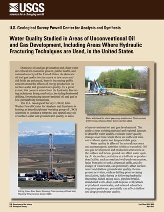
- 1. U.S. Geological Survey Powell Center for Analysis and Synthesis Water Quality Studied in Areas of Unconventional Oil and Gas Development, Including Areas Where Hydraulic Fracturing Techniques are Used, in the United States Domestic oil and gas production and clean water are critical for economic growth, public health, and national security of the United States. As domestic oil and gas production increases in new areas and old fields are enhanced, there is increasing public concern about the effects of energy production on surface-water and groundwater quality. To a great extent, this concern arises from the hydraulic fracturing techniques being used today, including horizontal drilling, for producing unconventional oil and gas in low-permeability formations. The U.S. Geological Survey (USGS) John Wesley Powell Center for Analysis and Synthesis is hosting an interdisciplinary working group of USGS scientists to conduct a temporal and spatial analysis of surface-water and groundwater quality in areas Drill rig, Green River Basin, Wyoming. Photo courtesy of David Mott, Wyoming Water Science Center, USGS. U.S. Department of the Interior U.S. Geological Survey Water withdrawal for oil and gas energy development. Photo courtesy of Tim Kresse, Arkansas Water Science Center, USGS. of unconventional oil and gas development. The analysis uses existing national and regional datasets to describe water quality, evaluate water-quality changes over time where there are sufficient data, and evaluate spatial and temporal data gaps. Water quality is affected by natural processes and anthropogenic activities within a watershed. Oil and gas development and production operations at the surface and below ground can affect water quality. At the surface, activities at a drill site or production facility, such as road and well-pad construction, leaks from pits or tanks, chemical spills, and discharge of wastewater, can potentially affect surfacewater and shallow groundwater quality. Belowground activities, such as drilling prior to casing installation, leaks during or following hydraulic fracturing, failed casing seals, pipeline breaks, abandoned wells, deep-well disposal of flowback or produced wastewater, and induced subsurface migration pathways, potentially can affect shallow and deep groundwater quality. Fact Sheet 2012-3049 April 2012
- 2. The effects of unconventional oil and gas development and production on regional water quality have not been previously described despite the fact that oil and gas development in the United States began nearly 150 years ago, and more than 4 million oil- and gas-related wells (fig. 1) (IHS Energy, 2011) have been drilled with an increasing trend in the use of hydraulic fracturing. The objectives of the USGS Powell Center work group are to (1) better understand hydraulic fracturing in the United States, (2) broadly assess the quality of surface water and groundwater in areas of unconventional oil and gas production, (3) evaluate potential changes in water quality over time, (4) determine current baseline concentrations of major ions in surface water and groundwater in areas of unconventional oil and gas production, (5) identify spatial and temporal data gaps where further information is needed to evaluate existing water quality and water-quality trends, and (6) identify future research needed to better understand the effects of oil and gas production and hydraulic fracturing on surface-water and groundwater quality. The Powell Center study is a collaboration with the USGS National Water-Quality Assessment (NAWQA) Program, which provided water-quality data from the USGS National Water Information System (NWIS) and U.S. Environmental Protection Agency (EPA) Modern Storage and Retrieval (STORET) databases. Preliminary data compilation for areas of unconventional oil and gas production (fig. 2) from the USGS and EPA databases yielded 754,000 water-quality samples collected from 78,000 groundwater (fig. 3) sampling sites and 32,000 surface-water (fig. 4) sampling sites. Major ions, including calcium, magnesium, sodium, bicarbonate (alkalinity), chloride, and sulfate, are the most commonly determined constituents for most waterquality samples. Concentrations of these constituents can be affected by oil and gas development and are typically elevated in produced waters. Spatial and temporal analyses will include summary statistics for major-ion concentrations in samples of surface water, shallow groundwater (within about 100 feet of land surface), and deep groundwater for selected time periods in selected unconventional oil and gas production areas. Where sufficient data are available, changes in water quality over time will be evaluated and described for each area. Areas and time periods for which sufficient data are unavailable will be identified as data gaps where additional data collection may be warranted to evaluate water quality and water-quality trends. EXPLANATION Number of wells 1–100 101–1,000 1,001–10,000 10,001–50,000 >50,001 Figure 1. Number of oil- and gas-related wells in the United States by eight-digit hydrologic unit code.
- 3. EXPLANATION TCFG = Trillions of Cubic Feet of Gas Unconventional oil and gas resources Figure 2. Major areas of unconventional oil and gas development in the United States (U.S. Energy Information Administration and U.S. Geological Survey boundary merge). EXPLANATION Number of groundwater samples 0 1–100 101–250 251–500 501–1,000 1,001–2,000 TCFG = Trillions of Cubic Feet of Gas 2,001–4,000 Figure 3. Number of groundwater-quality samples in areas of unconventional oil and gas development by eight-digit hydrologic unit code. Data compilation from USGS and EPA databases yielded 141,000 groundwater samples from 78,000 sites.
- 4. EXPLANATION Number of surface-water samples 0 1–100 101–250 251–500 501–1,000 1,001–2,000 TCFG = Trillions of Cubic Feet of Gas 2,001–26,000 Figure 4. Number of surface-water-quality samples in areas of unconventional oil and gas development by eight-digit hydrologic unit code. Data compilation from USGS and EPA databases yielded 613,000 surface-water samples from 32,000 sites. Water-resource managers and the public will be able to use these data to broadly assess baseline waterquality conditions, to determine whether water quality in areas of unconventional oil and gas production has changed, and to identify areas where additional water-quality monitoring is warranted. Water-quality changes can result from many different activities and Tanks and equipment used during hydraulic fracturing. Photo courtesy of Susquehanna River Basin Commission. Sand is one of the materials often used to prop open the cracks in rock after it is hydraulically fractured. Photo courtesy of D. Susong, Utah Water Science Center, USGS. sources; thus, identification of specific contaminant pathways is difficult and is beyond the scope of the data available for this study. The Powell Center analysis will identify chemical constituents and assessment tools for improving future water-quality monitoring and assessments specific to hydrocarbon development. Reference IHS Energy, 2011, U.S. production and well data: Database available from IHS Energy, 15 Inverness Way East, D205, Englewood, CO 80112, USA. For specific information about the USGS John Wesley Powell Center study on Hydraulic Fracturing, please email us at gs_powell_center_hydrofrac@usgs.gov