SlideShare a Scribd company logo
1 of 43
Download to read offline
Surface Conditions Report
June 17, 2013
Visit our website (http://www.ecy.wa.gov/programs/eap/mar_wat/)
Eyes Over Puget Sound
Up-to-date observations of visible water quality conditions in Puget Sound and the Strait of Juan de Fuca
Flight log Weather Water column Aerial photos Ferry and Satellite Moorings
Start here
sail boat
LONG-TERMMARINEMONITORINGUNIT
Personal flight log p. 3
Puget Sound on fire! Stunning views of a second
Noctiluca bloom this year from up high.
Weather conditions p.5
Rivers are running below normal.
Air temperatures and sunshine start climbing above expected
values, southerly winds in most places.
Water column and mooring p.6 , p.38
After 2 years of favorable conditions with colder temperatures
and higher oxygen, Puget Sound waters are turning warmer,
resulting in lower dissolved oxygen. A big Noctiluca bloom left
its imprint on dissolved oxygen.
Aerial photography p. 10
The second large Noctiluca bloom this year extends from Everett
to Tacoma. Red-brown blooms in Port Townsend, Discovery Bay,
and Bellingham Bay. Large algal mats or organic material
observed in many places. Jellyfish patches increasing in Budd,
Totten, and Eld Inlets.
Ferry and satellite p. 35
Landsat 8 and Victoria Clipper ferry data help document the
spatial and temporal extent of the large Noctiluca bloom seen in
central Puget Sound.
Mya Keyzers
Laura Friedenberg
Joe Leatherman
Skip Albertson
Dr. Christopher
Krembs
Dr. Brandon
Sackmann
Julia Bos
Suzan Pool
David Mora
www.ecy.wa.gov/programs/eap/mar_wat/eops/Previous Eyes Over Puget Sound reports:
Marine conditions from 6-17-2013 at a glance
Flight log Weather Water column Aerial photos Ferry and Satellite Moorings
Recent conditions created the perfect scenario for…
The real show came at the end of the day when we got to Edmonds and started to see a bright orange
Noctiluca bloom. It was huge! It persisted all the way to South East Passage. It was the most extensive
bloom I have ever seen. Every direction you looked - there it was. It’s as if Puget Sound was on fire!
North Sound Flight
Mya, Christopher and Joe,
go team!
Personal flight log 6-17-2013
Flight log Weather Water column Aerial photos Ferry and Satellite Moorings
Noctiluca to bloom yet again!
North Sound Flight
“The size of this bloom made me wonder…. Why is it happening in the Main Basin and not in South Sound?
Why is it happening again? Why don’t we know more about its appearance and ferocious appetite for
phytoplankton? Could it be that our imprint on Puget Sound is artfully surfacing to remind us of our daily
connection to the Sound? Could these large blooms be a clue of a shift in the food chain?“ –Mya
Christopher collecting a phytoplankton sample at our Skagit Bay station, CTD in background.
Personal flight log 6-17-2013
Flight log Weather Water column Aerial photos Ferry and Satellite Moorings
Weather patterns from 6-3-2013 to 6-17-2013
Meteorological conditions typically explain up to half of the variance in observed marine
variables (Moore et al. 2008), particularly in shallower waters like those of south Puget
Sound. I summarized the specific conditions prevalent during the past two weeks, from north
to south. Source: http://www-k12.atmos.washington.edu/k12/grayskies/nw_weather.html
Moore et al. 2008. Local and large-scale climate forcing of Puget Sound oceanographic properties on seasonal to interdecadal timescales. Limnol. Oceanogr., 53(5), 1746–1758
Summary:
Air temperatures have
increased to above normal
levels for the past several days
after a colder period.
Sunshine levels in the
north have been above
normal for the past several
days following a cloudy
period.
Rivers have been running
much below normal.
Winds have mostly been
from the south to southwest
with the exception in Central
Sound.
Moore et al. 2008. Local and large-scale climate forcing of Puget Sound oceanographic properties on seasonal to interdecadal timescales. Limnol. Oceanogr., 53(5), 1746–1758
We use a chartered float
plane to access our
monthly monitoring
stations most cost
effectively.
We communicate data
and environmental
marine conditions using:
1. Marine Water
Condition Index
(MWCI)
2. Eyes Over Puget
Sound (EOPS)
3. Anomalies and
source data
Flight log Weather Water column Aerial photos Ferry and Satellite Moorings
Our long-termmarinemonitoringstationsin Puget Sound
Start here
Temp: 2013 is warming Salinity: Increasing? Oxygen: Decreasing?
Puget Sound water conditions are changing again! Compared to 2011-2012, when waters were colder and
fresher with higher oxygen, values are closer to expected this year. A sensor check prevented Mar. and Apr.
oxygen data from being available for this report. Each pixel is a monthly survey at each station.
Flight log Weather Water column Aerial photos Ferry and Satellite Moorings
Conditions of the last two years change at our stations
a) Pacific Decadal Oscillation Index (PDO) …(explanation)
b) Upwelling Index (anomalies) (PFEL) …(explanation)
c) North Pacific Gyre Oscillation Index (NPGO) …(explanation)
-25
-15
-5
5
15
25
-1.5
-1
-0.5
0
0.5
1
1.5
1945 1950 1955 1960 1965 1970 1975 1980 1985 1990 1995 2000 2005 2010 2015
NPGO
PDO/UpwellingIndex
Three-year running average of PDO, Upwelling, and NPGO indices scores
Ocean boundary conditions have been favorable for water quality in Puget Sound: (a) colder water (PDO),
(b) less upwelled low oxygen and high nutrient ocean water reaching Puget Sound (Upwelling Index), and
(c) higher surface productivity along the coast (NPGO). Where are we heading next?
Flight log Weather Water column Aerial photos Ferry and Satellite Moorings
.
The oceanaffectswater quality: Ocean ClimateIndices
Nitrate Phosphate
Nutrients in Puget Sound are increasing, read http://www.ecy.wa.gov/programs/eap/mar_wat/trends.html
Nitrate Phosphate Nutrient Balance (Si:N)
Get the data and trends from us!
We observe increasing nutrients and changing algal biomass patterns in Puget Sound
Changing
Nutrient Balance
Algae bloom, Budd Inlet 2010
Summary: Aerial photography 6-17-2013
Second Noctiluca bloom extending from Everett to Tacoma. Red-brown blooms in Port
Townsend & Bellingham Bay. Large algal mats or organic material in may places. Jellyfish
patches increasing in Budd, Totten, and Eld Inlets.
Flight log Weather Water column Aerial photos Ferry and Satellite Moorings
Start here
Mixing and Fronts:
Fronts in the Strait near Lopez Island, Squamish Bay and
Port Townsend.
Debris:
Mostly Noctiluca in many places. Also organic material
rafts in Squamish Bay, Padilla Bay, Port Townsend, and
Hood Canal.
Visible blooms:
Red: Main Basin, Henderson Inlet.
Brown: Port Townsend, Discovery Bay, Bellingham Bay.
Green: Saratoga Passage, Filucy Bay.
Jellyfish: Present in increasing numbers Budd, Eld, Totten
Inlets.
BloomDebrisFront Suspended sediment:
High sediment load from Nooksack River.
Plume
suspended
sediment
2 6
2 4 5 10 13 14 15 16
17
18
19
20
1 2 5 6 7
8 9Ship stirring up sediment, Blakely Island
Oil sheen outside Gig Harbor
3
11 12
10 13 14 15 16
17
8 9 11 12
Aerial photography
navigation guide,
Flight log Weather Water column Aerial photos Ferry and Satellite Moorings
Central & North Sound
Observation Maps:
Seattle: H. tide: 12:29 PM , L. tides: 6:33 AM, 5:43 PM
Afternoon flight, 4-20:
Good visibility, wind increasing
from the south.
Strait of
Juan de Fuca
San Juan Islands
Flight Information:
Morning flight, 1-3:
Low visibility, clouds, calm
South Sound
Padilla Bay
Main Basin
Hood Canal
South Sound
1
2
3
4
5
6
7
8
9
10
12
13
15
11
14
16
17
20
18
19
Whidbey Basin
Organic material accumulating along a convergence. Many clouds obstructing the view.
Location: Scenic Beach State Park (Near Seabeck, Hood Canal), 9:41 AM.
1 Aerial photography 6-17-2013 Navigate
Flight log Weather Water column Aerial photos Ferry and Satellite Moorings
Debris
2 NavigateAerial photography 6-17-2013
Flight log Weather Water column Aerial photos Ferry and Satellite Moorings
A. Strong phytoplankton bloom and front. B. Drifting algal mat in Kilisut Harbor.
Location: Port Townsend (Admiralty Reach), 10:10 AM.
Bloom
Debris
A.
B.
Debris
3 NavigateAerial photography 6-17-2013
Front with two water masses in the Strait of Juan de Fuca west of Deception Pass.
Location: Above southern tip of Lopez Island (Strait Of Juan de Fuca), 11:34 AM.
Flight log Weather Water column Aerial photos Ferry and Satellite Moorings
4 Navigate
Flight log Weather Water column Aerial photos Ferry and Satellite Moorings
Aerial photography 6-17-2013
Red-brown phytoplankton bloom and organic material at surface.
Location: Bellingham Bay (North Sound), 1:32 PM.
Bloom
Bloom
Debris
5 NavigateAerial photography 6-17-2013
Flight log Weather Water column Aerial photos Ferry and Satellite Moorings
Red-brown phytoplankton bloom and abundant organic material at surface.
Location: Samish Bay (North Sound), 2:02 PM.
Debris
Bloom
Abundant organic material at surface.
Location: Samish Bay (North Sound), 2:03 PM.
6 NavigateAerial photography 6-17-2013
Flight log Weather Water column Aerial photos Ferry and Satellite Moorings
Debris
Patches of organic material at surface over shallow water.
Location: Padilla Bay (North Sound), 2:08 PM.
7 NavigateAerial photography 6-17-2013
Flight log Weather Water column Aerial photos Ferry and Satellite Moorings
Debris
Organic material accumulating in bands at surface. Green bloom and many centimeter-sized
organic particles in the water. Location: Saratoga Passage (Whidbey Basin), 2:55 PM.
8 NavigateAerial photography 6-17-2013
Flight log Weather Water column Aerial photos Ferry and Satellite Moorings
Debris boats
Noctiluca bloom beginning to accumulate at surface in bands.
Location: North of Edmonds (Central Basin), 4:52 PM.
9 NavigateAerial photography 6-17-2013
Flight log Weather Water column Aerial photos Ferry and Satellite Moorings
Bloom
Debris
10 NavigateAerial photography 6-17-2013
Noctiluca bloom beginning to accumulate at surface in bands following large eddies.
Location: Port Madison (Central Basin), 4:53 PM.
Flight log Weather Water column Aerial photos Ferry and Satellite Moorings
Debris
Bloom
11 NavigateAerial photography 6-17-2013
Noctiluca bloom at surface in very long bands.
Location: Between Shilshole Bay and Bainbridge Island (Central Basin), 5:25 PM.
Flight log Weather Water column Aerial photos Ferry and Satellite Moorings
Debris
Noctiluca bloom at surface in very long bands.
Location: Between Bainbridge Island and Elliott Bay (Central Basin), 5:27 PM.
12 Navigate
Flight log Weather Water column Aerial photos Ferry and Satellite Moorings
Aerial photography 6-17-2013
sail boat
Debris
Noctiluca bloom at surface in very long bands.
Location: Between Bainbridge Island and Elliott Bay (Central Basin), 4:47 PM.
13 Navigate
Flight log Weather Water column Aerial photos Ferry and Satellite Moorings
Aerial photography 6-17-2013
Debris
ferry
ship
sail boat
ship
Noctiluca bloom at surface in very long bands.
Location: Between Bainbridge Island and Elliott Bay (Central Basin), 4:48 PM.
14 Navigate
Flight log Weather Water column Aerial photos Ferry and Satellite Moorings
Aerial photography 6-17-2013
ship
Debris
sail boat
sail boat
15 Navigate
Flight log Weather Water column Aerial photos Ferry and Satellite Moorings
Noctiluca bloom at surface in very long bands.
Location: Between Bainbridge Island and Elliott Bay (Central Basin), 5:27 PM.
Aerial photography 6-17-2013Debris
ship
16 Navigate
Flight log Weather Water column Aerial photos Ferry and Satellite Moorings
Noctiluca bloom at surface in very long bands.
Location: East of Bainbridge Island (Central Basin), 4:49 PM.
Aerial photography 6-17-2013
Debris
ship
sail boat
17 Navigate
Flight log Weather Water column Aerial photos Ferry and Satellite Moorings
Noctiluca bloom at surface in very long bands. State ferry traveling towards Seattle.
Location: Elliott Bay (Central Basin), 4:50 PM.
Aerial photography 6-17-2013
Debris
18 Navigate
Flight log Weather Water column Aerial photos Ferry and Satellite Moorings
Noctiluca bloom at surface in large patch washing onto public beach.
Location: Alki Beach, West Seattle (Central Basin), 4:51 PM.
Aerial photography 6-17-2013
19 Navigate
Flight log Weather Water column Aerial photos Ferry and Satellite Moorings
Phytoplankton bloom in colors of green to brown.
Location: Filucy Bay across from McNeil Island (South Sound), 5:39 PM.
Aerial photography 6-17-2013
Bloom
20 Navigate
Flight log Weather Water column Aerial photos Ferry and Satellite Moorings
Green and red plankton bloom. Location: Henderson Inlet (South Sound), 5:43 PM.
Aerial photography 6-17-2013
Bloom
Bloom
North Sound/San Juans
Aerial photography observations in Central Sound Navigate
Flight log Weather Water column Aerial photos Ferry and Satellite Moorings
Numbers on map refer to picture numbers for spatial reference
Date: 6-17-2013
Central Sound
2
3
4
5
6
8
9
10
12
11
13
15
1416
17
18 7
Aerial
photography
Observations in
South Sound:
6-17-2012
Numbers on map refer to picture
numbers for spatial reference
Navigate
Flight log Weather Water column Aerial photos Ferry and Satellite Moorings
South Sound
1
20
Hood Canal very cloudy (1) not on map
19
Legend to map annotations
Comments:
Maps are produced by observers during and
after flights. They are intended to give an
approximate reconstruction of the surface
conditions on scales that connect to and
overlap with satellite images in the section that
follows.
Debris:
Debris can be distinguished into natural and
anthropogenic debris floating at the surface
sensu Moore and Allen (2000). The majority of
organic debris in Puget Sound is natural mixed
with discarded man-made pieces of plastic,
wood, etc. From the plane, we cannot
differentiate the quality of debris at the surface
and therefore, call it for reasons of practicality
just “debris”.
S.L. Moore, M. J. Allen. 2000. Distribution of
Anthropogenic and Natural Debris on the
Mainland Shelf of the Southern California Bight.
Marine Pollution Bulletin, 40(1), 83–88.
Navigate
Flight log Weather Water column Aerial photos Ferry and Satellite Moorings
Brandon Sackmann
Contact:
bsackmann@ecy.wa.gov
MERIS True Color image used for spatial context (19 February 2011) of the Victoria Clipper en route monitoring route (red dashes on map).
Ferry and satellite observations 6-17-2013
Flight log Weather Water column Aerial photos Ferry and Satellite Moorings
Start here
17 June 17 June
Current Conditions:
Warm, fresh water entering central Puget
Sound from Whidbey Basin. Sea surface
temperatures >15 °C. Moderate fluorescence
north of Elliott Bay, outside area covered by
intense Noctiluca bloom.
Ferry and satellite observations 6-17-2013
Flight log Weather Water column Aerial photos Ferry and Satellite Moorings
30-m RBG Color-enhanced
15-m B/W Panchromatic
Noctiluca bloom
visible from space
(Landsat 8)
17 June 2013
A new Landsat satellite
sensor (launched 11
February 2013) and clear
skies provided a synoptic
snapshot of the intense
Noctiluca bloom in
central Puget Sound,
located just outside of
Elliott Bay.
Aerial Photo
Ferry and satellite observations 6-17-2013
Flight log Weather Water column Aerial photos Ferry and Satellite Moorings
Clipper data suggests that the clearing of near-surface waters
in response to the Noctiluca bloom may have began on 14
June .
On 15 June clearer surface water (due to grazing by Noctiluca)
was observed as far north as 47.8 °N, near the Triple Junction
(off the south tip of Whidbey Island).
On 16-17 June clearer surface water was confined to <47.7 N,
closer to Elliott Bay. NoClipperDataAvailable
NoClipperDataAvailable
This particular Noctiluca bloom has
partially extended into the
warmer/fresher waters seen
entering central Puget Sound from
Whidbey Basin. See page 19.
Summary: After a recent peak in dissolved oxygen (and phytoplankton bloom) on June 13,
levels have dropped off sharply (>3.0 mg/L). The decline is coincident with the
Noctiluca bloom. Lower DO would be consistent with heterotrophic respiration and
the decrease of oxygen-producing phytoplankton from grazing.
Mooring observations and trends
6-3-2013 to 6-17-2013
Flight log Weather Water column Aerial photos Ferry and Satellite Moorings
Mukilteo, Whidbey Basin near Everett:
Real-time
data online
(click)
Mukilteo Dissolved Oxygen Conditions (12-16 m)
DO Max 11.1 mg/L 06/13 10.1 PSU 27.9 °C 11.7 db
DO Min 7.1 mg/L 06/17 7.3 PSU 29.2 °C 10.4 db
DO Avg 8
DO Trend 0.1 mg/L
DO-Sal Corr -0.65
DO-Temp
Corr
0.4
Mukilteo Salinity (Sal) Conditions (12-16 m)
Sal Max 29.4 PSU 06/07 29.4 °C 9.8 db
Sal Min 27.3 PSU 06/12 28.8 °C 10.7 db
Sal Avg 29 PSU
Sal Trend -0.4 PSU
Mukilteo Temperature (T) Conditions (12-16 m)
T Max 12.5 °C 06/13 11.1 PSU 12.5 db
T Min 9.8 °C 06/06 7.5 PSU 9.8 db
T Avg 10.4 °C
T Trend 1.2 °C
Left Panel: Probability of finding a specific density over
the past two-week period. High probability shown in
warm colors.
Right Panel: Dissolved oxygen concentration in relation to
salinity. High probability shown in warm colors.
This month we report on thickness of the fresh water layer by monitoring our near-
surface sensor. The pycnocline is often near the surface sensor.
We report on thickness of the fresher water layer by monitoring our near-surface sensor. This is another
way to interpret the amount of freshwater entering Puget Sound.
Go to our mooring website at: http://www.ecy.wa.gov/programs/eap/mar_wat/moorings.html
Real-time data online (click)
Summary: The depth of the surface water layer varied around 12–15 m responding to a suite
of local and distant marine and atmospheric factors that influence its character.
Mooring observations and trends
6-3-2013 to 6-17-2013
We track the depth of the
isohaline where salinity is
28.55 (±0.05) to measure the
thickness of the freshwater
layer at our Mukilteo station.
The near-surface sensor
experienced tidal pressure
variations of 11.0 to 16.0
meters (or decibars).
Flight log Weather Water column Aerial photos Ferry and Satellite Moorings
Daily average depth of the 28.55 isohaline at Mukilteo
Pressure(db)
Daily average depth of the 28.55 isohaline at Mukilteo
Pressure(db)
* The pycnocline is shallower and outside our monitored depth range.
*
10
11
12
13
14
15
16
17
6/3
6/4
6/5
6/6
6/7
6/8
6/9
6/10
6/11
6/12
6/13
6/14
6/15
6/16
* ** *
Mooring observations and trends
5-17-2013 to 6-17-2013
Flight log Weather Water column Aerial photos Ferry and Satellite Moorings
At Mukilteo (Whidbey Basin), the thickness of the surface water layer responded to winds and the tidal cycle
(tidal range, black dots). A shallow pycnocline (<10 m and therefore above our sensor location, indicated by
no blue bar) generally coincides with days of northerly winds. Freshwater input was relatively steady with
water from the Skagit River contributing the largest portion.
*
-10
-5
0
5
10
15
20
2510
12
14
16
18
20
22
24
26
28
30
17-May
18-May
19-May
20-May
21-May
22-May
23-May
24-May
25-May
26-May
27-May
28-May
29-May
30-May
31-May
1-Jun
2-Jun
3-Jun
4-Jun
5-Jun
6-Jun
7-Jun
8-Jun
9-Jun
10-Jun
11-Jun
12-Jun
13-Jun
14-Jun
15-Jun
16-Jun
17-Jun
Discharge(102m3/sec),Avg.Tidalrange(ft),
DailyN-SWindspeed(kts)
28.55IsohalinePressure(db)
Thickness of surface layer at Mukilteo and influencing factors
Skagit Flow Snohomish Flow 28.55 Isohaline N-S Wind Tide Range
Northerly Winds
Mooring observations and trends
Admiralty Inlet 2010 to 2013
Flight log Weather Water column Aerial photos Ferry and Satellite Moorings
This slide shows data from our Possession Sound
mooring (12-16 m). Inter-annual variability in
temperature, salinity, and dissolved oxygen is
shown over a
3.5 year period. All three variables show strong
seasonality.
Thus far, 2013 appears similar to 2010 with
relatively warmer water temperature, higher
salinity, and lower dissolved oxygen.0.0
2.0
4.0
6.0
8.0
10.0
12.0
J F M A M J J A S O N D
DissolvedOxygen(mg/l)
Dissolved Oxygen
(Monthly Average)
2010 2011 2012 2013
0.0
2.0
4.0
6.0
8.0
10.0
12.0
14.0
J F M A M J J A S O N D
Temperature(°C)
Temperature
(Monthly Average)
2010 2011 2012 2013
26.5
27.0
27.5
28.0
28.5
29.0
29.5
30.0
30.5
J F M A M J J A S O N D
Salinity(psu)
Salinity
(Monthly Average) 2010 2011 2012 2013
Access mooring
data:
http://www.ecy.wa.gov/pr
ograms/eap/mar_wat/-
.html
Ferry and satellite :
brandon.sackmann@ecy.w
a.gov
Get data from Ecology’s Monitoring Programs
Long–Term
Monitoring Network
Real–Time
Sensor Network
Access core
monitoring data:
http://www.ecy.wa.gov/a
pps/eap/marinewq/mwda
taset.asp
christopher.krembs@ecy.w
a.gov
Ecology’s long-term marine
monitoring stations
Ferry track
Morning flight
Evening flight
Freshwater Report:
http://www.ecy.wa.gov/programs
/eap/fw_riv/freshwaterReport/A
mbient_Monitoring-
Monthly_Summary.html
Flight log Weather Water column Aerial photos Ferry and Satellite Moorings
You may subscribe or unsubscribe to the Eyes Over Puget Sound email listserv by going to:
http://listserv.wa.gov/cgi-bin/wa?A0=ECOLOGY-EYES-OVER-PUGET-SOUND
Many thanks to our business partners: Clipper Navigation, Swantown Marina, and Kenmore Air.
We are looking for feedback to improve our products.
Dr. Christopher Krembs
christopher.krembs@ecy.wa.gov
Marine Monitoring Unit
Environmental Assessment Program
WA Department of Ecology
Flight log Weather Water column Aerial photos Ferry and Satellite Moorings

More Related Content

What's hot (17)

Eops 2013 12_31
Eops 2013 12_31Eops 2013 12_31
Eops 2013 12_31
 
Eops 2015 2_17
Eops 2015 2_17Eops 2015 2_17
Eops 2015 2_17
 
Eops 2013 09_11
Eops 2013 09_11Eops 2013 09_11
Eops 2013 09_11
 
Eops 2013 01_15
Eops 2013 01_15Eops 2013 01_15
Eops 2013 01_15
 
Eops 2014 09_16
Eops 2014 09_16Eops 2014 09_16
Eops 2014 09_16
 
Eops 2015 8_4
Eops 2015 8_4Eops 2015 8_4
Eops 2015 8_4
 
Eops 2014 04_21
Eops 2014 04_21Eops 2014 04_21
Eops 2014 04_21
 
Eops 2015 12_30
Eops 2015 12_30Eops 2015 12_30
Eops 2015 12_30
 
Eops 2016 05_02
Eops 2016 05_02Eops 2016 05_02
Eops 2016 05_02
 
Eops 2015 6_8
Eops 2015 6_8Eops 2015 6_8
Eops 2015 6_8
 
Eops 2014 03_24
Eops 2014 03_24Eops 2014 03_24
Eops 2014 03_24
 
Eops 2015 10_6
Eops 2015 10_6Eops 2015 10_6
Eops 2015 10_6
 
Eops 2015 1_28
Eops 2015 1_28Eops 2015 1_28
Eops 2015 1_28
 
Eops 2016 03_16
Eops 2016 03_16Eops 2016 03_16
Eops 2016 03_16
 
Eops 2015 12_14
Eops 2015 12_14Eops 2015 12_14
Eops 2015 12_14
 
Eops 2016 12_31
Eops 2016 12_31Eops 2016 12_31
Eops 2016 12_31
 
Eops 2015 9_21
Eops 2015 9_21Eops 2015 9_21
Eops 2015 9_21
 

Viewers also liked (15)

Introduction to UQU medical Research Club
Introduction to UQU medical Research ClubIntroduction to UQU medical Research Club
Introduction to UQU medical Research Club
 
Eops 2012 03_19
Eops 2012 03_19Eops 2012 03_19
Eops 2012 03_19
 
Introduction to UQU medical Reserach Club
Introduction to UQU medical Reserach ClubIntroduction to UQU medical Reserach Club
Introduction to UQU medical Reserach Club
 
First World
First WorldFirst World
First World
 
Eops 2011 09_12
Eops 2011 09_12Eops 2011 09_12
Eops 2011 09_12
 
Eops 2012 02_27
Eops 2012 02_27Eops 2012 02_27
Eops 2012 02_27
 
Eops 2014 10_29
Eops 2014 10_29Eops 2014 10_29
Eops 2014 10_29
 
Searching uqu library
Searching uqu librarySearching uqu library
Searching uqu library
 
Searching Uqu Library
Searching Uqu LibrarySearching Uqu Library
Searching Uqu Library
 
Eops 2013 11_21
Eops 2013 11_21Eops 2013 11_21
Eops 2013 11_21
 
Eops 2012 06_12
Eops 2012 06_12Eops 2012 06_12
Eops 2012 06_12
 
Eops 2013 10_28
Eops 2013 10_28Eops 2013 10_28
Eops 2013 10_28
 
Eops 2013 05_20
Eops 2013 05_20Eops 2013 05_20
Eops 2013 05_20
 
literature review
literature reviewliterature review
literature review
 
Principles of research
Principles of researchPrinciples of research
Principles of research
 

Similar to Eops 2013 06_17

Similar to Eops 2013 06_17 (17)

Eops 2014 09_16
Eops 2014 09_16Eops 2014 09_16
Eops 2014 09_16
 
EOPS_2012_03_19.pdf
EOPS_2012_03_19.pdfEOPS_2012_03_19.pdf
EOPS_2012_03_19.pdf
 
Eops 2015 4_29
Eops 2015 4_29Eops 2015 4_29
Eops 2015 4_29
 
EOPS_2012_02_27.pdf
EOPS_2012_02_27.pdfEOPS_2012_02_27.pdf
EOPS_2012_02_27.pdf
 
Eops 2013 03_25
Eops 2013 03_25Eops 2013 03_25
Eops 2013 03_25
 
Eops 2013 04_08
Eops 2013 04_08Eops 2013 04_08
Eops 2013 04_08
 
Eops 2014 11_17
Eops 2014 11_17Eops 2014 11_17
Eops 2014 11_17
 
EOPS_2011_11_15.pdf
EOPS_2011_11_15.pdfEOPS_2011_11_15.pdf
EOPS_2011_11_15.pdf
 
Eops 2014 02_04
Eops 2014 02_04Eops 2014 02_04
Eops 2014 02_04
 
EOPS_2011_08_08.pdf
EOPS_2011_08_08.pdfEOPS_2011_08_08.pdf
EOPS_2011_08_08.pdf
 
Eops 2014 10_29
Eops 2014 10_29Eops 2014 10_29
Eops 2014 10_29
 
EOPS_2011_10_17.pdf
EOPS_2011_10_17.pdfEOPS_2011_10_17.pdf
EOPS_2011_10_17.pdf
 
Eops 2016 04_06
Eops 2016 04_06Eops 2016 04_06
Eops 2016 04_06
 
Eops 2017 7_24
Eops 2017 7_24Eops 2017 7_24
Eops 2017 7_24
 
EOPS_2011_12_05.pdf
EOPS_2011_12_05.pdfEOPS_2011_12_05.pdf
EOPS_2011_12_05.pdf
 
Eops 2012 04_23
Eops 2012 04_23Eops 2012 04_23
Eops 2012 04_23
 
EOPS_2018_06_28.pdf
EOPS_2018_06_28.pdfEOPS_2018_06_28.pdf
EOPS_2018_06_28.pdf
 

More from Christopher Krembs (6)

Eops 2015 9_21
Eops 2015 9_21Eops 2015 9_21
Eops 2015 9_21
 
Eops 2015 7_6
Eops 2015 7_6Eops 2015 7_6
Eops 2015 7_6
 
Eops 2015 3_24
Eops 2015 3_24Eops 2015 3_24
Eops 2015 3_24
 
Eops 2014 12_30
Eops 2014 12_30Eops 2014 12_30
Eops 2014 12_30
 
Eops 2013 11_21
Eops 2013 11_21Eops 2013 11_21
Eops 2013 11_21
 
Eops 2013 06_17
Eops 2013 06_17Eops 2013 06_17
Eops 2013 06_17
 

Recently uploaded

Youth Involvement in an Innovative Coconut Value Chain by Mwalimu Menza
Youth Involvement in an Innovative Coconut Value Chain by Mwalimu MenzaYouth Involvement in an Innovative Coconut Value Chain by Mwalimu Menza
Youth Involvement in an Innovative Coconut Value Chain by Mwalimu Menzaictsugar
 
2024 Numerator Consumer Study of Cannabis Usage
2024 Numerator Consumer Study of Cannabis Usage2024 Numerator Consumer Study of Cannabis Usage
2024 Numerator Consumer Study of Cannabis UsageNeil Kimberley
 
IoT Insurance Observatory: summary 2024
IoT Insurance Observatory:  summary 2024IoT Insurance Observatory:  summary 2024
IoT Insurance Observatory: summary 2024Matteo Carbone
 
(Best) ENJOY Call Girls in Faridabad Ex | 8377087607
(Best) ENJOY Call Girls in Faridabad Ex | 8377087607(Best) ENJOY Call Girls in Faridabad Ex | 8377087607
(Best) ENJOY Call Girls in Faridabad Ex | 8377087607dollysharma2066
 
PSCC - Capability Statement Presentation
PSCC - Capability Statement PresentationPSCC - Capability Statement Presentation
PSCC - Capability Statement PresentationAnamaria Contreras
 
Future Of Sample Report 2024 | Redacted Version
Future Of Sample Report 2024 | Redacted VersionFuture Of Sample Report 2024 | Redacted Version
Future Of Sample Report 2024 | Redacted VersionMintel Group
 
APRIL2024_UKRAINE_xml_0000000000000 .pdf
APRIL2024_UKRAINE_xml_0000000000000 .pdfAPRIL2024_UKRAINE_xml_0000000000000 .pdf
APRIL2024_UKRAINE_xml_0000000000000 .pdfRbc Rbcua
 
Cybersecurity Awareness Training Presentation v2024.03
Cybersecurity Awareness Training Presentation v2024.03Cybersecurity Awareness Training Presentation v2024.03
Cybersecurity Awareness Training Presentation v2024.03DallasHaselhorst
 
Memorándum de Entendimiento (MoU) entre Codelco y SQM
Memorándum de Entendimiento (MoU) entre Codelco y SQMMemorándum de Entendimiento (MoU) entre Codelco y SQM
Memorándum de Entendimiento (MoU) entre Codelco y SQMVoces Mineras
 
Buy gmail accounts.pdf Buy Old Gmail Accounts
Buy gmail accounts.pdf Buy Old Gmail AccountsBuy gmail accounts.pdf Buy Old Gmail Accounts
Buy gmail accounts.pdf Buy Old Gmail AccountsBuy Verified Accounts
 
Kenya Coconut Production Presentation by Dr. Lalith Perera
Kenya Coconut Production Presentation by Dr. Lalith PereraKenya Coconut Production Presentation by Dr. Lalith Perera
Kenya Coconut Production Presentation by Dr. Lalith Pereraictsugar
 
International Business Environments and Operations 16th Global Edition test b...
International Business Environments and Operations 16th Global Edition test b...International Business Environments and Operations 16th Global Edition test b...
International Business Environments and Operations 16th Global Edition test b...ssuserf63bd7
 
Investment in The Coconut Industry by Nancy Cheruiyot
Investment in The Coconut Industry by Nancy CheruiyotInvestment in The Coconut Industry by Nancy Cheruiyot
Investment in The Coconut Industry by Nancy Cheruiyotictsugar
 
Call US-88OO1O2216 Call Girls In Mahipalpur Female Escort Service
Call US-88OO1O2216 Call Girls In Mahipalpur Female Escort ServiceCall US-88OO1O2216 Call Girls In Mahipalpur Female Escort Service
Call US-88OO1O2216 Call Girls In Mahipalpur Female Escort Servicecallgirls2057
 
Innovation Conference 5th March 2024.pdf
Innovation Conference 5th March 2024.pdfInnovation Conference 5th March 2024.pdf
Innovation Conference 5th March 2024.pdfrichard876048
 
Ms Motilal Padampat Sugar Mills vs. State of Uttar Pradesh & Ors. - A Milesto...
Ms Motilal Padampat Sugar Mills vs. State of Uttar Pradesh & Ors. - A Milesto...Ms Motilal Padampat Sugar Mills vs. State of Uttar Pradesh & Ors. - A Milesto...
Ms Motilal Padampat Sugar Mills vs. State of Uttar Pradesh & Ors. - A Milesto...ShrutiBose4
 
Pitch Deck Teardown: Geodesic.Life's $500k Pre-seed deck
Pitch Deck Teardown: Geodesic.Life's $500k Pre-seed deckPitch Deck Teardown: Geodesic.Life's $500k Pre-seed deck
Pitch Deck Teardown: Geodesic.Life's $500k Pre-seed deckHajeJanKamps
 
Call Us 📲8800102216📞 Call Girls In DLF City Gurgaon
Call Us 📲8800102216📞 Call Girls In DLF City GurgaonCall Us 📲8800102216📞 Call Girls In DLF City Gurgaon
Call Us 📲8800102216📞 Call Girls In DLF City Gurgaoncallgirls2057
 

Recently uploaded (20)

Youth Involvement in an Innovative Coconut Value Chain by Mwalimu Menza
Youth Involvement in an Innovative Coconut Value Chain by Mwalimu MenzaYouth Involvement in an Innovative Coconut Value Chain by Mwalimu Menza
Youth Involvement in an Innovative Coconut Value Chain by Mwalimu Menza
 
No-1 Call Girls In Goa 93193 VIP 73153 Escort service In North Goa Panaji, Ca...
No-1 Call Girls In Goa 93193 VIP 73153 Escort service In North Goa Panaji, Ca...No-1 Call Girls In Goa 93193 VIP 73153 Escort service In North Goa Panaji, Ca...
No-1 Call Girls In Goa 93193 VIP 73153 Escort service In North Goa Panaji, Ca...
 
2024 Numerator Consumer Study of Cannabis Usage
2024 Numerator Consumer Study of Cannabis Usage2024 Numerator Consumer Study of Cannabis Usage
2024 Numerator Consumer Study of Cannabis Usage
 
IoT Insurance Observatory: summary 2024
IoT Insurance Observatory:  summary 2024IoT Insurance Observatory:  summary 2024
IoT Insurance Observatory: summary 2024
 
(Best) ENJOY Call Girls in Faridabad Ex | 8377087607
(Best) ENJOY Call Girls in Faridabad Ex | 8377087607(Best) ENJOY Call Girls in Faridabad Ex | 8377087607
(Best) ENJOY Call Girls in Faridabad Ex | 8377087607
 
PSCC - Capability Statement Presentation
PSCC - Capability Statement PresentationPSCC - Capability Statement Presentation
PSCC - Capability Statement Presentation
 
Future Of Sample Report 2024 | Redacted Version
Future Of Sample Report 2024 | Redacted VersionFuture Of Sample Report 2024 | Redacted Version
Future Of Sample Report 2024 | Redacted Version
 
APRIL2024_UKRAINE_xml_0000000000000 .pdf
APRIL2024_UKRAINE_xml_0000000000000 .pdfAPRIL2024_UKRAINE_xml_0000000000000 .pdf
APRIL2024_UKRAINE_xml_0000000000000 .pdf
 
Cybersecurity Awareness Training Presentation v2024.03
Cybersecurity Awareness Training Presentation v2024.03Cybersecurity Awareness Training Presentation v2024.03
Cybersecurity Awareness Training Presentation v2024.03
 
Memorándum de Entendimiento (MoU) entre Codelco y SQM
Memorándum de Entendimiento (MoU) entre Codelco y SQMMemorándum de Entendimiento (MoU) entre Codelco y SQM
Memorándum de Entendimiento (MoU) entre Codelco y SQM
 
Buy gmail accounts.pdf Buy Old Gmail Accounts
Buy gmail accounts.pdf Buy Old Gmail AccountsBuy gmail accounts.pdf Buy Old Gmail Accounts
Buy gmail accounts.pdf Buy Old Gmail Accounts
 
Kenya Coconut Production Presentation by Dr. Lalith Perera
Kenya Coconut Production Presentation by Dr. Lalith PereraKenya Coconut Production Presentation by Dr. Lalith Perera
Kenya Coconut Production Presentation by Dr. Lalith Perera
 
International Business Environments and Operations 16th Global Edition test b...
International Business Environments and Operations 16th Global Edition test b...International Business Environments and Operations 16th Global Edition test b...
International Business Environments and Operations 16th Global Edition test b...
 
Investment in The Coconut Industry by Nancy Cheruiyot
Investment in The Coconut Industry by Nancy CheruiyotInvestment in The Coconut Industry by Nancy Cheruiyot
Investment in The Coconut Industry by Nancy Cheruiyot
 
Call US-88OO1O2216 Call Girls In Mahipalpur Female Escort Service
Call US-88OO1O2216 Call Girls In Mahipalpur Female Escort ServiceCall US-88OO1O2216 Call Girls In Mahipalpur Female Escort Service
Call US-88OO1O2216 Call Girls In Mahipalpur Female Escort Service
 
Innovation Conference 5th March 2024.pdf
Innovation Conference 5th March 2024.pdfInnovation Conference 5th March 2024.pdf
Innovation Conference 5th March 2024.pdf
 
Corporate Profile 47Billion Information Technology
Corporate Profile 47Billion Information TechnologyCorporate Profile 47Billion Information Technology
Corporate Profile 47Billion Information Technology
 
Ms Motilal Padampat Sugar Mills vs. State of Uttar Pradesh & Ors. - A Milesto...
Ms Motilal Padampat Sugar Mills vs. State of Uttar Pradesh & Ors. - A Milesto...Ms Motilal Padampat Sugar Mills vs. State of Uttar Pradesh & Ors. - A Milesto...
Ms Motilal Padampat Sugar Mills vs. State of Uttar Pradesh & Ors. - A Milesto...
 
Pitch Deck Teardown: Geodesic.Life's $500k Pre-seed deck
Pitch Deck Teardown: Geodesic.Life's $500k Pre-seed deckPitch Deck Teardown: Geodesic.Life's $500k Pre-seed deck
Pitch Deck Teardown: Geodesic.Life's $500k Pre-seed deck
 
Call Us 📲8800102216📞 Call Girls In DLF City Gurgaon
Call Us 📲8800102216📞 Call Girls In DLF City GurgaonCall Us 📲8800102216📞 Call Girls In DLF City Gurgaon
Call Us 📲8800102216📞 Call Girls In DLF City Gurgaon
 

Eops 2013 06_17

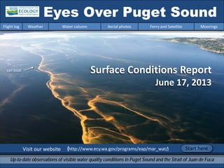
  • 1. Surface Conditions Report June 17, 2013 Visit our website (http://www.ecy.wa.gov/programs/eap/mar_wat/) Eyes Over Puget Sound Up-to-date observations of visible water quality conditions in Puget Sound and the Strait of Juan de Fuca Flight log Weather Water column Aerial photos Ferry and Satellite Moorings Start here sail boat
  • 2. LONG-TERMMARINEMONITORINGUNIT Personal flight log p. 3 Puget Sound on fire! Stunning views of a second Noctiluca bloom this year from up high. Weather conditions p.5 Rivers are running below normal. Air temperatures and sunshine start climbing above expected values, southerly winds in most places. Water column and mooring p.6 , p.38 After 2 years of favorable conditions with colder temperatures and higher oxygen, Puget Sound waters are turning warmer, resulting in lower dissolved oxygen. A big Noctiluca bloom left its imprint on dissolved oxygen. Aerial photography p. 10 The second large Noctiluca bloom this year extends from Everett to Tacoma. Red-brown blooms in Port Townsend, Discovery Bay, and Bellingham Bay. Large algal mats or organic material observed in many places. Jellyfish patches increasing in Budd, Totten, and Eld Inlets. Ferry and satellite p. 35 Landsat 8 and Victoria Clipper ferry data help document the spatial and temporal extent of the large Noctiluca bloom seen in central Puget Sound. Mya Keyzers Laura Friedenberg Joe Leatherman Skip Albertson Dr. Christopher Krembs Dr. Brandon Sackmann Julia Bos Suzan Pool David Mora www.ecy.wa.gov/programs/eap/mar_wat/eops/Previous Eyes Over Puget Sound reports: Marine conditions from 6-17-2013 at a glance Flight log Weather Water column Aerial photos Ferry and Satellite Moorings
  • 3. Recent conditions created the perfect scenario for… The real show came at the end of the day when we got to Edmonds and started to see a bright orange Noctiluca bloom. It was huge! It persisted all the way to South East Passage. It was the most extensive bloom I have ever seen. Every direction you looked - there it was. It’s as if Puget Sound was on fire! North Sound Flight Mya, Christopher and Joe, go team! Personal flight log 6-17-2013 Flight log Weather Water column Aerial photos Ferry and Satellite Moorings Noctiluca to bloom yet again!
  • 4. North Sound Flight “The size of this bloom made me wonder…. Why is it happening in the Main Basin and not in South Sound? Why is it happening again? Why don’t we know more about its appearance and ferocious appetite for phytoplankton? Could it be that our imprint on Puget Sound is artfully surfacing to remind us of our daily connection to the Sound? Could these large blooms be a clue of a shift in the food chain?“ –Mya Christopher collecting a phytoplankton sample at our Skagit Bay station, CTD in background. Personal flight log 6-17-2013 Flight log Weather Water column Aerial photos Ferry and Satellite Moorings
  • 5. Flight log Weather Water column Aerial photos Ferry and Satellite Moorings Weather patterns from 6-3-2013 to 6-17-2013 Meteorological conditions typically explain up to half of the variance in observed marine variables (Moore et al. 2008), particularly in shallower waters like those of south Puget Sound. I summarized the specific conditions prevalent during the past two weeks, from north to south. Source: http://www-k12.atmos.washington.edu/k12/grayskies/nw_weather.html Moore et al. 2008. Local and large-scale climate forcing of Puget Sound oceanographic properties on seasonal to interdecadal timescales. Limnol. Oceanogr., 53(5), 1746–1758 Summary: Air temperatures have increased to above normal levels for the past several days after a colder period. Sunshine levels in the north have been above normal for the past several days following a cloudy period. Rivers have been running much below normal. Winds have mostly been from the south to southwest with the exception in Central Sound. Moore et al. 2008. Local and large-scale climate forcing of Puget Sound oceanographic properties on seasonal to interdecadal timescales. Limnol. Oceanogr., 53(5), 1746–1758
  • 6. We use a chartered float plane to access our monthly monitoring stations most cost effectively. We communicate data and environmental marine conditions using: 1. Marine Water Condition Index (MWCI) 2. Eyes Over Puget Sound (EOPS) 3. Anomalies and source data Flight log Weather Water column Aerial photos Ferry and Satellite Moorings Our long-termmarinemonitoringstationsin Puget Sound Start here
  • 7. Temp: 2013 is warming Salinity: Increasing? Oxygen: Decreasing? Puget Sound water conditions are changing again! Compared to 2011-2012, when waters were colder and fresher with higher oxygen, values are closer to expected this year. A sensor check prevented Mar. and Apr. oxygen data from being available for this report. Each pixel is a monthly survey at each station. Flight log Weather Water column Aerial photos Ferry and Satellite Moorings Conditions of the last two years change at our stations
  • 8. a) Pacific Decadal Oscillation Index (PDO) …(explanation) b) Upwelling Index (anomalies) (PFEL) …(explanation) c) North Pacific Gyre Oscillation Index (NPGO) …(explanation) -25 -15 -5 5 15 25 -1.5 -1 -0.5 0 0.5 1 1.5 1945 1950 1955 1960 1965 1970 1975 1980 1985 1990 1995 2000 2005 2010 2015 NPGO PDO/UpwellingIndex Three-year running average of PDO, Upwelling, and NPGO indices scores Ocean boundary conditions have been favorable for water quality in Puget Sound: (a) colder water (PDO), (b) less upwelled low oxygen and high nutrient ocean water reaching Puget Sound (Upwelling Index), and (c) higher surface productivity along the coast (NPGO). Where are we heading next? Flight log Weather Water column Aerial photos Ferry and Satellite Moorings . The oceanaffectswater quality: Ocean ClimateIndices
  • 9. Nitrate Phosphate Nutrients in Puget Sound are increasing, read http://www.ecy.wa.gov/programs/eap/mar_wat/trends.html Nitrate Phosphate Nutrient Balance (Si:N) Get the data and trends from us! We observe increasing nutrients and changing algal biomass patterns in Puget Sound Changing Nutrient Balance Algae bloom, Budd Inlet 2010
  • 10. Summary: Aerial photography 6-17-2013 Second Noctiluca bloom extending from Everett to Tacoma. Red-brown blooms in Port Townsend & Bellingham Bay. Large algal mats or organic material in may places. Jellyfish patches increasing in Budd, Totten, and Eld Inlets. Flight log Weather Water column Aerial photos Ferry and Satellite Moorings Start here Mixing and Fronts: Fronts in the Strait near Lopez Island, Squamish Bay and Port Townsend. Debris: Mostly Noctiluca in many places. Also organic material rafts in Squamish Bay, Padilla Bay, Port Townsend, and Hood Canal. Visible blooms: Red: Main Basin, Henderson Inlet. Brown: Port Townsend, Discovery Bay, Bellingham Bay. Green: Saratoga Passage, Filucy Bay. Jellyfish: Present in increasing numbers Budd, Eld, Totten Inlets. BloomDebrisFront Suspended sediment: High sediment load from Nooksack River. Plume suspended sediment 2 6 2 4 5 10 13 14 15 16 17 18 19 20 1 2 5 6 7 8 9Ship stirring up sediment, Blakely Island Oil sheen outside Gig Harbor 3 11 12 10 13 14 15 16 17 8 9 11 12
  • 11. Aerial photography navigation guide, Flight log Weather Water column Aerial photos Ferry and Satellite Moorings Central & North Sound Observation Maps: Seattle: H. tide: 12:29 PM , L. tides: 6:33 AM, 5:43 PM Afternoon flight, 4-20: Good visibility, wind increasing from the south. Strait of Juan de Fuca San Juan Islands Flight Information: Morning flight, 1-3: Low visibility, clouds, calm South Sound Padilla Bay Main Basin Hood Canal South Sound 1 2 3 4 5 6 7 8 9 10 12 13 15 11 14 16 17 20 18 19 Whidbey Basin
  • 12. Organic material accumulating along a convergence. Many clouds obstructing the view. Location: Scenic Beach State Park (Near Seabeck, Hood Canal), 9:41 AM. 1 Aerial photography 6-17-2013 Navigate Flight log Weather Water column Aerial photos Ferry and Satellite Moorings Debris
  • 13. 2 NavigateAerial photography 6-17-2013 Flight log Weather Water column Aerial photos Ferry and Satellite Moorings A. Strong phytoplankton bloom and front. B. Drifting algal mat in Kilisut Harbor. Location: Port Townsend (Admiralty Reach), 10:10 AM. Bloom Debris A. B. Debris
  • 14. 3 NavigateAerial photography 6-17-2013 Front with two water masses in the Strait of Juan de Fuca west of Deception Pass. Location: Above southern tip of Lopez Island (Strait Of Juan de Fuca), 11:34 AM. Flight log Weather Water column Aerial photos Ferry and Satellite Moorings
  • 15. 4 Navigate Flight log Weather Water column Aerial photos Ferry and Satellite Moorings Aerial photography 6-17-2013 Red-brown phytoplankton bloom and organic material at surface. Location: Bellingham Bay (North Sound), 1:32 PM. Bloom Bloom Debris
  • 16. 5 NavigateAerial photography 6-17-2013 Flight log Weather Water column Aerial photos Ferry and Satellite Moorings Red-brown phytoplankton bloom and abundant organic material at surface. Location: Samish Bay (North Sound), 2:02 PM. Debris Bloom
  • 17. Abundant organic material at surface. Location: Samish Bay (North Sound), 2:03 PM. 6 NavigateAerial photography 6-17-2013 Flight log Weather Water column Aerial photos Ferry and Satellite Moorings Debris
  • 18. Patches of organic material at surface over shallow water. Location: Padilla Bay (North Sound), 2:08 PM. 7 NavigateAerial photography 6-17-2013 Flight log Weather Water column Aerial photos Ferry and Satellite Moorings Debris
  • 19. Organic material accumulating in bands at surface. Green bloom and many centimeter-sized organic particles in the water. Location: Saratoga Passage (Whidbey Basin), 2:55 PM. 8 NavigateAerial photography 6-17-2013 Flight log Weather Water column Aerial photos Ferry and Satellite Moorings Debris boats
  • 20. Noctiluca bloom beginning to accumulate at surface in bands. Location: North of Edmonds (Central Basin), 4:52 PM. 9 NavigateAerial photography 6-17-2013 Flight log Weather Water column Aerial photos Ferry and Satellite Moorings Bloom Debris
  • 21. 10 NavigateAerial photography 6-17-2013 Noctiluca bloom beginning to accumulate at surface in bands following large eddies. Location: Port Madison (Central Basin), 4:53 PM. Flight log Weather Water column Aerial photos Ferry and Satellite Moorings Debris Bloom
  • 22. 11 NavigateAerial photography 6-17-2013 Noctiluca bloom at surface in very long bands. Location: Between Shilshole Bay and Bainbridge Island (Central Basin), 5:25 PM. Flight log Weather Water column Aerial photos Ferry and Satellite Moorings Debris
  • 23. Noctiluca bloom at surface in very long bands. Location: Between Bainbridge Island and Elliott Bay (Central Basin), 5:27 PM. 12 Navigate Flight log Weather Water column Aerial photos Ferry and Satellite Moorings Aerial photography 6-17-2013 sail boat Debris
  • 24. Noctiluca bloom at surface in very long bands. Location: Between Bainbridge Island and Elliott Bay (Central Basin), 4:47 PM. 13 Navigate Flight log Weather Water column Aerial photos Ferry and Satellite Moorings Aerial photography 6-17-2013 Debris ferry ship sail boat ship
  • 25. Noctiluca bloom at surface in very long bands. Location: Between Bainbridge Island and Elliott Bay (Central Basin), 4:48 PM. 14 Navigate Flight log Weather Water column Aerial photos Ferry and Satellite Moorings Aerial photography 6-17-2013 ship Debris sail boat sail boat
  • 26. 15 Navigate Flight log Weather Water column Aerial photos Ferry and Satellite Moorings Noctiluca bloom at surface in very long bands. Location: Between Bainbridge Island and Elliott Bay (Central Basin), 5:27 PM. Aerial photography 6-17-2013Debris ship
  • 27. 16 Navigate Flight log Weather Water column Aerial photos Ferry and Satellite Moorings Noctiluca bloom at surface in very long bands. Location: East of Bainbridge Island (Central Basin), 4:49 PM. Aerial photography 6-17-2013 Debris ship sail boat
  • 28. 17 Navigate Flight log Weather Water column Aerial photos Ferry and Satellite Moorings Noctiluca bloom at surface in very long bands. State ferry traveling towards Seattle. Location: Elliott Bay (Central Basin), 4:50 PM. Aerial photography 6-17-2013 Debris
  • 29. 18 Navigate Flight log Weather Water column Aerial photos Ferry and Satellite Moorings Noctiluca bloom at surface in large patch washing onto public beach. Location: Alki Beach, West Seattle (Central Basin), 4:51 PM. Aerial photography 6-17-2013
  • 30. 19 Navigate Flight log Weather Water column Aerial photos Ferry and Satellite Moorings Phytoplankton bloom in colors of green to brown. Location: Filucy Bay across from McNeil Island (South Sound), 5:39 PM. Aerial photography 6-17-2013 Bloom
  • 31. 20 Navigate Flight log Weather Water column Aerial photos Ferry and Satellite Moorings Green and red plankton bloom. Location: Henderson Inlet (South Sound), 5:43 PM. Aerial photography 6-17-2013 Bloom Bloom
  • 32. North Sound/San Juans Aerial photography observations in Central Sound Navigate Flight log Weather Water column Aerial photos Ferry and Satellite Moorings Numbers on map refer to picture numbers for spatial reference Date: 6-17-2013 Central Sound 2 3 4 5 6 8 9 10 12 11 13 15 1416 17 18 7
  • 33. Aerial photography Observations in South Sound: 6-17-2012 Numbers on map refer to picture numbers for spatial reference Navigate Flight log Weather Water column Aerial photos Ferry and Satellite Moorings South Sound 1 20 Hood Canal very cloudy (1) not on map 19
  • 34. Legend to map annotations Comments: Maps are produced by observers during and after flights. They are intended to give an approximate reconstruction of the surface conditions on scales that connect to and overlap with satellite images in the section that follows. Debris: Debris can be distinguished into natural and anthropogenic debris floating at the surface sensu Moore and Allen (2000). The majority of organic debris in Puget Sound is natural mixed with discarded man-made pieces of plastic, wood, etc. From the plane, we cannot differentiate the quality of debris at the surface and therefore, call it for reasons of practicality just “debris”. S.L. Moore, M. J. Allen. 2000. Distribution of Anthropogenic and Natural Debris on the Mainland Shelf of the Southern California Bight. Marine Pollution Bulletin, 40(1), 83–88. Navigate Flight log Weather Water column Aerial photos Ferry and Satellite Moorings
  • 35. Brandon Sackmann Contact: bsackmann@ecy.wa.gov MERIS True Color image used for spatial context (19 February 2011) of the Victoria Clipper en route monitoring route (red dashes on map). Ferry and satellite observations 6-17-2013 Flight log Weather Water column Aerial photos Ferry and Satellite Moorings Start here 17 June 17 June Current Conditions: Warm, fresh water entering central Puget Sound from Whidbey Basin. Sea surface temperatures >15 °C. Moderate fluorescence north of Elliott Bay, outside area covered by intense Noctiluca bloom.
  • 36. Ferry and satellite observations 6-17-2013 Flight log Weather Water column Aerial photos Ferry and Satellite Moorings 30-m RBG Color-enhanced 15-m B/W Panchromatic Noctiluca bloom visible from space (Landsat 8) 17 June 2013 A new Landsat satellite sensor (launched 11 February 2013) and clear skies provided a synoptic snapshot of the intense Noctiluca bloom in central Puget Sound, located just outside of Elliott Bay. Aerial Photo
  • 37. Ferry and satellite observations 6-17-2013 Flight log Weather Water column Aerial photos Ferry and Satellite Moorings Clipper data suggests that the clearing of near-surface waters in response to the Noctiluca bloom may have began on 14 June . On 15 June clearer surface water (due to grazing by Noctiluca) was observed as far north as 47.8 °N, near the Triple Junction (off the south tip of Whidbey Island). On 16-17 June clearer surface water was confined to <47.7 N, closer to Elliott Bay. NoClipperDataAvailable NoClipperDataAvailable This particular Noctiluca bloom has partially extended into the warmer/fresher waters seen entering central Puget Sound from Whidbey Basin. See page 19.
  • 38. Summary: After a recent peak in dissolved oxygen (and phytoplankton bloom) on June 13, levels have dropped off sharply (>3.0 mg/L). The decline is coincident with the Noctiluca bloom. Lower DO would be consistent with heterotrophic respiration and the decrease of oxygen-producing phytoplankton from grazing. Mooring observations and trends 6-3-2013 to 6-17-2013 Flight log Weather Water column Aerial photos Ferry and Satellite Moorings Mukilteo, Whidbey Basin near Everett: Real-time data online (click) Mukilteo Dissolved Oxygen Conditions (12-16 m) DO Max 11.1 mg/L 06/13 10.1 PSU 27.9 °C 11.7 db DO Min 7.1 mg/L 06/17 7.3 PSU 29.2 °C 10.4 db DO Avg 8 DO Trend 0.1 mg/L DO-Sal Corr -0.65 DO-Temp Corr 0.4 Mukilteo Salinity (Sal) Conditions (12-16 m) Sal Max 29.4 PSU 06/07 29.4 °C 9.8 db Sal Min 27.3 PSU 06/12 28.8 °C 10.7 db Sal Avg 29 PSU Sal Trend -0.4 PSU Mukilteo Temperature (T) Conditions (12-16 m) T Max 12.5 °C 06/13 11.1 PSU 12.5 db T Min 9.8 °C 06/06 7.5 PSU 9.8 db T Avg 10.4 °C T Trend 1.2 °C Left Panel: Probability of finding a specific density over the past two-week period. High probability shown in warm colors. Right Panel: Dissolved oxygen concentration in relation to salinity. High probability shown in warm colors.
  • 39. This month we report on thickness of the fresh water layer by monitoring our near- surface sensor. The pycnocline is often near the surface sensor. We report on thickness of the fresher water layer by monitoring our near-surface sensor. This is another way to interpret the amount of freshwater entering Puget Sound. Go to our mooring website at: http://www.ecy.wa.gov/programs/eap/mar_wat/moorings.html Real-time data online (click) Summary: The depth of the surface water layer varied around 12–15 m responding to a suite of local and distant marine and atmospheric factors that influence its character. Mooring observations and trends 6-3-2013 to 6-17-2013 We track the depth of the isohaline where salinity is 28.55 (±0.05) to measure the thickness of the freshwater layer at our Mukilteo station. The near-surface sensor experienced tidal pressure variations of 11.0 to 16.0 meters (or decibars). Flight log Weather Water column Aerial photos Ferry and Satellite Moorings Daily average depth of the 28.55 isohaline at Mukilteo Pressure(db) Daily average depth of the 28.55 isohaline at Mukilteo Pressure(db) * The pycnocline is shallower and outside our monitored depth range. * 10 11 12 13 14 15 16 17 6/3 6/4 6/5 6/6 6/7 6/8 6/9 6/10 6/11 6/12 6/13 6/14 6/15 6/16 * ** *
  • 40. Mooring observations and trends 5-17-2013 to 6-17-2013 Flight log Weather Water column Aerial photos Ferry and Satellite Moorings At Mukilteo (Whidbey Basin), the thickness of the surface water layer responded to winds and the tidal cycle (tidal range, black dots). A shallow pycnocline (<10 m and therefore above our sensor location, indicated by no blue bar) generally coincides with days of northerly winds. Freshwater input was relatively steady with water from the Skagit River contributing the largest portion. * -10 -5 0 5 10 15 20 2510 12 14 16 18 20 22 24 26 28 30 17-May 18-May 19-May 20-May 21-May 22-May 23-May 24-May 25-May 26-May 27-May 28-May 29-May 30-May 31-May 1-Jun 2-Jun 3-Jun 4-Jun 5-Jun 6-Jun 7-Jun 8-Jun 9-Jun 10-Jun 11-Jun 12-Jun 13-Jun 14-Jun 15-Jun 16-Jun 17-Jun Discharge(102m3/sec),Avg.Tidalrange(ft), DailyN-SWindspeed(kts) 28.55IsohalinePressure(db) Thickness of surface layer at Mukilteo and influencing factors Skagit Flow Snohomish Flow 28.55 Isohaline N-S Wind Tide Range Northerly Winds
  • 41. Mooring observations and trends Admiralty Inlet 2010 to 2013 Flight log Weather Water column Aerial photos Ferry and Satellite Moorings This slide shows data from our Possession Sound mooring (12-16 m). Inter-annual variability in temperature, salinity, and dissolved oxygen is shown over a 3.5 year period. All three variables show strong seasonality. Thus far, 2013 appears similar to 2010 with relatively warmer water temperature, higher salinity, and lower dissolved oxygen.0.0 2.0 4.0 6.0 8.0 10.0 12.0 J F M A M J J A S O N D DissolvedOxygen(mg/l) Dissolved Oxygen (Monthly Average) 2010 2011 2012 2013 0.0 2.0 4.0 6.0 8.0 10.0 12.0 14.0 J F M A M J J A S O N D Temperature(°C) Temperature (Monthly Average) 2010 2011 2012 2013 26.5 27.0 27.5 28.0 28.5 29.0 29.5 30.0 30.5 J F M A M J J A S O N D Salinity(psu) Salinity (Monthly Average) 2010 2011 2012 2013
  • 42. Access mooring data: http://www.ecy.wa.gov/pr ograms/eap/mar_wat/- .html Ferry and satellite : brandon.sackmann@ecy.w a.gov Get data from Ecology’s Monitoring Programs Long–Term Monitoring Network Real–Time Sensor Network Access core monitoring data: http://www.ecy.wa.gov/a pps/eap/marinewq/mwda taset.asp christopher.krembs@ecy.w a.gov Ecology’s long-term marine monitoring stations Ferry track Morning flight Evening flight Freshwater Report: http://www.ecy.wa.gov/programs /eap/fw_riv/freshwaterReport/A mbient_Monitoring- Monthly_Summary.html Flight log Weather Water column Aerial photos Ferry and Satellite Moorings
  • 43. You may subscribe or unsubscribe to the Eyes Over Puget Sound email listserv by going to: http://listserv.wa.gov/cgi-bin/wa?A0=ECOLOGY-EYES-OVER-PUGET-SOUND Many thanks to our business partners: Clipper Navigation, Swantown Marina, and Kenmore Air. We are looking for feedback to improve our products. Dr. Christopher Krembs christopher.krembs@ecy.wa.gov Marine Monitoring Unit Environmental Assessment Program WA Department of Ecology Flight log Weather Water column Aerial photos Ferry and Satellite Moorings