Eops 2013 08_21
•
0 recomendaciones•276 vistas

A stunning view of a second large Noctiluca bloom captures the attention of many living near Puget Sound. Favorable conditions support several regional phytoplankton blooms. Red-brown blooms in Port Townsend, Discovery Bay and Bellingham Bay. Large algal mats or organic material particularly in Samish Bay. Jellyfish patches increasing in Budd, Totten and Eld Inlets.

Recomendados
Más contenido relacionado
La actualidad más candente
La actualidad más candente (19)
Similar a Eops 2013 08_21
Similar a Eops 2013 08_21 (16)
Más de Christopher Krembs
Último
Último (20)
Eops 2013 08_21
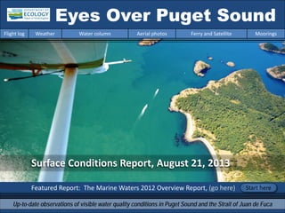
- 1. Surface Conditions Report, August 21, 2013 Featured Report: The Marine Waters 2012 Overview Report, (go here) Eyes Over Puget Sound Up-to-date observations of visible water quality conditions in Puget Sound and the Strait of Juan de Fuca Flight log Weather Water column Aerial photos Ferry and Satellite Moorings Start here
- 2. LONG-TERMMARINEMONITORINGUNIT Personal flight log p. 4 Yesterday’s flight encapsulates all the lovely things about summer. Weather conditions p.6 Warm air temperatures, less sunshine in the north, and increasing river flows in the past week. Water column and mooring p.7 , p.39 After 2 years of favorable conditions with colder temperatures and higher oxygen, Puget Sound waters are turning lower in dissolved oxygen. Aerial photography p. 11 Red-brown blooms abundant in inlets of South Sound and the Kitsap Peninsula. Large algal mats in Hood Canal, Central Sound, Sinclair Inlet Padilla Bay. Effects of glacier fed rivers strong. Ferry and satellite p. 36 Near-surface temperatures warm in South Sound. Low-tide imagery provides rare glimpse of beautiful braided channels criss-crossing Whidbey Basin river deltas! Mya Keyzers Laura Friedenberg Joe Leatherman Skip Albertson Dr. Christopher Krembs Dr. Brandon Sackmann Julia Bos Suzan Pool David Mora www.ecy.wa.gov/programs/eap/mar_wat/eops/Previous Eyes Over Puget Sound reports: Marine conditions from 8-21-2013 at a glance Flight log Weather Water column Aerial photos Ferry and Satellite Moorings
- 3. http://www.eopugetsound.org/Read about conditions in 2012 in Puget Sound in the latest report of PSEMP Flight log Weather Water column Aerial photos Ferry and Satellite Moorings • The Marine Waters 2012 Overview Report informs on the marine water conditions in Puget Sound annually. It compiles the physical, chemical, and biological information obtained from diverse marine monitoring and observing programs in Puget Sound. • The report represents a collaboration among agencies and scientists forming a collective view of marine water conditions in Puget Sound to enhances the ecological understanding of Puget Sound as an economic lifeline for Western Washington. • Highlights include intense blooms of Noctiluca and unprecedented shellfish harvesting closures in Hood Canal due to contamination with biotoxins from harmful algae. http://www.psp.wa.gov/downloads/pse mp/PSmarinewaters_2012_overview.pdf Picture by Bill Dewey.
- 4. North Sound Flight Mya and Christopher Yesterday’s flight seemed to encapsulate all the lovely things about this summer. I was having a lovefest with the northwest. Flying on a beautiful summer day will do that. Allow me to capture this moment so in a few months when we are bemoaning the short days and grey skies I can revisit my ode to these memorable summer days… Personal flight log 8-21-2013 Flight log Weather Water column Aerial photos Ferry and Satellite Moorings
- 5. Boaters everywhere! When water meets waterThatcher Pass Plane parked ashore Summer we love thee, Blue skies and cool water and salt air abound. The people on ships come wave and shake us, the kids looking up with faces of glee. When iced tea and lab work blend and befriend us and ideas are born from the wind and the sea. Please join us and take a minute to wonder at the Puget Sound summer of 2013! Personal flight log 8-21-2013 Flight log Weather Water column Aerial photos Ferry and Satellite Moorings
- 6. Flight log Weather Water column Aerial photos Ferry and Satellite Moorings Weather patterns from 8-3-2013 to 8-21-2013 Meteorological conditions typically explain up to half of the variance in observed marine variables (Moore et al. 2008), particularly in shallower waters like those of south Puget Sound. I summarized the specific conditions prevalent during the past two weeks, from north to south. Source: http://www-k12.atmos.washington.edu/k12/grayskies/nw_weather.html Moore et al. 2008. Local and large-scale climate forcing of Puget Sound oceanographic properties on seasonal to interdecadal timescales. Limnol. Oceanogr., 53(5), 1746–1758 Summary: Air temperatures. Daily average air temperatures have increased to above-normal levels for the past several days. Sunshine levels have been higher than normal in early August but lower for the past several days except in South Puget Sound. River flows transitioned from below to slightly above normal levels. Winds have been weak and variable throughout the region. Moore et al. 2008. Local and large-scale climate forcing of Puget Sound oceanographic properties on seasonal to interdecadal timescales. Limnol. Oceanogr., 53(5), 1746–1758
- 7. We use a chartered float plane to access our monthly monitoring stations most cost effectively. We communicate data and environmental marine conditions using: 1. Marine Water Condition Index (MWCI) 2. Eyes Over Puget Sound (EOPS) 3. Anomalies and source data Flight log Weather Water column Aerial photos Ferry and Satellite Moorings Our long-termmarinemonitoringstationsin Washington Start here Isl.
- 8. In 2013: Temp. is warming Salinity is increasing? Oxygen is decreasing!!! Puget Sound water conditions are changing again! Compared to 2011-2012, when waters were colder and fresher with higher oxygen, values are beginning to show signs of warmer temperatures and decreasing oxygen. Each pixel is a monthly survey at a single station. Flight log Weather Water column Aerial photos Ferry and Satellite Moorings Conditions of the last two years change at our stations
- 9. a) Pacific Decadal Oscillation Index (PDO) …(explanation) b) Upwelling Index (anomalies) (Upwelling) …(explanation) c) North Pacific Gyre Oscillation Index (NPGO) …(explanation) -25 -15 -5 5 15 25 -1.5 -1 -0.5 0 0.5 1 1.5 1945 1950 1955 1960 1965 1970 1975 1980 1985 1990 1995 2000 2005 2010 2015 NPGO PDO/UpwellingIndex Three-year running average of PDO, Upwelling, and NPGO indices scores Ocean boundary conditions have been favorable for water quality in Puget Sound: (a) colder water (PDO), (b) less upwelled low oxygen and high nutrient ocean water reaching Puget Sound (Upwelling Index), and (c) higher surface productivity along the coast (NPGO). Where are we heading next? Flight log Weather Water column Aerial photos Ferry and Satellite Moorings . The oceanaffectswater quality: Ocean ClimateIndices
- 10. Nitrate Phosphate Nutrients in Puget Sound are increasing, read http://www.ecy.wa.gov/programs/eap/mar_wat/trends.html Nitrate Phosphate Nutrient Balance (Si:N) Get the data and trends from us! We observe increasing nutrients and changing algal biomass patterns in Puget Sound Changing Nutrient Balance Algae bloom, Budd Inlet 2010
- 11. Summary: Aerial photography 8-21-2013 Red-brown blooms abundant in all inlets of South Sound and the Kitsap Peninsula. Large algal mats and floating organic material persists in Hood Canal, Central Sound, Sinclair Inlet and Padilla Bay. Jellyfish less abundant. Effects of glacier fed rivers are strong. Flight log Weather Water column Aerial photos Ferry and Satellite Moorings Start here Mixing and Fronts: Pronounced fronts due to suspended sediment in Skagit Bay and the San Juan Islands and into the Straits. Tidal eddies large. Debris: Abundant in Case, Budd, Eld, Totten Inlets and Oakland Bay and northern Central Basin. Abundant in Padilla Bay. Visible blooms: Red brown: All inlets of South Sound and Kitsap Peninsula. Green yellow: Scow Bay (Kilisut Harbor) and Echo Bay. Jellyfish: Low numbers in Budd Inlet. BloomDebrisFront Suspended sediment: Glacier fed rivers and re-suspension due to strong tides. Plume Small red-brown bloom, Sinclair Inlet Small red-brown bloom, Bainbridge 2 6 7 8 9 10 11 13 14 17 18 2 6 7 8 9 10 11 12 13 14 15 16 17 1 2 3 11 15 18 19 20 1 2 3 4 6 10 12 13 14 16 17 18 19
- 12. Aerial photography navigation guide, Flight log Weather Water column Aerial photos Ferry and Satellite Moorings Central Sound & North Sound Observation Maps: Seattle: H. tide: 5:02 AM, 6:18 PM , L. tides: 11:34 AM Afternoon flight, photos 10-20: Good visibility, wind increasing from the north. Strait of Juan de Fuca San Juan Islands Flight Information: Morning flight, photos 1-9: Good visibility calm Hood Canal & South Sound Padilla Bay Main Basin Hood Canal South Sound 1 3 4 5 6 7 8 12 16 17 20 18 19 Whidbey Basin 11 10 9 2 13 14 15
- 13. Debris A. B. C. D. Red-brown bloom and organic debris in southern inlets. Location: A-B. Budd Inlet, C-D. Totten Inlet (South Sound) 9:12 AM. 1 Aerial photography 8-21-2013 Navigate Flight log Weather Water column Aerial photos Ferry and Satellite Moorings Bloom Bloom Bloom Bloom Debris Debris Debris boats boats
- 14. 2 NavigateAerial photography 8-21-2013 Flight log Weather Water column Aerial photos Ferry and Satellite Moorings Different surface water with red-brown bloom, high sediment load and clearly delineated by a long line of organic debris. Location: Eld Inlet (South Sound), 9:14 AM. Front Bloom Debris boats
- 15. 3 NavigateAerial photography 8-21-2013 Sediment rich water, red-brown bloom and lines of organic surface debris. Location: Oakland Bay (South Sound), 9:18 AM. Flight log Weather Water column Aerial photos Ferry and Satellite Moorings Bloom aquaculture
- 16. 4 Navigate Flight log Weather Water column Aerial photos Ferry and Satellite Moorings Aerial photography 8-21-2013 Large drifting mats of organic material at surface. Location: Near Tahuya River (Hood Canal), 9:26 AM. Debris boats
- 17. 5 NavigateAerial photography 8-21-2013 Flight log Weather Water column Aerial photos Ferry and Satellite Moorings Intense green yellow and red-brown phytoplankton bloom. Location: Scow Bay in Kilisut Harbor (Indian Island near Port Townsend), 10:00 AM. boats
- 18. Surface debris (algal mats) and strong front with distinctly different water. Location: Off Marrowstone Island (Central Sound), 10:02 AM. 6 NavigateAerial photography 8-21-2013 Flight log Weather Water column Aerial photos Ferry and Satellite Moorings Debris boats
- 19. Fraser River sediment traversing and mixing dramatically with water in the San Juan Islands. Location: Blakely Island (San Juan Islands), 11:45 AM. 7 NavigateAerial photography 8-21-2013 Flight log Weather Water column Aerial photos Ferry and Satellite Moorings ships
- 20. Fraser River sediment traversing and mixing dramatically with water in the San Juan Islands. Location: Near Lopez Sound (San Juan Islands), 11:48 AM. 8 NavigateAerial photography 8-21-2013 Flight log Weather Water column Aerial photos Ferry and Satellite Moorings
- 21. Fraser River sediment traversing and mixing dramatically with water in the San Juan Islands. Location: Near Obstruction Island (San Juan Islands), 11:49 AM. 9 NavigateAerial photography 8-21-2013 Flight log Weather Water column Aerial photos Ferry and Satellite Moorings boats
- 22. 10 NavigateAerial photography 8-21-2013 Subsurface Fraser River plume re-surfacing in response to tidal currents. Location: Echo Bay, Sucia Island (San Juan Islands), 12:24 PM. Flight log Weather Water column Aerial photos Ferry and Satellite Moorings Fraser River front boats
- 23. 11 NavigateAerial photography 8-21-2013 A. Sub-surface Fraser River plume entering Echo Bay. B. Yellow-green bloom in Fossil Bay. Location: Echo Bay, Sucia Island (San Juan Islands), 12:24 PM. Flight log Weather Water column Aerial photos Ferry and Satellite Moorings A. B. Bloom boats boats
- 24. Interplay of water and sediment and waves form striking surface patterns. Location: East of Lummi Island (Bellingham Bay), 1:29 PM. 12 Navigate Flight log Weather Water column Aerial photos Ferry and Satellite Moorings Aerial photography 8-21-2013 Debris boat boat
- 25. Interplay of water and sediment and waves form striking surface patterns. Location: Samish Island (Samish Bay), 1:58 PM. 13 Navigate Flight log Weather Water column Aerial photos Ferry and Satellite Moorings Aerial photography 8-21-2013 Fishing vessel Waves breaking up plume
- 26. Large algal mats and organic debris. Location: Near Saddlebag Island (Padilla Bay), 2:00 PM. 14 Navigate Flight log Weather Water column Aerial photos Ferry and Satellite Moorings Aerial photography 8-21-2013 Debris Debris Debris boat tanker
- 27. 15 Navigate Flight log Weather Water column Aerial photos Ferry and Satellite Moorings Green phytoplankton bloom forms a fringe along a sediment plume in shallow water. Location: Skagit River estuary (Skagit Bay), 2:07 PM. Aerial photography 8-21-2013 Debris
- 28. 16 Navigate Flight log Weather Water column Aerial photos Ferry and Satellite Moorings Red brown phytoplankton bloom mixed in with Skagit River sediment. Location: North of Camano Island (Skagit Bay), 2:54 PM. Aerial photography 8-21-2013 Bloom Debris boats
- 29. 17 Navigate Flight log Weather Water column Aerial photos Ferry and Satellite Moorings Large tidal eddy with sediment rich water and surface debris. Location: Southern Bainbridge Island (Sinclair Inlet), 5:10 PM. Aerial photography 8-21-2013 Debris Debris boats ferry
- 30. 18 Navigate Flight log Weather Water column Aerial photos Ferry and Satellite Moorings Red-brown algae bloom, sediment stained water and surface debris. Location: Case Inlet (South Sound), 5:24 PM. Aerial photography 8-21-2013 Bloom Debris Debris boat
- 31. 19 Navigate Flight log Weather Water column Aerial photos Ferry and Satellite Moorings Red-brown algae bloom and abundant surface debris. Location: McMicken Island (Case Inlet), 5:24 PM. Aerial photography 8-21-2013 Debris boat boat
- 32. 20 Navigate Flight log Weather Water column Aerial photos Ferry and Satellite Moorings Red-brown bloom between Harstine Island and Squaxin Island Location: Squaxin Island (South Sound), 5:28 PM. Aerial photography 8-21-2013 Bloom boat boat
- 33. North Sound/San Juans Aerial photography observations in Central Sound Navigate Flight log Weather Water column Aerial photos Ferry and Satellite Moorings Numbers on map refer to picture numbers for spatial reference Date: 8-21-2013 Central Sound 17 Strait of Juan de Fuca San Juan Islands 6 7 8 16 1110 9 13 14 15 5 12
- 34. South SoundHood Canal Aerial photography observations in Central Sound Navigate Date: 8-21-2013 Flight log Weather Water column Aerial photos Ferry and Satellite Moorings 1 3 4 20 18 19 2
- 35. Legend to map annotations Comments: Maps are produced by observers during and after flights. They are intended to give an approximate reconstruction of the surface conditions on scales that connect to and overlap with satellite images in the section that follows. Debris: Debris can be distinguished into natural and anthropogenic debris floating at the surface sensu Moore and Allen (2000). The majority of organic debris in Puget Sound is natural mixed with discarded man-made pieces of plastic, wood, etc. From the plane, we cannot differentiate the quality of debris at the surface and therefore, call it for reasons of practicality just “debris”. S.L. Moore, M. J. Allen. 2000. Distribution of Anthropogenic and Natural Debris on the Mainland Shelf of the Southern California Bight. Marine Pollution Bulletin, 40(1), 83–88. Navigate Flight log Weather Water column Aerial photos Ferry and Satellite Moorings
- 36. Brandon Sackmann Contact: bsackmann@ecy.wa.gov MERIS True Color image used for spatial context (19 February 2011) of the Victoria Clipper en route monitoring route (red dashes on map). Ferry and satellite observations 8-21-2013 Flight log Weather Water column Aerial photos Ferry and Satellite Moorings Start here No Victoria Clipper data available – Hardware upgrades in progress!!! Current Conditions: LANDSAT 8 continues to provide valuable near- surface temperature estimates for Puget Sound. Low-tide imagery provides rare glimpse of beautiful braided channels criss-crossing Whidbey Basin river deltas!
- 37. Ferry and satellite observations 8-21-2013 Flight log Weather Water column Aerial photos Ferry and Satellite Moorings 100-m Thermal Infrared Landsat 8 helps visualize dynamic mixing processes in Puget Sound 21 August 2013 Northern arms of Case and Carr Inlet and Central/Southern Hood Canal are noticeably warmer than other areas in Puget Sound. Local rivers continue to add warm water at the surface. “C” Cooler “W” Warmer W C W W W W C C C C W
- 38. Ferry and satellite observations 8-21-2013 Flight log Weather Water column Aerial photos Ferry and Satellite Moorings 21 August 2013 - LANDSAT 8 - 15-m Panchromatic Skagit North (A) Skagit South (B) Stillaguamish (C) Snohomish (D) MODIS-Terra “Turbidity” Proxy 21 August 2013 A,B C D Tides 8-21-2013
- 39. At our Mukilteo moorings, we observed differences in salinity between the surface (26 and 29 PSU) and bottom (29.4 PSU) waters. In the deeper water, dissolved oxygen is lower while salinity is higher. Mooring observations and trends 8-7-2013 to 8-21-2013 Flight log Weather Water column Aerial photos Ferry and Satellite Moorings Left Panels: Density is defined by salinity and temperature. Probability of finding a specific density over the past two-week period can be shown in a T-S plot. High probability shown in warm colors. Right Panel: Dissolved oxygen concentration in relation to salinity. High probability shown in warm colors. Note: The mooring contribution to EOPS will be significantly downscaled due to budget cuts.
- 40. Mooring observations and trends 7-21-2013 to 8-21-2013 Flight log Weather Water column Aerial photos Ferry and Satellite Moorings We report on thickness of the fresher water layer by monitoring our sensor at 16m. We define its thickness using 28.55 (±0.05) PSU. At Mukilteo (Whidbey Basin), winds, fortnightly tidal cycle, and declining river flows influenced the surface water layer thickness. The bottom sensor detects the surface layer rarely in the past two weeks. Freshwater input from rivers continue to decline with the Skagit River contributing the largest portion. * The pycnocline is shallower and outside our monitored depth range. * * * * * ** * * * * * ** * * * * River data from Discharge(102m3s-1),Avg.tidalrange(ft), DailyN-Swindspeed(kts) 28.55isohalinedepth(m)
- 41. During the past two weeks, salinity has been increasing and dissolved oxygen decreasing. Real-time data online (click) Note: The mooring contribution to EOPS will be significantly downscaled due to budget cuts. Mooring observations and trends 8-7-2013 to 8-21-2013 Flight log Weather Water column Aerial photos Ferry and Satellite Moorings 12-16 m depth2-6 m depth Mukilteo Dissolved Oxygen Conditions DO Max 6.6 mg/L on 08/07 at 29.4 PSU 11.3 °C 14.7 db DO Min 3.9 mg/L on 08/14 at 29.5 PSU 12 °C 13.4 db DO Avg 4.8 DO Trend -0.6 mg/L DO-Sal Corr -0.68 DO-Temp Corr 0.3 Mukilteo Salinity (Sal) Conditions Sal Max 29.5 PSU on 08/10 at 11.3 °C 15.7 db Sal Min 28.8 PSU on 08/11 at 13 °C 15 db Sal Avg 29.3 PSU Sal Trend 0 PSU Mukilteo Temperature (T) Conditions T Max 13.1 °C on 08/11 at 28.8 PSU 14.9 db T Min 11 °C on 08/07 at 29.5 PSU 15.3 db T Avg 12 °C T Trend 0.9 °C Mukilteo Salinity (Sal) Sal Max 29.9 PSU on 08/08 at 12 °C 5.8 db Sal Min 24.7 PSU on 08/07 at 17.4 °C 4.3 db Sal Avg 27.3 PSU Sal Trend 0.3 PSU Mukilteo Temperature (T) T Max 18.1 °C on 08/14 at 26 PSU 2.9 db T Min 11.7 °C on 08/08 at 29.3 PSU 5.9 db T Avg 15 °C T Trend -0.3 °C
- 42. Note: The mooring contribution to EOPS will be significantly downscaled due to budget cuts. Mooring observations and trends Mukilteo 2010 to 2013 Flight log Weather Water column Aerial photos Ferry and Satellite Moorings This slide shows data from our Mukilteo mooring capturing water exchange between the Main Basin and Possession Sound at 12-16 m. Inter-annual variability in temperature, salinity, and dissolved oxygen is shown over a 3.5-year period. All three variables show strong seasonality. Thus far in 2013, trends are appearing to be similar to 2010 with relatively warmer water temperature, higher salinity, but lower dissolved oxygen. 0 2 4 6 8 10 12 14 J F M A M J J A S O N D Temperature(°C) 2010 2011 2012 2013 26.5 27.0 27.5 28.0 28.5 29.0 29.5 30.0 30.5 J F M A M J J A S O N D Salinity(psu) 2010 2011 2012 2013 0 2 4 6 8 10 12 J F M A M J J A S O N D DissolvedOxygen(mg/l) 2010 2011 2012 2013
- 43. Access mooring data: http://www.ecy.wa.gov/pr ograms/eap/mar_wat/- .html Ferry and satellite : brandon.sackmann@ecy.w a.gov Get data from Ecology’s Monitoring Programs Long–Term Monitoring Network Real–Time Sensor Network Access core monitoring data: http://www.ecy.wa.gov/a pps/eap/marinewq/mwda taset.asp christopher.krembs@ecy.w a.gov Ecology’s long-term marine monitoring stations Ferry track Morning flight Evening flight Freshwater Report: http://www.ecy.wa.gov/programs /eap/fw_riv/freshwaterReport/A mbient_Monitoring- Monthly_Summary.html Flight log Weather Water column Aerial photos Ferry and Satellite Moorings
- 44. You may subscribe or unsubscribe to the Eyes Over Puget Sound email listserv by going to: http://listserv.wa.gov/cgi-bin/wa?A0=ECOLOGY-EYES-OVER-PUGET-SOUND Many thanks to our business partners: Clipper Navigation, Swantown Marina, and Kenmore Air. We are looking for feedback to improve our products. Dr. Christopher Krembs christopher.krembs@ecy.wa.gov Marine Monitoring Unit Environmental Assessment Program WA Department of Ecology Flight log Weather Water column Aerial photos Ferry and Satellite Moorings