SlideShare una empresa de Scribd logo
1 de 2
Descargar para leer sin conexión
Arc Hydro Training
Hydrologic and Hydraulic Analysis


In-depth instructor knowledge, small class size, class activities and discussions
that encourage peer-to-peer learning, rich course materials, and hands-on
practice with the latest Esri® software are the hallmarks of instructor-led training
from Esri.


                                            Arc Hydro: GIS for Water Resources
                                            This three-day course presents the Arc Hydro data model
                                            and tools and shows how to implement them using a series
                                            of real-world examples. You will learn the basic principles
                                            of the Arc Hydro data model, how to extend it, and how the
                                            Arc Hydro tools manage and use the data model.

                                            Goals
                                            After completing this course, you will be able to do the
                                            following:

                                            •	 Understand and extend the Arc Hydro data model.
                                            •	 Understand core and advanced Arc Hydro tool
                                               functionality.
                                            •	 Solve realistic water resource problems using the
                                               Arc Hydro data structure and tools.
                                            •	 Extend Arc Hydro tools to create custom functionality.
                                            •	 Integrate external models into Arc Hydro.
Hydrologic and Hydraulic
                                                                                                                                           Analyses Using ArcGIS
                                                                                                                                           ArcGIS® technology and Arc Hydro provide a strong foun-
                                                                                                                                           dation for hydrologic and hydraulic analyses. This two-day
                                                                                                                                           course presents GIS techniques for terrain analysis, hydro-
                                                                                                                                           logic and hydraulic characteristics extraction, numerical
                                                                                                                                           model input and output, modeling process automation,
                                                                                                                                           and result mapping. The Hydrologic Engineering Center’s
                                                                                                                                           (HEC) GeoHMS and GeoRAS and the US Geological Sur-
                                                                                                                                           vey’s (USGS) StreamStats have been built on the founda-
                                                                                                                                           tion methodologies, data model, and toolsets provided by
                                                                                                                                           Arc Hydro. These toolsets are essential components of this
                                                                                                                                           course.

                                                                                                                                           Goals
                                                                                                                                           After completing this course, you will be able to do the
                                                                                                                                           following:

                                                                                                                                           •	 Use TIN and Esri Grid data structures for efficient terrain
                                                                                                                                              surface representation.
                                                                                                                                           •	 Implement GIS as a spatial and temporal integrator.
                                                                                                                                           •	 Use hydrologic statistical modeling—National
                                                                                                                                              Streamflow Statistics (NSS) and StreamStats.
                                                                                                                                           •	 Develop hydrologic physical models—HMS and
                                                                                                                                              GeoHMS.
                                                                                                                                           •	 Develop hydraulic models—River Analysis System (RAS)
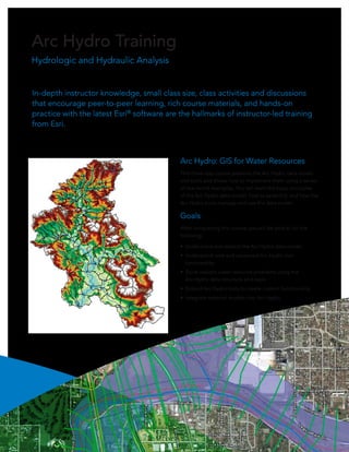
Arc Hydro is essential to water analysis.                                                                                                     and GeoRAS.
                                                                                                                                           •	 Perform floodplain mapping.
                                                                                                                                           •	 Implement GIS process automation and integration.


                                                                                                                                           These classes can be customized to meet your organi-
                                                                                                                                           zation’s specific needs. We can customize the class to
                                                                                                                                           include your data and/or reflect your workflows in data
                                                                                                                                           development and modeling. If you are interested in a
                                                                                                                                           customized class, contact Dean Djokic at
                                                                                                                                           ddjokic@esri.com/1-800-447-9778, ext. 1-1072.


                                                                                                                                           For more information about the classes
                                                                                                                                           and their schedules, contact an Esri
                                                                                                                                           training consultant at plugo@esri.com or
Copyright © 2012 Esri. All rights reserved. Esri, the Esri globe logo, ArcGIS, @esri.com, and esri.com are trademarks, service marks, or
registered marks of Esri in the United States, the European Community, or certain other jurisdictions. Other companies and products
or services mentioned herein may be trademarks, service marks, or registered marks of their respective mark owners.                        athorig@esri.com; call 1-800-447-9778,
130213      ESRI5C5/12es                                                                                                                   ext. 1-5757; or visit esri.com/training.

Más contenido relacionado

Similar a Arc Hydro Training

Subsurface 3D GIS 05nov2011
Subsurface 3D GIS 05nov2011Subsurface 3D GIS 05nov2011
Subsurface 3D GIS 05nov2011Andrew Zolnai
 
What's New in the ArcGIS Platform - Smart Education - Higher - AC18
What's New in the ArcGIS Platform - Smart Education - Higher - AC18What's New in the ArcGIS Platform - Smart Education - Higher - AC18
What's New in the ArcGIS Platform - Smart Education - Higher - AC18Esri UK
 
Julie Rediker GIS Professional
Julie Rediker GIS ProfessionalJulie Rediker GIS Professional
Julie Rediker GIS ProfessionalJulie Rediker
 
Commercially use GIS & REMOTE SENSING Software
Commercially use GIS & REMOTE SENSING SoftwareCommercially use GIS & REMOTE SENSING Software
Commercially use GIS & REMOTE SENSING Softwareanuj4849
 
Btp presentation
Btp presentationBtp presentation
Btp presentationRohan Jain
 
khalid sallam cv may 2015
khalid sallam cv may 2015khalid sallam cv may 2015
khalid sallam cv may 2015Khalid Farid
 
GIS for National Mapping and Charting
GIS for National Mapping and ChartingGIS for National Mapping and Charting
GIS for National Mapping and ChartingEsri
 
NDGeospatialSummit2019 - ArcGIS Pro – Next-Generation Desktop GIS
NDGeospatialSummit2019 - ArcGIS Pro – Next-Generation Desktop GISNDGeospatialSummit2019 - ArcGIS Pro – Next-Generation Desktop GIS
NDGeospatialSummit2019 - ArcGIS Pro – Next-Generation Desktop GISNorth Dakota GIS Hub
 
ArcGIS
ArcGISArcGIS
ArcGISEsri
 
FBSIC Functionalities Matrix
FBSIC Functionalities MatrixFBSIC Functionalities Matrix
FBSIC Functionalities MatrixFernando Gil
 
How will the Utility Network Affect You?
How will the Utility Network Affect You? How will the Utility Network Affect You?
How will the Utility Network Affect You? SSP Innovations
 
Enviromental impact assesment for highway projects
Enviromental impact assesment for highway projectsEnviromental impact assesment for highway projects
Enviromental impact assesment for highway projectsKushal Patel
 
Db graph a_tool_for_development_of_database_systems_based
Db graph a_tool_for_development_of_database_systems_basedDb graph a_tool_for_development_of_database_systems_based
Db graph a_tool_for_development_of_database_systems_basedAmbar Abdul
 
VenkataChary Maduri_CV_14.102016
VenkataChary Maduri_CV_14.102016VenkataChary Maduri_CV_14.102016
VenkataChary Maduri_CV_14.102016Venkatachary Maduri
 

Similar a Arc Hydro Training (20)

Geospatial Product Watch 2015
Geospatial Product Watch 2015Geospatial Product Watch 2015
Geospatial Product Watch 2015
 
Subsurface 3D GIS 05nov2011
Subsurface 3D GIS 05nov2011Subsurface 3D GIS 05nov2011
Subsurface 3D GIS 05nov2011
 
What's New in the ArcGIS Platform - Smart Education - Higher - AC18
What's New in the ArcGIS Platform - Smart Education - Higher - AC18What's New in the ArcGIS Platform - Smart Education - Higher - AC18
What's New in the ArcGIS Platform - Smart Education - Higher - AC18
 
Julie Rediker GIS Professional
Julie Rediker GIS ProfessionalJulie Rediker GIS Professional
Julie Rediker GIS Professional
 
3D Modeling by GIS
3D Modeling by GIS3D Modeling by GIS
3D Modeling by GIS
 
African Regional Geo-database
African Regional Geo-databaseAfrican Regional Geo-database
African Regional Geo-database
 
Commercially use GIS & REMOTE SENSING Software
Commercially use GIS & REMOTE SENSING SoftwareCommercially use GIS & REMOTE SENSING Software
Commercially use GIS & REMOTE SENSING Software
 
ERDAS IMAGINE
ERDAS IMAGINEERDAS IMAGINE
ERDAS IMAGINE
 
Btp presentation
Btp presentationBtp presentation
Btp presentation
 
khalid sallam cv may 2015
khalid sallam cv may 2015khalid sallam cv may 2015
khalid sallam cv may 2015
 
GIS for National Mapping and Charting
GIS for National Mapping and ChartingGIS for National Mapping and Charting
GIS for National Mapping and Charting
 
NDGeospatialSummit2019 - ArcGIS Pro – Next-Generation Desktop GIS
NDGeospatialSummit2019 - ArcGIS Pro – Next-Generation Desktop GISNDGeospatialSummit2019 - ArcGIS Pro – Next-Generation Desktop GIS
NDGeospatialSummit2019 - ArcGIS Pro – Next-Generation Desktop GIS
 
Fazli Hadi
Fazli HadiFazli Hadi
Fazli Hadi
 
ArcGIS
ArcGISArcGIS
ArcGIS
 
FBSIC Functionalities Matrix
FBSIC Functionalities MatrixFBSIC Functionalities Matrix
FBSIC Functionalities Matrix
 
How will the Utility Network Affect You?
How will the Utility Network Affect You? How will the Utility Network Affect You?
How will the Utility Network Affect You?
 
Enviromental impact assesment for highway projects
Enviromental impact assesment for highway projectsEnviromental impact assesment for highway projects
Enviromental impact assesment for highway projects
 
Db graph a_tool_for_development_of_database_systems_based
Db graph a_tool_for_development_of_database_systems_basedDb graph a_tool_for_development_of_database_systems_based
Db graph a_tool_for_development_of_database_systems_based
 
VenkataChary Maduri_CV_14.102016
VenkataChary Maduri_CV_14.102016VenkataChary Maduri_CV_14.102016
VenkataChary Maduri_CV_14.102016
 
CV-RAKESH KUMAR
CV-RAKESH KUMARCV-RAKESH KUMAR
CV-RAKESH KUMAR
 

Más de Esri

INIA- CISA: Análisis de las amenazas en la fauna silvestre
INIA- CISA: Análisis de las amenazas en la fauna silvestreINIA- CISA: Análisis de las amenazas en la fauna silvestre
INIA- CISA: Análisis de las amenazas en la fauna silvestreEsri
 
Aena Aeropuerto Adolfo Suárez-Barajas crea potentes aplicaciones para sus cli...
Aena Aeropuerto Adolfo Suárez-Barajas crea potentes aplicaciones para sus cli...Aena Aeropuerto Adolfo Suárez-Barajas crea potentes aplicaciones para sus cli...
Aena Aeropuerto Adolfo Suárez-Barajas crea potentes aplicaciones para sus cli...Esri
 
Plataforma Smart City de Móstoles
Plataforma Smart City de MóstolesPlataforma Smart City de Móstoles
Plataforma Smart City de MóstolesEsri
 
ArcGIS Online para Organizaciones
ArcGIS Online para OrganizacionesArcGIS Online para Organizaciones
ArcGIS Online para OrganizacionesEsri
 
Molina de Segura se convierte en una smart city
Molina de Segura se convierte en una smart cityMolina de Segura se convierte en una smart city
Molina de Segura se convierte en una smart cityEsri
 
Portal for ArcGIS
Portal for ArcGISPortal for ArcGIS
Portal for ArcGISEsri
 
GIS-Based Web Services Provide Rapid Analysis and Dissemination of Maritime Data
GIS-Based Web Services Provide Rapid Analysis and Dissemination of Maritime DataGIS-Based Web Services Provide Rapid Analysis and Dissemination of Maritime Data
GIS-Based Web Services Provide Rapid Analysis and Dissemination of Maritime DataEsri
 
An Effective Tool for Drinking Water Protection
An Effective Tool for Drinking Water ProtectionAn Effective Tool for Drinking Water Protection
An Effective Tool for Drinking Water ProtectionEsri
 
GeoCollector for ArcPad
GeoCollector for ArcPadGeoCollector for ArcPad
GeoCollector for ArcPadEsri
 
GeoCollector for ArcGIS for Windows Mobile
GeoCollector for ArcGIS for Windows MobileGeoCollector for ArcGIS for Windows Mobile
GeoCollector for ArcGIS for Windows MobileEsri
 
Data Appliance for ArcGIS
Data Appliance for ArcGISData Appliance for ArcGIS
Data Appliance for ArcGISEsri
 
Esri and BlackBridge
Esri and BlackBridgeEsri and BlackBridge
Esri and BlackBridgeEsri
 
GeoPlanner for ArcGIS
GeoPlanner for ArcGISGeoPlanner for ArcGIS
GeoPlanner for ArcGISEsri
 
Esri and AccuWeather
Esri and AccuWeatherEsri and AccuWeather
Esri and AccuWeatherEsri
 
Esri and Airbus Defense & Space
Esri and Airbus Defense & SpaceEsri and Airbus Defense & Space
Esri and Airbus Defense & SpaceEsri
 
Esri US Data Fact Sheet
Esri US Data Fact SheetEsri US Data Fact Sheet
Esri US Data Fact SheetEsri
 
ArcGIS for Server on Microsoft Azure Jumpstart
ArcGIS for Server on Microsoft Azure JumpstartArcGIS for Server on Microsoft Azure Jumpstart
ArcGIS for Server on Microsoft Azure JumpstartEsri
 
ArcGIS for the Military--Maritime Operations
ArcGIS for the Military--Maritime OperationsArcGIS for the Military--Maritime Operations
ArcGIS for the Military--Maritime OperationsEsri
 
Esri Geoportal Server
Esri Geoportal ServerEsri Geoportal Server
Esri Geoportal ServerEsri
 
ArcGIS GeoEvent Extension for Server
ArcGIS GeoEvent Extension for ServerArcGIS GeoEvent Extension for Server
ArcGIS GeoEvent Extension for ServerEsri
 

Más de Esri (20)

INIA- CISA: Análisis de las amenazas en la fauna silvestre
INIA- CISA: Análisis de las amenazas en la fauna silvestreINIA- CISA: Análisis de las amenazas en la fauna silvestre
INIA- CISA: Análisis de las amenazas en la fauna silvestre
 
Aena Aeropuerto Adolfo Suárez-Barajas crea potentes aplicaciones para sus cli...
Aena Aeropuerto Adolfo Suárez-Barajas crea potentes aplicaciones para sus cli...Aena Aeropuerto Adolfo Suárez-Barajas crea potentes aplicaciones para sus cli...
Aena Aeropuerto Adolfo Suárez-Barajas crea potentes aplicaciones para sus cli...
 
Plataforma Smart City de Móstoles
Plataforma Smart City de MóstolesPlataforma Smart City de Móstoles
Plataforma Smart City de Móstoles
 
ArcGIS Online para Organizaciones
ArcGIS Online para OrganizacionesArcGIS Online para Organizaciones
ArcGIS Online para Organizaciones
 
Molina de Segura se convierte en una smart city
Molina de Segura se convierte en una smart cityMolina de Segura se convierte en una smart city
Molina de Segura se convierte en una smart city
 
Portal for ArcGIS
Portal for ArcGISPortal for ArcGIS
Portal for ArcGIS
 
GIS-Based Web Services Provide Rapid Analysis and Dissemination of Maritime Data
GIS-Based Web Services Provide Rapid Analysis and Dissemination of Maritime DataGIS-Based Web Services Provide Rapid Analysis and Dissemination of Maritime Data
GIS-Based Web Services Provide Rapid Analysis and Dissemination of Maritime Data
 
An Effective Tool for Drinking Water Protection
An Effective Tool for Drinking Water ProtectionAn Effective Tool for Drinking Water Protection
An Effective Tool for Drinking Water Protection
 
GeoCollector for ArcPad
GeoCollector for ArcPadGeoCollector for ArcPad
GeoCollector for ArcPad
 
GeoCollector for ArcGIS for Windows Mobile
GeoCollector for ArcGIS for Windows MobileGeoCollector for ArcGIS for Windows Mobile
GeoCollector for ArcGIS for Windows Mobile
 
Data Appliance for ArcGIS
Data Appliance for ArcGISData Appliance for ArcGIS
Data Appliance for ArcGIS
 
Esri and BlackBridge
Esri and BlackBridgeEsri and BlackBridge
Esri and BlackBridge
 
GeoPlanner for ArcGIS
GeoPlanner for ArcGISGeoPlanner for ArcGIS
GeoPlanner for ArcGIS
 
Esri and AccuWeather
Esri and AccuWeatherEsri and AccuWeather
Esri and AccuWeather
 
Esri and Airbus Defense & Space
Esri and Airbus Defense & SpaceEsri and Airbus Defense & Space
Esri and Airbus Defense & Space
 
Esri US Data Fact Sheet
Esri US Data Fact SheetEsri US Data Fact Sheet
Esri US Data Fact Sheet
 
ArcGIS for Server on Microsoft Azure Jumpstart
ArcGIS for Server on Microsoft Azure JumpstartArcGIS for Server on Microsoft Azure Jumpstart
ArcGIS for Server on Microsoft Azure Jumpstart
 
ArcGIS for the Military--Maritime Operations
ArcGIS for the Military--Maritime OperationsArcGIS for the Military--Maritime Operations
ArcGIS for the Military--Maritime Operations
 
Esri Geoportal Server
Esri Geoportal ServerEsri Geoportal Server
Esri Geoportal Server
 
ArcGIS GeoEvent Extension for Server
ArcGIS GeoEvent Extension for ServerArcGIS GeoEvent Extension for Server
ArcGIS GeoEvent Extension for Server
 

Último

Leverage Zilliz Serverless - Up to 50X Saving for Your Vector Storage Cost
Leverage Zilliz Serverless - Up to 50X Saving for Your Vector Storage CostLeverage Zilliz Serverless - Up to 50X Saving for Your Vector Storage Cost
Leverage Zilliz Serverless - Up to 50X Saving for Your Vector Storage CostZilliz
 
Advanced Test Driven-Development @ php[tek] 2024
Advanced Test Driven-Development @ php[tek] 2024Advanced Test Driven-Development @ php[tek] 2024
Advanced Test Driven-Development @ php[tek] 2024Scott Keck-Warren
 
Connect Wave/ connectwave Pitch Deck Presentation
Connect Wave/ connectwave Pitch Deck PresentationConnect Wave/ connectwave Pitch Deck Presentation
Connect Wave/ connectwave Pitch Deck PresentationSlibray Presentation
 
DevoxxFR 2024 Reproducible Builds with Apache Maven
DevoxxFR 2024 Reproducible Builds with Apache MavenDevoxxFR 2024 Reproducible Builds with Apache Maven
DevoxxFR 2024 Reproducible Builds with Apache MavenHervé Boutemy
 
SIP trunking in Janus @ Kamailio World 2024
SIP trunking in Janus @ Kamailio World 2024SIP trunking in Janus @ Kamailio World 2024
SIP trunking in Janus @ Kamailio World 2024Lorenzo Miniero
 
The Future of Software Development - Devin AI Innovative Approach.pdf
The Future of Software Development - Devin AI Innovative Approach.pdfThe Future of Software Development - Devin AI Innovative Approach.pdf
The Future of Software Development - Devin AI Innovative Approach.pdfSeasiaInfotech2
 
CloudStudio User manual (basic edition):
CloudStudio User manual (basic edition):CloudStudio User manual (basic edition):
CloudStudio User manual (basic edition):comworks
 
Search Engine Optimization SEO PDF for 2024.pdf
Search Engine Optimization SEO PDF for 2024.pdfSearch Engine Optimization SEO PDF for 2024.pdf
Search Engine Optimization SEO PDF for 2024.pdfRankYa
 
Dev Dives: Streamline document processing with UiPath Studio Web
Dev Dives: Streamline document processing with UiPath Studio WebDev Dives: Streamline document processing with UiPath Studio Web
Dev Dives: Streamline document processing with UiPath Studio WebUiPathCommunity
 
"Federated learning: out of reach no matter how close",Oleksandr Lapshyn
"Federated learning: out of reach no matter how close",Oleksandr Lapshyn"Federated learning: out of reach no matter how close",Oleksandr Lapshyn
"Federated learning: out of reach no matter how close",Oleksandr LapshynFwdays
 
Story boards and shot lists for my a level piece
Story boards and shot lists for my a level pieceStory boards and shot lists for my a level piece
Story boards and shot lists for my a level piececharlottematthew16
 
Anypoint Exchange: It’s Not Just a Repo!
Anypoint Exchange: It’s Not Just a Repo!Anypoint Exchange: It’s Not Just a Repo!
Anypoint Exchange: It’s Not Just a Repo!Manik S Magar
 
Are Multi-Cloud and Serverless Good or Bad?
Are Multi-Cloud and Serverless Good or Bad?Are Multi-Cloud and Serverless Good or Bad?
Are Multi-Cloud and Serverless Good or Bad?Mattias Andersson
 
Tampa BSides - Chef's Tour of Microsoft Security Adoption Framework (SAF)
Tampa BSides - Chef's Tour of Microsoft Security Adoption Framework (SAF)Tampa BSides - Chef's Tour of Microsoft Security Adoption Framework (SAF)
Tampa BSides - Chef's Tour of Microsoft Security Adoption Framework (SAF)Mark Simos
 
Gen AI in Business - Global Trends Report 2024.pdf
Gen AI in Business - Global Trends Report 2024.pdfGen AI in Business - Global Trends Report 2024.pdf
Gen AI in Business - Global Trends Report 2024.pdfAddepto
 
Artificial intelligence in cctv survelliance.pptx
Artificial intelligence in cctv survelliance.pptxArtificial intelligence in cctv survelliance.pptx
Artificial intelligence in cctv survelliance.pptxhariprasad279825
 
Install Stable Diffusion in windows machine
Install Stable Diffusion in windows machineInstall Stable Diffusion in windows machine
Install Stable Diffusion in windows machinePadma Pradeep
 
"Debugging python applications inside k8s environment", Andrii Soldatenko
"Debugging python applications inside k8s environment", Andrii Soldatenko"Debugging python applications inside k8s environment", Andrii Soldatenko
"Debugging python applications inside k8s environment", Andrii SoldatenkoFwdays
 

Último (20)

Leverage Zilliz Serverless - Up to 50X Saving for Your Vector Storage Cost
Leverage Zilliz Serverless - Up to 50X Saving for Your Vector Storage CostLeverage Zilliz Serverless - Up to 50X Saving for Your Vector Storage Cost
Leverage Zilliz Serverless - Up to 50X Saving for Your Vector Storage Cost
 
Advanced Test Driven-Development @ php[tek] 2024
Advanced Test Driven-Development @ php[tek] 2024Advanced Test Driven-Development @ php[tek] 2024
Advanced Test Driven-Development @ php[tek] 2024
 
Connect Wave/ connectwave Pitch Deck Presentation
Connect Wave/ connectwave Pitch Deck PresentationConnect Wave/ connectwave Pitch Deck Presentation
Connect Wave/ connectwave Pitch Deck Presentation
 
E-Vehicle_Hacking_by_Parul Sharma_null_owasp.pptx
E-Vehicle_Hacking_by_Parul Sharma_null_owasp.pptxE-Vehicle_Hacking_by_Parul Sharma_null_owasp.pptx
E-Vehicle_Hacking_by_Parul Sharma_null_owasp.pptx
 
DevoxxFR 2024 Reproducible Builds with Apache Maven
DevoxxFR 2024 Reproducible Builds with Apache MavenDevoxxFR 2024 Reproducible Builds with Apache Maven
DevoxxFR 2024 Reproducible Builds with Apache Maven
 
SIP trunking in Janus @ Kamailio World 2024
SIP trunking in Janus @ Kamailio World 2024SIP trunking in Janus @ Kamailio World 2024
SIP trunking in Janus @ Kamailio World 2024
 
The Future of Software Development - Devin AI Innovative Approach.pdf
The Future of Software Development - Devin AI Innovative Approach.pdfThe Future of Software Development - Devin AI Innovative Approach.pdf
The Future of Software Development - Devin AI Innovative Approach.pdf
 
CloudStudio User manual (basic edition):
CloudStudio User manual (basic edition):CloudStudio User manual (basic edition):
CloudStudio User manual (basic edition):
 
Search Engine Optimization SEO PDF for 2024.pdf
Search Engine Optimization SEO PDF for 2024.pdfSearch Engine Optimization SEO PDF for 2024.pdf
Search Engine Optimization SEO PDF for 2024.pdf
 
Dev Dives: Streamline document processing with UiPath Studio Web
Dev Dives: Streamline document processing with UiPath Studio WebDev Dives: Streamline document processing with UiPath Studio Web
Dev Dives: Streamline document processing with UiPath Studio Web
 
"Federated learning: out of reach no matter how close",Oleksandr Lapshyn
"Federated learning: out of reach no matter how close",Oleksandr Lapshyn"Federated learning: out of reach no matter how close",Oleksandr Lapshyn
"Federated learning: out of reach no matter how close",Oleksandr Lapshyn
 
Story boards and shot lists for my a level piece
Story boards and shot lists for my a level pieceStory boards and shot lists for my a level piece
Story boards and shot lists for my a level piece
 
Anypoint Exchange: It’s Not Just a Repo!
Anypoint Exchange: It’s Not Just a Repo!Anypoint Exchange: It’s Not Just a Repo!
Anypoint Exchange: It’s Not Just a Repo!
 
Are Multi-Cloud and Serverless Good or Bad?
Are Multi-Cloud and Serverless Good or Bad?Are Multi-Cloud and Serverless Good or Bad?
Are Multi-Cloud and Serverless Good or Bad?
 
Tampa BSides - Chef's Tour of Microsoft Security Adoption Framework (SAF)
Tampa BSides - Chef's Tour of Microsoft Security Adoption Framework (SAF)Tampa BSides - Chef's Tour of Microsoft Security Adoption Framework (SAF)
Tampa BSides - Chef's Tour of Microsoft Security Adoption Framework (SAF)
 
Gen AI in Business - Global Trends Report 2024.pdf
Gen AI in Business - Global Trends Report 2024.pdfGen AI in Business - Global Trends Report 2024.pdf
Gen AI in Business - Global Trends Report 2024.pdf
 
Artificial intelligence in cctv survelliance.pptx
Artificial intelligence in cctv survelliance.pptxArtificial intelligence in cctv survelliance.pptx
Artificial intelligence in cctv survelliance.pptx
 
DMCC Future of Trade Web3 - Special Edition
DMCC Future of Trade Web3 - Special EditionDMCC Future of Trade Web3 - Special Edition
DMCC Future of Trade Web3 - Special Edition
 
Install Stable Diffusion in windows machine
Install Stable Diffusion in windows machineInstall Stable Diffusion in windows machine
Install Stable Diffusion in windows machine
 
"Debugging python applications inside k8s environment", Andrii Soldatenko
"Debugging python applications inside k8s environment", Andrii Soldatenko"Debugging python applications inside k8s environment", Andrii Soldatenko
"Debugging python applications inside k8s environment", Andrii Soldatenko
 

Arc Hydro Training

  • 1. Arc Hydro Training Hydrologic and Hydraulic Analysis In-depth instructor knowledge, small class size, class activities and discussions that encourage peer-to-peer learning, rich course materials, and hands-on practice with the latest Esri® software are the hallmarks of instructor-led training from Esri. Arc Hydro: GIS for Water Resources This three-day course presents the Arc Hydro data model and tools and shows how to implement them using a series of real-world examples. You will learn the basic principles of the Arc Hydro data model, how to extend it, and how the Arc Hydro tools manage and use the data model. Goals After completing this course, you will be able to do the following: • Understand and extend the Arc Hydro data model. • Understand core and advanced Arc Hydro tool functionality. • Solve realistic water resource problems using the Arc Hydro data structure and tools. • Extend Arc Hydro tools to create custom functionality. • Integrate external models into Arc Hydro.
  • 2. Hydrologic and Hydraulic Analyses Using ArcGIS ArcGIS® technology and Arc Hydro provide a strong foun- dation for hydrologic and hydraulic analyses. This two-day course presents GIS techniques for terrain analysis, hydro- logic and hydraulic characteristics extraction, numerical model input and output, modeling process automation, and result mapping. The Hydrologic Engineering Center’s (HEC) GeoHMS and GeoRAS and the US Geological Sur- vey’s (USGS) StreamStats have been built on the founda- tion methodologies, data model, and toolsets provided by Arc Hydro. These toolsets are essential components of this course. Goals After completing this course, you will be able to do the following: • Use TIN and Esri Grid data structures for efficient terrain surface representation. • Implement GIS as a spatial and temporal integrator. • Use hydrologic statistical modeling—National Streamflow Statistics (NSS) and StreamStats. • Develop hydrologic physical models—HMS and GeoHMS. • Develop hydraulic models—River Analysis System (RAS) Arc Hydro is essential to water analysis. and GeoRAS. • Perform floodplain mapping. • Implement GIS process automation and integration. These classes can be customized to meet your organi- zation’s specific needs. We can customize the class to include your data and/or reflect your workflows in data development and modeling. If you are interested in a customized class, contact Dean Djokic at ddjokic@esri.com/1-800-447-9778, ext. 1-1072. For more information about the classes and their schedules, contact an Esri training consultant at plugo@esri.com or Copyright © 2012 Esri. All rights reserved. Esri, the Esri globe logo, ArcGIS, @esri.com, and esri.com are trademarks, service marks, or registered marks of Esri in the United States, the European Community, or certain other jurisdictions. Other companies and products or services mentioned herein may be trademarks, service marks, or registered marks of their respective mark owners. athorig@esri.com; call 1-800-447-9778, 130213 ESRI5C5/12es ext. 1-5757; or visit esri.com/training.