

Recomendados
Recomendados
Más contenido relacionado
Más de ENPI Info Centre
Más de ENPI Info Centre (20)
EGNOS airport security system shown in Morocco
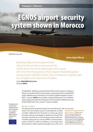
- 1. Transport > Morocco EGNOS airport security system shown in Morocco n EGNOS boosts airport safety www.enpi-info.eu Boosting safety and management effi- ciency for the vehicles in and around the airport area is one of the advantages which could stem from the introduction of the European Global Navigation Overlay System (EGNOS), the EU's first contribution to global satel- lite navigation and a precursor of Galileo. Text by ANSA/ENPI Info Centre Photos by METIS CASABLANCA - EGNOS was presented at the Mohammed V airport in Casablanca, Morocco, in October 2009 at a demonstration organised by the EU-funded METIS project (MEdiTerranean Introduction of European Satellite Navigation System – GNSS – Services). METIS aims to define a regional GNSS plan for a Euro-Mediter- ranean policy and prepare the introduction into the Southern Mediterranean area of both EGNOS and, in the coming 5-10 years, of Galileo. This publication does not represent the Moroccan interest official view of the EC or the EU institutions. The demonstration generated interest from the Moroccans. “We are very inter- The EC accepts no ested in the new European system,” Ismail Addarrak, air-traffic responsibility or controller at Mohammed V. “At present our drivers go around ENPI Info Centre – Feature no. 6 liability whatsoever This is a series of features on the airport without any navigation or equipment on board. They projects funded by the EU’s with regard to its content. have been trained to do so and they always need a written per- Regional Programme, prepared mit before going onto any runway. EGNOS is without doubt a by journalists and photographers on the ground or the ENPI Info system we'd like to install at Casablanca, even though other Centre. ENPI Info Centre/EU © demonstrations will be required. Especially as far as the use of
- 2. EGNOS airport security system shown in Morocco p.2 ENPI Info Centre - Feature no. 6 the system on the vehicles during take off and landing operations.” Using EGNOS you can The aim of EGNOS, a joint project between the European Space make great savings in Agency (ESA), the EU Commission and Eurocontrol (the European terms of equipment air-safety organisation), managed by a team composed by private and public organisations, led by Telespazio (Italy), is to guarantee improved safety for craft moving around the airport premises. In practical terms this means that any vehicle inside the airport will be equipped with an EGNOS receiver and will use a local wireless network to send its position to a control centre. The system, put together by European researchers, aims to improve on the GPS system which uses geo-stationary satellites via a terrestrial network of around 40 positioning stations. EU effort “Using EGNOS you can make great savings in terms of equipment,” said Michel Bosco, Deputy Head of satellite navigation at the EU's energy and transport division. He ex- plained this “is because there is already a signal present along the coast off Casablanca: it will suffice to equip yourself with just one vehicle-borne device, whether for commer- cial, passenger or container transport.” Boosting safety and Thanks to EGNOS, the terrestrial stations will be able to measure the GPS management efficiency signals, send the data to the centres to be calculated and returned via the for the vehicles in and satellites of the European system, thereby allowing GPS receivers to calcu- around the airport area late positions more accurately. Indeed, the new service offers positioning is one of the advan- precision with error factors of under two metres compared to the 15-20 tages which could stem metres for GPS signals. from the introduction of EGNOS METIS supports EGNOS Through METIS, the Partner Countries gathered valuable information on the technical and economic aspects of the service, especially transport effi- ciency and safety, and had the chance to contribute in sketching out the industrial and regulatory issues needed to define the roadmap to introduce EGNOS, in view of Galileo, in their country, says Antonella Di Fazio, coordinator of the METIS project at Telespazio. The project leader explained EGNOS is available in Europe and the North Mediterranean area, while its extension to the entire Mediterranean region is under implementation. “Conceived for applications in the Civil Aviation user domain, EGNOS has interesting perspectives of commercial utilisation in other user domains: Maritime, Rail, Road, Inland waterways, Personal mobility, GIS/High precision,” she says. Asked about the project’s most important achievements, she referred to the activities in support of the implementation of GNSS (Global navigation Satellite Systems) services in Algeria, Egypt, Israel, Jordan, Lebanon, Morocco, Palestinian Authority, Syria, Tunisia n Any vehicle inside the air- port will be equipped with an and Turkey. EGNOS receiver “The project defined a GNSS Regional Plan and ten National plans for EGNOS services introduction in the years 2009-2019, in view of Galileo,” she said, adding “they take into account the particular needs of the region in various user/application domains, and the social and economical benefits that the use of EGNOS and Galileo will generate.” Conceived as Euro-Mediterranean shared policy for the implementation of GNSS services in the Mediterranean region, the
- 3. EGNOS airport security system shown in Morocco p.3 ENPI Info Centre - Feature no. 6 Plans were jointly elaborated with stakeholders and shared with Authorities. The trans- port sector was identified as the most promising for the use of EGNOS today, to prepare the market for Galileo in the future. “All ten countries have clearly shown interest to- Through METIS, the wards the exploitation of EGNOS services in the civil aviation, maritime and Partner Countries freight markets,” Di Fazio says. gathered valuable METIS run demonstrations aimed at experimenting EGNOS commercial utilisa- information on the tion in various application domains and making use of the EGNOS service. The technical and economic demonstrations run in different countries and target applications in the priority aspects of the service, markets identified in the Plan. A training especially transport programme was also carried out com- efficiency and safety bined with the demonstration, to enable the countries to get involved with the Satellite Navigation, the enabling tech- nology and the infrastructures, the services and © Fabrizio Guerra applications, etc. Text adapted from an ANSA story by the ENPI Info Centre, a project managed by Action Global Communications. ANSA is a Consortium partner in the project. EuroMed Satellite Navigation (GNSS) / METIS Defines a common and shared policy towards the implementation of GNSS services in the Mediterranean Partner Countries www.metis-project.eu Participating Countries: Objectives Algeria, Egypt, Israel, It aims at defining a common, shared Euro-Mediterranean policy on the implementation of Global Jordan, Lebanon, Navigational Satellite System (GNSS) services and to pave the way for the introduction of EGNOS Morocco, Occupied and GALILEO services in the Mediterranean region. Palestinian Territory, Syria, Tunisia, Turkey Find out more METIS project fiche > http://www.enpi-info.eu/mainmed.php?id=43&id_type=10 Timeframe: ENPI Info Centre Transport webpage > http://www.enpi-info.eu/thememed.php?subject=8 2006-2009 Budget: €2.5 m The ENPI Info Centre is an EU-funded Regional Information and Communication project highlighting the partnership between the EU and Neighbouring countries. The project is managed ENPI info centre info ce t e by Action Global Communications. w ww.enpi-info.eu p