
Recomendados
Recomendados
Más contenido relacionado
La actualidad más candente
La actualidad más candente (20)
Destacado
Destacado (20)
Similar a Gulf of Saint Lawrence
Similar a Gulf of Saint Lawrence (14)
Último
Último (20)
Gulf of Saint Lawrence
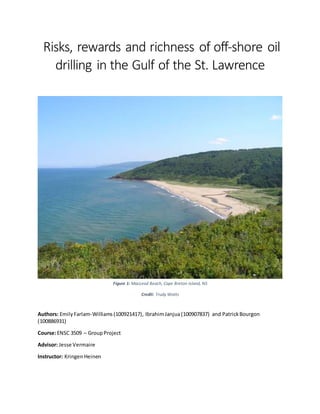
- 1. Risks, rewards and richness of off-shore oil drilling in the Gulf of the St. Lawrence Authors: EmilyFarlam-Williams(100921417), IbrahimJanjua(100907837) and PatrickBourgon (100886931) Course:ENSC 3509 – GroupProject Advisor: Jesse Vermaire Instructor: KringenHeinen Figure 1: MacLeod Beach, Cape Breton Island, NS Credit: Trudy Watts
- 2. Abstract From ecological,social andhydrological perspectives,the Gulf of the St.Lawrence inEastern NorthAmericacan provide certainaspectsthatno otherplace inCanada can provide.The abundantlife inthe OrdovicianandCarboniferousperiodshave potentiallyledtosignificantoil depositsunderthe Gulf.Aswell,the warmGulf Streamand coldLabrador Currentinfluence the kindof wildlife andhabitats found.There isa gradientof ecosystemsinthe Gulf,includingaquatic,marine,estuarine andterrestrial habitats.Ontop of this, a large proportionof the floraand fauna foundinthe Gulf are consideredat- risk.However,the Gulf facessimilarissuestothatof otherareas inthe world:overfishing,degradation of habitats,agricultural run-off,eutrophicationof estuariesandclimate change.Itisimportantto acknowledge howtheseare influencingthe ecosystemsinthe regionwhenlookingatwhetherornotto pursue oil drilling. Previousattemptstofindoil andgas have beenunsuccessful.Withthatbeingsaid,the Old Harry Salt Dome lookspromisingforhavingsignificantamountsof oil andgasdeposits.Notmuch researchhas beendone atthispointbyoil companiesdue tothe pushbackfrom the public.Thisis because anoil accidenthas the potential toimpactthe wildlife,the ecosystemsandthe fishingand tourismindustriesinthe Gulf.Eventhe exploratoryphases have the potential tonegativelyimpactthe wildlife andcanoverall be considereddamagingtothe environment.Itisimportanttonote that two of the most severe oil-drillingaccidentsinrecenthistoryhave occurredinthe exploratoryphase. In thisreport,factorsinfluencingthe Gulf of St.Lawrence fromthe followingperspectiveswill be lookedatinthe contextof off-shore oil drilling:geology,hydrology,ecologyandsocioeconomics.Itis importantto acknowledgethatthese fieldsof researchare interconnectedandcollectivelycontribute to the uniquenessandoverall significance of the Gulf.
- 3. Acknowledgements We wouldlike tothankKringenHeinenandJesse Vermaire forprovidingsomuchhelptous overthe semester.Emilywouldalsoliketothank herfriendsandfamilyfortheirsupport. Table of Contents Introduction SectionA (author: Patrick Bourgon) GeomorphologyandHydrology of the Gulfofthe St. Lawrence Chapter 1 – Geomorphologyof the Gulf of the St. Lawrence 1.1 How the Gulf of the St. Lawrence formed 1.2 Effectsof glaciation Chapter 2 – The Geologybehindthe Oil andGasDepositsinthe Gulf 2.1 Oil andNatural Gas Formation 2.2 The SedimentaryBasins 2.3 Oil Explorationinthe Gulf 2.4 The Importance of the OldHarry Site Chapter 3 – Hydrologyof the Gulf of the St. Lawrence 3.1 NorthAtlanticCurrent 3.2 The Labrador Current 3.3 Watershedof the Gulf:the St. Lawrence River 3.4 Conclusion SectionB (author: EmilyFarlam-Williams) The Ecologyand Biodiversityofthe Gulfofthe St. Lawrence Chapter 4 – The Ecologyof the Gulf Chapter 5 – Major Typesof Habitatsinthe Gulf 5.1 Terrestrial Habitats 5.2 Estuarine Habitats 5.3 AquaticHabitats Chapter 6 – AnthropogenicPressuresandHow TheyAre Impactingthe Region
- 4. SectionC (author: Ibrahim Janjua) A Brief History of Settlement,Oil-Drillingandthe Socioeconomic Impacts of Oil inthe Gulf Chapter 7 – Resourcesof the Gulf 7.1 Fishing,TourismandtheirImportance tothe Gulf 7.2: Historyof Offshore Oil Drillinginthe Gulf Chapter 8 -- Processof Oil and Gas Exploration 8.1 How the systemworksandthe playersinvolved 8.2 SeismicSurveying&Oil Drilling Chapter 9 -- Impactsof Oil Exploration 9.1 Environmental ImpactsandMitigationsforEachStage 9.2: SocioeconomicImpacts Conclusionand Future Areas of Research Table of Contents – Figures Figure 1: MacLeod Beach,Cape BretonIsland,NS (title page) Figure 2: Maximumextentof ice coverage aroundthe worldduringthe lastglaciation (p.8) Figure 3: The Milankovitchcyclesandthe timesof the lastglaciations (p.10) Figure 4: Map of the sedimentarybasinsinthe Gulf of the St.Lawrence (p.15) Figure 5: Map of the locationof oil wellsinthe Gulf of the St.Lawrence (p.16) Figure 6: Map of the pathwayof the Gulf Streamin the AtlanticOcean(p.17) Figure 7: A map of the pathwayof the Labrador Current (p.19) Figure 8: Drainage basinof the Gulf of St. Lawrence (p.20) Figure 9: the St. Lawrence Estuaryand where itwidensintothe Gulf (p.25) Figure 10: The St. Lawrence River(p.26) Figure 11: A comparisonof lowtide and hightide atHopewell Cape inthe Bayof Fundy (p.27) Figure 12: Exploitationrate bycommercial fisheriesonSouthernGulf cod (p.29) Figure 13: The Basinsof the Gulf of SaintLawrence (p.30) Figure 14: Oil explorationlicensesinthe Gulf of St.Lawrence (p.34) Figure 15: SeismicSurveysinthe Gulf of SaintLawrence (p.35)
- 5. Introduction The Gulf of the St. Lawrence hasplayeda large role inthe developmentof Canadasince European settlersfirstarrivedonitsshoresinthe 15th century.Evenpriorto that,it was extremelybeneficial to the Aboriginalsinthe area. The abundance of natural resources,mostnotablycod,ledtothe area gettingnamed“the Riverof Cod”.The manyspeciesof groundfish, includingcod,quicklybecamethe heartof the economyas itwas an importantfoodsource,a trade commodityandhelpedwiththe industrial developmentandeconomicexpansionbetweenEurope andpresent-dayNewfoundland(Lear, 1998). This ledtoa rise inthe fishingindustry andbecame asource of livelihoodof itsinhabitantsfor several centuries.However,due tooverfishing,the fishingindustry hasstruggledinthe pastfew decadesbuthas diversifiedgreatlyoverthe pastfew years.Todaythe maineconomicactivities inthe area are tourismandfishing. The Gulf notonlyhas a unique ecosystembutalsocontainsalotof potential resourcessuchasoil and gas.Oil companieshave beeninterestedinthe areaeversince the technologytodrill oil andgas was developed. The twomainstages of drillingisseismicsurveyinganddrilling.Seismicsurveyingis done firstsince drillingisexpensive (Archambault,2014) andit isimportantto know whatthe areahas to offerfirst.The processcan go onfrom days to months,dependingonthe scope of the project.Drilling isthe onlymeanstodetermine whetherthere isoil orgas. It isalsoone of the riskieststepsinthe exploratorycycle astwoof the largestoil spillsthathave occurredhave happenedduringthe exploratorydrillingphase.Bothstageshave the potentialtocause impactsonthe marine life. The oil and gas activityalsoaffectssocietyonaneconomical level since the jobmarketstartsto openup inthe oil industry (CanadianAssociationof PetroleumProducers,2015) and the fishingindustry may be negativelyinfluenced if aneventsuchasan oil spill occurs.
- 6. The Gulf of the St. Lawrence isfascinatingbothfroma geological andhydrological standpoint.Itwas createddue to the last glaciation andisone the mostsignificantfeaturescreatedbythem.There are twoocean currentsthat affectthe hydrologyandecologyof the Gulf of the St. Lawrence. Theyare the warm Gulf Stream(alsoknownasthe NorthAtlanticcurrent) andthe coldLabrador Current(Hogan, 2013). The mixingof the coldandwarm waterprovide adiverse amountof habitatsforlife toflourishin. The St. Lawrence Riverisanotherbodyof water hasa greateffectonthe Gulf of the St. Lawrence.It bringsinlarge amountsof freshwaterintothe Gulf whichallowsforthe formationof estuaries (EnvironmentCanada,2015).These are transitory zonesof fresh waterandsaltwater.The Gulf of the St. Lawrence isone of the fewplacesonEarth where estuariescanbe found (Hogan,2013). Lookingat the Gulf in itsentirety,itisevidentthatthere isa gradientof freshtosalt waterand fromcoldto warmerwaters.It isreflectedinthe wide varietyof flora,faunaandecosystems. In termsof how Canadahas beenprotectingthe ecologyof the region,the Conventionof Biological Diversity wassignedin1992 at Rio de Janeiroand the OceansAct was putintoeffect four yearslaterin 1996. The OceansAct issignificantinthatitdefinesarequirementtoprotectthe species that live inmarine habitats,the ecosystemsthese specieslive inandthe overall healthof the ocean.It alsoacknowledgesthatthese oceansare the commonheritage of all Canadians.However,Canadais experiencingwhatsomanyotherregionsinthe worldare strugglingwith,includinginvasive species, overfishingand lossof habitat(Archambaultetal.,2010). Canada isalreadyunique inthe factthat itscoastlinestouchonthree differentmajoroceans: the Pacific,Arcticand AtlanticOceans.Ona much smallerscale,the Gulf of the St.Lawrence inEastern Canada isunique inthatit touchesonthree provinces aswell astwostatesinthe UnitedStates.Aswell, the Gulf is ecologicallyrich, withthe St.Lawrence Riverflowingintothe AtlanticOcean.Thus,there isa gradientof freshto saltwater,creatinga wide varietyof habitats.Variable floodingconditionshave also helpedincreatingamyriadof habitats,bothterrestrial andaquatic.Giventhe complexityof the St.
- 7. Lawrence area,especiallythe aquaticecosystems,itisunlikelythata full understandingof boththe speciesandthe communitiesthatlive there will everbe obtained(DesgrangesandJobin,2003). Thispaperwill lookatthe geological historyof the Gulf of the St. Lawrence andhow itledto the possibilityof oil deposits,aswellasthe hydrologyof the regionandthe impactsithas on the biodiversity,the historyandeconomyof the Gulf.Finally,the positivesandnegativesof goingahead withoff-shore oil drillinginthe regionwill be examined. Chapter 1: Geomorphology of the St. Lawrence 1.1 How the Gulf of the St. Lawrence formed What is an ice age? An ice age is a periodof extreme coolingonEarth.It is associatedwiththe developmentof ice shelfsand glaciers,alongwiththe decrease of global sealevel.Ice ageshave greateffectsonnorthernlatitudes due to the encroachmentof ice and the landbecominginhospitable forlife.Italsohasan impacton sea life,due tothe changesinsealevel. Manyice ageshave occurred throughoutgeological timehowever theybecame more extreme afterthe Pleistocene.The Pleistoceneoccurredbetween2millionyearsago to 12 thousandyearsago. Duringwhicha large amountof ice agesand glacial periodsoccurred.(The AmericanMuseumof Natural History1998). Last glaciation The Gulf of the St. Lawrence formedduringthe endof the lastglacial period.The lastglaciationlasted fromabout 110,000 years ago to12,000 yearsago. Estimatesare thatapproximately26millionsquare kilometerswere coveredbyice duringthe peakof the glaciation.The entire northernhemisphere including;all of Canada,northernUnitedStates,southernSouthAmerica,Iceland,northernEurope,and parts of Russia.Alsomountainousregionslikethe Himalayasexperiencedthe formationof large glaciers. (Briney2015).
- 8. Figure 2: Maximum extent of ice coverage around the world during the last glaciation. (Credit: Bill Illis 2015). Glacial vs. interglacial periods Glaciationsare periodsof coolinginEarth’shistory,withinwhichice buildsupandeventuallyformsinto an ice sheet.Anice sheetisan immense formationof ice thatcan stretchfor manykilometers.There have beennumerousglaciationsinthe historyof the Earthand theyoccur around every100,000 years. In betweenthese periodsthere are interglacialperiods,whichare periodsof warming.Interglacial periodslastforabout15,000 yearsand we are currentlyinan interglacial period.(The American Museumof Natural History,1998). Causes Scientistsstilldon’tknowthe exactcausesof glaciation,howeverthe mostacceptedtheoryonwhat causesglaciationare the changesinthe amountof solar radiationthe planetisreceiving.Thistheory
- 9. was createdbyMilanMilankovitchandconsistsof three cyclesthataffectthe amountof solarradiation the planetisreceiving. The firstcycle is calledeccentricityanditconsistsof changesinthe orbitof the Earth aroundthe Sun. The Earth’s orbitaround the Sunchangesfrom circularto elliptical andbackagain.Thiscycle takes about100,000 yearsto complete.The Earthreceivesthe same amountof solarradiationwhenthe cycle isin the circularphase.The Earth receivesthe differentamountsof solarradiationwhenthe cycle isin the elliptical phase.Whenthe Earth’sorbitisinitsmost elliptical phase the differenceisatitsgreatest because duringcertaintimesof the yearitat itsfurthestpointfromthe sun.Thismeansthat itwill be coldestat those timesof the year.Currentlythe Earth’sorbitiscircular.(Climate Science Investigations, 2015). The secondcycle is calledobliquityanditconsistsof changesinthe tiltof the Earth’s axis.The Earth’s tilt changesfrom22.1° to 24.5°. This cycle takesabout41,000 years to complete.Summersare notas warm and wintersare notas cold whenthe tiltisless.Glaciationismore likelytooccurwhenthe tiltisat its lowestbecause thismakesthe summersunseasonablycool.Snow meltsduringthe summerbutif the summerisnot as warmthenmore snowwill remainandtherefore snow andice canbuildupovertime. Currentlythe Earth istitled23.5°. (Climate Science Investigations2015). The third cycle iscalledprecisionanditconsistsof changesinEarth’saxis.The Earth rotationsonitsaxis every24 hours. The axismakesa complete circle of itsaxisevery23,000 years.Thiscausesthe Earth to “wobble”,whichcausesthe Earthto be closerto the sun inJulyinsteadof January.Thiscauses intensificationof the summertemperaturesinthe NorthernHemisphere.Landmasscanchange in temperature muchquickerthanoceans.Thisisa significantfindingasthe majorityof landmassonEarth liesinthe NorthernHemisphere.Ice sheetshave atendencytogrow muchfasterand more easilyover landmassesthanoveroceans.Thisisbecause assnow fall onlandit pilesupandaccumulates,while in
- 10. the oceanssnowusuallyjustmeltsoncontact withthe water.Therefore,changesinthe time of yearof whenthe Earth isclosestto the suncan greatlyaffectthe climate onthisplanet.Whenthisoccurs summersbecome muchwarmerandtherefore more ice andsnow will be meltedwhichwillcause the ice sheetsandglacierstoretreat.(Climate ScienceInvestigations2015). Figure 3: The Milankovitch cycles and the times of the last glaciations (Credit: JeffreyLee, 2012) 2.2 Effects of glaciation Glaciationhasmultiple effectsonthe environmentsonEarth.These include:changesinsealevel, creationof unique geological features,anderosionof the landscape.The amountof wateronEarth remainsrelativelyconstantatall pointsintime.Waterchangesfromsolid,liquidorgasdependingon the environment.Whenglaciationoccurice sheetsformandice is solid water.The wateristakenfrom the oceansand fallsonthe landas precipitation.Whenthe climate iswarmthiswaterremainsinthe liquidphase andisovertime transportedbackintothe oceans.Howeverduringglaciationthe climate is coldand therefore the waterremainsonlandandsealevel dropsasa result.Thisprocessisknownas Eustatic.Whenthe ice sheetsbecome thick(1-3kilometersinheight) theyreachhundredsof thousands of poundsinweight.Thisaddedweightonthe Earth’scrust causes it to be lowereddue tobeing
- 11. squishedunderthe weight.Whenthe ice sheetsmeltthe crustthenreboundsuptoits original height, thisisknownas Isostaticrebound. (SFUMuseumof ArcheologyandEthnology2005). Erosion Glaciersleave evidenceof theirpresenceduringeveryglacial event.One of the mostobvioussignsof glaciersisthe erosionof a large area,some beinghundredsof kilometersinarea.Glaciersare very heavysolidmassesof ice (waterinitssolidstate) thatscrape the landas they move overit.Glacierscan pickup small andlarge amountsof soil debrisandthentrapit inside them.Whenthe glaciersretreat theymeltanddepositthem.Anothervisible evidence of glaciersisglacial valleys.Theseoccurwhen glaciersscraplarge valleysintomountainsides.There are three typesof mountainerosion;cirques, arêtes,andhorns. Cirquesare roundedshapedhollowswithsteepuphill faces.Arêtesare createdwhentwoglaciersmeet and erode the ridgesof mountainsonbothsides,this resultsinjagged-narrowridges.Hornsare created whenglaciersheavilyerode amountainleavingbehindasteeppointedpeak.(NationalSnow andIce Data Center,2015). Landforms Whenice sheetsandglaciersretreattheycan create multiple differentlandforms.Theseinclude fjords, moraines,kettlelakes,glacial erratics,anddrumlins.Fjordsare atype of valleyorhorncreatedwhen the glacierretreatsandscrape the landscape.Whenthe glaciersretreattheydepositmoundsof gravel or rocks. Sometimesthe glaciermeltsawayandleavesbehindaridge thatshow where the glacierwas, these are knownas kettle lakes.Kettlelakesformwhenapiece of aglacierbreaksoff andis leftbehind on the landscape.Overtime thispiece meltsandformsapond or small lake inthe landscape.Asglaciers retreattheymeltawayand dropanythingthat theyhave pickedupwhentheyoriginallyadvanced. Sometimestheycandropverylarge bouldersorrockswhichappearunnatural,these are calledglacial.
- 12. Drumlinsare long,teardrop-shapedsedimentdeposits.Theseforminlarge clusterssometimes hundredsinnumber.(NSIDC,2015). The Gulf of the St. Lawrence wascreatedwhenthe glaciersretreatedatthe endof the lastglaciation.As the glaciersretreatedtheyeroded the landscape andleftdepressionsinit.Overtime thesefilledwith water,and thisiswhyCanada has somany lakesandrivers.Asstatedpreviouslywaterthatfallsonland as precipitationwill eventuallyfinditswaybacktothe ocean.All of the waterinthe lakesandriversin Canada hadto reach the ocean some wayand thustheyflowedintothe areaof Gulf of the St. Lawrence, whichresultedinitscreation.(Briney,2015). Conditionsinthe Gulf The Gulf of the St. Lawrence hasunique waterqualitiesthatcanvary widely.There canbe changesin depth,lightconcentration,sedimentandcontaminates,salinity,andtemperature.The depthof the Gulf of the St.Lawrence rangesfrom 50-500 meters.Thisleadstodifferencesinthe lightconcentrationsin the waterbecause lightcan onlypenetrate watertoacertainextent.Indeeperpartsof the Gulf the lightconcentrationwillbe muchlowerthanthose atshallowerparts.The Gulf of the St.Lawrence isfed by the St. Lawrence Riverwhichbringsinhuge amountsof sedimentsandcontaminantsintothe Gulf. The concentrationsof sedimentsandcontaminantsdecreasesthe furtherone isfrom land. Mostof the containmentsare aresultof urban and rural runoff,suchas nitrogenandphosphorus.The Gulf of the St. Lawrence isalsofedby the Atlanticwhichbringsinsaltwaterintothe Gulf.Salinityinthe Gulf can range from25.2 to 30 parts perthousand.Salinity will become higherfromthe landtothe Atlantic.Lastly watertemperaturesinthe Gulf range from0.9°C to 5°C. The watertemperature iscolderinthe deeper parts of the Gulf andin areasclose the AtlanticOcean.(Hogan,2013).
- 13. Chapter 2: The Geology behind the Oil and Gas Deposits in the Gulf 2.1 Oil and Natural Gas Formation Oil and natural gas like all fossil fuelsare made fromlivingthingsinoceans,rangingfrommicroscopicto macroscopicinsize.Asthese lifeformslive,theyabsorbcarbonfromtheirenvironment.Whentheydie, theysinkto the seafloorand overmillionsof yearstheyget buriedinlayersafterlayers of sedimentand become exposedtoincreasingheatandpressure.Overtime,these conditions forcedthe creationof hydrocarbonsfromthe organicmaterial.The deeperthe organicmaterial isburiedthe more heatitis exposedto.Lighteroilsare producedwithmore heat.Overtime the oil andnatural gastravel up tothe surface or get caughtunderan impermeablelayerof rockor clay.Thisis due to the fact that the oil and natural gas are lighterinnatural thenthe surroundingground.(AdventuresinEnergy2015). 2.2 The Sedimentary Basins The Gulf of the St. Lawrence liesontopof twosedimentarybasins,asshowninfigure 3.Both of which are suitable forthe presence of oil ornatural gas.These twosedimentarybasinsare the AnticostiBasin and the Madeleine Basin.The Anticosti Basinoriginallyformedduringthe Ordovicianperiodwhilethe Madeleine Basinformedduringthe Carboniferousperiod.(Archambault,2014). The Ordovicianperiodoccurredapproximatelybetween485 millionyearsagoto443 millionyearsago. A huge diversificationof lifeoccurredduringthe Ordovicianperiod.Mostof the life onEarth at this pointintime wasfoundinthe oceans,whichwere filledwithflourishingecosystemsandspecies. Numerous newspeciesevolvedandcompletelycolonizedthe oceansduringthe Ordovician.The dominatingassemblagesof life inthe Ordovicianwere the brachiopods(lampshells),bryozoans(moss animals),trilobites,mollusks,andgraptolites(small,colonial,planktonicanimals).Alsothe first colonizationof landbyfishstartedtooccur. (Holland2015). The Carboniferousperiodoccurredapproximatelybetween358 millionyearsagoto298 millionyears ago. The Carboniferousmarkedaperiodof diverse marine invertebrates.Thiswascausedbythe
- 14. openingof manydifferentnichesdue toamass extinctionthattookplace shortlybeforethe beginning of the Carboniferousperiod.The Carboniferousperiodwasdominatedbythe crinoids,whichwere a groupof stalkedechinoderms.Theseanimalswere suspensionfeedersthatwere soabundantthatthey affectedbottomoceancurrentsandoceanwatercirculation (Manger,2015). The Carboniferousisalsonotedforitshuge anthropoids,nowadayscommonlyknownas insects. There were dragonflies the size of birdsandscorpionsthe size of dogs.The mainreasonfor the large size was the fact that oxygenlevelsinthe Earth’satmosphere reachedapproximately80%.Insectshave aunique ability,whichisthattheirsize isproportional tothe amountof oxygenavailable tothemintheir environments.(Than,2011).This wasalsothe time whenthe largestanthropoidtoeverexistlived, calledthe Arthropleura-- agiantcentipede thatcouldreachlengthsof upto three meters.(Prehistoric Wildlife, 2015). The Anticosti Basinandthe Madeleine Basinformedduringthe OrdovicianandCarboniferousperiods respectively, whichbothexperiencedalarge abundance of oceanlife.Asstatedpreviously, oil and natural gas form from the decompositionandcompressionof living organismsinthe oceans.Due tothis, boththe basinshave the possibilityof havingoil ornatural gas deposits, althoughgeologistsbelieve that the Madeleine Basinismore favourabletothe presence of oil ornatural gas. The reasonwhythese basinspossiblyhave oil andnatural gas deposits isbecause there wasahuge amountof life inthe oceansduringthe time whenthese basinswere forming. Therefore,there wasmore material towork withinthe productionof fossil fuels. (Archambaultetal.2015).
- 15. Figure 4: Map of the sedimentary basins in the Gulf of the St. Lawrence (Credit: Archambault et al. 2015) 2.3 Oil Exploration in the Gulf Due to its geological nature manyoil companiesare attemptingtofindoutif there are any oil deposits inthe Gulf of the St.Lawrence.The firstexploratorywellsweredrilledin1942 and continueduntil 1996, witha total of 10 wellsbeingdrilled.9of the wellswere drilledfrom1942 to 1983 and the last well was drilledin1996. All 10 of these producednegative resultsforthe presence of oil andrevealedonlytraces of natural gas.Onlythe E-49 well,drilledin1974, showedsignificantsignsof natural gaswithestimates beingabout77 billioncubicfeetof natural gas.All of the wellshave beendrilledinthe Madeleinebasin due to previouslystatedreasons.(Archambault,2014).
- 16. Figure 5: Map of the location of oil wells in the Gulf of the St. Lawrence (Credit: Archambault et al., 2015) 2.4 The Importance of the Old Harry Site Oil companieshave statedthatthe OldHarry site as a proposedsite forfuture drillingdue toits geological nature.The OldHarrystructure islocatedapproximately80 kilometersfromthe westcoastof Newfoundlandandthe MagdalenIslands,andinthe middle of the LaurentianChannel.The OldHarry site consistof a vast saltdome that isapproximately12kilometerswide and30 kilometerslong.Itis buriedunder3 kilometersof sedimentarylayers.The structure hastwo“bumps”that rise upward, whichissignificantas these moundsformhydrocarbontraps.One thirdof the structure isfoundon the Newfoundlandsidewhile the restliesonthe Quebecside.The Quebecside isbelievedtohave mostof the oil or natural gas, due to the fact that the majority of the site isonthe Quebecside.Itisuncertainas to howmuch oil ispresentinthe OldHarry site but estimatesare thatitcontains1-5 billionbarrelsof oil.These estimateswere basedonover20 yearsof seismicsurveys.(Archambault,2015).
- 17. 2.5 Dangers of an Oil Spill in this Area Many oil companiesare makingeffortstotryand continue oil explorationinthe Gulf of the St. Lawrence.Howeverthere isalotof oppositiontomore oil drillinginthe Gulf fromthe fishingindustry, the tourismindustry,andthe local population.The oppositionismostconcernedof the damage that wouldoccur to the ecosystemsandthe speciesthatlive inthem, if anoil spill were tooccur.If one did occur thenit wouldadverselyaffectall the ecosystemsandof the life inthe Gulf,thusimpactingthe tourismandfishingindustries,thusaffectingthe livelihoodsof those whocall the areahome. Chapter 3 Hydrology of the Gulf of the St. Lawrence 3.1 North Atlantic Current Figure 6: Map of the pathway of the Gulf Stream in the Atlantic Ocean (Credit: John Stoodley) The Gulf of the St. Lawrence hasa veryunique hydrologydue tothe mixingof freshandsaltwater,as well asthe mixingof coldand warmwater.There are three majorbodiesof waterthatfeedintothe Gulf of the St.Lawrence.These are;the North AtlanticCurrent(alsoknownasthe Gulf Stream),the Labrador Current,andthe St.Lawrence River(Hogan2013).
- 18. The Gulf Streamisthe main oceancurrentof the AtlanticOcean.Itis the maindriverof climate inthe northernhemisphere (otherthanthe sun),andstretchesfromFloridatoWesternEurope.The warm waterthat flowsthroughthe Gulf Streamoriginatesoff the north-westerncoastof Africa.The wateris thenpushedwestwardstowardsSouthAmerica,where itsplitsandsome goesnorthtothe Caribbean and some goessouthalongthe coast of SouthAmerica.The warmwaterflowsintothe Gulf of Mexico where itisthenforcednorthwardsalongthe easterncoastof the UnitedStates.Itthencontinues until it reachesthe eastcoast of Canadawhere itstarts headingintothe AtlantictowardsEurope.The main forcesthat drivesthiscurrentandthe movementof somuch waterare the trade-windsandthe north Atlanticdeepwatercirculation.The trade-windsare the prevailingwindsinthe specificlatitudinalbands that one resides.Southof the equatortheyruneastto westand northof the equatortheyruneast to west.The trade-windswerenamedsobecause shiptrade betweenNorthAmericaandEurope used these windstopropel theirsailingshipsacrossthe Atlantic.The northAtlanticdeepwatercirculationis an oceancurrent that flowsinthe lowlevelsof the AtlanticOcean.A factof wateristhat cold waterwill flowunderwarmwater.Thisis because colderwaterisheavierandtherefore throughgravityit naturallysinksbelow the warmwater.The northAtlanticdeepwatercirculationinvolvesthe transportationof coldArticwater downintoequatorial regionswhere itisthenwarmedupandrisesto the surface waters.It isthencarriedalongwiththe warm watercurrents.Whenthe water reachesthe Articit thencoolsand sinksandthe cycle beginsagain.Some of the warm waterisable to reach the coast of easternCanada,as the Gulf Streamwaterpassesbyon itsway to Europe.Thiswarmthen entersthe Gulf of the St.Lawrence and warmsthe waterin the Gulf.Thisencouragesthe migrationof warm waterfishandmammalsintothe Gulf of the St. Lawrence.(WeatherOnline 2015).
- 19. 3.2 The Labrador Current Figure 7: A map of the pathway of the Labrador Current (Credit: Wikipedia) The secondoceancurrent that affectsthe Gulf of the St. Lawrence isthe Labrador Current.The Labrador Currentisa coldoceancurrent that runsof the Northerncoastof Labrador. The waterthat flowsinto the Labrador Currentoriginatesof the coastof Greenland.Itflowsintothe northernislandsof Canada, and thenitflowssouthwardsintothe LabradorCurrentof the Northeasterncoastof Canada.However much of thiscold waterdoesn’tmake itintothe Gulf of the St.Lawrence because Newfoundlandblocks mostof it.Therefore the LabradorCurrentdoesn’taffectthe Gulf of the St. Lawrence asmuch as the Gulf Stream.Howeveritisstill greatlyaffectsthe Gulf of the St.Lawrence because itbringsincoldArtic water.The Labrador Currentis part of the northAtlanticdeepwatercirculation,whichasprevious statedtransportscoldArtic watersouthwardstoequatorial regions.(Joannaetal.2015).
- 20. Howeversome coldwaterdoesmanage tomake it intothe Gulf of the St. Lawrence.Thiscoldwater thenentersthe Gulf of the St.Lawrence and coolsthe waterinthe Gulf.Thisencouragesthe migration of coldwaterfishandmammalsintothe Gulf of the St. Lawrence. 3.3 Watershed of the Gulf: the St. Lawrence River Figure 8: Drainage basin of the Gulf of St. Lawrence (Credit: Environment Canada) The drainage basinof the Gulf of the St.Lawrence isthe St.Lawrence River,andit isone of the largestin the world.It incorporatesintoitall of the lakesandriversineasternCanadaand the northeastern UnitedStates,the biggestcontributorsbeingthe GreatLakes.There are many riversthatfeedfresh waterintothe Gulf of the St. Lawrence however,mostof these firstfeedintothe St.Lawrence Riverand thenthe riverfeedsthe freshwaterdirectlyinto the Gulf of the St.Lawrence.The drainage basinhasan area of 1.6 millionsquare kilometersanddrains25% of all the freshwateron Earth.(Environment Canada,2015).
- 21. The main contributorstothe St. Lawrence Riverare the Ottawa River,the SaguenayRiver,the ManicouaganRiver,the St-Maurice River,andthe RichelieuRiver.The actual St.Lawrence Riverruns fromLake Ontarioto Kingston,toMontreal andthen widensinto the Gulf of the St. Lawrence. Severalof Canada’scitiesare situatedalongthese rivers (aswellasthe Great Lakes) andcollectively theyhave a great impacton the qualityof the waterinthe rivers.Almosteverysingle cityonEarth hasurban runoff, whichoccurs whena cityexperiencesprecipitationorfloodingof some kind.The rainwatersimplysits on topof the ground,since the urban landisimpermeable.Duringthistime the waterabsorbslarge amountsof contaminants,includingalarge amountof nitratesandphosphatesinthe waterdue tothe run-off of agricultural land.This contaminatedwaterthenflowsintothe riversouttowardthe Gulf of the St. Lawrence andaffectsthe ecosystemsall alongthe way.(Marsh,2015). 3.4 Conclusion The Gulf of the St. Lawrence ina veryunique situation due tothe mixingof saltandfresh water,aswell as warm and coldwater.Thismixingallowsforthe creationof estuarieswhichare transitionzone betweensaltwaterareasandfreshwaterareas.Theyare rare ecosystemsthathouse adiverse amount of speciesinit. The Gulf of the St.Lawrence isone of the most diverse areasinall of Canadain termsof life.The nextsectionsof thisreportwillconsistsof examiningthe ecosystemsof the Gulf anditsspecies. Chapter 4: The Ecology of the Gulf of the St. Lawrence Canada isalreadyunique inthe factthat itscoastlinestouchonthree differentmajoroceans: the Pacific,Arcticand AtlanticOceans.Ona much smallerscale,the Gulf of the St.Lawrence inEastern Canada isunique inthatit touchesonthree provinces aswell as twostatesinthe US. Aswell,the Gulf is ecologicallyrich,asthe St.Lawrence Riverflowsintothe AtlanticOcean.Thus,there isa gradientof freshto saltwater,creatinga wide varietyof habitats.Variable floodingconditionshave also helpedin creatinga myriadof habitats,bothterrestrial andaquatic(DesgrangesandJobin,2003).
- 22. Canada signedthe Conventionof Biological Diversityin1992 at Riode Janeiroandenactedthe OceansAct fouryearslaterin 1996. The OceansAct is significantinthatitdefinesarequirementto protectthe speciesthatlive inmarine habitats,the ecosystemsthesespecieslive inandthe overall healthof the ocean.It alsoacknowledgesthatthese oceansare the commonheritage of all Canadians. However,Canadaisexperiencingwhatsomanyotherregionsinthe worldare strugglingwith,including invasive species,overfishing,lossof habitatandfoodwebsbeingaffectedbythe removal of target speciesandbycatch(Archambaultetal.,2010). It was estimatedin2003 that 10% of at riskvascularfloraand 27% of at riskherpetofaunacalled the wetlandsinthe Gulf home.Some 6000 specieswere foundtobreedalongthe St.Lawrence Riverin Quebecandsome estimatessuggestupto27 000 speciesinthe area; the majorityof whichhave yetto be discovered. Itshouldbe notedthatthe majorityof unknownspeciesare microorganisms –bacteria, fungi andviruses – and insects.Theymake upa large amountof biomassandare significanttothe upkeepof ecological healthandproductivity (DesgrangesandJobin,2003). To put numbersonhowlarge the St. Lawrence Riverandthe Gulf of the St. Lawrence area is,it was foundthatin Quebecthe drainage basinscoveranareaof 57 000 km2 .Includedinthisareaare more than 4000 km2 of shorelines,unique ecosystemsand abroad diversityof habitats.399 speciesof birds(aquaticandterrestrial) were foundinjustthe Quebecportionof the St.Lawrence area.The area withthe highestrichnesswasthe Islandof Montreal andsurroundingislands(with327 species) andthe poorestareawas aroundthe LowerNorthshore.Inthe case of the latter,itis difficulttoaccessand manyspeciespresentmaynothave beenrecordedyetdue toa lack of birdwatchers(Desgrangesand Jobin,2003).
- 23. Giventhe complexityof the St.Lawrence area,especiallythe aquaticecosystems,itisunlikely that a full understandingof boththe speciesandthe communitiesthatlive there will everbe obtained (DesgrangesandJobin,2003). Chapter 5: Major Ecosystems of the Gulf of the St. Lawrence 5.1 Terrestrial ecosystems Terrestrial ecologistsknowthatanexcellentwaytodetermineenvironmentalhealthandhow well anecosystemisfaringistolookat the biodiversityof anarea(Archambaultetal.,2010). An analysis on the primarybreedinghabitatsof birdsinthe St.Lawrence wasdone.It wasfoundthat about41% preferredaquatichabitats,36%had a preference forforestedhabitatsand23% had a penchantfor urban andagricultural areas.Consideringthe amountof migratoryspeciesthatfrequentterrestrial ecosystems,the decreaseinspeciesrichnessfromupstreamtodownstreaminthe St.Lawrence is expected. Thisoverall patternisparticularlynoticeableforspeciesthatfrequenthardwood-dominated forests,while coniferous-frequentingspecieshadamore uniformdistribution(regardlessof ahigher abundance inthe AppalachiansandLaurentians). Inthe Laurentians,anareareferredtoCap Tourmente has extremelyhigh biodiversityandisone of five areasof highspeciesrichnessintermsof herpetofauna,birdsandvascularflora.Thisparticularareaalsohasa significantamountof at-risk species(DesgrangesandJobin,2003). It has alsobeenfoundthatforestfireshelpwiththe healthof forestsbyimprovinglandscape- level productivityandshade-tolerantspeciesconservation.Despitethis,theyalsocome withheavy costs,includinginfrastructuredamage,highsuppressioncostsandthe decline of harvestable forest duringmore severe fire years.Frequency(andpossiblyseverity) of forestfiresislikelytoincrease with the warmingtemperaturesof climate change (Terrieretal.,2013).
- 24. 5.2 Estuarine ecosystems Wetlandsact as the middle groundbetweenterrestrialandaquaticecosystems,and the societal benefitstheyprovide are wellknown.These include habitatforwildlife,protectionfromfloodsand coastal erosion,improvementstowaterqualityandwastewatertreatment. Bothsaltwatermarshesand freshwaterwetlandsshare the commonality thattheyare low-energyenvironmentswithverylittle turbulence.Thus,thismakesthemparticularlysusceptibletothe stressesassociatedwithorganic chemical pollution,includinghydrocarbonsassociatedwithoilandgas(Venosaetal.,2002). Near Cornwall,Ontario,itwasfoundviaseasonal studiesin1995 and1996 that there are strong biogeochemical gradientsbetweenawetland,acreek,embaymentsandthe St.Lawrence River.Since the differencesare more significantata local scale than the overall lengthof the river,thisindicatesthe importance of near-shore ecosystems(like wetlandsandestuaries)tothe rivercarboncycle (Barth and Veizer,1999). Unique tothe St.Lawrence area, the LowerSt. Lawrence Estuarycoversan area of 1300km2 and itswater isbothdeepandhypoxicinnature (Archambaultetal.,2010). Phytoplankton,chemosythetic microbes,macroalgae andangiospermflora (more commonlyknownasfloweringplants) are widely consideredtobe the majorprimaryproducersintemperate ecosystems.Because of this,theyare able to supportotherorganismsinthe ecosystem, suchasheterotropicmicrobes,zooplankton,nektonand benthicinvertebrates.Betweenall these groups,theyare able tocreate by-productsfromprimaryand secondaryproductionthatsupportotherecosystemfunctionslikenutrient cycling(Strongetal.,2015). Because of the nature of the LowerSt. Lawrence Estuary,the phytoplanktonbloomthatoccursinthe springisrelativelylate,aroundmid-June,buthighbiomasspersiststhroughoutthe summermonths.It has alsobeeninferredthatthe estuaryisof significance toCalanusfinmarchiusproduction.Thisis because the amountof zooplanktonbiomassmaybe heavilyinfluencedbythe residual surface circulation(Plourdeand Runge,1993).
- 25. Figure 9: the St. Lawrence Estuary and where it widens into the Gulf (Source: Fisheries and Oceans Canada) Estuariesconstantlygetnutrientsfromfreshwatersources,but whathappenstothe inputsis not as well known(Fisheretal.,1988). Temperate estuariesworldwide are currentlyexperiencingmajor changesinboth oceanographyandecologyasa response tohumanexploitationandpollution.This includesmore sedimentationandturbidity,more intenseperiodsof hypoxia(highamountsof oxygen) and anoxia(minimal/nooxygen).Thisispartlyworsened bythe overfishingof oysters,whichgraze algae effectivelytothe pointitminimizesthe symptomsof eutrophicationand therefore leadstothe reductionof the riskof algal blooms. Large vertebratessuchasgray whales(whichare now extinctin the Atlantic),belugas,giantsturgeonandsharkswere all abundantinthe ChesapeakeBayareabut now almostgone (Jacksonetal.,2001).
- 26. 5.3 Marine ecosystems Out of the three oceans,EasternCanada isthe most well-knownandcan be describedmost adequatelybydividingitupintoregions.Inthe northernpart,the Labrador Currentmovessouthinto the Grand Banks,where itmeetsthe Gulf of the St.Lawrence.The Gulf of the St. Lawrence getsabout 600 km3 of freshwaterdischargesayearto the westof Newfoundland.Here,itisalmostanenclosed shallowsea. Italsoincludesacatchmentarea of 6x10⁶ km2 . Figure 10: The St. Lawrence River (Credit: Leeds Grenville) A regionunique inbothhydrologyandecology,the Bayof Fundyhas the highesttidal amplitude inthe world,at16 metersor 53 feet.The energyfromthese tides(whichisaround2000 timesgreater than that Gulf experiencesindailydischarge) helpstofuel highlyproductiveandspeciesrichecosystem. Thisin turndefinesthe surroundingenvironmentaswell asthe tourismandfishingindustriesinthe region. Intermsof the three oceansthatsurroundCanada, the part of the AtlanticOceanthatEastern Canada isa part of issecond-mostimportantinregardstophytoplanktondiversity,withatotal of 626 taxa.Of these 626 phytoplanktontaxa,274 are diatoms,190 are dinoflagellates,41are prymnesiophytes,29are choanoflagellatesand27 are prasinophytes (Archambaultetal.,2010).
- 27. Figure 11: A comparison of low tide (left) and high tide (right) at Hopewell Cape in the Bay of Fundy (Credit: Kathleen J. Wile) Chapter 6: Anthropogenic Pressures on the Habitats, Flora and Fauna of the Gulf Nearlyall threatenedspeciesliveinanarrow piece thatrunsalong a corridoralongthe St. Lawrence River.Ithas beenespeciallydifficulttocreate protectedlands,consideringhow littlepublic landremainsinthe area. Thisisproblematicasthis area inparticularissubjectto mostof the pressure exertedbyhumandevelopment.Thisispartlybecause populationgrowthandactivityinQuebecand alongthe St. Lawrence hasledto the deteriorationof riparianhabitats,notablyinthe Montreal Archipelago. Manyspecieshave alsobeenonthe decline aswetlandshave gottensmaller.Thisisof particularimportance giventhe productivityof wetlands,especiallythose inthe UpperSt.Lawrence Uplandsthat are locatedinthe mouthsof riversand within archipelagosanddeltacomplexes (DesgrangesandJobin,2003). For estuaries,aloomingproblemisnitrogenloadingfromcoastal watersheds. A veryspecific case of thisis the eutrophicationof eelgrassbeds. Thisisinfluencedinpartby humanpopulation, wastewaterproductionandlanduse,amongotherthings.InsevenestuariesinNew Brunswick,the total loadwas the resultof watershedandestuarysize whilethe loadrate wasconnectedtothe watershed populationdensity. Thisissignificantasimpactsof nitrogenloadingleadsincreasedplanktonic,
- 28. epiphyticandbenthicalgae.Thisinturnleadstolesslightenteringthe watercolumn,more direct shadingfromovergrowthandan acceleratedconsumptionof oxygenwhere the soil bedmeetsthe water.Residence timeof waterwithinthe estuaryinfluencesthe chancesof analgal bloomoccurring (McIveret al.,2015). As previouslystatedinsection2.3,the degradationof estuaries ispartlyworsened by the overfishingof oysters,whichgraze algae effectivelytothe pointitminimizesthe symptomsof eutrophicationandreducesthe riskof algal blooms. Large vertebratessuchasgraywhales(whichare nowextinctinthe Atlantic),belugas,giantsturgeonandsharkswere all abundantinthe Chesapeake Bay area butnow almostgone (Jacksonetal.,2001) Generallyspeakingforforesthabitats (includingthose aroundthe St.Lawrence),itisagreedthat the frequencyof forestfireswill increasethiscenturyasa response toclimate change.Howeverthisis underthe assumptionthe compositionof vegetationwill remainthe same overthe upcomingdecades. Thisis importantasit isexpectedthathigh-latitudeboreal forestsinparticularwillbe affectedbecause of this(Terrieretal.,2013). However,due tothe locationof thispaperbeinginQuebec,justnorthof the St. Lawrence Riverandthe Gulf of the St. Lawrence,itispossible thatforestsclosertothe Gulf may be affectedinthe future. Historical datais significantinecologicallysensitiveareassuchasthe St.Lawrence,as most ecological researchisbasedonlocal fieldstudiesthatmayonlybe fora few yearsin duration;aswell, the majorityof these studiestake place afterthe 1950s without lookingatissuesorimpactsfroma long- termperspective (Jacksonetal.,2001). Chapter 7: Resources of the Gulf 7.1 Fishing, Tourism and their Significance The Gulf of St. Lawrence hasprovento have a highlyproductive ecosystemthatcontainsvarious differentplantsandanimalsof differentshapesand sizes.Whatisevenmore interestingisthatthe bedrockand sedimentsof the Gulf containa lotof resources,fromnon-fuel mineralssuchassand and
- 29. gravel to fossil fuelssuchascoal,oil,gas and hydrates(Bewersetal.,1974). These distinctqualitiesof the Gulf combine tocreate a unique environment. Withall of thisinmind,one can note how valuable thiscan be to the economyof the surroundingprovinces. In the 15th century,withthe discoveryof the New Worldwasthe discoveryof the fishresources of the Gulf.The firstEuropeansto travel here calledit“the Riverof Cod”,due to the abundance of the cod fish.The cod fish,aswell asotherfishbecame animportantsource of foodforEuropeansandwas a vital fortrade,industrial developmentandeconomicexpansionbetweenEurope andthe Newfoundland communities(Lear,1998).The fishingindustry,whichconsistsof fishing,fishprocessingaswell as aquaculture hadmade up to $1.5 billioninrevenuesperyearin2006 and 2007 (Alexanderetal.,2010). As of today,the fishingindustryhassufferedinrecentyears,buthasdiversifiedintermsof fishing activitiesoverthe lastfewyearsinresponse tothe declineof codfishandsome otherground fish.The declinesinpopulationare mainly due tooverfishingandnatural predators.Several mitigationmeasures such as introducingbansandcertainfishingpermitshave beensetupinorderto restore the codfish populationandotherground fishtotheirnormal levels(Swain,2009). Figure 12: Exploitation rate by commercial fisheries on Southern Gulf cod (Source: Swain, 2009) The fur trade,shipbuildingandshippingdevelopedandplayedanimportantpartinthe history of the historyof the countrythanks to the Gulf.However,the twomost notable industriestothrive from
- 30. thisunique ecosystemare fishingandtourismwhichnotonlyconstitutethe mainactivitiesof todaybut alsoplaya part inthe heritage andlifestyle whichhave definedthe social developmentof itsinhabitants for several centuries(Archambault,2014). As fortourism,giventhe Gulf’suniqueecosystem, the industryincludescruises,recreational fishingandcoastal tourism andhas generatednearly$0.8billion(Alexanderetal.,2010). Together, these twoactivitiesaccountfortensof thousandsof jobson whichcoastal communitiesdependonthe Gulf for theirlivelihoodandshowsusthe social,economicandcultural significance thattheyplayapart of. Figure 13: The Basins of the Gulf of Saint Lawrence (Source: Hydro-Quebec, 2002) 7.2: History of Offshore Oil Drilling in the Gulf The Gulf of SaintLawrence primarilyconsistsof twolarge sedimentarybasinsfromwhich petroleumreservescouldbe located.The Anticosti Basin,ismade upof a shelf of carbonate rockssuch as limestone whichisseveral kilometersthickandisfromthe OrdovicianPeriod,whichisroughlyabout 415-490 millionyearsold.The Madeleine Basinconsistsof several saltdomes,andisfromthe Carboniferousperiodwhichis350 millionyearsold(OwensandBowen,1972).Accordingto geologists, since the Madeleine Basinisfromthe Carboniferousperiodandcontainsmanysaltdomes,itismore favorable forthe presence of oil andgas(Andre andPittet,2011).
- 31. The firstoil drillingthathappenedin the Gulf couldbe datedbackto 1860. However,real developmentstartedtotake place duringthe 1960s whenpetroleumseismologywentthrougha revolutionwiththe arrival of digitaltechnology.Sincethe fall of 1942, a total of 10 exploratorywellshad beendrilled.Mostof themhave beeninthe Madeleine Basinsince because of the saltdomes.Hydro- Quebec,agovernmentownedpublicutility,receivedthe licensesandmandate toexplore the Gulf of SaintLawrence Estuaryin 1963 whichleadtothe firstdrilling inthe Gulf at BrionIslandin1970 (Archambalt, 2014). Duringthe 1970s and the 1980s, SOQUIP(Societe Quebecoise d’Initiatives Petrolieres),whichwascreatedbythe province of Quebectoevaluate hydrocarbonpotential, eventuallyreceivedthe licensestoexplore the Gulf of SaintLawrence Estuary.SOQUIPS’s findingsdidn’t turn outto be as fruitful asexpected,since theirstudiesconductedinthe regionof Quebecshowedthat there waslittle hydrocarbonpotential gas(Andre andPittet,2011).In 1997, the licenseesonce againgot transferredbackto Hydro-Quebec,once theyformedanOil andGas subdivision(Archambault,2014). The discoveryof oil inPort-au-Port,whichislocatedonthe westcoastof Newfoundland boostedoil explorationinthe regionin1995. Because of thisnews,the QuebecMinisterof Natural ResourcesandWildlifegave licensesforcompaniestoexplore inthe Gulf of SaintLawrence.One such companywas CorridorResources,aprivate resource company.Theywere able togainthe license to explore the OldHarrySectoras shownby Figure 3. CorridorResourcesmentionedthatthe OldHarry geological structure hasworthabout1 to 5 billionbarrelsworthof Oil orGas due to it beingavast salt dome.However,itshouldbe notedthatthe OldHarry structure has notyetbeendrilledsothere isstill no wayto determine whetherthere are anyhydrocarbonspresentorwhattype theymay be gas (Andre and Pittet,2011). Today,due to environmental concernsandthe highprice of offshore drilling.The Energy StrategyPlanwasintroducedbythe QuebecMinisterof Natural Resourcesin2006 and will be continue on forthe next10 years.The planconsistsof workingincollaborationwithotherprovincessuchasNova
- 32. Scotia,Newfoundland,BritishColumbiaandthe federal government.Thisincludessettingsafety standardsfor seismicsurveyboatssothattheyhave little tonoimpacton the marine mammal populations.Italsocontainssettingcommonstandardsbetweentourism,fisheriesandseismic survey worksince theyare all important.Lastly,there shouldbe commonstandardsof practice intermsof environmental assessmentsbetweenthe federal governmentandthe provincial government (Governmentof Quebec,2006). In termsof findingoil andgas,companiessuchas Shell,PetrocanandevenSOQUIPhave tried theirluckbut 90% of theirdrillingswere negative andshowedonlytracesof gas.So,drillinginthe Gulf is a huge topic of debate since there are concernsthatit mightimpactthe unique ecosysteminanegative manner(Archambault,2014). Figure 13: Drilled Sites and Old Harry Project by Corridor Resources (Source: Corridor Resources)
- 33. Chapter 8: Process of Oil and Gas Exploration 8.1 How the system works and the players involved In orderto explore the Gulf of SaintLawrence,one mustgetanexplorationlicense.Thislicense will grantthe saidcompanysole accessto the area.For example,CorridorResourceshasanexploration license forOldHarry(Fitzpatrick,2013). However,thisdoesnotmeanthattheyhave the license todrill. In orderto do that,one must go throughan environmental assessment.Asof today,there isnoongoing explorationwork,butmanyprojectsare beingtakenintoconsiderationforthe future. ExplorationLicense:Who has them? Betweenthe yearsof 1996 to 1997, Quebechadgrantedseveral explorationlicenses.Corridor Resourceshastwoof these.One giventothembyQuebecprovincial governmentandthe otherbythe Canada-NewfoundlandandLabradorOffshore PetroleumBoardsince two-thirdsof the OldHarry geological structure ininOldHarry while the restisinNewfoundland(Koop,2011).AlthoughCorridor Resourcesdoesnothave muchexperience inthe marine environment,itsmainpurposeistoexplore for oil and gas mainlyinplaceslike NewBrunswickandthe Anticosti Island.However,itisimportanttonote that the federal governmentsuspended(Archambault,2014). Eightexplorationlicenseswere handedoutbyQuebectothe SkyHunter Explorationwhichisa small private companythatmade instrumentstolocate the presence of oil andgasfroma plane. However,itisimportanttonote that all of these licenseshave since thenbeensuspended.Thiswasdue to the fact that the federal governmentneverrecognizedtheselicensesandthatQuebecneverhadan agreementwiththe federal governmentintermsof managingoil andgas inthe Gulf.SkyHunter Explorationhave since thennolongeranyintenttoexploreordrill inthe nearfuture while Corridor Resourceshasfocusedits’resourcesonthe Newfoundlandside of the structure (Koop, 2011).
- 34. On the otherhand,NewfoundlandandLabradordidnothave to go throughthis ordeal.Besides the one givenoutto CorridorResourcesforthe OldHarry site,five licenseshave beengivenouttoShall PointEnergyand Enegi Oil,whichare bothsmall private companieswhose mainpurposeistodetermine oil and gas inthe Gulf (Koop,2011). Figure 14: Oil exploration licenses in the Gulf of St. Lawrence (Sources: C-NLOPB, MRN) 8.2 Seismic Surveying & Oil Drilling In orderto findthe presence of oil andgas,seismicsurveysmustfirstbe carriedout.Thisis done because of variousreasons.The firstisbecause since offshore drillingisveryexpensive.One offshore exploratorydrillestimatesabout$50 to $60 million(Sylvian,2014),therefore itisimportantto be firstmake sure that the areacontainsthe desiredresource.Furthermore,seismicsurveys provide informationaboutthe geological formationsunderneaththe Earth’ssurface suchas depth,positionand shape.Asa result,oil andgas explorerswouldbe able tofindthe rightlocationandsize of oil andgas reservoirs(MRCSP,2010).
- 35. Seismicsurveyscanbe offshore andonshore,butinthiscase it’soffshore.A typical offshore seismicsurveywouldconsistof asurveyvessel travellingatthe speedof 4.5 to 5 knots.Itcontains compressedairgunsthat are firedinsynchronyintothe waterwitha constant interval of 10 to 15 seconds.Once the waveshave travelledtothe subsurface rocklayers,theygetreflectedoff andtravel back up to the hydrophones,whichrecordthe reflectedenergythatthe seismicvessel hastowed (MRCSP,2010). This processcan go onfrom daysto monthsdependingonthe area. Withthe data received,scientistsanalyze itingreatdetail andare able to create maps of the structure underneaththe earth’ssurface thatmighthave the potential resource.A perfectanalogyto understandhowseismicsurveysworkisthe wayultrasoundisusedinmedicine(MRSCP,2010). Figure 15: Seismic Surveys in the Gulf of Saint Lawrence (Source: www.biologicaldiversity.org) Processof Oil Drilling To start an offshore well,athick,large diameterconductorpipe isembeddedinthe seafloor. Withthe aidof bit,whichis placedinside the conductorpipe,the jetsawaythe sedimentwithhigh pressure seawater.A blowoutpreventerisinstalledonthe topof the surface of the crust, to prevent hydrocarbonsfromescapingintothe environment.Whenthe conductorhaspenetratedabout250 feet,
- 36. the jetbit isretrievedandreplacedwithadrill bit.Itisnecessarytopreventthe hydrocarbonsfrom enteringthe hole thatisbeingdrilled,whichiscalledawellbore.Once drillingiscomplete,the wellbore isopenedupso that hydrocarbonscannow flow intothe hole.A special equipmentisinstalledatthe wellheadtocontrol the flowof hydrocarbonsandcollectthem(Offshore OperationsSubgroup,2011). Chapter 9: Impacts of Oil Exploration 9.1 Environmental Impacts and Mitigations for Each Stage The oil explorationcycle mayprove beneficial toCanada’seconomyif oil ornatural gasis found but at whatcost? Therefore,itisimportanttoknow whatsort of impactseachstage has on the Gulf of St. Lawrence’secosystem.If any,whatisbeingdone toaddressthe issue? SeismicSurveying An airgun, whenfiredwillrange from230 to 240 dB (decibels)whichisextremelyloud.Itis importantto note thatsoundwavestravel at a differentdensityinwatersoa soundwave noise inair wouldbe heardat a differentvolume levelinwater.The noise carriedoutbyone seismicsurveycan travel thousandsof kilmoters^2andraisesup the ambientnoise levelby20 dB than normal (Weildgart, 2013). Recentexperimentshave shownthatfishatmuch closedrange whenexposedata muchclosed range of a seismicsurveycansufferpermanenthearingdamage while verylittletonodamage at a distantrange.Suchlarge noise levelscandisruptcommunicationbetweenfishaswell asfeedinghabits like thatof the marine faunawhichrelyonsound.Furthermore,itcaninjure fishthathave a swim bladder,destroyeggsof the aquaticwildlifeandevencause the fishtomove outof theirnatural habitat. Otherimpactsthat couldhappentomarine life are behavioral disruptionandphysiological.Basicallythe closera fishisto the vessel where the soundoriginatedfrom, the damage causedwouldbe more likely and severe. However,marine life israrelyexposedtosuchhigh noise level fromairgunssince theytry
- 37. to avoiditif possible (Weildgart,2013).In the Gulf of SaintLawrence,notenoughresearchhasbeen done to studythe impactsthat seismicsurveyshave onthe marine life. Mitigation In Canada,it isrequiredforoperatorsforthe seismicsurveystage togeta permitfirstbefore operatingandfollowcertainstepstomake sure thatthere will be little tonoimpactonthe marine environment.These stepsincludethe following: •Making sure not to operate where there isahighdensityof fishorendangeredspecies. •To be aware of the range where animalsare probablygoingtogetinjuredandcomparingitto the air gun noise level (NovasekandBroker,2013). •To firstdosoundwavesat a softernoise levelsothatthe marine life will goawayfromthe area (NovasekandBroker,2013) •If a fishor marine mammal isspotted,itisimportanttostop the operationtill the areais cleared. The followingstepsshouldensure thatthe nexttime aseismicsurveyiscarried out,itwould pose no threatto the marine ecosystem. Oil Drilling Drillingforoil isthe onlymeanstodetermine the presence of oil andgas.Whenoil istakenout of the earth’ssurface bydrilling,there isapossibilityof chemicalssuchasleador mercury,whichcould potentiallyharmseamammalsorwhales,tocome up withthe oil (Horton,2008). Inthe Gulf, endangeredspecieslike the spermwhaleandotherhuge marine mammalscouldbe avictimof collision withvesselsoroil rigsalthoughitis a veryrare case.One environmentalimpactsof anoil drillingcould
- 38. be air pollution.Withotheranthropogenicfactorsalreadycontributingtoairpollution,oil drillingadsto that by contributing89%of Carbon monoxide and66% of sulfurdioxide(SouthernEnvironmental Law Center,2010). Afterdrillinghasbeendone,oil spill posesanotherseriousrisktothe marine life.Thishappens whenthe shipthatcarries the oil fromone place to anotherisleakedintothe sea/ocean.Althoughithas not happened inthe Gulf of SaintLawrence,itisimportanttostudyits impacts. Spillscanprove verydeadlyforbirdsthatrelyon the sea/oceanforfoodor cleaningthemselves up.The mostprobable reasoncouldbe due to ingestion.Anotherimpactthatspillscan have on birds,is that whentheygetincontact withoil,theygetstuckto it causingthemto eitherfreezetodeathor drown(Ober,2011). As formarine mammalsandfish,the oil can cause damage to the animal’slungsorliver.Like the birds,the mostprobable cause of deathby an oil spill isdue toingestion.Whenafishormarine mammal,hasingestedoil,itmayfinditdifficulttoeatfoodsince cellsinthe intestinaltractcan get damaged.Thiscan alsoaffectspeciesthathave notevencome close tothe oil spill.Anoil spill canmake the preynot edible forthe predatorthuscausingitto starve or looksomewhere else.Forexample,prey organismsthatonlyreside inthe areawhere the oil spill hasoccurredcouldprove disastrousforthe predatorssince theywill have nofoodresource,thusdisruptingthe foodchain(U.SFishandWildlife Service,2010). Mitigation
- 39. Althoughstrictmitigationmeasuresare alreadyinplace inCanada,mistakeshappenfromtime to time.Therefore itisimportanttostickto these measurestoensure thatthe probabilityof erroris reduced. •Specializedequipmentsuchasthe blowoutpreventerisinstalledduringeverydrilltomake sure that there will be nolossof hydrocarbonsanddischarge intothe ocean/sea(EnvironmentHealth and SafetyAffairs,2015). •To trainthe employeescorrectly,sothattheywill be able toidentifyandrespondtoanoil spill ina correct manner(EnvironmentHealthandSafetyAffairs,2015). •To repairandmonitorthe equipmenteveryfew weeks(UCSanDiego,2015). •To be aware of the potential risksthatcouldoccurand identifywaytomake sure minimal environmental impactsoccurs(EnvironmentHealthandSafetyAffairs,2015). •Addingfertilizertoenhance the biodegradationof residualoil (Venosaetal,2002) 9.2: Socioeconomic Impacts Withthe oil andgas explorationgoingoninthe gulf,itisimportanttoidentifythe socioeconomicimpacts.Ithelpsthe provincial andfederal governmentsee if itisworthdrillinginthe desiredlocation. Positive impactscouldinclude: •Givesopportunitiestolocal businessesthatoperate aroundthe Gulf •Createslotsof jobs,especiallyforthose impactedby downturnin the fishingindustry •Findingoil,cancreate a lot of revenue forthe province, whichcanleadtoa distributionof wealth(CanadianAssociationof PetroleumProducers,2015).
- 40. Negative impactscouldinclude: •Commercial fishingwill be affectedsince offshore rigs,whichusuallycoverslarge sectionsof the water,will take overthe areahence fishingwillnotbe allowedthere. •Oil spillsandpollutioncanreduce catchesforfisherman. •Offshore drillingiscostsabout$50 to $60 millionwhichisveryexpensive (Archambault,2014). It wouldbe veryimportanttoconsiderbothsidesbefore makingfuture decisionsaboutoil drillinginthe Gulf. Conclusion It was foundthatbecause of the two currentsthat influence the Gulf,there isalarge amountof biodiversityandavarietyof habitatsuncommontomany otherareasin Canada.Withinthese ecosystems,alarge proportionof species(bothfloraandfauna) are consideredtobe at risk.A looming problemisthata goodproportionof these at-riskspecieslivealonganarrow piece of the St. Lawrence Riverandputtingaside protectedlandcanbe difficultdue tothe lackof publicland.Forestuaries, eutrophicationasaresultof run-off isan issue due tomanycities,townsandvillagesaswell as agricultural landthatare basedalong the St. Lawrence River. The AtlanticOceannear the easterncoastof NorthAmericaandthe Gulf (since itcan be consideredaninlandsea) are experiencingthe same issuesasmanyotherregions –including overfishing,climatechange andincreasingsealevelsandtemperatures.However,all of these issuesare complex enoughindividuallyone couldwrite manypaperstryingtoencompassthe entire problem.The shorelinesalongthe Gulf andthe St. Lawrence Riverbothface a fairamountof pressure asa result of populationgrowthandincreasedactivity(botheconomical andrecreational).Thispressure hasbeen consistentsince Europeansettlersfirstarrivedinthe 1600s.
- 41. Althoughpreviousattemptstofindoil andgasin the Gulf has come up unsuccessful,there still runs the possibilityof adecentlysizeddepositunderneaththe OldHarrySaltDome.However,the risks of oil drillingshouldnotbe ignored,astwoof the largestaccidentsinthe oil industryinrecenthistory occurredduringthe exploratoryphase.Aswell,effectsonmarine lifeasa resultof seismicsurveyingare knownto occur. Future areasof researchshouldinclude betterunderstandingthe ecosystemsstatedinChapters 4 and 5, so a clearerpicture of howanthropogenicpressuresinfluences them.Aswell,findingmore informationaboutthe oil depositsmaybe helpful –inparticulargettinga more exactlocationas well as the qualityandquantityof oil present.Itmayalsobe beneficial tostudythe exactrepercussions onthe tourism,fishingandwildlifeof whatwouldhappenif anoil accident(explosion,spill,etc.) weretooccur inthe region.Workingwiththe publicwouldbe necessarywithall threeareasof research,asthey wouldprovide useful geographicinformation,local historyandtheiropinionsandviewsonoil drillingin the region. References AdventuresinEnergy.2015. How are oil/natural gasformed?AdventuresinEnergy. http://www.adventuresinenergy.org/what-are-oil-and-natural-gas/how-are-oil-natural-gas-formed.html Alexander,D.W.,D.R.Sooley,andC.C.Mullins.Gulf of SaintLawrence:HumanSystemsOverview report. http://www.dfo-mpo.gc.ca/Library/340113.pdf The AmericanMuseumof Natural History.1998. The ice age. The AmericanMuseumof natural history. http://www.amnh.org/science/biodiversity/extinction/Intro/Iceage.html Archambault,P.,P.V.R Snelgrove,J.A.D. Fisher,J-MGagnon,D. J. Garbary,M. Harvey…andM. Poulin. 2010. Fromsea to sea:Canada’sthree oceansof biodiversity.PLoSOne 5(8). Archambault, S.,D.Giroux, and J-PToussaint.Gulf 101, Oil in the Gulf of the St.Lawrence:Facts, Myths, and future outlook.St.Lawrence Coalition.ISBN 978-1-897375-66-2 Barth, J.A. C and J. Veizer.1999. Carboncycle inSt. Lawrence aquaticecosystemsatCornwall (Ontario), Canada: seasonal andspatial variations.Chemical Geology.159(1-4):107-128. Bewers,J.M.,I.D.Macaulay, andB. Sundby.1974. Trace Metals inthe Waters of the Gulf of St. Lawrence. CanadianJournal of Earth Sciences11: 939-950.
- 42. Briney,A.2015. The lastglaciation.AboutEducation. http://geography.about.com/od/climate/a/glaciation.htm Climate Science Investigations(CSI).2015. The causesof glaciation.Climate Science Investigations. Desgranges,J-L,andB. Jobin.2003. Knowing,mappingandunderstandingSt.Lawrence biodiversity, withspecial emphasisonbirdassemblages.Environmental MonitoringandAssessment88:177-192. Douglas,P.N.andK. Broker.2013. ResponsiblePracticesforMinimizingandMonitoringEnvironmental Impactsof Marine SeismicSurveyswithanEmphasisonMarine Mammals. AquaticMammals.39(4), 356-377. EH&S Environmental Affairs.2015. Oil Spill Prevention,Control,andCountermeasures. http://blink.ucsd.edu/safety/environment/outdoor/oil-spills.html EnvironmentCanada.2015. St.Lawrence River.EnvironmentCanada.https://www.ec.gc.ca/stl/ Fisher,T.R., L. W. HardingJr., D. W. StanleyandL. G Ward. 1988. Phytoplankton,nutrients,andturbidity inthe Chesapeake,Delaware, andHudsonestuaries.Estuarine,Coastal andShelf Science 27(1):61-93. Fitzpatrick,A.2013. Gulf of St.Lawrence oil projectstopicof discussionfor2014. http://www.thetelegram.com/Business/2013-12-28/article-3557997/Gulf-of-St-Lawrence-oil-projects- topic-of-discussion-for-2014/1 Governmentof Quebec.2006. Using Energyto Builda Quebecof Tomorrow. https://www.mern.gouv.qc.ca/english/publications/energy/strategy/energy-strategy-2006-2015- summary.pdf Gyory, J., A.J. Mariano and E. H. Ryan.2015. The LabradorCurrent.Surface Currentsinthe Atlantic Ocean.http://oceancurrents.rsmas.miami.edu/atlantic/labrador.html Hogan, C.M. 2013. Gulf of St. Lawrence.The Encyclopediaof Earth. http://www.eoearth.org/view/article/153203/ Holland,S.M. 2015. Ordovician Period.EncyclopediaBritannica. http://www.britannica.com/science/Ordovician-Period Jackson,J.B. C, M. X.Kirby, W.H. Berger, K.A. Bjorndal, L.W. Botsford, B.J. Bourque…andR.R. Warner. 2001. Historical overfishingandthe recentcollapse of coastal ecosystems.Science 293: 629-638. Koop,W. 2011. Backgrounderonshale gasand oil companiesinQuebec. http://www.bctwa.org/FrkQuebec-ShaleCompanies-Mar15-2011.pdf Lee,J.2012. Milankovitchcycles.The Encyclopediaof Earth. http://www.eoearth.org/view/article/154612/ Lear, W.H. 1998. Historyof Fisheriesinthe NorthwestAtlantic:The 500-YearPerspective.Departmentof FisheriesandOceans.23:41-73. National SnowandIce Data Center(NSIDC).2015.How do glaciersaffectland.National snow andice data center. https://nsidc.org/cryosphere/glaciers/questions/land.html
- 43. Manger, W. L. 2015. CarboniferousPeriod.EncyclopediaBritannica. http://www.britannica.com/science/Carboniferous-Period Marsh, J. H. 2015. St.Lawrence River.The CanadianEncyclopedia. http://www.thecanadianencyclopedia.ca/en/article/st-lawrence-river/ McIver,R., I. Milewski andH.K. Lotze. 2015. Land use and nitrogenloadinginseven estuariesalongthe southernGulf of St. Lawrence,Canada.Estuarine,Coastal andShelf Science.165:137-148. MidwestRegional CarbonSequestrationPartnership.2010 What isA SeismicSurvey? http://www.mrcsp.org/userdata/Fact%20Sheets/seismic.pdf Ober,K.H.2010. Effectsof Oil SpillsonMarine and Coastal Wildlife. http://www.wec.ufl.edu/Effects%20of%20oil%20spills%20on%20wildlife.pdf Offshore OperationsSubgroup.2011.SubseaDrilling,Well OperationsandCompletions. Operationsand EnvironmentTaskGroup.http://www.npc.org/prudent_development-topic_papers/2- 11_subsea_drilling-well_ops-completions_paper.pdf Owens,E.H.and J.R.Harper. 1972. The coastal geomorphologyof the southernGulf of St.Lawrence:a reconnaissance. MaritimeSediments.8:61-64. Plourde,S.andJ. A.Runge.1993. Reproductionof the planktoniccopepodCalanusfinmarchicusinthe LowerSt. Lawrence Estuary:relationtothe cycle of phytoplanktonproductionandevidenceforaCalnus pump.Marine EcologyProgressSeries102: 217-227. PrehistoricWildlife.2015. Arthropleura.PrehistoricWildlife. http://www.prehistoric- wildlife.com/species/a/arthropleura.html SFU Museumof ArcheologyandEthnology.2005. Glaciationandsealevel change.SFUMuseumof ArcheologyandEthnology. http://www.sfu.museum/journey/an-en/secondaire2eme- secondary/niveaux_marins-sea_levels SouthernEnvironmental LawCenter.2010.Drillingforoil inthe AtlanticandEasternGulf:A deadend idea. https://www.southernenvironment.org/uploads/pages/file/selc%20fact%20sheet%2005- 2010%20v%205-final.pdf Stoodley,J.N.2015. The Tao of climate change.A new paradigm. https://newiching.com/earth-day- 2015/the-tao-of-climate-change/ Swain, D.P.2009. Assessmentof Codinthe SouthernGulf of St.Lawrence. http://www.dfo- mpo.gc.ca/CSAS/Csas/Publications/SAR-AS/2009/2009_007_e.pdf Than, K.2011. Why giantbugsonce roamedthe Earth. National Geographic. http://news.nationalgeographic.com/news/2011/08/110808-ancient-insects-bugs-giants-oxygen- animals-science/ Terrier,A.,M. P. Girardin,C.Périém P.Legendre andY.Bergeron.2013. Potential changesinforest compositioncouldreduce impactsof climate change onboreal wildfires.Ecological Applications23(1): 21-35.
- 44. Turmal,A. 2011. Oil and Gas in the Gulf of the St.Lawrence:fromexplorationto production.Fasken Martineau. http://www.fasken.com/oil-and-gas-in-the-gulf-of-st-lawrence-from-exploration-to- production/ Venosa,A.D.,K. Lee,M. T. Suidan,S.Garcia-Blaco,S. Cobanli,M.Moteleb,J.R. Haines…M.Hazelwood. 2002. Bioremediationandbiorestorationof acrude oil-contaminatedfreshwaterwetlandonthe St. Lawrence River.BioremediationJournal6(3):261-281. WalterL. Manger. 2015. CarboniferousPeriod.EncyclopediaBritannica. http://www.britannica.com/science/Carboniferous-Period Weilgart,L.2013. A Reviewof the Impactsof SeismicAirgunSurveysonMarine Life.CBDExpert Workshop. https://www.cbd.int/doc/meetings/mar/mcbem-2014-01/other/mcbem-2014-01- submission-seismic-airgun-en.pdf