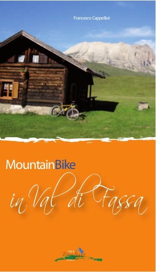
Mountain bike in Val di Fassa

18 itinerari di tutte le difficoltà Autore: Francesco Cappellari Editore: Idea Montagna Argomento: mountain bike Pagine: 120 a colori Formato: 11,5x20 cm 72 foto a colori 19 cartine 18 itinerari Anche in edizione inglese La riscoperta di sentieri e carrarecce sui fianchi e all’interno della Val di Fassa con l’uso delle due ruote. 18 itinerari di tutte le difficoltà: dalla tranquilla passeggiata per le famiglie agli arditi ed impegnativi giri in alta quota. Il tutto condito da un ambiente da favola. "Io credo che i mountain bikers non siano degli eroi. Credo che gli eroi veri siano quei ciclisti che, sfidando tutto e tutti, valicano passi, sfrecciano su rettilinei, si buttano per ripide discese su quei nastri grigi che solcano montagne e pianure. Sono dei veri eroi perché sfidano le auto, le moto, i camion, i pullman che li sfiorano e che fanno respirare loro quanto di peggio questo pianeta riserva. Forse non si rendono conto però che chi arriva da dietro non guarda in faccia nessuno! Posso solo dir loro: convertitevi! C’è un mondo di prati e boschi tutto da respirare." www.ideamontagna.it/librimontagna/libro-alpinismo-montagna.asp?cod=6

Recomendados
Más contenido relacionado
Más de Idea Montagna Editoria e Alpinismo
Más de Idea Montagna Editoria e Alpinismo (20)
Último
Último (20)
Mountain bike in Val di Fassa
- 2. Indice Introduzione Pag. 7 Note tecniche Pag. 10 Gradi di difficoltà Pag. 12 It. 1 La Val di Fassa da Moena a Canazei Pag. 13 It. 2 La Val di Fassa da Canazei a Moena Pag. 17 It. 3 Peniola e Medil Pag. 22 It. 4 Il giro del Latemar Pag. 26 It. 5 La Rampilonga Pag. 33 It. 6 Passo San Pellegrino e Passo Selle Pag. 39 It. 7 Val San Nicolò e Val Monzoni Pag. 46 It. 8 Tamion e Ciampedie Pag. 51 It. 9 L arrampicata al Buffaure Pag. 57 It. 10 Val Jumela e Sela dal Brunèch Pag. 61 It. 11 Tra i boschi di Campitello e Mazzin Pag. 68 It. 12 Passo Ciaregole e Val di Dona Pag. 74 It. 13 l giro dei sei rifugi Pag. 80 It. 14 Il giro del Sassolungo Pag. 87 It. 15 Il Passo San Nicolò e la Val Contrin Pag. 95 It. 16 Ai piedi della Marmolada Pag. 104 It. 17 Il Viel del Pan Pag. 109 It. 18 Passo Padon e Sentiero Geologico Pag. 113 Indice http://www.ideamontagna.it/librimontagna/libro-alpinismo- montagna.asp?cod=6
- 3. 47 WPT 1 - Km 0 - Height 1350 m From the church climb along the asphalted road of Valle S. Nicolò. A relatively steep section leads to the meadows of Malga Crocifisso (beautiful small church next to it). WPT 2 - Km 2,420 - Height 1540 m Continue on the road along the bottom of the valley. After a harder climb a dirt road descends right to the stream. WPT 3 - Km 4,240 - Height 1710 m Continue still on asphalt which becomes easier and crosses some beautiful alpine pastures. You then reach Baita Ciam- piè, where the asphalt finishes. WPT 4 - Km 5,960 - Height 1815 m The dirt road is wide. Stay on the main track. After a near flat section you climb a hard stony ramp after which you will see the Baita alla Cascate building on your right. WPT 5 - Km 7,720 - Height 2000 m After crossing the meadow near the baita you descend a track to the right of the stream. The track continues across the meadow until you reach a small hut where you continue along a cart track until a junction. WPT 6 - Km 8,680 - Height 1900 m Turn left towards the stream (signposted Monzoni), cross the stream (or use the bridge upstream) and reach another jun- ction. Photos of Val San Nicolò Itinerary7
- 4. 48 49 1 2 3 4 5 6 7 8 9 10 11 12 13 14 15 16 17 1819 20 ne hut you descend through meadows to another small hut called El Paradis . WPT 12 - Km 14,350 - Height 1820 m Turn right and climb, initially on grass, then along a rocky road. After crossing a stream you get to the meadows be- low Malga Monzoni. You reach the malga along an asphalted road. WPT 13 - Km 14,810 - Height 1870 m Descend this road until you get to Rifugio Monzoni. WPT 14 - Km 15,270 - Height 1815 m Leave the road to take a forestry track on the left which first climbs and then descends to a junction. WPT 15 - Km 16,550 - Height 1825 m Turn right (signposted Malga Crocifisso). The road ends and you continue along a pretty path which follows the hillside to reach a main dirt road. WPT 16 - Km 17,610 - Height 1760 m Descend along the beautiful cart track. At a switchback the WPT 7 - Km 8,760 - Height 1900 m Turn right onto Strada dei Russi , so-called because it was built by Russian prisoners during the war. A pretty descent takes you to a bridge at a junction. WPT 8 - Km 11,290 - Height 1710 m Turn left and climb a moderate ascent to a junction with a crucifix. WPT 9 - Km 12,820 - Height 1805 m Head right and climb the ramp with difficulty. The road fi- nishes at a small manger. Follow a path where it is neces- sary to dismount and push. You reach the top, from where a steep descent heads down on a narrow path. WPT 10 - Km 13,360 - Height 1885 m The path is very narrow and certain sections are very exposed and steep. After a first section where it is necessary to push, you continue more easily until a meadow with a signpost. WPT 11 - Km 14,110 - Height 1830 m Carry straight on along grassy sections and passing an alpi-