SlideShare una empresa de Scribd logo
1 de 2
Descargar para leer sin conexión
Each day, National Park Service (NPS)
managers make decisions with the
potential to affect park resources for
years to come. But in the past, many park
managers lacked even baseline informa-
tion about which resources were in the
parks – let alone about the overall state
of the ecosystem. This lack of reliable
data often made informed decision-
making difficult.
To facilitate collaboration, informa-
tion sharing, and economies of scale in
inventory and monitoring, the NPS has
organized more than 270 parks with sig-
nificant natural resources into 32 ecore-
gional networks to conduct expanded
inventory and monitoring activities. Each
network supports a core, professional
staff who conduct the day-to-day activi-
ties of the network and who collaborate
with staff from network parks and other
programs and agencies to implement an
integrated, long-term program to moni-
tor representative indicators of resource
health, or “vital signs”.
The Northeast Region hosts four Inven-
tory and Monitoring Program (I&M)
Networks. Network staff are involved
in numerous activities and functions,
such as: collecting data, performing data
analysis, synthesis, and modeling, and
providing data and expertise to park
managers. Network personnel are also
called upon to provide data and exper-
tise for resource assessments and State
of the Park reports.
The Networks
The Eastern Rivers and Mountains Net-
1.	 Inventory the natural resources and
park ecosystems under National Park
Service stewardship to determine
their nature and status.
2.	 Monitor park ecosystems to better
understand their dynamic nature and
condition and to provide reference
points for comparisons with other,
altered environments.
3.	 Establish natural resource inven-
tory and monitoring as a standard
practice throughout the National
Park system that transcends tradi-
tional program, activity, and funding
boundaries.
4.	 Integrate natural resource inventory
and monitoring information into
National Park Service planning, man-
agement, and decision making.
5.	 Share National Park Service accom-
plishments and information with
other natural resource organizations
and form partnerships for attaining
common goals and objectives.
Goals
Knowing the condition of natural re-
sources in national parks is fundamen-
tal to the Service’s ability to manage
park resources “unimpaired for the
enjoyment of future generations”.
National Park managers across the
country are confronted with increasing-
ly complex and challenging issues that
require a broad-based understanding
of the status and trends of each park’s
natural resources as a basis for making
decisions, working with other agencies,
and communicating with the public to
protect park natural systems and native
species. The challenge of protecting
and managing a park’s natural resourc-
es requires a multi-agency, ecosystem
approach because most parks are
open systems, with threats such as air
and water pollution, or invasive spe-
cies, originating outside of the park’s
boundaries.
At national parks across the nation, the Inventory & Monitoring Program
is dedicated to providing managers with the information they need to
make sound, science-based decisions that will help support the National
Park Service mission of preserving the resources of America’s most
special and treasured places for future generations.
National Park Service
U.S. Department of the Interior
Northeast Region
Inventory & Monitoring Program
Northeast Region Inventory and Monitoring Program
Importance
work (ERMN) consists of nine national
park units, each of which contains a
rich and varied array of natural and
cultural resources. The ERMN parks
formed around rivers contain some of
the most significant water resources and
water-based recreational activities in the
National Park system.
The Mid-Atlantic Network (MIDN)
consists of 10 parks distributed from
southern Pennsylvania to southern
Virginia, and extending from the Blue
Ridge Mountains to the Piedmont and
the Coastal Plain. Most MIDN parks
were primarily established for their
historical or cultural interest, however,
these parks also contain diverse natural
resources.
The Northeast Coastal and Barrier
Network (NCBN) consists of eight park
units located along the Atlantic sea-
board, from Cape Cod NS to Colonial
NHP. These parks are similar in their
extensive coastlines that interface with
uplands which grade into coastal riv-
ers, estuaries, and open ocean, and by
shifting sand ecosystems that comprise
beaches, dunes, barrier islands, and
coastal marshes.
The Northeast Temperate Network
(NETN) consists of 13 parks located
in seven northeastern states as well as
six additional states through which the
Appalachian NST passes. Diverse arrays
of ecological communities occur in the
parks, ranging from tidal wetlands and
other coastal ecological communities, to
freshwater wetlands and vernal pools,
and a variety of deciduous and mixed
forests.
Monitoring Activities
The broad-based, scientifically sound
information obtained through long-
term natural resource monitoring has
multiple applications for management
decision-making, research, education,
and promoting public understanding of
park resources. All four networks moni-
tor water quality, forest health, and bird
communities. Compilation of weather
and air quality data provide additional
information for interpreting trends. In
addition, each of the networks has pro-
grams focusing on other vital signs that
are particularly important for its group
of parks.
For more information, please visit:
http://science.nature.nps.gov/im/
The highly collaborative nature of the
I&M effort has resulted in an integrative,
park-based program with strong connections between natural resources invento-
ry and monitoring information and park management. The results of inventories
and monitoring performed to date are being used in resource management deci-
sion making and planning efforts, resource condition assessments, State of the
Park reports, general park planning documents, park interpretation, and other
public outreach efforts. Those results are made available to managers, planners,
interpreters, scientists, and the general public via websites, technical reports,
resource briefs, journal publications, presentations, and social media.
Management Applications
The intent of park vital signs
monitoring is to track a subset
of physical, chemical, and bio-
logical elements and processes
of park ecosystems that are
selected to represent the overall
health or condition of park re-
sources, known or hypothesized
effects of stressors, or elements
that have important human
values. As part of the National
Park Service’s effort to “improve
park management through
greater reliance on scientific
knowledge”, a primary role of
the Inventory and Monitoring
Program is to collect, organize,
and make available natural
resource data and to contribute
to the Service’s institutional
knowledge by facilitating the
transformation of data into
information through analysis,
synthesis, and modeling.
Vital Signs Monitoring
Eastern Rivers and Mountains Network
Matt Marshall, Matt_Marshall@nps.gov
Mid-Atlantic Network
Jim Comiskey, Jim_Comiskey@nps.gov
Northeast Coastal and Barrier Network
Sara Stevens, Sara_Stevens@nps.gov
Northeast Temperate Network
Brian Mitchell, Brian_Mitchell@nps.gov
Contacts
ERMN: Allegheny Portage Railroad NHS • Bluestone NSR • Delaware Water Gap NRA • Fort Necessity NB • Friendship Hill NHS • Gauley River NRA •
Johnstown Flood NM • New River Gorge NR • Upper Delaware S&RR • MIDN: Appomattox Court House NHP • Booker T. Washington NM • Eisenhower
NHS • Fredericksburg & Spotsylvania NMP • Gettysburg NMP • Hopewell Furnace NHS • Petersburg NB • Richmond NBP • Shenandoah NP • Valley Forge
NHP • NCBN: Assateague Island NS • Cape Cod NS • Colonial NHP • Fire Island NS • Gateway NRA • George Washington Birthplace NM • Sagamore Hill
NHS • Thomas Stone NHS • NETN: Acadia NP • Appalachian NST • Boston Harbor Islands NPA • Marsh-Billings-Rockefeller NHP • Minute Man NHP •
Morristown NHP • Roosevelt-Vanderbilt NHS • Saint-Gaudens NHS • Saratoga NHP • Saugus Iron Works NHS • Weir Farm NHS
February 2014

Más contenido relacionado

Similar a NER_I&M_Brochure

FY 2013 R&D REPORT January 6 2014 - National Oceanic and Atmospheric Administ...
FY 2013 R&D REPORT January 6 2014 - National Oceanic and Atmospheric Administ...FY 2013 R&D REPORT January 6 2014 - National Oceanic and Atmospheric Administ...
FY 2013 R&D REPORT January 6 2014 - National Oceanic and Atmospheric Administ...Lyle Birkey
 
Leveraging Environmental Observation Infrastructure for the Benefit of Society
Leveraging Environmental Observation Infrastructure for the Benefit of SocietyLeveraging Environmental Observation Infrastructure for the Benefit of Society
Leveraging Environmental Observation Infrastructure for the Benefit of SocietyBrian Wee
 
United States Geological Survey, Dr. William Guertal
United States Geological Survey, Dr. William GuertalUnited States Geological Survey, Dr. William Guertal
United States Geological Survey, Dr. William GuertalTWCA
 
Ottawa County Parks Five-Year Sustainability Plan
Ottawa County Parks Five-Year Sustainability PlanOttawa County Parks Five-Year Sustainability Plan
Ottawa County Parks Five-Year Sustainability Planottawacountyparks
 
NOAA's National Oceanographic Data Center
NOAA's National Oceanographic Data CenterNOAA's National Oceanographic Data Center
NOAA's National Oceanographic Data CenterUserservices
 
Contributing to indicator-based management of transboundary aquatic systems
Contributing to indicator-based management of transboundary aquatic systemsContributing to indicator-based management of transboundary aquatic systems
Contributing to indicator-based management of transboundary aquatic systemsIwl Pcu
 
DRI General Overview - What We Do
DRI General Overview  - What We DoDRI General Overview  - What We Do
DRI General Overview - What We DoDRIscience
 
Governing Marine Protected Areas (MPAs), with UCL's Peter Jones
Governing Marine Protected Areas (MPAs), with UCL's Peter JonesGoverning Marine Protected Areas (MPAs), with UCL's Peter Jones
Governing Marine Protected Areas (MPAs), with UCL's Peter JonesIIED
 
Esip workshop2010 nws
Esip workshop2010 nwsEsip workshop2010 nws
Esip workshop2010 nwsRebreid
 
Farone_Portfolio_poster_final
Farone_Portfolio_poster_finalFarone_Portfolio_poster_final
Farone_Portfolio_poster_finalSteve Farone, MBA
 
workshop-and-session-descriptions
workshop-and-session-descriptionsworkshop-and-session-descriptions
workshop-and-session-descriptionsMeredith Keller
 
Ennis RESUME combined 4-16
Ennis RESUME combined 4-16Ennis RESUME combined 4-16
Ennis RESUME combined 4-16Sara Ennis
 
Collaborative Momentum in the Delaware River Watershed
Collaborative Momentum in the Delaware River WatershedCollaborative Momentum in the Delaware River Watershed
Collaborative Momentum in the Delaware River WatershedKim Beidler
 
Remarks at Delaware River Watershed Forum 2014 by Clare Billett, William Penn...
Remarks at Delaware River Watershed Forum 2014 by Clare Billett, William Penn...Remarks at Delaware River Watershed Forum 2014 by Clare Billett, William Penn...
Remarks at Delaware River Watershed Forum 2014 by Clare Billett, William Penn...Kim Beidler
 
Petes 2014 science integration into us climate and ocean policy discussion
Petes 2014 science integration into us climate and ocean policy discussionPetes 2014 science integration into us climate and ocean policy discussion
Petes 2014 science integration into us climate and ocean policy discussionLoretta Roberson
 
Acadia Invasive Species Workshop December 2008
Acadia Invasive Species Workshop December 2008Acadia Invasive Species Workshop December 2008
Acadia Invasive Species Workshop December 2008cconrad
 

Similar a NER_I&M_Brochure (20)

FY 2013 R&D REPORT January 6 2014 - National Oceanic and Atmospheric Administ...
FY 2013 R&D REPORT January 6 2014 - National Oceanic and Atmospheric Administ...FY 2013 R&D REPORT January 6 2014 - National Oceanic and Atmospheric Administ...
FY 2013 R&D REPORT January 6 2014 - National Oceanic and Atmospheric Administ...
 
Leveraging Environmental Observation Infrastructure for the Benefit of Society
Leveraging Environmental Observation Infrastructure for the Benefit of SocietyLeveraging Environmental Observation Infrastructure for the Benefit of Society
Leveraging Environmental Observation Infrastructure for the Benefit of Society
 
United States Geological Survey, Dr. William Guertal
United States Geological Survey, Dr. William GuertalUnited States Geological Survey, Dr. William Guertal
United States Geological Survey, Dr. William Guertal
 
Ottawa County Parks Five-Year Sustainability Plan
Ottawa County Parks Five-Year Sustainability PlanOttawa County Parks Five-Year Sustainability Plan
Ottawa County Parks Five-Year Sustainability Plan
 
NOAA's National Oceanographic Data Center
NOAA's National Oceanographic Data CenterNOAA's National Oceanographic Data Center
NOAA's National Oceanographic Data Center
 
Contributing to indicator-based management of transboundary aquatic systems
Contributing to indicator-based management of transboundary aquatic systemsContributing to indicator-based management of transboundary aquatic systems
Contributing to indicator-based management of transboundary aquatic systems
 
its time to help ppt. NPCA
its time to help ppt. NPCAits time to help ppt. NPCA
its time to help ppt. NPCA
 
ResumeTJNergart
ResumeTJNergartResumeTJNergart
ResumeTJNergart
 
DRI General Overview - What We Do
DRI General Overview  - What We DoDRI General Overview  - What We Do
DRI General Overview - What We Do
 
Governing Marine Protected Areas (MPAs), with UCL's Peter Jones
Governing Marine Protected Areas (MPAs), with UCL's Peter JonesGoverning Marine Protected Areas (MPAs), with UCL's Peter Jones
Governing Marine Protected Areas (MPAs), with UCL's Peter Jones
 
Esip workshop2010 nws
Esip workshop2010 nwsEsip workshop2010 nws
Esip workshop2010 nws
 
Smart_vita
Smart_vitaSmart_vita
Smart_vita
 
Farone_Portfolio_poster_final
Farone_Portfolio_poster_finalFarone_Portfolio_poster_final
Farone_Portfolio_poster_final
 
workshop-and-session-descriptions
workshop-and-session-descriptionsworkshop-and-session-descriptions
workshop-and-session-descriptions
 
Framework for wqm
Framework for wqmFramework for wqm
Framework for wqm
 
Ennis RESUME combined 4-16
Ennis RESUME combined 4-16Ennis RESUME combined 4-16
Ennis RESUME combined 4-16
 
Collaborative Momentum in the Delaware River Watershed
Collaborative Momentum in the Delaware River WatershedCollaborative Momentum in the Delaware River Watershed
Collaborative Momentum in the Delaware River Watershed
 
Remarks at Delaware River Watershed Forum 2014 by Clare Billett, William Penn...
Remarks at Delaware River Watershed Forum 2014 by Clare Billett, William Penn...Remarks at Delaware River Watershed Forum 2014 by Clare Billett, William Penn...
Remarks at Delaware River Watershed Forum 2014 by Clare Billett, William Penn...
 
Petes 2014 science integration into us climate and ocean policy discussion
Petes 2014 science integration into us climate and ocean policy discussionPetes 2014 science integration into us climate and ocean policy discussion
Petes 2014 science integration into us climate and ocean policy discussion
 
Acadia Invasive Species Workshop December 2008
Acadia Invasive Species Workshop December 2008Acadia Invasive Species Workshop December 2008
Acadia Invasive Species Workshop December 2008
 

NER_I&M_Brochure

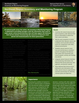
  • 1. Each day, National Park Service (NPS) managers make decisions with the potential to affect park resources for years to come. But in the past, many park managers lacked even baseline informa- tion about which resources were in the parks – let alone about the overall state of the ecosystem. This lack of reliable data often made informed decision- making difficult. To facilitate collaboration, informa- tion sharing, and economies of scale in inventory and monitoring, the NPS has organized more than 270 parks with sig- nificant natural resources into 32 ecore- gional networks to conduct expanded inventory and monitoring activities. Each network supports a core, professional staff who conduct the day-to-day activi- ties of the network and who collaborate with staff from network parks and other programs and agencies to implement an integrated, long-term program to moni- tor representative indicators of resource health, or “vital signs”. The Northeast Region hosts four Inven- tory and Monitoring Program (I&M) Networks. Network staff are involved in numerous activities and functions, such as: collecting data, performing data analysis, synthesis, and modeling, and providing data and expertise to park managers. Network personnel are also called upon to provide data and exper- tise for resource assessments and State of the Park reports. The Networks The Eastern Rivers and Mountains Net- 1. Inventory the natural resources and park ecosystems under National Park Service stewardship to determine their nature and status. 2. Monitor park ecosystems to better understand their dynamic nature and condition and to provide reference points for comparisons with other, altered environments. 3. Establish natural resource inven- tory and monitoring as a standard practice throughout the National Park system that transcends tradi- tional program, activity, and funding boundaries. 4. Integrate natural resource inventory and monitoring information into National Park Service planning, man- agement, and decision making. 5. Share National Park Service accom- plishments and information with other natural resource organizations and form partnerships for attaining common goals and objectives. Goals Knowing the condition of natural re- sources in national parks is fundamen- tal to the Service’s ability to manage park resources “unimpaired for the enjoyment of future generations”. National Park managers across the country are confronted with increasing- ly complex and challenging issues that require a broad-based understanding of the status and trends of each park’s natural resources as a basis for making decisions, working with other agencies, and communicating with the public to protect park natural systems and native species. The challenge of protecting and managing a park’s natural resourc- es requires a multi-agency, ecosystem approach because most parks are open systems, with threats such as air and water pollution, or invasive spe- cies, originating outside of the park’s boundaries. At national parks across the nation, the Inventory & Monitoring Program is dedicated to providing managers with the information they need to make sound, science-based decisions that will help support the National Park Service mission of preserving the resources of America’s most special and treasured places for future generations. National Park Service U.S. Department of the Interior Northeast Region Inventory & Monitoring Program Northeast Region Inventory and Monitoring Program Importance
  • 2. work (ERMN) consists of nine national park units, each of which contains a rich and varied array of natural and cultural resources. The ERMN parks formed around rivers contain some of the most significant water resources and water-based recreational activities in the National Park system. The Mid-Atlantic Network (MIDN) consists of 10 parks distributed from southern Pennsylvania to southern Virginia, and extending from the Blue Ridge Mountains to the Piedmont and the Coastal Plain. Most MIDN parks were primarily established for their historical or cultural interest, however, these parks also contain diverse natural resources. The Northeast Coastal and Barrier Network (NCBN) consists of eight park units located along the Atlantic sea- board, from Cape Cod NS to Colonial NHP. These parks are similar in their extensive coastlines that interface with uplands which grade into coastal riv- ers, estuaries, and open ocean, and by shifting sand ecosystems that comprise beaches, dunes, barrier islands, and coastal marshes. The Northeast Temperate Network (NETN) consists of 13 parks located in seven northeastern states as well as six additional states through which the Appalachian NST passes. Diverse arrays of ecological communities occur in the parks, ranging from tidal wetlands and other coastal ecological communities, to freshwater wetlands and vernal pools, and a variety of deciduous and mixed forests. Monitoring Activities The broad-based, scientifically sound information obtained through long- term natural resource monitoring has multiple applications for management decision-making, research, education, and promoting public understanding of park resources. All four networks moni- tor water quality, forest health, and bird communities. Compilation of weather and air quality data provide additional information for interpreting trends. In addition, each of the networks has pro- grams focusing on other vital signs that are particularly important for its group of parks. For more information, please visit: http://science.nature.nps.gov/im/ The highly collaborative nature of the I&M effort has resulted in an integrative, park-based program with strong connections between natural resources invento- ry and monitoring information and park management. The results of inventories and monitoring performed to date are being used in resource management deci- sion making and planning efforts, resource condition assessments, State of the Park reports, general park planning documents, park interpretation, and other public outreach efforts. Those results are made available to managers, planners, interpreters, scientists, and the general public via websites, technical reports, resource briefs, journal publications, presentations, and social media. Management Applications The intent of park vital signs monitoring is to track a subset of physical, chemical, and bio- logical elements and processes of park ecosystems that are selected to represent the overall health or condition of park re- sources, known or hypothesized effects of stressors, or elements that have important human values. As part of the National Park Service’s effort to “improve park management through greater reliance on scientific knowledge”, a primary role of the Inventory and Monitoring Program is to collect, organize, and make available natural resource data and to contribute to the Service’s institutional knowledge by facilitating the transformation of data into information through analysis, synthesis, and modeling. Vital Signs Monitoring Eastern Rivers and Mountains Network Matt Marshall, Matt_Marshall@nps.gov Mid-Atlantic Network Jim Comiskey, Jim_Comiskey@nps.gov Northeast Coastal and Barrier Network Sara Stevens, Sara_Stevens@nps.gov Northeast Temperate Network Brian Mitchell, Brian_Mitchell@nps.gov Contacts ERMN: Allegheny Portage Railroad NHS • Bluestone NSR • Delaware Water Gap NRA • Fort Necessity NB • Friendship Hill NHS • Gauley River NRA • Johnstown Flood NM • New River Gorge NR • Upper Delaware S&RR • MIDN: Appomattox Court House NHP • Booker T. Washington NM • Eisenhower NHS • Fredericksburg & Spotsylvania NMP • Gettysburg NMP • Hopewell Furnace NHS • Petersburg NB • Richmond NBP • Shenandoah NP • Valley Forge NHP • NCBN: Assateague Island NS • Cape Cod NS • Colonial NHP • Fire Island NS • Gateway NRA • George Washington Birthplace NM • Sagamore Hill NHS • Thomas Stone NHS • NETN: Acadia NP • Appalachian NST • Boston Harbor Islands NPA • Marsh-Billings-Rockefeller NHP • Minute Man NHP • Morristown NHP • Roosevelt-Vanderbilt NHS • Saint-Gaudens NHS • Saratoga NHP • Saugus Iron Works NHS • Weir Farm NHS February 2014