

Recomendados
Más contenido relacionado
La actualidad más candente
La actualidad más candente (20)
Destacado
Destacado (20)
Similar a Geology - Part 2
Similar a Geology - Part 2 (20)
Más de I Wonder Why Science
Más de I Wonder Why Science (20)
Último
Último (20)
Geology - Part 2
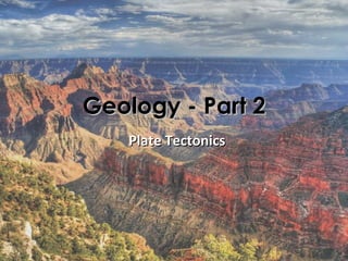
- 1. Geology - Part 2 Plate Tectonics
- 2. • Crust (lithosphere): 22 miles of SOLID rock (thinner on ocean floor) • Mantle: 2,220 miles of SEMI-SOLID rock (thick, molten magma)
- 3. • Outer core: 1,400 miles of LIQUID iron and nickel • Inner core: SOLID iron-nickel alloy (750 miles across, 3,200 mi. deep)
- 4. Pangaea • a theoretical, single super-continent • developed by Alfred Wegener • widely accepted since the 1960's • assumes the presence of 12 or so rigid tectonic "plates" • assumes rate of continental drift has always
- 5. Evidence for Pangaea • continents seem to fit together like pieces of a jigsaw puzzle • similar rock types and landforms found on different continents • similar plant and animal fossils that date to the same age found on separate modern-day continents
- 6. Tectonic Plate Theory • Earth's crust divided into 14 major "plates" – continents are embedded in these sections of crust Seismic Activity • Plates "float" above Earth's semi-solid mantle • Evidence supplied by: – worldwide seismology • earthquakes • volcanic eruptions – magnetic stratigraphy – deep sea exploration – satellite imagery
- 7. Earthquakes: Rapid sliding of earth's crust along fault lines as pressure is released Google Earth Volcanism: the movement of magma onto Earth's surface
- 9. Why Do Tectonic Plates Move? • Convection currents in the mantle below move plates – hot = less dense (rises up) – cool = denser atomic structure (sinks down) • Plates move at a rate of about 1 - 6 cm per year
- 10. What Occurs at Plate Boundaries? • Mountain building & trench formation • Volcanism • Earthquakes • Metamorphism & destruction of crust • Crust formation at ocean floor rifts
- 12. Tectonic Earthquakes • The edges of a fault (walls of rock) are stuck together. • As each tectonic plate slowly moves, pressure builds up at fault lines. • When the force of the moving plates overcomes the friction of the jagged edges of the fault, it rapidly gives way (slips), releasing the pressure as compression waves.
- 13. Fault Lines • A fault is a large crack in the Earth's crust where one section of crust moves against another, releasing pressure built-up by moving tectonic plates. • Normal – the hanging wall (the block of rock positioned above the plane) pushes down across the footwall, (the block of rock below the plane) • Reverse – hanging wall pushes up, footwall pushes down (thrust fault) • Strike-slip – walls of rock move in opposite horizontal directions
- 14. Normal Reverse (thrust) fault fault
- 15. Earthquakes under the Ocean • Tsunamis (tidal waves) result when a large section of the sea floor suddenly moves and therefore displaces a massive amount of water.
- 16. Tectonic Plate Movement • Transform: plates slide alongside each other • Divergent: plates move away from each other • Convergent: plates move toward one another
- 17. Divergent Boundaries • Plates are rifted apart, creating large expanses of oceanic crust • Crust is created in rift zones as rising magma is cooled by seawater • Volcanism • Normal faulted cliffs
- 19. Convergent Boundaries • One plate is pushed down under another plate • Crust is destroyed as it's pushed down into the mantle (called subduction zones) – Ocean-continent & Ocean-ocean arc – Continental collision • Metamorphism • Volcanism • Sedimentary wedges • Reverse faulted mountains
- 20. Metamorphism • An experiment using wax layers shows how rock layers tend to bend and fold before they break.
- 22. Ocean- continent Ocean- ocean Continental collision
- 23. Transform Boundaries • Plates slide past one another with no loss or creation of crust. • Not as common as convergent and divergent boundaries. • Shearing metamorphism • Occasional igneous intrusions • Strike-slip earthquakes
- 27. Uplift and Erosion • The movement of Earth’s tectonic plates can cause a lifting up of previously buried rock layers. • Uplift simply moves the strata, allowing for erosion to expose formerly buried layers. • Without uplift (& volcanism), the earth's surface might eventually become completely smooth and flat and entirely covered with water.
- 28. Unconformities
- 29. In Conclusion… • The rock cycle demonstrates the relationships among the three major rock groups • It is powered by the interior heat of the Earth • As well as earth’s gravitational forces and… • The energy from the sun • It involves processes on the Earth’s surface as well as the Earth’s interior • It connects the “hydrologic cycle” with the “tectonic cycle”.
- 30. Week 18 Lab Rock Identification
- 31. Identifying Minerals • Color: extremely variable, complex causes • Hardness: strength of atomic bonds • Density: mass and spacing of atoms • Luster: how electrons interact with light • Crystal Form: useful, but not for beginners • Cleavage: weak atomic planes • Other properties distinctive at times
- 33. Crystal Form and Cleavage • How minerals break apart gives a clue to what type of crystal shapes are present in the rock.
- 34. Identification by Geologic Setting • Some minerals occur in all geologic settings – quartz, feldspar, pyrite • Mostly sedimentary: – calcite, dolomite • Primarily igneous: – olivine • Metamorphic settings – garnet, kyanite
- 35. Other Methods of Identification Special Properties • Taste, Magnetism, Etc. Experience and Reading • “The best geologist is the one who’s seen the most rocks.” Professional Methods • Chemical Analysis • X-Ray Studies
Notas del editor
- Anybody know what type of rocks these are?
- Scale: 3,000 miles from Portland to Boston, 2,150 to Chicago, and 1,100 to San Diego
- Gravity : a result of Earth's MASS Magnetism: a result of the LIQUID outer core spinning around the SOLID iron inner core ~4,000 miles to center of Earth's core
- In the early 1900s, the German scientist Alfred Wegener noticed that the coastlines of Africa and South America looked like they might fit together. He also discovered evidence that the same plant and animal fossils were found along the coasts of these continents, although they were now separated by vast oceans. In addition, he noticed that geologic formations, like mountain ranges, on the two continents also matched up. In 1915, Wegener published his book, The Origin of Continents and Oceans , suggesting that the earth's continents were once joined together in one large mass. He called the original landmass (or supercontinent) " Pangaea ," the Greek word for "all the earth." According to Wegener, over time "Pangaea" split apart and the different landmasses, or continents, drifted to their current locations on the globe. While other scientists of the time vehemently rejected Wegener's ideas, they became the basis for the development of the theory of plate tectonics. 200 million years ago135 million years ago65 million years ago50-40 million years ago Pangaea begins to break up and splits into two major landmasses — Laurasia in the north, made up of North America and Eurasia, and Gondwana in the south, made up of the other continents. Gondwana splinters further — the South America-Africa landmass separates from the Antarctica-Australia landmass. The Indian landmass breaks away from the Antarctica-Australia landmass.Major rifting of Laurasia, with the North American landmass separating from Eurasia. South America and Madagascar separate from Africa. Greenland separates from North America. Australia separates from Antarctica and moves north. The Indian landmass collides with Asia. The modern plate tectonics theory , which has become widely accepted since the 1960s, states that the earth's outer layer, or lithosphere , is broken into several large slabs called plates . These plates, which hold the continents and oceans, are slowly but constantly moving around the planet. The movement of the plates not only supports our understanding that continents are not fixed and moved over time, but also explains how and why earthquakes, volcanoes, and other geologic events occur.
- Does the Bible mention Pangea? Not explicitly, but possibly. Genesis 1:9 records, “And God said, ‘Let the water under the sky be gathered to one place, and let dry ground appear.’ And it was so.” Presumably, if all the water was “gathered to one place,” the dry ground would also be all “in one place.” Genesis 10:25 mentions, “…one was named Peleg, because in his time the earth was divided…” Some point to Genesis 10:25 as evidence that the earth was divided after the Flood of Noah. While this view is possible, it is most definitely not universally held by Christians. Some view Genesis 10:25 as referring to the “division” that occurred at the Tower of Babel, not the division of the continents via “continental drift.” Some also dispute the post-Noahic Pangea separation due to the fact that, at the current rates of drift, the continents could not possibly have drifted so far apart in the time that has transpired since the Noahic Flood. However, it cannot be proven that the continents have always drifted at the same rate. Further, God is capable of expediting the continental-drift process to accomplish His goal of separating humanity ( Genesis 11:8 ). Again, though, the Bible does not explicitly mention Pangea, or conclusively tell us when Pangea was broken apart.
- The Worldwide Standardized Seismic Network created a global system of seismographs all using common timekeeping standards and sending data to common repositories. This system allowed radical improvements in accuracy of earthquake locations. Instead of showing a diffuse smear of seismicity along the mid-ocean ridges, the system showed that earthquakes were confined to extremely narrow zones along the crest of the ridges. Basically, the new maps showed that the earth consisted of large blocks or plates of crust with little earthquake activity, bounded by narrow zones of high activity. There is some activity within the plates. If it looks like the U.S. and Western Europe are particularly hard hit, that reflects the concentration of sensitive instruments capable of detecting tiny earthquakes in those regions.
- Deepest quakes occur along subduction zones
- Theories: Slab pull - The sinking of the cooled dense oceanic plates pulls on the rest of the plate Ridge rises - The material deposited on the top of the ridge slides downs from the rise pushing on the plate Convection - Movement within the mantle could be part of the driving force behind the motion of the plates No single idea explains everything but we can identify several forces that contribute to the movement of the plates.
- The Mariana Trench or Marianas Trench is the deepest part of the world's oceans. It is located in the western Pacific Ocean, to the east of the Mariana Islands. The trench is about 2,550 kilometres (1,580 mi) long but has an average width of only 69 kilometres (43 mi). It reaches a maximum-known depth of 10.911 km (10,911 ± 40 m) or 6.831 mi (36,069 ± 131 ft) at the Challenger Deep, a small slot-shaped valley in its floor, at its southern end,[2] although some unrepeated measurements place the deepest portion at 11.03 kilometres (6.85 mi).
- Why does the earth shake when there is an earthquake? While the edges of faults are stuck together, and the rest of the block is moving, the energy that would normally cause the blocks to slide past one another is being stored up. When the force of the moving blocks finally overcomes the friction of the jagged edges of the fault and it unsticks, all that stored up energy is released. The energy radiates outward from the fault in all directions in the form of seismic waves like ripples on a pond. The seismic waves shake the earth as they move through it, and when the waves reach the earth’s surface, they shake the ground and anything on it, like our houses and us!
- A fault is a large crack in the Earth's crust where one part of the crust has moved against another part. This movement means that faults prove the Earth is an active place. They are signs of powerful forces deep underground. The parts of a fault are (1) the fault plane, (2) the fault trace, (3) the hanging wall and (4) the footwall. The fault plane is where the action is. It is a flat surface that may be vertical or sloping. The line it makes on the Earth's surface is the fault trace . Where the fault plane is sloping, the upper side is the hanging wall and the lower side is the footwall . When the fault plane is vertical, there is no hanging wall or footwall. Any fault plane can be completely described with two measurements: its strike and its dip. The strike is the direction of the fault trace on the Earth's surface. The dip is the measurement of how steeply the fault plane slopes—if you dropped a marble on the fault plane, it would roll exactly down the direction of dip.
- Here, in this experiment using layerd sand, we can clearly see the strain resulting from applied stress.
- Metamorphism - sedimentary & igneous rock changed due to pressure and heat of one plate sliding beneath the other Volcanism - subduction zone loosens/releases magma from below Reverse Faulted Mountains - hanging wall pushes up, footwall pushes down Sedimentary Wedges (accretionary build-up consists of marine sediments scraped off from the downgoing slab of oceanic crust but in some cases includes the erosional products of volcanic island arcs formed on the overriding plate )
- (a) Mountains rising up off the coastline, (b) islands rising up out of the ocean, (c) mountains rising up in the middle of a continent NOTE: the globe showing location of event on (a) is incorrect
- Hardness : Resistance to Scratching (Mohs scale), directly related to relative strength of atomic bonds. 1 - Talc, 2 - Gypsum & Fingernail, 3 - Calcite & Penny 6 - Feldspar & Glass, 7 - Quartz, 8 - Topaz, 10 - Diamond Luster : Metallic or Nonmetallic is the most important distinction. Resinous, waxy, silky, etc. are self-explanatory. Vitreous is often used for glassy luster. Cleavage : Tendency to split along smooth planes of weakness between atoms in crystal. Directly related to atomic structure and crystal form - every cleavage face is a possible crystal face, but not every crystal face is a cleavage face. Quartz commonly forms crystals but lacks cleavage.
- Quartz (amethyst, tiger's eye, agates, embedded geode) Calcite with shell fossils. Olivine embedded in basalt Almandine occurs in medium-grade metamorphic environments. This garnet variety is sometimes used as inexpensive gemstones.
- Lodestone - a naturally occurring magnetic rock, composed of iron based material called magnetite. Fossil Limestone bubbling with HCl. In theory the XRF has the ability to detect X-ray emission from virtually all elements, depending on the wavelength and intensity of incident x-rays. However... In practice, most commercially available instruments are very limited in their ability to precisely and accurately measure the abundances of elements with Z<11 in most natural earth materials. XRF analyses cannot distinguish variations among isotopes of an element, so these analyses are routinely done with other instruments (see TIMS and SIMS ). XRF analyses cannot distinguish ions of the same element in different valence states, so these analyses of rocks and minerals are done with techniques such as wet chemical analysis or Mossbauer spectroscopy. Virtually any solid or liquid material can be analyzed, if adequate standards are available. For rocks and minerals, typical commercial instruments require a sample constituting at least several grams of material, although the sample collected may be much larger. For XRF chemical analyses of rocks, samples are collected that are several times larger than the largest size grain or particle in the rock. This initial sample then suffers a series of crushing steps to reduce it to an average grain size of a few millimeters to a centimeter, when it can be reduced by splitting to a small representative sample of a few tens to hundreds of grams. This small sample split is then ground into a fine powder by any of a variety of techniques to create the XRF sample. Care must be taken particularly at this step to be aware of the composition of the crushing implements, which will inevitably contaminate the sample to some extent.