E Q101 U S G S
•Descargar como PPS, PDF•
0 recomendaciones•669 vistas

Comparto una excelente presentación desarrollada por la U.S. Geological Survey, sobre la ocurrencia de sismos. Espero sea de su agrado

Recomendados
Más contenido relacionado
La actualidad más candente
La actualidad más candente (19)
Similar a E Q101 U S G S
Similar a E Q101 U S G S (20)
Último
Último (20)
E Q101 U S G S
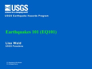
- 1. Earthquakes 101 (EQ101) Lisa Wald USGS Pasadena U.S. Department of the Interior U.S. Geological Survey USGS Earthquake Hazards Program
- 2. Global Distribution of Earthquakes
- 3. Plate Tectonics Lisa Wald USGS Pasadena U.S. Department of the Interior U.S. Geological Survey USGS Earthquake Hazards Program
- 6. Three Types of Faults Strike-Slip Thrust Normal
- 7. Strike-slip Fault Example
- 8. Strike-slip Fault Example 1906 San Francisco Earthquake
- 9. Normal Fault Example Dixie Valley-Fairview Peaks, Nevada earthquake December 16, 1954
- 13. Total Slip in the M7.3 Landers Earthquake Rupture on a Fault
- 14. Slip on an earthquake fault Depth Into the earth Surface of the earth Distance along the fault plane 100 km (60 miles) START
- 15. Slip on an earthquake fault Second 2.0
- 16. Slip on an earthquake fault Second 4.0
- 17. Slip on an earthquake fault Second 6.0
- 18. Slip on an earthquake fault Second 8.0
- 19. Slip on an earthquake fault Second 10.0
- 20. Slip on an earthquake fault Second 12.0
- 21. Slip on an earthquake fault Second 14.0
- 22. Slip on an earthquake fault Second 16.0
- 23. Slip on an earthquake fault Second 18.0
- 24. Slip on an earthquake fault Second 20.0
- 25. Slip on an earthquake fault Second 22.0
- 26. Slip on an earthquake fault Second 24.0
- 27. Bigger Faults Make Bigger Earthquakes
- 28. Bigger Earthquakes Last a Longer Time
- 30. Is there such a thing as “Earthquake Weather”??? No!
- 31. Earthquake Effects - Ground Shaking Northridge, CA 1994
- 32. Earthquake Effects - Ground Shaking Northridge, CA 1994
- 33. Earthquake Effects - Ground Shaking KGO-TV News ABC-7 Loma Prieta, CA 1989
- 34. Earthquake Effects - Ground Shaking Kobe, Japan 1995
- 35. Earthquake Effects - Ground Shaking Kobe, Japan 1995
- 36. Earthquake Effects - Surface Faulting Landers, CA 1992
- 37. Earthquake Effects - Liquefaction Source: National Geophysical Data Center Niigata, Japan 1964
- 38. Earthquake Effects - Landslides Turnnagin Heights,Alaska,1964 Source: National Geophysical Data Center
- 39. Earthquake Effects - Fires KGO-TV News ABC-7 Loma Prieta, CA 1989
- 40. Earthquake Effects - Tsunamis Photograph Credit: Henry Helbush. Source: National Geophysical Data Center 1957 Aleutian Tsunami
- 41. Seismic Waves
- 42. Earthquake Magnitude M5 M6 M7
- 44. The San Andreas Fault
- 45. Pacific-North American Plate Boundary
- 46. Will California eventually fall into the ocean??? No!
- 47. Faults of Southern California Source: SCEC Data Center
- 48. Shaking Hazard in Southern California
- 49. Faults in Our Local Area - Arcadia Source: SCEC Data Center 55 KM long Last ruptured in last 10,000 YEARS SLIP RATE : between 0.36 and 4 mm/yr PROBABLE MAGNITUDES: MW6.0 - 7.0 (?) Dips to the north THRUST fault Sierra Madre Fault Zone
- 50. Faults in Our Local Area - Arcadia Source: SCEC Data Center 26 KM long Last ruptured in last 10,000 YEARS SLIP RATE : between 0.10 and 0.22 mm/yr PROBABLE MAGNITUDES: MW6.0 - 7.0 Dips to the north STRIKE-SLIP fault Raymond Fault At least eight surface-rupturing events have occurred along this fault in the last 36,000 years
- 51. Faults in Our Local Area - Arcadia Source: SCEC Data Center 18 KM long Last ruptured in last 1.6 million YEARS SLIP RATE: ??? PROBABLE MAGNITUDES: ??? Dips to the north THRUST fault Clamshell-Sawpit Canyon fault
- 53. ShakeMaps
- 54. Did You Feel It? Community Internet Intensity Maps
- 55. U.S. Department of the Interior U.S. Geological Survey USGS Earthquake Hazards Program The End http://pasadena.wr.usgs.gov/ http://earthquake.usgs.gov/ Where to go for more information:
- 57. Faults in Our Local Area - La Canada Source: SCEC Data Center LENGTH: the zone is about 55 km long ; total length of main fault segments is about 75 km, with each segment measuring roughly 15 km long MOST RECENT SURFACE RUPTURE: Holocene, 10,000 years to present SLIP RATE: between 0.36 and 4 mm/yr INTERVAL BETWEEN SURFACE RUPTURES: several thousand years (?) PROBABLE MAGNITUDES: MW6.0 - 7.0 (?) OTHER NOTES: This fault zone dips to the north . TYPE OF FAULTING: reverse
Notas del editor
- Earthquake Basics But maybe some that you haven’t already learned and some great pictures to go with it Overview: Global perspective Plate tectonics Faults Real-life examples of faults Fault rupture movie Earthquake shaking and effects Seismic waves, magnitude and location Faults and earthquakes in our local area earthquake info on the web
- Map of world Dots are earthquakes Not scattered all over the world, but make a pattern
- Pattern of earthquakes defines the boundaries of tectonic plates About 23 major plates Can you see where we are? Boundary between two plates We’ll come back to this later
- Three types of interactions between plates as they move around: Sliding past one another - transform boundary Running into one another - convergent boundary Moving away from one another - divergent boundary
- Three types of faults Form depending on type of plate motion and complex reaction of earth’s lithospheric blocks Strike-slip Normal Thrust
- Strike-slip example moletrack
- Before earthquake manure pile was under window where farmer shoveled it out from inside Fault runs right under corner of barn After earthquake manure pile moved over about 10 feet
- Total distribution of slip after earthquake happened. Red is a lot of slip, blue is no slip You can see that the whole surface did not slip the same amount Nor did it slip all at the same time, as you will see in this movie
- Snapshots every 2 seconds during the rupture Starts in southern part of fault
- Y axis is length of fault X axis is magnitude of earthquake
- Y axis is how many seconds the earthquake lasts X axis is the magnitude of the earthquake
- Northridge earthquake 1994 Parking garage at Cal State Northridge
- LA on Pacific Plate San Francisco on North American Plate San Andreas Fault is boundary Relative motion Takes Big Bend above LA area and causes compression in our area
- San Andreas Fault in red Point out other major faults
- Can’t predict earthquakes But we can tell you a lot about one that just happened Within minutes after it happened All info on the web. Plot from last Thursday How many earthquakes happen each day in CA? ~60