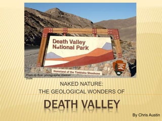
3. Its very name seems to imply that it is a lifeless inferno,
perhaps even dangerously so.
4. Yet nothing could be farther from the truth. Death Valley is
home to an stunning variety of flora and fauna, some
uniquely adapted to the harsh environment.
Photo by flickr photographer niiice dave.
5. With elevations ranging from below sea level to over 11,000 feet, Death Valley encompasses four
major life zones: The Lower Sonoran, the Upper Sonoran, a transition zone, and the Sub-Alpine
zone. With every rise in elevation, the cooler temperatures and the increased rainfall means
that different species of plants and animals can find suitable habitat.
Photo by flickr photographer Chris Grier.
6. And in the wetter years, parts of the valley burst into spectacular
fields of color in showy displays of wildflowers.
Photo by flickr photographer Ken McCown.
7. Death Valley is located in southeastern California, alongside the Nevada border.
8. With it’s pattern of mountain ranges with valleys in between, Death Valley is part of the
Basin and Range Province of the southwestern United States.
Photo of Death Valley from a space shuttle mission.
Map created by Daniel Mayer using data from the National Park
Service metadata.
9. In the Basin and Range Province, the Earth’s crust is slowly being pulled apart, creating large faults
that are generally aligned north-to-south. Along these fault lines, mountains are being uplifted while
the valleys are down-dropping, producing the distinctive pattern of steep mountain ranges
separated by deep valleys.
For more on the Basin and Range Province, click here:
http://www.nature.nps.gov/geology/usgsnps/province/basinrange.html
10. There are many things to see in Death Valley.
Here is a look at some of them.
By Jewel House Photography
By Morro Bay Chuck
11. ZABRISKE POINT
The badlands of Zabriske Point were formed when silt and
clay were deposited at the bottom of one of Death Valley’s
prehistoric lakes. The sediments were then compressed
and cemented to form a soft rock called mudstone.
12. When it rains here, there is no vegetation to hold the water, so it rushes
down the steep slopes, carrying loosened particles with it. Tiny rills form,
which cut into deeper gullies as the rain continues.
13. The yellow, tan and brown colors are from iron
minerals exposed to air, and the darker colors
are volcanic ash and lava flows.
For more information, click here: http://geomaps.wr.usgs.gov/parks/deva/ftzab1.html
14. TWENTY MULE
TEAM CANYON
The road through this canyon gives you a
close-up view of the colorful rocks that make
up Zabriske Point.
15. Prospectors didn’t find gold or silver here, but they did find borax , dubbed the “white gold of
the desert”. Borax was mined beginning in the late 1800s, producing $30 million worth by
1927. There is only one mine currently operating in Death Valley today.
For more on the history of Borax and 20-mule teams, go to:
http://www.scvhistory.com/scvhistory/borax-20muleteam.htm
16. HARMONY BORAX WORKS
The Harmony Borax Works began operation in
1882, employing 40 workers. When
in full operation, the mine produced
three tons of borax per day.
For more on Death Valley’s mining history,
click here:
http://digital-desert.com/death-valley-
history/mining-history.html
17. Today you can see the remains of the borax mill,
and learn how the borax was processed.
Pictures on this page by flickr photographer 123_456.
18. DESERT VARNISH
The dark brown to nearly black rocks are coated with a
thin layer of iron, manganese oxides and clay minerals,
the result of a natural weathering process taking
thousands of years to accumulate.
The varnish is actually a result of a biogeochemical process involving colonies of microscopic
bacteria living on the rock surface. To learn more, visit:
http://www.desertusa.com/magdec97/varnish/dec_varnish.html
19. DANTE’S VIEW
Here, at 5475 feet above sea level, you can look down at
Badwater, 280 feet below sea level. Most of the valley
floor is a vast salt pan covering 200 square miles.
Photo by flickr photographer Andrew Mace.
20. Even though the view is immense, you still cannot see the valley in its entirety; Death Valley is more
than 100 miles long. Much of the valley floor is below sea level, and it is still sinking.
21. The valley floor, called a graben, is a block of land bordered by
parallel faults. The graben is moving downward, while the horsts
(or mountains) are moving upwards, a indication of tensional
forces and crustal stretching that is occurring here.
22. GOLDEN CANYON This canyon was formed by flash floods washing
sediments, rocks and mud down towards the valley floor.
23. There was once a road here, but it was washed out by a flash flood in 1976.
24. The rocks here are the same composition as Zabriske Point. The layers were once horizontal,
but the uplifting of the mountains has tilted the sediments 45 degrees (or more).
Take a virtual hike up Golden Canyon here:
http://geomaps.wr.usgs.gov/parks/deva/ftgol1
.html
25. FURNACE CREEK INN
The Furnace Creek Inn was built by the Pacific Coast
Borax Company in 1927 as a way to attract tourists to
Death Valley and save their newly-built railroad.
Photo by Rachael Moore.
26. The Inn was a success but the railroad still ended up
closing as people preferred to arrive by car.
Photo by Judy Baxter.
27. The Inn is still in operation today, open mid-October to mid-May.
Summer guests are accommodated at the Furnace Creek Ranch.
Photo by Ian Joyce.
28. Photo by Rich Luhr.
Photo by Rachael Moore.Photo by Steve Ryan..
Photo by Judy Baxter.
The resort features a spring-fed pool, the world’s lowest golf course, lush
gardens, tennis, horseback riding, an air-strip and The Borax Museum.
Find out more
here:
http://www.nps.g
ov/deva/historyc
ulture/fcinn.htm
29. DEVIL’S GOLF COURSE
The salty, lumpy residue was left here after the last
significant lake evaporated about 2000 years ago,
forming a salty crust 3 to 5 feet thick.
30. Heat and cold, as well as cycles of solution/dissolution from
occasional rainstorms have caused the salt layers to expand and
contract over the years, creating this jumbled mess of salty crust.
31. New salt crystals continue to form as the saline groundwater seeps to the surface and
evaporates. The newer crystals are white; the older crystals are covered in dust.
Find out more here: http://geomaps.wr.usgs.gov/parks/deva/ftdev1.html
Photo by flickr photographer Alaskan Dude.
32. BADWATER Badwater is considered the lowest spot in North America.
It is also one of the hottest.
33. A sign up on the mountain notes where sea level is in relation to where you are standin
Photo by flickr photographer tomspixels.
34. Turn and look the other way, and you are standing
at the lowest point, looking at the highest point.
Telescope Peak, elev. 11,043 ft
Badwater. -282 ft
Photo by flickr photographer Andrew Mace.
35. The shallow pool of water is fed by groundwater seeping up
through a fault boundary. The water is saltier than the sea.
Find out more here: http://digital-desert.com/death-valley-
Photo by flickr photographer Gouldy99.
36. ARTIST’S PALETTE Here at the Artist’s Palette, nature has
painted the mountainside for you.
37. The red, pink, yellow, orange and brown colors result mainly
from the iron oxides hermatite and limonite. The violets and
greens are from minerals found in volcanic ash.
Photo by Ray Nordeen, NPS
Photo by Tom Bean, NPS
Find out more here:
http://geomaps.wr.usgs.gov/parks/
deva/ftart1.html
38. RACETRACK PLAYA
Photo by flickr photographer
Stuck Behind the Lens.
Here, the rocks appear to have been moved
as if by some invisible hand, but no one has
ever seen them in motion.
39. They don’t even take a straight or logical path some times.
How do they do it? Find out here:
http://geology.com/articles/racetrack-playa-sliding-rocks.shtml
Photo by flickr photographer Seamonkey78704
40. ALLUVIAL FANS
An alluvial fan is a fan-shaped deposit that is formed
when rushing water pushes mud, rocks and other
debris down a canyon and out onto a flat plain.
Find out more about alluvial fans here:
http://en.wikipedia.org/wiki/Alluvial_fan
Photos on this page by Marli Miller.
41. SCOTTY’S CASTLE
Photo by flickr photographer parks_traveler.
Who was Scotty, and what is a moorish
castle doing in Death Valley?
42. “Scotty”, also known as Death Valley Scotty,
was the area’s most famous prospector. He
was a con man, but a charming one.
Always talking about his ‘secret gold mine’ in
Death Valley and looking for backers, he told
everyone he had built this house with the
money from his mine, but in reality, the
mansion belonged to Scotty’s wealthy east
coast friend Albert Johnson, who had built it as
a vacation villa.
Find out more here:
http://www.nps.gov/deva/historyculture/scottys-
castle.htm
http://en.wikipedia.org/wiki/Scotty%27s_Castle
Photo by flickr photographer Jewel House Photography.
43. All photos on this slide by flickr photographer –libby.
44. UBEHEBE CRATER
Photo by flickr photographer deck chair.
Created by a volcanic explosion, the Ubehebe
Crater is over a half a mile wide and 770 feet deep.
45. Photo by flickr photographer
wisconsin hiker.
Molten rock rose along fractures in the rock, where it mixed with
groundwater, superheating the water and causing an explosion that
scattered rocks and cinders over six square miles.
46. The older fan deposits are lighter in color; the darker colors are
cinders were dumped on top after the eruption. The cinders also
form the dark gray soil that is prevalent in the surrounding area..
Photo by flickr photographer Andrew Mace.
47. Ubehebe is the largest volcanic crater in the area.
There are over a dozen smaller craters nearby.
To learn more, visit:
http://geomaps.wr.usgs.gov/parks/deva/ftube1.html
Photo by Peter Sanchez, NPS
Photo by Marli Miller.
48. DEVIL’S CORNFIELD
Picture by flickr photographer Andrew Mace
At the Devil’s Cornfield, the arrowroot plants
grow in rows, resembling cornshocks. The
Indians sometimes used the plant for arrow shafts
50. Once sand begins to accumulate, ripples and dunes can form.
Photo by flickr photographer Ice Nine John.
51. The dunes are formed when the wind moves the sand up to the top of the
pile until it is so steep that the pile collapses under its own weight, coming
to rest when it reaches the right angle to keep the dune stable.
Photo by flickr photographer deckchair.
52. Find out about Death Valley sand dunes here: http://geomaps.wr.usgs.gov/parks/deva/ftdune1.html
And a lot more about sand dunes in general here: http://en.wikipedia.org/wiki/Dune
.
53. WILDROSE CHARCOAL KILNS
Photo by flickr photographer ikes.
These kilns were constructed in
1877, and were used to make
charcoal for two nearby smelters.
For more information: http://digital-desert.com/death-valley-history/wildrose-kilns.html
54. SARASOTA SPRINGS
Located in the southernmost portion of the
park, Sarasota Springs is Death Valley’s third
largest marsh, supporting many rare species.
Photo by Stan Shebs, WikiCommons
For more information, click here: http://geomaps.wr.usgs.gov/parks/deva/ftsar1.html
55. IN CLOSING …. Death Valley is a land of superlatives which
perhaps has given it a bad rap …
56. However, “ … much of the Death Valley lore and its sometimes gruesome names were made up
by prospectors and promoters who wanted to embellish its mysterious reputation.
Relatively few people have died from the elements in Death Valley ... ”
Photo by flickr photographer omnipotentpoobah.
57. Photo by flickr photographer Outdoor PDK.
“ … Its landscapes are starkly beautiful, not lifeless; specialized
communities of plants and animals thrive in the diverse
environments in the valley and its surrounding mountains. … “
58. “ … When treated with respect, Death Valley is seldom deadly.”*
*Quoted from the Road Guide to Death Valley, p. 22. See References
Photo by flickr photographer
Picture Taking Fool.
59. FOR MORE INFORMATION:
Death Valley National Park, official website from the National Park Service:
http://www.nps.gov/deva/index.htm
Geology of Death Valley by USGS:
http://geomaps.wr.usgs.gov/parks/deva/index.html
Death Valley Wikipedia entry:
http://en.wikipedia.org/wiki/Death_Valley_National_Park
Pictures used in this presentation are mine (the author’s),
unless otherwise noted. Many (if not most) of the pictures
came from the flickr website, used under the Creative
Commons license. Others pictures came from
WikiCommons, the USGS and the National Park Service
A NOTE ABOUT THE PICTURES USED
REFERENCES
Death Valley Field Trip, by USGS:
http://geomaps.wr.usgs.gov/parks/deva/ftmap.html
Death Valley: The Story Behind the Scenery, by Bill Clark, KC Publications, 1992
Road Guide to Death Valley, by Barbara and Robert Decker; Double Decker
Press, 1989