E-Bird and Climate Change distribution and abundance models, John Alexander
•Descargar como PPT, PDF•
1 recomendación•1,086 vistas

This document summarizes a presentation on using eBird and climate change distribution and abundance models to inform wildlife conservation planning. It discusses how these tools can be used to assess conservation needs, set objectives, design management strategies, and measure effectiveness. Specific applications are proposed, including revising State Wildlife Action Plans to incorporate climate impacts, and informing management plans for National Forests, BLM lands, wildlife refuges, and private lands prioritizations. Case studies from Oregon are provided on modeling changes for bird species and identifying conservation hotspots and priorities for grassland birds.

Recomendados
Recomendados
Más contenido relacionado
La actualidad más candente
La actualidad más candente (20)
Similar a E-Bird and Climate Change distribution and abundance models, John Alexander
Similar a E-Bird and Climate Change distribution and abundance models, John Alexander (20)
Más de National Wildlife Federation
Más de National Wildlife Federation (20)
Último
Último (20)
E-Bird and Climate Change distribution and abundance models, John Alexander
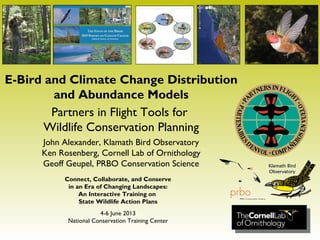
- 1. E-Bird and Climate Change Distribution and Abundance Models Partners in Flight Tools for Wildlife Conservation Planning John Alexander, Klamath Bird Observatory Ken Rosenberg, Cornell Lab of Ornithology Geoff Geupel, PRBO Conservation Science Connect, Collaborate, and Conserve in an Era of Changing Landscapes: An Interactive Training on State Wildlife Action Plans 4-6 June 2013 National Conservation Training Center
- 2. Avian Knowledge Alliance Collecting, Caretaking, and Communicating Avian Knowledge (Stephens et al. 2009, PIF Proceedings) Unique Capacities and Roles of NGOs Avian Knowledge Network
- 3. Bird Conservation Science Applied Multi-species Assess conservation needs Set measurable objectives Design management Measuring effectiveness Science-based tools • Species assessment database • Standard monitoring techniques • Conservation plans • Conservation design process (Alexander 2011, PhD Dissertation; Stephens et al. 2011, USFWS
- 5. Nation's first assessment of the distribution of birds on public lands and waters The State of the Birds 2011 Public Lands and Waters
- 6. Who Contributes to eBird More than… 100 million observations 1 million locations 93 thousand contributors 7.6 million field hours www.eBird.org
- 8. Stewardship Responsibilities for Birds
- 61. Stewardship Responsibilities for Birds
- 62. Stewardship Responsibilities for Birds
- 64. Focal Species (Altman and Alexander 2012; Alexander et al. 2007, FEM; Chase and Geupel 2005, PIF Proceedings) Habitat attributes of healthy functioning ecosystem Conservation Objectives
- 65. (North American Bird Conservation Initiative 2010)
- 66. Conservation priorities maps • Climate adaptation strategies Important environmental factors • Developed specific planning and management actions Maps of poorly sampled environmental space • Effective monitoring Detailed models • Bird distribution/abundance, their environment, and climate Results publicly accessible • Decision Support System for visualizing climate scenarios • Downloadable GIS layers NPLCC Project Goals
- 68. Modeling changes in bird distribution and abundance White-breasted Nuthatch (c) Peter LaTourrette
- 69. Bird Conservation Hotspots Conifer species Grassland species Oak woodland species Riparian species
- 70. Willamette Synthesis Update: Setting conservation priorities for grassland birds in the Willamette Valley • Future densities for 3 species • Predictive maps were included as “targets” in conjunction with current distributions • Determine optimal areas for conservation
- 71. Oregon Strategy: Key Conservation Issues Grasslands •Altered fire regimes: o Lincoln Sparrow – wet meadow •Invasive species: o Western Meadowlark – large grassland patches o Oregon Vesper Sparrow – scattered bunchgrass o Grasshopper Sparrow – moderate grass height with little to no bare ground
- 72. Proposed Application: Natural Resource Management Planning State Wildlife Action Plan Revisions (Climate) National Forest Plan Revisions BLM Western Oregon Resource Management Plan USFWS Refuge Comprehensive Conservation Planning NRCS and USWFS Partners Private Lands Prioritizations
- 73. Questions? Discussion John Alexander, jda@KlamathBird.org Ken Rosenberg, kvr2@cornell.edu Geoff Geupel, ggeupel@prbo.org
Notas del editor
- The Avian Knowledge Alliance (AKA) is an international group of organizations dedicated to amassing, caretaking, and communicating knowledge gained from the study of birds. The Avian Knowledge Alliance: Promotes and helps design coordinated monitoring projects; Facilitates the gathering, archiving, visualization, and delivery of observational data and analyses; and Maintains dialog with land managers and other stakeholders to improve conservation outcomes. Adding value to the bird conservation arena the AKA brings together the unique capacities and roles of non-government organizations (NGOs) that include: Focus and consistency in missions and visions; Sustained environmental monitoring efforts, long-term datasets, and highly developed expertise and knowledge; Effective collaborations and partnerships that transcend geographic, political, and academic boundaries; Cost-effectiveness with administrative and fiscal flexibility; Trust and credibility with public agencies, providing balance among disparate missions; and Consistent, objective, credible, and science-based perspective on issues.
- A recent USFWS Biological Technical Publication (BTP) recently came out of a PIF meeting we hosted back in 2005 ( http://library.fws.gov/BTP/information-ecosystem-management-2011.pdf ). It presents ten examples illustrating both the process and science behind bird conservation throughout the western United State. The articles 1) describe integrating bird conservation and effectiveness monitoring into land management guidelines with an emphasis on partnerships; and 2) present case studies which highlight bird monitoring within the adaptive management framework. The BTP emphasizes both the science of monitoring and the process of its integration into land management because both are necessary in order for effectiveness monitoring to fully impact decision making.
- Sophisticated data archive and delivery solutions for states
- This report provides the nation's first assessment of the distribution of birds on public lands and the opportunities for public agencies in each habitat. We combined bird distribution data from the eBird citizen-science project with the Protected Areas Database of the U.S. to determine the percentage of each species ’ U.S. distribution on public lands.
- What is significant is that this birder entered his sighting of the Brewer’s Sparrow into eBird – where it is combined with over 100 million other sightings as part of the largest observational database on any group of organizations on the planet. The result is an unprecedented resource available for ornithological science and bird conservation.
- The largest single forest land manager is USFS - 147 million acres or about 40% of publicly owned forests. Diverse U.S. forests harbor more than 300 breeding bird species. Nearly 40% of the U.S. land area is forested (856 m acres). Public forests are crucial for recovery of endangered species, including Kirtland’s Warbler, with 97% of its U.S. distribution on public lands.
- Regional plans use a focal species approach (Chase & Geupel, 2005) to propose habitat-based conservation objectives for both at-risk and more common species. The habitat objectives and focal species represent a variety of conditions needed to recover and sustain diverse landbird populations within the areas and habitats covered by the plans.
- The plans use a focal species approach to propose habitat-based conservation objectives for both at-risk and more common species. The habitat objectives and focal species represent a variety of conditions needed to recover and sustain diverse landbird populations within the areas and habitats covered by the plans. Focal species approach to propose habitat-based conservation objectives for both at-risk and more common species. The habitat bjectives and focal species represent a variety of conditions needed to recover and sustain diverse landbird populations within the areas and habitats covered by the plans. Alexander, J. D., N. E. Seavy, and P. E. Hosten. 2007. “Using Conservation Plans and Bird Monitoring to Evaluate Ecological Effects of Management: An Example with Fuels Reduction Activities in Southwest Oregon.” Forest Ecology and Management 238: 375–383. Altman, B., and J. D. Alexander. 2012. Habitat Conservation for Landbirds in Coniferous Forests of Western Oregon and Washington. Version 2.0 . Ashland, Oregon: Oregon-Washington Partners in Flight, American Bird Conservancy and Klamath Bird Observatory. http://www.orwapif.org/. Chase, M., and G. R Geupel. 2005. “The Use of Avian Focal Species for Conservation Planning in California.” In Bird Conservation Implementation and Integration in the Americas: Proceedings of the Third International Partners in Flight Conference. General Technical Report PSW-GTR-191 , edited by C. J. Ralph and T. D. Rich, 130–142. Albany, California: Pacific Southwest Research Station, U.S. Department of Agriculture, Forest Service. http://www.fs.fed.us/psw/publications/documents/psw_gtr191/Asilomar/pdfs/130-142.pdf.
- Climate Smart adaptative
- Talk about metadata. Also talk about expansion into BC and further north/east
- A recent USFWS Biological Technical Publication (BTP) recently came out of a PIF meeting we hosted back in 2005 ( http://library.fws.gov/BTP/information-ecosystem-management-2011.pdf ). It presents ten examples illustrating both the process and science behind bird conservation throughout the western United State. The articles 1) describe integrating bird conservation and effectiveness monitoring into land management guidelines with an emphasis on partnerships; and 2) present case studies which highlight bird monitoring within the adaptive management framework. The BTP emphasizes both the science of monitoring and the process of its integration into land management because both are necessary in order for effectiveness monitoring to fully impact decision making.