
Recomendados
Más contenido relacionado
La actualidad más candente
La actualidad más candente (20)
Similar a Physical regions of north america
Similar a Physical regions of north america (20)
Physical regions of north america
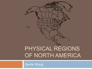
- 1. PHYSICAL REGIONS OF NORTH AMERICA Gerrik Wong
- 2. Map of The 8 Physical Regions of North America Legend: Appalachian Region Coastal Plains Great Lakes-St. Lawrence Lowlands Interior Plains Canadian Shield Western Cordillera Intermountain Region Arctic Plains Mount Logan
- 3. Appalachian Region - Overview Mountainous region that ranges between 160 to 480 kilometres in width Extends 2400 kilometers in length from Newfoundland to Alabama Mountains were formed by two tectonic plates coming together [Fold Mountains]
- 4. Appalachian Region Topography The Appalachian Mountains are made of many mountain ranges, formed roughly 300 million years ago, which has been eroded down in to low rolling hills The Appalachian region also contains fertile plateaus and river valleys Coals, oils and gasses can be found in the sedimentary layers of the region’s rocks
- 5. Appalachian Region - Climate Labrador Current brings in cold Arctic water south and causes freezing in the northern parts of the Appalachian Region Gulf Stream brings in warm Caribbean water north in to North America causing a warmer climate
- 6. Appalachian Region Vegetation The Original Plants in the Appalachian Region were as follows: Coniferous Deciduous These plants were able to survived infertile mountain soil and flourish in the plateaus and rivers that provided much more fertile soil.
- 7. Appalachian Region - Economic Activity Mining Logging Fishing Trade
- 8. Appalachian Region – Environmental Concern Due to the Appalachian Region’s large deposit of coal, Mountaintop Removal Mining, the process of removing a mountaintop in order to get access to a coal seam [layers of coal in which mining it out would result in a profit]. The remaining pieces of the mountain are dumped in to nearby hallow land in a giant pile called Valley Fill. The results of this mining ends in potentially toxic elements found in the tissues of fish downstream of the mines. The blasting cracks house foundations, and pose danger to the communities.
- 9. Coastal Plains - Overview Lowland area Stretches for 3200 km from Cape Cod to the Gulf of Mexico Extends 100 km inland from the ocean Streams from the Appalachian Region become rapid when they enter the Coastal Plains
- 10. Coastal Plains - Topography Average level of elevation is less than 200 metres above sea level Surface is generally flat or slightly rolling More than half of the Coastal Plains are below 30 metres above sea level The gradual sinking of the land created many swamps and marshes, as well as streams and rivers that can be navigated many miles inland The Mississippi delta provides fertile agriculture land The swamps and marshes not only provide transportation, but sources of shellfish and other water-dwelling animals as well.
- 11. Coastal Plains - Climate In the northern parts, the climate is cold and snowy during the winter, and hot and humid during the summer In the southern parts, the climate is comparable to sub-tropical climate, with mild to warm winters The southern portion are subject to hurricanes between the period spanning late summer to early winter
- 12. Coastal Plains - Vegetation Because of the sandy soil in the Coastal Plains, the vegetation of the land had adapted to this, sometimes even forming lush jungles, such as in Mexico The original vegetation of the Coastal Plains was pine forests.
- 13. Coastal Plains - Economic Activity Agriculture Manufacturing
- 14. Coastal Plains - Environmental Concern Rapidly expanding population, as well as industrial development threatens the fragile environment
- 15. The Great Lakes-St. Lawrence Lowland Overview [Or The “TGLSt.LL”] Smallest geographical region in Canada Contains several escarpments [a steep cliff formed by erosion or faulting] Cut short by the Canadian Shield near Kingston Bound in between the Canadian Shield to the north and the Appalachian Mountains to the south
- 16. TGL-St.LL - Topography Rolling land, created by glaciation [the process or result of covering something with glaciers or ice sheets] The plains are changed in to hills and deep river valleys The plains on each side of the river slowly begins to rise as they enter the Canadian Shield and the Appalachian Region
- 17. TGL-St.LL - Climate The climate of the TGL-St.LL is a humid continental climate [a climate type that develops away from the influence of oceans, and because of this, the temperature range tends to be large and precipitation is low] due of the presence of the Great Lakes The Great Lakes store heat, therefore warming the surrounding areas during the winter Winters vary from cool to cold and summers vary from warm to hot
- 18. TGL-St.LL - Vegetation This region had very fertile soils, therefore making it heavily treed [an area planted with trees] The parts near the Great Lakes allowed, because of soil and climate, maple, beech, hickory, and black walnut trees to grow The other parts of the region had mixed forests of deciduous and coniferous trees, such as maple, beech, oak, ash, birch, spruce, fir, pine, and cedar
- 19. TGL-St.LL - Economic Activity Farming Logging Manufacturing Urban economic activity
- 20. TGL-St.LL - Environmental Concern Mercury, Polychlorinated Biphenyl and other contaminants in the water and fish Bacterial contamination leading to beach closing Habitat destruction and degrading Excessive growth of nuisance aquatic plants Exotic species Fish and wildlife health impacts All of the listed above are environmental concerns in the St. Lawrence area Historically, contaminants have entered the St. Lawrence river due to industrial and municipal discharges, urban storm water, agricultural run off and other sources
- 21. The Interior Plains - Overview Vast sweep of plains, but not entirely flat Most places consist of gently rolling hills and deep river valleys Runs between the rocky mountains in the west and Canadian Shield, or Appalachian Mountains on the east Extends from the Gulf of Mexico to the Arctic Ocean Because of its size, the region is very diverse
- 22. The Interior Plains - Topography Separated in to central lowland and great plains in the United States Central lowland’s northern boundary is formed by the Canadian Shield and TGL-St.LL River Great plains are higher that the central lowland and rise from about 600 metres to 1500 metres above sea level in the west In Canada, the prairie provinces contain 3 different elevations which are separated by escarpments The plains are gently rolling, gradually sloping down from west to east The Interior Plains continue to the Arctic Ocean to the north
- 23. The Interior Plains - Climate Continental climate, due to its position in the center of the continent Extreme climate, including long, hot, summers and cold winters with little precipitation To the north, the winters are colder and longer and summers are shorter and cool The northern portion of the region has extremely long, cold, winters, and short, cool summers
- 24. The Interior Plains - Vegetation The central lowland east of the Mississippi was covered with mixed deciduous trees and scattered evergreens In the great plains, prairie grasses grew as tall as a person In Canada, the natural vegetation of the prairies were grasslands, trees only growing in the river valleys In the northern portion, boreal forests grow gradually turning in to a tundra towards the Arctic Ocean
- 25. The Interior Plains - Economic Activity Farming Mining Oil and natural gas drilling
- 26. The Interior Plains - Environmental Concern Oil sand mining creates environmental controversy and potential danger for residents The risk of an oil leak could devastate the environment A large amount of water is required to separate the oil and sand Produces a large amount of carbon dioxide and other emissions
- 27. Canadian Shield - Overview More than 2 billion years old Made of volcanic mountains that were levelled by millions of years of erosion Covers more than half of Canada’s surface Stretches from Labrador to the Interior Plains in the west Overlaps the US in two areas
- 28. Canadian Shield - Topography Most of the soil was removed during the Ice Age Because of the retreat of the glaciers, it caused the shield’s rivers to flow in different directions, creating a chaotic network of rivers, lakes, swamps and muskeg [a level bog or swamp] Average elevation is 100 metres above sea level in the north, and 500 metres in the south, the centre being much lower than it’s outer portion Around Hudson Bay and James Bay are lowland areas covered with clay, causing most rivers in the region to flow in to these two bays
- 29. Canadian Shield - Climate Climate varies in this vast land In the north, the winters become increasingly long and cold, with the summers shorter and cooler
- 30. Canadian Shield - Vegetation Boreal [of the Arctic] forests covers most of the Canadian Shield, since evergreens are suited to more sandy soil Deciduous trees are also present To the north, no trees are able to grow, since the growing season is too short and there is too little precipitation, as well as permafrost
- 31. Canadian Shield - Economic Activity Pulp and paper industry Mining ores such as gold, copper, lead, diamonds, nickel, platinum and so on
- 32. Canadian Shield - Environmental Concern Acid rain is an especially large problem for the Canadian Shield The sulphur dioxide produced by the mining industry to refine certain metals are put in to the atmosphere and absorbed in to the clouds, which then rain down acid rain The Canadian Shield, is especially susceptible to the acid rain, due to the lack of natural alkalinity, such as a lime base, and therefore can not neutralize the effects of the acid rain
- 33. Western Cordillera - Overview Runs along the west coast of North America Consists of range after range of mountains separated by plateaus and valleys The Rocky Mountains are the eastern range of mountains of the region, and in the US, it veers to the interior of the continent The western coastal chains of mountains are volcanic mountains, but the eastern mountains are fold mountains
- 34. Western Cordillera Topography Made of new mountains not yet worn down by erosion and are twice as high as the Appalachian Mountains There are many different mountain ranges, such as the Rocky Mountains that form the Continental Divide Rivers east of the Rockies flow east finding their outlets in the Gulf of Mexico, Arctic Ocean, Hudson Bay or James Bay, while the rivers to the west drain to the Pacific Ocean
- 35. Western Cordillera - Climate Maritime Climate [a climate strongly affected by its proximity to a large body of water, and has large precipitation and a small annual temperature range] although it varies from north to south West coast is moist and mild, with winters usually above freezing, and summers cooler than the interior of the continent Valleys are warmer than mountain slopes and windward slopes wetter than the leeward slopes, due to the rain-shadow effect
- 36. Western Cordillera - Vegetation Vegetation varies depending on which side of the mountain it is On the moist windward slopes, evergreens grow to tremendous age and enormous size on the lower slopes of the mountain Higher up, the trees are smaller, and at the top, vegetation becomes similar to a tundra’s or ceases to exist On the leeward slopes, grasses and cactuses grow in the dry valleys Farther south, evergreens no longer grow since rainfall is less
- 37. Western Cordillera - Economic Activity Logging Fishing Mining Farming
- 38. Western Cordillera - Environmental Concern Logging and oil exploration is responsible for accelerated slope erosion, both from the operation and from the roads created to reach them Erosion has created silting of streams
- 39. The Intermountain Region Overview Lies between the Rocky Mountains and Coast Mountains, the Cascades, and the Sierra Nevada Not heavily populated area of high plateaus [flat area at high elevation] and isolated mountains Contains only deserts in the United States Consists of the interior plateau valleys of British Columbia and Yukon in Canada
- 40. The Intermountain RegionTopography Streams and rivers usually never reach the sea, and instead, flow into brackish [somewhat salty] lakes or disappear in to desert sinks [a place where water is collected] Some areas of the region can be made productive by irrigation, and in others, cattleranching is possible
- 41. The Intermountain Region Climate Climate varies depending on its location and elevation Winters can be cool and wet or hot and dry In the south, winters are sort and warm with little precipitation Northern portions lack precipitation, although the climate is more moderate with moist winters and hot dry summers
- 42. The Intermountain RegionVegetation Ranges from sparse grassland to plants that can survive in desert or semi-desert conditions Higher areas are covered in thin pine forest
- 43. The Intermountain Region- Economic Activity Forestry Fresh Water Fishing Agriculture
- 44. The Intermountain Region- Environmental Concern The Intermountain Region contains over 370 species of birds, and because of the growing human population, and activities that help sustain the region’s economy, such as forestry destroy the birds’ habitats
- 45. The Arctic - Overview Combination of lowlands and mountains Lowlands are found in a series of islands lying to the north of Hudson Bay Mountains are found in the extreme northwest border
- 46. The Arctic - Topography Areas near the ocean are very flat Mountains in the far north were formed by folding and are covered in glaciers
- 47. The Arctic - Climate Severe climate due to its location away from the equator Winters last up to ten months in the far north Summer is short and not very warm Due to its little precipitation, the Arctic is a desert
- 48. The Arctic - Vegetation Besides lichen, very few life forms are able to grow on the mountains of the Arctic Trees can not grow on the tundra [northernmost vegetation region found in areas too cold for trees to grow] because of the cold and dry climate, and only a small amount of thawing occurs during the summer Small shrubs, mosses, and lichens are the only things that can grow, which cling to the ground and absorb the small amount of warmth and moisture available
- 49. The Arctic - Economic Activity Mining Oil and natural gas drilling Fishing
- 50. The Arctic - Environmental Concern Climate change Changes in biological diversity Accumulation of toxic chemicals
- 51. Bibliography naoutl. N.d. Map. worldatlas.comWeb. 17 Feb 2014. <www.worldatlas.com/webimage/countrys/namerica/naoutl.gif>. Meville, J.. "Geography of Canada." . N.p., n.d. Web. 17 Feb 2014. <www.dlcubc.ca/wordpress_dlc_mu/jeff1/files/2010/07/Geography-of-Canada.pdf>. Lindsey, Rebecca. United States. NASA. Coal Controversy In Appalachia. 2007. Web. <earthobservatory.nasa.gov/Features/MountaintopRemoval/>. "Economy." . N.p.. Web. 17 Feb 2014. <library.thinkquest.org/CR0213900/coastal plains economy.html>. "Coastal Plain Conservancy." . N.p.. Web. 17 Feb 2014. <www.wiser.org/organization/view/c4de7845c4e40ed291730d3fdbe88dd0>. Canada. Environment Canada. St. Lawrence Area of Concern. Web. <https://www.ec.gc.ca/rapspas/default.asp?lang=En&n=4948AC55-1>. Canada. Environment Canada. Acid Rain. Web. <www.ec.gc.ca/air/default.asp?lang=En&n=AA1521C2-1>. "Rocky Mountains." . N.p.. Web. 17 Feb 2014. <www.britannica.com/EBchecked/topic/506418/RockyMountains/39936/Environmental-concerns>. Rose, Briar, Hanan , and Jonah . "The Intermountain Region." . N.p., 05 03 2013. Web. 17 Feb 2014. <prezi.com/xdi0uvo7psek/the-intermountain-region/>. Williams, Tim. Canada. Parliament of Canada. Arctic: Environmental Issues. Web. <www.parl.gc.ca/Content/LOP/ResearchPublications/2008-04-e.htm>. Cranny, Michael. Crossroads A Meeting Of Nations. Ontario: Prentic Hall Ginn Canada, 1947. 164-180. Print.