FULL ENJOY 🔝 8264348440 🔝 Call Girls in Punjabi Bagh | Delhi
Presentasjon Ragnhild
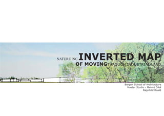
1. NATURE INC. INVERTED MAP
OF MOVINGTHROUGH INDUSTRIAL LAND
Bergen School of Architecture
Master Studio - Malmö DNA
Ragnhild Roald
2. ÖSTRA HAMNEN
5 min
15 min
30 min
FOSIE
FOSIE
Fosie industriby is one of the largest industrial areas in INDUSTRIBY
Malmö. Situated by the outer ringroad, and the railway,
the location is central, both in a local and global context.
Though the site is also within the 30 min range of biking
from the inne city, accesible for workers living within the
city, it represents the very limit of the city.
3. RESIDENTIAL
CO
M ME
RC
I AL
E
R ROSENGÅRD
TU
20 000 people
IL
IC
R
G
A
SUBURB OXIE
TYPOLOGY SCENARIO
The area is characterized by enclaves, or islands, of uniform Malmö is growing. With an estimated need of 100 000 new
programs. Together with the outer ringroad, the Fosie indus- dwellings, filling in the narrow streach between Fosie and
triby acts as a boundary between the city and the surround- suburb Oxie is a possibility.
ing agricultural area. When facing the future, could the area be looked upon
avsa frontier - a meeting place or point of contact - a
common ground, rather than the limiting and excluding
boundary it appears to be?
4. 100%
HARD
TOTAL AREA SURFACE
4,36 km2 2,53 km2 = 58%
3/5
CI
TY
/P
ERI A
SE
PH
PE
ER
Y
RO
EU
MAIN PERMEABLE
INFRASTRUCTURE SURFACE
8,3 km 2,53 km2 = 42%
surrounding road
2/5
PE
RO
EU
CONNECTING ROOFS
PATHS possible reduction
ca 2 km
straight through
1/5
5. INNER RINGROAD
GULLVIKS-
SKOLAN
AGNESFRIDS
GUMNASIUM FREDRIKSBERG
INVERTED MAP ALLOTTMENTS
JUNCTION
Connecting the green structures, and possible areas to
include. CHURCH
MALMÖ
FOLKHÖGSKOLA
ÖRESTADS
The red sites are points of interest; diverging programs RYTTER-
FÖRENING FREDRIKSBERG
that could work together with, or benefit from, a new public GÅRD
layer of semi-natural character. KUNGSHÖGEN
6. EDGE TYPOLOGY
Edges are established in order to highlight the inherent, but
challenged natural qualities at the site. Increasing the pres-
ence of nature by densification of typologies. The work on
establishing, or finding, these edges lead to the development
of a zoning map deciding where, and how to densify.
7. park
agriculture
unbuilt
densify by planting
DENSIFICATION ZONES
densifyby building
keep open
building
Densify by
by
Densify
planting
up
Opening
8. Densify by bilding Densify by planting Opening up
Increase hight New connection Claim open area
Infill Plant forest Cleans soil
Parking houses Infill/onfill Public
Shared ground fas-
cilities
DENSIFICATION ZONES
Today, only 30-40% of the plots are utilized for buildings, In the zonemap, different zones are distributed according to
althought they monopolize a lot of land, and to great extent their relation to the diagonal connection, and each other.
decide the use of the whole area. The density is low, on av- A combination of densifying by building and densifying by
erage one-storey industrial buildings. Open areas are mostly planting, will establish edges along the open area. Enhancing
used for parking. the presence of open fields of productive and recovering land
in the middle of the industrial area.
9. 2
1
3
existing alley
birch alley
existing bike path
forest trail
NEW CONNECTION new path
forest
A forest is established on the rim of the zones densifying
by planting. The forest varies from 50-100 m in width, and
spreading in between the buildings. A trail through the for- Streaching all the way through the area, you could actually
est is established to make it accessable for all, creating a take a 3,5 km walk in the forest.A shorter more efficient path
crossconnection between the existing bike paths running is also established, running inbetween the zones and open
through the area. fields. The path is alligned with alleys of birch trees.
10.
11. SECTION
2
1
3
Current situation
1-2 floor buildings
SECTION 1 industrial halls
PLAN
SECTION
+ one floor
SECTION 2
PLAN
+ 4-5 floor buildings
5 m vegetation vegetation
SECTION
+ 4-5 floor buildings
SECTION 3 15 m vegetation vegetation
narrow streets
12. Seasonal change
establishing the shrubbery some singular trees tall, singular trees
new landscape low trees low, compact forest low forest
Optaining CO2 in the process of growth composting trees release CO2,
which is obtained in fungi and
microorganisms
timeline
5 years
15 years
30 years
50 years
new experiences
100 years
sunflower
rapeseed
poppies
lavendar
cleansing the soil
annual changes in the landscape the ground is prepared for unknown interventions
13. THE ALLEY
Together with the forest, the alleys will add a strong visual Alleys will also add rythm and direction to the path running
element to the area. through the open landscape. Enhancing continuity and con-
Fast growing, up to 30 cm a year, and very fund of light, the nection with the other paths.
birch is well suited as a standalone alley tree. In addition, a
full grown birch can drink up to 4-500 l of water a day.
THE FOREST
A varied deciduous forest provides a rich ground vegetation. hancement of the pH and nutrient content in soil. This is es-
Combining different deciduous trees like ash, elm, hazel, pecially beneficial for snails and insects and a rich soil fauna.
maple, alder, linden and oak for a varied and complex visual
experience. Light and warm deciduous foresats provides rich Other aspects of the forest is the addition of color and sea-
ground vegetation. The different types of threes will provide sonal change to the area. The forest will also stop/slow down
living conditions for various types of mosses, fungi and in- the wind and prevent erosion from both wind and rain. The
sects, and small rodents and birds. For instance the leaves sound of the wind in the leaves will add new sound to offset
of the alder are rich in minerals and contribute to local en- the sound of traffic.