SlideShare una empresa de Scribd logo
1 de 30
Улаанбаатар хотод
OpenStreetMap-aар зураглал
хийх
11/11/2013
OSM-Mongolia
1

Нээлттэй ө гө гдө л гэж юу вэ?

Өгөгдлийн хэсэг нь-ашиглахад чөлөөтэй, дахин ашиглах
ба хуваарилаж болох агуулга, хэрэгцээнээс шалтгаалах
өгөгдөл эсвэл хамтран адилтгахыг хүссэн хүн бүхэнд
нээлттэй.
Хүмүүс, баг,эсвэл оролцогчдын хооронд ялгаварлал
байхгүй.

Энэ нь компаниудын хооронд шудрага өрсөлдөөнийг
бий болгож, эдийн засгийг бэхжүүлнэ.
1

OpenStreetMap- гэж юу вэ?
www.osm.org

OSM-гэдэг нь чөлөөтэй хэрэглэж татаж авч болох бүхэл дэлхийн байг чиглүүлэн
зураглал хийх web төсөл юм. Үүнийг 2004оноос эхлэн Английн сурагч хийж эхэлсэн.

=

+

Мянга мянган сайн дурын хандивлагч нарын хамтын ажиллагаан дээр тогтоноо.
Хүн бүхэн оролцож болно!
1

History and Stats
http://wiki.openstreetmap.org/wiki/History_of_OpenStreetMap

2004оноос хойш энэ төсөл нь
1.300.000н хэрэглэгчтэй
болсноос гадна 2тэрбум-аас их
цэг үүсгэн өсөн тэлсэн байна.

http://wiki.openstreetmap.org/wiki/Sta

OSM-ын одоогийн хийглэж буй ажлыг дараах хаягаар харж болно.
http://live.openstreetmap.fr/

1 жилд хийгдсэн засварыг дараах хаягаар харж болно.
http://vimeo.com/56374742
1

“Legal” Details

Was Licensed CC-BY-SA 2.0
Moved towards ODbL
Kate Chapman's article about OdbL:
http://www.maploser.com/2012/03/03/odbl-what-the-heck-can-you-do-with-it/
1

Osm-бол улс төрийн баригдмал байдалд
захирагдаагүй чөлөөт зураг юм жишээ нь
Хятадад osm-нь таамгаар хийснийг нөхөн хаасан
1

OSM-ийн харъяалал

OSM-ийн хамрах хүрээ
Оршин суугч
Холбоо
Орон нутгийн захиргаа
Хүмүүнлэгийн зохион байгуулалт
Олон улсын үйл ажиллагаа(UN, WB)
Их дээд Сургууль
Компани:
Microsoft, Foursquare
Cloudmade, Geofabrik, Camptocamp, MapBox
•

•

OSM-ийн хөгжлийн өсөлтөнд нөлөө үзүүлсэн:
OpenStreetMap зохион байгуулалт & Орон нутгийн хэсэг хүмүүс
Humanitarian OpenStreetMap Team
•

•
1

The complete history of every object is accessible
Бүх объектын ойлгоход хялбар дууссан түүх

History
1

It is possible to know what has been updated
recently over an area
Талбай дээр саяхан юу шинэчлэгдснийг мэдэх
Боломжтой

History
1

It is possible to know who are
the active contributors in an area
Хэн Талбай дээр идэвхтэй зохиогч байна вэ
Гэдгийг харах боломжтой

History
1

OSM Data Structure

Based on the idea of key/value pairs
Түлхүүр үгний санаанд тохируулсан түлхүүр үг/ хос
утгууд
highway=primary (шулуун
зам=нэн тэргүүний)
name=I66

amenity=hospital
name=Sacred Heart

building=yes
address=123 Main Street
city=Somewhere
1

Яаж хаяг/шинж чанар
тодорхойлогддог вэ?
Хэрвээ хаягийн систем нь хүн бүхэнд шинэ утга/түлхүүр үг үүсгэж болох бүрэн
чөлөөтэй байдлыг зөвшөөрсөн байвал, энэ нь аль хэдийн байгаа зүйлийг ашиглах,
хэлэлцэх, батлагдсан ба хэлэлцүүлэг явуулсан хаяг ба OSM-н үлдэгдлийг хамтран бүх
өоломжоор нь өгөгдөл оруулах юм.
The OSM tags can be found on the wiki : http://wiki.openstreetmap.org/wiki/Map_Features
1

OSM-д оролцох: дүрслэл дээр зураглал хийх

Bing allows the OpenStreetMap contributors to trace over all its imagery.
1

Coordinating tool: the Tasking Manager
http://tasks.hotosm.org/
1

OSM-ийн оролцоо: Талбайн
зураглал, зураглалын оролцогч нар
1

OSM-ийн цөм – системийн бүрэлдэхүүн хэсэг
1

OpenStreetMap API, based on RESTful Concepts
1

Different renderings for OSM
1

OpenStreetMap services:
Routing Tools
1

OpenStreetMap services:
Automatic City Maps
http://maposmatic.org/
1

OpenStreetMap services:
Thematic maps
http://www.itoworld.com
1

OpenStreetMap services:
Maps for GPS devices
1

OpenStreetMap services:
Editors for smartphones

OsmTracker
- Routing-хөдөлгөөний чиг
- Pedestrianе-явган хүн
- Edits/Bugs- хяналт/алдаа
- Edits/Bugs
& transports

Vespucci
- light online editor
- online
- Edits/Bugs
1

OpenStreetMap services:
Ухаалаг утасны газрын зураг

OsmAND
- Routing-заавар
- Pedestrian-явган хүн
- Edits/Bugs- засвар/ алдаа
- Edits/Bugs
& transports
1

Янз бүрийн GIS-н хийцтэй мэдээллийг
гаргах арга: HOT Exports
http://export.hotosm.org/
1

OSM-г ашиглан хийж болох боломжууд
Smart Complaint system
1

OSM-г ашиглан хийж болох боломжууд
Taxi Matchmaking system
1

OSM-г ашиглан хийж болох боломжууд
Clean UB – Цэвэр Улаанбаатар
1

OSM-г ашиглан хийж болох боломжууд
Clean UB – Цэвэр Улаанбаатар
Баярлалаа
https://lists.openstreetmap.org/listinfo/talk-mn
Kate Chapman
Humanitarian OpenStreetMap Team (AKA
https://www.facebook.com/groups/OSM.Mongolia/
H.O.T.)

Más contenido relacionado

Destacado

הראיות לפסיכולוגיה מונחית ראיות
הראיות לפסיכולוגיה מונחית ראיותהראיות לפסיכולוגיה מונחית ראיות
הראיות לפסיכולוגיה מונחית ראיותTsviGil
 
Participatory mapping with OSM in Ulan Bator, Mongolia: general presentation ...
Participatory mapping with OSM in Ulan Bator, Mongolia: general presentation ...Participatory mapping with OSM in Ulan Bator, Mongolia: general presentation ...
Participatory mapping with OSM in Ulan Bator, Mongolia: general presentation ...Severin Menard
 
Hr trainings expo_grishakova_malakut-best
Hr trainings expo_grishakova_malakut-bestHr trainings expo_grishakova_malakut-best
Hr trainings expo_grishakova_malakut-bestYulya Uzhakina
 
ขั้นตอนการเขียนโปรแกรมคอมพิวเตอร์
ขั้นตอนการเขียนโปรแกรมคอมพิวเตอร์ขั้นตอนการเขียนโปรแกรมคอมพิวเตอร์
ขั้นตอนการเขียนโปรแกรมคอมพิวเตอร์bpatra
 
Integrating omic approaches to investigate the gut microbiota, School of Bios...
Integrating omic approaches to investigate the gut microbiota, School of Bios...Integrating omic approaches to investigate the gut microbiota, School of Bios...
Integrating omic approaches to investigate the gut microbiota, School of Bios...Copenhagenomics
 
EDUBLOGS - Black Hawk Mines: She Can’t Pay says the Woman Who Lost Downloadin...
EDUBLOGS - Black Hawk Mines: She Can’t Pay says the Woman Who Lost Downloadin...EDUBLOGS - Black Hawk Mines: She Can’t Pay says the Woman Who Lost Downloadin...
EDUBLOGS - Black Hawk Mines: She Can’t Pay says the Woman Who Lost Downloadin...ginpark
 
T&T CATALOGO NATALE 2013
T&T CATALOGO NATALE 2013T&T CATALOGO NATALE 2013
T&T CATALOGO NATALE 2013pixelparty_it
 
Promosi sriayunie
Promosi sriayuniePromosi sriayunie
Promosi sriayunieSri Ayunie
 

Destacado (12)

Alfan P Laksono
Alfan P LaksonoAlfan P Laksono
Alfan P Laksono
 
192
192192
192
 
Lawyers Monaco
Lawyers MonacoLawyers Monaco
Lawyers Monaco
 
Unit 1. introduction
Unit 1. introductionUnit 1. introduction
Unit 1. introduction
 
הראיות לפסיכולוגיה מונחית ראיות
הראיות לפסיכולוגיה מונחית ראיותהראיות לפסיכולוגיה מונחית ראיות
הראיות לפסיכולוגיה מונחית ראיות
 
Participatory mapping with OSM in Ulan Bator, Mongolia: general presentation ...
Participatory mapping with OSM in Ulan Bator, Mongolia: general presentation ...Participatory mapping with OSM in Ulan Bator, Mongolia: general presentation ...
Participatory mapping with OSM in Ulan Bator, Mongolia: general presentation ...
 
Hr trainings expo_grishakova_malakut-best
Hr trainings expo_grishakova_malakut-bestHr trainings expo_grishakova_malakut-best
Hr trainings expo_grishakova_malakut-best
 
ขั้นตอนการเขียนโปรแกรมคอมพิวเตอร์
ขั้นตอนการเขียนโปรแกรมคอมพิวเตอร์ขั้นตอนการเขียนโปรแกรมคอมพิวเตอร์
ขั้นตอนการเขียนโปรแกรมคอมพิวเตอร์
 
Integrating omic approaches to investigate the gut microbiota, School of Bios...
Integrating omic approaches to investigate the gut microbiota, School of Bios...Integrating omic approaches to investigate the gut microbiota, School of Bios...
Integrating omic approaches to investigate the gut microbiota, School of Bios...
 
EDUBLOGS - Black Hawk Mines: She Can’t Pay says the Woman Who Lost Downloadin...
EDUBLOGS - Black Hawk Mines: She Can’t Pay says the Woman Who Lost Downloadin...EDUBLOGS - Black Hawk Mines: She Can’t Pay says the Woman Who Lost Downloadin...
EDUBLOGS - Black Hawk Mines: She Can’t Pay says the Woman Who Lost Downloadin...
 
T&T CATALOGO NATALE 2013
T&T CATALOGO NATALE 2013T&T CATALOGO NATALE 2013
T&T CATALOGO NATALE 2013
 
Promosi sriayunie
Promosi sriayuniePromosi sriayunie
Promosi sriayunie
 

Más de Severin Menard

OpenStreetMap - La carte libre du monde
OpenStreetMap - La carte libre du mondeOpenStreetMap - La carte libre du monde
OpenStreetMap - La carte libre du mondeSeverin Menard
 
Open data e OpenStreetMap
Open data e OpenStreetMapOpen data e OpenStreetMap
Open data e OpenStreetMapSeverin Menard
 
OpenStreetMap : la carte libre du monde
OpenStreetMap : la carte libre du mondeOpenStreetMap : la carte libre du monde
OpenStreetMap : la carte libre du mondeSeverin Menard
 
OpenStreetMap : um mapa wiki mundial livre
OpenStreetMap : um mapa wiki mundial livreOpenStreetMap : um mapa wiki mundial livre
OpenStreetMap : um mapa wiki mundial livreSeverin Menard
 
Cartographie systématique dans OSM avec un référentiel routier
Cartographie systématique dans OSM  avec un référentiel routierCartographie systématique dans OSM  avec un référentiel routier
Cartographie systématique dans OSM avec un référentiel routierSeverin Menard
 
GIS based flood risk assessment exercise in Phalombe and Zomba districts: 19t...
GIS based flood risk assessment exercise in Phalombe and Zomba districts: 19t...GIS based flood risk assessment exercise in Phalombe and Zomba districts: 19t...
GIS based flood risk assessment exercise in Phalombe and Zomba districts: 19t...Severin Menard
 
ProjetEOF presentation at SOTM2014
ProjetEOF presentation at SOTM2014 ProjetEOF presentation at SOTM2014
ProjetEOF presentation at SOTM2014 Severin Menard
 
OSM La Carte Libre du Monde
OSM La Carte Libre du MondeOSM La Carte Libre du Monde
OSM La Carte Libre du MondeSeverin Menard
 
OSM Présentation Summerlab Casablance 2014
OSM Présentation Summerlab Casablance 2014OSM Présentation Summerlab Casablance 2014
OSM Présentation Summerlab Casablance 2014Severin Menard
 
HOT OSM Community mapping in Lower Shire, Malawi
HOT OSM Community mapping in Lower Shire, MalawiHOT OSM Community mapping in Lower Shire, Malawi
HOT OSM Community mapping in Lower Shire, MalawiSeverin Menard
 
OSM et trois échelles de référence pour la cartographie
OSM et trois échelles de référence pour la cartographieOSM et trois échelles de référence pour la cartographie
OSM et trois échelles de référence pour la cartographieSeverin Menard
 
Presentation OSM dans le contexte de l'Afrique de l'Ouest
Presentation OSM dans le contexte de l'Afrique de l'OuestPresentation OSM dans le contexte de l'Afrique de l'Ouest
Presentation OSM dans le contexte de l'Afrique de l'OuestSeverin Menard
 
Activation de crise humanitaire avec OSM : la République centrafricaine, une...
Activation de crise humanitaire avec OSM : la République centrafricaine,  une...Activation de crise humanitaire avec OSM : la République centrafricaine,  une...
Activation de crise humanitaire avec OSM : la République centrafricaine, une...Severin Menard
 
OpenStreetMap (OSM): Mapping from the crowd and on the field open data prepa...
OpenStreetMap (OSM):  Mapping from the crowd and on the field open data prepa...OpenStreetMap (OSM):  Mapping from the crowd and on the field open data prepa...
OpenStreetMap (OSM): Mapping from the crowd and on the field open data prepa...Severin Menard
 
OpenStreetMap : um mapa wiki mondial livre. Seu uso nas situações de crise ...
 OpenStreetMap : um mapa wiki mondial livre.  Seu uso nas situações de crise ... OpenStreetMap : um mapa wiki mondial livre.  Seu uso nas situações de crise ...
OpenStreetMap : um mapa wiki mondial livre. Seu uso nas situações de crise ...Severin Menard
 
Humanitarian OpenStreetMap Team : Respuesta masiva y organizada ante y post ...
Humanitarian OpenStreetMap Team : Respuesta masiva y organizada  ante y post ...Humanitarian OpenStreetMap Team : Respuesta masiva y organizada  ante y post ...
Humanitarian OpenStreetMap Team : Respuesta masiva y organizada ante y post ...Severin Menard
 
JRC OpenStreetMap, editing and tasking mechanisms, 20130326
JRC OpenStreetMap, editing and tasking mechanisms, 20130326JRC OpenStreetMap, editing and tasking mechanisms, 20130326
JRC OpenStreetMap, editing and tasking mechanisms, 20130326Severin Menard
 
Presentation eurosha tchad_restitution_20130314_debut
Presentation eurosha tchad_restitution_20130314_debutPresentation eurosha tchad_restitution_20130314_debut
Presentation eurosha tchad_restitution_20130314_debutSeverin Menard
 
Eurosha kenya pres_osm_en_20121031
Eurosha kenya pres_osm_en_20121031Eurosha kenya pres_osm_en_20121031
Eurosha kenya pres_osm_en_20121031Severin Menard
 

Más de Severin Menard (20)

OpenStreetMap - La carte libre du monde
OpenStreetMap - La carte libre du mondeOpenStreetMap - La carte libre du monde
OpenStreetMap - La carte libre du monde
 
Open data e OpenStreetMap
Open data e OpenStreetMapOpen data e OpenStreetMap
Open data e OpenStreetMap
 
OpenStreetMap : la carte libre du monde
OpenStreetMap : la carte libre du mondeOpenStreetMap : la carte libre du monde
OpenStreetMap : la carte libre du monde
 
OpenStreetMap : um mapa wiki mundial livre
OpenStreetMap : um mapa wiki mundial livreOpenStreetMap : um mapa wiki mundial livre
OpenStreetMap : um mapa wiki mundial livre
 
Cartographie systématique dans OSM avec un référentiel routier
Cartographie systématique dans OSM  avec un référentiel routierCartographie systématique dans OSM  avec un référentiel routier
Cartographie systématique dans OSM avec un référentiel routier
 
GIS based flood risk assessment exercise in Phalombe and Zomba districts: 19t...
GIS based flood risk assessment exercise in Phalombe and Zomba districts: 19t...GIS based flood risk assessment exercise in Phalombe and Zomba districts: 19t...
GIS based flood risk assessment exercise in Phalombe and Zomba districts: 19t...
 
ProjetEOF presentation at SOTM2014
ProjetEOF presentation at SOTM2014 ProjetEOF presentation at SOTM2014
ProjetEOF presentation at SOTM2014
 
OSM La Carte Libre du Monde
OSM La Carte Libre du MondeOSM La Carte Libre du Monde
OSM La Carte Libre du Monde
 
OSM Présentation Summerlab Casablance 2014
OSM Présentation Summerlab Casablance 2014OSM Présentation Summerlab Casablance 2014
OSM Présentation Summerlab Casablance 2014
 
HOT OSM Community mapping in Lower Shire, Malawi
HOT OSM Community mapping in Lower Shire, MalawiHOT OSM Community mapping in Lower Shire, Malawi
HOT OSM Community mapping in Lower Shire, Malawi
 
OSM et trois échelles de référence pour la cartographie
OSM et trois échelles de référence pour la cartographieOSM et trois échelles de référence pour la cartographie
OSM et trois échelles de référence pour la cartographie
 
Presentation OSM dans le contexte de l'Afrique de l'Ouest
Presentation OSM dans le contexte de l'Afrique de l'OuestPresentation OSM dans le contexte de l'Afrique de l'Ouest
Presentation OSM dans le contexte de l'Afrique de l'Ouest
 
Activation de crise humanitaire avec OSM : la République centrafricaine, une...
Activation de crise humanitaire avec OSM : la République centrafricaine,  une...Activation de crise humanitaire avec OSM : la République centrafricaine,  une...
Activation de crise humanitaire avec OSM : la République centrafricaine, une...
 
OpenStreetMap (OSM): Mapping from the crowd and on the field open data prepa...
OpenStreetMap (OSM):  Mapping from the crowd and on the field open data prepa...OpenStreetMap (OSM):  Mapping from the crowd and on the field open data prepa...
OpenStreetMap (OSM): Mapping from the crowd and on the field open data prepa...
 
OpenStreetMap : um mapa wiki mondial livre. Seu uso nas situações de crise ...
 OpenStreetMap : um mapa wiki mondial livre.  Seu uso nas situações de crise ... OpenStreetMap : um mapa wiki mondial livre.  Seu uso nas situações de crise ...
OpenStreetMap : um mapa wiki mondial livre. Seu uso nas situações de crise ...
 
Projet CAP103
Projet CAP103Projet CAP103
Projet CAP103
 
Humanitarian OpenStreetMap Team : Respuesta masiva y organizada ante y post ...
Humanitarian OpenStreetMap Team : Respuesta masiva y organizada  ante y post ...Humanitarian OpenStreetMap Team : Respuesta masiva y organizada  ante y post ...
Humanitarian OpenStreetMap Team : Respuesta masiva y organizada ante y post ...
 
JRC OpenStreetMap, editing and tasking mechanisms, 20130326
JRC OpenStreetMap, editing and tasking mechanisms, 20130326JRC OpenStreetMap, editing and tasking mechanisms, 20130326
JRC OpenStreetMap, editing and tasking mechanisms, 20130326
 
Presentation eurosha tchad_restitution_20130314_debut
Presentation eurosha tchad_restitution_20130314_debutPresentation eurosha tchad_restitution_20130314_debut
Presentation eurosha tchad_restitution_20130314_debut
 
Eurosha kenya pres_osm_en_20121031
Eurosha kenya pres_osm_en_20121031Eurosha kenya pres_osm_en_20121031
Eurosha kenya pres_osm_en_20121031
 

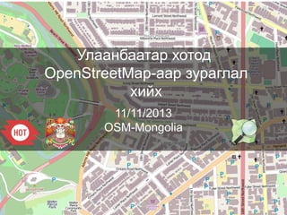
OSM Ulaanbaatar City - Улаанбаатар хотод OpenStreetMap-aар зураглал хийх

Notas del editor

  1. [nothing to add more than what is in the slide]
  2. [after presenting the slide, we will click on the the live.openstreetmap.fr link that shows the contributions in OSM in real time and let it run during the whole presentation. At the end of it, we will show how many were the contributions in the meantime]
  3. ODbL allows any kind of use, even commercial. A private company can use the OSM data in a product it sells. The data will remain open and not under copyright. The benefit for OSM is that these companies will contribute to improve the data. Нээлттэй мэдээллийн лиценз нь OSM-ыг ямар ч төрлөөр ашиглахыг зөвшөөрдөг, ашгийн төлөөг ч мөн адил.
  4. This is the major point regarding OSM and quality: everything is tracked and can be reviewed, or even canceled OSM-ын гол мөн чанар нь: бүх зүйлийг тэмдэглэн заана, дүгнэнэ бүр өөрчилж устгаж ч болно.
  5. So it is possible to know the last edits on a area Тухайн бүст хамгийн сүүлд хийсэн засварыг мэдэж болно.
  6. Or to know who mapped where Мөн хэн зурсныг ч мэдэж болно.
  7. These tags are described in the OSM wiki Энэ шошгууд OSM wiki -д тодорхойлогдоно.
  8. Contributions are made by first tracing over imagery. OSM has access to all the high resolution Bing Imagery Нэмэлтүүд дүрслэл дээрх хамгийн эхний үр дүн дээр хийгдэнэ. OSM нь хамгийн өндөр нягтаршил бүхий Bing Дүрслэлийг ашиглана.
  9. Some specific tools like the Tasking Manager have been created to avoid mappers to map the same area in the same time Зарим тусгай хэрэглүүрүүдийн нэг болох Tasking Manager нь л гэхэд газрын зургийн мэргэжилтнүүдийг ижил бүст зуруулахыг нь болиулах үүрэгтэйгээр хийгдсэн.
  10. Contributions are also made on the ground with GPS and Printed maps to be annotated Нэмэлтүүдийг хэвлэмэл газрын зураг болон газар дээр нь GPS ашиглан тэмдэглэн оруулна.
  11. The whole OSM structure is organized this way, mixing various editors, an API, a PostGIS database, tile renderers. OSM -ын бүтэц бүхэлдээ энэ аргаар хийгддэг. API, PostGIS өгөгдөл, Төрөл бүрийн засваруудыг нэгтгэж
  12. The API is based on RESTful concepts Програмын интерфэйс нь RESTful концепцид суурилна.
  13. It is possible to create various renderings {here I will click on the image and shows different rendering over UB] Олон төрлийн давхаргыг үүсгэж болно.
  14. The data is routable so it is possible to create routing webservices like OSM RM (Routing Machine) Мэдээллийг ашиглан замчлах вэб үйлчилгээ хийх боломжтой OSM Routing Machine-тай адил.
  15. Or create webservices allowing to create City Maps in a few clicks with an automatic index of Street names and facilities Вэб үйлчилгээг хийснээр гудамж барилга байгууламжийн нэрсийн автомат тоон үзүүлэлтийг ашиглан хэдхэн товшилтоор хотын газрын зургийг бүтээх боломжтой.
  16. Or to design specific thematic maps Мөн дэд бүтэц гэх мэт онцлог шинж чанартай зургийг ч хийж болно.
  17. The OSM data can be easily added in Garmin devices just by adding one file OSM -ын мэдээллийг Garmin-ы төхөөрөмж ашиглан ганцхан файл нэмснээр амархан баяжуулж болно.
  18. OSM Editors for smartphones exist. Offline or online. Here for Androids Ухаалаг утсанд зориулсан OSM Editors байгаа. Оффлайнаар болон онлайнаар. Энэ бол андройд утсанд зориулсан нь.
  19. Or application to visualize, search and navigate the OSM data offline. Just install this app for free, and download the OSM data for Mongolia or another country. Then you can use it without being connected to internet OSM -ыг оффлайнаар харах, хайх, чиглүүлэх аппликэйшн байгаа.
  20. Whoever wants to store the OSM data to create maps or make spatial analysis can easily download it from this website in various GIS (Geographic Information Systems) Хэн бүхэн OSM -ын мэдээллийг татаж авч төрөл бүрийн газар зүйн мэдээллийн систем ашиглан газрын зураг хийх мөн орон зайн судалгааг хийх боломжтой.
  21. Whoever wants to store the OSM data to create maps or make spatial analysis can easily download it from this website in various GIS (Geographic Information Systems) Хэн бүхэн OSM -ын мэдээллийг татаж авч төрөл бүрийн газар зүйн мэдээллийн систем ашиглан газрын зураг хийх мөн орон зайн судалгааг хийх боломжтой.
  22. Whoever wants to store the OSM data to create maps or make spatial analysis can easily download it from this website in various GIS (Geographic Information Systems) Хэн бүхэн OSM -ын мэдээллийг татаж авч төрөл бүрийн газар зүйн мэдээллийн систем ашиглан газрын зураг хийх мөн орон зайн судалгааг хийх боломжтой.
  23. Whoever wants to store the OSM data to create maps or make spatial analysis can easily download it from this website in various GIS (Geographic Information Systems) Хэн бүхэн OSM -ын мэдээллийг татаж авч төрөл бүрийн газар зүйн мэдээллийн систем ашиглан газрын зураг хийх мөн орон зайн судалгааг хийх боломжтой.
  24. Whoever wants to store the OSM data to create maps or make spatial analysis can easily download it from this website in various GIS (Geographic Information Systems) Хэн бүхэн OSM -ын мэдээллийг татаж авч төрөл бүрийн газар зүйн мэдээллийн систем ашиглан газрын зураг хийх мөн орон зайн судалгааг хийх боломжтой.
  25. There is a discussion list for OSM in Mongolia. Be free to subscribe to it! Дараах хаяг дээр Монголын OSM хэлэлцүүлэг байршиж байгаа тул та бүхэн нэгдээрэй.