Red Sísmica de Puerto Rico
•Download as PPSX, PDF•
1 like•836 views

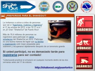
The mission of the Puerto Rico Seismic Network (PRSN)is to monitor and rapidly determine the location and sizeof all earthquakes and the alert level of tsunamis in theArea of Responsibility (AOR) and to immediatelydisseminate this information to concerned agencies,scientists, and the general public. The PRSN compilesand maintains an extensive seismic database ofearthquake parameters, continuous waveforms(earthquakes, GPS and sea level) and their effects whichserve as a solid foundation for basic and applied earthscience/oceanography research in Puerto Rico and the Caribbean.

Recommended
More Related Content
Similar to Red Sísmica de Puerto Rico
Similar to Red Sísmica de Puerto Rico (20)
More from Pedromiguel Pagán Rivera
Recently uploaded
Recently uploaded (20)
Red Sísmica de Puerto Rico
- 2. Dr. Victor Huérfano UNIVERSITY OF PUERTO RICO MAYAGUEZ CAMPUS GEOLOGY DEPARTMENT May 29 / 2013
- 3. The mission of the Puerto Rico Seismic Network (PRSN) is to monitor and rapidly determine the location and size of all earthquakes and the alert level of tsunamis in the Area of Responsibility (AOR) and to immediately disseminate this information to concerned agencies, scientists, and the general public. The PRSN compiles and maintains an extensive seismic database of earthquake parameters, continuous waveforms (earthquakes, GPS and sea level) and their effects which serve as a solid foundation for basic and applied earth science/oceanography research in Puerto Rico and the Caribbean. PRSN MISSION
- 6. 1670 MM = VII, San Germán y San Juan 1787 M @7-8,MM = VII-VIII, Costa Norte, Este y Oeste 1867 M =7.3, MM = VIII, Islas Vírgenes, Tsunami 20’ 1918 M = 7.3, MM = VIII, Área Oeste de PR, Tsunami 20’ 1943 M = 7.5, MM = V, Noreste de Puerto Rico TECTONIC SETTING
- 7. PRSN SEISMIC CATALOGUE (AOR)
- 8. PRSN SEISMIC CATALOGUE (AOR)
- 9. I. No felt II. Scarcely Felt III. Weak IV. Largely Observed V. Strong VI. Slightly Damaging VII. Damaging VIII. Heavily Damaging IX. Destructive X. Very destructive XI. Devastating XII. Completely Devastating Intensity H (m) I-V < 1.0 VI 2.0 VII-VIII 4.0 IX-X 8.0 XI 16.0 XII 32.0 TSUNAMI HISTORY OF PUERTO RICO
- 10. TSUNAMI PROBLEM
- 11. R5: Strike = 122 Dip = 80 Rake = 90 Mw = 7.7 { Geometry Size…….
- 14. Generación deTsunami Terremoto Alerta Temprana y/o Señal Natural Confirmación o Cancelación Señales Naturales (TeleTsunami) Tsunami Ataque “Cancelación" Proceso: Diseminación Proceso: Reacción Proceso: Recuperación “All Clear" SISTEMA DE ALERTA DE TSUNAMIS: LINEAS DE TIEMPO Years 0m 5m 10m Hours Weeks
- 15. Magnitude 7.4 - MARTINIQUE REGION WINDWARD ISLANDS Thursday, November 29, 2007 at 19:00:19 UTC 0 19 35 67 109 300 FDF MBWH Location Mwp ShakeMap Tsunami ??
- 16. Magnitude 7.0 - HAITI REGION Tuesday, January 12, 2010 at 21:53:09 UTC
- 17. What Next? HF CODAR Radar RT GPS W-PHASE Early Warning
- 18. PRSN VIRTUAL SEISMIC NETWORK IU: IRIS/USGS II : IRIS/IDA CU: USGS Caribbean PR: PRSN/PRSM, Puerto Rico UA: Aruba Meteorological Agency G : Geoscope GE: Geofone GT: Global Telemetered Seismic Network WI: French West Indies MO: Montserrat Volcano Observatory NA: KMNI Antilles DR: ISU Dominican Republic, UT UC: Colima University, Mexico US: United States Seismic Network SV: SNET, El Salvador NU: INETER, Nicaragua OV: OVSICORI, Costa Rica PA: Volcan Baru Network, Panama TR: West Indies Seismic Research Center CM: Colombian National Seismological Network CN: Canadian Seismic Network (Haiti) BL : Brazil Seismic Network MG: National Seismological Service of Mexico CY: Cayman Island VE: FUNVISIS, Venezuela CURRENT CARIBBEAN RT EARTHQUAKE MONITORING
- 19. Current real time Sea Level/tsunami monitoring PRSN VIRTUAL TIDE NETWORK NOS: NOAA/National Ocean Service PRSN: Puerto Rico Seismic Network UHSLC: University of Hawaii/Sea Level Center IPGP: Institut de Physique du Globe UNESCO/IOC
- 21. 1. Decades: Probabilistic seismic shaking hazard 2. Years: Hazard information and education 3. Days-2 minutes: Location, size and Catalogs 4. 3-5 minutes: ShakeMaps 5. Real time loss estimation, EW.. 6. 5 minutes: Tsunami Messages… Forecasting? 7. WHAT NEXT, Prediction ? Current Earthquake/Tsunami Knowledge and Information
- 24. The New PRSN Tsunami Portal Tour