

Recomendados
Recomendados
Más contenido relacionado
La actualidad más candente
La actualidad más candente (20)
Similar a GEOG 100 Lecture 08--Airmasses and Storms
Similar a GEOG 100 Lecture 08--Airmasses and Storms (20)
Más de angelaorr
Más de angelaorr (20)
Último
Último (20)
GEOG 100 Lecture 08--Airmasses and Storms
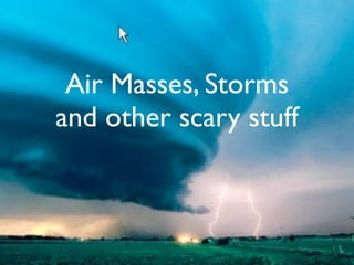
- 1. Air Masses, Storms and other scary stuff
- 2. What Is An Air Mass?
- 3. What Is An Air Mass? A large parcel of air with characteristics which distinguish it from surrounding air
- 4. What Is An Air Mass? A large parcel of air with characteristics which distinguish it from surrounding air 1000 mi (1600 km) across, several miles deep
- 5. What Is An Air Mass? A large parcel of air with characteristics which distinguish it from surrounding air 1000 mi (1600 km) across, several miles deep Conditions of temp., humidity, stability consistent horizontally at any altitude
- 6. What Is An Air Mass? A large parcel of air with characteristics which distinguish it from surrounding air 1000 mi (1600 km) across, several miles deep Conditions of temp., humidity, stability consistent horizontally at any altitude Moves as a coherent whole, not easily torn apart by local turbulence
- 7. What Is An Air Mass? A large parcel of air with characteristics which distinguish it from surrounding air 1000 mi (1600 km) across, several miles deep Conditions of temp., humidity, stability consistent horizontally at any altitude Moves as a coherent whole, not easily torn apart by local turbulence Sourceregion: Where an air mass originates
- 9. Source Regions Extensive, physically uniform surface area
- 10. Source Regions Extensive, physically uniform surface area High or low latitude
- 11. Source Regions Extensive, physically uniform surface area High or low latitude Not found in the midlatitudes (too much atmospheric activity)
- 12. Source Regions Extensive, physically uniform surface area High or low latitude Not found in the midlatitudes (too much atmospheric activity) High pressure zones are common source regions (because air sinks, stays close to the ground, where it picks up surface characteristics)
- 14. Lake-effect snow: cP air crossing warmer water 5
- 15. Lake-effect snow: cP air crossing warmer water Areas commonly affected around the Great Lakes 5
- 16. Lake-effect snow: cP air crossing warmer water Areas commonly affected around the Great Lakes Buffalo, NY (Dec., 2001)--Nearly seven feet of lake effect snow fell in 5 days 5
- 18. Air Mass Classification Latitude A = arctic/antarctic P = polar T = tropical E = equatorial
- 19. Air Mass Classification Latitude A = arctic/antarctic P = polar T = tropical E = equatorial Surface Conditions m = maritime c = continental
- 20. Major Air Mass Source Regions
- 21. Major Air Mass Source Regions (c)A
- 22. Major Air Mass Source Regions (c)A mP
- 23. Major Air Mass Source Regions (c)A mP cP
- 24. Major Air Mass Source Regions (c)A mP cP mT
- 25. Major Air Mass Source Regions (c)A mP cP mT cT
- 26. Major Air Mass Source Regions (c)A mP cP mT cT (m)E
- 27. Air Masses of North America
- 28. So what happens when these air masses meet???
- 29. So what happens when these air masses meet??? They start frontin’.
- 30. Frontal lifting
- 31. Movement of a Warm Front
- 33. Movement of a Cold Front
- 36. Comparison: Note the shape of the frontal boundary
- 37. Stationary Front
- 38. Occluded Front
- 39. Fronts on a Weather Map
- 40. Putting it together: Note line A – A’
- 41. A cross section along line A – A’ (from the map on the previous slide)
- 42. Real-World Application: An Atlantic Storm
- 43. Life-cycle of a Midlatitude Cyclone
- 44. A Hypothetical Weather Map (note the alternating Highs and Lows…)
- 45. How do the Upper-level Winds Move?
- 46. Major Midlatitude Disturbances Midlatitudes are the most dynamic weather region Where polar and tropical air masses meet and mix Midlatitude cyclones (a.k.a. depressions, lows, wave cyclones) Large low pressure systems (1000+ miles across) moving from west to east in the region of the Westerlies (35º to 70º N and S latitude)
- 47. Characteristic weather changes with the passage of a cold front:
- 48. Characteristic weather changes with the passage of a cold front: Sharp temp. drop as the front approaches
- 49. Characteristic weather changes with the passage of a cold front: Sharp temp. drop as the front approaches As the front approaches, wind direction is southerly
- 50. Characteristic weather changes with the passage of a cold front: Sharp temp. drop as the front approaches As the front approaches, wind direction is southerly After the front passes, wind shifts to more northerly (opposite for the Southern Hemisphere)
- 51. Characteristic weather changes with the passage of a cold front: Sharp temp. drop as the front approaches As the front approaches, wind direction is southerly After the front passes, wind shifts to more northerly (opposite for the Southern Hemisphere) Air pressure drops as the front approaches, rises after it passes
- 52. Characteristic weather changes with the passage of a cold front: Sharp temp. drop as the front approaches As the front approaches, wind direction is southerly After the front passes, wind shifts to more northerly (opposite for the Southern Hemisphere) Air pressure drops as the front approaches, rises after it passes Clear skies, followed by clouds and precip. along the edge of the front, then colder with clear skies again as the front passes
- 53. Mapping it out:
- 54. Midlatitude Anticyclones High pressure systems moving west to east No fronts Subsidence Clear, dry weather Cold in winter May stagnate, stalling other weather systems behind them
- 55. Now on to the fun stuff!
- 56. Lightning
- 57. Lightning
- 58. Lightning
- 59. Thunder
- 60. Tornadoes
- 62. 35
- 63. 36
- 64. Tropical Disturbances Tropical Depression - winds up to 38 mph Tropical Storm - winds 39 - 73 mph Hurricane - winds 74+ mph
- 65. Hurricanes Four different names for the same event: Hurricane Typhoon Cyclones, tropical cyclones Baguios
- 66. Hurricanes Four different names for the same event: Hurricane Typhoon Cyclones, tropical cyclones Baguios
- 68. Hurricane Origins Form in tropical and subtropical zones approx. 8° to 15° N or S latitude
- 69. Hurricane Origins Form in tropical and subtropical zones approx. 8° to 15° N or S latitude Rarely form within 3° N or S of equator (no Coriolis force), rarely cross it
- 70. Hurricane Origins Form in tropical and subtropical zones approx. 8° to 15° N or S latitude Rarely form within 3° N or S of equator (no Coriolis force), rarely cross it Tend to form in or just poleward of the ITCZ
- 71. Hurricane Origins Form in tropical and subtropical zones approx. 8° to 15° N or S latitude Rarely form within 3° N or S of equator (no Coriolis force), rarely cross it Tend to form in or just poleward of the ITCZ Tend to form in late summer and fall (warmest sea sfc. temps.)
- 72. Hurricane Origins Form in tropical and subtropical zones approx. 8° to 15° N or S latitude Rarely form within 3° N or S of equator (no Coriolis force), rarely cross it Tend to form in or just poleward of the ITCZ Tend to form in late summer and fall (warmest sea sfc. temps.) Storm’s low pressure cell feeds off warm sea sfc. temps. (up to 81°F!)
- 73. Hurricane Origins Form in tropical and subtropical zones approx. 8° to 15° N or S latitude Rarely form within 3° N or S of equator (no Coriolis force), rarely cross it Tend to form in or just poleward of the ITCZ Tend to form in late summer and fall (warmest sea sfc. temps.) Storm’s low pressure cell feeds off warm sea sfc. temps. (up to 81°F!) Gains energy from release of latent heat of condensation during intense precipitation
- 74. Hurricane Origins Form in tropical and subtropical zones approx. 8° to 15° N or S latitude Rarely form within 3° N or S of equator (no Coriolis force), rarely cross it Tend to form in or just poleward of the ITCZ Tend to form in late summer and fall (warmest sea sfc. temps.) Storm’s low pressure cell feeds off warm sea sfc. temps. (up to 81°F!) Gains energy from release of latent heat of condensation during intense precipitation Always form over oceans
- 75. Hurricane Origins Form in tropical and subtropical zones approx. 8° to 15° N or S latitude Rarely form within 3° N or S of equator (no Coriolis force), rarely cross it Tend to form in or just poleward of the ITCZ Tend to form in late summer and fall (warmest sea sfc. temps.) Storm’s low pressure cell feeds off warm sea sfc. temps. (up to 81°F!) Gains energy from release of latent heat of condensation during intense precipitation Always form over oceans Do not / rarely form in the south Atlantic or southeast Pacific because the water is too cold and air pressure too high
- 76. Hurricane Origins Form in tropical and subtropical zones approx. 8° to 15° N or S latitude Rarely form within 3° N or S of equator (no Coriolis force), rarely cross it Tend to form in or just poleward of the ITCZ Tend to form in late summer and fall (warmest sea sfc. temps.) Storm’s low pressure cell feeds off warm sea sfc. temps. (up to 81°F!) Gains energy from release of latent heat of condensation during intense precipitation Always form over oceans Do not / rarely form in the south Atlantic or southeast Pacific because the water is too cold and air pressure too high Storm intensity lessens as it gains latitude (into cooler waters) or moves over land
- 77. Hurricanes
- 79. Pressure Signature of a Hurricane
- 81. Hurricane Katrina making landfall
- 82. Storm Surge
Notas del editor
- \n
- \n
- \n
- \n
- \n
- \n
- \n
- \n
- \n
- \n
- \n
- \n
- \n
- \n
- \n
- \n
- \n
- \n
- \n
- \n
- \n
- \n
- \n
- \n
- \n
- \n
- \n
- \n
- \n
- \n
- \n
- \n
- \n
- \n
- \n
- \n
- \n
- \n
- \n
- \n
- \n
- \n
- \n
- \n
- \n
- \n
- \n
- \n
- \n
- \n
- \n
- \n
- \n
- \n
- \n
- \n
- \n
- \n
- \n
- \n
- \n
- \n
- \n
- \n
- \n
- \n
- \n
- \n
- \n
- \n
- \n
- \n
- \n
- \n
- \n