SlideShare una empresa de Scribd logo
1 de 30
ArchaeoLandscapes Europe


      Networking Remote Sensing in
 Archaeology: Fostering Methods and Knowledge                             in
                           Europe and Beyond
                                   ---
               From International Associations Scattering
                         Towards Globalization

                                                Dr. Axel G. Posluschny M.A.
                                                ArchaeoLandscapes Europe
                                         Roman-Germanic Commission of the
                                            German Archaeological Institute
                                                    Palmengartenstr. 10-12
                                                         D-60325 Frankfurt
                                                  posluschny@rgk.dainst.de

www.archaeolandscapes.eu
ArchaeoLandscapes Europe
                                                                         Content
   • Remote Sensing & Surveying for Cultural
     Heritage Management

   • Knowledge, Expertise and their Distribution

   • ArchaeoLandscapes Europe Network


                                                                                              introduction
Roman-Germanic Commission of the German Archaeological Institute   www.archaeolandscapes.eu
ArchaeoLandscapes Europe
                         Landscape Archaeology & Invisible Sites
      http://www.aegypten-spezialist.de/uploads/pics/gizeh-cheops-sphinx.jpg    http://www.online-reisefuehrer.com/bilder-reisen/tuerkei/ephesos.jpg


                                                                                                                                                                       introduction – RS for CHM & research
          http://www.zum.de/Faecher/G/BW/Landeskunde/w3/provence/vienne/augustus1.jpg http://www.ohiotraveler.com/images/serpent%20mound.jpg

Roman-Germanic Commission of the German Archaeological Institute                                                                            www.archaeolandscapes.eu
ArchaeoLandscapes Europe
                                Beyond the Fascination of the Visible


                                                                                              introduction – RS for CHM & research
Roman-Germanic Commission of the German Archaeological Institute   www.archaeolandscapes.eu
ArchaeoLandscapes Europe
                                         Beyond the Meaning of the Visible


                                                                                              introduction – RS for CHM & research
    Cowley et al. 2010


Roman-Germanic Commission of the German Archaeological Institute   www.archaeolandscapes.eu
ArchaeoLandscapes Europe
                                     Non-invasive Methods for Research


                                                                                              introduction – RS for CHM & research
Roman-Germanic Commission of the German Archaeological Institute   www.archaeolandscapes.eu
ArchaeoLandscapes Europe
        Visualisation – Public outreach & Lobby
                                        Building


                                                                                              introduction – RS for CHM & research
Roman-Germanic Commission of the German Archaeological Institute   www.archaeolandscapes.eu
ArchaeoLandscapes Europe
                          RS Data & Visualisations for the Public


                                                                                              introduction – RS for CHM & research
Roman-Germanic Commission of the German Archaeological Institute   www.archaeolandscapes.eu
ArchaeoLandscapes Europe
                                                                   Expert Knowledge
   •    Remote Sensing needs expert knowledge
   •    RS is more than just pushing buttons
   •    RS is more than buying data or even worse, their
        interpretation
         • Archaeologists often pay (technical) experts to do remote sensing for
           them
         • What they get as a result/product is often a filtered interpretation,


                                                                                                    knowledge, expertise & distribution
           based on the technicians experience
         • They don’t get the real data and even if so, many archaeologists
           wouldn’t be able to deal with that


Roman-Germanic Commission of the German Archaeological Institute         www.archaeolandscapes.eu
ArchaeoLandscapes Europe
                                                                   Knowledge and its Spread

   •    Expert knowledge about RS is not evenly distributed amongst
        archaeologists in Europe, nor world-wide

   •    Acquiring RS data as well as dealing with that data in a
        sufficient way is not being taught with the same intensity and
        on a regular basis at universities all over Europe


                                                                                                            knowledge, expertise & distribution
         • There is still a lack of education in these methods in many parts of
              Europe and also in the rest of the world


Roman-Germanic Commission of the German Archaeological Institute                 www.archaeolandscapes.eu
ArchaeoLandscapes Europe
  ArchaeoLandscape Europe is supported by the
  EU within the framework of the Culture 2007-
  2013 programme

  •   Agreement Number: 2010-1486
  •   Start: 15th September 2010
  •   End: 14th September 2015
  •   EU Advancement: 2,5 Mio €
  •   Total Budget: 5 Mio €
  •   Partner Institutions: 61(at present)


                                                                          ArchaeoLandscapes network
  •   Project Leadership: Roman-Germanic Commission of
      the German Archaeological Institute


Roman-Germanic Commission                      www.archaeolandscapes.eu
ArchaeoLandscapes Europe
         61 Project Partner from all over Europe and Beyond
   Coordinator/Project Leader                                                 3.    Estonian Heritage Society (EE)
   1. Roman-Germanic Commission, German Archaeological Institut (DE)          4.    Aalto University School of Science and Technology (FI)
                                                                              5.    National Museum of the Faroe Islands (FO)
   Co-organisers:
                                                                              6.    Université de Franche Comté (FR)
   1. In Flanders Fields Museum, Belgium (BE)
   2. Cyprus Research and Education Foundation (STARC) (CY)                   7.    University of Applied Sciences - i3mainz (DE)
   3. Holstebro Museum (DK)                                                   8.    University of Bamberg (DE)
   4. State Heritage Service Baden-Wü    rttemberg (DE)                       9.    University of Frankfurt (DE)
   5. Institute for Mediterranean Studies (FORTH) (GR)                        10.   Aerial Archaeology Research Group (international)
   6. Baranya County Museum Authority (HU)                                    11.   Culture Lab - International Cultural Expertise (BE)
   7. Institute of Archaeology (IS)                                           12.   Dutch Expertise Centre for Archaeological Remote Sensing (NL/BE)
   8. Discovery Programme (IE)
                                                                              13.   Dundalk Institute of Technology (IE)
   9. University College Dublin (IE)
   10. University of Foggia (IT)                                              14.   Latvian Academy of Culture (LV)
   11. University of Salento (LabTAF), Lecce (IT)                             15.   University of Granada (ES)
   12. University of Siena (LAP&T) (IT)                                       16.   University of Uppsala (SE)
   13. University of Klaipeda (LT)                                            17.   University of Ulster (IE)
   14. University of Leiden (NL)                                              18.   Landscape & Geophysical Services (IE)
   15. Norwegian Institute for Cultural Heritage Research (NIKU) (NO)         19.   Macquarie University, NSW (AU)
   16. Adam Mickiewicz University, Poznań (PL)
                                                                              20.   The DART Project - University of Leeds (UK)
   17. Institute for Cultural Memory (CIMEC) (RO)
   18. Institute of Archaeology (RS)                                          21.   Leuven University (BE)
   19. Slovak Academy of Sciences (SK)                                        22.   Department of Earth and Environment of the Italian National
   20. Slovenian Academy of Sciences and Arts (ZRC SAZU) (SI)                       Research Council (IT)


                                                                                                                                                              ArchaeoLandscapes network
   21. University of Ljubljana (SI)                                           23.   University of Zagreb (HR)
   22. Instituto de Estudos Galeos Padre Sarmiento (ES)                       24.   VU Amsterdam (NL)
   23. English Heritage (UK)                                                  25.   Moesgaard Museum (DK)
   24. University of Exeter (UK)                                              26.   The Rathcroghan Heritage Centre (IE)
   25. University of Glasgow (UK)
                                                                              27.   The Landscape Research Centre (UK)
   26. Royal Commission on the Ancient and Historical Monuments of Scotland
       (UK)                                                                   28.   Polytechnic Institute of Tomar University (PT)
                                                                              29.   ArchaeoPhysica (UK)
   Associated Partners:                                                       30.   University of Bologna (IT)
   1. University of Vienna (AT)                                               31.   Norwegian University of Science and Technology (NO)
   2. University of West Bohemia (CZ)                                         32.   Szczecin University - Institute of History and International Relations,
                                                                                    Department of Archaeology (PL)
                                                                              33.   University of California, Merced (USA)
                                                                              34.   Cyprus University of Technology (CY)
                                                                                    ...


Roman-Germanic Commission                                                                                                   www.archaeolandscapes.eu
ArchaeoLandscapes Europe
                                                   Project Aims
 • "To increase public appreciation, understanding and
   conservation .....

       – of the landscape and archaeological heritage
       –    of Europe ....

       – through the application and international sharing of skills


                                                                                 ArchaeoLandscapes network
         and experience ....

 • in airborne and other forms of remote sensing"


Roman-Germanic Commission                             www.archaeolandscapes.eu
ArchaeoLandscapes Europe

                            A busy 5-year Programme ...
  • Create a self-supporting ArchaeoLandscapes Network Europe
  • Communicate the value of aerial survey, remote sensing and
    landscape studies
  • Promote the pan-European exchange of people, skills and
    experience
  • Enhance teaching in aerial survey, remote sensing and
    landscape studies
  • Exploit existing air-photo archives more effectively


                                                                                ArchaeoLandscapes network
  • Support aerial survey, remote sensing and landscape exploration
  • Explore laser, satellite and other forms of remote sensing to a
    larger extent
  • Provide technical guidance and advice on best practice


Roman-Germanic Commission                            www.archaeolandscapes.eu
ArchaeoLandscapes Europe
                                                       Networking and Collaborating

   • Building a network of experts

   • Teaching with workshops & schools

   • Sharing knowledge via publications, website and exchange
        visits
   • Supporting students & young scholars


                                                                                                    ArchaeoLandscapes network
   • Raising awareness for both the archaeological experts and
        the laymen


Roman-Germanic Commission of the German Archaeological Institute         www.archaeolandscapes.eu
ArchaeoLandscapes Europe
                 Addressing the Archaeological Community

   •    Technical Workshops: LiDAR, Aerial Archaeology, Geophysics, Satellite
        Imagery, UAV, Integrated Data Analyses, …
   •    Aerial Archaeology Training Schools
   •    2 International Conferences (2013 Dublin, 2015 Frankfurt)
   •    Symposia, Workshops, Meetings, Conference Sessions, ...
   •    Publications (2 Monographs, Flyer, Conference Papers, Best Practices


                                                                                              ArchaeoLandscapes network
        Guides, ...)
   •    Website http://www.archaeolandscapes.eu (the site will be updated
        continuously during the 3 coming years of the project)
   •    Grants for Students and Young Researchers to participate in Workshops,
        Schools and Conferences
Roman-Germanic Commission of the German Archaeological Institute   www.archaeolandscapes.eu
ArchaeoLandscapes Europe
                                                                   Addressing the Public
   • Travelling exhibition, starting on 8th May 2013 in Dublin
   • Conference about RS & Community Archaeology as a
     starting event for the travelling exhibition (8th – 11th May 2013
     in Dublin)
   • Website http://www.archaeolandscapes.eu (the site will be
     updated continuously during the 3 coming years of the
     project)


                                                                                                         ArchaeoLandscapes network
   • Flyer, sticker


Roman-Germanic Commission of the German Archaeological Institute              www.archaeolandscapes.eu
ArchaeoLandscapes Europe
                                                                   Addressing the Public
   • Newspaper, radio & TV interviews:
         • Spiegel Online: http://www.spiegel.de/international/zeitgeist/remote-
           scanning-techniques-revolutionize-archaeology-a-846793.html -
           copied or used as the basis for other articles:
                 • http://videnskab.dk/teknologi/flyvende-lasere-afslorer-begravede-
                   fortidsminder (DK)
                 • http://www.niburu.nl/archeologie/vliegende-lasers-sporen-ondergrondse-
                   bouwwerken-op.html (NL)
                 • Politiken (DK)


                                                                                                         ArchaeoLandscapes network
                 • http://nachrichten.t-online.de/fliegender-laser-verraet-verschuettete-
                   bauten/id_58398140/index (DE)
         • http://yle.fi/radio1/kulttuuri/kultakuume/ => Kun hakku ja lapio eivä t
           enä ä riitä (FI)
   • Planned: TV documentaries about RS in archaeology

Roman-Germanic Commission of the German Archaeological Institute              www.archaeolandscapes.eu
ArchaeoLandscapes Europe
                                                                   Previous Activities
   • Technical Workshops:
         •    Bibracte/FR – LiDAR
         •    Slane/IE – Geophysics, kite photography, data integration
         •    Poznan/PL – satellite & aerial images
         •    Klaipeda/LT – geophysics
         •    Ljubljana/SL – 3D data
         •    Rethymno/GR – geophysics, satellite & aerial images

   • Aerial Archaeology Training Schools:


                                                                                                      ArchaeoLandscapes network
         •    Kostolac/RS
         •    Velling/DK
         •    Merida/ES
         •    Pilsen/CZ
         •    Kocaeli/TR


Roman-Germanic Commission of the German Archaeological Institute           www.archaeolandscapes.eu
ArchaeoLandscapes Europe
                                                                   Previous Activities
   • Symposia, Workshops, Meetings, Conference Sessions:
         • CAA 2012, Southampton – ArcLand session
         • EAA 2011, Oslo – ArcLand session
         • EAA 2012, Helsinki – ArcLand session
         • UNESCO Best Practice Conference 2012, Menorca – 3 ArcLand
           related papers
         • ESOF – European Science Open Forum 2012, Dublin – ArcLand
           session
         • …


                                                                                                      ArchaeoLandscapes network
   • Publications (2 Monographs in print, Flyer, Conference Papers)


Roman-Germanic Commission of the German Archaeological Institute           www.archaeolandscapes.eu
ArchaeoLandscapes Europe
                                                                   Previous Activities
   • Grants for Students and Young Researchers to participate in
     Workshops, Schools and Conferences
   • 43 grants have been paid from ArcLand:
     • 19 for aerial archaeological training schools
     • 16 for technical workshops
     • 6 exchange visits / mobility grants
     • 2 conference grants


                                                                                                      ArchaeoLandscapes network
Roman-Germanic Commission of the German Archaeological Institute           www.archaeolandscapes.eu
ArchaeoLandscapes Europe
                                                                   Future Activities
   • Technical Workshops:
         •    Belgrade/RS – Archiving questions
         •    Bamberg/DE – Airphoto interpretation
         •    Rathcroghan/IE – Geophysics, LiDAR, data integration
         •    Esslingen/DE – LiDAR
         •    Montferrand/FR – LiDAR

   • Aerial Archaeology Training Schools:
         • Leuven/BE


                                                                                                    ArchaeoLandscapes network
         • Pecs/HU


Roman-Germanic Commission of the German Archaeological Institute         www.archaeolandscapes.eu
ArchaeoLandscapes Europe
                                                                   Measuring Impact (?)
   • Webpage hits – estimated number of visits until the end of the
     project: 15,000
   • number of visits by September 2012: 20,600 !!!


                                                                                                        ArchaeoLandscapes network
   2 main peaks:
   •start of the Facebook page in January
   •Spiegel Online article in late July

Roman-Germanic Commission of the German Archaeological Institute             www.archaeolandscapes.eu
ArchaeoLandscapes Europe
                                                                   Measuring Distribution


                                                                                                         ArchaeoLandscapes network
Roman-Germanic Commission of the German Archaeological Institute              www.archaeolandscapes.eu
ArchaeoLandscapes Europe
                                                                        Resume
  • Knowing that the use of all modern RS techniques and
    methods need skill, expertise and experience and being
    aware of the fact that these factors are not evenly distributed
    all over Europe (as well as in the rest of the world), the
    ArchaeoLandscapes Europe project, supported by the EU
    Culture 2007–2013 programme, aims for a better
    understanding and a more excessive use of modern
    archaeological surveying techniques as well as for an
    exchange of people, working in these fields, their expertise
    and of new ideas.
  • Moreover, we think that involving the public in various ways is


                                                                                              conclusion
    an important aspect of our work, fostering an understanding
    as well as public support for archaeological remote sensing.
Roman-Germanic Commission of the German Archaeological Institute   www.archaeolandscapes.eu
ArchaeoLandscapes Europe

                                                                   Further information
    If you want to know more about the project and
    the various (future) activities, opportunities and
                 so on, visit our website


       http://www.archaeolandscapes.eu


                                                                                                         arcland
Roman-Germanic Commission of the German Archaeological Institute              www.archaeolandscapes.eu
ArchaeoLandscapes Europe


                                                                   posluschny@rgk.dainst.de


          Thank you very much for your attention


Roman-Germanic Commission of the German Archaeological Institute        www.archaeolandscapes.eu

Más contenido relacionado

Similar a Networking Remote Sensing

Enhancing user access to european digital heritage
Enhancing user access to european digital heritageEnhancing user access to european digital heritage
Enhancing user access to european digital heritageEuropeanaConnect
 
EuropeanaConnect
EuropeanaConnectEuropeanaConnect
EuropeanaConnectMax Kaiser
 
Non-invasive Techniques – Tools for Preventive Archaeology?
Non-invasive Techniques – Tools for Preventive Archaeology?Non-invasive Techniques – Tools for Preventive Archaeology?
Non-invasive Techniques – Tools for Preventive Archaeology?ArchaeoLandscapes Europe
 
Czech digital collections from the archaeology and architecture domain in Eur...
Czech digital collections from the archaeology and architecture domain in Eur...Czech digital collections from the archaeology and architecture domain in Eur...
Czech digital collections from the archaeology and architecture domain in Eur...locloud
 
Breaking the Waves - Alastair Dunning
Breaking the Waves - Alastair DunningBreaking the Waves - Alastair Dunning
Breaking the Waves - Alastair DunningJisc
 
“Archäologische Informationen” and Open Journal Systems. Chances and Possibil...
“Archäologische Informationen” and Open Journal Systems. Chances and Possibil...“Archäologische Informationen” and Open Journal Systems. Chances and Possibil...
“Archäologische Informationen” and Open Journal Systems. Chances and Possibil...ariadnenetwork
 
Challenges and opportunities of aggregating multiple databases in Europeana
Challenges and opportunities of aggregating multiple databases in EuropeanaChallenges and opportunities of aggregating multiple databases in Europeana
Challenges and opportunities of aggregating multiple databases in EuropeanaDavid Haskiya
 
Europeana roadmap and satellite projects (Lizzy Komen)
Europeana roadmap and satellite projects (Lizzy Komen)Europeana roadmap and satellite projects (Lizzy Komen)
Europeana roadmap and satellite projects (Lizzy Komen)Kulturnett Sogn og Fjordane
 
3 biketrail audioguide signposting maps by K. Schillig_r. johannknecht_l. azzani
3 biketrail audioguide signposting maps by K. Schillig_r. johannknecht_l. azzani3 biketrail audioguide signposting maps by K. Schillig_r. johannknecht_l. azzani
3 biketrail audioguide signposting maps by K. Schillig_r. johannknecht_l. azzaniTRANSROMANICA
 
CV-Europass-20160509-Marković-EN
CV-Europass-20160509-Marković-ENCV-Europass-20160509-Marković-EN
CV-Europass-20160509-Marković-ENMilan Markovic
 
Europeana: from inspirational idea to sustainable service
Europeana: from inspirational idea to sustainable serviceEuropeana: from inspirational idea to sustainable service
Europeana: from inspirational idea to sustainable serviceEuropeanaLocal Project
 
Europeana Aggregators' Fair day 1
Europeana Aggregators' Fair day 1Europeana Aggregators' Fair day 1
Europeana Aggregators' Fair day 1Europeana
 
Judaica europeana part_one
Judaica europeana part_oneJudaica europeana part_one
Judaica europeana part_oneJE_presentations
 

Similar a Networking Remote Sensing (20)

ArcLand Network
ArcLand NetworkArcLand Network
ArcLand Network
 
Enhancing user access to european digital heritage
Enhancing user access to european digital heritageEnhancing user access to european digital heritage
Enhancing user access to european digital heritage
 
EuropeanaConnect
EuropeanaConnectEuropeanaConnect
EuropeanaConnect
 
Non-invasive Techniques – Tools for Preventive Archaeology?
Non-invasive Techniques – Tools for Preventive Archaeology?Non-invasive Techniques – Tools for Preventive Archaeology?
Non-invasive Techniques – Tools for Preventive Archaeology?
 
Czech digital collections from the archaeology and architecture domain in Eur...
Czech digital collections from the archaeology and architecture domain in Eur...Czech digital collections from the archaeology and architecture domain in Eur...
Czech digital collections from the archaeology and architecture domain in Eur...
 
Breaking the Waves - Alastair Dunning
Breaking the Waves - Alastair DunningBreaking the Waves - Alastair Dunning
Breaking the Waves - Alastair Dunning
 
“Archäologische Informationen” and Open Journal Systems. Chances and Possibil...
“Archäologische Informationen” and Open Journal Systems. Chances and Possibil...“Archäologische Informationen” and Open Journal Systems. Chances and Possibil...
“Archäologische Informationen” and Open Journal Systems. Chances and Possibil...
 
Breaking the Waves
Breaking the WavesBreaking the Waves
Breaking the Waves
 
01 eagle
01 eagle01 eagle
01 eagle
 
Challenges and opportunities of aggregating multiple databases in Europeana
Challenges and opportunities of aggregating multiple databases in EuropeanaChallenges and opportunities of aggregating multiple databases in Europeana
Challenges and opportunities of aggregating multiple databases in Europeana
 
Europeana roadmap and satellite projects (Lizzy Komen)
Europeana roadmap and satellite projects (Lizzy Komen)Europeana roadmap and satellite projects (Lizzy Komen)
Europeana roadmap and satellite projects (Lizzy Komen)
 
Minutes
MinutesMinutes
Minutes
 
3 biketrail audioguide signposting maps by K. Schillig_r. johannknecht_l. azzani
3 biketrail audioguide signposting maps by K. Schillig_r. johannknecht_l. azzani3 biketrail audioguide signposting maps by K. Schillig_r. johannknecht_l. azzani
3 biketrail audioguide signposting maps by K. Schillig_r. johannknecht_l. azzani
 
CV-Europass-20160509-Marković-EN
CV-Europass-20160509-Marković-ENCV-Europass-20160509-Marković-EN
CV-Europass-20160509-Marković-EN
 
Europeana: from inspirational idea to sustainable service
Europeana: from inspirational idea to sustainable serviceEuropeana: from inspirational idea to sustainable service
Europeana: from inspirational idea to sustainable service
 
Europeana Aggregators' Fair day 1
Europeana Aggregators' Fair day 1Europeana Aggregators' Fair day 1
Europeana Aggregators' Fair day 1
 
Europeana Libraries Review
Europeana Libraries ReviewEuropeana Libraries Review
Europeana Libraries Review
 
EuropeanaLocal: its contribution
EuropeanaLocal: its contributionEuropeanaLocal: its contribution
EuropeanaLocal: its contribution
 
Judaica europeana part_one
Judaica europeana part_oneJudaica europeana part_one
Judaica europeana part_one
 
Rescue Archival Documents
Rescue Archival DocumentsRescue Archival Documents
Rescue Archival Documents
 

Último

Earth Day Presentation wow hello nice great
Earth Day Presentation wow hello nice greatEarth Day Presentation wow hello nice great
Earth Day Presentation wow hello nice greatYousafMalik24
 
Daily Lesson Plan in Mathematics Quarter 4
Daily Lesson Plan in Mathematics Quarter 4Daily Lesson Plan in Mathematics Quarter 4
Daily Lesson Plan in Mathematics Quarter 4JOYLYNSAMANIEGO
 
Transaction Management in Database Management System
Transaction Management in Database Management SystemTransaction Management in Database Management System
Transaction Management in Database Management SystemChristalin Nelson
 
4.16.24 21st Century Movements for Black Lives.pptx
4.16.24 21st Century Movements for Black Lives.pptx4.16.24 21st Century Movements for Black Lives.pptx
4.16.24 21st Century Movements for Black Lives.pptxmary850239
 
Food processing presentation for bsc agriculture hons
Food processing presentation for bsc agriculture honsFood processing presentation for bsc agriculture hons
Food processing presentation for bsc agriculture honsManeerUddin
 
Keynote by Prof. Wurzer at Nordex about IP-design
Keynote by Prof. Wurzer at Nordex about IP-designKeynote by Prof. Wurzer at Nordex about IP-design
Keynote by Prof. Wurzer at Nordex about IP-designMIPLM
 
HỌC TỐT TIẾNG ANH 11 THEO CHƯƠNG TRÌNH GLOBAL SUCCESS ĐÁP ÁN CHI TIẾT - CẢ NĂ...
HỌC TỐT TIẾNG ANH 11 THEO CHƯƠNG TRÌNH GLOBAL SUCCESS ĐÁP ÁN CHI TIẾT - CẢ NĂ...HỌC TỐT TIẾNG ANH 11 THEO CHƯƠNG TRÌNH GLOBAL SUCCESS ĐÁP ÁN CHI TIẾT - CẢ NĂ...
HỌC TỐT TIẾNG ANH 11 THEO CHƯƠNG TRÌNH GLOBAL SUCCESS ĐÁP ÁN CHI TIẾT - CẢ NĂ...Nguyen Thanh Tu Collection
 
ENG 5 Q4 WEEk 1 DAY 1 Restate sentences heard in one’s own words. Use appropr...
ENG 5 Q4 WEEk 1 DAY 1 Restate sentences heard in one’s own words. Use appropr...ENG 5 Q4 WEEk 1 DAY 1 Restate sentences heard in one’s own words. Use appropr...
ENG 5 Q4 WEEk 1 DAY 1 Restate sentences heard in one’s own words. Use appropr...JojoEDelaCruz
 
Music 9 - 4th quarter - Vocal Music of the Romantic Period.pptx
Music 9 - 4th quarter - Vocal Music of the Romantic Period.pptxMusic 9 - 4th quarter - Vocal Music of the Romantic Period.pptx
Music 9 - 4th quarter - Vocal Music of the Romantic Period.pptxleah joy valeriano
 
Visit to a blind student's school🧑‍🦯🧑‍🦯(community medicine)
Visit to a blind student's school🧑‍🦯🧑‍🦯(community medicine)Visit to a blind student's school🧑‍🦯🧑‍🦯(community medicine)
Visit to a blind student's school🧑‍🦯🧑‍🦯(community medicine)lakshayb543
 
4.16.24 Poverty and Precarity--Desmond.pptx
4.16.24 Poverty and Precarity--Desmond.pptx4.16.24 Poverty and Precarity--Desmond.pptx
4.16.24 Poverty and Precarity--Desmond.pptxmary850239
 
Concurrency Control in Database Management system
Concurrency Control in Database Management systemConcurrency Control in Database Management system
Concurrency Control in Database Management systemChristalin Nelson
 
Active Learning Strategies (in short ALS).pdf
Active Learning Strategies (in short ALS).pdfActive Learning Strategies (in short ALS).pdf
Active Learning Strategies (in short ALS).pdfPatidar M
 
Grade 9 Quarter 4 Dll Grade 9 Quarter 4 DLL.pdf
Grade 9 Quarter 4 Dll Grade 9 Quarter 4 DLL.pdfGrade 9 Quarter 4 Dll Grade 9 Quarter 4 DLL.pdf
Grade 9 Quarter 4 Dll Grade 9 Quarter 4 DLL.pdfJemuel Francisco
 
Field Attribute Index Feature in Odoo 17
Field Attribute Index Feature in Odoo 17Field Attribute Index Feature in Odoo 17
Field Attribute Index Feature in Odoo 17Celine George
 
GRADE 4 - SUMMATIVE TEST QUARTER 4 ALL SUBJECTS
GRADE 4 - SUMMATIVE TEST QUARTER 4 ALL SUBJECTSGRADE 4 - SUMMATIVE TEST QUARTER 4 ALL SUBJECTS
GRADE 4 - SUMMATIVE TEST QUARTER 4 ALL SUBJECTSJoshuaGantuangco2
 
Inclusivity Essentials_ Creating Accessible Websites for Nonprofits .pdf
Inclusivity Essentials_ Creating Accessible Websites for Nonprofits .pdfInclusivity Essentials_ Creating Accessible Websites for Nonprofits .pdf
Inclusivity Essentials_ Creating Accessible Websites for Nonprofits .pdfTechSoup
 

Último (20)

Earth Day Presentation wow hello nice great
Earth Day Presentation wow hello nice greatEarth Day Presentation wow hello nice great
Earth Day Presentation wow hello nice great
 
Daily Lesson Plan in Mathematics Quarter 4
Daily Lesson Plan in Mathematics Quarter 4Daily Lesson Plan in Mathematics Quarter 4
Daily Lesson Plan in Mathematics Quarter 4
 
Transaction Management in Database Management System
Transaction Management in Database Management SystemTransaction Management in Database Management System
Transaction Management in Database Management System
 
4.16.24 21st Century Movements for Black Lives.pptx
4.16.24 21st Century Movements for Black Lives.pptx4.16.24 21st Century Movements for Black Lives.pptx
4.16.24 21st Century Movements for Black Lives.pptx
 
Food processing presentation for bsc agriculture hons
Food processing presentation for bsc agriculture honsFood processing presentation for bsc agriculture hons
Food processing presentation for bsc agriculture hons
 
Keynote by Prof. Wurzer at Nordex about IP-design
Keynote by Prof. Wurzer at Nordex about IP-designKeynote by Prof. Wurzer at Nordex about IP-design
Keynote by Prof. Wurzer at Nordex about IP-design
 
HỌC TỐT TIẾNG ANH 11 THEO CHƯƠNG TRÌNH GLOBAL SUCCESS ĐÁP ÁN CHI TIẾT - CẢ NĂ...
HỌC TỐT TIẾNG ANH 11 THEO CHƯƠNG TRÌNH GLOBAL SUCCESS ĐÁP ÁN CHI TIẾT - CẢ NĂ...HỌC TỐT TIẾNG ANH 11 THEO CHƯƠNG TRÌNH GLOBAL SUCCESS ĐÁP ÁN CHI TIẾT - CẢ NĂ...
HỌC TỐT TIẾNG ANH 11 THEO CHƯƠNG TRÌNH GLOBAL SUCCESS ĐÁP ÁN CHI TIẾT - CẢ NĂ...
 
ENG 5 Q4 WEEk 1 DAY 1 Restate sentences heard in one’s own words. Use appropr...
ENG 5 Q4 WEEk 1 DAY 1 Restate sentences heard in one’s own words. Use appropr...ENG 5 Q4 WEEk 1 DAY 1 Restate sentences heard in one’s own words. Use appropr...
ENG 5 Q4 WEEk 1 DAY 1 Restate sentences heard in one’s own words. Use appropr...
 
YOUVE GOT EMAIL_FINALS_EL_DORADO_2024.pptx
YOUVE GOT EMAIL_FINALS_EL_DORADO_2024.pptxYOUVE GOT EMAIL_FINALS_EL_DORADO_2024.pptx
YOUVE GOT EMAIL_FINALS_EL_DORADO_2024.pptx
 
Music 9 - 4th quarter - Vocal Music of the Romantic Period.pptx
Music 9 - 4th quarter - Vocal Music of the Romantic Period.pptxMusic 9 - 4th quarter - Vocal Music of the Romantic Period.pptx
Music 9 - 4th quarter - Vocal Music of the Romantic Period.pptx
 
Visit to a blind student's school🧑‍🦯🧑‍🦯(community medicine)
Visit to a blind student's school🧑‍🦯🧑‍🦯(community medicine)Visit to a blind student's school🧑‍🦯🧑‍🦯(community medicine)
Visit to a blind student's school🧑‍🦯🧑‍🦯(community medicine)
 
4.16.24 Poverty and Precarity--Desmond.pptx
4.16.24 Poverty and Precarity--Desmond.pptx4.16.24 Poverty and Precarity--Desmond.pptx
4.16.24 Poverty and Precarity--Desmond.pptx
 
Concurrency Control in Database Management system
Concurrency Control in Database Management systemConcurrency Control in Database Management system
Concurrency Control in Database Management system
 
YOUVE_GOT_EMAIL_PRELIMS_EL_DORADO_2024.pptx
YOUVE_GOT_EMAIL_PRELIMS_EL_DORADO_2024.pptxYOUVE_GOT_EMAIL_PRELIMS_EL_DORADO_2024.pptx
YOUVE_GOT_EMAIL_PRELIMS_EL_DORADO_2024.pptx
 
Active Learning Strategies (in short ALS).pdf
Active Learning Strategies (in short ALS).pdfActive Learning Strategies (in short ALS).pdf
Active Learning Strategies (in short ALS).pdf
 
Grade 9 Quarter 4 Dll Grade 9 Quarter 4 DLL.pdf
Grade 9 Quarter 4 Dll Grade 9 Quarter 4 DLL.pdfGrade 9 Quarter 4 Dll Grade 9 Quarter 4 DLL.pdf
Grade 9 Quarter 4 Dll Grade 9 Quarter 4 DLL.pdf
 
Field Attribute Index Feature in Odoo 17
Field Attribute Index Feature in Odoo 17Field Attribute Index Feature in Odoo 17
Field Attribute Index Feature in Odoo 17
 
GRADE 4 - SUMMATIVE TEST QUARTER 4 ALL SUBJECTS
GRADE 4 - SUMMATIVE TEST QUARTER 4 ALL SUBJECTSGRADE 4 - SUMMATIVE TEST QUARTER 4 ALL SUBJECTS
GRADE 4 - SUMMATIVE TEST QUARTER 4 ALL SUBJECTS
 
Inclusivity Essentials_ Creating Accessible Websites for Nonprofits .pdf
Inclusivity Essentials_ Creating Accessible Websites for Nonprofits .pdfInclusivity Essentials_ Creating Accessible Websites for Nonprofits .pdf
Inclusivity Essentials_ Creating Accessible Websites for Nonprofits .pdf
 
FINALS_OF_LEFT_ON_C'N_EL_DORADO_2024.pptx
FINALS_OF_LEFT_ON_C'N_EL_DORADO_2024.pptxFINALS_OF_LEFT_ON_C'N_EL_DORADO_2024.pptx
FINALS_OF_LEFT_ON_C'N_EL_DORADO_2024.pptx
 

Networking Remote Sensing

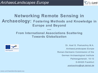
  • 1. ArchaeoLandscapes Europe Networking Remote Sensing in Archaeology: Fostering Methods and Knowledge in Europe and Beyond --- From International Associations Scattering Towards Globalization Dr. Axel G. Posluschny M.A. ArchaeoLandscapes Europe Roman-Germanic Commission of the German Archaeological Institute Palmengartenstr. 10-12 D-60325 Frankfurt posluschny@rgk.dainst.de www.archaeolandscapes.eu
  • 2. ArchaeoLandscapes Europe Content • Remote Sensing & Surveying for Cultural Heritage Management • Knowledge, Expertise and their Distribution • ArchaeoLandscapes Europe Network introduction Roman-Germanic Commission of the German Archaeological Institute www.archaeolandscapes.eu
  • 3. ArchaeoLandscapes Europe Landscape Archaeology & Invisible Sites http://www.aegypten-spezialist.de/uploads/pics/gizeh-cheops-sphinx.jpg http://www.online-reisefuehrer.com/bilder-reisen/tuerkei/ephesos.jpg introduction – RS for CHM & research http://www.zum.de/Faecher/G/BW/Landeskunde/w3/provence/vienne/augustus1.jpg http://www.ohiotraveler.com/images/serpent%20mound.jpg Roman-Germanic Commission of the German Archaeological Institute www.archaeolandscapes.eu
  • 4. ArchaeoLandscapes Europe Beyond the Fascination of the Visible introduction – RS for CHM & research Roman-Germanic Commission of the German Archaeological Institute www.archaeolandscapes.eu
  • 5. ArchaeoLandscapes Europe Beyond the Meaning of the Visible introduction – RS for CHM & research Cowley et al. 2010 Roman-Germanic Commission of the German Archaeological Institute www.archaeolandscapes.eu
  • 6. ArchaeoLandscapes Europe Non-invasive Methods for Research introduction – RS for CHM & research Roman-Germanic Commission of the German Archaeological Institute www.archaeolandscapes.eu
  • 7. ArchaeoLandscapes Europe Visualisation – Public outreach & Lobby Building introduction – RS for CHM & research Roman-Germanic Commission of the German Archaeological Institute www.archaeolandscapes.eu
  • 8. ArchaeoLandscapes Europe RS Data & Visualisations for the Public introduction – RS for CHM & research Roman-Germanic Commission of the German Archaeological Institute www.archaeolandscapes.eu
  • 9. ArchaeoLandscapes Europe RS Data & Visualisations for the Public introduction – RS for CHM & research Roman-Germanic Commission of the German Archaeological Institute www.archaeolandscapes.eu
  • 10. ArchaeoLandscapes Europe RS Data & Visualisations for the Public introduction – RS for CHM & research Roman-Germanic Commission of the German Archaeological Institute www.archaeolandscapes.eu
  • 11. ArchaeoLandscapes Europe RS Data & Visualisations for the Public introduction – RS for CHM & research Roman-Germanic Commission of the German Archaeological Institute www.archaeolandscapes.eu
  • 12. ArchaeoLandscapes Europe Expert Knowledge • Remote Sensing needs expert knowledge • RS is more than just pushing buttons • RS is more than buying data or even worse, their interpretation • Archaeologists often pay (technical) experts to do remote sensing for them • What they get as a result/product is often a filtered interpretation, knowledge, expertise & distribution based on the technicians experience • They don’t get the real data and even if so, many archaeologists wouldn’t be able to deal with that Roman-Germanic Commission of the German Archaeological Institute www.archaeolandscapes.eu
  • 13. ArchaeoLandscapes Europe Knowledge and its Spread • Expert knowledge about RS is not evenly distributed amongst archaeologists in Europe, nor world-wide • Acquiring RS data as well as dealing with that data in a sufficient way is not being taught with the same intensity and on a regular basis at universities all over Europe knowledge, expertise & distribution • There is still a lack of education in these methods in many parts of Europe and also in the rest of the world Roman-Germanic Commission of the German Archaeological Institute www.archaeolandscapes.eu
  • 14. ArchaeoLandscapes Europe ArchaeoLandscape Europe is supported by the EU within the framework of the Culture 2007- 2013 programme • Agreement Number: 2010-1486 • Start: 15th September 2010 • End: 14th September 2015 • EU Advancement: 2,5 Mio € • Total Budget: 5 Mio € • Partner Institutions: 61(at present) ArchaeoLandscapes network • Project Leadership: Roman-Germanic Commission of the German Archaeological Institute Roman-Germanic Commission www.archaeolandscapes.eu
  • 15. ArchaeoLandscapes Europe 61 Project Partner from all over Europe and Beyond Coordinator/Project Leader 3. Estonian Heritage Society (EE) 1. Roman-Germanic Commission, German Archaeological Institut (DE) 4. Aalto University School of Science and Technology (FI) 5. National Museum of the Faroe Islands (FO) Co-organisers: 6. Université de Franche Comté (FR) 1. In Flanders Fields Museum, Belgium (BE) 2. Cyprus Research and Education Foundation (STARC) (CY) 7. University of Applied Sciences - i3mainz (DE) 3. Holstebro Museum (DK) 8. University of Bamberg (DE) 4. State Heritage Service Baden-Wü rttemberg (DE) 9. University of Frankfurt (DE) 5. Institute for Mediterranean Studies (FORTH) (GR) 10. Aerial Archaeology Research Group (international) 6. Baranya County Museum Authority (HU) 11. Culture Lab - International Cultural Expertise (BE) 7. Institute of Archaeology (IS) 12. Dutch Expertise Centre for Archaeological Remote Sensing (NL/BE) 8. Discovery Programme (IE) 13. Dundalk Institute of Technology (IE) 9. University College Dublin (IE) 10. University of Foggia (IT) 14. Latvian Academy of Culture (LV) 11. University of Salento (LabTAF), Lecce (IT) 15. University of Granada (ES) 12. University of Siena (LAP&T) (IT) 16. University of Uppsala (SE) 13. University of Klaipeda (LT) 17. University of Ulster (IE) 14. University of Leiden (NL) 18. Landscape & Geophysical Services (IE) 15. Norwegian Institute for Cultural Heritage Research (NIKU) (NO) 19. Macquarie University, NSW (AU) 16. Adam Mickiewicz University, Poznań (PL) 20. The DART Project - University of Leeds (UK) 17. Institute for Cultural Memory (CIMEC) (RO) 18. Institute of Archaeology (RS) 21. Leuven University (BE) 19. Slovak Academy of Sciences (SK) 22. Department of Earth and Environment of the Italian National 20. Slovenian Academy of Sciences and Arts (ZRC SAZU) (SI) Research Council (IT) ArchaeoLandscapes network 21. University of Ljubljana (SI) 23. University of Zagreb (HR) 22. Instituto de Estudos Galeos Padre Sarmiento (ES) 24. VU Amsterdam (NL) 23. English Heritage (UK) 25. Moesgaard Museum (DK) 24. University of Exeter (UK) 26. The Rathcroghan Heritage Centre (IE) 25. University of Glasgow (UK) 27. The Landscape Research Centre (UK) 26. Royal Commission on the Ancient and Historical Monuments of Scotland (UK) 28. Polytechnic Institute of Tomar University (PT) 29. ArchaeoPhysica (UK) Associated Partners: 30. University of Bologna (IT) 1. University of Vienna (AT) 31. Norwegian University of Science and Technology (NO) 2. University of West Bohemia (CZ) 32. Szczecin University - Institute of History and International Relations, Department of Archaeology (PL) 33. University of California, Merced (USA) 34. Cyprus University of Technology (CY) ... Roman-Germanic Commission www.archaeolandscapes.eu
  • 16. ArchaeoLandscapes Europe Project Aims • "To increase public appreciation, understanding and conservation ..... – of the landscape and archaeological heritage – of Europe .... – through the application and international sharing of skills ArchaeoLandscapes network and experience .... • in airborne and other forms of remote sensing" Roman-Germanic Commission www.archaeolandscapes.eu
  • 17. ArchaeoLandscapes Europe A busy 5-year Programme ... • Create a self-supporting ArchaeoLandscapes Network Europe • Communicate the value of aerial survey, remote sensing and landscape studies • Promote the pan-European exchange of people, skills and experience • Enhance teaching in aerial survey, remote sensing and landscape studies • Exploit existing air-photo archives more effectively ArchaeoLandscapes network • Support aerial survey, remote sensing and landscape exploration • Explore laser, satellite and other forms of remote sensing to a larger extent • Provide technical guidance and advice on best practice Roman-Germanic Commission www.archaeolandscapes.eu
  • 18. ArchaeoLandscapes Europe Networking and Collaborating • Building a network of experts • Teaching with workshops & schools • Sharing knowledge via publications, website and exchange visits • Supporting students & young scholars ArchaeoLandscapes network • Raising awareness for both the archaeological experts and the laymen Roman-Germanic Commission of the German Archaeological Institute www.archaeolandscapes.eu
  • 19. ArchaeoLandscapes Europe Addressing the Archaeological Community • Technical Workshops: LiDAR, Aerial Archaeology, Geophysics, Satellite Imagery, UAV, Integrated Data Analyses, … • Aerial Archaeology Training Schools • 2 International Conferences (2013 Dublin, 2015 Frankfurt) • Symposia, Workshops, Meetings, Conference Sessions, ... • Publications (2 Monographs, Flyer, Conference Papers, Best Practices ArchaeoLandscapes network Guides, ...) • Website http://www.archaeolandscapes.eu (the site will be updated continuously during the 3 coming years of the project) • Grants for Students and Young Researchers to participate in Workshops, Schools and Conferences Roman-Germanic Commission of the German Archaeological Institute www.archaeolandscapes.eu
  • 20. ArchaeoLandscapes Europe Addressing the Public • Travelling exhibition, starting on 8th May 2013 in Dublin • Conference about RS & Community Archaeology as a starting event for the travelling exhibition (8th – 11th May 2013 in Dublin) • Website http://www.archaeolandscapes.eu (the site will be updated continuously during the 3 coming years of the project) ArchaeoLandscapes network • Flyer, sticker Roman-Germanic Commission of the German Archaeological Institute www.archaeolandscapes.eu
  • 21. ArchaeoLandscapes Europe Addressing the Public • Newspaper, radio & TV interviews: • Spiegel Online: http://www.spiegel.de/international/zeitgeist/remote- scanning-techniques-revolutionize-archaeology-a-846793.html - copied or used as the basis for other articles: • http://videnskab.dk/teknologi/flyvende-lasere-afslorer-begravede- fortidsminder (DK) • http://www.niburu.nl/archeologie/vliegende-lasers-sporen-ondergrondse- bouwwerken-op.html (NL) • Politiken (DK) ArchaeoLandscapes network • http://nachrichten.t-online.de/fliegender-laser-verraet-verschuettete- bauten/id_58398140/index (DE) • http://yle.fi/radio1/kulttuuri/kultakuume/ => Kun hakku ja lapio eivä t enä ä riitä (FI) • Planned: TV documentaries about RS in archaeology Roman-Germanic Commission of the German Archaeological Institute www.archaeolandscapes.eu
  • 22. ArchaeoLandscapes Europe Previous Activities • Technical Workshops: • Bibracte/FR – LiDAR • Slane/IE – Geophysics, kite photography, data integration • Poznan/PL – satellite & aerial images • Klaipeda/LT – geophysics • Ljubljana/SL – 3D data • Rethymno/GR – geophysics, satellite & aerial images • Aerial Archaeology Training Schools: ArchaeoLandscapes network • Kostolac/RS • Velling/DK • Merida/ES • Pilsen/CZ • Kocaeli/TR Roman-Germanic Commission of the German Archaeological Institute www.archaeolandscapes.eu
  • 23. ArchaeoLandscapes Europe Previous Activities • Symposia, Workshops, Meetings, Conference Sessions: • CAA 2012, Southampton – ArcLand session • EAA 2011, Oslo – ArcLand session • EAA 2012, Helsinki – ArcLand session • UNESCO Best Practice Conference 2012, Menorca – 3 ArcLand related papers • ESOF – European Science Open Forum 2012, Dublin – ArcLand session • … ArchaeoLandscapes network • Publications (2 Monographs in print, Flyer, Conference Papers) Roman-Germanic Commission of the German Archaeological Institute www.archaeolandscapes.eu
  • 24. ArchaeoLandscapes Europe Previous Activities • Grants for Students and Young Researchers to participate in Workshops, Schools and Conferences • 43 grants have been paid from ArcLand: • 19 for aerial archaeological training schools • 16 for technical workshops • 6 exchange visits / mobility grants • 2 conference grants ArchaeoLandscapes network Roman-Germanic Commission of the German Archaeological Institute www.archaeolandscapes.eu
  • 25. ArchaeoLandscapes Europe Future Activities • Technical Workshops: • Belgrade/RS – Archiving questions • Bamberg/DE – Airphoto interpretation • Rathcroghan/IE – Geophysics, LiDAR, data integration • Esslingen/DE – LiDAR • Montferrand/FR – LiDAR • Aerial Archaeology Training Schools: • Leuven/BE ArchaeoLandscapes network • Pecs/HU Roman-Germanic Commission of the German Archaeological Institute www.archaeolandscapes.eu
  • 26. ArchaeoLandscapes Europe Measuring Impact (?) • Webpage hits – estimated number of visits until the end of the project: 15,000 • number of visits by September 2012: 20,600 !!! ArchaeoLandscapes network 2 main peaks: •start of the Facebook page in January •Spiegel Online article in late July Roman-Germanic Commission of the German Archaeological Institute www.archaeolandscapes.eu
  • 27. ArchaeoLandscapes Europe Measuring Distribution ArchaeoLandscapes network Roman-Germanic Commission of the German Archaeological Institute www.archaeolandscapes.eu
  • 28. ArchaeoLandscapes Europe Resume • Knowing that the use of all modern RS techniques and methods need skill, expertise and experience and being aware of the fact that these factors are not evenly distributed all over Europe (as well as in the rest of the world), the ArchaeoLandscapes Europe project, supported by the EU Culture 2007–2013 programme, aims for a better understanding and a more excessive use of modern archaeological surveying techniques as well as for an exchange of people, working in these fields, their expertise and of new ideas. • Moreover, we think that involving the public in various ways is conclusion an important aspect of our work, fostering an understanding as well as public support for archaeological remote sensing. Roman-Germanic Commission of the German Archaeological Institute www.archaeolandscapes.eu
  • 29. ArchaeoLandscapes Europe Further information If you want to know more about the project and the various (future) activities, opportunities and so on, visit our website http://www.archaeolandscapes.eu arcland Roman-Germanic Commission of the German Archaeological Institute www.archaeolandscapes.eu
  • 30. ArchaeoLandscapes Europe posluschny@rgk.dainst.de Thank you very much for your attention Roman-Germanic Commission of the German Archaeological Institute www.archaeolandscapes.eu

Notas del editor

  1. Dear colleagues, First of all I would like to thank the organisers of this meeting for the invitation and the opportunity to present the ArcLand project that I am currently working for. Prospection in all its various forms, has always been one of the major sources for archaeological knowledge. Especially aerial archeology has been of greater importance since crop marks, soils marks and so on became recognized as hints to former human remains and landscape artifacts. These methods have been supplemented by the growing application of computer or otherwise technologically based prospection methods like geophysics, LiDAR or satellite imagery. For your better understanding: When I talk about Remote Sensing I include geophysics as well, though of course one could argue that these techniques are not remote at all but to make things a bit easier I define these contactless methods as remote as well 
  2. This meeting aims not to discuss technologies – in which you all are far more experienced than I am – but to focus on modern technologies and their impact on the conservation and communication of cultural heritage. To cite the invitation from Stefano and Maurizio: “ Networking and education at global scale of remote sensing in archaeology will also be a main topic of the conference. ” So I will give a very very brief overview about RS for cultural heritage before I will talk about certain aspects of knowledge distribution which form the background for the introduction to the ArchaeoLandscapes Europe project.
  3. Before I started to work for ArcLand, I was involved in a number of landscape archaeological investigations – in fact I would call myself a landscape archaeologist. This is the background for my understanding of what I do now as well – seeing archaeological prospection and remote sensing as tools for landscape archaeology. But of course these things are also tools for site based research, conservation, documentation and so on – especially when we deal with all those invisible things that seem to be far less attractive or at least far less visible than the things that the general public thinks of when hearing the word “ archaeology ”
  4. Making things visible is one of the main aims of remote sensing but making things visible is not only necessary for archaeologists who investigate a site or a landscape or for cultural heritage managers who aim to protect sites and landscapes – it can also be crucial to raise awareness for a specific site or for cultural heritage in general amongst the public.
  5. Satellite images or LiDAR make it possible to monitor landscapes or to find the archaeological features that have to be protected before a looter can find it.
  6. I am not going to preach to the converted – you all know what remote sensing, geophysics and other prospection methods can bring for archaeological research, for the investigation of a site, for the understanding of a landscape and its development over a period of thousands of years.
  7. But remote sensing can do more than that, remote sensing can produce aesthetic pictures which attract people, which combine 2 things that many people have a positive connotation with – archaeology and high tech. We can explain things that are hard to understand as they are not visible and we can make them even interesting – for our colleagues as well as for the public, for those that we collaborate with as well as for those that pay our wages with their taxes.
  8. Geophysics, LiDAR and aerial images can be simply nice to see, but they can also be speaking – speaking also for those that are not archaeological experts.
  9. Google Earth has brought a totally new tool, a tool that not only archaeologists can use and understand but which also is of interest for the public. The picture of a gigantic earthwork like this one here in Romania (the length of the red line is about 2800 m) shows the fascination of remote sensing even when it is done from an arm chair.
  10. And of course LiDAR with its ability to look beyond the forest canopy is still not just a useful tool but it also creates astonishing effects both for the experts and the laymen
  11. as this example from an early Iron Age hillfort in the Czech republic shows
  12. The big problem is, that Remote Sensing needs a lot of expert knowledge. RS is more than just pushing buttons, moreover, it ’ s more than buying data or even worse, their interpretation. Archaeologists like me – and in this case I am excluding people like you here in the audience who all are technical experts as well – often pay (technical) experts to do remote sensing for them. What they get as a result/product is often a filtered interpretation, based on the technicians experience. They don ’ t get the real data and even if so, many archaeologists wouldn ’ t be able to deal with that
  13. Expert knowledge about RS is not evenly distributed amongst archaeologists in Europe, nor world-wide Acquiring RS data as well as dealing with that data in a sufficient way is not being taught with the same intensity and on a regular basis at universities all over Europe There is still a lack of education in these methods in many parts of Europe and also in the rest of the world
  14. Based on the experience that the knowledge and the use of landscape archaeology in general and modern surveying techniques in particular are not evenly distributed all over Europe we have created the ArchaeoLandscapes Europe project, short ArcLand . Wit a budget of 5 Million Euros all in all (which more or less equals to 6.5 Million US Dollars) we aim to equal these differences and to develop a self-sustaining network that will carry on with this task even beyond the project ’ s life span of 5 years.
  15. The project consortium so far consists of 61 partner institutions from all over Europe as well as one partner from Australia and one from the USA. These partners represent experts in various fields of remote sensing, geophysics, aerial archaeology, GIS and so on and also partners that act as network hubs in their country or region to act as a multiplicator of knowledge and expertise.
  16. To cite the words of our project application, we aim "To increase public appreciation, understanding and conservation ..... of the landscape and archaeological heritage of Europe .... through the application and international sharing of skills and experience .... in airborne and other forms of remote sensing ”
  17. The project consist of a number of so-called actions or work packages. We want to … Create a self-supporting ArchaeoLandscapes Network Europe Communicate the value of aerial survey, remote sensing and landscape studies Promote the pan-European exchange of people, skills and experience Enhance teaching in aerial survey, remote sensing and landscape studies Exploit existing air-photo archives more effectively Support aerial survey, remote sensing and landscape exploration Explore laser, satellite and other forms of remote sensing to a larger extent Provide technical guidance and advice on best practice
  18. We want to reach our aims by a number of activities: We do not find it necessary to preach to the converted, but we think that building up a network of experts is a very important aspect of our work. Teaching with workshops & schools Sharing knowledge via publications, website and exchange visits Supporting students & young scholars Raising awareness for both the archaeological experts and the laymen
  19. ArcLand is a project both for the experts and for the interested laymen. Our activities that address the archaeological community consist of: Technical Workshops: LiDAR, Aerial Archaeology, Geophysics, Satellite Imagery, UAV, Integrated Data Analyses, … Aerial Archaeology Training Schools 2 International Conferences (2013 Dublin, 2015 Frankfurt) Symposia, Workshops, Meetings, Conference Sessions, ... Publications (2 Monographs, Flyer, Conference Papers, Best Practices Guides, ...) Website http://www.archaeolandscapes.eu (the site will be updated continuously during the 3 coming years of the project) Grants for Students and Young Researchers to participate in Workshops, Schools and Conferences
  20. Our activities that address the public consist of: Travelling exhibition, starting on 8 th May 2013 in Dublin Conference about RS & Community Archaeology as a starting event for the travelling exhibition (8 th – 11 th May 2013 in Dublin) Website http://www.archaeolandscapes.eu (the site will be updated continuously during the 3 coming years of the project) Flyer, sticker
  21. Of course we try to be present in the media as well. Newspaper, radio & TV interviews: Spiegel Online: http://www.spiegel.de/international/zeitgeist/remote-scanning-techniques-revolutionize-archaeology-a-846793.html - copied or used as the basis for other articles: http://videnskab.dk/teknologi/flyvende-lasere-afslorer-begravede-fortidsminder (DK) http://www.niburu.nl/archeologie/vliegende-lasers-sporen-ondergrondse-bouwwerken-op.html (NL) Politiken (DK) http://nachrichten.t-online.de/fliegender-laser-verraet-verschuettete-bauten/id_58398140/index (DE) http://yle.fi/radio1/kulttuuri/kultakuume/ => Kun hakku ja lapio eivät enää riitä (FI) Planned: TV documentaries about RS in archaeology
  22. So far one of the main aspects of our work was teaching in various forms, especially with our workshops and aerial archaeology training schools. Technical Workshops Bibracte/FR – LiDAR Slane/IE – Geophysics, kite photography, data integration Poznan/PL – satellite & aerial images Klaipeda/LT – geophysics Ljubljana – 3D data Rethymno/GR – geophysics, satellite & aerial images Aerial Archaeology Training Schools Kostolac/RS Velling/DK Merida/ES Pilsen/CZ Kocaeli/TR
  23. We have been visible and involved in a large number of conferences, workshops and meetings which besides supporting our outreach activities was also important to build up and widen our network and to stay in touch with the newest developments in archaeological remote sensing and surveying.
  24. Grants for Students and Young Researchers to participate in Workshops, Schools and Conferences 43 grants have been paid from ArcLand : 19 for aerial archaeological training schools 16 for technical workshops 6 exchange visits / mobility grants 2 conference grants
  25. We do plan of course more activities for the future, including more workshops and more aerial archaeology training schools as well as the aforementioned conference and exhibition, which either deal with or directly aim for a dialog with the broader public.
  26. very successful as regards the hits and visits we expected 15.000 visits by the end of the project but have already reached 20.600 by now! we have 2 main peaks in the graph, one relates to opening a Facebook page in January and to a number of posts there which obviously made people curious about our work the second peak is clearly related to the aforementioned article on Spiegel Online in late July this year the article - available both in English and German - was copied or at least used as the basis for other online articles in at least Denmark and the Netherlands which also reflects the great interest the general public has in topics that connect archaeology and high tech.
  27. the origin of visitors is in the meantime from all over the world. we even have people from Guyana, the Dutch Antilles, Gibraltar and from the Turks- and Caicos Islands (wherever that may be) but the majority of visitors come from Europe, Germany being the leading country, the United Kingdom, Spain, Italy, Poland and Ireland
  28. Knowing that the use of all modern RS techniques and methods need skill, expertise and experience and being aware of the fact that these factors are not evenly distributed all over Europe (as well as in the rest of the world), the ArchaeoLandscapes Europe project, supported by the EU Culture 2007–2013 programme, aims for a better understanding and a more excessive use of modern archaeological surveying techniques as well as for an exchange of people, working in these fields, their expertise and of new ideas. Moreover, we think that involving the public in various ways is an important aspect of our work, fostering an understanding as well as public support for archaeological remote sensing.
  29. If you want to know more about the project and the various (future) activities, opportunities and so on, visit our website
  30. Thank you very much for your attention, I am looking forward to your question and hope we will have an interesting discussion!