SlideShare una empresa de Scribd logo
1 de 100
Descargar para leer sin conexión
Maritime Survival Training Centre                   Environment Impact Assessment


                    Maldives College of Higher Education


Environmental Impact Assessment construction of
 Maritime Survival Training Centre at K. Villingili


                                    March 2007


                                      Prepared by


                   Land & Marine Environmental Resource Group Pvt Ltd
                   3rd Floor, H. Coleezium, Ameenee Magu, Malé 20-05, MALDIVES
                   Tel: +960 331 5049, Email: lamer@riyan.com.mv


                                                                                    i
Maritime Survival Training Centre                                                                  Environment Impact Assessment


TABLE OF CONTENTS


A.       EXECUTIVE SUMMARY ........................................................................................................................... 6
B. PROJECT DESCRIPTION ............................................................................................................................. 8
     B.1 PURPOSE OF THE REPORT AND NEED FOR THE EIA .................................................................................... 8
     B.2 PROCEDURE OF THE EIA ........................................................................................................................... 8
C. PROJECT DESCRIPTION ...........................................................................................................................11
     C.1 PROJECT PROPONENT ..............................................................................................................................11
     C.2 THE PROJECT ...........................................................................................................................................11
     C.3 PROJECT LOCATION .................................................................................................................................12
     C.4 NEED FOR THE PROJECT ..........................................................................................................................13
     C.5 LOCATION AND EXTENT OF SITE BOUNDARIES ........................................................................................13
     C.6 CONSTRUCTION PHASES AND SCHEDULE FOR IMPLEMENTATION ............................................................14
     C.7 MAJOR INPUTS - CONSTRUCTION MATERIALS, METHODS AND PROCESSES ..............................................15
     C.8 RISKS ASSOCIATED WITH THE PROJECT ...................................................................................................18
D. LEGAL AND ADMINISTRATIVE FRAMEWORK.......................................................................................19
     D.1 ENVIRONMENT PROTECTION AND PRESERVATION ACT OF MALDIVES ...................................................19
     D.2 BY LAW, CUTTING DOWN, UPROOTING, DIGGING OUT AND EXPORT OF TREES AND PALMS FROM ONE
     ISLAND TO ANOTHER ......................................................................................................................................19
     D.3 THE NATIONAL BIODIVERSITY STRATEGY AND ACTION PLAN 2002......................................................20
     D.4 INTERNATIONAL MARITIME ORGANIZATION (IMO) CONVENTION.........................................................21
        D.4.1 International Convention on Standards of Training, Certification and Watchkeeping for
        Seafarers, 1978. Amendments made 1998, 2006......................................................................................22
        D.4.1.1 Emergency, occupational safety, medical care and survival functions.......................................22
        D.4.1.2 Special training requirements for personnel on certain types of ships .......................................26
E. EXISTING ENVIRONMENT.........................................................................................................................28
     E.1 GENERAL SETTING - MALDIVES ...............................................................................................................28
     E.2 GEOGRAPHIC LOCATION AND GENERAL SETTING OF K. VILLINGILI .......................................................29
       E.2.1 Island Setting...................................................................................................................................29
       E.2.2 Climatology .....................................................................................................................................30
     E.3 BEACH ENVIRONMENT ............................................................................................................................40
     E.4 MARINE ENVIRONMENT ..........................................................................................................................42
       E.4.1 Introduction .....................................................................................................................................42
       E.4.2 Methodology....................................................................................................................................42
       E.4.3 Results and discussion.....................................................................................................................43
       E.4.3.1 Reef benthos .................................................................................................................................43
       E.4.3.2 Reef fish community .....................................................................................................................47
       E.4.3.3 Invertebrates.................................................................................................................................49
       E.4.3.4 Protected marine species .............................................................................................................49
       E.4.3.5 Sea water quality..........................................................................................................................50
       E.4.3.6 Terrestrial.....................................................................................................................................50
     E.5 SOCIAL ENVIRONMENT ............................................................................................................................51
F. ENVIRONMENTAL IMPACTS AND MITIGATION MEASURES ...............................................................53
     F.1 ACTIVITIES CAUSING ENVIRONMENTAL IMPACTS ....................................................................................53
     F.2 IMPACTS DURING CONSTRUCTION ............................................................................................................53
        F.2.1 Schedule, logistics and loading and unloading construction materials .........................................54
        F.2.2 Construction materials and solid waste..........................................................................................55
        F.2.3 Impacts due to construction methods ..............................................................................................56
        F.2.4 Impact on vegetation .......................................................................................................................57
        F.2.5 Impact on groundwater ...................................................................................................................57


                                                                                                                                                                ii
Maritime Survival Training Centre                                                                 Environment Impact Assessment


       F.2.6 Coastal structures ...........................................................................................................................58
       F.2.7 Cumulative impacts .........................................................................................................................58
       F.2.8 Social impacts, noise and air pollution...........................................................................................59
    F.3 OPERATIONAL IMPACTS ...........................................................................................................................60
       F.3.1 Social impacts..................................................................................................................................60
    F.4 MITIGATION PLAN ...................................................................................................................................61
    F.5 UNCERTAINTIES INVOLVED IN IDENTIFYING IMPACTS .............................................................................66
G. ALTERNATIVES ...........................................................................................................................................66
    G.1 PROJECT LOCATION .................................................................................................................................66
    G.2 DREDGING AND RECLAMATION METHOD ................................................................................................67
    G.3 THE NO PROJECT SCENARIO .....................................................................................................................68
H. PUBLIC CONSULTATION ..........................................................................................................................69
I. MONITORING PROGRAM ...........................................................................................................................71
J. REFERENCES ...............................................................................................................................................73
K. ANNEXES .....................................................................................................................................................75
    K.1 SCOPE OF WORK APPROVED BY MEEW (TOR).......................................................................................75
    K.2 SCALED DRAWING SET ............................................................................................................................80
    K.3 LANDUSE PLAN........................................................................................................................................91
    K.4 PHOTO PLATES ........................................................................................................................................93
    K.5 LETTER TO MINISTRY OF ENVIRONMENT, ENERGY AND WATER ............................................................99


                                                                                                                                                               iii
Maritime Survival Training Centre                                 Environment Impact Assessment


LIST OF FIGURES

Figure 1 Project layout (see Annex 2 for scaled drawings set) ___________________________________ 11
Figure 2 Edge of small finger like reclaimed process (left), cement pavement damaged over the years, this
area was used by landing crafts (right) _____________________________________________________ 12
Figure 3 Project site location at K. Villingili _________________________________________________ 12
Figure 4 Project site boundaries, giving direct and indirect impact areas from excavation and dredging
works ________________________________________________________________________________ 14
Figure 5 Geographic location of Villingili at north Male’ atoll___________________________________ 30
Figure 6 Wind rose plots for the four seasons in Male region (daily wind data for the years 2002 and 2003
obtained from Department of Meteorology, Maldives)__________________________________________ 32
Figure 7 Tidal recordings at Hulhule _______________________________________________________ 33
Figure 8 Spectral density graph for the tidal records presented in figure 7 _________________________ 34
Figure 9 Graphs showing the significant wave height and wave directions in the southern region of Maldives
(source: DHI, 1999) ____________________________________________________________________ 35
Figure 10 Wave height, Hs, exceedence curves for southern region of Maldives (Source DHI, 1999) ____ 35
Figure 11 Global distributions of mean monthly values of the mean wave direction, for the months of
January, April, July and October. Values are shown as direction vectors (from Young, 1999). __________ 37
Figure 12 Map showing the types of waves experienced at K. Villingili ____________________________ 38
Figure 13 Current measurements taken using drogues, recording interval at 30s ____________________ 39
Figure 14 Accretion of sand at the northern side of the project area and southern side of waste management
area at Villingili (Photo taken during February 2007) _________________________________________ 41
Figure 15 Condition of the small beach strip observed at the northern side of the project area, erosion
observed at the northern side, whilst accretion observed at the southern side close to project area (photo
taken during February 2007) _____________________________________________________________ 41
Figure 16 Location of survey sites and seawater sampling sites at Villingili reef_____________________ 43
Figure 17 Reef substrate in the vicinity if the proposed development site. 95% confidence interval for each
category is shown. n=3 __________________________________________________________________ 44
Figure 18 Generic composition of the live coral community _____________________________________ 45
Figure 19 Porites lobata colony observed at the southern western side of the reef (left), three species of
butterfly fish was observed at survey sites, two species of butterfly as seen in this picture, Hemiturichthys
zoster and Chaetodon melannotus _________________________________________________________ 46
Figure 20 Effects of shore-based fishing and mis-management of solid waste; dense mesh of monofilament
line from high intensity shore based fishing (left) and fish waste disposed to the reef from a nearby semi
industrial fish processing household. _______________________________________________________ 47
Figure 21 Reef slope highly degraded with little coral cover (left), Acanthurus leucosternon schooling at the
reef edge in the vicinity of the project site (right)______________________________________________ 49
Figure 22 Dhiggaa, Funna and Maggoo observed along the small beach strip at the northern side of the
project area ___________________________________________________________________________ 51
Figure 23 Waste dumped at the project area, semi industrial work related solid waste ________________ 56


                                                                                                           iv
Maritime Survival Training Centre                               Environment Impact Assessment


LIST OF TABLES

Table 1 Construction schedule for the Maritime Survival Training Centre __________________________ 15
Table 2 Inputs for the development project- construction and operational phase _____________________ 17
Table 3 Summary of four seasons in Maldives ________________________________________________ 30
Table 4 Table summarizing tide levels at Hulhule Island, Male Atoll. _____________________________ 33
Table 5 Fish census survey at the proposed project area________________________________________ 48
Table 6 Fish diversity and abundance at the study sites_________________________________________ 48
Table 7 Seawater quality parameter at the sampling location in the reef at Villingili. Data analysis was
carried out by the National Health Laboratory, Maldives Food and Drug Authority. Report number
PHL/RE/WC166 _______________________________________________________________________ 50
Table 8 Type and source of potential solid waste generated during construction stage ________________ 55
Table 9 Potential impacts during construction and operation of the development project and possible
mitigation measures identified to minimize the impacts _________________________________________ 62
Table 10 Monitoring plan for the development project at Villingili reef system. ______________________ 71


 Issue                Issue date                                    Summary
                 th
     A         8      March 2006                 First draft submitted to Maldives
                                                 College of Higher Education
     B         13th March 2006                   Revised Draft
     C         15th March 2006                   Final report
     D
     E


                                                                                                       v
Maritime Survival Training Centre                Environment Impact Assessment


    A. EXECUTIVE SUMMARY

Maldives College of Higher Education has proposed the development
project outlined below in order to establish a Maritime Survival Training
Centre, especially catering requirements of courses such as personal
survival techniques and proficiency in survival craft and rescue boat
training.


This EIA is concerned with the dredging of a small harbour (40m by 22m)
and land reclamation of area 3700m3. Dredged material excavated from
the harbour basin deepening works will be used as filling material during
reclamation. A sea wall (breakwater) will be constructed at the western
side of the harbour area.


At the time of field surveys and report compilation, the bidding process
was on-going; therefore the consultants are not informed of a specific
time period for the development works. However, according to the
proponent construction works have to be completed within 6 months.
Therefore this timeframe was taken into consideration to describe the
environmental conditions inherent to the project site.


The projected number of workers at peak construction time is expected to
be 30 labourers. Accommodation of labourers could be in rented rooms or
houses at Villingili or Male’. All construction related materials can be
stored in the project site once the reclamation work is completed.


There are two main types of potential impacts arising from the
development of the proposed project site: short term impacts during the
construction phase and impacts from irreversible modifications of the site.


Long term negative impacts due proposed development are few and the
magnitudes of these impacts are difficult to determine due to the time
available to carry out appropriate field assessments. Furthermore, no
information is available of the impacts associated with coastal modification
works that have been already implemented in Villingili as part of various
development projects (at the moment large scale coastal modification is
observed at Villingili, commercial and ferry harbour, reclamation and
seawall at the southern side and coastal protection in the form of a
revetment or retaining wall at the south west corner of the island).


                                     6
Maritime Survival Training Centre                     Environment Impact Assessment


The proposed site for the project appears to be suitable for the
development, taking into account the environment, construction feasibility
and economic values of the proposed development.


No major impacts are predicted by the proposed development project.
Minor     impacts      associated   with   the   project   are   short-term   (e.g.
sedimentation) and due to the scale of the proposed activities and the
nature of the habitat that would be impacted, the sedimentation impacts
are considered insignificant.          Hydrodynamics and coastal processes
around the island may have already changed as a result of impacts
associated with previous development works which are more significant
and long-term (duration of the project) than the proposed project.
Therefore, predicted coastal impacts associated with this project would be
comparatively minor and insignificant.


No major socio economic impacts were identified as a consequence of the
project since no local people would be relocated. Furthermore, the land
allocated for the project belongs to the state and there were no vegetation
that may be privately owned.


Despite negligible impacts associated with the project, appropriate
monitoring of constructional activities will be part of the development
strategy to further minimise any impacts identified. Furthermore the
proposed monitoring would assist to mitigate any unforeseen impacts that
may occur.


                                           7
Maritime Survival Training Centre                              Environment Impact Assessment


B. PROJECT DESCRIPTION


B.1 Purpose of the report and need for the EIA

This document presents the findings of an Environmental Impact Assessment
(EIA) for the construction of a Maritime Survival Training Centre at K. Villingili.
The centre will have a harbour (40m in length, 22m in width) for life boat and
emergency evacuation training. Part of the land allocated for the project has to
be reclaimed. Estimated area of reclamation is 3700m2 (volume of dredged
material required, 2856m3).            Development projects are required to carryout
EIA studies under the Environment Protection and Preservation Act of
Maldives.      The developer is required to obtain approval of the Ministry of
Environment,        Water     and    Energy       prior   to   the   implementation     of     any
development activities on the island or on the reef system.


Land and Marine Environmental Resource Group Pte Ltd (consultant) have
been contracted by the Maldives College of Higher Education (client), to
prepare the EIA and to provide assistance in other environmental related
activities of the project.          This EIA is thus prepared by the consultant is in
accordance with Maldives Environmental Impact Assessment guidelines, and
other relevant regulations and guidelines applicable to the proposed project.


B.2 Procedure of the EIA

All the development projects that have a socioeconomic relevance are required
to submit an environmental impact report which forms the basis for project
approval. As such projects are required to follow a screening process
identifying the environmental impacts associated with the project. As the
regulator, MEEW based on the impacts associated with project makes a
decision on the nature of the report to be submitted. An EIA shall be submitted
for projects with significant impacts whereas an IEE suits for projects without
significant impacts. The screening process required to submit an EIA which
requires an approval of the scope of work for the report in consultation with
MEEW. In accordance to the regulations of Ministry of Environment, Energy
and Water, a letter was send stating to the nature of the project and likely
impacts associated. The study parameters stated in the letter will be used as
the TOR for the EIA as agreed by the Ministry of Environment, Energy and
Water (see Annex 1 for the letter).


                                              8
Maritime Survival Training Centre                                Environment Impact Assessment


The project proponent revealed the project to the consultant before a site
inspection was carried out to assess the conditions at the site and determine
the potential impacts. Qualitative methods were used to determine the coastal
processes and areas affected: qualitative methods to assess substrate types
and cover on the areas concerned by the works, as well as downstream from
this area. This study was complemented with both land and underwater
photographs of the area in question.


The following tasks were undertaken in carrying out the EIA study:


Task 1.         Description of the Proposed Project - Provide a full description of
                the overall project using plans, maps and graphic aids at
                appropriate scales. This is to include: project locations; general
                layout (size, capacity, etc.); land and lagoon areas selected for
                development, construction methodology (excavation works, wharf
                etc.), site management, operation and maintenance activities;
                plans for providing utilities, waste disposal, sewage treatment
                and other necessary services; and employment.


Task 2.         Description         of   the    Environment         -     Describe    the    physical,
                ecological, demographic setting of the project.                        Survey and
                present information provides a detail assessment of the existing
                conditions of the site. Assemble, evaluate and present baseline
                data on the relevant environmental characteristics of the study
                area, including the following:


                a-    Physical      environment;         reef     line;    depth     measurements;
                seawater        quality;       climate    and       meteorology        and    coastal
                oceanography.


                b- Biological environment: flora and fauna of the terrestrial,
                coastal environment, and coral reef ecosystems around the
                island.


Task 3.         Legislative and Regulatory Considerations - Describe the pertinent
                environmental laws, regulations and standards governing harbour
                developments,            environmental          quality,    health     and     safety,
                protection of marine and terrestrial flora and fauna, protection of
                endangered species, and construction of tourism facilities.


                                                9
Maritime Survival Training Centre                       Environment Impact Assessment


Task 4.         Determination of Potential Impacts – Identify the major issues of
                environmental concern and indicate their relative importance to
                the design of the project. Distinguish long-term and short-term
                impacts,      construction    and   post-construction   phase   impacts.
                Identify the significant impacts and those that are cumulative,
                unavoidable or irreversible.


Task 5.         Mitigation and Management of Negative Impacts – Recommend
                feasible and cost-effective measures to prevent or to reduce the
                significant negative impacts to acceptable levels.


Task 6.         Development of a Monitoring Plan - Prepare the outline of a plan
                for monitoring the impacts of the project and the implementation
                of mitigating measures during construction and preconstruction.


Task 7.         Determination of Project Alternatives – Examine alternatives to
                the project including the no-action option.


                                             10
Maritime Survival Training Centre                       Environment Impact Assessment


C. PROJECT DESCRIPTION

C.1 Project Proponent

Project proponent of the proposed project is Maldives College of Higher
Education. The Maritime Survival Training Centre will be managed by the
Centre for Maritime Studies. This centre is a faculty of Maldives College of
Higher Education.


C.2 The Project

The proposed development project involves reclamation of land (2856 m3),
dredging a small harbour (40m in length and 22m in width) for life boat
evacuation and emergency jumping training (880 m3) and break water of 36m
long and 6.9m wide will be constructed at the western side of the harbour area
to protect the harbour. The Harbour area will be sheet piled. Entrance area will
also be dredged to -4.5MSL. Class room and changing facilities will be built on
the reclaimed land (see Annex 2 for the scaled drawings of the site, harbour
and the buildings).


Figure 1 Project layout (see Annex 2 for scaled drawings set)


                                          11
Maritime Survival Training Centre                      Environment Impact Assessment


C.3 Project Location

The island of Villingili is located on the southern periphery of K. Atoll, in the
Maldivian Island chain (Figure 5). The project site is located at the western side
of the Villingili south of the commercial harbour (Figure 3). The area was
previously used as a boat yard for repairing works of vessels. Part of the
vessel repair yard will be reclaimed under the proposed project. Furthermore,
currently allocated commercial plots temporarily allocated to fish processors
and other type of processors at cottage level falls within the allocated
boundary. Alternative sites both for boat repair harbour and commercial plots
have been identified by the Ministry of Housing and Urban Development (see
Annex 3 for the land-use plan of Villingili demarcating the allocated land for
the Maritime Survival Training Centre and alternative site for commercial
plots; section E5).


Figure 2 Edge of small finger like reclaimed process (left), cement pavement damaged
over the years, this area was used by landing crafts (right)


Figure 3 Project site location at K. Villingili


                                              12
Maritime Survival Training Centre                   Environment Impact Assessment


C.4 Need for the Project
The centre of Maritime Studies conducts various types of seamanship
trainings. The faculty for Maritime Studies is mandated with training seafarers
to internationally required qualities and efficiency. These training programs
have to comply with the requirements of IMO conventions on Standard of
Training, Certification and Watchkeeping (STCW). Among the trainings,
personal survival techniques and proficiency in survival craft and rescue boat
training needs a water tank or pool to conduct the training with safety to
trainees.


For the above mentioned trainings, emergency evacuation training consists of
abandoning vessels (jumping off) during a fire related or similar scenario. For
this training a pool constructed inland would be considerably deep, which will
have lots of maintenance problems (e.g. flushing, filtration). The easiest way
would be to have a harbour like enclosure that has a depth of 4-4.5m. Since
the training involves simulation of real event the participants have to jump
from a tower that has similar height as a cargo or similar class vessel.


Also since Maldives has signed the IMO convention, the government focal point
has to provide the trainings for its international and national commercial
seafarers. Shipping is a competitive and high-tech international industry;
therefore it is imperative that Maldives train its seafarers to international
standards to keep pace with other countries.


C.5 Location and extent of site boundaries

The proposed Maritime survival Training Centre will be located at the western
side of the island, south of the commercial harbour close to the now
abandoned vessel repair yard (Figure 2, 3). The area has already been modified
over the years; the proposed site is also part of a reclaimed portion of
Villingili.


Project boundaries are defined by the dominant current flow (tidal currents)
experienced at the area. Strong tidal currents are experienced at channels
near Male’ (Gaadhoo kolu, channel between Male’ and Villingili and Channel
between Villingili and Gulhifalhu). Direct impact area for the proposed project
is the immediate project area, whilst the indirect impact areas are northern
and southern side of the project area (Figure 4).


                                     13
Maritime Survival Training Centre                 Environment Impact Assessment


Figure 4 Project site boundaries, giving direct and indirect impact areas from
excavation and dredging works


C.6        Construction             phases    and       schedule          for
implementation

At the time of field surveys and report compilation, the bidding process was
on-going; therefore the consultants are not informed of a specific time period
for the development works. However, according to the proponent construction
works have to be completed within 6 months. Therefore this timeframe was
taken into consideration to describe the environmental conditions inherent to
the project site. Wind, wave and current related impacts were assessed for
both northeast and southwest monsoon to reflect the duration of the
construction phase.


Work schedules of similar dredging and excavation projects were used by the
consultants to draw up a work schedule for the proposed project (harbour
development at various islands in Maldives). According to the project


                                       14
Maritime Survival Training Centre                                                 Environment Impact Assessment


proponent they estimate 2-3 months for dredging and reclamation works.
After that the sheet piling and levelling works will be done. After completion of
the dredging and reclamation works, the sea wall protecting the harbour area
will be constructed. After the levelling works is finished construction of davits,
jumping platforms and class room facility will be initiated.


Table 1 Construction schedule for the Maritime Survival Training Centre
                                                Work schedule for harbour construction
No.                Description                                                              2007
                                             February March    April     May         June    July   August   September October
1     Bidding
2     Mobilization
3     Excavation and dredging works
4     Sheet piling, inside and outside
5     Construction of sea wall
6     Construction of Devits and platforms
      Construction of class room and
7     changing facility
8     Demobilazation


C.7 Major inputs - Construction materials, methods
and processes

At the time of this study, the bid hasn’t been awarded to a contractor yet;
therefore method of excavation or dredging is not informed to the consultants.
Therefore projects of similar nature were used to assess suitable methods that
could be used for the proposed project.


Due relatively small dredging and excavation involved in the project, most
economical method would be to use excavators. One excavator will be enough
to do the reclamation and dredging works. 2-3 trucks and bulldozer have to
be used for levelling the ground. Sheet piling can be done either using the
excavator with a hammer or crane with driving equipment. For the
construction of seawall, a crane loaded on to a barge will be used. The rocks
for the seawall construction will be loaded on to the barge for their
deployment.


Since the project location is at an inhabited island, constructing temporary
accommodation isn’t required, but temporary storage shed may have to be
built. Method and location of accommodating construction workforce depends
on the contractor; either in Malé where the workforce can commute daily to
the work site or in Villingili in rented accommodation.


                                                              15
Maritime Survival Training Centre                  Environment Impact Assessment


Major input of the proposed project is reclamation of 3700m2 area of land
(volume 2856m3) and dredging of a harbour 40m in length and 22m in width
to a depth of -4.5m (MSL). The dredged material removed (880 m3) during
harbour basin excavation will be use as filling during reclamation. At present
the entrance and entrance channel of the harbour for the proposed project has
depth of -2.1m (MSL) and is sandy (probably dredged during construction of
the temporary vessel repair yard).


Materials needed for the proposed project can be brought to the site either
using the existing commercial harbour north of the site. Trucks or lorries can
be used to transport the material to the site. The materials can be stored on
the reclaimed land. Rocks for the sea wall can be brought to the site on a
barge. Since the construction of davits, platform and class room facilities will
be initiated after the reclamation and dredging works, the harbour constructed
under the project can also be used for downloading the construction materials.


Since the bid is not awarded to a contractor, the number of labourers to be
stationed at project site has not been brought to the knowledge of the
consultants. Therefore work force used in similar projects is used to estimate
the number of workers used during the peak period of construction. For the
reclamation and dredging works total of 10 workers could be used (including
heavy machine and equipment operators), for the sea wall construction 6
workers and for the rest around 30 workers.


Electricity for the construction site can be met by portable generator sets or
pubic electricity grid of Villingili. In case portable generator sets are used, fuel
has to be stored in barrels on land. No groundwater will be used for the
construction works, since it is not recommended by the environmental
consultants and project consultants. Therefore freshwater will be brought to
the site on tanks (plastic tanks of volume 3000-5000liters). The sewage out
lets from the toilets in the changing room will be connected to the Villingili
sewerage grid. Detail drawings of the harbour, seawall, and class rooms are
given in Annex 2.


                                      16
Maritime Survival Training Centre                                        Environment Impact Assessment


Table 2 Inputs for the development project- construction and operational phase
                    Input resource(s)                          Type                    Method of purchase/obtain

 Construction   20-30 Construction                                                     By bidding and
   Phase        workers and laboures (at   Local, foreign                              announcement in local
                peak)                                                                  newspapers
                                           Harbour: Bolts, nuts, angles,
                                           sheetpiles, bollards, tires, GI pipes,
                                           metal rods paving blocks

                                           Sea wall: 3 class rocks (amour rocks,
                                           filter stones)

                                           Davits, platforms: Cement, rods, GI
                                           pipes, nuts, bolts, machine screws, river
                                           sand, aggregate, timber, paving rocks,
                                                                                       Purchase locally (depend on
                Construction material      nails
                                                                                       the contractor)

                                           Class room and changing facility:
                                           electrical cables and wires, DBs and
                                           MCBs, PVC pipes, light weight,
                                           telephone cable CAT 5, PVC conduits,
                                           floor and wall tiles, gypsum boards,
                                           calcium silicate boards, zinc coated
                                           corrugated metal roof, paint, varnish,
                                           lacquer, thinner, timber, nails, bolts,
                                           screws etc
                                                                                       Purchase from MWSC at
                Fresh water                Desalinated water,
                                                                                       Villingili
                                           Diesel generators (depending on
                Electricity/Energy                                                     Depends on contractor
                                           contract) or Villingili electrical grid
                                           Energy efficient machinery and lighting;
                Electrical
                                           ozone-friendly refrigerators (class room    Local suppliers
                appliances/machinery
                                           and changing facility)
                                                                                       Import or local supply/ Local
                                           Fire pumps, Fire protection system,         companies will be contracted
                Fire fighting equipment    Smoke detectors; Carbon dioxide and         for maintenance of
                                           Foam fire extinguishers.                    equipment (depends on
                                                                                       project proponent)
  Operational                                                                          Depends on the Project
                5-6 staff                  Local
    phase                                                                              proponent

                                           Timber, wooden shingles for roof,           Depends on Project
                Maintenance material       electrical cables, electrical appliances,   proponent (maintenance
                                           paint                                       work awarded by bidding)

                Fresh water                Desalinated water for 8 toilets             Villingili water grid (MWSC)

                                           For class room, changing facility and
                Electricity/Energy                                                     Villingili electrical grid
                                           harbour

                                           PABX system, fax machines, e-mail           Local suppliers (depends on
                Telecommunications
                                           and internet facilities                     project proponent)


                                                   17
Maritime Survival Training Centre                  Environment Impact Assessment


C.8 Risks associated with the project

Major risks associated with the project are damage to the marine environment
due to sedimentation by excavation and construction works. Chronic impacts
such as this are cumulative and long term. Coastal modification involved by
this proposed project may have some impacts on the littoral movement of the
island. At present significant coastal modifications have already been carried
out at K. Villingili, therefore hydrodynamic and littoral impacts by this project
is likely to be significantly less compared to the large scale modifications made
at the northern side and southern side (e.g. commercial harbour, Ferry
harbour, reclamation and seawall at southern side). Since the site is located in
between two man made features, the commercial harbour at northern side and
revetment wall and breakwaters at the southern side, the site is effectively
between two terminal groynes trapping the sediment in between creating a
small beach. Therefore impacts on sediment movement by the proposed
coastal modification are likely to be minor, if any.


Damage to live coral is inevitable in development projects such as these.
Major impacts are likely from sedimentation and smothering of live coral and
other benthic organisms (close to the harbour basin and indirect impact areas,
southern and northern side of the project area).


In terms of social impacts, noise pollution at the excavation and construction
site will be an issue. But considering this, at present a number of construction
works are underway at Villingili. Heavy vehicles operating in the area may
cause public safety issues. To counter this, the project area has to be closed
by a fence.


                                      18
Maritime Survival Training Centre                     Environment Impact Assessment


D. LEGAL AND ADMINISTRATIVE FRAMEWORK

This section outlines the relevant international convections and environmental
legislation pertaining to the development under study for the construction of
Maritime Survival Training Centre at K. Villingili.


D.1 Environment Protection and Preservation Act of
Maldives

The Environmental Protection and Preservation Act of Maldives (Law no:
4/93) is concerned with the natural environment and its resources as a
national heritage that need to be protected and preserved for future
generation, taking in consideration land, water resource, flora, fauna,
beaches, reefs, lagoons and all the natural resources.


Major components of this law include environmental impact assessments prior
to developmental projects that are likely to have significant impact to the
environment. It also refers to specific procedure that should be followed with
regard to waste disposal, oil and poisonous substances. Furthermore,
hazardous, toxic and nuclear waste cannot be disposed in territorial water of
Maldives and any trans-boundary movement of such material shall obtain
prior permission if it is shipped through Maldives.


Under Article 5 (a) of this law, an Environmental Impact Assessment has to
be submitted by the developer of a project which may have potential impacts
on the environment, to the Ministry of Environment, Energy and Water
(MEEW) for approval before commencement of project. The development of
all new resorts is outlined as such a project in the MEEW guidelines.


D.2 By Law, Cutting down, uprooting, digging out
and export of trees and palms from one island to
another

In pursuant to law number 4/93 (Environment Protection and Preservation
Act of Maldives 1993), the Ministry of Environment, Energy and Water has
made a by law with the purpose of educating developers about the


                                      19
Maritime Survival Training Centre                       Environment Impact Assessment


importance of trees including best management practices for maintaining
trees and provide standards fro preservation of trees in the Maldives and set
down rules and regulations to be adhered to prior to commencing felling,
uprooting, digging out and exporting of trees and palms from one island to
another in Maldives.


The by law states that the cutting down, uprooting, digging out and export of
trees and palms from one island to another can only be done if it is absolutely
necessary and there is no other alternative.


It further states that for every tree or palm removed in the Maldives two
more should be planted and grown in the island.


The by law prohibits the removal of the following tree types;
    •    The coastal vegetation growing around the islands extending to about
         15 meters into the island are protected by this by law;
    •    All the trees and palms growing in mangrove and wetlands spreading
         to 15 meters of land area is protected under this by law;
    •    All the trees that are in a Government protected area;
    •    Trees that are being protected by the Government in order to protect
         species of animal/organisms that live in such trees;
    •    Trees/palms that is abnormal in structure


D.3 The National Biodiversity Strategy and Action
Plan 2002

The national Biodiversity Strategy and Action Plan (NBSAP) is, in many ways,
an environmental protection strategy and action plan. It establishes a number
of pertinent guiding principles sets three focussed goals and adopts a number
of wide-ranging policies and targets. This brief review identifies those
elements of the NBSAP which are essentially relevant to the present project.


One guiding principle established by the NBSAP is very relevant to coastal
projects in general, viz. “While socio-economic development is essential, it
cannot be achieved at the cost of the environment. Ecological sustainability
must be a major goal in the national development”. Likewise, the following
policy    statements       must     be   borne   in   mind   when   designing    coastal
development projects:


                                           20
Maritime Survival Training Centre                           Environment Impact Assessment


    •   Restrict coastal development projects such as ports only to island that
        have been identified in the national/regional development plan.
    •   Discourage dredging/excavation of small harbour basins for every
        inhabited island by encouraging the use of natural harbours (vilu) and
        by seeking alternative means, such as jetties to access the islands.
    •   Retain a shoreline vegetation buffer zone when allocating land for new
        housing zones or plots and other physical development activities in the
        inhabited islands.
    •   Prohibit the use of coral for building coastal protection such as seawalls
        and promote use of alternative materials


D.4       International                  Maritime      Organization            (IMO)
Convention

Maldives joined International Maritime Organization of United Nations in
1967.     IMO     convention        on    Standards   of   Training,   Certificates   and
Watchkeeping of Seafarers was developed in 1978. The IMO convention
on Standards of Training, Certification and Watchkeeping of Seafarers
entered in to full was on 1st February 1997 with the 1995 amendments
which completely revised the convention. The 1978 STCW Convention was
the first to establish basic requirements on training, certification and
watchkeeping for seafarers on an international level. Previously the
standards of training, certifications, and watchkeeping of officers and
rating were established by individual governments, usually without
reference to practices in other countries. As a result standards and
procedures varied, even though shipping is the most international of all
industries.


The Convention prescribes minimum standards relating to training,
certification and watchkeeping for seafarers which countries are obliged to
meet or exceed.


The Convention did not deal with manning levels: IMO provisions in this
area are covered by a regulation in Chapter V of the International
Convention for the Safety of Life at Sea (SOLAS), 1974, whose
requirements are backed up by resolution A.890(21) Principles of safe
manning, adopted by the IMO Assembly in 1999, as amended by


                                              21
Maritime Survival Training Centre                        Environment Impact Assessment


Resolution A.955(23) Amendments to the Principles of Safe Manning
(Resolution-A.890(21)).


The Articles of the convention include requirements relating to issues
surrounding certification and port state control.


One especially important feature of the Convention is that it applies to
ships of non-party States when visiting ports of States which are Parties
to the Convention. Article X requires Parties to apply the control measures
to ships of all flags to the extent necessary to ensure that no more
favourable treatment is given to ships entitled to fly the flag of a State
which is not a Party than is given to ships entitled to fly the flag of a State
that is a Party.


While Article VI requires flag States to ensure that seafarers hold
certificates, Article X provides an enforcement mechanism by allowing Port
States to verify that seafarers serving on board hold any required
certificates, and to detain a ship when certain officers are not properly
certificated. The port control aspects of STCW are discussed in more detail
in section 4 of this handbook, under the heading "Regulation I/4 - Control
Procedures."


D.4.1      International            Convention    on   Standards      of   Training,
            Certification           and   Watchkeeping    for   Seafarers,     1978.
            Amendments made 1998, 2006

D.4.1.1 Emergency, occupational safety, medical care and survival
            functions


Regulation VI/l Familiarization and basic safety training and instruction for all
seafarers: The requirements in this regulation are divided into two
categories. The details are specified in section A-VI/l of the STCW Code,
and the required training or instruction must be provided before the
seafarer concerned is assigned any shipboard duties.

All seafarers (i.e., persons who are working on the ship and are not
classified as passengers) must receive either (i) approved training in
personal survival techniques, based on table VI/l-l; or (ii) sufficient
information and instruction to be able to take steps in an emergency to
respond quickly, properly and safely. A checklist of these skills is set out


                                             22
Maritime Survival Training Centre                 Environment Impact Assessment


in Section A-VI/l of the STCW Code. All seafarers who are working on the
ship as part of the complement involved in manning, watchkeeping,
emergency response training or instruction in four areas: personal
survival; fire prevention and fire-fighting; elementary first-aid; and
personal safety and social responsibilities. The standards of competence
for these areas are set out in four-column tables in Section AVI/1 of the
STCW Code. Seafarers subject to this training requirement must provide
evidence of achieving or maintaining the standard of competence within
the previous five years of being assigned shipboard duties.

Except in respect of seafarers on passenger ships of over 500 gross tons
on international voyages, and tankers, specific training requirements may
be modified to suit a ship’s size and the length or character of its voyage.

Regu1ation VI/2 - Proficiency in survival craft rescue boats and fast rescue
boats: Under this regulation, a candidate for a certificate of proficiency in
survival craft and rescue boats must (a) meet a minimum age
requirement, (b) have approved seagoing service or a combination of
approved training and seagoing service; and (c) meet the relevant
standard of competence set out in Section AVI/2 of the STCW Code. A
four-column table is provided in that section of the code. (This section of
the code is referred to in the standard of competence in Chapters II and
III, under the function of controlling the operation of the ship and care for
persons on board at the operational level.)

In addition to meeting the requirements described in the previous
paragraph, a candidate for a certificate of proficiency in fast rescue boats
must (a) attend an approved training course; and (b) meet the relevant
standard of competence set out in a four-column table in Section A-VI/2
of the STCW Code.

Regulation VI/3 - Training in advanced fire-fighting: Those responsible for
controlling fire-fighting operations on seagoing ships must (a) complete
advanced training in techniques for fire-fighting, with an emphasis on
organization, tactics and command, and (b) meet the standard of
competence set out in the four-column table in Section A-VI/3 of the
STCW Code. Unless this training is already included as a qualification for a
certificate (as it is for certain operational level certificates under Chapter
II and III), the seafarer concerned is to be issued documentary evidence
of having attended the training.


                                     23
Maritime Survival Training Centre                 Environment Impact Assessment


Seafarers subject to this training requirement must provide evidence of
achieving or maintaining the standard of competence within the previous
five years of being certificated.

Regulation VI/4 - Requirements relating to medical first-aid and medical care:
Those responsible for "providing" medical first-aid on seagoing ships must
meet the standard of competence in medical first aid as set out in the
four-column table in Section A-VI/4 of the STCW Code. This standard,
which is higher than elementary first aid, must be met by officers at the
operational level under Chapters II and III. The master must be able to
organize and manage the provision of medical care on board under Table
A-II/2.

Those designated to take charge of medical care on seagoing ships must
meet the standard of competence in medical care as set out in the four-
column table in Section A-VI/4 of the STCW Code.

Unless this training is already included as a qualification for a certificate
(as it is for a management level certificates under regulation 11/2), the
seafarer concerned is to be issued documentary evidence of having
attended the appropriate training.

Except in respect of seafarers on passenger ships of over 500 gross tons
on international voyages, and tankers, specific training requirements may
be modified to suit a ship’s size and the length or character of its voyage.

Regu1ation VI/2 - Proficiency in survival craft rescue boats and fast rescue
boats: Under this regulation, a candidate for a certificate of proficiency in
survival craft and rescue boats must (a) meet a minimum age
requirement, (b) have approved seagoing service or a combination of
approved training and seagoing service; and (c) meet the relevant
standard of competence set out in Section AVI/2 of the STCW Code. A
four-column table is provided in that section of the code. (This section of
the code is referred to in the standard of competence in Chapters II and
III, under the function of controlling the operation of the ship and care for
persons on board at the operational level.)

In addition to meeting the requirements described in the previous
paragraph, a candidate for a certificate of proficiency in fast rescue boats
must (a) attend an approved training course; and (b) meet the relevant


                                     24
Maritime Survival Training Centre                 Environment Impact Assessment


standard of competence set out in a four-column table in Section A-VI/2
of the STCW Code.

Regulation VI/3 - Training in advanced fire-fighting: Those responsible for
controlling fire-fighting operations on seagoing ships must (a) complete
advanced training in techniques for fire-fighting, with an emphasis on
organization, tactics and command, and (b) meet the standard of
competence set out in the four-column table in Section A-VI/3 of the
STCW Code. Unless this training is already included as a qualification for a
certificate (as it is for certain operational level certificates under Chapter
II and III), the seafarer concerned is to be issued documentary evidence
of having attended the training.

Seafarers subject to this training requirement must provide evidence of
achieving or maintaining the standard of competence within the previous
five years of being certificated.

Regulation VI/4 - Requirements relating to medical first-aid and medical care:
Those responsible for "providing" medical first-aid on seagoing ships must
meet the standard of competence in medical first aid as set out in the
four-column table in Section A-VI/4 of the STCW Code. This standard,
which is higher than elementary first aid, must be met by officers at the
operational level under Chapters II and III. The master must be able to
organize and manage the provision of medical care on board under Table
A-II/2.

Those designated to take charge of medical care on seagoing ships must
meet the standard of competence in medical care as set out in the four-
column table in Section A-VI/4 of the STCW Code.

Unless this training is already included as a qualification for a certificate
(as it is for a management level certificates under regulation 11/2), the
seafarer concerned is to be issued documentary evidence of having
attended the appropriate training.


                                     25
Maritime Survival Training Centre                       Environment Impact Assessment


D.4.1.2 Special training requirements for personnel on certain
            types of ships


Regulation V/1 - Training and qualification of masters, officers
and ratings on tankers: Under this regulation, certificates must be
issued in respect of two levels of training for three types of tankers.

Officers and ratings who are assigned specific duties and responsibilities
related to cargo or cargo equipment on tankers must (a) complete an
approved shore based fire-fighting course (b) receive basic safety training
as required under regulation VI of Chapter VI (discussed in section 9 of
this handbook); and (c) either (i) complete at least three months of
approved seagoing service on tankers in order to acquire knowledge of
safe    operational      practices;   or   (ii)   complete   an   approved    tanker
familiarization course covering the syllabus given in section A-V/i of the
STCW Code. Masters, chief mates, chief engineer officers, and second
engineer officers, as well as any other person who has immediate
(supervisory) responsibility for loading, discharging and care in transit or
handling of cargo, must, in addition to the requirements identified in the
previous paragraph, have experience on the particular type of tanker on
which they serve (in other words, oil, chemical or liquefied gas tanker),
and complete an approved specialized training program covering the
subjects listed in section A-V/i of the STCW Code for the type of tanker
concerned.

Regulation V 2 - Training and qualification of masters, officers and
ratings and other personnel on ro-ro passenger ships: For purposes
of this regulation, the term ‘ro-ro passenger ship" is defined in regulation
III as meaning a passenger ship with roll on – roll off cargo spaces or
special category spaces as defined in SOLAS, as amended. Regulation V/2
only applies to masters, officers and crew serving on ro-ro passenger
ships engaged on international voyages. However, flag States are
obligated to determine the extent to which the requirements in the
regulation should apply to personnel serving on ro-ro passenger ships
engaged on domestic voyages.

The regulation requires personnel on ro-ro passenger ships to have
specialized training, as outlined in section A-V/2 of the STCW Code, in
areas such as crowd management, operational limitations of the ship,
procedures for opening and closing hull openings, special emergency


                                           26
Maritime Survival Training Centre                Environment Impact Assessment


procedures to prevent ingress of water on vehicle decks, loading and
embarkation procedures, and crisis management. Refresher training is
required at least every five years.

Flag States are to ensure that documentary evidence of the completed
training is issued to every person found qualified under the regulation.


                                      27
Maritime Survival Training Centre                            Environment Impact Assessment


E. EXISTING ENVIRONMENT

E.1 General setting - Maldives

The Maldives archipelago consists of a double chain of coral atolls, 80 –
120km wide stretching 860km from latitude 7° 6’ 30” N to 0° 41’ 48” S and
longitude 72° 32’ 30 E to 73° 45’ 54” E (Ministry of Construction and Public
Works, 1999). The double chain of Maldivian atolls lies on the parallel
submarine ridges in the central part of Indian Ocean known as Laccadive-
Chagos ridge. The archipelago comprises 25 atolls (Naseer, 2004) grouped
into 20 administrative units. The atolls are separated by east-west running
deeper channels. The atolls vary in shape from circular and oval to elliptical.
The atolls contain 1190 islands, of which only 198 are inhabited. The total
reef area of Maldives is 4,493.85km2 while the total land area is 227.45km2
(Naseer, 2004). Approximately 80% of Maldivian land area is less than 1m
above mean sea-level.


The    characteristics      of      reefs   and    coral   islands   of   the   Maldives   vary
considerably from north to south. The atolls to the north are broad banks
discontinuously fringed by reefs with small coral islands and with numerous
patch reefs and faros (the word faros is derived from the Maldivian word
“faru”) in the lagoon. To the south the depth of atoll lagoon increases, faros
and patch reefs are rare in the lagoon, the continuity of the atoll rim is
greater and a large proportion of the perimeter of the atolls is occupied by
islands (Woodroffe, 1992). The islands have shallow reef flats on their
seaward side, some with shingle ramparts at the seaward limit of the reef
flat. The islands and the shingle ramparts owe their origin to the deposition of
shingle or coral debris during storms. A number of islands can be found on a
single reef. These islands may be separated by shallow passages that run
across the reef flat. The width of some of these passages could be less 100m
while some passages are over few hundred meters wide.


                                              28
Maritime Survival Training Centre                      Environment Impact Assessment


E.2 Geographic Location and General Setting of K.
Villingili


E.2.1 Island Setting


The island of Villingili lie at coordinates 73°29.1’E and 4°10.4’ N which lies on
the southern periphery of North Male Atoll (Figure 5). To the west at about
1km from Villingili is Gulhifalhu, which is a round shaped faro and to the east
of Villingili is the island of Male. The typical depth within North and South
Male Atolls is about 45 – 50m. Vaadhoo Kandu to the south of Villingili that
separates North and South Male Atoll is a relatively deep channel. This
channel has an average depth of about 400m and a width of about 10Km.
This channel is well known to be a rough channel during the southwest
monsoon.


The reef system accommodating the island of Villingili has an area of
approximately 0.563 km2. The reef flat on the southern and eastern sides of
the island is shallower than the northern side reef flat. The southern side reef
flat is typical of an ocean ward reef flat of the islands of Maldives. The near-
shore environments of Villingili are composed of coralline and other bioclastic
skeletal material derived from the reef. The sediments in this environment
are   predominantly         coral   fragments,   calcareous   algae   (Halimeda)       and
foraminiferans. Coral predominates in coarser fraction while the sandy
fraction is mainly Halimeda and foraminifera. The major forces, which
produce sediment on the reef, are storm waves and waves driven by
monsoon winds. Tidal and wave driven currents play a significant role in the
transport of sediment.


A large area of the islands limited reef flat area has been modified to cater for
the needs of the population on the island. As such almost the entire reef flat
area on the northern side of the island has been dredged to create small
harbours (ferry and small commercial harbour). A large area of the reef flat
on the southern side of the island has also been reclaimed in association with
the development of the harbour in 2003. The extent of the reclamation
reaches almost up to the reef edge. The ocean-ward extent of this reclaimed
land is protected with a rubble mound revetment.


                                           29
Maritime Survival Training Centre                           Environment Impact Assessment


Figure 5 Geographic location of Villingili at north Male’ atoll


E.2.2 Climatology


The local Maldivians divide the climate of the Maldives into four monsoon
periods that are characterised by very different wind climate, rain fall. These
four seasons are (Table 3) the NE monsoon (Iruvai moosun), Transitonal
period from NE monsoon to SW monsoon (Hulhangu halha), SW monsoon
(Hulhangu moosun) and Transtional period from SW monsoon to NE monsoon
(Iruvai halha).


Table 3 Summary of four seasons in Maldives


                          Season                 Month


                                                 December
                          NE-Monsoon             January
                          (Iruvai moosun)        February
                          Transition Period 1 March
                          (Hulhangu halha) April


                                            30
Maritime Survival Training Centre                       Environment Impact Assessment


                                                 May
                                                 June
                          SW-Monsoon      July
                          (Hulhangu moosunAugust
                                                 September
                          Transition Period 2 October
                          (Iruvai halha)         November


Generally the SW monsoon generates westerly winds and the seas are rough
and the period is wetter than the NE monsoon.                The NE monsoon in the
Maldives archipelago is marked by north-northeast winds (Woodroffe, 1992)
which are generally lighter and the period is dryer.            Storms and gales are
infrequent in this part of the globe and cyclones do not reach as far south as
the Maldives archipelago (Ministry of Construction and Public Works, 1999).


For detail analysis of wind patterns for the four seasons daily wind data for
the years 2002 and 2003 for Male have been studied. The summary of these
analysis indicate the winds in the central regions of Maldives is predominantly
westerly and north easterly (Figure 6). The analysis also indicates that there
is almost no wind from the quadrant between East and South. Analysis of the
wind data for the four seasons (Figure 6) indicate that the during NE monsoon
the wind is predominantly from ENE with wind speeds reaching as high as15
– 20 knots for 8% of this period (3 months). For up to 41% of the time the
wind speed reaches 10 – 15 knots. During Hulhangu halha (2 months) wind
direction varies between SW – E. The predominant wind direction during this
period remains between ENE and E.                 The maximum wind speed reached
during this period is 14knots. For up to 11% of this period the wind speed
reaches over 10knots. For 43% of the time the wind speed is between 5 and
10knots. During SW monsoon (5 months) the wind direction is distinctly from
W and WNW. Up to 8% of this period the wind speed reaches between 15
and 20knots. For 28% of the time the wind speed reaches between 10 and
15knots.      For 51% of the time the wind speed is between 5 and 10knots.
During the transitional period from SW monsoon to NE monsoon (2 months)
the predominant wind direction remains westerly. For up to 26% of the time
wind speed reaches between 15 and 20knots, 22% of the time the wind
speed is between 10 and 15knots, 48% of the time the wind speed reaches
between 5 and 10knots.              These results have been confirmed by Kench and
Brander, 2005 to be consistent with the mean long term trend in the wind
climate in the central region of the Maldives.


                                            31
Maritime Survival Training Centre                       Environment Impact Assessment


                                       All seasons


              NE monsoon                              Hulhangu Halha (T1)


               SW monsoon                                 Iruvai Halha (T2)


Figure 6 Wind rose plots for the four seasons in Male region (daily wind data for the years
2002 and 2003 obtained from Department of Meteorology, Maldives)


                                          32
Maritime Survival Training Centre                          Environment Impact Assessment


E.2.2.1 Tide


Tides experienced in the Maldives are mixed semi-diurnal and diurnal with a
strong diurnal inequality. A tide station at Male International Airport has
continuous records of tide for over the past 30 years. The maximum tidal
range recorded at this tide station is 1.20m. The highest astronomical tide
level is +0.64m (MSL) and the lowest astronomical tide level is -0.56m (MSL)
(Table 4).     Due to close proximity of the permanent tide station at Male
International Airport (Hulhule) it was assumed that the tidal signal at Hulhule
will be the same as that at Villingili. Therefore the tidal datum for Hulhule
applied at Villingili.


Table 4 Table summarizing tide levels at Hulhule Island, Male Atoll.
        Tide level                             Water level referred to Mean Sea Lev
                                               (MSL) (m)

        Highest Astronomical Tide (HAT)        +0.64
        Mean Higher High Water (MHHW)          +0.34
        Mean Lower High Water (MLHW)           +0.14
        Mean Sea Level (MSL)                   0.0
        Mean Higher Low Water (MHLW)           -0.16
        Mean Lower Low Water (MLLW)            -0.36
        Lowest Astronomical Tide (LAT)         -0.56


Figure 7 Tidal recordings at Hulhule


                                          33
Maritime Survival Training Centre                        Environment Impact Assessment


Figure 8 Spectral density graph for the tidal records presented in figure 7


E.2.2.2 Waves


Information on the swells around Maldives is limited, but there have been a
few studies carried out around Male and Fuahmulah (southern region of
Maldives).      Wave data for Male that were recorded for the period between
June 1988 and January 1990 revealed that the maximum significant wave
height (Hs) recorded for the month of June 1989 was 1.23m with a mean
period (Tm) of 7.53s. For the month of July 1989 maximum recorded Hs was
1.51m and the corresponding Tm was 7.74s.                In June and July 1989 mean
wave periods were 5.0 – 9.0s and the peak wave periods within 8.0 – 13.0s.
Wave data for the period between September 1988 and July 1989 shows a
probability of exceedance of Hs = 1.0 m was approximately 0.1 and of Hs =
1.5 m was approximately 0.0015 based on the wave data of period
September 1988 to July 1989.


JICA, (1992) reported that the wave climate in Male region is generally higher
in the months of June, July and August with a predominant wave direction of
S (180o).      During October-December the waves have a shorter period with
wave directions varying from S and W (180o -270o) (Figure 9).


                                           34
Maritime Survival Training Centre                     Environment Impact Assessment


Figure 9 Graphs showing the significant wave height and wave directions in the
southern region of Maldives (source: DHI, 1999)


According to DHI, (1999) the significant wave height (Hs) in the southern
regions of Maldives exceeds 3m in about 0.1percent of the time (Figure 10).
Figure 5 also shows that the highest waves are from W and S. From NW, N,
NE and E, significant wave height exceeds 1m in less than about one per cent
of the time.


Figure 10 Wave height, Hs, exceedence curves for southern region of Maldives
(Source DHI, 1999)


                                         35
Maritime Survival Training Centre                   Environment Impact Assessment


Deepwater wave information for the region obtained from global wave climate
data indicates that the dominant swell approaches Maldivian archipelago from
southerly quarters (Young 1999) (Figure 10). On a seasonal basis, swell is
from the south-southwest from March to October with a peak significant wave
height (Hs) of 1.8 m in July, and from the southeast from November to
February with a minimum mean Hs of 0.75 m in March.


During the field visit, monsoonal wind generated waves were experienced at
the western side of the island. Wind direction during field surveys was north
eastern direction. Since the commercial harbour is located at the northern
side, the project area is considerably sheltered. Since the weather was calm
during the field visit, wave action at Vaadhoo channel was low.


During the south west monsoon, wind direct will be from south west to west.
The presence of large ring reef, Gulhi falhu protects the western side of
Villingili. But during rough weather swell induced waves break off at the south
western corner of Villingili reef. During the south west monsoon the project
site will be sheltered. Diffracted waves hitting the southern corner of Villingili
channel may create circular currents at the southern side of the Villingili
channel (see figure 12 for general wave direction for K. Villingili).


                                       36
Maritime Survival Training Centre                      Environment Impact Assessment


Figure 11 Global distributions of mean monthly values of the mean wave direction, for
the months of January, April, July and October. Values are shown as direction vectors
(from Young, 1999).


                                         37
Maritime Survival Training Centre                       Environment Impact Assessment


Figure 12 Map showing the types of waves experienced at K. Villingili

                                                                        38
Maritime Survival Training Centre                     Environment Impact Assessment


Figure 13 Current measurements taken using drogues, recording interval at 30s


                                                                     39
Maritime Survival Training Centre                Environment Impact Assessment


Current measurements at the western side and southern side of the island,
using a drogue that was tracked with a DGPS system provided limited
information on the current pattern at the project location (figure 13). These
data indicated that the current at the project location is driven by the wind
generated waves and tidal currents flowing through the Villingili channel and
Vaadhoo channel. At the time of drogue tracking exercise the tidal current
was flowing out of the atoll lagoon. This is recorded by the tracks, during a
mid tide, as a slow mowing current at a maximum speed of 0.17m/s. But at
the central area of the channel, currents created by waves at the Vaadhoo
channel breaking at the south eastern corner of Gulhi falhu, creates a wirl
pool current (area where both currents meet).


Current measurements taken at the Vaadhoo channel close to the Villingili
channel entrance recorded currents speed at a maximum 0.57m/s. Waves
converging to shallow reef slope area creates a current at slow speed of
0.29m/s. This current then moves into the channel, where it meets the
current generated by the wind waves and tide flux.


E.3 Beach Environment

Significant alterations and modifications have been made to the Villingili
shoreline over the past several years. Among the modifications, the ferry
terminal at the north eastern side of the island, Commercial harbour at
northern western side of the island, reclamation and seawall at southern side
have significantly impacted the beach environment of Villingili. A somewhat
modified stretch of beach (partly replenished beach suing sediments from a
previous reclamation project) in the proximity of the project is at the northern
south of the commercial harbour. This beach is relatively stable in the area
because; the commercial harbour wall and vessel repair yard acts as two
terminal groynes trapping the sediments with little change to the shoreline
due to alternating monsoons. During the north east monsoon the beach
accumulates at the vessel harbour/boat repair area. During south west
monsoon the beach accumulates at the commercial harbour area (figure 14,
15). At the time this survey (north east monsoon) the beach is accumulated
at vessel harbour/boat repair end.


The sediment movement at the southern side of Villingili is also obstructed
trapped in between two man-made coastal structures. The revetment wall of
waste management area and the coastal protection constructed at the south


                                     40
Maritime Survival Training Centre                       Environment Impact Assessment


eastern side (granite rock composed break water). During north east
monsoon sediment accumulates at the waste management site area, whilst
during the south west monsoon this sand is transported to the reclaimed bay
like area at the southern side (see annex 3 to identify various locations).


At present a natural beach is formed on the eastern side of the island in
between the projection of the shoreline extending east and the expanded
ferry harbour somewhat creating a bay. The beach here is likely to alternate
to in response to monsoonal winds and near-shore currents. In short, due to
the coastal modifications that exist around the island with several terminal
groynes there is very little room for beach sediments to move around the
island and the extent of beach movement is determined by these coastal
structures.


Figure 14 Accretion of sand at the northern side of the project area and southern side
of waste management area at Villingili (Photo taken during February 2007)


Figure 15 Condition of the small beach strip observed at the northern side of the
project area, erosion observed at the northern side, whilst accretion observed at the
southern side close to project area (photo taken during February 2007)


                                          41
Maritime Survival Training Centre                  Environment Impact Assessment


E.4 Marine Environment


E.4.1 Introduction


This EIA report presents the environmental impacts associated with the
construction of Maritime Survival Training Centre at K. Villingili (western side
of the island). Impacts associated with such projects maybe multiple and
cumulative, and in some cases can lead to significant damages to the
environment. Purpose of this survey is to describe the current status of the
environment and also to establish a baseline for monitoring possible impacts
related to the project on major marine habitats.


E.4.2 Methodology


In order to assess the status of the marine environment in the vicinity of the
proposed project location was surveyed. Documenting the status of the reef
benthic community prior to start of construction works of the project was
considered as a major component of the marine environment that could be
used to monitor impacts to the marine environment especially due to the
project construction and operation activities.


The reef benthic community in the vicinity of the project site were studied
using standard marine survey methodologies.          These include photographic
quadrat survey method for the assessment of reef benthic community and the
visual census methodology for the assessment of the fish community. One
square meter frame was used along a fixed transect line in the vicinity of the
proposed development area, photographs taken every meter along a 20 meter
transect line. Same transect line was used as the basis for the fish survey to
assess the abundance and diversity of reef fish at the time of the survey. The
locations of the reef surveys are given in Figure 16. These survey methods are
widely practiced in coral reef ecological surveys in many coral reef areas of the
world and the methodology is described in survey manual for tropical marine
studies (English et al., 1997).


                                     42
Maritime Survival Training Centre                        Environment Impact Assessment


Figure 16 Location of survey sites and seawater sampling sites at Villingili reef


                                                                          43
Maritime Survival Training Centre                         Environment Impact Assessment


E.4.3 Results and discussion


E.4.3.1 Reef benthos


The reef comprising Villingli is an atoll rim ring reef on the south-western end
of North Male atoll (figure 5). This reef is separated from the other reefs by
two channels on its west and east. On the east is the Villingili channel between
Male and Villingili and on the west is Gulheefalhu (ring reef) separated by a
narrow channel. Reef morphology here is characteristic of typical atoll out side
reefs with poorly developed spur and groove formation at wave break zone.
On the north side the reef is characterized by a typical atoll inner reef. With
two channels on either side of the reef, the reef complex of Villingili is
surrounded by a diversity of habitats.


Villingili has a history of various types of developments. Prior to 1970s the
island was used as a jail, subsequently developed as a tourist resort until early
1980s until      it was decided to develop to meet the housing demand for Male’.
As such, the existing urbanization started in 1980s and slowly became a dense
population centre next to Male’.               Along this development include the
requirement for various infrastructures, which include expansion of the old
harbour, waste disposal and collection centre. The land required for this
infrastructure development was reclaimed by material dredged from the
shallow lagoon. As such the land reclaimed and developed on the shallow reef
flat added to the landmass and the reclamation extended to the reef edge
from north and west side of the island exhausting the extend of reclamation.
Because of this reclamation the outer reef flat and reef slope has been
considerably modified.


This   ecological      study    is   an   attempt   to   describe   the   existing   marine
environmental condition at the proposed project site. It has been recognized
that the proposed project implementation would have little impact on
ecological functioning of the reef. It is evident that significant environmental
impact has already resulted through various coastal development activities
over the past several decades. These include Villingili ferry terminal, Villingili
harbour, reclamation works on the southern side of Villingili and reclamation
works associated with waste disposal site of Villingili on the western shoreline.
These activities have directly resulted in substantial change not only to the


                                              43
Maritime Survival Training Centre                                                            Environment Impact Assessment


coastal hydrodynamics but also adjoining coastal habitats almost exclusively to
the coral reefs.              It is also evident that some modification has been resulted to
the reef ecosystem in the vicinity.


Live coral cover was relatively low for all surveyed sites (figure 17). Coral cover
ranged from very low 5% to 8% between the sites surveyed at the proposed
reclamation area and the vicinity around 2 to 3 meter depth. Over 40% of the
reef substrate consisted of coral rock, rubble and sand.                                                               Turf algae covered
approximately 40% of the reef substrate covering the dead corals and reef
pavement. These rubbles have originated from dead branching corals that may
have been part of the coral community in these locations.


                       45

                       40

                       35

                       30
             % cover


                       25

                       20

                       15

                       10

                        5

                        0
                                                                  Turf algae


                                                                               Macro algae
                                           Rock


                                                  Rubble


                                                           Sand


                                                                                                          Soft coral


                                                                                                                       Coralline algae


                                                                                                                                            Others
                              Live coral


                                                                                              Ascidians


Figure 17 Reef substrate in the vicinity if the proposed development site. 95% confidence
interval for each category is shown. n=3


Coral species diversity was low for all the surveyed transects and was similar
to both sites and depths surveyed (figure 18). Branching coral species (mainly
Acropora sp) were few but recorded from all transects.                                                                                   Recently settled
corals are not common in the survey area. The presence of adult colonies in
the area indicates that it potentially would be the source of larvae as new coral
settlement.                 However, in the presence of environmental stress such as
sedimentation, mortality of newly settled corals would be high. Smothering of
newly settled corals and its death would therefore be high on horizontal
surfaces compared to vertical surfaces. Massive types of corals such as poritids


                                                                  44
Maritime Survival Training Centre                          Environment Impact Assessment


and several species of Faviids (Favia, Favites, Pavona and Leptoria) are
present among the live coral cover. The dominant coral genera were Porites
(76%) and 5 genera of the family Faviidae accounting to 19%. Pavona was
low in abundance (2%).                    In general coral of massive growth forms are
dominant corals among the coral community. Pocillopora (mainly Pocillopora
verrrucosa) accounted for less than 2% of the live coral cover (figure 18).

                                                          Favia
                                                           4%
                                                                  Favites
                                                                    5%
                                                                       Leptoria
                                                                         6%

                                                                              Pavona
                                                                                2%

                                                                             Hydnophora
                                                                                2%

                                                                                  Platygyra
                                                                                     2%
                                    Porites
                                     76%

                                                                            Pocillopora
                                                                               1%


                                                                             Others
                                                                              2%


Figure 18 Generic composition of the live coral community


Previous studies at Villingili reported similar results on reef benthos.                      Direct
comparison of the can be made on live coral cover reported at the same site
as part of an environmental evaluation for a reclamation project by Ministry of
Housing and Urban Development (Environmental Evaluation for the Proposed
Reclamation and Coastal Protection Works at Villingili, Male atoll, 2006). Live
coral cover reported from this site ranged from 2 to 8% with an average cover
of 5% from 4 transects. This is in agreement with the coral cover estimated
from this study.


                                                  45
Maritime Survival Training Centre                        Environment Impact Assessment


Figure 19 Porites lobata colony observed at the southern western side of the reef (left), three
species of butterfly fish was observed at survey sites, two species of butterfly as seen in
this picture, Hemiturichthys zoster and Chaetodon melannotus


Similarly, a large-scale survey around the reef system of Villingili conducted in
1998 as part of ecological assessment of Villingili harbour development
project. Live coral cover for the outer reef stations reported from this study
varied from 12-27%.            Coral cover in the atoll channel (close to this project
site) was reported higher (20%) in the reef slope compared to the
corresponding reef flat stations. Live coral cover then (1998 study) at
approximately same location of the present study reported approximately 7-
15%. Comparable figures to reef health to the previous estimations were also
reported in 1988 in Villingili Development Plan, a report prepared by United
Nations Centre for Human Settlement in 1988 (UNCHS/project MDV 88/006).
Based on this information and the results of the present study it can be
concluded that the reef environment around Villingili has experienced some
inevitable damage to the reef as result of the reclamation and show a declining
trend in coral cover over the past few decades.                Large part of reef flat of
Villingili has been reclaimed very close to the reef edge for various coastal
development projects consequently leading to the current status of the reef. In
addition to these coastal development projects, natural causes may also have
contributed to degradation of the reef.            Among these, the most significant
damage to the reefs has been caused by coral bleaching event which severely
affected the reefs in Maldives. Live coral cover in shallow reef areas around
Maldives was reduced from 40-60% (average value for a healthy reef) to less
than 5%. In addition there is significant evidence that the reefs are
compounded with solid waste either direct disposal to the reef or spill over
during the transport of waste to Thilafushi. It also noteworthy to mention that
prior to the current waste management practice the waste generated from


                                              46
Maritime Survival Training Centre                       Environment Impact Assessment


Villingili was disposed as a landfill in Villingili. This has lead to substantial level
of solid waste pollution on the reef environment. There are no studies on
impact of pollution specific to this site to substantiate whether the current reef
status resulted from waste disposal on to the reef. However it is likely that
harmful leachates from the waste may be a significant factor influencing to the
current deteriorated state of the reef, especially due to the proximity of the
waste disposal site to the shoreline.


Figure 20 Effects of shore-based fishing and mis-management of solid waste; dense mesh
of monofilament line from high intensity shore based fishing (left) and fish waste disposed
to the reef from a nearby semi industrial fish processing household.


E.4.3.2 Reef fish community


Fish census surveys showed similar trends in terms of abundance of fish at the
two sites surveyed. Between 35 species of fishes belonging to 11 groups of
fish were recorded (Table 5, 6).           Schools of damselfishes, surgeon-fishes and
fusilier form school within the study area.           The densities of fish grouped as
families are given in (Table 5, 6). Butterfly fishes and parrot-fishes are good in
species diversity despite the low live coral cover.                   The reef slope is
characterized by relatively high topographic relief which may have been the
reason     for   the     diversity   and    abundance    of   fish   species   (figure 21).
Commercially valuable food fishes such as jacks and snappers are also
recorded here though not in abundance. Fusiliers, a popular baitfish species
are also observed schooling in the vicinity.


                                               47
Maritime Survival Training Centre                           Environment Impact Assessment


Table 5 Fish census survey at the proposed project area

    Name                                Species   Numbers   Species   Numbers   Species     Numbers

    CHAETODONTIDATE (Butterflyfishes)     5         10          3       12         2             8
    POMACANTHIDAE (Angelfishes)           2         3           2       14         1             7
    SCARIDAE (Parrotfishes)               5         8           4       13         2             7
    LUTJANIDAE (Snappers)                 2         8           3       6          2             5
    CARANGIDAE      (Jacks)               1         8           2       7          1             3
    LETHRINIDAE (Emperors)                1         4           1       4          1             5
    POMACENTRIDAE (Damselfishes)          3       schools       1       12         3             34
    ACANTHURIDAE (Surgeonfishes)          4       schools       2       34         2             35
    CAESIONIDAE (Fusiliers)               2       schools       2       15         0        schools
    SERRANIDAE (Groupers)                 1         4           2       5          1             2
    LABRIDAE      (Wrasses)               4         10          3       9          2             13
    Total                                 30        55          25     131         17           119


Table 6 Fish diversity and abundance at the study sites
                                                          No. of        Total           Density
        Name
                                                         species       Number           no./m2
        CHAETODONTIDATE (Butterflyfishes)                   7            30               0.1
        POMACANTHIDAE (Angelfishes)                         2            24               0.1
        SCARIDAE (Parrotfishes)                             5            28               0.1
        LUTJANIDAE (Snappers)                               2            19               0.1
        CARANGIDAE            (Jacks)                       2            18               0.1
        LETHRINIDAE (Emperors)                              1            13               0.0
        POMACENTRIDAE (Damselfishes)                        3         46+ school          >0.5
        ACANTHURIDAE (Surgeonfishes)                        5         69+ school         > 0.2
        CAESIONIDAE (Fusiliers)                             2         15+ school         > 0.3
        SERRANIDAE (Groupers)                               2            11               0.0
        LABRIDAE         (Wrasses)                          4            32               0.1


                                               48
Maldives Maritime Center's_Maritime survival training_centre_eia_final

Más contenido relacionado

La actualidad más candente

Recommended Best Management Practices for Marcellus Shale Gas Development in ...
Recommended Best Management Practices for Marcellus Shale Gas Development in ...Recommended Best Management Practices for Marcellus Shale Gas Development in ...
Recommended Best Management Practices for Marcellus Shale Gas Development in ...Marcellus Drilling News
 
Pfra Main Report Rev B 110715 Final
Pfra Main Report   Rev B   110715   FinalPfra Main Report   Rev B   110715   Final
Pfra Main Report Rev B 110715 Finalshirleyannegallagher
 
Golf Course Waste Reduction
Golf Course Waste ReductionGolf Course Waste Reduction
Golf Course Waste Reductioniaturfblog
 
05 fishing port2009
05 fishing port200905 fishing port2009
05 fishing port2009herdianam
 
Transition from School to Work: A Handbook for the Mentally Handicapped
Transition from School to Work: A Handbook for the Mentally HandicappedTransition from School to Work: A Handbook for the Mentally Handicapped
Transition from School to Work: A Handbook for the Mentally HandicappedBenBeckers
 
Role of Rock Mechanics in Mining Industry : Applications in Underground Mining
Role of Rock Mechanics in Mining Industry : Applications in Underground MiningRole of Rock Mechanics in Mining Industry : Applications in Underground Mining
Role of Rock Mechanics in Mining Industry : Applications in Underground MiningPavan Josyula
 
Africaadapatationgapreport
AfricaadapatationgapreportAfricaadapatationgapreport
AfricaadapatationgapreportDr Lendy Spires
 
Adaptive Networking Protocol for Rapid Mobility
Adaptive Networking Protocol for Rapid MobilityAdaptive Networking Protocol for Rapid Mobility
Adaptive Networking Protocol for Rapid MobilityDr. Edwin Hernandez
 
A Water Handbook
A Water HandbookA Water Handbook
A Water HandbookD4Z
 
Monitoring and evaluation_plan____a_practical_guide_to_prepare_good_quality_m...
Monitoring and evaluation_plan____a_practical_guide_to_prepare_good_quality_m...Monitoring and evaluation_plan____a_practical_guide_to_prepare_good_quality_m...
Monitoring and evaluation_plan____a_practical_guide_to_prepare_good_quality_m...Malik Khalid Mehmood
 
Final evaluation report of immediate impacts of cp is under eerp by AID
Final evaluation report of immediate impacts of cp is under eerp by AIDFinal evaluation report of immediate impacts of cp is under eerp by AID
Final evaluation report of immediate impacts of cp is under eerp by AIDSRSP
 

La actualidad más candente (17)

Recommended Best Management Practices for Marcellus Shale Gas Development in ...
Recommended Best Management Practices for Marcellus Shale Gas Development in ...Recommended Best Management Practices for Marcellus Shale Gas Development in ...
Recommended Best Management Practices for Marcellus Shale Gas Development in ...
 
Pfra Main Report Rev B 110715 Final
Pfra Main Report   Rev B   110715   FinalPfra Main Report   Rev B   110715   Final
Pfra Main Report Rev B 110715 Final
 
Golf Course Waste Reduction
Golf Course Waste ReductionGolf Course Waste Reduction
Golf Course Waste Reduction
 
U.S. Airport Green Initiatives
U.S. Airport  Green InitiativesU.S. Airport  Green Initiatives
U.S. Airport Green Initiatives
 
05 fishing port2009
05 fishing port200905 fishing port2009
05 fishing port2009
 
Water & sanitation handbook
Water & sanitation handbookWater & sanitation handbook
Water & sanitation handbook
 
Transition from School to Work: A Handbook for the Mentally Handicapped
Transition from School to Work: A Handbook for the Mentally HandicappedTransition from School to Work: A Handbook for the Mentally Handicapped
Transition from School to Work: A Handbook for the Mentally Handicapped
 
Water from roads
Water from roadsWater from roads
Water from roads
 
Role of Rock Mechanics in Mining Industry : Applications in Underground Mining
Role of Rock Mechanics in Mining Industry : Applications in Underground MiningRole of Rock Mechanics in Mining Industry : Applications in Underground Mining
Role of Rock Mechanics in Mining Industry : Applications in Underground Mining
 
Rules for hull 2014
Rules for hull 2014Rules for hull 2014
Rules for hull 2014
 
Ind ii npmp revision final report
Ind ii npmp revision final reportInd ii npmp revision final report
Ind ii npmp revision final report
 
Africaadapatationgapreport
AfricaadapatationgapreportAfricaadapatationgapreport
Africaadapatationgapreport
 
Adaptive Networking Protocol for Rapid Mobility
Adaptive Networking Protocol for Rapid MobilityAdaptive Networking Protocol for Rapid Mobility
Adaptive Networking Protocol for Rapid Mobility
 
A Water Handbook
A Water HandbookA Water Handbook
A Water Handbook
 
Monitoring and evaluation_plan____a_practical_guide_to_prepare_good_quality_m...
Monitoring and evaluation_plan____a_practical_guide_to_prepare_good_quality_m...Monitoring and evaluation_plan____a_practical_guide_to_prepare_good_quality_m...
Monitoring and evaluation_plan____a_practical_guide_to_prepare_good_quality_m...
 
Final evaluation report of immediate impacts of cp is under eerp by AID
Final evaluation report of immediate impacts of cp is under eerp by AIDFinal evaluation report of immediate impacts of cp is under eerp by AID
Final evaluation report of immediate impacts of cp is under eerp by AID
 
NHLCRW Settlement Agreement
NHLCRW Settlement AgreementNHLCRW Settlement Agreement
NHLCRW Settlement Agreement
 

Similar a Maldives Maritime Center's_Maritime survival training_centre_eia_final

דו"ח פשיטת הרגל של סולינדרה
דו"ח פשיטת הרגל של סולינדרהדו"ח פשיטת הרגל של סולינדרה
דו"ח פשיטת הרגל של סולינדרהTashtiot media
 
Djibouti lake assal salt_project_eia_report_nov 2008
Djibouti lake assal salt_project_eia_report_nov 2008Djibouti lake assal salt_project_eia_report_nov 2008
Djibouti lake assal salt_project_eia_report_nov 2008Parti Djibouti
 
Green growth2012medreport full_en
Green growth2012medreport full_enGreen growth2012medreport full_en
Green growth2012medreport full_enorchata2005
 
235770727 bitumen-safety-code
235770727 bitumen-safety-code235770727 bitumen-safety-code
235770727 bitumen-safety-codeSameer Ahmed
 
CREAL Induction Manual
CREAL Induction Manual CREAL Induction Manual
CREAL Induction Manual CREALresearch
 
GREEN ROOF ADVISORY GROUP, Austin TX
GREEN ROOF ADVISORY GROUP, Austin TXGREEN ROOF ADVISORY GROUP, Austin TX
GREEN ROOF ADVISORY GROUP, Austin TXFlanna489y
 
Adopted scoping plan
Adopted scoping planAdopted scoping plan
Adopted scoping planarchercri
 
International review of summer report
International review of summer reportInternational review of summer report
International review of summer reportPartheeban Deeban
 
Lasbela - Integrated Development Vision
Lasbela - Integrated Development VisionLasbela - Integrated Development Vision
Lasbela - Integrated Development Visionzubeditufail
 
post_sandy_enhancement_plan
post_sandy_enhancement_planpost_sandy_enhancement_plan
post_sandy_enhancement_planKishan Patel
 
Quetta - Integrated Development Vision
Quetta - Integrated Development VisionQuetta - Integrated Development Vision
Quetta - Integrated Development Visionzubeditufail
 
Final feasiblity reprtmarina
Final feasiblity reprtmarinaFinal feasiblity reprtmarina
Final feasiblity reprtmarinaanil sharma
 
MD: Prince George's County: Bioretention Manual
MD: Prince George's County: Bioretention ManualMD: Prince George's County: Bioretention Manual
MD: Prince George's County: Bioretention ManualSotirakou964
 
Bioretentional Manual - managing stormwater runoff, Maryland USA
Bioretentional Manual - managing stormwater runoff, Maryland USABioretentional Manual - managing stormwater runoff, Maryland USA
Bioretentional Manual - managing stormwater runoff, Maryland USAD4Z
 
Feasibility study coconut industry
Feasibility study coconut industryFeasibility study coconut industry
Feasibility study coconut industrySetiono Winardi
 
Georgia Rainwater Harvesting Manual
Georgia Rainwater Harvesting ManualGeorgia Rainwater Harvesting Manual
Georgia Rainwater Harvesting ManualK9T
 
SOUND MANAGEMENT AND PERFORMANCE OF MICROFINANCE INSTITUTIONS
SOUND MANAGEMENT AND PERFORMANCE OF MICROFINANCE INSTITUTIONSSOUND MANAGEMENT AND PERFORMANCE OF MICROFINANCE INSTITUTIONS
SOUND MANAGEMENT AND PERFORMANCE OF MICROFINANCE INSTITUTIONSinnocent25
 
Malaysia initial national communication
Malaysia initial national communicationMalaysia initial national communication
Malaysia initial national communicationSazalina85
 

Similar a Maldives Maritime Center's_Maritime survival training_centre_eia_final (20)

דו"ח פשיטת הרגל של סולינדרה
דו"ח פשיטת הרגל של סולינדרהדו"ח פשיטת הרגל של סולינדרה
דו"ח פשיטת הרגל של סולינדרה
 
Djibouti lake assal salt_project_eia_report_nov 2008
Djibouti lake assal salt_project_eia_report_nov 2008Djibouti lake assal salt_project_eia_report_nov 2008
Djibouti lake assal salt_project_eia_report_nov 2008
 
Green growth2012medreport full_en
Green growth2012medreport full_enGreen growth2012medreport full_en
Green growth2012medreport full_en
 
235770727 bitumen-safety-code
235770727 bitumen-safety-code235770727 bitumen-safety-code
235770727 bitumen-safety-code
 
Trib Benefits
Trib BenefitsTrib Benefits
Trib Benefits
 
CREAL Induction Manual
CREAL Induction Manual CREAL Induction Manual
CREAL Induction Manual
 
GREEN ROOF ADVISORY GROUP, Austin TX
GREEN ROOF ADVISORY GROUP, Austin TXGREEN ROOF ADVISORY GROUP, Austin TX
GREEN ROOF ADVISORY GROUP, Austin TX
 
Adopted scoping plan
Adopted scoping planAdopted scoping plan
Adopted scoping plan
 
International review of summer report
International review of summer reportInternational review of summer report
International review of summer report
 
Lasbela - Integrated Development Vision
Lasbela - Integrated Development VisionLasbela - Integrated Development Vision
Lasbela - Integrated Development Vision
 
post_sandy_enhancement_plan
post_sandy_enhancement_planpost_sandy_enhancement_plan
post_sandy_enhancement_plan
 
621
621621
621
 
Quetta - Integrated Development Vision
Quetta - Integrated Development VisionQuetta - Integrated Development Vision
Quetta - Integrated Development Vision
 
Final feasiblity reprtmarina
Final feasiblity reprtmarinaFinal feasiblity reprtmarina
Final feasiblity reprtmarina
 
MD: Prince George's County: Bioretention Manual
MD: Prince George's County: Bioretention ManualMD: Prince George's County: Bioretention Manual
MD: Prince George's County: Bioretention Manual
 
Bioretentional Manual - managing stormwater runoff, Maryland USA
Bioretentional Manual - managing stormwater runoff, Maryland USABioretentional Manual - managing stormwater runoff, Maryland USA
Bioretentional Manual - managing stormwater runoff, Maryland USA
 
Feasibility study coconut industry
Feasibility study coconut industryFeasibility study coconut industry
Feasibility study coconut industry
 
Georgia Rainwater Harvesting Manual
Georgia Rainwater Harvesting ManualGeorgia Rainwater Harvesting Manual
Georgia Rainwater Harvesting Manual
 
SOUND MANAGEMENT AND PERFORMANCE OF MICROFINANCE INSTITUTIONS
SOUND MANAGEMENT AND PERFORMANCE OF MICROFINANCE INSTITUTIONSSOUND MANAGEMENT AND PERFORMANCE OF MICROFINANCE INSTITUTIONS
SOUND MANAGEMENT AND PERFORMANCE OF MICROFINANCE INSTITUTIONS
 
Malaysia initial national communication
Malaysia initial national communicationMalaysia initial national communication
Malaysia initial national communication
 

Maldives Maritime Center's_Maritime survival training_centre_eia_final

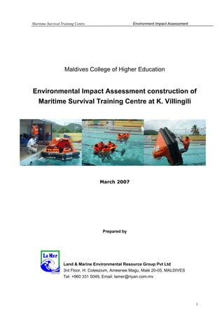
  • 1. Maritime Survival Training Centre Environment Impact Assessment Maldives College of Higher Education Environmental Impact Assessment construction of Maritime Survival Training Centre at K. Villingili March 2007 Prepared by Land & Marine Environmental Resource Group Pvt Ltd 3rd Floor, H. Coleezium, Ameenee Magu, Malé 20-05, MALDIVES Tel: +960 331 5049, Email: lamer@riyan.com.mv i
  • 2. Maritime Survival Training Centre Environment Impact Assessment TABLE OF CONTENTS A. EXECUTIVE SUMMARY ........................................................................................................................... 6 B. PROJECT DESCRIPTION ............................................................................................................................. 8 B.1 PURPOSE OF THE REPORT AND NEED FOR THE EIA .................................................................................... 8 B.2 PROCEDURE OF THE EIA ........................................................................................................................... 8 C. PROJECT DESCRIPTION ...........................................................................................................................11 C.1 PROJECT PROPONENT ..............................................................................................................................11 C.2 THE PROJECT ...........................................................................................................................................11 C.3 PROJECT LOCATION .................................................................................................................................12 C.4 NEED FOR THE PROJECT ..........................................................................................................................13 C.5 LOCATION AND EXTENT OF SITE BOUNDARIES ........................................................................................13 C.6 CONSTRUCTION PHASES AND SCHEDULE FOR IMPLEMENTATION ............................................................14 C.7 MAJOR INPUTS - CONSTRUCTION MATERIALS, METHODS AND PROCESSES ..............................................15 C.8 RISKS ASSOCIATED WITH THE PROJECT ...................................................................................................18 D. LEGAL AND ADMINISTRATIVE FRAMEWORK.......................................................................................19 D.1 ENVIRONMENT PROTECTION AND PRESERVATION ACT OF MALDIVES ...................................................19 D.2 BY LAW, CUTTING DOWN, UPROOTING, DIGGING OUT AND EXPORT OF TREES AND PALMS FROM ONE ISLAND TO ANOTHER ......................................................................................................................................19 D.3 THE NATIONAL BIODIVERSITY STRATEGY AND ACTION PLAN 2002......................................................20 D.4 INTERNATIONAL MARITIME ORGANIZATION (IMO) CONVENTION.........................................................21 D.4.1 International Convention on Standards of Training, Certification and Watchkeeping for Seafarers, 1978. Amendments made 1998, 2006......................................................................................22 D.4.1.1 Emergency, occupational safety, medical care and survival functions.......................................22 D.4.1.2 Special training requirements for personnel on certain types of ships .......................................26 E. EXISTING ENVIRONMENT.........................................................................................................................28 E.1 GENERAL SETTING - MALDIVES ...............................................................................................................28 E.2 GEOGRAPHIC LOCATION AND GENERAL SETTING OF K. VILLINGILI .......................................................29 E.2.1 Island Setting...................................................................................................................................29 E.2.2 Climatology .....................................................................................................................................30 E.3 BEACH ENVIRONMENT ............................................................................................................................40 E.4 MARINE ENVIRONMENT ..........................................................................................................................42 E.4.1 Introduction .....................................................................................................................................42 E.4.2 Methodology....................................................................................................................................42 E.4.3 Results and discussion.....................................................................................................................43 E.4.3.1 Reef benthos .................................................................................................................................43 E.4.3.2 Reef fish community .....................................................................................................................47 E.4.3.3 Invertebrates.................................................................................................................................49 E.4.3.4 Protected marine species .............................................................................................................49 E.4.3.5 Sea water quality..........................................................................................................................50 E.4.3.6 Terrestrial.....................................................................................................................................50 E.5 SOCIAL ENVIRONMENT ............................................................................................................................51 F. ENVIRONMENTAL IMPACTS AND MITIGATION MEASURES ...............................................................53 F.1 ACTIVITIES CAUSING ENVIRONMENTAL IMPACTS ....................................................................................53 F.2 IMPACTS DURING CONSTRUCTION ............................................................................................................53 F.2.1 Schedule, logistics and loading and unloading construction materials .........................................54 F.2.2 Construction materials and solid waste..........................................................................................55 F.2.3 Impacts due to construction methods ..............................................................................................56 F.2.4 Impact on vegetation .......................................................................................................................57 F.2.5 Impact on groundwater ...................................................................................................................57 ii
  • 3. Maritime Survival Training Centre Environment Impact Assessment F.2.6 Coastal structures ...........................................................................................................................58 F.2.7 Cumulative impacts .........................................................................................................................58 F.2.8 Social impacts, noise and air pollution...........................................................................................59 F.3 OPERATIONAL IMPACTS ...........................................................................................................................60 F.3.1 Social impacts..................................................................................................................................60 F.4 MITIGATION PLAN ...................................................................................................................................61 F.5 UNCERTAINTIES INVOLVED IN IDENTIFYING IMPACTS .............................................................................66 G. ALTERNATIVES ...........................................................................................................................................66 G.1 PROJECT LOCATION .................................................................................................................................66 G.2 DREDGING AND RECLAMATION METHOD ................................................................................................67 G.3 THE NO PROJECT SCENARIO .....................................................................................................................68 H. PUBLIC CONSULTATION ..........................................................................................................................69 I. MONITORING PROGRAM ...........................................................................................................................71 J. REFERENCES ...............................................................................................................................................73 K. ANNEXES .....................................................................................................................................................75 K.1 SCOPE OF WORK APPROVED BY MEEW (TOR).......................................................................................75 K.2 SCALED DRAWING SET ............................................................................................................................80 K.3 LANDUSE PLAN........................................................................................................................................91 K.4 PHOTO PLATES ........................................................................................................................................93 K.5 LETTER TO MINISTRY OF ENVIRONMENT, ENERGY AND WATER ............................................................99 iii
  • 4. Maritime Survival Training Centre Environment Impact Assessment LIST OF FIGURES Figure 1 Project layout (see Annex 2 for scaled drawings set) ___________________________________ 11 Figure 2 Edge of small finger like reclaimed process (left), cement pavement damaged over the years, this area was used by landing crafts (right) _____________________________________________________ 12 Figure 3 Project site location at K. Villingili _________________________________________________ 12 Figure 4 Project site boundaries, giving direct and indirect impact areas from excavation and dredging works ________________________________________________________________________________ 14 Figure 5 Geographic location of Villingili at north Male’ atoll___________________________________ 30 Figure 6 Wind rose plots for the four seasons in Male region (daily wind data for the years 2002 and 2003 obtained from Department of Meteorology, Maldives)__________________________________________ 32 Figure 7 Tidal recordings at Hulhule _______________________________________________________ 33 Figure 8 Spectral density graph for the tidal records presented in figure 7 _________________________ 34 Figure 9 Graphs showing the significant wave height and wave directions in the southern region of Maldives (source: DHI, 1999) ____________________________________________________________________ 35 Figure 10 Wave height, Hs, exceedence curves for southern region of Maldives (Source DHI, 1999) ____ 35 Figure 11 Global distributions of mean monthly values of the mean wave direction, for the months of January, April, July and October. Values are shown as direction vectors (from Young, 1999). __________ 37 Figure 12 Map showing the types of waves experienced at K. Villingili ____________________________ 38 Figure 13 Current measurements taken using drogues, recording interval at 30s ____________________ 39 Figure 14 Accretion of sand at the northern side of the project area and southern side of waste management area at Villingili (Photo taken during February 2007) _________________________________________ 41 Figure 15 Condition of the small beach strip observed at the northern side of the project area, erosion observed at the northern side, whilst accretion observed at the southern side close to project area (photo taken during February 2007) _____________________________________________________________ 41 Figure 16 Location of survey sites and seawater sampling sites at Villingili reef_____________________ 43 Figure 17 Reef substrate in the vicinity if the proposed development site. 95% confidence interval for each category is shown. n=3 __________________________________________________________________ 44 Figure 18 Generic composition of the live coral community _____________________________________ 45 Figure 19 Porites lobata colony observed at the southern western side of the reef (left), three species of butterfly fish was observed at survey sites, two species of butterfly as seen in this picture, Hemiturichthys zoster and Chaetodon melannotus _________________________________________________________ 46 Figure 20 Effects of shore-based fishing and mis-management of solid waste; dense mesh of monofilament line from high intensity shore based fishing (left) and fish waste disposed to the reef from a nearby semi industrial fish processing household. _______________________________________________________ 47 Figure 21 Reef slope highly degraded with little coral cover (left), Acanthurus leucosternon schooling at the reef edge in the vicinity of the project site (right)______________________________________________ 49 Figure 22 Dhiggaa, Funna and Maggoo observed along the small beach strip at the northern side of the project area ___________________________________________________________________________ 51 Figure 23 Waste dumped at the project area, semi industrial work related solid waste ________________ 56 iv
  • 5. Maritime Survival Training Centre Environment Impact Assessment LIST OF TABLES Table 1 Construction schedule for the Maritime Survival Training Centre __________________________ 15 Table 2 Inputs for the development project- construction and operational phase _____________________ 17 Table 3 Summary of four seasons in Maldives ________________________________________________ 30 Table 4 Table summarizing tide levels at Hulhule Island, Male Atoll. _____________________________ 33 Table 5 Fish census survey at the proposed project area________________________________________ 48 Table 6 Fish diversity and abundance at the study sites_________________________________________ 48 Table 7 Seawater quality parameter at the sampling location in the reef at Villingili. Data analysis was carried out by the National Health Laboratory, Maldives Food and Drug Authority. Report number PHL/RE/WC166 _______________________________________________________________________ 50 Table 8 Type and source of potential solid waste generated during construction stage ________________ 55 Table 9 Potential impacts during construction and operation of the development project and possible mitigation measures identified to minimize the impacts _________________________________________ 62 Table 10 Monitoring plan for the development project at Villingili reef system. ______________________ 71 Issue Issue date Summary th A 8 March 2006 First draft submitted to Maldives College of Higher Education B 13th March 2006 Revised Draft C 15th March 2006 Final report D E v
  • 6. Maritime Survival Training Centre Environment Impact Assessment A. EXECUTIVE SUMMARY Maldives College of Higher Education has proposed the development project outlined below in order to establish a Maritime Survival Training Centre, especially catering requirements of courses such as personal survival techniques and proficiency in survival craft and rescue boat training. This EIA is concerned with the dredging of a small harbour (40m by 22m) and land reclamation of area 3700m3. Dredged material excavated from the harbour basin deepening works will be used as filling material during reclamation. A sea wall (breakwater) will be constructed at the western side of the harbour area. At the time of field surveys and report compilation, the bidding process was on-going; therefore the consultants are not informed of a specific time period for the development works. However, according to the proponent construction works have to be completed within 6 months. Therefore this timeframe was taken into consideration to describe the environmental conditions inherent to the project site. The projected number of workers at peak construction time is expected to be 30 labourers. Accommodation of labourers could be in rented rooms or houses at Villingili or Male’. All construction related materials can be stored in the project site once the reclamation work is completed. There are two main types of potential impacts arising from the development of the proposed project site: short term impacts during the construction phase and impacts from irreversible modifications of the site. Long term negative impacts due proposed development are few and the magnitudes of these impacts are difficult to determine due to the time available to carry out appropriate field assessments. Furthermore, no information is available of the impacts associated with coastal modification works that have been already implemented in Villingili as part of various development projects (at the moment large scale coastal modification is observed at Villingili, commercial and ferry harbour, reclamation and seawall at the southern side and coastal protection in the form of a revetment or retaining wall at the south west corner of the island). 6
  • 7. Maritime Survival Training Centre Environment Impact Assessment The proposed site for the project appears to be suitable for the development, taking into account the environment, construction feasibility and economic values of the proposed development. No major impacts are predicted by the proposed development project. Minor impacts associated with the project are short-term (e.g. sedimentation) and due to the scale of the proposed activities and the nature of the habitat that would be impacted, the sedimentation impacts are considered insignificant. Hydrodynamics and coastal processes around the island may have already changed as a result of impacts associated with previous development works which are more significant and long-term (duration of the project) than the proposed project. Therefore, predicted coastal impacts associated with this project would be comparatively minor and insignificant. No major socio economic impacts were identified as a consequence of the project since no local people would be relocated. Furthermore, the land allocated for the project belongs to the state and there were no vegetation that may be privately owned. Despite negligible impacts associated with the project, appropriate monitoring of constructional activities will be part of the development strategy to further minimise any impacts identified. Furthermore the proposed monitoring would assist to mitigate any unforeseen impacts that may occur. 7
  • 8. Maritime Survival Training Centre Environment Impact Assessment B. PROJECT DESCRIPTION B.1 Purpose of the report and need for the EIA This document presents the findings of an Environmental Impact Assessment (EIA) for the construction of a Maritime Survival Training Centre at K. Villingili. The centre will have a harbour (40m in length, 22m in width) for life boat and emergency evacuation training. Part of the land allocated for the project has to be reclaimed. Estimated area of reclamation is 3700m2 (volume of dredged material required, 2856m3). Development projects are required to carryout EIA studies under the Environment Protection and Preservation Act of Maldives. The developer is required to obtain approval of the Ministry of Environment, Water and Energy prior to the implementation of any development activities on the island or on the reef system. Land and Marine Environmental Resource Group Pte Ltd (consultant) have been contracted by the Maldives College of Higher Education (client), to prepare the EIA and to provide assistance in other environmental related activities of the project. This EIA is thus prepared by the consultant is in accordance with Maldives Environmental Impact Assessment guidelines, and other relevant regulations and guidelines applicable to the proposed project. B.2 Procedure of the EIA All the development projects that have a socioeconomic relevance are required to submit an environmental impact report which forms the basis for project approval. As such projects are required to follow a screening process identifying the environmental impacts associated with the project. As the regulator, MEEW based on the impacts associated with project makes a decision on the nature of the report to be submitted. An EIA shall be submitted for projects with significant impacts whereas an IEE suits for projects without significant impacts. The screening process required to submit an EIA which requires an approval of the scope of work for the report in consultation with MEEW. In accordance to the regulations of Ministry of Environment, Energy and Water, a letter was send stating to the nature of the project and likely impacts associated. The study parameters stated in the letter will be used as the TOR for the EIA as agreed by the Ministry of Environment, Energy and Water (see Annex 1 for the letter). 8
  • 9. Maritime Survival Training Centre Environment Impact Assessment The project proponent revealed the project to the consultant before a site inspection was carried out to assess the conditions at the site and determine the potential impacts. Qualitative methods were used to determine the coastal processes and areas affected: qualitative methods to assess substrate types and cover on the areas concerned by the works, as well as downstream from this area. This study was complemented with both land and underwater photographs of the area in question. The following tasks were undertaken in carrying out the EIA study: Task 1. Description of the Proposed Project - Provide a full description of the overall project using plans, maps and graphic aids at appropriate scales. This is to include: project locations; general layout (size, capacity, etc.); land and lagoon areas selected for development, construction methodology (excavation works, wharf etc.), site management, operation and maintenance activities; plans for providing utilities, waste disposal, sewage treatment and other necessary services; and employment. Task 2. Description of the Environment - Describe the physical, ecological, demographic setting of the project. Survey and present information provides a detail assessment of the existing conditions of the site. Assemble, evaluate and present baseline data on the relevant environmental characteristics of the study area, including the following: a- Physical environment; reef line; depth measurements; seawater quality; climate and meteorology and coastal oceanography. b- Biological environment: flora and fauna of the terrestrial, coastal environment, and coral reef ecosystems around the island. Task 3. Legislative and Regulatory Considerations - Describe the pertinent environmental laws, regulations and standards governing harbour developments, environmental quality, health and safety, protection of marine and terrestrial flora and fauna, protection of endangered species, and construction of tourism facilities. 9
  • 10. Maritime Survival Training Centre Environment Impact Assessment Task 4. Determination of Potential Impacts – Identify the major issues of environmental concern and indicate their relative importance to the design of the project. Distinguish long-term and short-term impacts, construction and post-construction phase impacts. Identify the significant impacts and those that are cumulative, unavoidable or irreversible. Task 5. Mitigation and Management of Negative Impacts – Recommend feasible and cost-effective measures to prevent or to reduce the significant negative impacts to acceptable levels. Task 6. Development of a Monitoring Plan - Prepare the outline of a plan for monitoring the impacts of the project and the implementation of mitigating measures during construction and preconstruction. Task 7. Determination of Project Alternatives – Examine alternatives to the project including the no-action option. 10
  • 11. Maritime Survival Training Centre Environment Impact Assessment C. PROJECT DESCRIPTION C.1 Project Proponent Project proponent of the proposed project is Maldives College of Higher Education. The Maritime Survival Training Centre will be managed by the Centre for Maritime Studies. This centre is a faculty of Maldives College of Higher Education. C.2 The Project The proposed development project involves reclamation of land (2856 m3), dredging a small harbour (40m in length and 22m in width) for life boat evacuation and emergency jumping training (880 m3) and break water of 36m long and 6.9m wide will be constructed at the western side of the harbour area to protect the harbour. The Harbour area will be sheet piled. Entrance area will also be dredged to -4.5MSL. Class room and changing facilities will be built on the reclaimed land (see Annex 2 for the scaled drawings of the site, harbour and the buildings). Figure 1 Project layout (see Annex 2 for scaled drawings set) 11
  • 12. Maritime Survival Training Centre Environment Impact Assessment C.3 Project Location The island of Villingili is located on the southern periphery of K. Atoll, in the Maldivian Island chain (Figure 5). The project site is located at the western side of the Villingili south of the commercial harbour (Figure 3). The area was previously used as a boat yard for repairing works of vessels. Part of the vessel repair yard will be reclaimed under the proposed project. Furthermore, currently allocated commercial plots temporarily allocated to fish processors and other type of processors at cottage level falls within the allocated boundary. Alternative sites both for boat repair harbour and commercial plots have been identified by the Ministry of Housing and Urban Development (see Annex 3 for the land-use plan of Villingili demarcating the allocated land for the Maritime Survival Training Centre and alternative site for commercial plots; section E5). Figure 2 Edge of small finger like reclaimed process (left), cement pavement damaged over the years, this area was used by landing crafts (right) Figure 3 Project site location at K. Villingili 12
  • 13. Maritime Survival Training Centre Environment Impact Assessment C.4 Need for the Project The centre of Maritime Studies conducts various types of seamanship trainings. The faculty for Maritime Studies is mandated with training seafarers to internationally required qualities and efficiency. These training programs have to comply with the requirements of IMO conventions on Standard of Training, Certification and Watchkeeping (STCW). Among the trainings, personal survival techniques and proficiency in survival craft and rescue boat training needs a water tank or pool to conduct the training with safety to trainees. For the above mentioned trainings, emergency evacuation training consists of abandoning vessels (jumping off) during a fire related or similar scenario. For this training a pool constructed inland would be considerably deep, which will have lots of maintenance problems (e.g. flushing, filtration). The easiest way would be to have a harbour like enclosure that has a depth of 4-4.5m. Since the training involves simulation of real event the participants have to jump from a tower that has similar height as a cargo or similar class vessel. Also since Maldives has signed the IMO convention, the government focal point has to provide the trainings for its international and national commercial seafarers. Shipping is a competitive and high-tech international industry; therefore it is imperative that Maldives train its seafarers to international standards to keep pace with other countries. C.5 Location and extent of site boundaries The proposed Maritime survival Training Centre will be located at the western side of the island, south of the commercial harbour close to the now abandoned vessel repair yard (Figure 2, 3). The area has already been modified over the years; the proposed site is also part of a reclaimed portion of Villingili. Project boundaries are defined by the dominant current flow (tidal currents) experienced at the area. Strong tidal currents are experienced at channels near Male’ (Gaadhoo kolu, channel between Male’ and Villingili and Channel between Villingili and Gulhifalhu). Direct impact area for the proposed project is the immediate project area, whilst the indirect impact areas are northern and southern side of the project area (Figure 4). 13
  • 14. Maritime Survival Training Centre Environment Impact Assessment Figure 4 Project site boundaries, giving direct and indirect impact areas from excavation and dredging works C.6 Construction phases and schedule for implementation At the time of field surveys and report compilation, the bidding process was on-going; therefore the consultants are not informed of a specific time period for the development works. However, according to the proponent construction works have to be completed within 6 months. Therefore this timeframe was taken into consideration to describe the environmental conditions inherent to the project site. Wind, wave and current related impacts were assessed for both northeast and southwest monsoon to reflect the duration of the construction phase. Work schedules of similar dredging and excavation projects were used by the consultants to draw up a work schedule for the proposed project (harbour development at various islands in Maldives). According to the project 14
  • 15. Maritime Survival Training Centre Environment Impact Assessment proponent they estimate 2-3 months for dredging and reclamation works. After that the sheet piling and levelling works will be done. After completion of the dredging and reclamation works, the sea wall protecting the harbour area will be constructed. After the levelling works is finished construction of davits, jumping platforms and class room facility will be initiated. Table 1 Construction schedule for the Maritime Survival Training Centre Work schedule for harbour construction No. Description 2007 February March April May June July August September October 1 Bidding 2 Mobilization 3 Excavation and dredging works 4 Sheet piling, inside and outside 5 Construction of sea wall 6 Construction of Devits and platforms Construction of class room and 7 changing facility 8 Demobilazation C.7 Major inputs - Construction materials, methods and processes At the time of this study, the bid hasn’t been awarded to a contractor yet; therefore method of excavation or dredging is not informed to the consultants. Therefore projects of similar nature were used to assess suitable methods that could be used for the proposed project. Due relatively small dredging and excavation involved in the project, most economical method would be to use excavators. One excavator will be enough to do the reclamation and dredging works. 2-3 trucks and bulldozer have to be used for levelling the ground. Sheet piling can be done either using the excavator with a hammer or crane with driving equipment. For the construction of seawall, a crane loaded on to a barge will be used. The rocks for the seawall construction will be loaded on to the barge for their deployment. Since the project location is at an inhabited island, constructing temporary accommodation isn’t required, but temporary storage shed may have to be built. Method and location of accommodating construction workforce depends on the contractor; either in Malé where the workforce can commute daily to the work site or in Villingili in rented accommodation. 15
  • 16. Maritime Survival Training Centre Environment Impact Assessment Major input of the proposed project is reclamation of 3700m2 area of land (volume 2856m3) and dredging of a harbour 40m in length and 22m in width to a depth of -4.5m (MSL). The dredged material removed (880 m3) during harbour basin excavation will be use as filling during reclamation. At present the entrance and entrance channel of the harbour for the proposed project has depth of -2.1m (MSL) and is sandy (probably dredged during construction of the temporary vessel repair yard). Materials needed for the proposed project can be brought to the site either using the existing commercial harbour north of the site. Trucks or lorries can be used to transport the material to the site. The materials can be stored on the reclaimed land. Rocks for the sea wall can be brought to the site on a barge. Since the construction of davits, platform and class room facilities will be initiated after the reclamation and dredging works, the harbour constructed under the project can also be used for downloading the construction materials. Since the bid is not awarded to a contractor, the number of labourers to be stationed at project site has not been brought to the knowledge of the consultants. Therefore work force used in similar projects is used to estimate the number of workers used during the peak period of construction. For the reclamation and dredging works total of 10 workers could be used (including heavy machine and equipment operators), for the sea wall construction 6 workers and for the rest around 30 workers. Electricity for the construction site can be met by portable generator sets or pubic electricity grid of Villingili. In case portable generator sets are used, fuel has to be stored in barrels on land. No groundwater will be used for the construction works, since it is not recommended by the environmental consultants and project consultants. Therefore freshwater will be brought to the site on tanks (plastic tanks of volume 3000-5000liters). The sewage out lets from the toilets in the changing room will be connected to the Villingili sewerage grid. Detail drawings of the harbour, seawall, and class rooms are given in Annex 2. 16
  • 17. Maritime Survival Training Centre Environment Impact Assessment Table 2 Inputs for the development project- construction and operational phase Input resource(s) Type Method of purchase/obtain Construction 20-30 Construction By bidding and Phase workers and laboures (at Local, foreign announcement in local peak) newspapers Harbour: Bolts, nuts, angles, sheetpiles, bollards, tires, GI pipes, metal rods paving blocks Sea wall: 3 class rocks (amour rocks, filter stones) Davits, platforms: Cement, rods, GI pipes, nuts, bolts, machine screws, river sand, aggregate, timber, paving rocks, Purchase locally (depend on Construction material nails the contractor) Class room and changing facility: electrical cables and wires, DBs and MCBs, PVC pipes, light weight, telephone cable CAT 5, PVC conduits, floor and wall tiles, gypsum boards, calcium silicate boards, zinc coated corrugated metal roof, paint, varnish, lacquer, thinner, timber, nails, bolts, screws etc Purchase from MWSC at Fresh water Desalinated water, Villingili Diesel generators (depending on Electricity/Energy Depends on contractor contract) or Villingili electrical grid Energy efficient machinery and lighting; Electrical ozone-friendly refrigerators (class room Local suppliers appliances/machinery and changing facility) Import or local supply/ Local Fire pumps, Fire protection system, companies will be contracted Fire fighting equipment Smoke detectors; Carbon dioxide and for maintenance of Foam fire extinguishers. equipment (depends on project proponent) Operational Depends on the Project 5-6 staff Local phase proponent Timber, wooden shingles for roof, Depends on Project Maintenance material electrical cables, electrical appliances, proponent (maintenance paint work awarded by bidding) Fresh water Desalinated water for 8 toilets Villingili water grid (MWSC) For class room, changing facility and Electricity/Energy Villingili electrical grid harbour PABX system, fax machines, e-mail Local suppliers (depends on Telecommunications and internet facilities project proponent) 17
  • 18. Maritime Survival Training Centre Environment Impact Assessment C.8 Risks associated with the project Major risks associated with the project are damage to the marine environment due to sedimentation by excavation and construction works. Chronic impacts such as this are cumulative and long term. Coastal modification involved by this proposed project may have some impacts on the littoral movement of the island. At present significant coastal modifications have already been carried out at K. Villingili, therefore hydrodynamic and littoral impacts by this project is likely to be significantly less compared to the large scale modifications made at the northern side and southern side (e.g. commercial harbour, Ferry harbour, reclamation and seawall at southern side). Since the site is located in between two man made features, the commercial harbour at northern side and revetment wall and breakwaters at the southern side, the site is effectively between two terminal groynes trapping the sediment in between creating a small beach. Therefore impacts on sediment movement by the proposed coastal modification are likely to be minor, if any. Damage to live coral is inevitable in development projects such as these. Major impacts are likely from sedimentation and smothering of live coral and other benthic organisms (close to the harbour basin and indirect impact areas, southern and northern side of the project area). In terms of social impacts, noise pollution at the excavation and construction site will be an issue. But considering this, at present a number of construction works are underway at Villingili. Heavy vehicles operating in the area may cause public safety issues. To counter this, the project area has to be closed by a fence. 18
  • 19. Maritime Survival Training Centre Environment Impact Assessment D. LEGAL AND ADMINISTRATIVE FRAMEWORK This section outlines the relevant international convections and environmental legislation pertaining to the development under study for the construction of Maritime Survival Training Centre at K. Villingili. D.1 Environment Protection and Preservation Act of Maldives The Environmental Protection and Preservation Act of Maldives (Law no: 4/93) is concerned with the natural environment and its resources as a national heritage that need to be protected and preserved for future generation, taking in consideration land, water resource, flora, fauna, beaches, reefs, lagoons and all the natural resources. Major components of this law include environmental impact assessments prior to developmental projects that are likely to have significant impact to the environment. It also refers to specific procedure that should be followed with regard to waste disposal, oil and poisonous substances. Furthermore, hazardous, toxic and nuclear waste cannot be disposed in territorial water of Maldives and any trans-boundary movement of such material shall obtain prior permission if it is shipped through Maldives. Under Article 5 (a) of this law, an Environmental Impact Assessment has to be submitted by the developer of a project which may have potential impacts on the environment, to the Ministry of Environment, Energy and Water (MEEW) for approval before commencement of project. The development of all new resorts is outlined as such a project in the MEEW guidelines. D.2 By Law, Cutting down, uprooting, digging out and export of trees and palms from one island to another In pursuant to law number 4/93 (Environment Protection and Preservation Act of Maldives 1993), the Ministry of Environment, Energy and Water has made a by law with the purpose of educating developers about the 19
  • 20. Maritime Survival Training Centre Environment Impact Assessment importance of trees including best management practices for maintaining trees and provide standards fro preservation of trees in the Maldives and set down rules and regulations to be adhered to prior to commencing felling, uprooting, digging out and exporting of trees and palms from one island to another in Maldives. The by law states that the cutting down, uprooting, digging out and export of trees and palms from one island to another can only be done if it is absolutely necessary and there is no other alternative. It further states that for every tree or palm removed in the Maldives two more should be planted and grown in the island. The by law prohibits the removal of the following tree types; • The coastal vegetation growing around the islands extending to about 15 meters into the island are protected by this by law; • All the trees and palms growing in mangrove and wetlands spreading to 15 meters of land area is protected under this by law; • All the trees that are in a Government protected area; • Trees that are being protected by the Government in order to protect species of animal/organisms that live in such trees; • Trees/palms that is abnormal in structure D.3 The National Biodiversity Strategy and Action Plan 2002 The national Biodiversity Strategy and Action Plan (NBSAP) is, in many ways, an environmental protection strategy and action plan. It establishes a number of pertinent guiding principles sets three focussed goals and adopts a number of wide-ranging policies and targets. This brief review identifies those elements of the NBSAP which are essentially relevant to the present project. One guiding principle established by the NBSAP is very relevant to coastal projects in general, viz. “While socio-economic development is essential, it cannot be achieved at the cost of the environment. Ecological sustainability must be a major goal in the national development”. Likewise, the following policy statements must be borne in mind when designing coastal development projects: 20
  • 21. Maritime Survival Training Centre Environment Impact Assessment • Restrict coastal development projects such as ports only to island that have been identified in the national/regional development plan. • Discourage dredging/excavation of small harbour basins for every inhabited island by encouraging the use of natural harbours (vilu) and by seeking alternative means, such as jetties to access the islands. • Retain a shoreline vegetation buffer zone when allocating land for new housing zones or plots and other physical development activities in the inhabited islands. • Prohibit the use of coral for building coastal protection such as seawalls and promote use of alternative materials D.4 International Maritime Organization (IMO) Convention Maldives joined International Maritime Organization of United Nations in 1967. IMO convention on Standards of Training, Certificates and Watchkeeping of Seafarers was developed in 1978. The IMO convention on Standards of Training, Certification and Watchkeeping of Seafarers entered in to full was on 1st February 1997 with the 1995 amendments which completely revised the convention. The 1978 STCW Convention was the first to establish basic requirements on training, certification and watchkeeping for seafarers on an international level. Previously the standards of training, certifications, and watchkeeping of officers and rating were established by individual governments, usually without reference to practices in other countries. As a result standards and procedures varied, even though shipping is the most international of all industries. The Convention prescribes minimum standards relating to training, certification and watchkeeping for seafarers which countries are obliged to meet or exceed. The Convention did not deal with manning levels: IMO provisions in this area are covered by a regulation in Chapter V of the International Convention for the Safety of Life at Sea (SOLAS), 1974, whose requirements are backed up by resolution A.890(21) Principles of safe manning, adopted by the IMO Assembly in 1999, as amended by 21
  • 22. Maritime Survival Training Centre Environment Impact Assessment Resolution A.955(23) Amendments to the Principles of Safe Manning (Resolution-A.890(21)). The Articles of the convention include requirements relating to issues surrounding certification and port state control. One especially important feature of the Convention is that it applies to ships of non-party States when visiting ports of States which are Parties to the Convention. Article X requires Parties to apply the control measures to ships of all flags to the extent necessary to ensure that no more favourable treatment is given to ships entitled to fly the flag of a State which is not a Party than is given to ships entitled to fly the flag of a State that is a Party. While Article VI requires flag States to ensure that seafarers hold certificates, Article X provides an enforcement mechanism by allowing Port States to verify that seafarers serving on board hold any required certificates, and to detain a ship when certain officers are not properly certificated. The port control aspects of STCW are discussed in more detail in section 4 of this handbook, under the heading "Regulation I/4 - Control Procedures." D.4.1 International Convention on Standards of Training, Certification and Watchkeeping for Seafarers, 1978. Amendments made 1998, 2006 D.4.1.1 Emergency, occupational safety, medical care and survival functions Regulation VI/l Familiarization and basic safety training and instruction for all seafarers: The requirements in this regulation are divided into two categories. The details are specified in section A-VI/l of the STCW Code, and the required training or instruction must be provided before the seafarer concerned is assigned any shipboard duties. All seafarers (i.e., persons who are working on the ship and are not classified as passengers) must receive either (i) approved training in personal survival techniques, based on table VI/l-l; or (ii) sufficient information and instruction to be able to take steps in an emergency to respond quickly, properly and safely. A checklist of these skills is set out 22
  • 23. Maritime Survival Training Centre Environment Impact Assessment in Section A-VI/l of the STCW Code. All seafarers who are working on the ship as part of the complement involved in manning, watchkeeping, emergency response training or instruction in four areas: personal survival; fire prevention and fire-fighting; elementary first-aid; and personal safety and social responsibilities. The standards of competence for these areas are set out in four-column tables in Section AVI/1 of the STCW Code. Seafarers subject to this training requirement must provide evidence of achieving or maintaining the standard of competence within the previous five years of being assigned shipboard duties. Except in respect of seafarers on passenger ships of over 500 gross tons on international voyages, and tankers, specific training requirements may be modified to suit a ship’s size and the length or character of its voyage. Regu1ation VI/2 - Proficiency in survival craft rescue boats and fast rescue boats: Under this regulation, a candidate for a certificate of proficiency in survival craft and rescue boats must (a) meet a minimum age requirement, (b) have approved seagoing service or a combination of approved training and seagoing service; and (c) meet the relevant standard of competence set out in Section AVI/2 of the STCW Code. A four-column table is provided in that section of the code. (This section of the code is referred to in the standard of competence in Chapters II and III, under the function of controlling the operation of the ship and care for persons on board at the operational level.) In addition to meeting the requirements described in the previous paragraph, a candidate for a certificate of proficiency in fast rescue boats must (a) attend an approved training course; and (b) meet the relevant standard of competence set out in a four-column table in Section A-VI/2 of the STCW Code. Regulation VI/3 - Training in advanced fire-fighting: Those responsible for controlling fire-fighting operations on seagoing ships must (a) complete advanced training in techniques for fire-fighting, with an emphasis on organization, tactics and command, and (b) meet the standard of competence set out in the four-column table in Section A-VI/3 of the STCW Code. Unless this training is already included as a qualification for a certificate (as it is for certain operational level certificates under Chapter II and III), the seafarer concerned is to be issued documentary evidence of having attended the training. 23
  • 24. Maritime Survival Training Centre Environment Impact Assessment Seafarers subject to this training requirement must provide evidence of achieving or maintaining the standard of competence within the previous five years of being certificated. Regulation VI/4 - Requirements relating to medical first-aid and medical care: Those responsible for "providing" medical first-aid on seagoing ships must meet the standard of competence in medical first aid as set out in the four-column table in Section A-VI/4 of the STCW Code. This standard, which is higher than elementary first aid, must be met by officers at the operational level under Chapters II and III. The master must be able to organize and manage the provision of medical care on board under Table A-II/2. Those designated to take charge of medical care on seagoing ships must meet the standard of competence in medical care as set out in the four- column table in Section A-VI/4 of the STCW Code. Unless this training is already included as a qualification for a certificate (as it is for a management level certificates under regulation 11/2), the seafarer concerned is to be issued documentary evidence of having attended the appropriate training. Except in respect of seafarers on passenger ships of over 500 gross tons on international voyages, and tankers, specific training requirements may be modified to suit a ship’s size and the length or character of its voyage. Regu1ation VI/2 - Proficiency in survival craft rescue boats and fast rescue boats: Under this regulation, a candidate for a certificate of proficiency in survival craft and rescue boats must (a) meet a minimum age requirement, (b) have approved seagoing service or a combination of approved training and seagoing service; and (c) meet the relevant standard of competence set out in Section AVI/2 of the STCW Code. A four-column table is provided in that section of the code. (This section of the code is referred to in the standard of competence in Chapters II and III, under the function of controlling the operation of the ship and care for persons on board at the operational level.) In addition to meeting the requirements described in the previous paragraph, a candidate for a certificate of proficiency in fast rescue boats must (a) attend an approved training course; and (b) meet the relevant 24
  • 25. Maritime Survival Training Centre Environment Impact Assessment standard of competence set out in a four-column table in Section A-VI/2 of the STCW Code. Regulation VI/3 - Training in advanced fire-fighting: Those responsible for controlling fire-fighting operations on seagoing ships must (a) complete advanced training in techniques for fire-fighting, with an emphasis on organization, tactics and command, and (b) meet the standard of competence set out in the four-column table in Section A-VI/3 of the STCW Code. Unless this training is already included as a qualification for a certificate (as it is for certain operational level certificates under Chapter II and III), the seafarer concerned is to be issued documentary evidence of having attended the training. Seafarers subject to this training requirement must provide evidence of achieving or maintaining the standard of competence within the previous five years of being certificated. Regulation VI/4 - Requirements relating to medical first-aid and medical care: Those responsible for "providing" medical first-aid on seagoing ships must meet the standard of competence in medical first aid as set out in the four-column table in Section A-VI/4 of the STCW Code. This standard, which is higher than elementary first aid, must be met by officers at the operational level under Chapters II and III. The master must be able to organize and manage the provision of medical care on board under Table A-II/2. Those designated to take charge of medical care on seagoing ships must meet the standard of competence in medical care as set out in the four- column table in Section A-VI/4 of the STCW Code. Unless this training is already included as a qualification for a certificate (as it is for a management level certificates under regulation 11/2), the seafarer concerned is to be issued documentary evidence of having attended the appropriate training. 25
  • 26. Maritime Survival Training Centre Environment Impact Assessment D.4.1.2 Special training requirements for personnel on certain types of ships Regulation V/1 - Training and qualification of masters, officers and ratings on tankers: Under this regulation, certificates must be issued in respect of two levels of training for three types of tankers. Officers and ratings who are assigned specific duties and responsibilities related to cargo or cargo equipment on tankers must (a) complete an approved shore based fire-fighting course (b) receive basic safety training as required under regulation VI of Chapter VI (discussed in section 9 of this handbook); and (c) either (i) complete at least three months of approved seagoing service on tankers in order to acquire knowledge of safe operational practices; or (ii) complete an approved tanker familiarization course covering the syllabus given in section A-V/i of the STCW Code. Masters, chief mates, chief engineer officers, and second engineer officers, as well as any other person who has immediate (supervisory) responsibility for loading, discharging and care in transit or handling of cargo, must, in addition to the requirements identified in the previous paragraph, have experience on the particular type of tanker on which they serve (in other words, oil, chemical or liquefied gas tanker), and complete an approved specialized training program covering the subjects listed in section A-V/i of the STCW Code for the type of tanker concerned. Regulation V 2 - Training and qualification of masters, officers and ratings and other personnel on ro-ro passenger ships: For purposes of this regulation, the term ‘ro-ro passenger ship" is defined in regulation III as meaning a passenger ship with roll on – roll off cargo spaces or special category spaces as defined in SOLAS, as amended. Regulation V/2 only applies to masters, officers and crew serving on ro-ro passenger ships engaged on international voyages. However, flag States are obligated to determine the extent to which the requirements in the regulation should apply to personnel serving on ro-ro passenger ships engaged on domestic voyages. The regulation requires personnel on ro-ro passenger ships to have specialized training, as outlined in section A-V/2 of the STCW Code, in areas such as crowd management, operational limitations of the ship, procedures for opening and closing hull openings, special emergency 26
  • 27. Maritime Survival Training Centre Environment Impact Assessment procedures to prevent ingress of water on vehicle decks, loading and embarkation procedures, and crisis management. Refresher training is required at least every five years. Flag States are to ensure that documentary evidence of the completed training is issued to every person found qualified under the regulation. 27
  • 28. Maritime Survival Training Centre Environment Impact Assessment E. EXISTING ENVIRONMENT E.1 General setting - Maldives The Maldives archipelago consists of a double chain of coral atolls, 80 – 120km wide stretching 860km from latitude 7° 6’ 30” N to 0° 41’ 48” S and longitude 72° 32’ 30 E to 73° 45’ 54” E (Ministry of Construction and Public Works, 1999). The double chain of Maldivian atolls lies on the parallel submarine ridges in the central part of Indian Ocean known as Laccadive- Chagos ridge. The archipelago comprises 25 atolls (Naseer, 2004) grouped into 20 administrative units. The atolls are separated by east-west running deeper channels. The atolls vary in shape from circular and oval to elliptical. The atolls contain 1190 islands, of which only 198 are inhabited. The total reef area of Maldives is 4,493.85km2 while the total land area is 227.45km2 (Naseer, 2004). Approximately 80% of Maldivian land area is less than 1m above mean sea-level. The characteristics of reefs and coral islands of the Maldives vary considerably from north to south. The atolls to the north are broad banks discontinuously fringed by reefs with small coral islands and with numerous patch reefs and faros (the word faros is derived from the Maldivian word “faru”) in the lagoon. To the south the depth of atoll lagoon increases, faros and patch reefs are rare in the lagoon, the continuity of the atoll rim is greater and a large proportion of the perimeter of the atolls is occupied by islands (Woodroffe, 1992). The islands have shallow reef flats on their seaward side, some with shingle ramparts at the seaward limit of the reef flat. The islands and the shingle ramparts owe their origin to the deposition of shingle or coral debris during storms. A number of islands can be found on a single reef. These islands may be separated by shallow passages that run across the reef flat. The width of some of these passages could be less 100m while some passages are over few hundred meters wide. 28
  • 29. Maritime Survival Training Centre Environment Impact Assessment E.2 Geographic Location and General Setting of K. Villingili E.2.1 Island Setting The island of Villingili lie at coordinates 73°29.1’E and 4°10.4’ N which lies on the southern periphery of North Male Atoll (Figure 5). To the west at about 1km from Villingili is Gulhifalhu, which is a round shaped faro and to the east of Villingili is the island of Male. The typical depth within North and South Male Atolls is about 45 – 50m. Vaadhoo Kandu to the south of Villingili that separates North and South Male Atoll is a relatively deep channel. This channel has an average depth of about 400m and a width of about 10Km. This channel is well known to be a rough channel during the southwest monsoon. The reef system accommodating the island of Villingili has an area of approximately 0.563 km2. The reef flat on the southern and eastern sides of the island is shallower than the northern side reef flat. The southern side reef flat is typical of an ocean ward reef flat of the islands of Maldives. The near- shore environments of Villingili are composed of coralline and other bioclastic skeletal material derived from the reef. The sediments in this environment are predominantly coral fragments, calcareous algae (Halimeda) and foraminiferans. Coral predominates in coarser fraction while the sandy fraction is mainly Halimeda and foraminifera. The major forces, which produce sediment on the reef, are storm waves and waves driven by monsoon winds. Tidal and wave driven currents play a significant role in the transport of sediment. A large area of the islands limited reef flat area has been modified to cater for the needs of the population on the island. As such almost the entire reef flat area on the northern side of the island has been dredged to create small harbours (ferry and small commercial harbour). A large area of the reef flat on the southern side of the island has also been reclaimed in association with the development of the harbour in 2003. The extent of the reclamation reaches almost up to the reef edge. The ocean-ward extent of this reclaimed land is protected with a rubble mound revetment. 29
  • 30. Maritime Survival Training Centre Environment Impact Assessment Figure 5 Geographic location of Villingili at north Male’ atoll E.2.2 Climatology The local Maldivians divide the climate of the Maldives into four monsoon periods that are characterised by very different wind climate, rain fall. These four seasons are (Table 3) the NE monsoon (Iruvai moosun), Transitonal period from NE monsoon to SW monsoon (Hulhangu halha), SW monsoon (Hulhangu moosun) and Transtional period from SW monsoon to NE monsoon (Iruvai halha). Table 3 Summary of four seasons in Maldives Season Month December NE-Monsoon January (Iruvai moosun) February Transition Period 1 March (Hulhangu halha) April 30
  • 31. Maritime Survival Training Centre Environment Impact Assessment May June SW-Monsoon July (Hulhangu moosunAugust September Transition Period 2 October (Iruvai halha) November Generally the SW monsoon generates westerly winds and the seas are rough and the period is wetter than the NE monsoon. The NE monsoon in the Maldives archipelago is marked by north-northeast winds (Woodroffe, 1992) which are generally lighter and the period is dryer. Storms and gales are infrequent in this part of the globe and cyclones do not reach as far south as the Maldives archipelago (Ministry of Construction and Public Works, 1999). For detail analysis of wind patterns for the four seasons daily wind data for the years 2002 and 2003 for Male have been studied. The summary of these analysis indicate the winds in the central regions of Maldives is predominantly westerly and north easterly (Figure 6). The analysis also indicates that there is almost no wind from the quadrant between East and South. Analysis of the wind data for the four seasons (Figure 6) indicate that the during NE monsoon the wind is predominantly from ENE with wind speeds reaching as high as15 – 20 knots for 8% of this period (3 months). For up to 41% of the time the wind speed reaches 10 – 15 knots. During Hulhangu halha (2 months) wind direction varies between SW – E. The predominant wind direction during this period remains between ENE and E. The maximum wind speed reached during this period is 14knots. For up to 11% of this period the wind speed reaches over 10knots. For 43% of the time the wind speed is between 5 and 10knots. During SW monsoon (5 months) the wind direction is distinctly from W and WNW. Up to 8% of this period the wind speed reaches between 15 and 20knots. For 28% of the time the wind speed reaches between 10 and 15knots. For 51% of the time the wind speed is between 5 and 10knots. During the transitional period from SW monsoon to NE monsoon (2 months) the predominant wind direction remains westerly. For up to 26% of the time wind speed reaches between 15 and 20knots, 22% of the time the wind speed is between 10 and 15knots, 48% of the time the wind speed reaches between 5 and 10knots. These results have been confirmed by Kench and Brander, 2005 to be consistent with the mean long term trend in the wind climate in the central region of the Maldives. 31
  • 32. Maritime Survival Training Centre Environment Impact Assessment All seasons NE monsoon Hulhangu Halha (T1) SW monsoon Iruvai Halha (T2) Figure 6 Wind rose plots for the four seasons in Male region (daily wind data for the years 2002 and 2003 obtained from Department of Meteorology, Maldives) 32
  • 33. Maritime Survival Training Centre Environment Impact Assessment E.2.2.1 Tide Tides experienced in the Maldives are mixed semi-diurnal and diurnal with a strong diurnal inequality. A tide station at Male International Airport has continuous records of tide for over the past 30 years. The maximum tidal range recorded at this tide station is 1.20m. The highest astronomical tide level is +0.64m (MSL) and the lowest astronomical tide level is -0.56m (MSL) (Table 4). Due to close proximity of the permanent tide station at Male International Airport (Hulhule) it was assumed that the tidal signal at Hulhule will be the same as that at Villingili. Therefore the tidal datum for Hulhule applied at Villingili. Table 4 Table summarizing tide levels at Hulhule Island, Male Atoll. Tide level Water level referred to Mean Sea Lev (MSL) (m) Highest Astronomical Tide (HAT) +0.64 Mean Higher High Water (MHHW) +0.34 Mean Lower High Water (MLHW) +0.14 Mean Sea Level (MSL) 0.0 Mean Higher Low Water (MHLW) -0.16 Mean Lower Low Water (MLLW) -0.36 Lowest Astronomical Tide (LAT) -0.56 Figure 7 Tidal recordings at Hulhule 33
  • 34. Maritime Survival Training Centre Environment Impact Assessment Figure 8 Spectral density graph for the tidal records presented in figure 7 E.2.2.2 Waves Information on the swells around Maldives is limited, but there have been a few studies carried out around Male and Fuahmulah (southern region of Maldives). Wave data for Male that were recorded for the period between June 1988 and January 1990 revealed that the maximum significant wave height (Hs) recorded for the month of June 1989 was 1.23m with a mean period (Tm) of 7.53s. For the month of July 1989 maximum recorded Hs was 1.51m and the corresponding Tm was 7.74s. In June and July 1989 mean wave periods were 5.0 – 9.0s and the peak wave periods within 8.0 – 13.0s. Wave data for the period between September 1988 and July 1989 shows a probability of exceedance of Hs = 1.0 m was approximately 0.1 and of Hs = 1.5 m was approximately 0.0015 based on the wave data of period September 1988 to July 1989. JICA, (1992) reported that the wave climate in Male region is generally higher in the months of June, July and August with a predominant wave direction of S (180o). During October-December the waves have a shorter period with wave directions varying from S and W (180o -270o) (Figure 9). 34
  • 35. Maritime Survival Training Centre Environment Impact Assessment Figure 9 Graphs showing the significant wave height and wave directions in the southern region of Maldives (source: DHI, 1999) According to DHI, (1999) the significant wave height (Hs) in the southern regions of Maldives exceeds 3m in about 0.1percent of the time (Figure 10). Figure 5 also shows that the highest waves are from W and S. From NW, N, NE and E, significant wave height exceeds 1m in less than about one per cent of the time. Figure 10 Wave height, Hs, exceedence curves for southern region of Maldives (Source DHI, 1999) 35
  • 36. Maritime Survival Training Centre Environment Impact Assessment Deepwater wave information for the region obtained from global wave climate data indicates that the dominant swell approaches Maldivian archipelago from southerly quarters (Young 1999) (Figure 10). On a seasonal basis, swell is from the south-southwest from March to October with a peak significant wave height (Hs) of 1.8 m in July, and from the southeast from November to February with a minimum mean Hs of 0.75 m in March. During the field visit, monsoonal wind generated waves were experienced at the western side of the island. Wind direction during field surveys was north eastern direction. Since the commercial harbour is located at the northern side, the project area is considerably sheltered. Since the weather was calm during the field visit, wave action at Vaadhoo channel was low. During the south west monsoon, wind direct will be from south west to west. The presence of large ring reef, Gulhi falhu protects the western side of Villingili. But during rough weather swell induced waves break off at the south western corner of Villingili reef. During the south west monsoon the project site will be sheltered. Diffracted waves hitting the southern corner of Villingili channel may create circular currents at the southern side of the Villingili channel (see figure 12 for general wave direction for K. Villingili). 36
  • 37. Maritime Survival Training Centre Environment Impact Assessment Figure 11 Global distributions of mean monthly values of the mean wave direction, for the months of January, April, July and October. Values are shown as direction vectors (from Young, 1999). 37
  • 38. Maritime Survival Training Centre Environment Impact Assessment Figure 12 Map showing the types of waves experienced at K. Villingili 38
  • 39. Maritime Survival Training Centre Environment Impact Assessment Figure 13 Current measurements taken using drogues, recording interval at 30s 39
  • 40. Maritime Survival Training Centre Environment Impact Assessment Current measurements at the western side and southern side of the island, using a drogue that was tracked with a DGPS system provided limited information on the current pattern at the project location (figure 13). These data indicated that the current at the project location is driven by the wind generated waves and tidal currents flowing through the Villingili channel and Vaadhoo channel. At the time of drogue tracking exercise the tidal current was flowing out of the atoll lagoon. This is recorded by the tracks, during a mid tide, as a slow mowing current at a maximum speed of 0.17m/s. But at the central area of the channel, currents created by waves at the Vaadhoo channel breaking at the south eastern corner of Gulhi falhu, creates a wirl pool current (area where both currents meet). Current measurements taken at the Vaadhoo channel close to the Villingili channel entrance recorded currents speed at a maximum 0.57m/s. Waves converging to shallow reef slope area creates a current at slow speed of 0.29m/s. This current then moves into the channel, where it meets the current generated by the wind waves and tide flux. E.3 Beach Environment Significant alterations and modifications have been made to the Villingili shoreline over the past several years. Among the modifications, the ferry terminal at the north eastern side of the island, Commercial harbour at northern western side of the island, reclamation and seawall at southern side have significantly impacted the beach environment of Villingili. A somewhat modified stretch of beach (partly replenished beach suing sediments from a previous reclamation project) in the proximity of the project is at the northern south of the commercial harbour. This beach is relatively stable in the area because; the commercial harbour wall and vessel repair yard acts as two terminal groynes trapping the sediments with little change to the shoreline due to alternating monsoons. During the north east monsoon the beach accumulates at the vessel harbour/boat repair area. During south west monsoon the beach accumulates at the commercial harbour area (figure 14, 15). At the time this survey (north east monsoon) the beach is accumulated at vessel harbour/boat repair end. The sediment movement at the southern side of Villingili is also obstructed trapped in between two man-made coastal structures. The revetment wall of waste management area and the coastal protection constructed at the south 40
  • 41. Maritime Survival Training Centre Environment Impact Assessment eastern side (granite rock composed break water). During north east monsoon sediment accumulates at the waste management site area, whilst during the south west monsoon this sand is transported to the reclaimed bay like area at the southern side (see annex 3 to identify various locations). At present a natural beach is formed on the eastern side of the island in between the projection of the shoreline extending east and the expanded ferry harbour somewhat creating a bay. The beach here is likely to alternate to in response to monsoonal winds and near-shore currents. In short, due to the coastal modifications that exist around the island with several terminal groynes there is very little room for beach sediments to move around the island and the extent of beach movement is determined by these coastal structures. Figure 14 Accretion of sand at the northern side of the project area and southern side of waste management area at Villingili (Photo taken during February 2007) Figure 15 Condition of the small beach strip observed at the northern side of the project area, erosion observed at the northern side, whilst accretion observed at the southern side close to project area (photo taken during February 2007) 41
  • 42. Maritime Survival Training Centre Environment Impact Assessment E.4 Marine Environment E.4.1 Introduction This EIA report presents the environmental impacts associated with the construction of Maritime Survival Training Centre at K. Villingili (western side of the island). Impacts associated with such projects maybe multiple and cumulative, and in some cases can lead to significant damages to the environment. Purpose of this survey is to describe the current status of the environment and also to establish a baseline for monitoring possible impacts related to the project on major marine habitats. E.4.2 Methodology In order to assess the status of the marine environment in the vicinity of the proposed project location was surveyed. Documenting the status of the reef benthic community prior to start of construction works of the project was considered as a major component of the marine environment that could be used to monitor impacts to the marine environment especially due to the project construction and operation activities. The reef benthic community in the vicinity of the project site were studied using standard marine survey methodologies. These include photographic quadrat survey method for the assessment of reef benthic community and the visual census methodology for the assessment of the fish community. One square meter frame was used along a fixed transect line in the vicinity of the proposed development area, photographs taken every meter along a 20 meter transect line. Same transect line was used as the basis for the fish survey to assess the abundance and diversity of reef fish at the time of the survey. The locations of the reef surveys are given in Figure 16. These survey methods are widely practiced in coral reef ecological surveys in many coral reef areas of the world and the methodology is described in survey manual for tropical marine studies (English et al., 1997). 42
  • 43. Maritime Survival Training Centre Environment Impact Assessment Figure 16 Location of survey sites and seawater sampling sites at Villingili reef 43
  • 44. Maritime Survival Training Centre Environment Impact Assessment E.4.3 Results and discussion E.4.3.1 Reef benthos The reef comprising Villingli is an atoll rim ring reef on the south-western end of North Male atoll (figure 5). This reef is separated from the other reefs by two channels on its west and east. On the east is the Villingili channel between Male and Villingili and on the west is Gulheefalhu (ring reef) separated by a narrow channel. Reef morphology here is characteristic of typical atoll out side reefs with poorly developed spur and groove formation at wave break zone. On the north side the reef is characterized by a typical atoll inner reef. With two channels on either side of the reef, the reef complex of Villingili is surrounded by a diversity of habitats. Villingili has a history of various types of developments. Prior to 1970s the island was used as a jail, subsequently developed as a tourist resort until early 1980s until it was decided to develop to meet the housing demand for Male’. As such, the existing urbanization started in 1980s and slowly became a dense population centre next to Male’. Along this development include the requirement for various infrastructures, which include expansion of the old harbour, waste disposal and collection centre. The land required for this infrastructure development was reclaimed by material dredged from the shallow lagoon. As such the land reclaimed and developed on the shallow reef flat added to the landmass and the reclamation extended to the reef edge from north and west side of the island exhausting the extend of reclamation. Because of this reclamation the outer reef flat and reef slope has been considerably modified. This ecological study is an attempt to describe the existing marine environmental condition at the proposed project site. It has been recognized that the proposed project implementation would have little impact on ecological functioning of the reef. It is evident that significant environmental impact has already resulted through various coastal development activities over the past several decades. These include Villingili ferry terminal, Villingili harbour, reclamation works on the southern side of Villingili and reclamation works associated with waste disposal site of Villingili on the western shoreline. These activities have directly resulted in substantial change not only to the 43
  • 45. Maritime Survival Training Centre Environment Impact Assessment coastal hydrodynamics but also adjoining coastal habitats almost exclusively to the coral reefs. It is also evident that some modification has been resulted to the reef ecosystem in the vicinity. Live coral cover was relatively low for all surveyed sites (figure 17). Coral cover ranged from very low 5% to 8% between the sites surveyed at the proposed reclamation area and the vicinity around 2 to 3 meter depth. Over 40% of the reef substrate consisted of coral rock, rubble and sand. Turf algae covered approximately 40% of the reef substrate covering the dead corals and reef pavement. These rubbles have originated from dead branching corals that may have been part of the coral community in these locations. 45 40 35 30 % cover 25 20 15 10 5 0 Turf algae Macro algae Rock Rubble Sand Soft coral Coralline algae Others Live coral Ascidians Figure 17 Reef substrate in the vicinity if the proposed development site. 95% confidence interval for each category is shown. n=3 Coral species diversity was low for all the surveyed transects and was similar to both sites and depths surveyed (figure 18). Branching coral species (mainly Acropora sp) were few but recorded from all transects. Recently settled corals are not common in the survey area. The presence of adult colonies in the area indicates that it potentially would be the source of larvae as new coral settlement. However, in the presence of environmental stress such as sedimentation, mortality of newly settled corals would be high. Smothering of newly settled corals and its death would therefore be high on horizontal surfaces compared to vertical surfaces. Massive types of corals such as poritids 44
  • 46. Maritime Survival Training Centre Environment Impact Assessment and several species of Faviids (Favia, Favites, Pavona and Leptoria) are present among the live coral cover. The dominant coral genera were Porites (76%) and 5 genera of the family Faviidae accounting to 19%. Pavona was low in abundance (2%). In general coral of massive growth forms are dominant corals among the coral community. Pocillopora (mainly Pocillopora verrrucosa) accounted for less than 2% of the live coral cover (figure 18). Favia 4% Favites 5% Leptoria 6% Pavona 2% Hydnophora 2% Platygyra 2% Porites 76% Pocillopora 1% Others 2% Figure 18 Generic composition of the live coral community Previous studies at Villingili reported similar results on reef benthos. Direct comparison of the can be made on live coral cover reported at the same site as part of an environmental evaluation for a reclamation project by Ministry of Housing and Urban Development (Environmental Evaluation for the Proposed Reclamation and Coastal Protection Works at Villingili, Male atoll, 2006). Live coral cover reported from this site ranged from 2 to 8% with an average cover of 5% from 4 transects. This is in agreement with the coral cover estimated from this study. 45
  • 47. Maritime Survival Training Centre Environment Impact Assessment Figure 19 Porites lobata colony observed at the southern western side of the reef (left), three species of butterfly fish was observed at survey sites, two species of butterfly as seen in this picture, Hemiturichthys zoster and Chaetodon melannotus Similarly, a large-scale survey around the reef system of Villingili conducted in 1998 as part of ecological assessment of Villingili harbour development project. Live coral cover for the outer reef stations reported from this study varied from 12-27%. Coral cover in the atoll channel (close to this project site) was reported higher (20%) in the reef slope compared to the corresponding reef flat stations. Live coral cover then (1998 study) at approximately same location of the present study reported approximately 7- 15%. Comparable figures to reef health to the previous estimations were also reported in 1988 in Villingili Development Plan, a report prepared by United Nations Centre for Human Settlement in 1988 (UNCHS/project MDV 88/006). Based on this information and the results of the present study it can be concluded that the reef environment around Villingili has experienced some inevitable damage to the reef as result of the reclamation and show a declining trend in coral cover over the past few decades. Large part of reef flat of Villingili has been reclaimed very close to the reef edge for various coastal development projects consequently leading to the current status of the reef. In addition to these coastal development projects, natural causes may also have contributed to degradation of the reef. Among these, the most significant damage to the reefs has been caused by coral bleaching event which severely affected the reefs in Maldives. Live coral cover in shallow reef areas around Maldives was reduced from 40-60% (average value for a healthy reef) to less than 5%. In addition there is significant evidence that the reefs are compounded with solid waste either direct disposal to the reef or spill over during the transport of waste to Thilafushi. It also noteworthy to mention that prior to the current waste management practice the waste generated from 46
  • 48. Maritime Survival Training Centre Environment Impact Assessment Villingili was disposed as a landfill in Villingili. This has lead to substantial level of solid waste pollution on the reef environment. There are no studies on impact of pollution specific to this site to substantiate whether the current reef status resulted from waste disposal on to the reef. However it is likely that harmful leachates from the waste may be a significant factor influencing to the current deteriorated state of the reef, especially due to the proximity of the waste disposal site to the shoreline. Figure 20 Effects of shore-based fishing and mis-management of solid waste; dense mesh of monofilament line from high intensity shore based fishing (left) and fish waste disposed to the reef from a nearby semi industrial fish processing household. E.4.3.2 Reef fish community Fish census surveys showed similar trends in terms of abundance of fish at the two sites surveyed. Between 35 species of fishes belonging to 11 groups of fish were recorded (Table 5, 6). Schools of damselfishes, surgeon-fishes and fusilier form school within the study area. The densities of fish grouped as families are given in (Table 5, 6). Butterfly fishes and parrot-fishes are good in species diversity despite the low live coral cover. The reef slope is characterized by relatively high topographic relief which may have been the reason for the diversity and abundance of fish species (figure 21). Commercially valuable food fishes such as jacks and snappers are also recorded here though not in abundance. Fusiliers, a popular baitfish species are also observed schooling in the vicinity. 47
  • 49. Maritime Survival Training Centre Environment Impact Assessment Table 5 Fish census survey at the proposed project area Name Species Numbers Species Numbers Species Numbers CHAETODONTIDATE (Butterflyfishes) 5 10 3 12 2 8 POMACANTHIDAE (Angelfishes) 2 3 2 14 1 7 SCARIDAE (Parrotfishes) 5 8 4 13 2 7 LUTJANIDAE (Snappers) 2 8 3 6 2 5 CARANGIDAE (Jacks) 1 8 2 7 1 3 LETHRINIDAE (Emperors) 1 4 1 4 1 5 POMACENTRIDAE (Damselfishes) 3 schools 1 12 3 34 ACANTHURIDAE (Surgeonfishes) 4 schools 2 34 2 35 CAESIONIDAE (Fusiliers) 2 schools 2 15 0 schools SERRANIDAE (Groupers) 1 4 2 5 1 2 LABRIDAE (Wrasses) 4 10 3 9 2 13 Total 30 55 25 131 17 119 Table 6 Fish diversity and abundance at the study sites No. of Total Density Name species Number no./m2 CHAETODONTIDATE (Butterflyfishes) 7 30 0.1 POMACANTHIDAE (Angelfishes) 2 24 0.1 SCARIDAE (Parrotfishes) 5 28 0.1 LUTJANIDAE (Snappers) 2 19 0.1 CARANGIDAE (Jacks) 2 18 0.1 LETHRINIDAE (Emperors) 1 13 0.0 POMACENTRIDAE (Damselfishes) 3 46+ school >0.5 ACANTHURIDAE (Surgeonfishes) 5 69+ school > 0.2 CAESIONIDAE (Fusiliers) 2 15+ school > 0.3 SERRANIDAE (Groupers) 2 11 0.0 LABRIDAE (Wrasses) 4 32 0.1 48