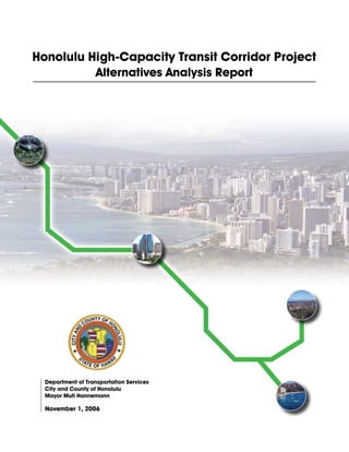
Powerful Love Spells in Phoenix, AZ (310) 882-6330 Bring Back Lost Lover
Alternatives Analysis Report
1. Honolulu High-Capacity Transit Corridor Project
Alternatives Analysis Report
Department of Transportation Services
City and County of Honolulu
Mayor Mufi Hannemann
November 1, 2006
2.
3. _________________________________Preface
Context of the Alternatives Analysis
This Alternatives Analysis (AA) supports the selection of a locally preferred transit
alternative for the City and County of Honolulu consistent with the planning and project
development process defined by the Federal Transit Administration (FTA). The first step
of the process was systems planning, which culminated with the O‘ahu Metropolitan
Planning Organization (OMPO) including a fixed guideway transit system in the 2030
O‘ahu Regional Transportation Plan (OMPO, 2006a). This phase, Alternatives
Analysis, evaluates a range of transit mode and general alignment alternatives in terms of
their costs, benefits and impacts.
The Honolulu City Council will select a locally preferred alternative (LPA) based on the
findings of this AA report. Subsequently, design options within the LPA will be
evaluated and an Environmental Impact Statement (EIS) will be prepared according to
the National Environmental Policy Act (NEPA) as part of the Preliminary Engineering
phase. Final Design, construction, and operation of the LPA will follow.
Purpose of the Alternatives Analysis Report
The purpose of this report is to provide the Honolulu City Council with the information
necessary to select a mode and general alignment alternative for high-capacity transit
service on O‘ahu. The primary project study area is the travel corridor between Kapolei
and the University of Hawai‘i at Mānoa. The report summarizes the results of an AA that
followed FTA planning guidance and provides information on the costs, benefits, and
impacts of four alternatives:
• No Build Alternative
• Transportation System Management Alternative
• Managed Lane Alternative
• Fixed Guideway Alternative.
The goal of the AA process is to reach a broad consensus regarding which alternative
best meets the goals and objectives for the study corridor. The analysis in the AA is
defined by the need to make an intelligent selection of a preferred mode and general
alignment. After public release of this report, the City Council will conduct public
hearings to solicit community views on the evaluated alternatives. Considering both the
technical information provided in the AA and the comments from the public, the Council
will select an LPA to provide improved transit service in the study corridor. After
selection of the LPA, the City and County of Honolulu Department of Transportation
Services (DTS) will apply to FTA to begin Preliminary Engineering.
Alternatives Analysis Report Page i
Honolulu High-Capacity Transit Corridor Project
4. Organization of the Alternatives Analysis Report
This report is organized into a summary followed by seven chapters. Chapter 1 provides
the context for the study, including a description of the corridor and the existing
transportation system, planned growth and improvements in the corridor, the need for an
improved transit system, and a definition of the purpose of the alternatives evaluated.
Chapter 2 describes the alternatives being evaluated and how they were selected through
both technical review and public comment.
Chapters 3 through 5 evaluate the technical merits and consequences of the alternatives.
Chapter 3 presents the effects that the alternatives would have on the transportation
system. The physical and social environment that would be affected by the alternatives
and the effects on that environment are described in Chapter 4. Chapter 5 presents the
financial evaluation of the alternatives, including their costs and how their
implementation and long-term operation would be funded.
Chapter 6 summarizes all of the technical findings and describes how each alternative
would meet the goals and objectives established for the project. It also compares the
trade-offs among the alternatives. The final chapter, Chapter 7, describes the public
involvement and agency coordination that has been conducted to include the concerns of
affected parties in the planning process.
Page ii Alternatives Analysis Report
Honolulu High-Capacity Transit Corridor Project
5. Table of Contents
SUMMARY ................................................................................................................................ S-1
Purpose of and Need for Transportation Improvements ............................................................................... S-1
Alternatives Considered .................................................................................................................................... S-2
Transportation Impacts and Benefits .............................................................................................................. S-2
Environmental Impacts and Benefits............................................................................................................... S-3
Financial Feasibility........................................................................................................................................... S-4
Capital Costs .................................................................................................................................................. S-4
Operating and Maintenance Costs.................................................................................................................. S-4
Funding Options............................................................................................................................................. S-4
Evaluation of Alternatives................................................................................................................................. S-5
Residents’ Alternatives Preferences ................................................................................................................. S-6
Issues to be Resolved ......................................................................................................................................... S-7
CHAPTER 1 PURPOSE AND NEED..................................................................................... 1-1
Purpose of the Project ........................................................................................................................................1-1
Need for Transportation Improvements...........................................................................................................1-1
Improved mobility for travelers facing increasingly severe traffic congestion. ..............................................1-1
Improved transportation system reliability. ....................................................................................................1-2
Accessibility to new development in ‘Ewa/Kapolei/Makakilo as a way of supporting policy to develop the
area as a second urban center. .........................................................................................................................1-2
Improved transportation equity for all travelers..............................................................................................1-2
Description of the Corridor ...............................................................................................................................1-2
Travel Patterns in the Corridor........................................................................................................................1-4
Existing Transportation Facilities and Services in the Corridor..................................................................1-11
Street and Highway System ..........................................................................................................................1-11
Public Transit System ...................................................................................................................................1-12
Parking ..........................................................................................................................................................1-12
Performance of the Existing Transportation System ....................................................................................1-12
Traffic Volumes ............................................................................................................................................1-12
Traffic Operating Conditions ........................................................................................................................1-12
Transit Operating Conditions........................................................................................................................1-13
Potential Transit Markets ................................................................................................................................1-15
History of the Project .......................................................................................................................................1-15
Goals and Objectives ........................................................................................................................................1-16
CHAPTER 2 ALTERNATIVES CONSIDERED................................................................... 2-1
Screening and Selection Process ........................................................................................................................2-1
Alternatives Considered .....................................................................................................................................2-1
Alternatives Considered but Rejected ..............................................................................................................2-1
Alternatives Analysis Report Page iii
Honolulu High-Capacity Transit Corridor Project
6. Alternatives Evaluated in this Alternatives Analysis ...................................................................................... 2-2
Alternative 1: No Build ................................................................................................................................. 2-2
Alternative 2: Transportation System Management ...................................................................................... 2-3
Alternative 3: Managed Lane ........................................................................................................................ 2-3
Alternative 4: Fixed Guideway Alternative................................................................................................... 2-7
Costs of the Alternatives.................................................................................................................................. 2-16
Capital Costs ................................................................................................................................................ 2-16
Operating and Maintenance Costs................................................................................................................ 2-16
Schedule ............................................................................................................................................................ 2-19
CHAPTER 3 TRANSPORTATION BENEFITS AND IMPACTS ...................................... 3-1
Transportation Demand and Travel Patterns ................................................................................................. 3-1
Systemwide Travel by Mode.......................................................................................................................... 3-4
Transit................................................................................................................................................................. 3-7
Transit Service................................................................................................................................................ 3-7
Roadway Traffic............................................................................................................................................... 3-18
Systemwide Travel Statistics........................................................................................................................ 3-18
Traffic Volumes and Level-of-Service......................................................................................................... 3-22
Measures Taken to Minimize Uncertainties Associated with Transportation Analysis ............................ 3-27
Conclusions Regarding Transportation ......................................................................................................... 3-28
CHAPTER 4 ENVIRONMENTAL CONSEQUENCES ....................................................... 4-1
Alternative 3: Managed Lane Alternative ...................................................................................................... 4-1
Alternative 4: Fixed Guideway Alternative .................................................................................................... 4-1
Section I. Kapolei to Fort Weaver Road......................................................................................................... 4-3
Section II. Fort Weaver Road to Aloha Stadium............................................................................................ 4-3
Section III. Aloha Stadium to Middle Street .................................................................................................. 4-3
Section IV. Middle Street to Iwilei................................................................................................................. 4-4
Section V. Iwilei to UH Mānoa...................................................................................................................... 4-4
Uncertainties Associated with Environmental Resources .............................................................................. 4-4
CHAPTER 5 FINANCIAL FEASIBILITY ANALYSIS ..................................................... 5-1
Capital Costs....................................................................................................................................................... 5-1
Estimation Methods........................................................................................................................................ 5-1
Capital Cost Estimates by Alternative............................................................................................................ 5-2
Operating and Maintenance Costs ................................................................................................................... 5-3
Estimation Methods........................................................................................................................................ 5-3
Transit Operating and Maintenance Cost Estimates by Alternative............................................................... 5-4
Proposed Funding Sources ................................................................................................................................ 5-5
Sources of Project Capital .............................................................................................................................. 5-5
Sources for System Capital Replacement and Operating and Maintenance (O&M) Expenses...................... 5-6
Additional Sources ......................................................................................................................................... 5-9
Financing Options .......................................................................................................................................... 5-9
Assessment of Financial Feasibility of the Alternatives................................................................................ 5-10
Financial Feasibility of Major Capital Investment ....................................................................................... 5-10
Financial Feasibility of the Capital Replacement and Operating Needs ...................................................... 5-13
Risks and Uncertainties ................................................................................................................................... 5-15
Page iv Alternatives Analysis Report
Honolulu High-Capacity Transit Corridor Project
7. Economic Risk ..............................................................................................................................................5-15
Level of FTA Funds......................................................................................................................................5-15
Construction Risk..........................................................................................................................................5-16
CHAPTER 6 COMPARISON OF ALTERNATIVES ........................................................... 6-1
Optimum Alternatives........................................................................................................................................6-1
Managed Lane Alternative..............................................................................................................................6-1
Fixed Guideway Alternative ...........................................................................................................................6-1
Effectiveness at Meeting Goals and Objectives ................................................................................................6-5
Improve Corridor Mobility .............................................................................................................................6-5
Encourage Patterns of Smart Growth and Economic Development................................................................6-6
Find Cost-Effective Solutions .........................................................................................................................6-6
Provide Equitable Solutions............................................................................................................................6-8
Develop Feasible Solutions.............................................................................................................................6-8
Minimize Community and Environmental Impacts ........................................................................................6-9
Achieve Consistency with Other Planning Efforts..........................................................................................6-9
Comparison of Benefits and Consequences among the Alternatives..............................................................6-9
Important Trade-offs........................................................................................................................................6-13
CHAPTER 7 COORDINATION AND CONSULTATION .................................................. 7-1
REFERENCES.......................................................................................................................... R-1
Alternatives Analysis Report Page v
Honolulu High-Capacity Transit Corridor Project
8. List of Tables
Table 1-1. Existing and 2030 No Build Alternative A.M. Peak Period Speeds and Level-of-
Service on H-1.................................................................................................................... 1-13
Table 1-2. Project Goals and Objectives.................................................................................... 1-16
Table 2-1. Transit Vehicle Requirements .................................................................................... 2-3
Table 2-2. Fixed Guideway Alternative Analysis Sections and Alignments............................... 2-8
Table 2-3. Fixed Guideway Alternative Operating Assumptions.............................................. 2-15
Table 3-1. Year 2030 Daily Compared to Existing Daily Trips by Transportation Analysis Area,
All Modes ............................................................................................................................. 3-2
Table 3-2. Year 2030 Compared to Existing Peak-Period Work Trips by Transportation Analysis
Area, All Modes ................................................................................................................... 3-3
Table 3-3. Total Daily Person Trips by Mode ............................................................................. 3-4
Table 3-4. Transit Mode Share for Home-based Work Trips by Alternative.............................. 3-5
Table 3-5. Park-and-Ride Lot Locations and Size for the Fixed Guideway Alternative Alignment
Combinations...................................................................................................................... 3-10
Table 3-6. A.M. Peak-hour Transit Travel Times by Alternative (in minutes) ......................... 3-11
Table 3-7. Daily Transit Ridership ............................................................................................ 3-15
Table 3-8. A.M. Peak Two-hour Transit Ridership ................................................................... 3-16
Table 3-9. Year 2030 Fixed Guideway Forecast Daily Boardings............................................ 3-19
Table 3-10. Systemwide Daily Travel Statistics by Alternative................................................ 3-20
Table 3-11. Selected Screenline Peak-hour Volumes by Alternative........................................ 3-23
Table 3-12. A.M. Peak-hour Screenline Volumes and Level of Service (LOS) ....................... 3-25
Table 3-13. P.M. Peak-hour Screenline Volumes and Level of Service (LOS) ........................ 3-25
Table 3-14. Summary of Transportation Effects ....................................................................... 3-30
Table 4-1. Numbers of Parcels Affected (Full or Partial Acquisitions) ...................................... 4-2
Table 5-1. Capital Cost Estimates (millions 2006 dollars) .......................................................... 5-2
Table 5-2. Capital Cost Estimates of the Fixed Guideway Alternative Alignments ................... 5-3
Table 5-3. Estimated Year 2030 Annual Transit Operating and Maintenance Costs (millions
2006 dollars)......................................................................................................................... 5-4
Table 5-4. GET Surcharge Revenues for Three Growth Scenarios 2007-2022 .......................... 5-6
Table 5-5. Expected FTA Revenues by Alternative in 2007 and 2030 (in millions of year of
expenditure dollars) .............................................................................................................. 5-9
Table 5-6. Sources and Uses of Funds for the Managed Lane Reversible Option .................... 5-11
Table 5-7. Sources and Uses of Funds - Full-corridor Alignment............................................. 5-12
Table 5-8. Sources and Uses of Funds - 20-mile Alignment..................................................... 5-12
Table 5-9. Fixed Guideway 20-mile Alignment Cash Flow, Council on Revenues Scenario 1 5-14
Table 5-10. Average Fare Box Recovery Ratio and City Operating Support to Transit ........... 5-15
Table 6-1. Transportation System Costs and Transit User Benefits Compared to No Build ...... 6-2
Page vi Alternatives Analysis Report
Honolulu High-Capacity Transit Corridor Project
9. Table 6-2. Incremental Cost per Hour of Transportation System User Benefits Compared to TSM
Alternative ............................................................................................................................ 6-7
Table 6-3. Effectiveness of Alternatives at Meeting Goals and Objectives in the Year 2030 .. 6-11
List of Figures
Figure 1-1. Areas and Districts in the Study Corridor ................................................................. 1-3
Figure 1-2. Major Activity Centers in the Study Corridor........................................................... 1-5
Figure 1-3. Population Distribution for O‘ahu ............................................................................ 1-6
Figure 1-4. Employment Distribution for O‘ahu ......................................................................... 1-7
Figure 1-5. Concentrations of Transit-dependent Households .................................................. 1-10
Figure 1-6. P.M. Peak-period Scheduled Bus Trip Times......................................................... 1-14
Figure 2-1. Managed Lane Alternative (‘Ewa Section)............................................................... 2-5
Figure 2-2. Managed Lane Alternative (Koko Head Section)..................................................... 2-6
Figure 2-3. Fixed Guideway Alternative Section I...................................................................... 2-9
Figure 2-4. Fixed Guideway Alternative Section II................................................................... 2-10
Figure 2-5. Fixed Guideway Alternative Section III ................................................................. 2-11
Figure 2-6. Fixed Guideway Alternative Section IV ................................................................. 2-12
Figure 2-7. Fixed Guideway Alternative Section V .................................................................. 2-13
Figure 2-8. Kalaeloa - Airport - Dillingham - Halekauwila Combination (Twenty-eight-mile
Alignment).......................................................................................................................... 2-17
Figure 2-9. Twenty-mile Alignment .......................................................................................... 2-18
Figure 2-10. Project Schedule.................................................................................................... 2-19
Figure 3-1. Change in Islandwide 2030 Daily Person Trips by Mode Compared to No Build... 3-5
Figure 3-2. Locations of Origins and Destinations for Selected Travel Time Routes and
Screenlines.......................................................................................................................... 3-12
Figure 3-3. Islandwide Daily Transit Trips for All Alternatives ............................................... 3-16
Figure 3-4. Islandwide Daily Vehicle Hours of Delay for All Alternatives.............................. 3-21
Alternatives Analysis Report Page vii
Honolulu High-Capacity Transit Corridor Project
10. Acronyms Used in this Document
AA Alternatives Analysis
DTS Department of Transportation Services
EIS Environmental Impact Statement
FGM Fixed Guideway Modernization
FTA Federal Transit Administration
FY Fiscal Year
GET General Excise and Use Tax
GO General Obligation
HDOT Hawai‘i Department of Transportation
HOV High Occupancy Vehicle
LOS Level-of-Service
LPA Locally Preferred Alternative
NEPA National Environmental Policy Act
O&M Operation and Maintenance
OMPO O‘ahu Metropolitan Planning Organization
ORTP O‘ahu Regional Transportation Plan
OTS O‘ahu Transit Services, Inc.
PE Preliminary Engineering
PUC Primary Urban Center
SAFETEA-LU Safe, Accountable, Flexible, Efficient Transportation Equity Act
SCC Standard Cost Categories
TSM Transportation System Management
UH University of Hawai‘i
USC United States Code
V/C Volume-to-Capacity Ratio
VHD Vehicle Hours of Delay
YOE Year of Expenditure
Page viii Alternatives Analysis Report
Honolulu High-Capacity Transit Corridor Project
11. Summary
The City and County of Honolulu Department of Transportation Services (DTS), in
coordination with the U.S. Department of Transportation Federal Transit Administration
(FTA), has carried out an Alternatives Analysis (AA) to evaluate alternatives that would
provide high-capacity transit service on O‘ahu. The primary project study area is the
travel corridor between Kapolei and the University of Hawai‘i at Mānoa (UH Mānoa)
(Figure S-1). This corridor includes the majority of housing and employment on O‘ahu.
The east-west length of the corridor is approximately 23 miles. The north-south width of
the corridor is at most four miles, as much of the corridor is bounded by the Ko‘olau and
Wai‘anae Mountain Ranges to the north and the Pacific Ocean to the south.
Figure S-1. Project Vicinity
Purpose of and Need for Transportation Improvements
The purpose of the Honolulu High-Capacity Transit Corridor Project is to provide
improved mobility for persons traveling in the highly congested east-west transportation
corridor between Kapolei and UH Mānoa. System planning for the corridor culminated
in the 2030 O‘ahu Regional Transportation Plan (OMPO, 2006a).
The O‘ahu Metropolitan Planning Organization (OMPO) concluded that the existing
transportation infrastructure in this corridor is overburdened handling current levels of
Alternatives Analysis Report Page S-1
Honolulu High-Capacity Transit Corridor Project
12. travel demand. Motorists experience substantial traffic congestion and delay at most
times of the day during both the weekdays and weekends. Currently, transit is caught in
the same congestion. As roadways become more congested, they become more
susceptible to substantial delays caused by incidents such as traffic accidents or heavy
rain. Current travel times are not reliable for either transit or automobile trips.
The highest population growth rates for the island, consistent with the General Plan for
the City and County of Honolulu, are projected in the ‘Ewa Development Plan area.
Many lower-income and minority workers live in the corridor outside of the urban core
and commute to work in the Primary Urban Center Development Plan area. Many lower-
income workers also rely on transit because of its affordability.
Alternatives Considered
Four alternatives are evaluated in this report. They were developed through a screening
process that considered alternatives identified through previous transit studies, a field
review of the study corridor, an analysis of current population and employment data for
the corridor, a literature review of technology modes, work completed by the O‘ahu
Metropolitan Planning Organization (OMPO) for its 2030 O‘ahu Regional
Transportation Plan (OMPO, 2006a), and public and agency comments received during
a formal project scoping process. The four alternatives are described in detail in the
Honolulu High-Capacity Transit Corridor Project Alternatives Analysis Detailed
Definition of Alternatives (DTS, 2006a). The alternatives evaluated are as follows:
• No Build Alternative
• Transportation System Management Alternative
• Managed Lane Alternative
• Fixed Guideway Alternative.
Two operational options were studied for the Managed Lane Alternative. Several
alignments were studied for the Fixed Guideway Alternative, including a shorter 20-mile
Alignment.
Transportation Impacts and Benefits
In the year 2030, the only alternative that is expected to significantly affect transit mode
share and attract additional transit riders is the Fixed Guideway Alternative. Many Fixed
Guideway alignment options were evaluated and the Kalaeloa - Airport - Dillingham -
Halekauwila alignment combination is projected to attract the highest number of daily
transit trips systemwide.
In regards to serving existing and future transit markets, the Fixed Guideway Alternative
does the best job in accommodating both longer corridor transit trips, as well as the
increase in work commute trips to West O‘ahu, which is expected to become much more
pronounced in the future. Two operational concepts for the Managed Lane Alternative
were evaluated, and the Two-direction Option best serves the increase in work commute
trips to West O‘ahu.
Page S-2 Alternatives Analysis Report
Honolulu High-Capacity Transit Corridor Project
13. The Fixed Guideway Alternative most consistently results in improved transit travel
times between key corridor origins and destinations. In many cases these travel times are
equivalent to, or faster than, the same trip time made by private vehicle under No Build
conditions, especially when considering the use of park-and-ride trips. The Fixed
Guideway Alternative would produce the most reliable travel times because the vehicles
would operate in their own right-of-way separate from roadways and associated
congestion. The Managed Lane Alternative would provide some travel time
improvements between selected origins and destinations that are well served by the
facility, but in many cases the travel time savings experienced is offset by the increased
congestion experienced before entering and upon exiting the facility.
Traffic congestion on key corridor facilities is expected to continue to exist under all
alternatives, particularly during peak travel periods. Systemwide vehicle hours of delay
(VHD) are projected to be substantially lower for the Fixed Guideway Alternative as
compared to all other alternatives. While all other alternatives have a minimal to
negligible impact on peak-period traffic volumes in the corridor (in fact, the Managed
Lane options are expected to increase vehicle peak-hour volumes in the corridor), the
Fixed Guideway Alternative is projected to reduce peak traffic volumes that cross
Kalauao Stream and Kapālama Canal by three to 12 percent. Most importantly, however,
the Fixed Guideway Alternative would provide a mobility option that the other
alternatives do not. It gives users the opportunity to bypass the congestion that will occur
on roadways throughout the study corridor.
Environmental Impacts and Benefits
The No Build and TSM Alternatives would generate minimal environmental impacts;
however, they also would not generate environmental benefits.
The Managed Lane Alternative would require a moderate number of displacements and
would affect a moderate number of potentially historic structures and one recreational
facility. It would generate the greatest amount of air pollution, require the greatest
amount of energy for transportation use, and would result in the largest number of
transportation noise impacts. It would provide little community benefit, as it would not
provide substantially improved transit access to the corridor.
Compared to the other alternatives, the Fixed Guideway Alternative would require more
acquisitions and affect more potentially historic structures, as well as three park or
recreational facilities. It would result in fewer transportation noise impacts than the
Managed Lane Alternative.
Visual impacts for the Fixed Guideway Alternative would be less than those for the
Managed Lane Alternative in areas where both alternatives would include structures, but
the Fixed Guideway Alternative would extend beyond the area of the Managed Lane
Alternative. The visual impacts of the 20-mile Alignment would be less than that for the
28-mile Full-corridor Alignment because the area of effect would be less.
Alternatives Analysis Report Page S-3
Honolulu High-Capacity Transit Corridor Project
14. The Fixed Guideway Alternative would generate the least air pollution and require the
least energy for transportation. It would provide improved connections between
communities, employment, and services in the corridor. The benefits of the Full-corridor
Alignment would be somewhat greater than those for the 20-mile Alignment.
Financial Feasibility
Capital Costs
Capital costs for the No Build and TSM Alternatives would be $660 and $856 million,
respectively, which accounts for bus replacement and system expansion. Total capital
costs for the Managed Lane Alternative would range between $3.6 and $4.7 billion, of
which $2.6 to $3.8 billion would be for construction of the managed lanes. Capital costs
for the Fixed Guideway Alternative, including bus system costs, would range between
$5.2 and $6.1 billion for the Full-corridor Alignments, of which $4.6 to $5.5 billion
would be for the fixed guideway system. The costs would be $4.2 billion for the 20-mile
Alignment, of which $3.6 billion would be for the fixed guideway system.
Operating and Maintenance Costs
Operating costs in 2030 for the No Build Alternative, in 2006 dollars, would be
approximately $192 million. Operating costs for the TSM Alternative would be
approximately $42 million greater than for the No Build Alternative. Transit operating
costs for the Managed Lane Alternative would range between approximately $251 and
$261 million as a result of additional buses that would be put in service under that
alternative. These costs do not include the cost of maintaining the managed lane facility.
The total operating costs for the Fixed Guideway Alternative, including the bus and fixed
guideway, would range between approximately $248 and $256 million.
Funding Options
Funding sources for capital investments include a State General Excise and Use Tax
(GET) surcharge, City general obligation bonds, and FTA funds. Only the Fixed
Guideway Alternative could be funded with the GET surcharge. The No Build and TSM
Alternatives are a continuation of existing bus services and system costs reflect ongoing
operations with current funding sources.
With the Managed Lane Alternative, toll revenues would pay for ongoing operation and
maintenance; remaining revenues would be used to contribute to repaying debt incurred
to construct the system. Projections identify a funding deficit of $2.3 billion in 2006
dollars. Other funding sources would need to be identified to provide the remaining
funding. Toll revenues would pay for less than one-quarter of debt service; other city
funds would be needed for the remaining three-quarters.
For the Fixed Guideway Alternative, the GET surcharge is expected to yield between
$2.6 and $3.2 billion in 2006 dollars. The 20-mile Alignment would require between
$0.7 and $1.2 billion in 2006 dollars in funds from FTA New Starts or other sources. The
Full-corridor Alignment would require between $1.7 and $2.2 billion in 2006 dollars in
funds from FTA New Starts or other sources.
Page S-4 Alternatives Analysis Report
Honolulu High-Capacity Transit Corridor Project
15. Evaluation of Alternatives
The alternatives were compared regarding their ability to improve corridor mobility,
support smart growth and economic development, provide a cost-effective and equitable
transportation solution, be constructible, minimize community and environmental
impacts, and be consistent with other planning efforts.
The relative merits of two operational options were evaluated for the Managed Lane
Alternative, and one was determined to be more effective than the other. Similarly, the
Fixed Guideway Alternatives were evaluated and an optimal option of the alignments
was selected. Because the performance differences between the two Managed Lane
options would be small, the less costly Reversible Option would offer a better benefit-to-
cost ratio; therefore, it would be the best option for the Managed Lane Alternative. The
Kalaeloa - Airport - Dillingham - Halekauwila combination is the optimal Fixed
Guideway alignment for the entire corridor. A 20-mile portion of that alignment from
East Kapolei to Ala Moana Center provides a lower-cost option within the Fixed
Guideway Alternative.
The Fixed Guideway Alternative performs the best when considering the goal of
improving corridor mobility. The Full-corridor Alignment provides greater
transportation benefits than the 20-mile Alignment. Although less effective than the full-
corridor system, the 20-mile Alignment is still more effective at providing improved
mobility than any of the other three alternatives.
In relation to encouraging patterns of smart growth and economic development, the No
Build, TSM, and Managed Lane Alternatives generally maintain existing transit service
patterns and methods. None of these alternatives would provide a high level of transit
service that would serve as a nucleus for transit-oriented development. The Fixed
Guideway Alternative would include new stations providing reliable high-capacity transit
at locations zoned for new development or suitable for redevelopment. The Full-corridor
Alignment would provide the greatest opportunity for smart growth, but considerable
opportunities also would occur with the 20-mile Alignment.
The Fixed Guideway Alternative is substantially more cost-effective than the Managed
Lane Alternative when the respective transit user benefits per dollar of cost relative to the
TSM Alternative are compared.
The Fixed Guideway Alternative best meets the goal of providing equitable solutions.
The Full-corridor Alignment would best serve transit-dependent populations, but the 20-
mile Alignment would serve the majority of those served by the Full-corridor Alignment.
The No Build and Fixed Guideway Alternatives are financially feasible considering
reasonably certain funding sources. The No Build Alternative would continue bus
service using existing funding sources. The TSM Alternative would require a limited
amount of additional funds, which could be from existing funding sources. Because the
implementing legislation prohibits the GET surcharge from being used to fund existing
transit systems, it would not be available to fund the TSM Alternative. The Managed
Alternatives Analysis Report Page S-5
Honolulu High-Capacity Transit Corridor Project
16. Lane Alternative has no defined funding source. Because it would be open to general
purpose vehicles, including single-occupancy vehicles (cars carrying only the driver),
neither the GET surcharge nor FTA funds could be used for its construction. The 20-mile
Alignment for the Fixed Guideway Alternative could be funded with a combination of
expected GET revenues and FTA New Starts funds. There is more uncertainty in funding
of the Full-corridor Alignment. Either a larger share of FTA funds would be needed or
other sources would need to be tapped.
The alternatives range widely in relation to community and environmental impacts. The
No Build and TSM Alternatives would have little direct effect on existing resources;
however, they also would not offer community or environmental benefits. The Managed
Lane Alternative would require acquisition of private property, generate the highest
levels of air and water pollution, consume the greatest amount of energy for
transportation uses, and create the greatest number of noise impacts. The Fixed
Guideway Alternative would require the greatest number or property acquisitions and
have the greatest number of utility conflicts during construction, but it would also provide
a new safe transportation connection between communities in the corridor. It would
provide the greatest environmental benefits related to air and water pollution and energy
consumption.
All alternatives are generally consistent with Local, District, and State plans. The Fixed
Guideway Alternative best serves the areas of O‘ahu that are designated for future growth
and development. The Fixed Guideway Alternative is the only alternative that is
consistent with regional transportation system planning defined in the 2030 O‘ahu
Regional Transportation Plan (OMPO, 2006a).
Residents’ Alternatives Preferences
The residents of Honolulu are very concerned about transportation. In the Honolulu
Advertiser Hawai‘i Poll conducted in June 2006, traffic was identified by most
respondents as the most important issue currently facing Hawai‘i (Honolulu Advertiser,
2006). While preparing the 2030 O‘ahu Regional Transportation Plan, OMPO
conducted a telephone survey of O‘ahu residents to gauge public reaction to
transportation solutions (OMPO, 2006b). More than 50 percent of the respondents said
that they would use rapid transit regularly or occasionally.
Scoping conducted for the Honolulu High-Capacity Transit Corridor Project also
indicated broad interest and a majority of support for transportation improvements in the
corridor. The majority of comments received during scoping related to a preference for
one of the alternatives or a proposed modification to one of the alternatives. As a result
of public comments, moderating the growth in traffic congestion was added to the
purpose and need, a second Managed Lane option was added, and the presentation of the
Fixed Guideway Alternative was changed. There continues to be both organized support
for and opposition to the Managed Lane and Fixed Guideway Alternatives.
Page S-6 Alternatives Analysis Report
Honolulu High-Capacity Transit Corridor Project
17. Issues to be Resolved
This AA report supports the selection of an LPA by the Honolulu City Council.
Subsequently, an Environmental Impact Statement (EIS) will be prepared and
preliminary engineering will be completed for the selected alternative. While the AA
defines the alternatives under consideration, many issues have to be resolved, beginning
with selection of the LPA. Many of the other issues will be resolved as the project is
refined during the environmental and preliminary engineering phases. The following
outstanding issues have been identified:
• Selection of mode, alignment, and limits (this will be defined in selection of the Locally
Preferred Alternative)
• Selection of transit technology for the Fixed Guideway Alternative (if selected)
• Development of a financial plan to provide project funding
• Opportunities for public-private partnership to enhance the project that can be delivered
with limited public funds
• Environmental commitments.
Alternatives Analysis Report Page S-7
Honolulu High-Capacity Transit Corridor Project
19. Chapter 1 Purpose and Need
Purpose of the Project
The purpose of the Honolulu High-Capacity Transit Corridor Project is to provide
improved mobility for persons traveling in the highly congested east-west transportation
corridor between Kapolei and UH Mānoa, confined by the Wai‘anae and Ko‘olau
Mountain Ranges to the north and the Pacific Ocean to the south. The project would
provide faster, more reliable public transportation services in the corridor than those
currently operating in mixed-flow traffic. The project would also provide an alternative
to private automobile travel and improve linkages between Kapolei, the urban core, UH
Mānoa, Waikīkī, and urban areas in between. Implementation of the project, in
conjunction with other improvements included in the 2030 O‘ahu Regional
Transportation Plan (ORTP), would moderate anticipated traffic congestion in the
corridor. The project also supports the goals of the O‘ahu General Plan and the ORTP by
serving areas designated for urban growth.
Need for Transportation Improvements
Improved mobility for travelers facing increasingly severe traffic congestion.
The existing transportation infrastructure in the corridor between Kapolei and UH Mānoa
is overburdened handling current levels of travel demand. Motorists experience
substantial traffic congestion and delay at most times of the day during both the
weekdays and weekends. Average weekday peak-period speeds on the H-1 Freeway are
currently less than 20 mph in many places and will degrade even further by 2030. Transit
vehicles are caught in the same congestion. Travelers on O‘ahu’s roadways currently
experience 51,000 vehicle hours of delay, a measure of how much time is lost daily by
travelers stuck in traffic, on a typical weekday. This is projected to increase to more than
71,000 daily vehicle hours of delay by 2030, assuming implementation of all of the
planned improvements listed in the ORTP (except for a fixed guideway system). Without
these improvements, the ORTP indicates that daily vehicle-hours of delay could increase
to as much as 326,000 vehicle hours.
Current a.m. peak-period travel times for motorists from West O‘ahu to Downtown
average between 45 and 81 minutes. By 2030, after including all of the planned roadway
improvements in the ORTP, this travel time is projected to increase to between 53 and 83
minutes. Average bus speeds in the system have been decreasing steadily as congestion
has increased. Currently, express bus travel times from ‘Ewa Beach to Downtown range
from 45 to 76 minutes and local bus travel times from ‘Ewa Beach to Downtown range
from 65 to 110 minutes during the peak period. By 2030, these travel times are projected
to increase by 20 percent on an average weekday. Within the urban core, most major
arterial streets will experience increasing peak-period congestion, including Ala Moana
Boulevard, Dillingham Boulevard, Kalākaua Avenue, Kapi‘olani Boulevard, King Street,
and Nimitz Highway. Expansion of the roadway system between Kapolei and UH
Mānoa is constrained by physical barriers and by dense urban neighborhoods that abut
many existing roadways. Given the current and increasing levels of congestion, a need
Alternatives Analysis Report Page 1-1
Honolulu High-Capacity Transit Corridor Project
20. exists to offer an alternative way to travel within the corridor independent of current and
projected highway congestion.
Improved transportation system reliability.
As roadways become more congested, they become more susceptible to substantial
delays caused by incidents, such as traffic accidents or heavy rain. Even a single driver
unexpectedly braking can have a ripple effect delaying hundreds of cars. Because of the
operating conditions in the study corridor, current travel times are not reliable for either
transit or automobile trips. To get to their destination on time, travelers must allow extra
time in their schedules to account for the uncertainty of travel time. This is inefficient
and results in lost productivity. Because the bus system primarily operates in mixed-
traffic, transit users experience the same level of travel time uncertainty as automobile
users. A need exists to reduce transit travel times and provide a more reliable transit
system.
Accessibility to new development in ‘Ewa/Kapolei/Makakilo as a way of
supporting policy to develop the area as a second urban center.
Consistent with the General Plan for the City and County of Honolulu, the highest
population growth rates for the island are projected in the ‘Ewa Development Plan area
(comprised of the ‘Ewa, Kapolei and Makakilo communities), which is expected to grow
by 170 percent between 2000 and 2030. This growth represents nearly 50 percent of the
total growth projected for the entire island. The Wai‘anae, Wahiawā, North Shore,
Windward, Waimānalo, and East Honolulu areas will have population growth of between
zero and 16 percent because of this policy. This keeps the country country. Kapolei,
which is developing as a “second city” to Downtown Honolulu, is projected to grow by
nearly 600 percent to 81,100 people, the ‘Ewa neighborhood by 100 percent, and
Makakilo by 125 percent between 2000 and 2030. Accessibility to the overall ‘Ewa
Development Plan area is currently severely impaired by the congested roadway network,
which will only get worse in the future. This area is less likely to develop as planned
unless it is accessible to Downtown and other parts of O‘ahu; therefore, the ‘Ewa,
Kapolei, and Makakilo area needs improved accessibility to support its future growth as
planned.
Improved transportation equity for all travelers.
Many lower-income and minority workers live in the corridor outside of the urban core
and commute to work in the Primary Urban Center Development Plan area. Many lower-
income workers also rely on transit because of its affordability. In addition, daily parking
costs in Downtown Honolulu are among the highest in the United States (Colliers, 2005),
further limiting this population’s access to Downtown. Improvements to transit capacity
and reliability will serve all transportation system users, including low-income and under-
represented populations.
Description of the Corridor
The study corridor extends from Kapolei in the west (Wai‘anae or ‘Ewa direction) to the
University of Hawai‘i at Mānoa (UH Mānoa) in the east (Koko Head direction), and is
Page 1-2 Alternatives Analysis Report
Honolulu High-Capacity Transit Corridor Project
21. confined by the Wai‘anae and Ko‘olau Mountain Ranges to the north (mauka direction)
and the Pacific Ocean to the south (makai direction). Between Pearl City and ‘Aiea, the
corridor’s width is less than one mile between the Pacific Ocean and the base of the
Ko‘olau Mountains.
The General Plan for the City and County of Honolulu directs future population and
employment growth to the ‘Ewa and Primary Urban Center Development Plan areas and
the Central O‘ahu Sustainable Communities Plan area. The largest increases in
population and employment are projected in the ‘Ewa, Waipahu, Downtown, and
Kaka‘ako districts, which are all located in the corridor (Figure 1-1). Major activity
centers in the corridor are shown in Figure 1-2.
Figure 1-1. Areas and Districts in the Study Corridor
Currently, 63 percent of the population of 876,200 and 81 percent of the employment of
499,300 on O‘ahu are located within the study corridor. By 2030 this distribution will
increase to 69 percent of the population and 84 percent of the employment as
development continues to be concentrated into the Primary Urban Center (PUC) and
‘Ewa Development Plan areas. These trends are shown in two figures, Figure 1-3 and
Figure 1-4, which illustrate existing and year 2030 projected population of 1,117,300 and
employment of 632,900, respectively, by transportation analysis area.
Kapolei is the center of the ‘Ewa Development Plan area and has been designated
O‘ahu’s “second city.” City and State government offices have opened in Kapolei and
the University of Hawai‘i is developing a master plan for a new West O‘ahu campus
there. The Kalaeloa Community Development District (formerly known as Barbers Point
Alternatives Analysis Report Page 1-3
Honolulu High-Capacity Transit Corridor Project
22. Naval Air Station) covers 3,700 acres adjacent to Kapolei and is planned for
redevelopment. The Department of Hawaiian Home Lands is also a major landowner in
the area and has plans for residential and retail development. In addition, developers
have several proposals to continue the construction of residential subdivisions.
Continuing Koko Head, the corridor follows Farrington and Kamehameha Highways
through a mixture of low-density commercial and residential development. This part of
the corridor passes through the makai portion of the Central O‘ahu Sustainable
Communities Plan area.
Farther Koko Head, the corridor enters the Primary Urban Center Development Plan area,
which is bounded by commercial and residential densities that begin to increase in the
vicinity of Aloha Stadium. The Pearl Harbor Naval Reserve, Hickam Air Force Base,
and Honolulu International Airport border the corridor on the makai side. Military and
civilian housing are the dominant land uses mauka of Interstate Route H-1 (the H-1
Freeway), with a concentration of high-density housing along Salt Lake Boulevard.
As the corridor continues Koko Head across Moanalua Stream, the land use becomes
increasingly dense. Industrial and port land uses dominate along the harbor, shifting to
primarily commercial uses along Dillingham Boulevard, a mixture of residential and
commercial uses along North King Street, and primarily residential use mauka of the H-1
Freeway.
Koko Head of Nu‘uanu Stream, the corridor continues through Chinatown and
Downtown. The Chinatown and Downtown areas, with 62,300 jobs, have the highest
employment density in the corridor. The Kaka‘ako and Ala Moana neighborhoods,
comprised historically of low-rise industrial and commercial uses, are being revitalized
with several high-rise residential towers currently under construction. Ala Moana Center,
both a major transit hub and shopping destination, is served by more than 2,000 weekday
bus trips and visited by more than 56 million shoppers annually.
The corridor continues to Waikīkī and through the McCully neighborhood to the
University of Hawai‘i. Today, Waikīkī has more than 20,000 residents and provides
more than 44,000 jobs. It is one of the densest tourist areas in the world, serving
approximately 72,000 visitors daily (DBEDT, 2003). UH Mānoa is the other major
destination at the Koko Head end of the corridor. It has an enrollment of more than
20,000 students and approximately 6,000 staff (UH, 2005). Approximately 60 percent of
students do not live within walking distance of campus (UH, 2002) and must travel by
vehicle or transit to attend classes.
Travel Patterns in the Corridor
The vast majority of trips made on the island occur within the study corridor. Currently,
morning travel patterns in the corridor are heavily directional. Morning town-bound
(Koko Head direction) traffic volumes through the Waipahu and ‘Aiea areas are more
than twice the volume traveling in the ‘Ewa direction. Afternoon flows are less
directional with ‘Ewa-bound traffic volumes about 50 percent greater than town-bound
(Koko Head-bound) traffic.
Page 1-4 Alternatives Analysis Report
Honolulu High-Capacity Transit Corridor Project
23. Figure 1-2. Major Activity Centers in the Study Corridor
Alternatives Analysis Report Page 1-5
Honolulu High-Capacity Transit Corridor Project
24. Figure 1-3. Population Distribution for O‘ahu
Page 1-6 Alternatives Analysis Report
Honolulu High-Capacity Transit Corridor Project
25. Figure 1-4. Employment Distribution for O‘ahu
Alternatives Analysis Report Page 1-7
Honolulu High-Capacity Transit Corridor Project
27. Trip origins correlate closely with the level of population in a given area, while trip
destinations correlate to a high degree with the level of employment. Based on these
data, 1,826,000 or 68 percent of the 2,698,000 islandwide daily trips and 335,000, or 64
percent of the 523,000 peak-period work-related trips are currently generated within the
study corridor. The study corridor attracts an even higher percentage of islandwide trips
with 2,092,000, or 78 percent of daily trips and 424,000 or 82 percent of peak-period
work-related trips having destinations within the study corridor.
More trips will originate and remain within the Primary Urban Center in 2030 than they
do today. However, the greatest increases in trips will be to and from the ‘Ewa
Development Plan area. These patterns illustrate the continued transportation importance
of the study corridor with peak-period travel becoming less directional and more work
trips destined for Kapolei.
Transit Travel Patterns
An on-board transit survey was conducted on all of TheBus routes in December 2005 and
January 2006. Information obtained from the survey included the origins and
destinations of current transit bus users across a variety of trip purposes for both the
178,400 total daily trips and the 57,000 peak-period work trips. These survey data
indicate that the substantial majority of trips made by transit on the island occur within
the study corridor.
When compared to total travel, the current number of transit trips within the corridor as a
percentage of total islandwide transit trips is even more pronounced. Based on the survey
data, 83 percent of both islandwide daily and peak-period work-related trips originate
within the study corridor; while the study corridor attracts 90 percent of total islandwide
daily trips and 94 percent of peak-period work-related trips.
Daily Transit Trips
The major destinations for weekday bus riders are Downtown (20 percent) and the
Punchbowl-Sheridan-Date area (18 percent). Downtown contains the region’s highest
concentration of jobs. Punchbowl-Sheridan-Date also contains a high number of jobs, as
well as Ala Moana Center, the state’s largest shopping complex.
Overall, the largest share of TheBus riders’ trips originates in Waikīkī (16.5 percent).
The major destinations for these trips are Downtown (24 percent) and Punchbowl-
Sheridan-Date (27 percent). In addition to Waikīkī, Punchbowl-Sheridan-Date (9
percent), Kāhala-Pālolo (8 percent), and Pauoa-Kalihi (9 percent) are the origins of a
large number of trips. These areas are densely populated, with relatively high
concentrations of transit-dependent households (Figure 1-5).
Alternatives Analysis Report Page 1-9
Honolulu High-Capacity Transit Corridor Project
29. Peak-Period Transit Work Trips
Nearly 34 percent of all peak-period work trips are destined to Downtown, while
Punchbowl-Sheridan-Date and Waikīkī each are destinations for about 12.5 percent of
trips. Combined, these areas are the destinations of approximately 60 percent of the
islandwide peak-period home-based work trips. Waikīkī, Punchbowl-Sheridan-Date,
Pauoa-Kalihi, Waipahu-Waikele-Kunia, and Kāhala-Pālolo together account for about 50
percent of the home-based origins for work trips taken during the peak period on TheBus.
Existing Transportation Facilities and Services in the
Corridor
The study corridor is currently served by roadway and transit systems, parking facilities,
and pedestrian and bicycle facilities. Existing development throughout the study corridor
combined with the previously described geographic boundaries limits the potential for
new roadways or expansion of existing facilities.
Street and Highway System
The study corridor is served primarily by the H-1 Freeway, Farrington Highway,
Kamehameha Highway, Nimitz Highway, and Moanalua Road (Route H201). The H-2
Freeway provides access to the corridor from Central O‘ahu, and the H-3 Freeway
provides access to the corridor from the Windward side. Because of the constraints
posed by geography and existing development, the expansion of existing roadways or the
addition of new roadways in many sections of the corridor would be extremely difficult
and/or expensive. As a result, some sections of the corridor are served by a relatively
small number of facilities, and the lack of redundancy in the system at these locations can
cause severe traffic problems should any of the facilities become overly congested or
incapacitated. An example of this is in Pearl City where only three primary roadways, H-
1 Freeway, Moanalua Road, and Kamehameha Highway, serve the high volume of traffic
traversing this area. Of these roadways, the H-1 Freeway carries 70 to 75 percent of the
a.m. and p.m. peak-hour traffic. Hence, when traffic is congested on H-1 through this
location, traffic is affected for miles along the adjacent corridor segments.
To better utilize the existing roadway facilities, both the Hawai‘i Department of
Transportation (HDOT) and the City and County of Honolulu have implemented a
number of roadway management strategies, including the use of contraflow lanes and
high-occupancy vehicle (HOV) lanes. A contraflow lane is a strategy wherein a lane that
typically provides vehicular travel in one direction is reversed during certain times of the
day. Current contraflow lanes operate on the H-1 Freeway, Nimitz Highway, Kapi‘olani
Boulevard, Ward Avenue, Atkinson Drive, and Wai‘alae Avenue during the a.m. peak
period. During the p.m. peak period, contraflow lanes operate on Kapi‘olani Boulevard.
HOV lanes are freeway or surface street lanes designated for exclusive use by buses,
carpools, and vanpools. HDOT operates HOV lanes on several state highways during
certain times of the day. HOV lanes currently operate on the H-1 and H-2 Freeways, the
Moanalua Road, the H-1 Zipper Lane and Shoulder Express Lane, and Nimitz Highway.
Alternatives Analysis Report Page 1-11
Honolulu High-Capacity Transit Corridor Project
30. Public Transit System
O‘ahu Transit Services, Inc. (OTS) operates the public transit system (TheBus) on the
island of O‘ahu under contract to the City and County of Honolulu. TheBus system
serves more than 80 percent of the developed areas of the island and carries
approximately 73 million passengers per year and experiences about 236,600 boardings
on an average weekday. Annual transit passenger miles per-capita is higher in Honolulu
than in all other major U.S. cities without a fixed guideway transit system.
Parking
Downtown Honolulu parking rates are high; however, many employers subsidize parking
for their employees. Daily parking rates are the third-highest in the United States behind
New York and Boston, while monthly parking rates are in the top 15 (Colliers, 2005).
Downtown parking availability is considered limited, and garages have an average
waiting list of three months for monthly parking. Parking availability also is limited in
Waikīkī and near UH Mānoa.
Performance of the Existing Transportation System
Traffic Volumes
The highest daily traffic volumes occur near Downtown Honolulu. More than 398,000
vehicles cross Nu‘uanu Stream daily on a total of nine roadways. During the a.m. and
p.m. peak hours, more than 26,000 vehicles cross Nu‘uanu Stream each hour.
At the facility level, the Interstate Freeway system carries a considerable amount of the
island’s traffic, with the H-1 being the most heavily traveled freeway on O‘ahu. At the
Kalauao Stream screenline in Pearl City, approximately 20,000 and 17,000 vehicles
currently travel on H-1 (both directions combined) during the a.m. and p.m. peak hours,
respectively. Approximately 245,000 vehicles travel through this section of H-1 daily.
Traffic Operating Conditions
The operating conditions of a roadway can be represented by a variety of measures,
including the volume-to-capacity (V/C) ratio, operating speeds, and the density of traffic
on the facility. These measures can be used to determine level-of-service (LOS). A
roadway’s V/C ratio compares the volume of traffic traveling on the roadway to the
physical capacity of the roadway. Speeds are typically a reflection of the amount of
congestion on a roadway or its geometric design characteristics. Traffic density is
measured in terms of vehicles per mile per lane and is a function of both volumes and
speeds. LOS is a grading scale from A through F for roadway operation; LOS A
represents the best condition and LOS F represents more vehicles attempting to use a
roadway than the capacity is able to accommodate.
In general, congested conditions (e.g., LOS E or F) occur during the a.m. and p.m. peak
hours on many of the major roadways, particularly on segments of the H-1 Freeway from
the Waiawa Interchange to the UH Mānoa area, where stop-and-go conditions are typical.
Signalized routes, such as Nimitz Highway, require more than one traffic signal cycle to
clear intersections during peak periods. To avoid peak-hour congestion, motorists have
Page 1-12 Alternatives Analysis Report
Honolulu High-Capacity Transit Corridor Project
31. changed their time of travel, resulting in extended peak traffic conditions. Weekday a.m.
and p.m. peak traffic conditions generally last three to four hours each. Weekend traffic
during the mid-day also resembles weekday peak-period conditions.
Recent traffic counts for the corridor indicate that existing travel conditions are congested
during the a.m. peak hour for Koko Head-bound traffic crossing the Kalauao Stream in
Pearl City (V/C ratio of 1.06 [LOS F]) and the Kapālama Canal closer to Downtown
(V/C 1.04 [LOS F]). These conditions are also indicated by estimated travel speeds along
H-1 in the corridor, as shown in Table 1-1. The table indicates that existing speeds
between the Waiawa Interchange and Downtown in the general purpose lanes range from
14 to 20 mph (LOS F) and will generally get worse by the year 2030 despite many
planned roadway improvements.. The only location where speeds in the corridor on H-1
are predicted to increase in 2030 as compared to today is east of the Middle Street merge,
where the addition of a lane is expected to result in an average a.m. peak period speed of
24 mph, which still indicates LOS F at this location.
Table 1-1. Existing and 2030 No Build Alternative A.M. Peak Period Speeds and Level-of-
Service on H-1
2005 2030
Speed Level-of- Speed Level-of-
Location (mph) Service1 (mph) Service
Waiawa Interchange - Koko Head Bound
General Purpose Traffic 19 F 12 F
HOV Lane Traffic 24 F 14 F
Zipper Lane Traffic 39 F 37 F
Kalauao Stream - Koko Head Bound
General Purpose Traffic 20 F 15 F
HOV Lane Traffic 46 E 24 F
Zipper Lane Traffic 37 F 36 F
East of Middle Street Merge - Koko Head Bound
General Purpose Traffic 14 F 24 F
Liliha Street - Koko Head Bound
General Purpose Traffic 19 F 12 F
East of Ward Avenue - ‘Ewa Bound
General Purpose Traffic 21 F 18 F
West of University Avenue - ‘Ewa Bound
General Purpose Traffic 36 F 34 F
1
Level-of-Service is calculated based on vehicle density, a function of traffic volume and speed.
Based on recent traffic counts as well as field observations, the p.m. peak period is also
experiencing a high level of congestion in the corridor. Analysis of operations at
Kalauao Stream and Kapālama Canal show p.m. peak-hour levels-of-service of E for
each; however, H-1 itself is over capacity and operating at LOS F.
Transit Operating Conditions
The public transit system, TheBus, uses the general roadway network described above.
The major factors influencing bus operating conditions are the traffic conditions under
Alternatives Analysis Report Page 1-13
Honolulu High-Capacity Transit Corridor Project
32. which the service operates, passenger loading time, and bus-stop spacing. Honolulu has
substantial traffic congestion, high ridership and load factors, and closely spaced bus
stops. Combined, these factors result in declining bus operating speeds over recent years,
which are not competitive with the private automobile. Between 2002 and 2006,
islandwide average bus speeds decreased four percent to 13.4 miles per hour. Because
congestion in the study corridor is greater than in other parts of O‘ahu, the decrease in
average bus speed in the corridor is greater than the islandwide average. To account for
the congestion, OTS has lengthened the peak-period scheduled trip lengths by between
nine and 26 percent for several routes operating in the study corridor. Trip lengths for
these typical routes serving various parts of O‘ahu are shown in Figure 1-6.
180
Route 52 Wahiawa -
150 Circle Island
Route 55 Kaneohe -
Schedule Time (Minutes)
Circle Island
120
Route 62 Honolulu -
Wahiawa
90
60
30
0
2002 2003 2004 2005 2006
Year
Figure 1-6. P.M. Peak-period Scheduled Bus Trip Times
Implementation of peak-period HOV lanes on H-1 and H-2, as well as the addition of the
H-1 a.m. peak zipper lane, were intended to provide higher priority and mobility to buses
and other high-occupancy vehicles. However, with a minimum eligibility requirement of
only two persons per vehicle, these special lanes are often just as congested as the
adjacent general purpose lanes (Table 1-1), thus negating much of the travel time
advantage for transit buses.
Page 1-14 Alternatives Analysis Report
Honolulu High-Capacity Transit Corridor Project
33. As roadways become more congested, they become more susceptible to substantial
delays caused by incidents such as traffic accidents or heavy rain. As a result, current
transit schedules in the corridor are not reliable. Recent statistics from TheBus indicate
that on a systemwide basis 27 percent of all buses were more than five minutes late.
During the a.m. peak period, express buses were more than five minutes late 38 percent
of the time (OTS, 2006).
Transit speed and reliability with mixed-traffic operations will continue to diminish in the
corridor as the number of transit passengers increases and traffic volumes approach
roadway capacity on more streets.
Potential Transit Markets
A comparison of the location and number of new employment opportunities in relation to
population growth shows that many workers will still be required to travel to the Primary
Urban Center for work (Figure 1-4). Despite the large growth of employment
opportunities in the Kapolei area, population is projected to outpace and exceed the
available employment in the area. Additionally, there will be a bidirectional flow of
traffic throughout the day as more City and County administrative offices move their
daily operations to Kapolei and other employment grows in the area. Both of these
factors point to increased travel on the transportation system between Kapolei and the
Primary Urban Center and represent an important potential future transit market.
Relatively large areas within the corridor are transit-dependent because they contain a
large number of zero-car households relative to other parts of O‘ahu. Persons living in
zero-car households are much more likely to use transit than other residents. These
concentrations of zero-car household areas include much of the Primary Urban Center
(including the Central Business District, Chinatown, Kaka‘ako, Kalihi-Pālama, and
Iwilei) and some Waipahu neighborhoods as indicated in Figure 1-5. These areas
represent a robust transit market because they already rely on existing transit and are
likely to use an improved system.
Finally, although the primary market for the transit corridor improvements are for the
residents, the visitor industry and location of visitor attractions within the corridor
combine to create a transit market for visitors traveling within the corridor. O‘ahu hosts
more than 4.4 million visitors annually (DBEDT, 2005). Many of these visitors stay in
the Waikīkī area and travel to points of interest outside of Waikīkī, including many of the
activity centers in the corridor (Figure 1-2).
History of the Project
During the summer of 2005, the State legislature recognized the need and public support
for a high-capacity transit system on O‘ahu and passed Act 247. Act 247 authorized the
County to levy a general excise tax surcharge to construct and operate a mass transit
project serving O‘ahu. The City Council subsequently adopted Ordinance 05-027 to levy
a tax surcharge to fund public transportation. With secure local funding established for
the first time, the City began the AA process to analyze the feasibility of a high-capacity
transit system in the corridor between Kapolei and UH Mānoa. A range of alternatives
Alternatives Analysis Report Page 1-15
Honolulu High-Capacity Transit Corridor Project
34. was evaluated and screened to select alternatives that would provide the most
improvement to person-mobility and travel reliability in the study corridor. FTA
published a Notice of Intent to Prepare an AA and an EIS in the Federal Register on
December 7, 2005, and DTS published an EIS Preparation Notice in the State of Hawai‘i
Environmental Notice on December 8, 2005. The public was asked to comment on the
proposed alternatives, the purpose and need for the project, and the range of issues to be
evaluated at a series of scoping meetings in December 2005.
Goals and Objectives
Seven project goals were developed to address the transportation needs identified in the
study corridor. The project has several objectives related to each of the project goals
(Table 1-2).
Table 1-2. Project Goals and Objectives
Goal Objectives
Improve Corridor Reduce corridor travel times
Mobility Improve corridor travel time reliability1
Provide convenient, attractive, and effective transit service within the corridor
Provide transit corridor travel times competitive with auto travel times
Connect major trip attractors/generators within the corridor1
Maximize the number of persons within convenient access range of transit
Provide safe and convenient access to corridor transit stations1
Encourage Patterns Encourage transit-oriented development in existing and new growth areas
of Smart Growth and Utilize corridor land use policies/opportunities related to economic
Economic development
Development Support economic development of major regional economic centers
Find Cost-Effective Provide solutions with benefits commensurate with their costs
Solutions Provide solutions that meet the project purpose and needs while minimizing
total costs
Improve transit operating efficiency
Provide Equitable Distribute costs and benefits fairly across different population groups1
Solutions Avoid disproportionate impacts on low income and minority population groups
Provide effective transit options to transit-dependent communities
Develop Feasible Ensure the cost of building, operating, and maintaining the alternative is within
Solutions the range of likely available funding
Develop a feasible alternative in terms of constructability and ROW availability
Minimize Community Minimize impacts on natural and cultural resources
and Environmental Minimize the effect on homes and businesses
Impacts Minimize disruption to traffic operations1
Minimize conflicts with utilities
Minimize construction impacts
Minimize impacts to the community and community amenities
Reduce energy consumption
Minimize impacts to future development
Achieve Consistency Achieve consistency with adopted community, regional, and state plans
with Other Planning
Efforts
1
This objective was considered during project development, but is not evaluated in the comparison of alternatives.
Page 1-16 Alternatives Analysis Report
Honolulu High-Capacity Transit Corridor Project
35. Chapter 2 Alternatives Considered
Screening and Selection Process
During the fall of 2005 and winter of 2006, the City and County of Honolulu conducted
an alternatives screening that is documented in the Honolulu High-Capacity Transit
Corridor Project Alternatives Screening Memorandum (DTS, 2006b). The alternatives
screening was approached through a top-down analysis completed in five major steps.
The first step was to gather input needed for the analysis. The input included the purpose
and need for the project, past studies and their recommendations, requirements of the
FTA process, adopted community and area plans, and a visual assessment of the entire
corridor as it currently exists. The second step used the information gathered to identify a
comprehensive list of potential alternatives. The third step included developing screening
criteria and undertaking the initial screening of all potential alternatives to identify those
that address the needs of the corridor and do not have any “fatal flaws.” Those surviving
alternatives were then presented to the public and interested public agencies and officials
for comment through a scoping process in the fourth step. Finally, input from the
scoping process was collected and analyzed, and refinements were made to the
alternatives. Once the evaluations were completed, the modal, technology, and alignment
options were matched to create the alternatives that are carried forward into this AA.
Alternatives Considered
Multiple sources were accessed for input to determine the initial options screened. The
goal was to screen as broad a range of feasible alternatives as possible to ensure that the
best solutions for the corridor would be considered. A long list of alternatives was
developed based on these previous studies, a field review of the study corridor, an
analysis of current population and employment data for the corridor, and a literature
review of modal technologies.
The alternatives considered during screening included a No Build Alternative, a
Transportation System Management Alternative, and a number of “build” alternatives.
Transit technologies that were examined included conventional bus, guided bus, light rail
transit, personal rapid transit, people mover, monorail, magnetic levitation, rapid rail,
commuter rail, and waterborne ferry service. Several highway improvements considered
during OMPO’s 2030 ORTP planning process also were reviewed for their ability to
improve transit capacity and reliability, including a bridge or tunnel crossing of Pearl
Harbor to connect ‘Ewa with the PUC and the construction of a two-lane elevated
structure from the Waiawa Interchange to Iwilei, which would be used by transit vehicles
and potentially carpools and single-occupant vehicles willing to pay a congestion-based
toll. In addition, 75 Fixed Guideway alignment options were screened.
Alternatives Considered but Rejected
All of the alternatives considered are detailed in the Honolulu High-Capacity Transit
Corridor Project Alternatives Screening Memorandum (DTS, 2006b). The following
alternatives were eliminated before undertaking this AA.
Alternatives Analysis Report Page 2-1
Honolulu High-Capacity Transit Corridor Project
36. The tunnel crossing of Pearl Harbor was rejected because it would not provide an
alternative to private automobile use or improve linkages within the study corridor, as it
would bypass much of the corridor and not provide any new connections within the
remainder of the corridor.
Waterborne ferry service was eliminated as a primary transit system because its capacity
and travel times were not competitive with other alternatives. This alternative is being
studied as an augmentation to the existing transit system in a separate effort from this
project.
Several transit technologies were eliminated for various reasons. Diesel multiple unit
was eliminated based on technical maturity, supplier competition, and environmental
performance. Personal rapid transit was eliminated based on lack of technical maturity
and line capacity. Commuter rail was eliminated because it is not suited for short station
spacing and is not competitive without existing freight tracks being available. Also,
emerging rail concepts were eliminated because of their lack of technical maturity and
the rapid implementation schedule for the project.
For the Fixed Guideway Alternative screening analysis, the corridor was divided into
eight sections. (Following the screening analysis, the eight sections were combined into
a set of five sections.) Within each of the sections, the alignments that demonstrated the
best performance related to mobility and accessibility, supporting smart growth and
economic development, constructability and cost, community and environmental quality,
and planning consistency were retained for evaluation in the AA.
Alternatives Evaluated in this Alternatives Analysis
Four alternatives are evaluated in this AA report. They were developed through a
screening process that considered alternatives identified through previous transit studies,
a field review of the study corridor, an analysis of current population and employment
data for the corridor, a literature review of technology modes, work completed by the
O‘ahu Metropolitan Planning Organization (OMPO) for its 2030 O‘ahu Regional
Transportation Plan (OMPO, 2006a), and public and agency comments received during a
formal project scoping process held that would satisfy the requirements of the National
Environmental Policy Act (NEPA) and the Hawai‘i EIS Law (Chapter 343). The four
alternatives are described in detail in the Honolulu High-Capacity Transit Corridor
Project Alternatives Analysis Detailed Definition of Alternatives (DTS, 2006a). The
alternatives evaluated are as follows:
• No Build Alternative
• Transportation System Management Alternative
• Managed Lane Alternative
• Fixed Guideway Alternative.
Alternative 1: No Build
The No Build Alternative includes existing transit and highway facilities and committed
transportation projects anticipated to be operational by 2030. Committed transportation
Page 2-2 Alternatives Analysis Report
Honolulu High-Capacity Transit Corridor Project