SlideShare una empresa de Scribd logo
1 de 15
Descargar para leer sin conexión
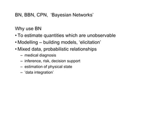
BN, BBN, CPN, ‘Bayesian Networks’

Why use BN
• To estimate quantities which are unobservable
              q
• Modelling – building models, ‘elicitation’
• Mixed data, probabilistic relationships
  –   medical diagnosis
  –   inference, risk, decision support
  –   estimation of physical state
                     p y
  –   ‘data integration’
Example : Dryland Salinity WA   ………….[ land condition, forest changes]
SALINITY : Information Gap, Policy & Management Problem :
      – where is it, where changed, where will it.. MAP, MONITOR, PREDICT
BIG AREA
~230,000 sq km
Knowledge about SALINITY PROCESS
– rising saline groundwater as the result of clearing
Sample ‘truth’
      Observational
      data – spatial
      Y/N (date?)


Knowledge about PROCESS


                          Knowledge ??
                          Landscape position important
                           - more likely in valleys
                          Salinity affects vegetation
                           - Visible effects ? – images
                          Groundwater levels S il t
                          G    d t l        l Soil type,
                          Vegetation type, etc ???
Network diagram – dryland salinity – FIRST VERSION


Is each location (likely to be) saline or not ? - Not observable directly

Meaning of network, then

- A. How do we observe (get data) on ‘Landform Position’ ? everywhere
- B. How do we observe ‘vegetation condition’ ?
       (A from processing DEM; B [surrogate] classification from Landsat)
Network – dryland salinity – FIRST VERSION - getting the data


             processing                              classification task
             task

DEM                                               IMAGE
‘Raw data’                ?arrows?                ‘Raw data’
                          ?what happens?
Hydrologists
H d l i t concept di
                t diagram - NOT a BN


 Ground water
 depth and rate               Salinity
 of rise

    ?
 Hydrological model
 - deterministic         X  Data
                            Model Parameters
Water Poverty ‘Network’


              limitations for agriculture                    ?
              volume, critical supply gap,
              uncertainty supply

                                             ??
Opportunity
cost labour                                       Poverty
                                                  measure
                                 WP               or surrogate
                                                          g

  Water-related
  health costs
                       Education/Invest
                       ment constraints
                                                         ?
Land Monitor – Information Gap

•   The three highest priority environmental issues
    - Land salinisation,
    - Salinisation of inland waters, and
    - Maintaining biodiversity
    (Western Australian State of the Environment Report, 1998)


•   About 1.8 million ha in WA are already salt-affected,
    and this area could double in the next 15 to 25 years
                                                    years.

•   Effects on Vegetation

•   No Accurate map, No spatially explicit information
    on change, or prediction
Salinity Problem & Impact
Resource Problem affects people
Economic & Social Problem

Prediction 25% - 35% land lost

$$ - 40% Australia’s grain

Farming is not subsidised in Aust
      g
Business, Land value, Banks $

Built infrastucture : road network
Maintenance;
Town Buildings ‘Rescue Towns’
Land Monitor - Components

I.
I Institutional support (agencies).
                        (agencies)

2. Demonstrated Technical Capacity (CMIS)
  Define necessary data (Landsat TM 1988-2000 DEM)
                                    1988-2000,
  and methods

3.
3 Funding Support (National Govt)
------------------------
4. Public Interest

LANDSAT TM – Complete Australian Archive since 1988
CMIS Methods and technical developments

• Rectification & Registration, Calibration (robust regression)

• Discriminant Analysis (C
                        (CVA etc)
                                )

• Enhanced ML classification (PP – uncertainty)

• DEM (pre)Processing – derived variables

• Data Integration - CPN, Decision Trees

• Trend summary and representation (vegetation condition)


(others e.g. NN, LD, D i i T
( th         NN LD Decision Trees …)
                                   )
Salinity Mapping & Monitoring Ground Data

Más contenido relacionado

Similar a Why use Bayesian Networks for poverty analysis

Using GIS for Water Resources Management – Selected U.S. and International Ap...
Using GIS for Water Resources Management – Selected U.S. and International Ap...Using GIS for Water Resources Management – Selected U.S. and International Ap...
Using GIS for Water Resources Management – Selected U.S. and International Ap...
Michael Baker Jr., Inc.
 
Birr - Identifying Critical Portions of the Landscape
Birr - Identifying Critical Portions of the LandscapeBirr - Identifying Critical Portions of the Landscape
Birr - Identifying Critical Portions of the Landscape
Jose A. Hernandez
 
Dr N.H.Rao Joint Direcotr - National Academy of Agricultural Research Manag...
Dr N.H.Rao   Joint Direcotr - National Academy of Agricultural Research Manag...Dr N.H.Rao   Joint Direcotr - National Academy of Agricultural Research Manag...
Dr N.H.Rao Joint Direcotr - National Academy of Agricultural Research Manag...
naarm web
 
GEOG8260.8, The power of simplicity
GEOG8260.8, The power of simplicityGEOG8260.8, The power of simplicity
GEOG8260.8, The power of simplicity
Scott St. George
 
NGIC: Environmental Database
NGIC: Environmental DatabaseNGIC: Environmental Database
NGIC: Environmental Database
GeoMedeelel
 
Dissertation Defense Powerpoint FINAL
Dissertation Defense Powerpoint FINALDissertation Defense Powerpoint FINAL
Dissertation Defense Powerpoint FINAL
Khalil A. Lezzaik
 

Similar a Why use Bayesian Networks for poverty analysis (20)

BFP Andes-Project Plans
BFP Andes-Project PlansBFP Andes-Project Plans
BFP Andes-Project Plans
 
Using GIS for Water Resources Management – Selected U.S. and International Ap...
Using GIS for Water Resources Management – Selected U.S. and International Ap...Using GIS for Water Resources Management – Selected U.S. and International Ap...
Using GIS for Water Resources Management – Selected U.S. and International Ap...
 
DPU-UCL Lecture Dev Env & Pui
DPU-UCL Lecture Dev Env & PuiDPU-UCL Lecture Dev Env & Pui
DPU-UCL Lecture Dev Env & Pui
 
Great Lakes Restoration Initiative Remote Sensing Applications
Great Lakes Restoration Initiative Remote Sensing ApplicationsGreat Lakes Restoration Initiative Remote Sensing Applications
Great Lakes Restoration Initiative Remote Sensing Applications
 
Fed Geo Day - Applying GeoTrellis at the US Army Corps
Fed Geo Day - Applying GeoTrellis at the US Army CorpsFed Geo Day - Applying GeoTrellis at the US Army Corps
Fed Geo Day - Applying GeoTrellis at the US Army Corps
 
Using GIS for Civil/Environmental Projects
Using GIS for Civil/Environmental ProjectsUsing GIS for Civil/Environmental Projects
Using GIS for Civil/Environmental Projects
 
Birr - Identifying Critical Portions of the Landscape
Birr - Identifying Critical Portions of the LandscapeBirr - Identifying Critical Portions of the Landscape
Birr - Identifying Critical Portions of the Landscape
 
Dr N.H.Rao Joint Direcotr - National Academy of Agricultural Research Manag...
Dr N.H.Rao   Joint Direcotr - National Academy of Agricultural Research Manag...Dr N.H.Rao   Joint Direcotr - National Academy of Agricultural Research Manag...
Dr N.H.Rao Joint Direcotr - National Academy of Agricultural Research Manag...
 
Geospatial Tools for Targeting and Prioritisation in Agriculture
Geospatial Tools for Targeting and Prioritisation in AgricultureGeospatial Tools for Targeting and Prioritisation in Agriculture
Geospatial Tools for Targeting and Prioritisation in Agriculture
 
GEOG8260.8, The power of simplicity
GEOG8260.8, The power of simplicityGEOG8260.8, The power of simplicity
GEOG8260.8, The power of simplicity
 
Philippines spatial context - manila observat
Philippines  spatial context - manila observatPhilippines  spatial context - manila observat
Philippines spatial context - manila observat
 
International assessment of adaptation Water, Food and Environment under Clim...
International assessment of adaptation Water, Food and Environment under Clim...International assessment of adaptation Water, Food and Environment under Clim...
International assessment of adaptation Water, Food and Environment under Clim...
 
Hydro-Meteorology and Sustainable Development in the Caribbean
Hydro-Meteorology and Sustainable Development in the CaribbeanHydro-Meteorology and Sustainable Development in the Caribbean
Hydro-Meteorology and Sustainable Development in the Caribbean
 
Msr apyouth
Msr apyouthMsr apyouth
Msr apyouth
 
Presentation - Eighth Roundtable on Financing Water - Roger Pulwarty
Presentation - Eighth Roundtable on Financing Water - Roger PulwartyPresentation - Eighth Roundtable on Financing Water - Roger Pulwarty
Presentation - Eighth Roundtable on Financing Water - Roger Pulwarty
 
NGIC: Environmental Database
NGIC: Environmental DatabaseNGIC: Environmental Database
NGIC: Environmental Database
 
R.sres final
R.sres finalR.sres final
R.sres final
 
Floodplain Mapping Status in Wisconsin
Floodplain Mapping Status in WisconsinFloodplain Mapping Status in Wisconsin
Floodplain Mapping Status in Wisconsin
 
Zultner kate
Zultner kateZultner kate
Zultner kate
 
Dissertation Defense Powerpoint FINAL
Dissertation Defense Powerpoint FINALDissertation Defense Powerpoint FINAL
Dissertation Defense Powerpoint FINAL
 

Más de Water, food and livelihoods in River Basins: Basin Focal Projects

Más de Water, food and livelihoods in River Basins: Basin Focal Projects (20)

El ambiente Institucional como un indicador para orientar intervenciones estr...
El ambiente Institucional como un indicador para orientar intervenciones estr...El ambiente Institucional como un indicador para orientar intervenciones estr...
El ambiente Institucional como un indicador para orientar intervenciones estr...
 
Pobreza y Agua en los Andes
Pobreza y Agua en los AndesPobreza y Agua en los Andes
Pobreza y Agua en los Andes
 
Presentación de productos del Proyecto Focal de Cuencas de Los Andes
Presentación de productos del Proyecto Focal de Cuencas de Los AndesPresentación de productos del Proyecto Focal de Cuencas de Los Andes
Presentación de productos del Proyecto Focal de Cuencas de Los Andes
 
Water availability and Productivity in the Andes Region- long version
Water availability and Productivity in the Andes Region- long versionWater availability and Productivity in the Andes Region- long version
Water availability and Productivity in the Andes Region- long version
 
The human footprint on water : agricultural, industrial, and urban impacts on...
The human footprint on water : agricultural, industrial, and urban impacts on...The human footprint on water : agricultural, industrial, and urban impacts on...
The human footprint on water : agricultural, industrial, and urban impacts on...
 
HACIA UNA APROXIMACIÓN DE LA ESTIMACIÓN DE LA ESCASEZ Y COSTO DEL ACCESO AL A...
HACIA UNA APROXIMACIÓN DE LA ESTIMACIÓN DE LA ESCASEZ Y COSTO DEL ACCESO AL A...HACIA UNA APROXIMACIÓN DE LA ESTIMACIÓN DE LA ESCASEZ Y COSTO DEL ACCESO AL A...
HACIA UNA APROXIMACIÓN DE LA ESTIMACIÓN DE LA ESCASEZ Y COSTO DEL ACCESO AL A...
 
Water and Climate Change. Bridging Gaps
Water and Climate Change. Bridging GapsWater and Climate Change. Bridging Gaps
Water and Climate Change. Bridging Gaps
 
Water availability and Productivity in the Andes Region
Water availability and Productivity in the Andes RegionWater availability and Productivity in the Andes Region
Water availability and Productivity in the Andes Region
 
SCIENTIFIC CAPACITY STRENGTHENING FOR WATER RESOURCES MANAGEMENT FACING CLIMA...
SCIENTIFIC CAPACITY STRENGTHENING FOR WATER RESOURCES MANAGEMENT FACING CLIMA...SCIENTIFIC CAPACITY STRENGTHENING FOR WATER RESOURCES MANAGEMENT FACING CLIMA...
SCIENTIFIC CAPACITY STRENGTHENING FOR WATER RESOURCES MANAGEMENT FACING CLIMA...
 
Efectos del Cambio Climático en la Salud Pública
Efectos del Cambio Climático en la Salud PúblicaEfectos del Cambio Climático en la Salud Pública
Efectos del Cambio Climático en la Salud Pública
 
Cambio climático y su impacto sobre la biodiversidad
Cambio climático y su impacto sobre la biodiversidadCambio climático y su impacto sobre la biodiversidad
Cambio climático y su impacto sobre la biodiversidad
 
Hydroinformatics and some of its roles in the view of climate variability
Hydroinformatics and some of its roles in the view of climate variabilityHydroinformatics and some of its roles in the view of climate variability
Hydroinformatics and some of its roles in the view of climate variability
 
The global water and food crisis
The global water and food crisisThe global water and food crisis
The global water and food crisis
 
Water Integrity, Gender Equity and Climate Change
Water Integrity, Gender Equity and Climate ChangeWater Integrity, Gender Equity and Climate Change
Water Integrity, Gender Equity and Climate Change
 
Linkages between Fisheries, Poverty and Growth: Key concepts and methodology
Linkages between Fisheries, Poverty and Growth: Key concepts and methodologyLinkages between Fisheries, Poverty and Growth: Key concepts and methodology
Linkages between Fisheries, Poverty and Growth: Key concepts and methodology
 
Linkages between Fisheries, Poverty and Growth: Policy brief
Linkages between Fisheries, Poverty and Growth: Policy briefLinkages between Fisheries, Poverty and Growth: Policy brief
Linkages between Fisheries, Poverty and Growth: Policy brief
 
Linkages between Fisheries, Poverty and Growth: A Summary and Synthesis...
Linkages between Fisheries, Poverty and Growth: A Summary and Synthesis...Linkages between Fisheries, Poverty and Growth: A Summary and Synthesis...
Linkages between Fisheries, Poverty and Growth: A Summary and Synthesis...
 
Linkages between Fisheries, Poverty and Growth: India Case Study
Linkages between Fisheries, Poverty and Growth: India Case StudyLinkages between Fisheries, Poverty and Growth: India Case Study
Linkages between Fisheries, Poverty and Growth: India Case Study
 
Linkages between Fisheries, Poverty and Growth: Malawi Case Study
Linkages between Fisheries, Poverty and Growth: Malawi Case StudyLinkages between Fisheries, Poverty and Growth: Malawi Case Study
Linkages between Fisheries, Poverty and Growth: Malawi Case Study
 
INVESTIGATING THE LINKAGES BETWEEN FISHERIES, POVERTY AND GROWTH: Thailand Ca...
INVESTIGATING THE LINKAGES BETWEEN FISHERIES, POVERTY AND GROWTH: Thailand Ca...INVESTIGATING THE LINKAGES BETWEEN FISHERIES, POVERTY AND GROWTH: Thailand Ca...
INVESTIGATING THE LINKAGES BETWEEN FISHERIES, POVERTY AND GROWTH: Thailand Ca...
 

Último

Último (20)

FSB Advising Checklist - Orientation 2024
FSB Advising Checklist - Orientation 2024FSB Advising Checklist - Orientation 2024
FSB Advising Checklist - Orientation 2024
 
Plant propagation: Sexual and Asexual propapagation.pptx
Plant propagation: Sexual and Asexual propapagation.pptxPlant propagation: Sexual and Asexual propapagation.pptx
Plant propagation: Sexual and Asexual propapagation.pptx
 
NO1 Top Black Magic Specialist In Lahore Black magic In Pakistan Kala Ilam Ex...
NO1 Top Black Magic Specialist In Lahore Black magic In Pakistan Kala Ilam Ex...NO1 Top Black Magic Specialist In Lahore Black magic In Pakistan Kala Ilam Ex...
NO1 Top Black Magic Specialist In Lahore Black magic In Pakistan Kala Ilam Ex...
 
How to Add New Custom Addons Path in Odoo 17
How to Add New Custom Addons Path in Odoo 17How to Add New Custom Addons Path in Odoo 17
How to Add New Custom Addons Path in Odoo 17
 
Accessible Digital Futures project (20/03/2024)
Accessible Digital Futures project (20/03/2024)Accessible Digital Futures project (20/03/2024)
Accessible Digital Futures project (20/03/2024)
 
Understanding Accommodations and Modifications
Understanding  Accommodations and ModificationsUnderstanding  Accommodations and Modifications
Understanding Accommodations and Modifications
 
TỔNG ÔN TẬP THI VÀO LỚP 10 MÔN TIẾNG ANH NĂM HỌC 2023 - 2024 CÓ ĐÁP ÁN (NGỮ Â...
TỔNG ÔN TẬP THI VÀO LỚP 10 MÔN TIẾNG ANH NĂM HỌC 2023 - 2024 CÓ ĐÁP ÁN (NGỮ Â...TỔNG ÔN TẬP THI VÀO LỚP 10 MÔN TIẾNG ANH NĂM HỌC 2023 - 2024 CÓ ĐÁP ÁN (NGỮ Â...
TỔNG ÔN TẬP THI VÀO LỚP 10 MÔN TIẾNG ANH NĂM HỌC 2023 - 2024 CÓ ĐÁP ÁN (NGỮ Â...
 
Application orientated numerical on hev.ppt
Application orientated numerical on hev.pptApplication orientated numerical on hev.ppt
Application orientated numerical on hev.ppt
 
How to Create and Manage Wizard in Odoo 17
How to Create and Manage Wizard in Odoo 17How to Create and Manage Wizard in Odoo 17
How to Create and Manage Wizard in Odoo 17
 
UGC NET Paper 1 Mathematical Reasoning & Aptitude.pdf
UGC NET Paper 1 Mathematical Reasoning & Aptitude.pdfUGC NET Paper 1 Mathematical Reasoning & Aptitude.pdf
UGC NET Paper 1 Mathematical Reasoning & Aptitude.pdf
 
How to Manage Global Discount in Odoo 17 POS
How to Manage Global Discount in Odoo 17 POSHow to Manage Global Discount in Odoo 17 POS
How to Manage Global Discount in Odoo 17 POS
 
COMMUNICATING NEGATIVE NEWS - APPROACHES .pptx
COMMUNICATING NEGATIVE NEWS - APPROACHES .pptxCOMMUNICATING NEGATIVE NEWS - APPROACHES .pptx
COMMUNICATING NEGATIVE NEWS - APPROACHES .pptx
 
Basic Civil Engineering first year Notes- Chapter 4 Building.pptx
Basic Civil Engineering first year Notes- Chapter 4 Building.pptxBasic Civil Engineering first year Notes- Chapter 4 Building.pptx
Basic Civil Engineering first year Notes- Chapter 4 Building.pptx
 
On National Teacher Day, meet the 2024-25 Kenan Fellows
On National Teacher Day, meet the 2024-25 Kenan FellowsOn National Teacher Day, meet the 2024-25 Kenan Fellows
On National Teacher Day, meet the 2024-25 Kenan Fellows
 
ICT role in 21st century education and it's challenges.
ICT role in 21st century education and it's challenges.ICT role in 21st century education and it's challenges.
ICT role in 21st century education and it's challenges.
 
This PowerPoint helps students to consider the concept of infinity.
This PowerPoint helps students to consider the concept of infinity.This PowerPoint helps students to consider the concept of infinity.
This PowerPoint helps students to consider the concept of infinity.
 
Jamworks pilot and AI at Jisc (20/03/2024)
Jamworks pilot and AI at Jisc (20/03/2024)Jamworks pilot and AI at Jisc (20/03/2024)
Jamworks pilot and AI at Jisc (20/03/2024)
 
How to setup Pycharm environment for Odoo 17.pptx
How to setup Pycharm environment for Odoo 17.pptxHow to setup Pycharm environment for Odoo 17.pptx
How to setup Pycharm environment for Odoo 17.pptx
 
Key note speaker Neum_Admir Softic_ENG.pdf
Key note speaker Neum_Admir Softic_ENG.pdfKey note speaker Neum_Admir Softic_ENG.pdf
Key note speaker Neum_Admir Softic_ENG.pdf
 
Graduate Outcomes Presentation Slides - English
Graduate Outcomes Presentation Slides - EnglishGraduate Outcomes Presentation Slides - English
Graduate Outcomes Presentation Slides - English
 

Why use Bayesian Networks for poverty analysis

  • 1. BN, BBN, CPN, ‘Bayesian Networks’ Why use BN • To estimate quantities which are unobservable q • Modelling – building models, ‘elicitation’ • Mixed data, probabilistic relationships – medical diagnosis – inference, risk, decision support – estimation of physical state p y – ‘data integration’
  • 2. Example : Dryland Salinity WA ………….[ land condition, forest changes]
  • 3. SALINITY : Information Gap, Policy & Management Problem : – where is it, where changed, where will it.. MAP, MONITOR, PREDICT
  • 5. Knowledge about SALINITY PROCESS – rising saline groundwater as the result of clearing
  • 6. Sample ‘truth’ Observational data – spatial Y/N (date?) Knowledge about PROCESS Knowledge ?? Landscape position important - more likely in valleys Salinity affects vegetation - Visible effects ? – images Groundwater levels S il t G d t l l Soil type, Vegetation type, etc ???
  • 7. Network diagram – dryland salinity – FIRST VERSION Is each location (likely to be) saline or not ? - Not observable directly Meaning of network, then - A. How do we observe (get data) on ‘Landform Position’ ? everywhere - B. How do we observe ‘vegetation condition’ ? (A from processing DEM; B [surrogate] classification from Landsat)
  • 8. Network – dryland salinity – FIRST VERSION - getting the data processing classification task task DEM IMAGE ‘Raw data’ ?arrows? ‘Raw data’ ?what happens?
  • 9. Hydrologists H d l i t concept di t diagram - NOT a BN Ground water depth and rate Salinity of rise ? Hydrological model - deterministic X Data Model Parameters
  • 10. Water Poverty ‘Network’ limitations for agriculture ? volume, critical supply gap, uncertainty supply ?? Opportunity cost labour Poverty measure WP or surrogate g Water-related health costs Education/Invest ment constraints ?
  • 11. Land Monitor – Information Gap • The three highest priority environmental issues - Land salinisation, - Salinisation of inland waters, and - Maintaining biodiversity (Western Australian State of the Environment Report, 1998) • About 1.8 million ha in WA are already salt-affected, and this area could double in the next 15 to 25 years years. • Effects on Vegetation • No Accurate map, No spatially explicit information on change, or prediction
  • 12. Salinity Problem & Impact Resource Problem affects people Economic & Social Problem Prediction 25% - 35% land lost $$ - 40% Australia’s grain Farming is not subsidised in Aust g Business, Land value, Banks $ Built infrastucture : road network Maintenance; Town Buildings ‘Rescue Towns’
  • 13. Land Monitor - Components I. I Institutional support (agencies). (agencies) 2. Demonstrated Technical Capacity (CMIS) Define necessary data (Landsat TM 1988-2000 DEM) 1988-2000, and methods 3. 3 Funding Support (National Govt) ------------------------ 4. Public Interest LANDSAT TM – Complete Australian Archive since 1988
  • 14. CMIS Methods and technical developments • Rectification & Registration, Calibration (robust regression) • Discriminant Analysis (C (CVA etc) ) • Enhanced ML classification (PP – uncertainty) • DEM (pre)Processing – derived variables • Data Integration - CPN, Decision Trees • Trend summary and representation (vegetation condition) (others e.g. NN, LD, D i i T ( th NN LD Decision Trees …) )
  • 15. Salinity Mapping & Monitoring Ground Data