SlideShare una empresa de Scribd logo
1 de 31
Descargar para leer sin conexión
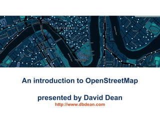
An introduction to OpenStreetMap

    presented by David Dean
         http://www.dbdean.com
What is OpenStreetMap?

• Geographic data
    – For driving, riding,
      walking, boating,
      skiing, hiking, anything
• Free
    – Currently CC-BY-SA,
      moving to ODBL
• Wiki-like editing
                                       http://www.osm.org


 An introduction to OpenStreetMap                           2
Why not just use Google Maps?


                      or WhereIs/Yahoo/Bing Maps?

               or whatever is on your GPS/Phone?


An introduction to OpenStreetMap                    3
Updated rapidly


                    Google                       OpenStreetMap


An introduction to OpenStreetMap                                 4
But, coverage can be poor


An introduction to OpenStreetMap                5
Not just for cars


An introduction to OpenStreetMap   6
Data freely available (and editable)


An introduction to OpenStreetMap              7
Raw traces are available too


An introduction to OpenStreetMap                8
Free data means you can do more neat stuff


  An introduction to OpenStreetMap           9
Lots of Mappers


An introduction to OpenStreetMap   10
Worldwide activity


                                     OSM 2008: A Year of Edits


An introduction to OpenStreetMap                                 11
Available on many devices
                                                          Garmin PNDs


 OffMaps on IPhone
                                                                                                     Garmin GPSs


                                                                        Gosmore on Windows Mobile


AndNav2 on Android
                                         GPSMid on J2ME                          MaemoMapper on Nokia Maemo


      An introduction to OpenStreetMap                                                                        12
Humanitarian OpenStreetMap Team


An introduction to OpenStreetMap      13
OpenStreetMap Gaza Project
                                   Jan 2009: Mikel Maron announces
                                   OpenStreetMap Gaza Project

                                   Feb 2009: Mapping begins with
                                   purchased aerial imagery
                                   (~ $6000)


An introduction to OpenStreetMap                                     14
Gaza Strip today


An introduction to OpenStreetMap                      15
MAP Kibera (April 2009)

• First complete, free and open map of Kibera,
  Nairobi.
• Mapped primarily
  with local volunteers
  with the assistance
  of MAP Kibera.
http://mapkibera.org


 An introduction to OpenStreetMap                  16
Kibera today


An introduction to OpenStreetMap                  17
Haiti earthquake, Jan 2010


An introduction to OpenStreetMap                 18
Haiti earthquake, Jan 2010


                        High-res imagery donated this time. (many providers)
An introduction to OpenStreetMap                                               19
Haiti earthquake, Jan 2010


                        High-res imagery donated this time. (many providers)
An introduction to OpenStreetMap                                               20
http://haiti.ushahidi.com

An introduction to OpenStreetMap                               21
World Bank Situation Room


                                                http://haiti.ushahidi.com

An introduction to OpenStreetMap                                            22
"Hello guys, I just wanted to let you know
                                         that your work on improving the Haiti
                                         maps is really appreciated here. A few
                                         days ago I installed a version on my
                                         Garmin Oregon GPS and the result is
                                         impressive. It has already saved me and
                                         my driver from getting lost twice, and the
                                         alternative would have been long delays.
                                         In the coming days I will try to update our
                                         Red Cross relief GPS receivers with your
                                         map.” - Kjeld Jensen, Red Cross (IFRC)


                    World Bank Situation Room


                                                         http://haiti.ushahidi.com

An introduction to OpenStreetMap                                                       23
So, how can you map?


An introduction to OpenStreetMap                24
(Option 1) Trace aerial imagery


An introduction to OpenStreetMap              25
(Option 2) Go outside

          Take notes, →


  record your trip
     (optional),

   and update the map from your notes at home

An introduction to OpenStreetMap                    26
(Option 3) Tell someone about a problem


An introduction to OpenStreetMap          27
(Option 4) Be social

• Brisbane mapping events occur monthly
  – Alternate between mapping parties and meetups
• Next event: OSM Mapping Meetup
  – 7pm Monday 21st June at Grange Library
  – See http://wiki.osm.org/wiki/Brisbane
• What is a mapping party?
  – A group of people get together to map a large
    area in a single day
  – Example: Macleay Island in November 2009


 An introduction to OpenStreetMap                     28
Data representation

• Geographic information is
  represented as
   – Nodes
   – Ways
          • Ordered collections of nodes
          • Closed ways can be areas
   – Relations
          • Ordered collections of ways
            and nodes
• All can be tagged with
  any key/value pairs

 An introduction to OpenStreetMap                    29
No formal key/value ontology

• Let freedom flourish!
• Common tagging is
  encouraged
    –    Map Features wiki
    –    Editor presets
    –    Renderers
    –    OSMDoc
    –    Tagwatch


 An introduction to OpenStreetMap              30
Questions/Suggestions?


Thanks for listening.


 An introduction to OpenStreetMap               31

Más contenido relacionado

La actualidad más candente

Band Combination of Landsat 8 Earth-observing Satellite Images
Band Combination of Landsat 8 Earth-observing Satellite ImagesBand Combination of Landsat 8 Earth-observing Satellite Images
Band Combination of Landsat 8 Earth-observing Satellite ImagesKabir Uddin
 
Aerial Photogrammetry
Aerial Photogrammetry Aerial Photogrammetry
Aerial Photogrammetry Mujeeb Muji
 
Accuracy of UAV Photogrammetry
Accuracy of UAV PhotogrammetryAccuracy of UAV Photogrammetry
Accuracy of UAV Photogrammetrybaselinesurvey
 
Digitization arc gis
Digitization arc gisDigitization arc gis
Digitization arc gisAshok Peddi
 
Commercially use GIS & REMOTE SENSING Software
Commercially use GIS & REMOTE SENSING SoftwareCommercially use GIS & REMOTE SENSING Software
Commercially use GIS & REMOTE SENSING Softwareanuj4849
 
Platforms of Remote sensing and GIS
Platforms of Remote sensing and GISPlatforms of Remote sensing and GIS
Platforms of Remote sensing and GISMouna Guru
 
SURVEYING - Photogrammetry (CE 115) Lec2 By Afia Narzis Spring 2016
SURVEYING - Photogrammetry (CE 115) Lec2 By Afia Narzis Spring 2016SURVEYING - Photogrammetry (CE 115) Lec2 By Afia Narzis Spring 2016
SURVEYING - Photogrammetry (CE 115) Lec2 By Afia Narzis Spring 2016PIYAL Bhuiyan
 
Remote Sensing error sources
Remote Sensing error sourcesRemote Sensing error sources
Remote Sensing error sourcesGilbert Okoth
 
Thermal remote sensing
Thermal remote sensingThermal remote sensing
Thermal remote sensingSakthivel R
 

La actualidad más candente (20)

70.mobile gis
70.mobile gis70.mobile gis
70.mobile gis
 
photogrammetry
photogrammetryphotogrammetry
photogrammetry
 
Band Combination of Landsat 8 Earth-observing Satellite Images
Band Combination of Landsat 8 Earth-observing Satellite ImagesBand Combination of Landsat 8 Earth-observing Satellite Images
Band Combination of Landsat 8 Earth-observing Satellite Images
 
Aerial Photogrammetry
Aerial Photogrammetry Aerial Photogrammetry
Aerial Photogrammetry
 
Digital Cartography
Digital CartographyDigital Cartography
Digital Cartography
 
Gps
GpsGps
Gps
 
Accuracy of UAV Photogrammetry
Accuracy of UAV PhotogrammetryAccuracy of UAV Photogrammetry
Accuracy of UAV Photogrammetry
 
GPS ERRORS
GPS ERRORS GPS ERRORS
GPS ERRORS
 
Digitization arc gis
Digitization arc gisDigitization arc gis
Digitization arc gis
 
Commercially use GIS & REMOTE SENSING Software
Commercially use GIS & REMOTE SENSING SoftwareCommercially use GIS & REMOTE SENSING Software
Commercially use GIS & REMOTE SENSING Software
 
Mobile gis
Mobile gisMobile gis
Mobile gis
 
Dgps
DgpsDgps
Dgps
 
Platforms of Remote sensing and GIS
Platforms of Remote sensing and GISPlatforms of Remote sensing and GIS
Platforms of Remote sensing and GIS
 
SURVEYING - Photogrammetry (CE 115) Lec2 By Afia Narzis Spring 2016
SURVEYING - Photogrammetry (CE 115) Lec2 By Afia Narzis Spring 2016SURVEYING - Photogrammetry (CE 115) Lec2 By Afia Narzis Spring 2016
SURVEYING - Photogrammetry (CE 115) Lec2 By Afia Narzis Spring 2016
 
Remote Sensing error sources
Remote Sensing error sourcesRemote Sensing error sources
Remote Sensing error sources
 
GIS
GISGIS
GIS
 
Introduction to GIS
Introduction to GISIntroduction to GIS
Introduction to GIS
 
Thermal remote sensing
Thermal remote sensingThermal remote sensing
Thermal remote sensing
 
Introduction of photogrammetry
Introduction of photogrammetryIntroduction of photogrammetry
Introduction of photogrammetry
 
Web GIS
Web GISWeb GIS
Web GIS
 

Destacado

Another Game of Chess, Professor Falken?
Another Game of Chess, Professor Falken?Another Game of Chess, Professor Falken?
Another Game of Chess, Professor Falken?Iván Sánchez Ortega
 
Introduction to OpenStreetMap
Introduction to OpenStreetMapIntroduction to OpenStreetMap
Introduction to OpenStreetMapdbdean
 
GeOng presentation about OpenStreetMap
GeOng presentation about OpenStreetMapGeOng presentation about OpenStreetMap
GeOng presentation about OpenStreetMapchippy
 
Safer Schools through Open Mapping and Data Sharing
Safer Schools through Open Mapping and Data SharingSafer Schools through Open Mapping and Data Sharing
Safer Schools through Open Mapping and Data SharingNama Raj Budhathoki
 
Open Data Day 2015- Kathmandu (Nama Budhathoki)
Open Data Day 2015- Kathmandu  (Nama Budhathoki)Open Data Day 2015- Kathmandu  (Nama Budhathoki)
Open Data Day 2015- Kathmandu (Nama Budhathoki)Nama Raj Budhathoki
 
Ctrl+F5 Mumbai, 2016: A Practical Approach to Design Thinking by Simran Talreja
Ctrl+F5 Mumbai, 2016: A Practical Approach to Design Thinking by Simran TalrejaCtrl+F5 Mumbai, 2016: A Practical Approach to Design Thinking by Simran Talreja
Ctrl+F5 Mumbai, 2016: A Practical Approach to Design Thinking by Simran TalrejaResellerClub
 
Volunteered Geographic Information and OpenStreetMap
Volunteered Geographic Information and OpenStreetMapVolunteered Geographic Information and OpenStreetMap
Volunteered Geographic Information and OpenStreetMapchippy
 
Social by Design: Design Thinking & Business
Social by Design: Design Thinking & BusinessSocial by Design: Design Thinking & Business
Social by Design: Design Thinking & BusinessDavid Armano
 
Lean & Design Thinking in Education
Lean & Design Thinking in EducationLean & Design Thinking in Education
Lean & Design Thinking in EducationAndres Ospina
 
Design Thinking for Startups - Are You Design Driven?
Design Thinking for Startups - Are You Design Driven?Design Thinking for Startups - Are You Design Driven?
Design Thinking for Startups - Are You Design Driven?Amir Khella
 
OpenStreetMap (OSM): Mapping from the crowd and on the field open data prepa...
OpenStreetMap (OSM):  Mapping from the crowd and on the field open data prepa...OpenStreetMap (OSM):  Mapping from the crowd and on the field open data prepa...
OpenStreetMap (OSM): Mapping from the crowd and on the field open data prepa...Severin Menard
 
Introducing design thinking
Introducing design thinkingIntroducing design thinking
Introducing design thinkingZaana Jaclyn
 
Design Thinking: The one thing that will transform the way you think
Design Thinking: The one thing that will transform the way you thinkDesign Thinking: The one thing that will transform the way you think
Design Thinking: The one thing that will transform the way you thinkDigital Surgeons
 
Intro to Design Thinking
Intro to Design ThinkingIntro to Design Thinking
Intro to Design ThinkingMike Krieger
 
Team Building PowerPoint PPT Content Modern Sample
Team Building PowerPoint PPT Content Modern SampleTeam Building PowerPoint PPT Content Modern Sample
Team Building PowerPoint PPT Content Modern SampleAndrew Schwartz
 

Destacado (20)

Another Game of Chess, Professor Falken?
Another Game of Chess, Professor Falken?Another Game of Chess, Professor Falken?
Another Game of Chess, Professor Falken?
 
Introduction to OpenStreetMap
Introduction to OpenStreetMapIntroduction to OpenStreetMap
Introduction to OpenStreetMap
 
GeOng presentation about OpenStreetMap
GeOng presentation about OpenStreetMapGeOng presentation about OpenStreetMap
GeOng presentation about OpenStreetMap
 
Presentation OpenStreetMap
Presentation OpenStreetMapPresentation OpenStreetMap
Presentation OpenStreetMap
 
OSM Presentations
OSM PresentationsOSM Presentations
OSM Presentations
 
Safer Schools through Open Mapping and Data Sharing
Safer Schools through Open Mapping and Data SharingSafer Schools through Open Mapping and Data Sharing
Safer Schools through Open Mapping and Data Sharing
 
Open Data Day 2015- Kathmandu (Nama Budhathoki)
Open Data Day 2015- Kathmandu  (Nama Budhathoki)Open Data Day 2015- Kathmandu  (Nama Budhathoki)
Open Data Day 2015- Kathmandu (Nama Budhathoki)
 
Ctrl+F5 Mumbai, 2016: A Practical Approach to Design Thinking by Simran Talreja
Ctrl+F5 Mumbai, 2016: A Practical Approach to Design Thinking by Simran TalrejaCtrl+F5 Mumbai, 2016: A Practical Approach to Design Thinking by Simran Talreja
Ctrl+F5 Mumbai, 2016: A Practical Approach to Design Thinking by Simran Talreja
 
Volunteered Geographic Information and OpenStreetMap
Volunteered Geographic Information and OpenStreetMapVolunteered Geographic Information and OpenStreetMap
Volunteered Geographic Information and OpenStreetMap
 
OSM- An Introduction
OSM- An IntroductionOSM- An Introduction
OSM- An Introduction
 
Design Thinking 101
Design Thinking 101Design Thinking 101
Design Thinking 101
 
Social by Design: Design Thinking & Business
Social by Design: Design Thinking & BusinessSocial by Design: Design Thinking & Business
Social by Design: Design Thinking & Business
 
Lean & Design Thinking in Education
Lean & Design Thinking in EducationLean & Design Thinking in Education
Lean & Design Thinking in Education
 
Design Thinking for Startups - Are You Design Driven?
Design Thinking for Startups - Are You Design Driven?Design Thinking for Startups - Are You Design Driven?
Design Thinking for Startups - Are You Design Driven?
 
OpenStreetMap (OSM): Mapping from the crowd and on the field open data prepa...
OpenStreetMap (OSM):  Mapping from the crowd and on the field open data prepa...OpenStreetMap (OSM):  Mapping from the crowd and on the field open data prepa...
OpenStreetMap (OSM): Mapping from the crowd and on the field open data prepa...
 
Team Building
Team BuildingTeam Building
Team Building
 
Introducing design thinking
Introducing design thinkingIntroducing design thinking
Introducing design thinking
 
Design Thinking: The one thing that will transform the way you think
Design Thinking: The one thing that will transform the way you thinkDesign Thinking: The one thing that will transform the way you think
Design Thinking: The one thing that will transform the way you think
 
Intro to Design Thinking
Intro to Design ThinkingIntro to Design Thinking
Intro to Design Thinking
 
Team Building PowerPoint PPT Content Modern Sample
Team Building PowerPoint PPT Content Modern SampleTeam Building PowerPoint PPT Content Modern Sample
Team Building PowerPoint PPT Content Modern Sample
 

Similar a An Introduction to OpenStreetMap

An introduction to OpenStreetMap (HUMBUG)
An introduction to OpenStreetMap (HUMBUG)An introduction to OpenStreetMap (HUMBUG)
An introduction to OpenStreetMap (HUMBUG)dbdean
 
An Introduction to OpenStreetMap (UQ GIS Students)
An Introduction to OpenStreetMap (UQ GIS Students)An Introduction to OpenStreetMap (UQ GIS Students)
An Introduction to OpenStreetMap (UQ GIS Students)dbdean
 
An introduction to OpenStreetMap for bushwalkers
An introduction to OpenStreetMap for bushwalkersAn introduction to OpenStreetMap for bushwalkers
An introduction to OpenStreetMap for bushwalkersdbdean
 
Intro to OpenStreetMap- UC Merced 4.22.09
Intro to OpenStreetMap- UC Merced 4.22.09Intro to OpenStreetMap- UC Merced 4.22.09
Intro to OpenStreetMap- UC Merced 4.22.09Sarah_Manley
 
Stanford Presentation to GISSIG
Stanford Presentation to GISSIGStanford Presentation to GISSIG
Stanford Presentation to GISSIGSarah_Manley
 
Introduction to OpenStreetMap and Humanitarian OSM Team for Plan Internationa...
Introduction to OpenStreetMap and Humanitarian OSM Team for Plan Internationa...Introduction to OpenStreetMap and Humanitarian OSM Team for Plan Internationa...
Introduction to OpenStreetMap and Humanitarian OSM Team for Plan Internationa...chippy
 
Open Geo Data in Italy and the OpenStreetMap case
Open Geo Data in Italy and the OpenStreetMap caseOpen Geo Data in Italy and the OpenStreetMap case
Open Geo Data in Italy and the OpenStreetMap caseMaurizio Napolitano
 
Presenting OpenStreetMap in Ghana during Project Flood Risk Accra Workshop
Presenting OpenStreetMap in Ghana during Project Flood Risk Accra WorkshopPresenting OpenStreetMap in Ghana during Project Flood Risk Accra Workshop
Presenting OpenStreetMap in Ghana during Project Flood Risk Accra WorkshopEnock Seth Nyamador
 
Answer togoogleearthuniverseandevrythingelse abbreviated
Answer togoogleearthuniverseandevrythingelse abbreviatedAnswer togoogleearthuniverseandevrythingelse abbreviated
Answer togoogleearthuniverseandevrythingelse abbreviatedShashank Singh
 
Talk: "Using Open Data and Crowdsourcing to develop CycleStreets"
Talk: "Using Open Data and Crowdsourcing to develop CycleStreets"Talk: "Using Open Data and Crowdsourcing to develop CycleStreets"
Talk: "Using Open Data and Crowdsourcing to develop CycleStreets"CycleStreets
 
Openstreetmap and its value during emergencies
Openstreetmap and its value during emergenciesOpenstreetmap and its value during emergencies
Openstreetmap and its value during emergenciesErvin Malicdem
 
[Day 3] Agcommons Quickwin: gRoads
[Day 3] Agcommons Quickwin: gRoads[Day 3] Agcommons Quickwin: gRoads
[Day 3] Agcommons Quickwin: gRoadscsi2009
 
OpenStreetMap Sri Lanka
OpenStreetMap Sri LankaOpenStreetMap Sri Lanka
OpenStreetMap Sri LankaJeff Haack
 
From a niche to a global user community: Open Source GIS and OSGeo
From a niche to a global user community: Open Source GIS and OSGeoFrom a niche to a global user community: Open Source GIS and OSGeo
From a niche to a global user community: Open Source GIS and OSGeoMarkus Neteler
 
Open streetmapによる鳥取ガイドの試み3
Open streetmapによる鳥取ガイドの試み3Open streetmapによる鳥取ガイドの試み3
Open streetmapによる鳥取ガイドの試み3Hiroyuki Nakaji
 
DSD-INT 2016 A crowd-sourced spatial database can change the way we work - Va...
DSD-INT 2016 A crowd-sourced spatial database can change the way we work - Va...DSD-INT 2016 A crowd-sourced spatial database can change the way we work - Va...
DSD-INT 2016 A crowd-sourced spatial database can change the way we work - Va...Deltares
 
OpenStreetMap Response to Haiti earthquake
OpenStreetMap Response to Haiti earthquake OpenStreetMap Response to Haiti earthquake
OpenStreetMap Response to Haiti earthquake Shoaib Burq
 
OpenStreetMap and CycleStreets: collaborative map-making and cartography in t...
OpenStreetMap and CycleStreets: collaborative map-making and cartography in t...OpenStreetMap and CycleStreets: collaborative map-making and cartography in t...
OpenStreetMap and CycleStreets: collaborative map-making and cartography in t...CycleStreets
 

Similar a An Introduction to OpenStreetMap (20)

An introduction to OpenStreetMap (HUMBUG)
An introduction to OpenStreetMap (HUMBUG)An introduction to OpenStreetMap (HUMBUG)
An introduction to OpenStreetMap (HUMBUG)
 
An Introduction to OpenStreetMap (UQ GIS Students)
An Introduction to OpenStreetMap (UQ GIS Students)An Introduction to OpenStreetMap (UQ GIS Students)
An Introduction to OpenStreetMap (UQ GIS Students)
 
An introduction to OpenStreetMap for bushwalkers
An introduction to OpenStreetMap for bushwalkersAn introduction to OpenStreetMap for bushwalkers
An introduction to OpenStreetMap for bushwalkers
 
Intro to OpenStreetMap- UC Merced 4.22.09
Intro to OpenStreetMap- UC Merced 4.22.09Intro to OpenStreetMap- UC Merced 4.22.09
Intro to OpenStreetMap- UC Merced 4.22.09
 
Stanford Presentation to GISSIG
Stanford Presentation to GISSIGStanford Presentation to GISSIG
Stanford Presentation to GISSIG
 
Introduction to OpenStreetMap and Humanitarian OSM Team for Plan Internationa...
Introduction to OpenStreetMap and Humanitarian OSM Team for Plan Internationa...Introduction to OpenStreetMap and Humanitarian OSM Team for Plan Internationa...
Introduction to OpenStreetMap and Humanitarian OSM Team for Plan Internationa...
 
Open Geo Data in Italy and the OpenStreetMap case
Open Geo Data in Italy and the OpenStreetMap caseOpen Geo Data in Italy and the OpenStreetMap case
Open Geo Data in Italy and the OpenStreetMap case
 
Osm Presentation
Osm PresentationOsm Presentation
Osm Presentation
 
OpenStreetMap
OpenStreetMapOpenStreetMap
OpenStreetMap
 
Presenting OpenStreetMap in Ghana during Project Flood Risk Accra Workshop
Presenting OpenStreetMap in Ghana during Project Flood Risk Accra WorkshopPresenting OpenStreetMap in Ghana during Project Flood Risk Accra Workshop
Presenting OpenStreetMap in Ghana during Project Flood Risk Accra Workshop
 
Answer togoogleearthuniverseandevrythingelse abbreviated
Answer togoogleearthuniverseandevrythingelse abbreviatedAnswer togoogleearthuniverseandevrythingelse abbreviated
Answer togoogleearthuniverseandevrythingelse abbreviated
 
Talk: "Using Open Data and Crowdsourcing to develop CycleStreets"
Talk: "Using Open Data and Crowdsourcing to develop CycleStreets"Talk: "Using Open Data and Crowdsourcing to develop CycleStreets"
Talk: "Using Open Data and Crowdsourcing to develop CycleStreets"
 
Openstreetmap and its value during emergencies
Openstreetmap and its value during emergenciesOpenstreetmap and its value during emergencies
Openstreetmap and its value during emergencies
 
[Day 3] Agcommons Quickwin: gRoads
[Day 3] Agcommons Quickwin: gRoads[Day 3] Agcommons Quickwin: gRoads
[Day 3] Agcommons Quickwin: gRoads
 
OpenStreetMap Sri Lanka
OpenStreetMap Sri LankaOpenStreetMap Sri Lanka
OpenStreetMap Sri Lanka
 
From a niche to a global user community: Open Source GIS and OSGeo
From a niche to a global user community: Open Source GIS and OSGeoFrom a niche to a global user community: Open Source GIS and OSGeo
From a niche to a global user community: Open Source GIS and OSGeo
 
Open streetmapによる鳥取ガイドの試み3
Open streetmapによる鳥取ガイドの試み3Open streetmapによる鳥取ガイドの試み3
Open streetmapによる鳥取ガイドの試み3
 
DSD-INT 2016 A crowd-sourced spatial database can change the way we work - Va...
DSD-INT 2016 A crowd-sourced spatial database can change the way we work - Va...DSD-INT 2016 A crowd-sourced spatial database can change the way we work - Va...
DSD-INT 2016 A crowd-sourced spatial database can change the way we work - Va...
 
OpenStreetMap Response to Haiti earthquake
OpenStreetMap Response to Haiti earthquake OpenStreetMap Response to Haiti earthquake
OpenStreetMap Response to Haiti earthquake
 
OpenStreetMap and CycleStreets: collaborative map-making and cartography in t...
OpenStreetMap and CycleStreets: collaborative map-making and cartography in t...OpenStreetMap and CycleStreets: collaborative map-making and cartography in t...
OpenStreetMap and CycleStreets: collaborative map-making and cartography in t...
 

Último

Handwritten Text Recognition for manuscripts and early printed texts
Handwritten Text Recognition for manuscripts and early printed textsHandwritten Text Recognition for manuscripts and early printed texts
Handwritten Text Recognition for manuscripts and early printed textsMaria Levchenko
 
Scaling API-first – The story of a global engineering organization
Scaling API-first – The story of a global engineering organizationScaling API-first – The story of a global engineering organization
Scaling API-first – The story of a global engineering organizationRadu Cotescu
 
08448380779 Call Girls In Civil Lines Women Seeking Men
08448380779 Call Girls In Civil Lines Women Seeking Men08448380779 Call Girls In Civil Lines Women Seeking Men
08448380779 Call Girls In Civil Lines Women Seeking MenDelhi Call girls
 
Boost Fertility New Invention Ups Success Rates.pdf
Boost Fertility New Invention Ups Success Rates.pdfBoost Fertility New Invention Ups Success Rates.pdf
Boost Fertility New Invention Ups Success Rates.pdfsudhanshuwaghmare1
 
08448380779 Call Girls In Diplomatic Enclave Women Seeking Men
08448380779 Call Girls In Diplomatic Enclave Women Seeking Men08448380779 Call Girls In Diplomatic Enclave Women Seeking Men
08448380779 Call Girls In Diplomatic Enclave Women Seeking MenDelhi Call girls
 
Strategize a Smooth Tenant-to-tenant Migration and Copilot Takeoff
Strategize a Smooth Tenant-to-tenant Migration and Copilot TakeoffStrategize a Smooth Tenant-to-tenant Migration and Copilot Takeoff
Strategize a Smooth Tenant-to-tenant Migration and Copilot Takeoffsammart93
 
Workshop - Best of Both Worlds_ Combine KG and Vector search for enhanced R...
Workshop - Best of Both Worlds_ Combine  KG and Vector search for  enhanced R...Workshop - Best of Both Worlds_ Combine  KG and Vector search for  enhanced R...
Workshop - Best of Both Worlds_ Combine KG and Vector search for enhanced R...Neo4j
 
Boost PC performance: How more available memory can improve productivity
Boost PC performance: How more available memory can improve productivityBoost PC performance: How more available memory can improve productivity
Boost PC performance: How more available memory can improve productivityPrincipled Technologies
 
Axa Assurance Maroc - Insurer Innovation Award 2024
Axa Assurance Maroc - Insurer Innovation Award 2024Axa Assurance Maroc - Insurer Innovation Award 2024
Axa Assurance Maroc - Insurer Innovation Award 2024The Digital Insurer
 
Finology Group – Insurtech Innovation Award 2024
Finology Group – Insurtech Innovation Award 2024Finology Group – Insurtech Innovation Award 2024
Finology Group – Insurtech Innovation Award 2024The Digital Insurer
 
Data Cloud, More than a CDP by Matt Robison
Data Cloud, More than a CDP by Matt RobisonData Cloud, More than a CDP by Matt Robison
Data Cloud, More than a CDP by Matt RobisonAnna Loughnan Colquhoun
 
08448380779 Call Girls In Greater Kailash - I Women Seeking Men
08448380779 Call Girls In Greater Kailash - I Women Seeking Men08448380779 Call Girls In Greater Kailash - I Women Seeking Men
08448380779 Call Girls In Greater Kailash - I Women Seeking MenDelhi Call girls
 
How to Troubleshoot Apps for the Modern Connected Worker
How to Troubleshoot Apps for the Modern Connected WorkerHow to Troubleshoot Apps for the Modern Connected Worker
How to Troubleshoot Apps for the Modern Connected WorkerThousandEyes
 
[2024]Digital Global Overview Report 2024 Meltwater.pdf
[2024]Digital Global Overview Report 2024 Meltwater.pdf[2024]Digital Global Overview Report 2024 Meltwater.pdf
[2024]Digital Global Overview Report 2024 Meltwater.pdfhans926745
 
Bajaj Allianz Life Insurance Company - Insurer Innovation Award 2024
Bajaj Allianz Life Insurance Company - Insurer Innovation Award 2024Bajaj Allianz Life Insurance Company - Insurer Innovation Award 2024
Bajaj Allianz Life Insurance Company - Insurer Innovation Award 2024The Digital Insurer
 
What Are The Drone Anti-jamming Systems Technology?
What Are The Drone Anti-jamming Systems Technology?What Are The Drone Anti-jamming Systems Technology?
What Are The Drone Anti-jamming Systems Technology?Antenna Manufacturer Coco
 
Raspberry Pi 5: Challenges and Solutions in Bringing up an OpenGL/Vulkan Driv...
Raspberry Pi 5: Challenges and Solutions in Bringing up an OpenGL/Vulkan Driv...Raspberry Pi 5: Challenges and Solutions in Bringing up an OpenGL/Vulkan Driv...
Raspberry Pi 5: Challenges and Solutions in Bringing up an OpenGL/Vulkan Driv...Igalia
 
How to convert PDF to text with Nanonets
How to convert PDF to text with NanonetsHow to convert PDF to text with Nanonets
How to convert PDF to text with Nanonetsnaman860154
 
Exploring the Future Potential of AI-Enabled Smartphone Processors
Exploring the Future Potential of AI-Enabled Smartphone ProcessorsExploring the Future Potential of AI-Enabled Smartphone Processors
Exploring the Future Potential of AI-Enabled Smartphone Processorsdebabhi2
 
TrustArc Webinar - Stay Ahead of US State Data Privacy Law Developments
TrustArc Webinar - Stay Ahead of US State Data Privacy Law DevelopmentsTrustArc Webinar - Stay Ahead of US State Data Privacy Law Developments
TrustArc Webinar - Stay Ahead of US State Data Privacy Law DevelopmentsTrustArc
 

Último (20)

Handwritten Text Recognition for manuscripts and early printed texts
Handwritten Text Recognition for manuscripts and early printed textsHandwritten Text Recognition for manuscripts and early printed texts
Handwritten Text Recognition for manuscripts and early printed texts
 
Scaling API-first – The story of a global engineering organization
Scaling API-first – The story of a global engineering organizationScaling API-first – The story of a global engineering organization
Scaling API-first – The story of a global engineering organization
 
08448380779 Call Girls In Civil Lines Women Seeking Men
08448380779 Call Girls In Civil Lines Women Seeking Men08448380779 Call Girls In Civil Lines Women Seeking Men
08448380779 Call Girls In Civil Lines Women Seeking Men
 
Boost Fertility New Invention Ups Success Rates.pdf
Boost Fertility New Invention Ups Success Rates.pdfBoost Fertility New Invention Ups Success Rates.pdf
Boost Fertility New Invention Ups Success Rates.pdf
 
08448380779 Call Girls In Diplomatic Enclave Women Seeking Men
08448380779 Call Girls In Diplomatic Enclave Women Seeking Men08448380779 Call Girls In Diplomatic Enclave Women Seeking Men
08448380779 Call Girls In Diplomatic Enclave Women Seeking Men
 
Strategize a Smooth Tenant-to-tenant Migration and Copilot Takeoff
Strategize a Smooth Tenant-to-tenant Migration and Copilot TakeoffStrategize a Smooth Tenant-to-tenant Migration and Copilot Takeoff
Strategize a Smooth Tenant-to-tenant Migration and Copilot Takeoff
 
Workshop - Best of Both Worlds_ Combine KG and Vector search for enhanced R...
Workshop - Best of Both Worlds_ Combine  KG and Vector search for  enhanced R...Workshop - Best of Both Worlds_ Combine  KG and Vector search for  enhanced R...
Workshop - Best of Both Worlds_ Combine KG and Vector search for enhanced R...
 
Boost PC performance: How more available memory can improve productivity
Boost PC performance: How more available memory can improve productivityBoost PC performance: How more available memory can improve productivity
Boost PC performance: How more available memory can improve productivity
 
Axa Assurance Maroc - Insurer Innovation Award 2024
Axa Assurance Maroc - Insurer Innovation Award 2024Axa Assurance Maroc - Insurer Innovation Award 2024
Axa Assurance Maroc - Insurer Innovation Award 2024
 
Finology Group – Insurtech Innovation Award 2024
Finology Group – Insurtech Innovation Award 2024Finology Group – Insurtech Innovation Award 2024
Finology Group – Insurtech Innovation Award 2024
 
Data Cloud, More than a CDP by Matt Robison
Data Cloud, More than a CDP by Matt RobisonData Cloud, More than a CDP by Matt Robison
Data Cloud, More than a CDP by Matt Robison
 
08448380779 Call Girls In Greater Kailash - I Women Seeking Men
08448380779 Call Girls In Greater Kailash - I Women Seeking Men08448380779 Call Girls In Greater Kailash - I Women Seeking Men
08448380779 Call Girls In Greater Kailash - I Women Seeking Men
 
How to Troubleshoot Apps for the Modern Connected Worker
How to Troubleshoot Apps for the Modern Connected WorkerHow to Troubleshoot Apps for the Modern Connected Worker
How to Troubleshoot Apps for the Modern Connected Worker
 
[2024]Digital Global Overview Report 2024 Meltwater.pdf
[2024]Digital Global Overview Report 2024 Meltwater.pdf[2024]Digital Global Overview Report 2024 Meltwater.pdf
[2024]Digital Global Overview Report 2024 Meltwater.pdf
 
Bajaj Allianz Life Insurance Company - Insurer Innovation Award 2024
Bajaj Allianz Life Insurance Company - Insurer Innovation Award 2024Bajaj Allianz Life Insurance Company - Insurer Innovation Award 2024
Bajaj Allianz Life Insurance Company - Insurer Innovation Award 2024
 
What Are The Drone Anti-jamming Systems Technology?
What Are The Drone Anti-jamming Systems Technology?What Are The Drone Anti-jamming Systems Technology?
What Are The Drone Anti-jamming Systems Technology?
 
Raspberry Pi 5: Challenges and Solutions in Bringing up an OpenGL/Vulkan Driv...
Raspberry Pi 5: Challenges and Solutions in Bringing up an OpenGL/Vulkan Driv...Raspberry Pi 5: Challenges and Solutions in Bringing up an OpenGL/Vulkan Driv...
Raspberry Pi 5: Challenges and Solutions in Bringing up an OpenGL/Vulkan Driv...
 
How to convert PDF to text with Nanonets
How to convert PDF to text with NanonetsHow to convert PDF to text with Nanonets
How to convert PDF to text with Nanonets
 
Exploring the Future Potential of AI-Enabled Smartphone Processors
Exploring the Future Potential of AI-Enabled Smartphone ProcessorsExploring the Future Potential of AI-Enabled Smartphone Processors
Exploring the Future Potential of AI-Enabled Smartphone Processors
 
TrustArc Webinar - Stay Ahead of US State Data Privacy Law Developments
TrustArc Webinar - Stay Ahead of US State Data Privacy Law DevelopmentsTrustArc Webinar - Stay Ahead of US State Data Privacy Law Developments
TrustArc Webinar - Stay Ahead of US State Data Privacy Law Developments
 

An Introduction to OpenStreetMap

  • 1. An introduction to OpenStreetMap presented by David Dean http://www.dbdean.com
  • 2. What is OpenStreetMap? • Geographic data – For driving, riding, walking, boating, skiing, hiking, anything • Free – Currently CC-BY-SA, moving to ODBL • Wiki-like editing http://www.osm.org An introduction to OpenStreetMap 2
  • 3. Why not just use Google Maps? or WhereIs/Yahoo/Bing Maps? or whatever is on your GPS/Phone? An introduction to OpenStreetMap 3
  • 4. Updated rapidly Google OpenStreetMap An introduction to OpenStreetMap 4
  • 5. But, coverage can be poor An introduction to OpenStreetMap 5
  • 6. Not just for cars An introduction to OpenStreetMap 6
  • 7. Data freely available (and editable) An introduction to OpenStreetMap 7
  • 8. Raw traces are available too An introduction to OpenStreetMap 8
  • 9. Free data means you can do more neat stuff An introduction to OpenStreetMap 9
  • 10. Lots of Mappers An introduction to OpenStreetMap 10
  • 11. Worldwide activity OSM 2008: A Year of Edits An introduction to OpenStreetMap 11
  • 12. Available on many devices Garmin PNDs OffMaps on IPhone Garmin GPSs Gosmore on Windows Mobile AndNav2 on Android GPSMid on J2ME MaemoMapper on Nokia Maemo An introduction to OpenStreetMap 12
  • 13. Humanitarian OpenStreetMap Team An introduction to OpenStreetMap 13
  • 14. OpenStreetMap Gaza Project Jan 2009: Mikel Maron announces OpenStreetMap Gaza Project Feb 2009: Mapping begins with purchased aerial imagery (~ $6000) An introduction to OpenStreetMap 14
  • 15. Gaza Strip today An introduction to OpenStreetMap 15
  • 16. MAP Kibera (April 2009) • First complete, free and open map of Kibera, Nairobi. • Mapped primarily with local volunteers with the assistance of MAP Kibera. http://mapkibera.org An introduction to OpenStreetMap 16
  • 17. Kibera today An introduction to OpenStreetMap 17
  • 18. Haiti earthquake, Jan 2010 An introduction to OpenStreetMap 18
  • 19. Haiti earthquake, Jan 2010 High-res imagery donated this time. (many providers) An introduction to OpenStreetMap 19
  • 20. Haiti earthquake, Jan 2010 High-res imagery donated this time. (many providers) An introduction to OpenStreetMap 20
  • 22. World Bank Situation Room http://haiti.ushahidi.com An introduction to OpenStreetMap 22
  • 23. "Hello guys, I just wanted to let you know that your work on improving the Haiti maps is really appreciated here. A few days ago I installed a version on my Garmin Oregon GPS and the result is impressive. It has already saved me and my driver from getting lost twice, and the alternative would have been long delays. In the coming days I will try to update our Red Cross relief GPS receivers with your map.” - Kjeld Jensen, Red Cross (IFRC) World Bank Situation Room http://haiti.ushahidi.com An introduction to OpenStreetMap 23
  • 24. So, how can you map? An introduction to OpenStreetMap 24
  • 25. (Option 1) Trace aerial imagery An introduction to OpenStreetMap 25
  • 26. (Option 2) Go outside Take notes, → record your trip (optional), and update the map from your notes at home An introduction to OpenStreetMap 26
  • 27. (Option 3) Tell someone about a problem An introduction to OpenStreetMap 27
  • 28. (Option 4) Be social • Brisbane mapping events occur monthly – Alternate between mapping parties and meetups • Next event: OSM Mapping Meetup – 7pm Monday 21st June at Grange Library – See http://wiki.osm.org/wiki/Brisbane • What is a mapping party? – A group of people get together to map a large area in a single day – Example: Macleay Island in November 2009 An introduction to OpenStreetMap 28
  • 29. Data representation • Geographic information is represented as – Nodes – Ways • Ordered collections of nodes • Closed ways can be areas – Relations • Ordered collections of ways and nodes • All can be tagged with any key/value pairs An introduction to OpenStreetMap 29
  • 30. No formal key/value ontology • Let freedom flourish! • Common tagging is encouraged – Map Features wiki – Editor presets – Renderers – OSMDoc – Tagwatch An introduction to OpenStreetMap 30
  • 31. Questions/Suggestions? Thanks for listening. An introduction to OpenStreetMap 31