Enviar búsqueda
Cargar
Watershed and Volume Analysis using a LiDAR DEM
•
Descargar como PPT, PDF
•
2 recomendaciones
•
593 vistas
C
Civil Solutions, a division of ARH Assoiates
Seguir
Tecnología
Empresariales
Denunciar
Compartir
Denunciar
Compartir
1 de 11
Descargar ahora
Recomendados
Understanding runoff generation processes and rainfall runoff modeling: The c...
International Water Management Institute (IWMI)
Nigtrogen Pollution Change Due to Land Use Changes in the Plano/Allen area.
stoughne
WATER RESOURCES MODELING OF THE GANGES-BRAHMAPUTRA-MEGHNA RIVER BASINS USING ...
Moudud Hasan
Analysis of Stormwater System for Urban Development Project in North Louisiana
Brian Elkins
23 - NRSC - Remote Satellite Imgae - Hydrology and Water Management-Sep-17
indiawrm
Using Computer-simulated hydrological model (SWAT) to estimate the ground-wat...
Dhiraj Jhunjhunwala
Scale-dependency and Sensitivity of Hydrological Estimations to Land Use and ...
Beniamino Murgante
Rainfall Runoff Modelling on the Lower Tapi Basin using HEC-HMS
Ankit Balyan MBA, B.Tech.
Watershed analysis using GIS
Aya Osman
Poster GSA 2014
Poster GSA 2014
Khalil A. Lezzaik
REMOTE SENSING DATA FOR HYDROLOGICAL MODELING
Shyam Mohan Chaudhary
Senior Thesis Poster
James Blumenschein
Aquifer recharge from flash floods in the arid environment: A mass balance ap...
Amro Elfeki
APPLICATIONS OF ARC SWAT MODEL FOR HYDROLOGICAL MODELLING
Abhiram Kanigolla
Kieffer Huck 2008
Kieffer Huck 2008
dougkieffer
Arc swat
Arc swat
vishvjeet tholia
2016Fall_GSFC_NorthCarolinaWater_Poster_FD
John Fitz
Exploring California Central Valley Groundwater Quality with Python
Walt McNab
Effectiveness Analysis of Best Management Practices by SWAT for Appropriate C...
ExternalEvents
Master's course defense presentation in Water Resource Management and GIS
Tooryalay Ayoubi
MUSE
MUSE
Emily Hennessy
Hydrologic Assessment in a Middle Narmada Basin, India using SWAT Model
Sumant Diwakar
Hydrological modelling
Bharath Viswakarma
Estimation of phosphorus loss from agricultural land in the southern region o...
LPE Learning Center
International Journal of Computational Engineering Research(IJCER)
ijceronline
Modeling phosphorus runoff in the chesapeake bay region to test the phosphoru...
LPE Learning Center
Assessing the ability of SWAT as a water quality model in the Lake Victoria b...
Timo Brussée
Understanding impacts of sustainable land management interventions using SWAT...
International Water Management Institute (IWMI)
HOLMDEL TOWNSHIP EASEMENTS
Civil Solutions, a division of ARH Assoiates
THE TRENTON BOARD OF EDUCATION MEETS GIS
Civil Solutions, a division of ARH Assoiates
Más contenido relacionado
La actualidad más candente
Watershed analysis using GIS
Aya Osman
Poster GSA 2014
Poster GSA 2014
Khalil A. Lezzaik
REMOTE SENSING DATA FOR HYDROLOGICAL MODELING
Shyam Mohan Chaudhary
Senior Thesis Poster
James Blumenschein
Aquifer recharge from flash floods in the arid environment: A mass balance ap...
Amro Elfeki
APPLICATIONS OF ARC SWAT MODEL FOR HYDROLOGICAL MODELLING
Abhiram Kanigolla
Kieffer Huck 2008
Kieffer Huck 2008
dougkieffer
Arc swat
Arc swat
vishvjeet tholia
2016Fall_GSFC_NorthCarolinaWater_Poster_FD
John Fitz
Exploring California Central Valley Groundwater Quality with Python
Walt McNab
Effectiveness Analysis of Best Management Practices by SWAT for Appropriate C...
ExternalEvents
Master's course defense presentation in Water Resource Management and GIS
Tooryalay Ayoubi
MUSE
MUSE
Emily Hennessy
Hydrologic Assessment in a Middle Narmada Basin, India using SWAT Model
Sumant Diwakar
Hydrological modelling
Bharath Viswakarma
Estimation of phosphorus loss from agricultural land in the southern region o...
LPE Learning Center
International Journal of Computational Engineering Research(IJCER)
ijceronline
Modeling phosphorus runoff in the chesapeake bay region to test the phosphoru...
LPE Learning Center
Assessing the ability of SWAT as a water quality model in the Lake Victoria b...
Timo Brussée
Understanding impacts of sustainable land management interventions using SWAT...
International Water Management Institute (IWMI)
La actualidad más candente
(20)
Watershed analysis using GIS
Poster GSA 2014
Poster GSA 2014
REMOTE SENSING DATA FOR HYDROLOGICAL MODELING
Senior Thesis Poster
Aquifer recharge from flash floods in the arid environment: A mass balance ap...
APPLICATIONS OF ARC SWAT MODEL FOR HYDROLOGICAL MODELLING
Kieffer Huck 2008
Kieffer Huck 2008
Arc swat
Arc swat
2016Fall_GSFC_NorthCarolinaWater_Poster_FD
Exploring California Central Valley Groundwater Quality with Python
Effectiveness Analysis of Best Management Practices by SWAT for Appropriate C...
Master's course defense presentation in Water Resource Management and GIS
MUSE
MUSE
Hydrologic Assessment in a Middle Narmada Basin, India using SWAT Model
Hydrological modelling
Estimation of phosphorus loss from agricultural land in the southern region o...
International Journal of Computational Engineering Research(IJCER)
Modeling phosphorus runoff in the chesapeake bay region to test the phosphoru...
Assessing the ability of SWAT as a water quality model in the Lake Victoria b...
Understanding impacts of sustainable land management interventions using SWAT...
Destacado
HOLMDEL TOWNSHIP EASEMENTS
Civil Solutions, a division of ARH Assoiates
THE TRENTON BOARD OF EDUCATION MEETS GIS
Civil Solutions, a division of ARH Assoiates
SLR WIZARD: A SEA LEVEL RISE INUNDATION MAPPING AND PLANNING APPLICATION
Civil Solutions, a division of ARH Assoiates
GEOSPATIALLY ENHANCED SNOW REMOVAL OPERATIONS
Civil Solutions, a division of ARH Assoiates
FEMA RISK MAP PROGRAM
Civil Solutions, a division of ARH Assoiates
COLLABORATION CENTER
Civil Solutions, a division of ARH Assoiates
Destacado
(6)
HOLMDEL TOWNSHIP EASEMENTS
THE TRENTON BOARD OF EDUCATION MEETS GIS
SLR WIZARD: A SEA LEVEL RISE INUNDATION MAPPING AND PLANNING APPLICATION
GEOSPATIALLY ENHANCED SNOW REMOVAL OPERATIONS
FEMA RISK MAP PROGRAM
COLLABORATION CENTER
Similar a Watershed and Volume Analysis using a LiDAR DEM
Southerland_GSA_2013
Lauren Southerland
Groundwater Data Requirement and Analysis
C. P. Kumar
carothers_ewriPoster_whole_final.compressed
Richard Carothers, EIT
2016 conservation track: evaluating lidar derived synthetic streams as a ...
GIS in the Rockies
Bathymetric Survey of Cross Lake
Darin Fortenberry, MBA
DSD-INT 2018 Floodplain Circulation Dynamics - van der Steeg
Deltares
Runoff estimation and water management for Holetta River, Awash subbasin, Eth...
International Water Management Institute (IWMI)
Birr - Identifying Critical Portions of the Landscape
Jose A. Hernandez
Brackish Groundwater Characterization, John Meyer and Sanjeev Kalaswad, Texas...
Texas Alliance of Groundwater Districts
Poster Draft
Poster Draft
Rebekah Riemann
Aquifer Mapping, Moni-ppt.pptx
TejasKadam44
Groundwater Resources Program (Dennehy)
Iwl Pcu
Groundwater Resources Program (Dennehy)
Iwl Pcu
The Thiessen polygons method is a common method used to interpolate p.pdf
anshuanil26
Methodology
Methodology
RCB78
Field methods final project
QisKIA
Remote sensing based water management from the watershed to the field level
CIMMYT
Groundwater Quality Mapping and Modeling
PARITOSH SINGH CHAUHAN
SRBC Remote Water Quality Monitoring Network Report - Dec 2013
Marcellus Drilling News
Monitoring playa water resources using gis and remote sensing
Texas Natural Resources Information System
Similar a Watershed and Volume Analysis using a LiDAR DEM
(20)
Southerland_GSA_2013
Groundwater Data Requirement and Analysis
carothers_ewriPoster_whole_final.compressed
2016 conservation track: evaluating lidar derived synthetic streams as a ...
Bathymetric Survey of Cross Lake
DSD-INT 2018 Floodplain Circulation Dynamics - van der Steeg
Runoff estimation and water management for Holetta River, Awash subbasin, Eth...
Birr - Identifying Critical Portions of the Landscape
Brackish Groundwater Characterization, John Meyer and Sanjeev Kalaswad, Texas...
Poster Draft
Poster Draft
Aquifer Mapping, Moni-ppt.pptx
Groundwater Resources Program (Dennehy)
The Thiessen polygons method is a common method used to interpolate p.pdf
Methodology
Methodology
Field methods final project
Remote sensing based water management from the watershed to the field level
Groundwater Quality Mapping and Modeling
SRBC Remote Water Quality Monitoring Network Report - Dec 2013
Monitoring playa water resources using gis and remote sensing
Último
Apidays Singapore 2024 - Building Digital Trust in a Digital Economy by Veron...
apidays
Real Time Object Detection Using Open CV
Khem
Manulife - Insurer Innovation Award 2024
The Digital Insurer
Why Teams call analytics are critical to your entire business
panagenda
MINDCTI Revenue Release Quarter One 2024
MIND CTI
A Year of the Servo Reboot: Where Are We Now?
Igalia
Deploy with confidence: VMware Cloud Foundation 5.1 on next gen Dell PowerEdg...
Principled Technologies
A Domino Admins Adventures (Engage 2024)
Gabriella Davis
Apidays New York 2024 - The Good, the Bad and the Governed by David O'Neill, ...
apidays
Apidays New York 2024 - The value of a flexible API Management solution for O...
apidays
Workshop - Best of Both Worlds_ Combine KG and Vector search for enhanced R...
Neo4j
ProductAnonymous-April2024-WinProductDiscovery-MelissaKlemke
Product Anonymous
Polkadot JAM Slides - Token2049 - By Dr. Gavin Wood
Juan lago vázquez
GenAI Risks & Security Meetup 01052024.pdf
lior mazor
Automating Google Workspace (GWS) & more with Apps Script
wesley chun
Mastering MySQL Database Architecture: Deep Dive into MySQL Shell and MySQL R...
Miguel Araújo
Connector Corner: Accelerate revenue generation using UiPath API-centric busi...
DianaGray10
2024: Domino Containers - The Next Step. News from the Domino Container commu...
Martijn de Jong
HTML Injection Attacks: Impact and Mitigation Strategies
Boston Institute of Analytics
presentation ICT roal in 21st century education
jfdjdjcjdnsjd
Último
(20)
Apidays Singapore 2024 - Building Digital Trust in a Digital Economy by Veron...
Real Time Object Detection Using Open CV
Manulife - Insurer Innovation Award 2024
Why Teams call analytics are critical to your entire business
MINDCTI Revenue Release Quarter One 2024
A Year of the Servo Reboot: Where Are We Now?
Deploy with confidence: VMware Cloud Foundation 5.1 on next gen Dell PowerEdg...
A Domino Admins Adventures (Engage 2024)
Apidays New York 2024 - The Good, the Bad and the Governed by David O'Neill, ...
Apidays New York 2024 - The value of a flexible API Management solution for O...
Workshop - Best of Both Worlds_ Combine KG and Vector search for enhanced R...
ProductAnonymous-April2024-WinProductDiscovery-MelissaKlemke
Polkadot JAM Slides - Token2049 - By Dr. Gavin Wood
GenAI Risks & Security Meetup 01052024.pdf
Automating Google Workspace (GWS) & more with Apps Script
Mastering MySQL Database Architecture: Deep Dive into MySQL Shell and MySQL R...
Connector Corner: Accelerate revenue generation using UiPath API-centric busi...
2024: Domino Containers - The Next Step. News from the Domino Container commu...
HTML Injection Attacks: Impact and Mitigation Strategies
presentation ICT roal in 21st century education
Watershed and Volume Analysis using a LiDAR DEM
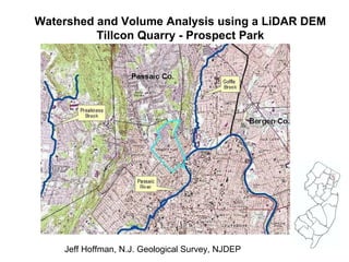
1.
Watershed and Volume
Analysis using a LiDAR DEM Tillcon Quarry - Prospect Park Jeff Hoffman, N.J. Geological Survey, NJDEP
2.
Pumping at quarry
to dewater. But no allocation permit. NJDEP investigation . 2007 imagery
3.
3-meter spacing LiDAR
data. Draft DEM. 3-D Analyst tools to clip and contour elevations.
4.
Spatial Analyst Fill
Quarry’s watershed?
5.
Spatial Analyst Fill
Flow Direction Flow Accumulation 11-100 101- 1,000
6.
Spatial Analyst Fill
Flow Direction Flow Accumulation Create flow lines.
7.
Spatial Analyst Fill
Flow Direction Flow Accumulation Create flow lines. Create vertices.
8.
Spatial Analyst Fill
Flow Direction Flow Accumulation Create flow lines. Create vertices. Pick pour point. Create watershed.
9.
87 acres
Reservoir potential?
10.
0.56 billion gallons
Raster tool: Cut/Fill Actual elevation Filled to 200’ Raster tools: Reclassify, Minus
11.
Reservoir Volumes, northeast
New Jersey (billions of gallons)
Descargar ahora