Map Projections, Datums, GIS and GPS for Everyone
•Descargar como PPTX, PDF•
12 recomendaciones•68,702 vistas

A description of map projections, datum models, and global positioning systems. Enjoy.

Recomendados
Más contenido relacionado
La actualidad más candente
La actualidad más candente (20)
Similar a Map Projections, Datums, GIS and GPS for Everyone
Similar a Map Projections, Datums, GIS and GPS for Everyone (20)
Último
Último (20)
Map Projections, Datums, GIS and GPS for Everyone
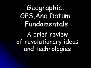
- 1. Geographic, GPS,And Datum Fundamentals A brief review of revolutionary ideas and technologies
- 2. GPS Description: The Global Positioning System* (GPS) is based on observations of signals transmitted from satellites Source:http://www.garmin.com/aboutGPS/ *Owned and operated by the Department of Defense
- 3. Beacon Receiver - Most Common Choice for High Resolution Surveying CORS – Continuous Operation Reference Station PAPT—University of Pittsburgh CORS Station. Check us on the web at http://www.ngs.noaa.gov
- 4. Geographic Coordinates Origin at Greenwich Observatory and Equator
- 5. Old School: Determining an unknown position. Benchmarks represented highly accurate known reference positions! Brass disk Chisel marks Rock piles Buried monuments Now replaced, and being relocated with respect to, NGS CORS GPS Reference Stations.
- 7. Continuously Operating Reference Stations
- 8. PAPT: The Univ. of Pittsburgh CORS NGS Reference Station
- 11. Specifying an unknown Position Measure unknown position with respect to known features. Involved triangulation of known features to determine an unknown point. National networks established.
- 12. Datum, Survey Network Historically: Triangulation Network Astronomical observation Initial, intermittent, and ending baselines Multiple, redundant angle measurements Why these technologies? Easy to measure angles Difficult to measure distance accurately Time consuming to measure point position accurately
- 13. Survey Network, 1900 (from Schwartz, 1989)
- 14. Space based measurements The advent of the Earth orbiting satellites starting in 1955, and the development of radio astronomy (Jansky, 1932) started to bring about a revolution in geodetic accuracy. Activity started after WWII using technology developed during the war and in response to cold war. New methods removed the need for line-of-sight
- 15. GPS Original Design Started development in the late 1960s as NAVY/USAF project to replace Doppler positioning system Aim: Real-time positioning to < 10 meters, capable of being used on fast moving vehicles. Limit civilian (“non-authorized”) users to 100 meter positioning.
- 16. GPS Design Innovations: Use multiple satellites (originally 21, now ~28) All satellites transmit at same frequency Signals encoded with unique “bi-phase, quadrature code” generated by pseudo-random sequence. Dual frequency band transmission: L1 ~1.5 GHz, L2 ~1.25 GHz
- 17. The Macrometer V1000 -- the first GPS receiver owned by NOAA!! The GPS Pathfinder – puts a whole new spin on WHEN and WHERE!!
- 18. GPS Description: The Global Positioning System* (GPS) is based on observations of signals transmitted from satellites Source: http://msl.jpl.nasa.gov/QuickLooks/gps1QL.html *Owned and operated by the Department of Defense
- 19. Measurements Measurements: Time difference between signal transmission from satellite and its arrival at ground station (called “pseudo-range”, precise to 0.1–10 m) Carrier phase difference between transmitter and receiver (precise to a few millimeters) All measurements relative to “clocks” in ground receiver and satellites (potentially poses problems).
- 20. Positioning For pseudo-range to be used for “point-positioning” we need: Knowledge of errors in satellite clocks Knowledge of positions of satellites This information is transmitted by satellite in “broadcast ephemeris”. “Differential” positioning (DGPS) eliminates need for accurate satellite clock knowledge by differencing the satellite between GPS receivers (needs multiple ground receivers). Not discussed in this talk, but used in Geology and Planetary Science for ultra precise measurements (less than 1 mm relative horizontal uncertainty).
- 21. Satellite constellation Since multiple satellites need to be seen at same time (four or more): Many satellites (original 21 but now 28) High altitude so that large portion of Earth can be seen (20,000 km altitude —MEO)
- 22. The Global Positioning System (GPS) was designed for military applications. Its primary purpose was to allow soldiers to keep track of their position and to assist in guiding weapons to their targets. The satellites were built by Rockwell International and were launched by the U.S. Air Force. The entire system is funded by the U.S. government and controlled by the U.S. Department of Defense. The total cost for implementing the system was over $12 billion. A GPS satellite. The GPS constellation of satellites consists of at least 24 satellites – 21 primary satellites and 3 orbiting spares. They orbit the earth at an altitude of 17,500 KM (10,900 miles) at a speed of 1.9 miles per second between 60°N and 60°S latitude. Each satellite weighs 1900 lbs and is 17 feet (5.81 meters) wide with solar panels extended. The satellites orbit the earth twice a day. This guarantees that signals from six of the satellites can be received from any point on earth at almost any time.
- 23. Global Positioning System Its official name is NAVSTAR-GPS. Although NAVSTAR-GPS is not an acronym, a few backronyms have been created for it. The GPS satellite constellation is managed by the United States Air Force50th Space Wing. Similar satellite navigation systems include the Russian GLONASS (incomplete as of 2008), the upcoming European Galileo positioning system, the proposed COMPASS navigation system of China, and IRNSS of India. SiRF Star III based GPS receiver with integrated antenna. M10214 from Antenova, a UK company. From: http://en.wikipedia.org/wiki/GPS
- 24. THE GLOBAL POSITIONING SYSTEM PARTNERSHIP COUNCIL 2008 05 18 Partnership Council Welcome Slides
- 25. Hosting Organizations – Senior Representative BRIGADIER GENERAL JOHN E. HYTEN Brig Gen John E. Hyten is the Director of Requirements, Headquarters Air Force Space Command, Peterson Air Force Base, CO. As Director, he is responsible for ensuring future space and missile systems meet the operational needs of our joint forces into the 21st century. COLONEL DAVID W. MADDEN Colonel David W. Madden is Commander, Global Positioning Systems Wing (GPSW), Space and Missile Systems Center, LA AFB, CA. He is responsible for the multi-service, multi-national Systems Wing which conducts development, acquisition, fielding and sustainment of all GPS space segment, satellite command and control (ground) segment, and GPS military user equipment. 2008 05 18 Partnership Council Welcome Slides
- 26. Dr. Bradford W. Parkinson Dr. Bradford Parkinson (then USAF Colonel) was the original Program Director for Navstar GPS during the programs first six critical years (1972-1978). He and his team championed the effort to define the GPS system, sell the concept, develop the system architecture and perform the first test for DoD. Their first attempt for program approval failed in August 1973. It was packaged as the Air Force’s 621B system. It was determined that a more broadly based program, embracing the views and requirements of all US military services be developed. In response, Dr. Parkinson assembled about a dozen members of the JPO, on the fifth floor of the Pentagon. He directed the development of a new design that employed the best of all available concepts and technology. The result was a synthesis of the Air Force and Navy’s prior systems: Air Force’s 621B, Navy’s Timation, and Navy/Applied Physics Lab’s Transit program, as well as new ideas. The GPS design of today is essentially unchanged from the concept approved in December 1973. Dr. Parkinson’s continual focus on the future has assured his place in the history of navigation. 2008 05 18 Partnership Council Welcome Slides
- 27. Dr. A.J. Van Dierendonck Dr. A.J. Van Dierendonck, as an employee of AVAND Systems Engineering (his own company), has performed as a Consultant or Contract Engineer to eight major aerospace companies, all involved with the GPS program since 1977. He performed systems engineering tasks on GPS Monitor Station receivers, Position Reference System receivers, the GPSPAC Spaceborne Navigation Set, the X-set, the Y-set and the M-set. In addition, Dr. Van Dierendonck consulted on a significant portion of a FAA contract for an assessment of GPS applied to Civil Aviation Navigation requirements and on the development of a GPS user receiver simulation to be used in conjunction with their Inertial Navigation Systems simulations. Prior to March 1977, Dr. Van Dierendonck was the GPS Technical Manager at General Dynamics Electronics Division, responsible for the Phase I GPS Control Segment system designs requirements, system interfaces and algorithm development. The GPS program is indebted to Dr. A.J. Van Dierendonck for his tireless efforts. 2008 05 18 Partnership Council Welcome Slides
- 28. Dr. James J. Spilker, Jr. For over thirty years, Dr. Spilker has made repeated and lasting contributions to the technical, architectural and programmatic definition of GPS. In the 1970’s, he was a key creator of, and advocate for, the navigation signal structure now used by millions of civil and military users around the world. In the 1980’s, he founded and led Stanford Telecom as it developed a wide range of electronic products and services for diverse customers. In the 1990’s he continued to be a strong advocate to the National leadership for modernization of the GPS system. His leadership has made GPS the success it is today. 2008 05 18 Partnership Council Welcome Slides
- 29. Mr. Gaylord B. Green Colonel (ret) Green has made significant contributions in the civil, military, and scientific development and use of GPS. In the early 1970’s, he served an integral role in the development of GPS Block I satellites. In the 1980’s, he led the Guidance and Control Division of the Ballistic Missile Office where he integrated GPS receivers on two flights of Minuteman ICBMs. His government service culminated in his return to the JPO as the System Program Director. Upon entering the commercial sector in the late 1980’s, he continued to support GPS as President of the Institute of Navigation and President of Navastro Company, Inc., where he oversaw the application of high-precision GPS-based orbit determination to test Einstein’s General Theory of Relativity. Mr. Green’s distinguished service has contributed immeasurability to the success of GPS. 2008 05 18 Partnership Council Welcome Slides
- 30. Mr. Thomas A. Stansell, Jr. Mr. Thomas A. Stansell, Jr. has made repeated and lasting contributions to the technical, architectural and programmatic definition as well as regulatory protection of GPS over the past twenty years. In the 1980’s, he was a key creator of, and advocate for, all-digital GPS receiver technology now use by million of civil and military users around the world. In the 1990’s, he brought forward the concept of the GPS L5 data-less channel, which has now been fully developed. In the 2000s, he led the technical development of GPS L2C signal and improved the antijam performance of M-Code. He has been a continuing advocate to the National leadership for GPS modernization, as well as fighting for regulatory protection of modernized civil and military signals. Mr. Stansell has been recognized repeatedly for his contributions. He has been a Technical and a General Chair for two GPS ION Conferences and is a Fellow of ION. He won the ION Capt P.V.H. Weems award in 1995 and the IEEE PLANS most prestigious honor, the Kershner award, in 2000. Mr. Stansell’s leadership has helped make GPS the success it is today. 2008 05 18 Partnership Council Welcome Slides
- 31. Mr. Charles (Charlie) Cahn Dr. Charles Cahn was one of the primary architects of both the 621B program that preceded GPS and of the current GPS navigation signals. Dr. Cahn pioneered many advanced GPS receiver concepts during and after GPS Phases I and II, including novel signal tracking concepts to improve acquisition an “all digital” receiver architecture, and more recently, notch filtering, specialized interference cancellation, and other high antijam techniques. He also has advanced the state of the art of GPS multipath mitigation techniques. In recent years, Dr. Cahn has been a major contributor to GPS Signal modernization. He initially proposed Manchester modulation for what became the BOC (10, 5) M-Code, influenced Selection of convolutional coding for M-Code data, invented the M-Code Frequency Hopping acquisition method, provided the analysis which justified splitting all modernized GPS Signals into data and data-less components, including L5, L2C, and M-Code, and developed a code generator not based on Gold codes, which will be used for L2C. Dr. Cahn’s ongoing contributions span more than 30 years and continue unabated today 2008 05 18 Partnership Council Welcome Slides
- 32. 30th Anniversary of 1st GPS Launch,22 Feb 78 Navstar 1 launched at Vandenberg AFB, 22 February 1978 Block I’s launched from 22 February 1978 - 9 October 1985 Block I contract (F04701-74-C-0527) signed August 1974 1st satellite launch (Navstar 1) was 42 months later 1st four satellites were launched within a year--all in 1978 Rockwell International made a special "first day of issue" card for each Block I launch Vandenberg AFB Post Office stamped them with the date of the launch. Color scan of the memento on next slide Inside GNSS recapped the 30th anniversary of 1st GPS launch at: insidegnss.com/node/522 2008 05 18 Partnership Council Welcome Slides
- 33. Block I “First Day of Issue” Card Vandenberg AFBPost Office February 22, 1978 2008 05 18 Partnership Council Welcome Slides
- 34. The 3 segments of GPS
- 35. Current constellation • Relative sizes correct (inertial space view) • “Fuzzy” lines not due to orbit perturbations, but due to satellites being in 6-planes at 55o inclination.
- 36. Ground Track Paths followed by satellite along surface of Earth.
- 37. GPS Relativity Related Corrections Gravitational redshift (blueshift) predicted from General Relativity Orbital altitude 20,183 km Clock runs fast by 45.7 s per day Time dilation predicted from Special Relativity Satellite velocity 3.874 km/s Clock runs slow by 7.1 s per day Net secular effect (satellite clock runs fast) Clock runs fast by 38.6 s per day Residual periodic effect Orbital eccentricity 0.02 Amplitude of periodic effect 46 ns Sagnaceffect (rotation related) Maximum value 133 ns for a stationary receiver on the geoid
- 38. GPS (Summary) Net secular relativistic effect is 38.6 s per day Nominal clock rate is 10.23 MHz Satellite clocks are offset by – 4.464733 parts in 1010 to compensate effect Resulting (proper) frequency in orbit is 10229999.9954326 Hz Observed average rate of satellite clock is same as clock on the geoid Residual periodic effect Maximum amplitude 46 ns Correction applied in receiver Sagnac effect Maximum value 133 ns Correction applied in receiver
- 39. Pseudo-range accuracy Original intent was to position using pseudo-range: Accuracy better than planned. C/A code (open to all users) 10 cm-10 meters. Used by most hikers and low cost GPS units to determine position. P(Y) code (restricted access since 1992) 5 cm-5 meters
- 40. Example of FM Station 97.1 with 440 A note
- 41. Determining an unknown location today. Use GPS Range = speed of light x travel time Range = c(t1 – t2) (c =299,792,458 meters per second)
- 43. Step 1: using satellite ranging GPS is based on satellite ranging, i.e. distance from satellites …satellites are precise reference points …we determine our distance from them we will assume for now that we know exactly where satellite is and how far away from it we are… if we are lost and we know that we are 11,000 miles from satellite A… we are somewhere on a sphere whose middle is satellite A and diameter is 11,000 miles
- 44. if we also know that we are 12,000 miles from satellite B …we can narrow down where we must be… only place in universe is on circle where two spheres intersect if we also know that we are 13,000 miles from satellite C …our situation improves immensely… only place in universe is at either of two points where three spheres intersect
- 45. three can be enough to determine position… one of the two points generally is not possible (far off in space) two can be enough if you know your elevation …why? one of the spheres can be replaced with Earth… …center of Earth is “satellite position” generally four are best and necessary….why this is a little later this is basic principle behind GPS… …using satellites for triangulation
- 46. step 2: measuring distance from satellite because GPS based on knowing distance from satellite …we need to have a method for determing how far away the satellites are use velocity x time = distance GPS system works by timing how long it takes a radio signal to reach the receiver from a satellite… …distance is calculated from that time… radio waves travel at speed of light: 180,000 miles per second problem: need to know when GPS satellite started sending its radio message
- 47. requires very good clocks that measure short times… …electromagnetic waves move very quickly use atomic clocks came into being during World War II; nothing to do with GPS -physicists wanted to test Einstein’s ideas about gravity and time • previous clocks relied on pendulums • early atomic clocks looked at vibrations of quartz crystal …keep time to < 1/1000th second per day ..not accurate enough to assess affect of gravity on time …Einstein predicted that clock on Mt. Everest would run 30 millionths of a second faster than clock at sea level …needed to look at oscillations of atoms
- 48. principle behind atomic clocks… atoms absorb or emit electomagnetic energy in discrete amounts that correspond to differences in energy between different configurations of the atoms when atom goes from one energy state to lower one, it emits an electromagnetic wave of characteristic frequency …known as “resonant frequency” these resonant frequencies are identical for every atom of a given type: cesium 133 atoms: 9,192,631,770 cycles/second cesium can be used to create extraordinarily precise clock (advances also led to using hydrogen and rubidium) GPS clocks are cesium clocks
- 49. now that we have precise clocks… …how do we know when the signals left the satellite? this is where the designers of GPS were clever… …synchronize satellite and receiver so they are generating same code at same time analogy: 2 people separated by some distance both start yelling one, two, three…at same time person 2 hears “one” shouted by person 1 when person 2 says “three” …if you both said one at same time, the distance away person 2 is from person 1 is time difference between “one” and “three” times the velocity of the sound let us examine GPS satellite signals more closely…
- 50. SVs transmit two microwave carrier (carry information) signals L1 (1575.42 MHz): carries navigation message; SPS code (SPS: standard positioning servic) L2 (1227.60 MHz): measures ionospheric delay 3 binary codes shift L1 and/or L2 carrier phases C/A code (coarse acquisition) modulates L1 carrier phase …repeating 1 MHz pseudo random noise (PRN) code …pseudo-random because repeats every 1023 bits or every millisecond…each SV has its own C/A code …basis for civilian SPS P-code (precise) modulates both L1 and L2 …long (7 days) pseudo random 10 MHz noise code …basis for PPS (precise positioning service) …AS (anti-spoofing) encrypts P-code into Y-code (need classified module for receiver) navigation message modulates L1-C/A; 50 Mhz signal ….describes satellite orbits, clock corrections, etc.
- 52. GPS receiver produces replicas of C/A and/or P (Y) code receiver produces C/A code sequence for specific SV
- 53. C/A code generator repeats same 1023 chip PRN code sequence every millisecond PRN codes defined for 32 satellite ID numbers modern receivers usually store complete set of precomputed C/A code chips in memory
- 54. receiver slides replica of code in time until finds correlation with SV signal (codes are series of digital numbers)
- 55. if receiver applies different PRN code to SV signal …no correlation when receiver uses same code as SV and codes begin to align …some signal power detected
- 56. when receiver and SV codes align completely …full signal power detected usually a late version of code is compared with early version to insure that correlation peak is tracked
- 57. receiver PRN code start position at time of full correlation is time of arrival of the SV PRN at receiver the time of arrival is a measure of range to SV offset by amount to which receiver clock is offset from GPS time …the time of arrival is pseudo-range
- 58. position of receiver is where pseudo-ranges from set of SVs intersect • position determined from multiple pseudo-range measurements from a single measurement epoch (i.e. time) • psuedo-range measurements used together with SV position estimates based on precise orbital elements (ephemeris data) sent by each SV GPS navigation data from navigation message
- 59. each SV sends amount to which GPS time is offset from UTC (universal time) time… correction used by receiver to set UTC to within 100 nanoseconds
- 60. GPS With three satellites we have three observations and four unknowns (our X, Y, Z, and clock bias). We must either assume we know Z (e.g. at sea level or from map), or track extra satellite. Generally we track extra satellites. We need at least three satellites for 2-D, four satellites for 3-D positioning.
- 61. Determine Position by Combining Pseudo Range Measurements One satellite: Unknown location is somewhere on a sphere
- 62. GPS
- 63. Two satellites: circle of intersection
- 64. GPS
- 65. Three satellites: two points
- 66. Four or more satellites: one point
- 67. RMS versus Time Carrier-Phase (North)
- 68. RMS versus TimeCarrier-Phase (East)
- 69. RMS versus Time Carrier-Phase (Up)
- 70. Our Range Measurements Aren’t Perfect
- 71. Standalone Positioning: Since May 1, 2000 6-11 m C/A Code on L1 No Selective Availability
- 73. Standalone Positioning: By 2011 Better resistance to interference 1-3 m C/A Code on L1 C/A Code on L2 New Code on L5
- 76. finally… step 4: knowing where a satellite is in space • Air Force injected satellites into known orbits • orbits known in advance and programmed into receivers • satellites constantly monitored by DoD …identify errors (ephemeris errors) in orbits …usually minor • corrections relayed back to satellite “data message” about their “health”
- 77. sites have co-located: • VLBI (very long baseline interferometry); • lunar laser-ranging (from instrument left by Apollo astronauts) …primarily for length of day considerations • satellite laser-ranging
- 78. step 5: identifying errors ionosphere: electrically charged particles 80-120 miles up; affects speed of electromagnetic energy …amount of affect depends on frequency …look at differences in L1 and L2 (need “dual-frequency” receivers to correct)
- 80. tropospheric water vapor: affects all frequencies; difficult to correct multipath: reflected signals from surfaces near receiver noise: combined effect of PRN noise and receiver noise bias: SV clock errors; ephemeris errors selective availability: SA; error introduced by DoD; turned off May, 2000 blunders: human error in control segment user mistakes (e.g. incorrect geodetic datum) …more on this in a minute receiver errors geometric dilution of precision (GDOP): errors from range vector differences between receiver and SVs (pictures coming…)
- 81. GPS Signal Delays Caused by the Atmosphere TEC IPWV
- 82. On July 2nd, a summer lightning storm rolled in beneath a curtain of Northern Lights over Manitoba, Canada. "This is only the second time I've seen a scene like this," says veteran aurora photographer Chris Gray, who used a D100 Nikon camera set at f2.8 and ISO 1000 to capture this 30-second exposure. http://www.spaceweather.com/
- 83. . . . . . . . . . . . . . Signal Multipath d ø/dt ~ 2 rad/12 hr. h ø ø Figure 1 Multipath Description August 1987 -Ionospheric refraction and Multipath Effects in GPS Carrier Phase Observations Yola Georgiadou and Alfred Kleusberg IUGG XIX General Assembly Meeting, Vancouver, Canada
- 84. PDOP – Position Dilution of Precision Figure of merit that describes the quality of satellite geometry Varies from 1 (best) to infinity
- 85. PDOP - Measure of Satellite Geometry Low PDOPs Are GOOD!!!!! Ideal (one overhead and three all at 120° intervals)
- 86. geometric dilution of precision (GDOP) SVs occupy a small volume in the sky
- 87. SVs occupy a large volume in the sky
- 88. when measuring must have good GDOP and good visibility …may not always be possible
- 90. Causes of Range Uncertainty Ionospheric effects 3 meter Atmospheric effects 0.5 meter Satellite/system errors 2 meters Receiver errors 0.5 meter Multipath depends Total Range Error 6 meters TOTAL Positional Error 10 meters
- 91. Relativity is important in GPS According to the theory of relativity, due to their constant movement and height relative to the Earth-centered inertial reference frame, the clocks on the satellites are affected by their speed (special relativity) as well as their gravitational potential (general relativity). For the GPS satellites, general relativity predicts that the atomic clocks at GPS orbital altitudes will tick more rapidly, by about 45.9 microseconds (μs) per day, because they are in a weaker gravitational field than atomic clocks on Earth's surface. Special relativity predicts that atomic clocks moving at GPS orbital speeds will tick more slowly than stationary ground clocks by about 7.2 μs per day. When combined, the discrepancy is about 38 microseconds per day; a difference of 4.465 parts in 1010.[43]. To account for this, the frequency standard onboard each satellite is given a rate offset prior to launch, making it run slightly slower than the desired frequency on Earth; specifically, at 10.22999999543 MHz instead of 10.23 MHz.[44] Since the atomic clocks on board the GPS satellites are precisely tuned, it makes the system a practical engineering application of the scientific theory of relativity in a real-world environment. http://en.wikipedia.org/wiki/GPS
- 92. Non-Differential GPS(Autonomous or Stand-alone) x14 y14 z14 X23 y23 z23 x19 y19 z19 x21 y21 z21 d14 d19 d23 d21 Measured: x y z
- 93. Differential GPS x14 y14 z14 X23 y23 z23 x19 y19 z19 x21 y21 z21 Measured: x y z True: x y z Measured: x y z ______________ Delta: x y z Delta: x y z _________ Corrections applied after survey True: x y z
- 94. Real-Time Differential GPS x14 y14 z14 X23 y23 z23 x19 y19 z19 x21 y21 z21 Measured: x y z Delta: x y z _________ Corrections applied during the survey True: x y z True: x y z Measured: x y z ______________ Delta: x y z
- 95. Selective Availability It is possible to correct for Selective Availability (as well as other inherent signal errors). However, SA has not been employed for many years. If it was, there would be media attention since it would affect car GPS systems and many others. This process is called Differential Correction Here’s how it works…
- 96. Differential Correction There are already established base stations established around the U.S. Surveyors have determined the precise location of these base stations already. Each base station has a GPS receiver, which collects incoming (scrambled) signals. The true (surveyed) location is then compared to the GPS coordinates. The correction values are then sent to other GPS receivers in the field.
- 97. Differential Correction Base station w/ GPS receiver at known location: Differential Correction Signal GPS receiver in the field collecting points, routes, etc. Exact known coordinates differ significantly from GPS coordinates at this location = exact amount of error!
- 99. WAAS also provides additional accuracy “on the ground”
- 101. WAAS Satellites Historically, some areas have had trouble acquiring the WAAS satellites because only two. A new WAAS satellite will be launched in the Fall 2006 (October…) Better coverage for Mid-Atlantic and higher accuracy levels
- 102. Other Tricks of the Trade:Averaging Averaging: A GPS receiver can collect points continuously for 15-30 seconds. The receiver can then average all these locations together This only works when you are standing still!! GPS Collected Points GPS Averaged Position “True” location
- 104. Wireless radio telemetry for the 1 Hz real time data stream from 12 SCIGN/CORS sites.
- 105. Capture data on server. QC data and transfer via TCP/IP to CSRC/SOPAC in real-time (1 sec latency).
- 106. Testing Leica’s CRNet and Trimble’s VRS software.Y. Bock, CORS Users Forum, April 19, 2002
- 107. GPS Antennas (for precise positioning) Nearly all antennas are patch antennas (conducting patch mounted in insulating ceramic). • Rings are called choke-rings (used to suppress multi-path)
- 108. Portable GPS Receivers ($100 - $1,000)
- 109. GPS: Users with a device that records data transmitted by each satellite and processes this data to obtain three dimensional coordinates Source:http://www.trimble.com/geoexplorer3.html
- 110. Satellite Status Shown: Sky position of GPS satellite Signal Strength of each satellite Battery Life
- 111. Hiking and Driving with a GPS Heading - direction of travel, Bearing - direction to a waypoint Using a compass, compass rose on GPS ( motion is required for accurate heading indication Navigation towards trail heads and trail crossings Horizontal accuracy - 100 ft or less. GPS is not a substitute for having accurate maps, compass and the ten essentials on every trip. Common sense is always useful. Know the Map Projection and Earth Shape Model or Datum being used by your GPS device
- 112. Map Projections A map projection is used to portray all or part of the Earth on a flat surface. Every flat map misrepresents the surface of the Earth in some way. No map truly representing the surface of the entire Earth. However, a map or parts of a map can show one or more—but never all—of the following: True directions. True distances. True areas. True shapes.
- 113. What are the coordinates displayed on a GPS unit? e.g. The earth's surface is complex and curved - how to make a flat map? MAP PROJECTIONS Check : http://www.colorado.edu/geography/gcraft/notes/mapproj/mapproj_f.html Definition: A systematic rendering of points from the earth to points on a flat sheet (Think of it as passing rays of light from some point through the globe and onto the map surface)
- 114. Remember that any map or parts of a map can show one or more—but never all—of the following: True directions. True distances. True areas. True shapes. Two Common Projection Types Universal Transverse Mercator (also termed UTM) 2) Lambert Conformal Conic (also termed State Plane System)
- 115. Map Projections Map Projections Map Projections A map projection is used to portray all or part of the round Earth on a flat surface. This cannot be done without some distortion. Every projection has its own set of advantages and disadvantages. There is no "best" projection.The mapmaker must select the one best suited to the needs, reducing distortion of the most important features. Mapmakers and mathematicians have devised almost limitless ways to project the image of the globe onto paper. Scientists at the U. S. Geological Survey have designed projections for their specific needs—such as the Space Oblique Mercator, which allows mapping from satellites with little or no distortion. These slides gives the key properties, characteristics, and preferred uses of several historically important projections and of those frequently used by mapmakers today. Gerardus Mercator (1512-1594). Frontispiece to Mercator's Atlas sive Cosmographicae, 1585-1595. Courtesy of the Library of Congress, Rare Book Division, Which ones best suit your needs? Every flat map misrepresents the surface of the Earth in some way. No map can rival a globe in truly representing the surface of the entire Earth. However, a map or parts of a map can show one or more—but never all—of the following: True directions. True distances. True areas. True shapes. For example, the basic Mercator projection is unique; it yields the only map on which a straight line drawn anywhere within its bounds shows a particular type of direction, but distances and areas are grossly distorted near the map's polar regions. On an equidistant map, distances are true only along particular lines such as those radiating from a single point selected as the center of the projection. Shapes are more or less distorted on every equal-area map. Sizes of areas are distorted on conformal maps even though shapes of small areas are shown correctly. The degree and kinds of distortion vary with the projection used in making a map of a particular area. Some projections are suited for mapping large areas that are mainly north-south in extent, others for large areas that are mainly east-west in extent, and still others for large areas that are oblique to the Equator. The scale of a map on any projection is always important and often crucial to the map's usefulness for a given purpose. For example, the almost grotesque distortion that is obvious at high latitudes on a small-scale Mercator map of the world disappears almost completely on a properly oriented large-scale Transverse Mercator map of a small area in the same high latitudes. A large-scale (1:24,000) 7.5-minute USGS Topographic Map based on the Transverse Mercator projection is nearly correct in every respect. A basic knowledge of the properties of commonly used projections helps in selecting a map that comes closest to fulfilling a specific need.
- 116. The Globe
- 117. Mercator
- 118. TransverseMercator
- 123. State Plane Coordinate System
- 124. State Plane Coordinate System Pennsylvania
- 125. USGS topographic maps have different map projection specific coordinates to compare with your GPS location:
- 127. Post-seismic Estimates As more earthquakes are seen with GPS, deformations after earthquakes are clearer Here we show log dependence to the behavior.
- 128. WIDC (74 km from epicenter)Coseismic offset removed N 51.5±0.8 mmE 15.7±0.6 mmU 4.3±1.8 mm Log amplitude N 4.5 ± 0.3 mmE 0.7 ± 0.2 mmU 3.3 ± 0.7 mm
- 129. Deformation in the Los Angeles Basin Measurements of this type tell us how rapidly strain is accumulating Strain will be released in earthquakes (often large). Note 10 mm/yr scale
- 130. GPS Measured propagating seismic waves Data from 2002 Denali earthquake
- 131. Deformation in California The position time series on the left shows the north position component of the SCIGN site at Pinemeadows (ROCH) changing by almost 200 mm over a 10-year interval. Each point represents a 24-hour solution of GPS data sampled at a 30 s sampling rate. The filtered time series (minus regional common-mode signature) is modeled by three linear trends discontinuous at Landers and Hector Mine earthquakes, three coseismic offsets (Joshua Tree, Landers, Hector Mine earthquakes), two postseismic decays (Landers and Hector Mine), an annual term, and one equipment-change offset. The weighted rms is only 1.2 mm.
- 132. Tectonic Motion in Southern California Southern California is the location of the plate boundary between the North America and Pacific plates. The map shows the motion of the SCIGN sites with respect to the North America, including a total motion of about 45 mm/yr across a region about 200 km wide with numerous geologic faults. Determining the architecture of faulting and distribution of strain is critical for earthquake studies.
- 133. Subsidence in California California is also “blessed” with large areas of vertical motion due to fluid extraction (water, oil), and volcanic deformation. Y. Bock, CORS Users Forum, April 19, 2002
- 134. Vertical motion in Southern California California also relies on other technologies to monitor crustal motion, but these also depend in some way on CORS. In this example, large areas in the Los Angeles and Orange Counties becomes inflated in April which is consistent with water table measurements and the end of the rainy season. The spatial pattern of the amplitude of the annual signal (solid yellow contours in mm) derived from SCIGN sites is consistent with the shape of the interferometric SAR fringes (black/white image). Each fringe represents about 28 mm of motion in the line of sight to the satellite.Reference: Watson et al., Journal of Geophysical Research, in press, 2002.
- 135. CONCLUSIONS GPS is probably the most successful dual-use (civilian and military) system developed by the United States GPS allows accurate navigation and location. Maps, compass and the ten essentials should be included with every GPS unit when hiking.
- 136. DATUMS Kindly made availble for student use and prepared entirely by John Hamilton, CEO Terrasurv Inc.
- 137. COORDINATE One of an ordered set of N numbers which designates the location of a point in a space of N dimensions In surveying and mapping, 1≤N≤3 A coordinate is AN ESTIMATE OF THE POSITIONof a point As more data is collected, the position is refined, coordinate changes
- 138. DATUM “Any quantity or set of such quantities that may serve as a reference or basis for calculation of other quantities” Geodetic Datum-”A set of constants specifying the coordinate system used for geodetic control, i.e., for calculating coordinates of points on the Earth”
- 139. ACRONYMS US R NAD 27 ITRF 00 GRS 80 WGS 84 HARN EGM 96 HPGN NGVD 29 NAVD 88 NAD 83
- 140. Defining a Datum 5 parameter-horizontal location (2), azimuth, and size of ellipsoid (2) Used for older datums before geocentric datums were possible 8 parameter-spatial location (3), spatial orientation (3), and size of ellipsoid (2) Used for modern datums Other possibilities
- 141. Early Horizontal Datums New England Datum – based on astronomic position of PRINCIPIO in Maryland (1879) Position transferred to MEADES RANCH (Kansas), later renamed US Standard Datum in 1901 and North American Datum (NAD) in 1913
- 144. NAD 1927 NAD 1927 – readjustment of all data accumulated up to that time Used MEADES RANCH in Kansas as origin (astronomic position) Non-geocentric Best fit to CONUS
- 146. NAD 1983 (1986) NAD 1983 1986 readjustment by NGS of all NSRS data geocentric, GRS 1980 ellipsoid, same parameters as WGS 1984 (very slight difference) contained small (up to 1 m) distortions fixed to the North American continent
- 147. HARN NAD 1983 199X based on High Accuracy Reference Network (HARN) surveys different states have different year suffixes, but basically the same improvement on NAD 1983 1986, with space based technologies Not a different datum than NAD 1983 1986, but a different realization
- 148. NEW ADJUSTMENT NAD 1983 (NSRS) February 2007 completion GPS observations only Hold CORS fixed Accurate to a couple of cm Changes in existing coordinates up to 10 cm, usually less than 5 cm Same parameters as NAD 1983, more accurate realization
- 149. ITRF XX International Terrestrial Reference Frame, where XX is the epoch of the system, for example ITRF 96 most accurate system in use worldwide, not fixed to any continental plate NAD 1983 coordinates have velocity component in ITRF
- 150. ITRF Slightly different ellipsoid, basically same as GRS 1980 Updated every few years, latest is ITRF 2000, ITRF 2004 is due out soon Plate Tectonics are accounted for No single fixed point All points have velocities
- 151. WGS 1984 Created by Defense Department (third in a series, replaced WGS 1972) Intended to be the same as NAD 1983, used same ellipsoid DIFFERENT REALIZATION “realized” by coordinates of GPS tracking stations NOT ACCESSIBLE to public users
- 152. WGS 1984 Periodically “redefined” Made to coincide with ITRF at a certain epoch Latest is WGS 9184 (G1150)=ITRF 2000 2001.0 Broadcast by GPS satellites in the ephemeris Will change again due to plate tectonics
- 153. North American Datum of 1983 (NAD 83) * Legal reference system in the United States * National Geodetic Survey is responsible agency in U.S. * First realized in 1986, revised for HARN, revised again for CORS * Originally, NAD 83 was mostly a horizontal reference system * Evolving to a 3-dimensional reference system, thanks to GPS
- 154. North American Datum of 1983 (NAD 83) (continued) * Origin is located about 2 meters from Earth’s center * Orientation of axes differs from current international standard * Scale has been changed to agree with current international standard * Discrepancies exist between HARN and CORS positional coordinates
- 155. World Geodetic System of 1984 (WGS 84) * GPS broadcast orbits give satellite positions in WGS 84 * Department of Defense is responsible agency * System originally agreed with NAD 83 * Revised to agree with International Terrestrial Reference Frame (ITRF) * Supports stand-alone positioning * Does not support high-precision differential positioning
- 157. SHANNON
- 158. SHANNON NAD 1983 (1992) 40º21´33.39838" N/80º01´25.03102" W NAD 1983 (1995) 40º21´33.39907" N/80º01´25.03264" W NAD 1983 (1986) 40º21´33.40178" N/80º01´25.03959" W NAD 1927 40º21´33.15538" N/80º01´25.85590" W NAD 40º21´33.53" N/80º01´26.95" W
- 159. Inverses from HARN position NAD 1983 1995 0.044 m (0.14 ft) 299º NAD 1983 1986 0.228 m (0.75 ft) 297º NAD 1927 20.86 m (68.44 ft) 249º NAD 45.46 m (149.15 ft) 275º
- 160. NAD 83, NAD 27, NAD
- 161. Vertical Datums NGVD 1929 (previously called Mean Sea Level) Fixed to the tide level at 29 stations across the US and Canada Distortions present for various reasons Used in US from 1930’s until 1990 Still used in many areas for legacy reasons
- 162. Vertical Datums NAVD 1988 Legislated in the Federal Register, Feds often try to force states to use it More accurate, more consistent Difference in western PA between NGVD 1929 and NAVD 1988 is about ½ foot. Can convert using VERTCON or CORPSCON Approximate, good for mapping, not accurate enough for survey purposes
- 163. Coordinate Systems ECEF - Earth Centered Earth Fixed LLH - Latitude, Longitude, Height Grid - State Plane, UTM, local Height Systems Geoid Ellipsoid
- 164. ECEF three dimensional cartesian system origin at center of mass used by GPS system convert to/from LLH cartesian geometry independent of ellipsoid
- 165. LLH Latitude, Longitude, (Ellipsoidal) Height convert to/from ECEF convert to/from grid coordinates complicated formulas for direct/inverse computations depends on ellipsoid
- 167. Grid Coordinates two dimensional - Y and X or N and E related to LLH, can convert back and forth easy computations most systems distort distances vary in extent plane, Transverse Mercator, Lambert UTM, State Plane, Local
- 168. State Plane developed by the US Coast & Geodetic Survey (now NGS) to enable use of geodetic control by local surveyors mathematically rigorous Lambert or Transverse Mercator Projections maximum 100 ppm distance distortion transform to/from LLH
- 169. UTM Universal Transverse Mercator developed by US military worldwide, broken into sixty 6° zones maximum distance distortion 400 ppm MGRS - Military Grid Reference System transform to/from LLH easy to program into GPS receiver US National Grid – 1 meter resolution
- 171. Local Grid Systems usually tangent system (plane) if origin is known, can transform to/from LLH simplified computations very common, but not recommended
- 172. City of Pittsburgh Origin
- 173. Geoid level surface of the gravity field which best fits mean sea level not a smooth mathematical surface affected by gravity anomalies, such as mountains reference surface for orthometric heights
- 174. Ellipsoid mathematical surface which closely approximates the physical shape of the earth generated by rotating an ellipsoid about its semiminor axis defined by two axes, or by one axis and the flattening geocentric or non-geocentric (“local”)
- 176. Relation between Ellipsoid and Geoid N is the separation varies from point to point interpolated using geoid model GEOID96 (North America), other regional models OSU91 and other worldwide
- 177. Ellipsoid & Geoid
- 178. Geoid 2003
- 182. Fin I hoped you enjoyed this overview of GPS, map projections and earth shape models. GPS gear and maps should not be a replacement for common sense and careful navigation in remote regions. Remember to always have available the 10 essentials when in remote regions regardless of your navigation system.
- 183. The 10 Essentials Map and compass (and know how to use them) Water (including filter or purification tablets) Emergency food First aid kit (including personal medication) Flashlight and/or headlamp (including spare bulb and batteries) Necessary clothing rain/wind protection extra shoe laces Pocket knife or multi-purpose tool Pencil and paper Large plastic trash bag (33-gallon) or emergency “space” blanket (to serve as emergency rain protection, emergency shelter) Signaling device (whistle) These should always be carried when hiking in remote regions.
- 184. Time dilation of muon lifetimeB. Rossi and D.B. Hall (1941); D.H. Frisch and J.H. Smith (1963) Muons observed in 1 h at top of Mt. Washington (elev. 1910 m) and at sea level. Number observed at elev. 1910 m is 568. Number observed at sea level is 412. Exponential law of decay with mean proper lifetime = 2.2 s Muons selected with velocity 0.9952 c Time of flight in laboratory frame = 6.4 s Time of flight in muon rest frame = 0.63 s
- 185. Around the world atomic clock experiment(J.C. Hafele and R.E. Keating (1971)
- 186. Around the world atomic clock experiment(Flying clock – Reference clock) predicted effectdirection East West Gravitational potential (redshift) + 144 ns + 179 ns Velocity (time dilation) 51 ns 47 ns Sagnac effect 133 ns + 143 ns Total 40 23 ns + 275 21 ns Measured 59 10 ns + 273 7 ns
- 187. Gravitational redshift of an atomic clockC.O. Alley, et al. (1975) Gravitational redshift 52.8 ns Time dilation 5.7 ns Net effect 47.1 ns
- 188. TWTT Flight Tests Tests conducted by Timing Solutions Corp., Zeta Associates, and AFRL Flight clock data collected on a C-135E aircraft to demonstrate TWTT in background of an active communications channel 6 flights in November 2002 from WPAFB L-Band Antenna
- 189. General Relativity Test This slide combines images found at: http://www.leapsecond.com
- 190. World’s Most Accurate Wristwatch This slide combines images found at: http://www.leapsecond.com
- 191. Pack too light—throw in an Atomic Clock This slide combines images found at: http://www.leapsecond.com