assets-state-of-the-art-May-2012
•Download as PPTX, PDF•
1 like•394 views

ESPA ASSETS project; overview incl team, themes, research strategies

Recommended
Recommended
More Related Content
What's hot
What's hot (20)
Viewers also liked
Similar to assets-state-of-the-art-May-2012
Similar to assets-state-of-the-art-May-2012 (20)
Recently uploaded
Recently uploaded (9)
assets-state-of-the-art-May-2012
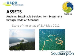
- 1. ASSETS Attaining Sustainable Services from Ecosystems through Trade-off Scenarios State of the art as of 21st May 2012 Photo by Erwin Palacios CI Colombia © The Economist
- 2. Our Team • Southampton (Poppy, Eigenbrod, Hudson, Mad ise, Schreckenberg, plus Dawson, Margetts) • Conservation International (USA) • Basque Centre for Climate Change • CIAT & CI International Colombia plus Colombian research centres, universities and NGOs • Chancellor College, Malawi, plus Worldfish and LEAD Africa
- 3. The overarching goal is to explicitly quantify the linkages between the natural ecosystem services that affect – and are affected by – food security and nutritional health for the rural poor at the forest-agricultural interface Photo by Erwin Palacios CI Colombia
- 4. A complex ecosystem where agroecosystem meets “natural” ecosystems
- 6. ASSETS Research Themes Theme 1: Drivers, pressures and linkages between food security, nutritional health and ES • Relationships between forest ES, food & health • Identifying key drivers and pressures
- 7. Choice of Case studies- cutting across two continents Africa & Amazonia: different situations…… much in common • Deforestation: Africa much more advanced Amazonia in rapd transition due to a range of drivers • impacted by climate change and extreme weather events • issues of extreme poverty, malnutrition and inequality Our workshops selected paired case study regions in Malawi and Colombia- as the best locations to address our research questions, but also because of links to partner organisations already active locally
- 8. Sub-Saharan Africa: Malawi • One of the poorest countries on earth: 52% in poverty, 29% undernourished • Mostly deforested: 27% remaining • Prolonged droughts and occasional extreme rain • Paired case study regions: East Chilwa and Chingale (Zomba West) • 80% of people are subsistence farmers or smallholders; • Differences in rainfall, water availability, forest cover… • ….but with some protected forests and wetlands (under pressure from overexploitation & drought) Data from UNDP, FAO, CIA Factbook,; imafe from nyastimes
- 9. Amazonia: Colombia • Extremes of wealth and poverty in a fast growing economy • 45% forested- mostly in Amazonia and Andes, but under great pressure • Suffering climate & weather extremes: La Nina, Climate Change • Paired case study regions: Upper and Lower Caqueta: • 62% living in poverty • At different stages of transition- driven by incoming settlers, clearance for cattle, soya, biofuels • Several protected forest areas • Indigenous groups may be most Data from UNDP, FAO, CIA threatened by land use changes Factbook; image from
- 10. Participatory research • Aims: – To understand links between ES and food security – To derive non-monetary values for different ES • Well-being ranking of study communities • Focus groups (differentiated by social group) to: – Understand local concepts of food (in)security – Identify ES that contribute to food security at different temporal and spatial scales • Seasonal calendars – seasonal coping strategies • Community timelines – inter-annual food security • Matrix scoring and ranking to prioritise the most important ES for food security for different groups • Participatory economic valuation of some ES
- 11. Participatory mapping to develop adaptation strategies
- 12. The Food Estimation and Export for Diet and Malnutrition Evaluation (FEEDME) Model
- 13. Food Balance Sheets SUPPLY = UTILIZATION
- 14. Measuring household poverty, food security, and nutrition health Aims: • Identify poverty status of households using objective and subjective measures (expenditure, subjective wealth, assets) • Measure food security and nutritional status of under-five children in households across the forest-agricultural gradient • Deeper understanding of coping mechanisms • Disseminate to, and feedback from the local community
- 15. Food security surveys • Aim : Assess availability, access, and utilisation of food and how ES affects each • Measures (men, women, children) – Number of meals eaten on regular day/ yesterday – Frequency of not having enough to eat in the past 6 months – Frequency of sleeping hungry – Detailed food consumption data including types, sources, amounts (weighed), repeated to capture seasonal variation • Perception of hunger – has enough to eat – Hunger • Nutritional health surveys – Anthropometric measurements
- 16. ASSETS Research Themes Theme 2: Crises and tipping points: Past, present and future interactions between food insecurity and ES at the forest-agricultural interface • Coping strategies • Future scenarios http://blogs.reuters.com/photographers-blog/2010/08/12/an- aerial-view-of-sumatra-island/
- 17. The ARIES Model: Artificial Intelligence for Ecosystem Services A bit of history • Initially developed at the University of Vermont (Gund Institute) and Conservation International mainly on NSF money by ESPA co-PI Ferdinando Villa (now at Basque Centre for Climate Change, Bilbao Spain) • Co-lead on ARIES is Miroslav Honzák at Conservation International Malawian (Washington) boy, Zomba, November 2010
- 18. ARIES: summary • A rapid spatial assessment tool for ecosystem services and their values; not a single model but an artificial intelligence assisted system that customizes models to user goals. • Demonstrates a mapping process for ecosystem service provision, use, sink and flow while most ES assessments only look at provision. • Probabilistic, Bayesian models inform decision- makers about the likelihood of possible scenarios; users can explore effects of policy changes and external events on estimates of uncertainty.
- 19. Components of the ARIES system
- 20. Ecosystem Services flow analysis in ARIES 4. Flow of Ecosystem Services 1. Provisionshed 2. Benefitshed 3. Sinks of Ecosystem Services
- 21. Precise spatial representation and Area of Critical Flow Area of Critical Flow
- 22. ASSETS Research Themes Theme 3: The science-policy interface: How can we manage ES to reduce food insecurity and increase nutritional health? • Minimising risk of future environmental change • Influencing policy to better manage ES conflicts, trade-offs and synergies to sustain food security and health? http://news.bbc.co.uk/1/hi/world/south_asia/744 5570.stm
- 23. Pidgeon … Poppy 2006 Proc Roy Soc
- 24. Stakeholder Engagement & Feedback Target audience • Community members – Through village meetings, community radios • National policymakers e.g. Govt, civil society, NGOs – National advisory board meetings, briefings, policy briefs • International policymakers – Scientific advisory meetings & through partners (CIAT, CI, WorldFish) • Academic beneficiaries
- 25. Our consortium will undertake world class research on ecosystem services (ES) for poverty alleviation at the forest-agricultural interface and deliver evidence from a range of sources and in various formats to inform policy and behaviour. Photo by Erwin Palacios CI Colombia We hope to make a difference to the lives of 2 million poor people living in our case-study regions – up to 550 million people living in similar environments around the world.
- 26. This presentation was produced by ASSETS (NE-J002267- 1), funded with support from the Ecosystem Services for Poverty Alleviation Programme (ESPA). The ESPA programme is funded by the Department for International Development (DFID), the Economic and Social Research Council (ESRC) and the Natural Environment Research Council (NERC), as part of the UK’s Living with Environmental Change Programme (LWEC). The views expressed here are those of the authors and do not necessarily represent those of the funders, the ESPA Programme, the ESPA Directorate, or LWEC.
Editor's Notes
- Source: Mathews Tsirizeni – LEAD Southern & Eastern Africa. Note – this slide has animation – the first picture shows flooding, the second the participatory GIS they have been doing to identify causes and solutions.
- The provisionshed is constituted by all different ecosystem sources where the service is generated. The benefitshed identifies areas where potential recipients or users of benefit are. Precise pathways of flow from their point of origin to beneficiaries are identified. One of the key features of ARIES and what makes it different from other approaches is the flow analysis of ecosystem services.
- For each specific beneficiary we can quantify, fluxes are precise and spatial, so it is known how much of the service reaches each beneficiary, and the trajectories required for the service to flow. Point by point we can tell how much each beneficiary receives from which specific area and this has important implications for example in payments for ecosystem services. As an example the analysis allows to identify areas that are critical for the delivery of a given service. Critical areas of ES flow should be given the highest importance in planning conservation of biodiversity and ES.