PSAV Presentation Services - An eSpatial Case Study
•
1 recomendación•1,587 vistas

PSAV Presentation Services needed a solution that could quickly turn complex geographic data into easy to interpret, detailed, visual maps and reports - enhancing operational analysis and territory management. Discover how PSAV Presentation Services are using eSpatial. Find out more about eSpatial and sign up for a free trial by visiting https://www.eSpatial.com

Recomendados
Recomendados
Más contenido relacionado
Último
Último (20)
Destacado
Destacado (20)
PSAV Presentation Services - An eSpatial Case Study
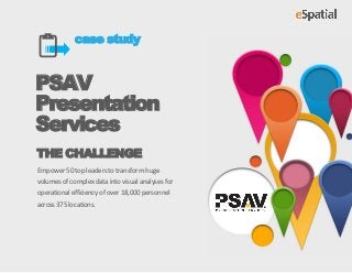
- 1. case study PSAV Presentation Services THE CHALLENGE Empower 50 top leaders to transform huge volumes of complex data into visual analyses for operational efficiency of over 18,000 personnel across 375 locations.
- 2. Case Study | Swank Audio Visual 01 Introduction 02 Highlights Since 1937, PSAV Presentation Services has Detailed, visual analysis of approximately been setting the standard for event technology services within the hotel, resort, 1,800 personnel across more than 375 meeting and conference center industry. locations PSAV has over 18,000 personnel across 375 Regional and territory reporting that locations, servicing clients throughout the allows the leadership team to drill down US and Canada. They have a mass of data and answer questions about the areas that requires strategic analysis to they manage understand their clients’ facilities and eSpatial gives us an instant detailed, visual analysis of any provide integrated approaches with on- geographic data we upload. More location staff to ensure a seamless, worry- Interactive reports that can instantly be than 50 of our top leaders now use eSpatial maps for instant free environment and strong client loyalty. shared across the organization with a analysis of their territories. click of a button Mike Stengel, VP, PSAV Using eSpatial, PSAV are able to manage Presentation Services their huge volumes of geographic information for each location. eSpatial Major increase in top-level empowers 50 of PSAV’s top leaders to communication across the company analyse territories and manage operations, instantly. PSAV Presentation Services does more with their data in less time than before, using eSpatial Page 2
- 3. Case Study | Swank Audio Visual 03 The Challenge 04 Requirements 05 Solution PSAV needed a robust solution that could Using eSpatial, PSAV Presentation Services Support resource allocation with a can now respond to their data in faster and transform huge volumes of complex data tool that visualized multiple datasets easier ways than before. into visual analyses that could be easily shared across the organization - and that in one place eSpatial delivered: would aid operational analysis for more than 375 locations across 30+ states and Enhance operational territory analysis A tool that produces detailed, yet Canada. for expansion and growth by effortless to interpret, visual combining revenue data with analytics online resource data Reports that can be shared organization-wide with just one click Simple-to-navigate user interface Monitor, manage, analyze and All of the functionality without any update operations data, such as heavy IT investment personnel, hotels and offices, A dedicated, hands-on team to help distances and routes, plus revenue drive mapping success percentages, in one tool Page 3
- 4. Let’s connect Let’s connect About eSpatial eSpatial delivers powerful mapping in minutes. At eSpatial we believe mapping should be fast, easy and powerful. With our mapping software you can easily upload and visualize multiple layers of data. Quickly create dynamic reports. Analyze key areas and share results. It’s rapid visual insight that takes the guesswork out of decision making. www.eSpatial.com