SlideShare una empresa de Scribd logo
1 de 45
High Resolution Aerial Mapping Using UAV Geo Sense Sdn. Bhd. 79A, Jalan Seri Impian 1 Taman ImpianEmas 81300 Johor Bahru T06-03, JlnCentry Square Block 2320 63000 Cyberjaya ismaili@geosense.com.my www.geosense.com.my
Agenda Company Background  UAV Services Case Study & Demo MPBP – Bandar Penggaram, BatuPahat TapakPelupusan, Seelong, MPJBT   ZonIndustriKajang-B. BaruBangi  MCMC / Pos Malaysia - Part of Bandar Samporna Urban Monitoring – Part of Parit Raja, BatuPahat GIS Integration Study – Part of GelangPatah Web GIS Integration – SkudaiKiri, JPPD Johor Tinjaukopter Q&A
Geo Sense Sdn. Bhd.Brief Background Establish May 2006 MSC Status – in web GIS and mapping 100% Bumi Company Skudai, Johor Bahru Base Company Collaboration with UTM-IMREC and Inst. Sustainable Agri of Cardoba Spain Since 2007 - R&D in unmanned aerial mapping , GIS & GPS Tagging Recipient AnugerahPerdanaMenteri APICTA ICT eGov. Catergory in 2007 Vision, to become leading tech company in unmanned aerial system
Products & Services  Unmanned Aerial Mapping  GPS – Geo Tagging Mobile application  GIS /  Web GIS
UAV For Aerial mapping & surveillance services Technology Brief
Unmanned Aerial Mapping Services
Technology Collaboration IMREC & Geo Sense Converting military technology of unmanned aerial vehicle (UAV) into civilian Application for urban aerial mapping and remote sensing
UAV Specification Battery operated, light, quite (discreet), stable,low maintenance, limited take off & recovery space. Geo Sense “Glider Based UAV” Geo Sense UAV System Length: 1.7m Weight: 2 kg 30 min endurance Air speed 61 km / hrs Total Distance : 24 km Alt. Max 5000 feet Micropilot Ardupilot / Attopilot /  Live & Recorded Video Battery operator (silence) Current productivity: 1 mission : 1.5 – 2 sq km 1 days – 5 sq km (3-4 flights)  Customer needs 10 – 20 sq km
UAV Aerial Mapping – Process Flow UAV Image Acquisition Image Processing
Software - Flight Plan
Safety & Security – Ground Control System
Compact Camera - RGB
Flight Approval Flow  Acknowledge To DCA Approved Client Letter of Request Prepare Flight Plan & Schedule JUPEM Application Forms yes Site Planning (GCP) Flight Mission Image Processing GIS Integration Deliver to Client Copy to JUPEM
Safety Procedures Ground control to monitor UAV Fail save system – Back to LP Cockpit video monitoring  Manual take over in the case of lost communication or GPS lost Intelligence system will automatically bring back UAV Flight redundancy module Safety procedure Each mission - Fly only in smaller coverage area (2 sq km) – visual contact Limit to 30 min fly even through the standard flying time is 45 min Constant communication with RC pilot and ground control officer Telemetric monitoring    12.1  monitor battery life   12.2 Throttle Maintenance procedure – wear & tear standard, eg Battery , engine, ESC, etc. Flight landing in space of 50 sq m
Sample of UAV Images  and Show Cases of Utilizing UAV Images  -
INTEGRATION WITH GIS PLATFORM
Base Map Preparation – Using High Res Aerial Image from UAV High resolution UAV Images Image digitalizing Base Map from high res images Asset Data in Base Map
Base Map Preparation – Using High Res Aerial Image from UAV Asset data on base map
GIS Platform & Integration GIS SuperGeo Desktop SuperPad
Case Study 2 - UAV Mapping by Geo Sense  – Semporna, Sabah (5 sq km) Visual Using UAV Population: ~ 130K Mail Volume: ~ 200 per day PO: Semporna Post Office Mail delivery: limited  Address: Using kampung, schools & PO Box (710 units) Bank: Maybank & BSN
House Numbering and Address Assignment by Pos Malaysia Digitizing using GIS KAMPUNG BANGAU-BANGAU 2,436 houses ADDRESS SAMPLE Cikgu Ahmad  No2, KampungBangauBangau 91300 Semporna, Sabah POSTTUDE: 52798-5610-1570Lat 4.4883 NLong 118.6050 E PERKAMPUNGAN AIR 1 659 houses PERKAMPUNGAN AIR 2 3,313 houses Approximately 6,000 new delivery points identified
Experience & Showcase (2009 – 2010) Online and batch (sync)  To update directly On MCMC Web GIS Community postman Equip with smartphone ,[object Object],Survey & geo tagging  Creating property Polygon from UAV images
Recognition World POS EXPO 2010 Copenhagen
Potential Applications Progress Monitoring 27 March 2010 22 July 2010
Potential Applications Progress Monitoring – Rumah Rakyat Lima  Kedai IRDA April 2010 April 2010 Aug 2010 Dec 2010
Potential Applications Work Auditing / Verification Feb 2010 June 2010
Potential Application Coastal Study / Monitoring
Potential Application River Monitoring / Flood Management
Potential Application Environmental / Water Catchment  protection
Potential Applications Asset Monitoring
Potential Application Monitoring of Strategic assets andWater Sources
TINJAUKOPTER SOLUTION OVERVIEW
SpecificationsDiagonal length: 600mmNo. of propellors: 6Flight time: Up to 30 min.Altitude: Up to 1000 ft.Telemetry distance: Max. 3 kmWeight without payload: 1200gMax. payload: 1000g                                                                                                                                                       Specification Diagonal length: 600mmNo. of propellers: 6Flight time: Up to 30 min.Altitude: Up to 1000 ft.Telemetry distance: Max. 3 kmWeight without payload: 1200g Max payload: 1000g
Advance solution ,[object Object]
High-rise building
Natural disaster recovery
Surveillance
Dangerous & Hazardous mission,[object Object]
Infrastructure Video Transmission Up to 3 km Digital video Recorder Radio Frequency comm 250m to 1 km Ground control
General Proposal  Outsourcing of acquiring high resolution aerial images High interest areas To start with 147 local authorities (10 sq km city center) Aerial surveillance (images & video) Web GIS Development – Integration with UAV images Transfer of technology UAV technology, training & maintenance Image processing Tinjaukopter services & transfer of technology
Thank YouQ&A

Más contenido relacionado

La actualidad más candente

Sora Raku (Rakuten Drone Project)
Sora Raku (Rakuten Drone Project)Sora Raku (Rakuten Drone Project)
Sora Raku (Rakuten Drone Project)Rakuten Group, Inc.
 
Machine Vision for Intelligent Drones: An Overview
Machine Vision for Intelligent Drones: An OverviewMachine Vision for Intelligent Drones: An Overview
Machine Vision for Intelligent Drones: An OverviewKevin Heffner
 
Drone Lobby Presentation
Drone Lobby PresentationDrone Lobby Presentation
Drone Lobby Presentationlhfang
 
Drones and The Practice of Real Estate
Drones and The Practice of Real EstateDrones and The Practice of Real Estate
Drones and The Practice of Real EstateJillayne Schlicke
 
Are Drones our best friends?
Are Drones our best friends?Are Drones our best friends?
Are Drones our best friends?Codemotion
 
Economic Impact of Drones
Economic Impact of DronesEconomic Impact of Drones
Economic Impact of DronesShannon Ebert
 
Drones: The Future of Society
Drones: The Future of SocietyDrones: The Future of Society
Drones: The Future of SocietyXavier Imperial
 
Internet of Civil Unmanned Aerial Systems: Challenges and Opportunities (by J...
Internet of Civil Unmanned Aerial Systems: Challenges and Opportunities (by J...Internet of Civil Unmanned Aerial Systems: Challenges and Opportunities (by J...
Internet of Civil Unmanned Aerial Systems: Challenges and Opportunities (by J...TUS Expo
 
Drones for Good - The Event!
Drones for Good - The Event!Drones for Good - The Event!
Drones for Good - The Event!Lab
 
Unmanned Aerial Vehicles: COMP4DRONES (ECSEL JU)
Unmanned Aerial Vehicles: COMP4DRONES (ECSEL JU)Unmanned Aerial Vehicles: COMP4DRONES (ECSEL JU)
Unmanned Aerial Vehicles: COMP4DRONES (ECSEL JU)Big Data Value Association
 
Drone and its application
Drone and its applicationDrone and its application
Drone and its application14209276
 
Drone Transforming Media
Drone Transforming Media Drone Transforming Media
Drone Transforming Media Abhinav Aditya
 
Drones the future technology
Drones the future technologyDrones the future technology
Drones the future technologyvikram singh
 
Ultimate History of All Things Drones
Ultimate History of All Things DronesUltimate History of All Things Drones
Ultimate History of All Things DronesDavid W. Ewing
 
The world of Unmanned Systems is Evolving. DRONES TAKE OFF !
The world of Unmanned Systems is Evolving. DRONES TAKE OFF !The world of Unmanned Systems is Evolving. DRONES TAKE OFF !
The world of Unmanned Systems is Evolving. DRONES TAKE OFF !RonnyKenens
 
Use of Drones in Humanitarian Action and Disaster Management
Use of Drones in Humanitarian Action and Disaster ManagementUse of Drones in Humanitarian Action and Disaster Management
Use of Drones in Humanitarian Action and Disaster ManagementNepal Flying Labs
 
Best ppt on Micro air vehicle with flapping wings
Best ppt on Micro air vehicle with flapping wingsBest ppt on Micro air vehicle with flapping wings
Best ppt on Micro air vehicle with flapping wingsRonak Thakare
 
Drones presentation
Drones presentationDrones presentation
Drones presentationAmna Abrar
 

La actualidad más candente (20)

Sora Raku (Rakuten Drone Project)
Sora Raku (Rakuten Drone Project)Sora Raku (Rakuten Drone Project)
Sora Raku (Rakuten Drone Project)
 
Machine Vision for Intelligent Drones: An Overview
Machine Vision for Intelligent Drones: An OverviewMachine Vision for Intelligent Drones: An Overview
Machine Vision for Intelligent Drones: An Overview
 
Drone Lobby Presentation
Drone Lobby PresentationDrone Lobby Presentation
Drone Lobby Presentation
 
Drones and The Practice of Real Estate
Drones and The Practice of Real EstateDrones and The Practice of Real Estate
Drones and The Practice of Real Estate
 
Are Drones our best friends?
Are Drones our best friends?Are Drones our best friends?
Are Drones our best friends?
 
Economic Impact of Drones
Economic Impact of DronesEconomic Impact of Drones
Economic Impact of Drones
 
Drones: The Future of Society
Drones: The Future of SocietyDrones: The Future of Society
Drones: The Future of Society
 
Internet of Civil Unmanned Aerial Systems: Challenges and Opportunities (by J...
Internet of Civil Unmanned Aerial Systems: Challenges and Opportunities (by J...Internet of Civil Unmanned Aerial Systems: Challenges and Opportunities (by J...
Internet of Civil Unmanned Aerial Systems: Challenges and Opportunities (by J...
 
Drones for Good - The Event!
Drones for Good - The Event!Drones for Good - The Event!
Drones for Good - The Event!
 
Unmanned Aerial Vehicles: COMP4DRONES (ECSEL JU)
Unmanned Aerial Vehicles: COMP4DRONES (ECSEL JU)Unmanned Aerial Vehicles: COMP4DRONES (ECSEL JU)
Unmanned Aerial Vehicles: COMP4DRONES (ECSEL JU)
 
Drone and its application
Drone and its applicationDrone and its application
Drone and its application
 
Drone Transforming Media
Drone Transforming Media Drone Transforming Media
Drone Transforming Media
 
Drones the future technology
Drones the future technologyDrones the future technology
Drones the future technology
 
Ultimate History of All Things Drones
Ultimate History of All Things DronesUltimate History of All Things Drones
Ultimate History of All Things Drones
 
The world of Unmanned Systems is Evolving. DRONES TAKE OFF !
The world of Unmanned Systems is Evolving. DRONES TAKE OFF !The world of Unmanned Systems is Evolving. DRONES TAKE OFF !
The world of Unmanned Systems is Evolving. DRONES TAKE OFF !
 
Use of Drones in Humanitarian Action and Disaster Management
Use of Drones in Humanitarian Action and Disaster ManagementUse of Drones in Humanitarian Action and Disaster Management
Use of Drones in Humanitarian Action and Disaster Management
 
Best ppt on Micro air vehicle with flapping wings
Best ppt on Micro air vehicle with flapping wingsBest ppt on Micro air vehicle with flapping wings
Best ppt on Micro air vehicle with flapping wings
 
11. Future of Drones
11. Future of Drones11. Future of Drones
11. Future of Drones
 
Drones presentation
Drones presentationDrones presentation
Drones presentation
 
7. Scope Of UAV In India
7. Scope Of UAV In India7. Scope Of UAV In India
7. Scope Of UAV In India
 

Similar a Geo Sense Unmanned Aerial Mapping Services

1 Aerial View - Drone Snapshot2
1 Aerial View - Drone Snapshot21 Aerial View - Drone Snapshot2
1 Aerial View - Drone Snapshot2Garth Torasadhewa
 
Geo sense drone mapping solution
Geo sense drone mapping solutionGeo sense drone mapping solution
Geo sense drone mapping solutionIsmail Ibrahim
 
COMIT Dec 2016 - Automated Drone Reality Project
COMIT Dec 2016 - Automated Drone Reality ProjectCOMIT Dec 2016 - Automated Drone Reality Project
COMIT Dec 2016 - Automated Drone Reality ProjectComit Projects Ltd
 
UAVmapping_11111.ppt
UAVmapping_11111.pptUAVmapping_11111.ppt
UAVmapping_11111.pptBismaJZ
 
Prototype of Google Maps-Based Flood Monitoring System using Arduino and GSM ...
Prototype of Google Maps-Based Flood Monitoring System using Arduino and GSM ...Prototype of Google Maps-Based Flood Monitoring System using Arduino and GSM ...
Prototype of Google Maps-Based Flood Monitoring System using Arduino and GSM ...IRJET Journal
 
AirSense - Neogeography
AirSense - NeogeographyAirSense - Neogeography
AirSense - NeogeographyIsmail Ibrahim
 
Fnal year project on iot accident detection and tracking system 26-may 21'
 Fnal year project on iot accident detection and tracking system  26-may 21' Fnal year project on iot accident detection and tracking system  26-may 21'
Fnal year project on iot accident detection and tracking system 26-may 21'ankitadeokate
 
Geomatics for emergency management
Geomatics for emergency managementGeomatics for emergency management
Geomatics for emergency managementSalvatore Morreale
 
IPage UMS, Singapore Started Operations in India
IPage UMS, Singapore Started Operations in India IPage UMS, Singapore Started Operations in India
IPage UMS, Singapore Started Operations in India Dev R
 
Single camera depth control in micro class ROV
Single camera depth control in micro class ROVSingle camera depth control in micro class ROV
Single camera depth control in micro class ROVTELKOMNIKA JOURNAL
 
Droning On! Navajo Nation _ Darling Geomatics
Droning On! Navajo Nation _ Darling GeomaticsDroning On! Navajo Nation _ Darling Geomatics
Droning On! Navajo Nation _ Darling GeomaticsKatinaJohnson11
 
Utilizing drone in land development
Utilizing drone  in land developmentUtilizing drone  in land development
Utilizing drone in land developmentKosygin Leishangthem
 
5.3 Produits & Services en Observation de la Terre au service de la coopérati...
5.3 Produits & Services en Observation de la Terre au service de la coopérati...5.3 Produits & Services en Observation de la Terre au service de la coopérati...
5.3 Produits & Services en Observation de la Terre au service de la coopérati...grisicap
 
Mekanchi - Work @ heights - Drone Services
Mekanchi - Work @ heights - Drone ServicesMekanchi - Work @ heights - Drone Services
Mekanchi - Work @ heights - Drone ServicesShashank Arya
 
UAV/Drone survey and its methodology and applications
UAV/Drone survey and its methodology and applicationsUAV/Drone survey and its methodology and applications
UAV/Drone survey and its methodology and applicationsUpendra Oli
 
DEDICAT 6G_HEXA-X_Workshop_on-6G The Dedicat6G use cases
DEDICAT 6G_HEXA-X_Workshop_on-6G The Dedicat6G use casesDEDICAT 6G_HEXA-X_Workshop_on-6G The Dedicat6G use cases
DEDICAT 6G_HEXA-X_Workshop_on-6G The Dedicat6G use casesDedicat6G
 
IRJET - Drone Delivery System: A Review
IRJET - Drone Delivery System: A ReviewIRJET - Drone Delivery System: A Review
IRJET - Drone Delivery System: A ReviewIRJET Journal
 

Similar a Geo Sense Unmanned Aerial Mapping Services (20)

1 Aerial View - Drone Snapshot2
1 Aerial View - Drone Snapshot21 Aerial View - Drone Snapshot2
1 Aerial View - Drone Snapshot2
 
Geo sense drone mapping solution
Geo sense drone mapping solutionGeo sense drone mapping solution
Geo sense drone mapping solution
 
COMIT Dec 2016 - Automated Drone Reality Project
COMIT Dec 2016 - Automated Drone Reality ProjectCOMIT Dec 2016 - Automated Drone Reality Project
COMIT Dec 2016 - Automated Drone Reality Project
 
UAVmapping_11111.ppt
UAVmapping_11111.pptUAVmapping_11111.ppt
UAVmapping_11111.ppt
 
Prototype of Google Maps-Based Flood Monitoring System using Arduino and GSM ...
Prototype of Google Maps-Based Flood Monitoring System using Arduino and GSM ...Prototype of Google Maps-Based Flood Monitoring System using Arduino and GSM ...
Prototype of Google Maps-Based Flood Monitoring System using Arduino and GSM ...
 
AirSense - Neogeography
AirSense - NeogeographyAirSense - Neogeography
AirSense - Neogeography
 
Fnal year project on iot accident detection and tracking system 26-may 21'
 Fnal year project on iot accident detection and tracking system  26-may 21' Fnal year project on iot accident detection and tracking system  26-may 21'
Fnal year project on iot accident detection and tracking system 26-may 21'
 
Geomatics for emergency management
Geomatics for emergency managementGeomatics for emergency management
Geomatics for emergency management
 
digital_heritage
digital_heritagedigital_heritage
digital_heritage
 
IPage UMS, Singapore Started Operations in India
IPage UMS, Singapore Started Operations in India IPage UMS, Singapore Started Operations in India
IPage UMS, Singapore Started Operations in India
 
Single camera depth control in micro class ROV
Single camera depth control in micro class ROVSingle camera depth control in micro class ROV
Single camera depth control in micro class ROV
 
Droning On! Navajo Nation _ Darling Geomatics
Droning On! Navajo Nation _ Darling GeomaticsDroning On! Navajo Nation _ Darling Geomatics
Droning On! Navajo Nation _ Darling Geomatics
 
women safety
women safetywomen safety
women safety
 
Utilizing drone in land development
Utilizing drone  in land developmentUtilizing drone  in land development
Utilizing drone in land development
 
5.3 Produits & Services en Observation de la Terre au service de la coopérati...
5.3 Produits & Services en Observation de la Terre au service de la coopérati...5.3 Produits & Services en Observation de la Terre au service de la coopérati...
5.3 Produits & Services en Observation de la Terre au service de la coopérati...
 
Mekanchi - Work @ heights - Drone Services
Mekanchi - Work @ heights - Drone ServicesMekanchi - Work @ heights - Drone Services
Mekanchi - Work @ heights - Drone Services
 
UAV/Drone survey and its methodology and applications
UAV/Drone survey and its methodology and applicationsUAV/Drone survey and its methodology and applications
UAV/Drone survey and its methodology and applications
 
DEDICAT 6G_HEXA-X_Workshop_on-6G The Dedicat6G use cases
DEDICAT 6G_HEXA-X_Workshop_on-6G The Dedicat6G use casesDEDICAT 6G_HEXA-X_Workshop_on-6G The Dedicat6G use cases
DEDICAT 6G_HEXA-X_Workshop_on-6G The Dedicat6G use cases
 
IRJET - Drone Delivery System: A Review
IRJET - Drone Delivery System: A ReviewIRJET - Drone Delivery System: A Review
IRJET - Drone Delivery System: A Review
 
Geosense Uav
Geosense UavGeosense Uav
Geosense Uav
 

Más de Ismail Ibrahim

Swiftlet bird nest sg kapal proposal
Swiftlet bird nest sg kapal proposalSwiftlet bird nest sg kapal proposal
Swiftlet bird nest sg kapal proposalIsmail Ibrahim
 
Geo Sense - UAV service, unmanned remote sensing
Geo Sense - UAV service, unmanned remote sensingGeo Sense - UAV service, unmanned remote sensing
Geo Sense - UAV service, unmanned remote sensingIsmail Ibrahim
 
Baby Car Rf Id Solution 2
Baby Car Rf Id Solution 2Baby Car Rf Id Solution 2
Baby Car Rf Id Solution 2Ismail Ibrahim
 
High Resolution Aerial Images Services
High Resolution Aerial Images ServicesHigh Resolution Aerial Images Services
High Resolution Aerial Images ServicesIsmail Ibrahim
 

Más de Ismail Ibrahim (9)

Reversing diabetes
Reversing diabetesReversing diabetes
Reversing diabetes
 
Maskom v2
Maskom v2Maskom v2
Maskom v2
 
Swiftlet bird nest sg kapal proposal
Swiftlet bird nest sg kapal proposalSwiftlet bird nest sg kapal proposal
Swiftlet bird nest sg kapal proposal
 
Godcha forward
Godcha forwardGodcha forward
Godcha forward
 
Geo Sense UAV service
Geo Sense UAV serviceGeo Sense UAV service
Geo Sense UAV service
 
Geo Sense - UAV service, unmanned remote sensing
Geo Sense - UAV service, unmanned remote sensingGeo Sense - UAV service, unmanned remote sensing
Geo Sense - UAV service, unmanned remote sensing
 
Baby Car Rf Id Solution 2
Baby Car Rf Id Solution 2Baby Car Rf Id Solution 2
Baby Car Rf Id Solution 2
 
High Resolution Aerial Images Services
High Resolution Aerial Images ServicesHigh Resolution Aerial Images Services
High Resolution Aerial Images Services
 
Geosense 12
Geosense 12Geosense 12
Geosense 12
 

Último

Salesforce Community Group Quito, Salesforce 101
Salesforce Community Group Quito, Salesforce 101Salesforce Community Group Quito, Salesforce 101
Salesforce Community Group Quito, Salesforce 101Paola De la Torre
 
Neo4j - How KGs are shaping the future of Generative AI at AWS Summit London ...
Neo4j - How KGs are shaping the future of Generative AI at AWS Summit London ...Neo4j - How KGs are shaping the future of Generative AI at AWS Summit London ...
Neo4j - How KGs are shaping the future of Generative AI at AWS Summit London ...Neo4j
 
Pigging Solutions in Pet Food Manufacturing
Pigging Solutions in Pet Food ManufacturingPigging Solutions in Pet Food Manufacturing
Pigging Solutions in Pet Food ManufacturingPigging Solutions
 
Scaling API-first – The story of a global engineering organization
Scaling API-first – The story of a global engineering organizationScaling API-first – The story of a global engineering organization
Scaling API-first – The story of a global engineering organizationRadu Cotescu
 
[2024]Digital Global Overview Report 2024 Meltwater.pdf
[2024]Digital Global Overview Report 2024 Meltwater.pdf[2024]Digital Global Overview Report 2024 Meltwater.pdf
[2024]Digital Global Overview Report 2024 Meltwater.pdfhans926745
 
The 7 Things I Know About Cyber Security After 25 Years | April 2024
The 7 Things I Know About Cyber Security After 25 Years | April 2024The 7 Things I Know About Cyber Security After 25 Years | April 2024
The 7 Things I Know About Cyber Security After 25 Years | April 2024Rafal Los
 
A Domino Admins Adventures (Engage 2024)
A Domino Admins Adventures (Engage 2024)A Domino Admins Adventures (Engage 2024)
A Domino Admins Adventures (Engage 2024)Gabriella Davis
 
Enhancing Worker Digital Experience: A Hands-on Workshop for Partners
Enhancing Worker Digital Experience: A Hands-on Workshop for PartnersEnhancing Worker Digital Experience: A Hands-on Workshop for Partners
Enhancing Worker Digital Experience: A Hands-on Workshop for PartnersThousandEyes
 
Maximizing Board Effectiveness 2024 Webinar.pptx
Maximizing Board Effectiveness 2024 Webinar.pptxMaximizing Board Effectiveness 2024 Webinar.pptx
Maximizing Board Effectiveness 2024 Webinar.pptxOnBoard
 
My Hashitalk Indonesia April 2024 Presentation
My Hashitalk Indonesia April 2024 PresentationMy Hashitalk Indonesia April 2024 Presentation
My Hashitalk Indonesia April 2024 PresentationRidwan Fadjar
 
Transcript: #StandardsGoals for 2024: What’s new for BISAC - Tech Forum 2024
Transcript: #StandardsGoals for 2024: What’s new for BISAC - Tech Forum 2024Transcript: #StandardsGoals for 2024: What’s new for BISAC - Tech Forum 2024
Transcript: #StandardsGoals for 2024: What’s new for BISAC - Tech Forum 2024BookNet Canada
 
Slack Application Development 101 Slides
Slack Application Development 101 SlidesSlack Application Development 101 Slides
Slack Application Development 101 Slidespraypatel2
 
IAC 2024 - IA Fast Track to Search Focused AI Solutions
IAC 2024 - IA Fast Track to Search Focused AI SolutionsIAC 2024 - IA Fast Track to Search Focused AI Solutions
IAC 2024 - IA Fast Track to Search Focused AI SolutionsEnterprise Knowledge
 
Presentation on how to chat with PDF using ChatGPT code interpreter
Presentation on how to chat with PDF using ChatGPT code interpreterPresentation on how to chat with PDF using ChatGPT code interpreter
Presentation on how to chat with PDF using ChatGPT code interpreternaman860154
 
Beyond Boundaries: Leveraging No-Code Solutions for Industry Innovation
Beyond Boundaries: Leveraging No-Code Solutions for Industry InnovationBeyond Boundaries: Leveraging No-Code Solutions for Industry Innovation
Beyond Boundaries: Leveraging No-Code Solutions for Industry InnovationSafe Software
 
SIEMENS: RAPUNZEL – A Tale About Knowledge Graph
SIEMENS: RAPUNZEL – A Tale About Knowledge GraphSIEMENS: RAPUNZEL – A Tale About Knowledge Graph
SIEMENS: RAPUNZEL – A Tale About Knowledge GraphNeo4j
 
Swan(sea) Song – personal research during my six years at Swansea ... and bey...
Swan(sea) Song – personal research during my six years at Swansea ... and bey...Swan(sea) Song – personal research during my six years at Swansea ... and bey...
Swan(sea) Song – personal research during my six years at Swansea ... and bey...Alan Dix
 
How to Troubleshoot Apps for the Modern Connected Worker
How to Troubleshoot Apps for the Modern Connected WorkerHow to Troubleshoot Apps for the Modern Connected Worker
How to Troubleshoot Apps for the Modern Connected WorkerThousandEyes
 
08448380779 Call Girls In Friends Colony Women Seeking Men
08448380779 Call Girls In Friends Colony Women Seeking Men08448380779 Call Girls In Friends Colony Women Seeking Men
08448380779 Call Girls In Friends Colony Women Seeking MenDelhi Call girls
 
Transforming Data Streams with Kafka Connect: An Introduction to Single Messa...
Transforming Data Streams with Kafka Connect: An Introduction to Single Messa...Transforming Data Streams with Kafka Connect: An Introduction to Single Messa...
Transforming Data Streams with Kafka Connect: An Introduction to Single Messa...HostedbyConfluent
 

Último (20)

Salesforce Community Group Quito, Salesforce 101
Salesforce Community Group Quito, Salesforce 101Salesforce Community Group Quito, Salesforce 101
Salesforce Community Group Quito, Salesforce 101
 
Neo4j - How KGs are shaping the future of Generative AI at AWS Summit London ...
Neo4j - How KGs are shaping the future of Generative AI at AWS Summit London ...Neo4j - How KGs are shaping the future of Generative AI at AWS Summit London ...
Neo4j - How KGs are shaping the future of Generative AI at AWS Summit London ...
 
Pigging Solutions in Pet Food Manufacturing
Pigging Solutions in Pet Food ManufacturingPigging Solutions in Pet Food Manufacturing
Pigging Solutions in Pet Food Manufacturing
 
Scaling API-first – The story of a global engineering organization
Scaling API-first – The story of a global engineering organizationScaling API-first – The story of a global engineering organization
Scaling API-first – The story of a global engineering organization
 
[2024]Digital Global Overview Report 2024 Meltwater.pdf
[2024]Digital Global Overview Report 2024 Meltwater.pdf[2024]Digital Global Overview Report 2024 Meltwater.pdf
[2024]Digital Global Overview Report 2024 Meltwater.pdf
 
The 7 Things I Know About Cyber Security After 25 Years | April 2024
The 7 Things I Know About Cyber Security After 25 Years | April 2024The 7 Things I Know About Cyber Security After 25 Years | April 2024
The 7 Things I Know About Cyber Security After 25 Years | April 2024
 
A Domino Admins Adventures (Engage 2024)
A Domino Admins Adventures (Engage 2024)A Domino Admins Adventures (Engage 2024)
A Domino Admins Adventures (Engage 2024)
 
Enhancing Worker Digital Experience: A Hands-on Workshop for Partners
Enhancing Worker Digital Experience: A Hands-on Workshop for PartnersEnhancing Worker Digital Experience: A Hands-on Workshop for Partners
Enhancing Worker Digital Experience: A Hands-on Workshop for Partners
 
Maximizing Board Effectiveness 2024 Webinar.pptx
Maximizing Board Effectiveness 2024 Webinar.pptxMaximizing Board Effectiveness 2024 Webinar.pptx
Maximizing Board Effectiveness 2024 Webinar.pptx
 
My Hashitalk Indonesia April 2024 Presentation
My Hashitalk Indonesia April 2024 PresentationMy Hashitalk Indonesia April 2024 Presentation
My Hashitalk Indonesia April 2024 Presentation
 
Transcript: #StandardsGoals for 2024: What’s new for BISAC - Tech Forum 2024
Transcript: #StandardsGoals for 2024: What’s new for BISAC - Tech Forum 2024Transcript: #StandardsGoals for 2024: What’s new for BISAC - Tech Forum 2024
Transcript: #StandardsGoals for 2024: What’s new for BISAC - Tech Forum 2024
 
Slack Application Development 101 Slides
Slack Application Development 101 SlidesSlack Application Development 101 Slides
Slack Application Development 101 Slides
 
IAC 2024 - IA Fast Track to Search Focused AI Solutions
IAC 2024 - IA Fast Track to Search Focused AI SolutionsIAC 2024 - IA Fast Track to Search Focused AI Solutions
IAC 2024 - IA Fast Track to Search Focused AI Solutions
 
Presentation on how to chat with PDF using ChatGPT code interpreter
Presentation on how to chat with PDF using ChatGPT code interpreterPresentation on how to chat with PDF using ChatGPT code interpreter
Presentation on how to chat with PDF using ChatGPT code interpreter
 
Beyond Boundaries: Leveraging No-Code Solutions for Industry Innovation
Beyond Boundaries: Leveraging No-Code Solutions for Industry InnovationBeyond Boundaries: Leveraging No-Code Solutions for Industry Innovation
Beyond Boundaries: Leveraging No-Code Solutions for Industry Innovation
 
SIEMENS: RAPUNZEL – A Tale About Knowledge Graph
SIEMENS: RAPUNZEL – A Tale About Knowledge GraphSIEMENS: RAPUNZEL – A Tale About Knowledge Graph
SIEMENS: RAPUNZEL – A Tale About Knowledge Graph
 
Swan(sea) Song – personal research during my six years at Swansea ... and bey...
Swan(sea) Song – personal research during my six years at Swansea ... and bey...Swan(sea) Song – personal research during my six years at Swansea ... and bey...
Swan(sea) Song – personal research during my six years at Swansea ... and bey...
 
How to Troubleshoot Apps for the Modern Connected Worker
How to Troubleshoot Apps for the Modern Connected WorkerHow to Troubleshoot Apps for the Modern Connected Worker
How to Troubleshoot Apps for the Modern Connected Worker
 
08448380779 Call Girls In Friends Colony Women Seeking Men
08448380779 Call Girls In Friends Colony Women Seeking Men08448380779 Call Girls In Friends Colony Women Seeking Men
08448380779 Call Girls In Friends Colony Women Seeking Men
 
Transforming Data Streams with Kafka Connect: An Introduction to Single Messa...
Transforming Data Streams with Kafka Connect: An Introduction to Single Messa...Transforming Data Streams with Kafka Connect: An Introduction to Single Messa...
Transforming Data Streams with Kafka Connect: An Introduction to Single Messa...
 

Geo Sense Unmanned Aerial Mapping Services

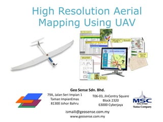
  • 1. High Resolution Aerial Mapping Using UAV Geo Sense Sdn. Bhd. 79A, Jalan Seri Impian 1 Taman ImpianEmas 81300 Johor Bahru T06-03, JlnCentry Square Block 2320 63000 Cyberjaya ismaili@geosense.com.my www.geosense.com.my
  • 2. Agenda Company Background UAV Services Case Study & Demo MPBP – Bandar Penggaram, BatuPahat TapakPelupusan, Seelong, MPJBT ZonIndustriKajang-B. BaruBangi MCMC / Pos Malaysia - Part of Bandar Samporna Urban Monitoring – Part of Parit Raja, BatuPahat GIS Integration Study – Part of GelangPatah Web GIS Integration – SkudaiKiri, JPPD Johor Tinjaukopter Q&A
  • 3. Geo Sense Sdn. Bhd.Brief Background Establish May 2006 MSC Status – in web GIS and mapping 100% Bumi Company Skudai, Johor Bahru Base Company Collaboration with UTM-IMREC and Inst. Sustainable Agri of Cardoba Spain Since 2007 - R&D in unmanned aerial mapping , GIS & GPS Tagging Recipient AnugerahPerdanaMenteri APICTA ICT eGov. Catergory in 2007 Vision, to become leading tech company in unmanned aerial system
  • 4. Products & Services  Unmanned Aerial Mapping  GPS – Geo Tagging Mobile application  GIS / Web GIS
  • 5. UAV For Aerial mapping & surveillance services Technology Brief
  • 7. Technology Collaboration IMREC & Geo Sense Converting military technology of unmanned aerial vehicle (UAV) into civilian Application for urban aerial mapping and remote sensing
  • 8. UAV Specification Battery operated, light, quite (discreet), stable,low maintenance, limited take off & recovery space. Geo Sense “Glider Based UAV” Geo Sense UAV System Length: 1.7m Weight: 2 kg 30 min endurance Air speed 61 km / hrs Total Distance : 24 km Alt. Max 5000 feet Micropilot Ardupilot / Attopilot / Live & Recorded Video Battery operator (silence) Current productivity: 1 mission : 1.5 – 2 sq km 1 days – 5 sq km (3-4 flights) Customer needs 10 – 20 sq km
  • 9. UAV Aerial Mapping – Process Flow UAV Image Acquisition Image Processing
  • 11. Safety & Security – Ground Control System
  • 13.
  • 14.
  • 15. Flight Approval Flow Acknowledge To DCA Approved Client Letter of Request Prepare Flight Plan & Schedule JUPEM Application Forms yes Site Planning (GCP) Flight Mission Image Processing GIS Integration Deliver to Client Copy to JUPEM
  • 16. Safety Procedures Ground control to monitor UAV Fail save system – Back to LP Cockpit video monitoring Manual take over in the case of lost communication or GPS lost Intelligence system will automatically bring back UAV Flight redundancy module Safety procedure Each mission - Fly only in smaller coverage area (2 sq km) – visual contact Limit to 30 min fly even through the standard flying time is 45 min Constant communication with RC pilot and ground control officer Telemetric monitoring 12.1 monitor battery life 12.2 Throttle Maintenance procedure – wear & tear standard, eg Battery , engine, ESC, etc. Flight landing in space of 50 sq m
  • 17. Sample of UAV Images and Show Cases of Utilizing UAV Images -
  • 19.
  • 20.
  • 21. Base Map Preparation – Using High Res Aerial Image from UAV High resolution UAV Images Image digitalizing Base Map from high res images Asset Data in Base Map
  • 22. Base Map Preparation – Using High Res Aerial Image from UAV Asset data on base map
  • 23. GIS Platform & Integration GIS SuperGeo Desktop SuperPad
  • 24. Case Study 2 - UAV Mapping by Geo Sense – Semporna, Sabah (5 sq km) Visual Using UAV Population: ~ 130K Mail Volume: ~ 200 per day PO: Semporna Post Office Mail delivery: limited Address: Using kampung, schools & PO Box (710 units) Bank: Maybank & BSN
  • 25. House Numbering and Address Assignment by Pos Malaysia Digitizing using GIS KAMPUNG BANGAU-BANGAU 2,436 houses ADDRESS SAMPLE Cikgu Ahmad No2, KampungBangauBangau 91300 Semporna, Sabah POSTTUDE: 52798-5610-1570Lat 4.4883 NLong 118.6050 E PERKAMPUNGAN AIR 1 659 houses PERKAMPUNGAN AIR 2 3,313 houses Approximately 6,000 new delivery points identified
  • 26.
  • 27. Recognition World POS EXPO 2010 Copenhagen
  • 28. Potential Applications Progress Monitoring 27 March 2010 22 July 2010
  • 29. Potential Applications Progress Monitoring – Rumah Rakyat Lima Kedai IRDA April 2010 April 2010 Aug 2010 Dec 2010
  • 30. Potential Applications Work Auditing / Verification Feb 2010 June 2010
  • 31. Potential Application Coastal Study / Monitoring
  • 32. Potential Application River Monitoring / Flood Management
  • 33. Potential Application Environmental / Water Catchment protection
  • 35. Potential Application Monitoring of Strategic assets andWater Sources
  • 37. SpecificationsDiagonal length: 600mmNo. of propellors: 6Flight time: Up to 30 min.Altitude: Up to 1000 ft.Telemetry distance: Max. 3 kmWeight without payload: 1200gMax. payload: 1000g                                                                                                                                                       Specification Diagonal length: 600mmNo. of propellers: 6Flight time: Up to 30 min.Altitude: Up to 1000 ft.Telemetry distance: Max. 3 kmWeight without payload: 1200g Max payload: 1000g
  • 38.
  • 42.
  • 43. Infrastructure Video Transmission Up to 3 km Digital video Recorder Radio Frequency comm 250m to 1 km Ground control
  • 44. General Proposal Outsourcing of acquiring high resolution aerial images High interest areas To start with 147 local authorities (10 sq km city center) Aerial surveillance (images & video) Web GIS Development – Integration with UAV images Transfer of technology UAV technology, training & maintenance Image processing Tinjaukopter services & transfer of technology
  • 46.
  • 48. 3 in – 60 in resolution (avg 30 in resolution)
  • 50.
  • 51. 7 - 15 cm resolution
  • 52. Surveillance / Monitoring3 km 90 km 200 meter 300 meter 30 km 3 km