Meteorology - study of atmospheric phenomena
•Descargar como PPT, PDF•
0 recomendaciones•393 vistas

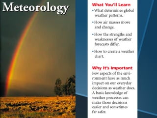
Meteorology is the study of atmospheric phenomena including weather and climate. Weather refers to current atmospheric conditions while climate describes average conditions over time for a particular region. Air masses form over large areas and take on characteristics of that region, later influencing other areas as the air mass moves horizontally. Global wind patterns called zones transport air masses. Weather systems form as air masses with different properties interact, such as through fronts which occur at boundaries between air masses.

Recomendados
Más contenido relacionado
La actualidad más candente
La actualidad más candente (20)
Destacado
Destacado (19)
Similar a Meteorology - study of atmospheric phenomena
Similar a Meteorology - study of atmospheric phenomena (20)
Meteorology - study of atmospheric phenomena
- 2. Meteorology – the study of atmospheric phenomena (weather and climate). •“Meteor” is derived from ancient Greek meaning “high in the air.” •Clouds, raindrops, fog, and rainbows are atmospheric “meteors.” Types: hydrometeors, lithometeors, electrometeors.
- 3. Weather – the current state of the atmosphere. What is the weather in our area? Climate – the long-term average state of atmosphere in a particular area. What is the climate in Hawaii? Alaska?
- 4. What are the “reasons for the seasons?
- 5. Air Masses •A large body of air that takes on the characteristics of the area over which it forms. Air masses can cover hundreds of thousands of square miles. 1) (cP) continental polar – cold & dry. Stable 2) (cT) continental tropical – hot & dry. Stable air aloft—unstable surface air. 3) (mP) maritime polar – cool & moist. Unstable. 4) (mT) maritime tropical – warm & moist. Usually unstable
- 6. 1. Polar latitudes P - typically located poleward of 60 degrees north and south Latitude. Cold. 2. Tropical latitudes T - typically located within about 25 degrees of the equator. Warm. 3. continental c - located over large land masses- dry. 4. marine m - located over the oceans----moist
- 8. 1. Continental Polar (cP): cold temperatures and dry. •Those who live in northern portions of the United States expect cold weather during the winter months. These conditions usually result from the invasion of cold arctic air masses that originate from the snow covered regions of northern Canada.
- 9. 2. Maritime Polar (mP): Cool temperatures and rich in moisture.
- 10. 3. Continental Tropical (cT) – hot and dry. • The air usually only influences the US in summertime as warm, dry air is pumped up off of the Mexican Plateau. • It is usually fairly stable and dry, and if it becomes stagnant over the midwest, results in a drought. • Deaths associated with the 1995 heat wave in the midwest were the result of cT and mT air which stagnated over the central and eastern part of the US this last summer.
- 11. 4. Maritime Tropical (mT): forms over the ocean near the equator. Warm, moist air. Brings hot & humid weather. •Maritime tropical air masses originate over the warm waters of the tropics and Gulf of Mexico, where heat and moisture are transferred to the overlying air from the waters below. The northward movement of tropical air masses transports warm moist air into the United States, increasing the potential for precipitation.
- 12. Air Mass Characteristics •An air mass can acquire some the characteristics of the surface beneath it. This is known as air mass modification, where the exchange of heat or moisture with the surface occurs.
- 13. Weather Systems The Coriolis effect, which is a result of Earth’s rotation, causes moving particles such as air & water to be deflected to the right in the northern hemisphere and to the left in the southern hemisphere. The Coriolis effect combines with the heat imbalance found on Earth to create distinct global wind systems that transport colder air to warmer areas and warmer air to colder areas.
- 14. Coriolis Effect and Weather Systems 2 min
- 16. Global Wind Systems Subpolar low (High Pressure) (Low Pressure)
- 17. Weather Systems There are three basic zones, or wind systems, in each hemisphere. 1. The trade winds, the first major wind zone, flows at 30° north and south latitude, where air sinks, warms, and returns to the equator in a westerly direction. Around 30° latitude, known as the horse latitudes, the sinking air associated with the trade winds creates a belt of high pressure that in turn causes generally weak surface winds.
- 18. When air converges it is forced upward and creates an area of low pressure in a process called convergence. Near the equator, convergence occurs over a large area called the intertropical convergence zone (ITCZ), also called the doldrums. The ITCZ migrates south and north of the equator as the seasons change. The ITCZ is characterized by a band of cloudiness and occasional showers.
- 19. Weather Systems
- 20. Other Wind Zones 2. The prevailing westerlies, the second major wind zone, flows between 30° and 60° north and south latitude in a circulation pattern opposite that of the trade winds. – The prevailing westerlies are responsible for much of the movement of weather across the United States and Canada. 3. The polar easterlies, the third major wind zone, lies between 60° latitude and the poles. – In both hemispheres, the polar easterlies are characterized by cold air.
- 21. Jet Streams Jet streams are narrow bands of high-altitude, Jet streams are narrow bands of high-altitude, westerly winds that flow at speeds up to 185 km/h at elevations of 10.7 km to 12.2 km. – The polar jet stream separates the polar easterlies from the prevailing westerlies. – The jet stream affects the intensity of weather systems by moving air of different temperatures from one region to another.
- 22. In the middle latitudes, air masses with Fronts different characteristics sometimes collide, forming a front. A front is the narrow region separating two air masses of different densities that are caused by differences in temperature, pressure, and humidity. The interaction between the colliding air masses can bring dramatic changes in weather. There are four main types of fronts: cold fronts, warm fronts, stationary fronts, and occluded fronts.
- 23. Fronts 1. Cold Fronts – In a cold front, cold, dense air displaces warm air and forces the warm air up along a steep front. – Clouds, showers, and sometimes thunderstorms are associated with cold fronts.
- 24. Fronts – In a warm front, advancing warm air displaces cold air. 2. Warm Fronts – The warm air develops a gradual frontal slope rather than a steep boundary. – A warm front is characterized by extensive cloudiness and precipitation.
- 25. Fronts 3. Stationary Fronts – A stationary front is the result of two air masses meeting and neither advancing into the other’s territory, stalling the boundary between them. - May rain for days.
- 26. Fronts 4. Occluded Fronts – An occluded front is the result of a cold air mass overtaking a warm front, wedging the warm air upward. – Precipitation is common on both sides of an occluded front.
- 27. Click here for: Current Weather