Managing the risks of unforseen ground conditions

Encountering unforeseen ground conditions mid-project can be an expensive problem. Buried obstructions, waste, contamination, mineshafts, solution features, soft ground, landfills, storage tanks, unexploded ordnance, archaeological features and difficult geology may variously lie in wait. Buried services are often early concerns. Managing the health and safety risks means getting the right information at the right time. A well-designed investigation can pick up much more than just services at the same cost. Each project is different. This presentation covers the latest developments in surveying and geophysics with examples of how they can be tailored to understand and reduce the specific risks encountered at any particular stage in a project. A graphical approach to visualising information and risk is used to discuss the value and usefulness of different types of intrusive and geophysical site investigation data, including illustrations of when and when not to use geophysics, and, if it is used, how best to integrate it into a site investigation approach. Detailed case studies illustrate the lessons and objectives. For more information contact George Tuckwell: gtuckwell @ rsk.co.uk

Recomendados
Recomendados
Más contenido relacionado
Último
Último (20)
Destacado
Destacado (20)
Managing the risks of unforseen ground conditions
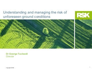
- 1. Understanding and managing the risk of unforeseen ground conditions Dr George Tuckwell Director Copyright of RSK 1
- 2. What do you know about your risks? “…there are known knowns; there are things we know that we know. There are known unknowns; that is to say there are things that we now know we don't know. But there are also unknown unknowns; there are things we do not know we don't know.” Donald Rumsfeld Former US Secretary for Defence Copyright of RSK 2
- 3. Managing the risk of unforeseen ground conditions Thinking fast and slow Understanding and avoiding bias Site investigation: Information vs Risk Case study examples When and when not to use geophysics How do I know the survey will work? Wrap up Copyright of RSK 3
- 4. Thinking fast and slow Copyright of RSK November 18, 2013 4
- 5. Clever brains How cmoe your bairn is albe to udnertsnad this snetence eevn tghouh olny the frist and lsat lteteres of ecah wrod are crreoct? Copyright of RSK
- 6. Mind minefields: Perception • While we think we observe the world, we are actually already interpreting • We ‘fill in the blanks’ as soon as possible to minimise cognitive effort • Judgments are made in “automatic gear” • It is hard to turn the “lazy system” on and off (paraphrasing Kahneman) PRACTICE TIME: Copyright of RSK
- 7. What do you see? Copyright of RSK
- 8. What do you see? Copyright of RSK
- 9. What do you see? What do the three exibits have in common? (source: D. Kahneman) Copyright of RSK
- 10. Muller-Lyer’s exp. Copyright of RSK
- 11. Decision making – “slow” thinking • Define problem slowly to: get all the facts formulate alternatives weigh-up and decide Copyright of RSK
- 12. Decision making - “fast” thinking • Fast thinking tends to place action ahead of diagnosis of problem and to reward speed; • Fast thinking combines causal determination with problem definition PRACTICE TIME: Copyright of RSK
- 13. What do you see? Example: as printed on the page, is the figure on the right larger than the figure on the left? Copyright of RSK
- 14. Decisions Paul owns shares in company A. During the past year he considered switching to stock in company B, but he decided against it. He now learns that he would have been better off by €1000 if he had switched to the stock of company B. John owned shares in company B. During the past year he switched to stock in company A. He now learns that he would have been better off by €1000 if he had kept his stock in company B. Who feels greater regret? (source: Kahneman) Copyright of RSK
- 15. Decisions Mr Brown almost never picks up hitchhikers. Yesterday he gave a man a ride and was robbed. Mr Smith frequently picks up hitchhikers. Yesterday he gave a man a ride and was robbed. Who of the two will experience greater regret over the episode? Who will be criticized most severely by others? (source: Kahneman) Copyright of RSK
- 16. Mind minefields: Idealized view on decision making • People expect to have stronger emotional reactions (regret included) to an outcome that is produced by action than to the same outcome when it is produced by inaction • Biases decisions towards conventional and risk averse choices If this is true for site investigations – what is the risk that decision makers are averse to? Copyright of RSK
- 17. Mind minefields: Questions we ask Is there difficult ground here? Are sites like this usually difficult? Have I demonstrated the ground is fine? Copyright of RSK
- 18. Mind minefields: Questions we should ask What difficult ground have I found? Why do I think that this land might be difficult? How can I demonstrate the ground isn’t difficult? Copyright of RSK
- 19. Understanding and avoiding bias Copyright of RSK November 18, 2013 19
- 20. The trouble with experts They are wrong more often than they think they are, and by a greater margin than they would ever expect to be, for reasons that are predictable… Copyright of RSK
- 21. Heuristic Bias People need to make decisions constantly, including when they are asked to make expert judgments They do this by estimating probabilities People employ several types of heuristics to assess probabilities However, these heuristics often lead to significant biases in a consistent fashion Copyright of RSK
- 22. Summary: Heuristics and Biases Understanding biases decreases their effect Copyright of RSK
- 23. Inspection Team Functionality How to plan and execute a large and difficult site investigation…. Copyright of RSK November 18, 2013 23
- 24. CTBT Copyright of RSK November 18, 2013 24
- 25. CTBT Copyright of RSK November 18, 2013 25
- 26. International Monitoring Stations If a suspicious event is detected it may trigger an on-site inspection… Copyright of RSK November 18, 2013 26
- 27. OSI Inspection area •1000 km2 •6 days to assemble a team and deploy •72 hours to start field activities •25 days to justify continuation •130 days maximum Copyright of RSK
- 28. Signatures of underground nuclear explosions Changes caused by UNE • radiation anomalies • apical voids • rubble chimney • underground cavities • fractures • surface spallation (craters / retarcs) • changes of soil density • displacement of water table Features related to UNE • drill-hole (metallic) casing • buried ferrous objects (e.g. drill pipes) • shallow-buried cables • construction debris Copyright of RSK
- 29. Visual observation Example from IFE08 Example from IFE08 Undeclared Bh51A Concrete platform over Bh130 Detected from the air Detected from the ground Copyright of RSK
- 30. Gamma radiation monitoring Equipment: • Ground high-resolution gamma spectrometer for field and lab • Car/Airborne gamma spectroscopy γ-survey over • Noble gas measurement equipment IFE08 IA (cps) identiFinder gamma spectrometer Dose rate, finding and nuclide identification with NaI detector Geiger-Mueller tube for high doses Copyright of RSK
- 31. Sampling and RN identification Copyright of RSK
- 32. Seismic Aftershock Monitoring (SAMS) UNE aftershocks are: • Shallower than EQ aftershocks • Decay more rapidly than most EQ aftershocks • UNE explosions may induce aftershocks in nearby faults Copyright of RSK
- 33. Seismic Aftershock Monitoring (SAMS) Example of aftershocks magnitude: • Magnitude -1: dropping a brick from 1 meter altitude • Magnitude -2: explosion in hard rock of 70 gr explosive at 3 m depth Example of event recorded by SAMS array Copyright of RSK
- 34. Continuation phase (geophysics) surveys Copyright of RSK
- 35. Drilling Last opportunity to detect relevant radionuclides if the test is contained One chance to drill in one location Max 130 days to fine a spot 50m across at 500-1500m depth in a 1000 sq km The inspection team need to be efficient, justified, beyond criticism and correct Copyright of RSK
- 36. Aspects of an OSI Finite resources Limited time Pressure Scrutiny Copyright of RSK November 18, 2013 36
- 37. 40 people… The techniques must be applied by a restricted number of inspectors in a limited amount of time: • Understanding of phenomenology / knowledge about signatures • Properly developed search logic to prioritise activities/missions • Synergy among different technical subdisciplines Copyright of RSK
- 38. Difficult environmental conditions Copyright of RSK
- 39. Pressurised working conditions Copyright of RSK
- 40. Bad food (very bad!) Copyright of RSK
- 41. Copyright of RSK
- 42. Requirements •A system that allows people to work effectively •Clear purpose and direction •Search logic that is robust •Allow technologies to work together •Synergy of analysis and interpretation •Communication •Maximisation of team resources Copyright of RSK
- 43. What does that mean for an OSI? Copyright of RSK November 18, 2013 43
- 44. OSI in five easy steps STEP 1 STEP 1 Consider the information Consider the information that is available to update that is available to update the logic map with IL’s and the logic map with IL’s and develop questions develop questions STEP 5 STEP 5 Implement the missions and Implement the missions and collect the information collect the information generated generated STEP 2 STEP 2 Develop missions to answer Develop missions to answer the questions from step 1 the questions from step 1 STEP 3 STEP 3 Prioritise missions according Prioritise missions according to the search logic to the search logic Copyright of RSK STEP 4 STEP 4 Determine which missions Determine which missions can be implemented with can be implemented with the resources available the resources available
- 45. OSI in five easy steps STEP 1 STEP 1 Consider the information Consider the information that is available to update that is available to update the areas of interest and the areas of interest and develop questions develop questions DO Consider only the information you have Be clear what is fact and what is interpretation Use your expertise, intuition, and imagination Develop questions that do not prescribe the methods used to get the answer Copyright of RSK
- 46. OSI in five easy steps STEP 1 STEP 1 Consider the information Consider the information that is available to update that is available to update the areas of interest and the areas of interest and develop questions develop questions DONT Assume you know things you do not yet know Overestimate the accuracy of completeness of the information you have Work towards an answer, do work towards the answer! Copyright of RSK
- 47. OSI in five easy steps STEP 2 STEP 2 Develop missions to answer Develop missions to answer the questions from step 1 the questions from step 1 DO Consider each question Use your expertise to develop the most effective missions Ensure each mission has clear objectives and deliverables Carefully consider the information that the mission will deliver • limitations • accuracy Copyright of RSK • risks of failure
- 48. OSI in five easy steps STEP 2 STEP 2 Develop missions to answer Develop missions to answer the questions from step 1 the questions from step 1 DONT Develop missions using technologies you are not expert in Develop missions that do not address the live questions Develop missions that have a low liklihood of success Over-use your ‘favourite’ technology Copyright of RSK
- 49. OSI in five easy steps STEP 3 STEP 3 Prioritise missions according Prioritise missions according to the search logic to the search logic DO Objectively consider the information that each mission will return Ensure that the information of most value to the purpose of the investigation Ensure time-critical missions are prioritised Copyright of RSK
- 50. OSI in five easy steps STEP 3 STEP 3 Prioritise missions according Prioritise missions according to the search logic to the search logic DONT Confuse volume of information with value Prioritise missions unlikely to deliver the promised information Consider the resources you have available (these are considered later!) Copyright of RSK
- 51. OSI in five easy steps STEP 4 STEP 4 Determine which missions Determine which missions can be implemented with can be implemented with the resources available the resources available DO Allocate resources to the missions in priority order Combine prioritised missions where possible to make the most efficient use of resources Copyright of RSK
- 52. OSI in five easy steps STEP 4 STEP 4 Determine which missions Determine which missions can be implemented with can be implemented with the resources available the resources available DONT Revisit the priority of missions Combine missions if it violates the priority order Listen to the technical expert banging the table insisting that his technology is deployed first. Copyright of RSK
- 53. OSI in five easy steps STEP 5 STEP 5 Implement the missions and Implement the missions and collect the information collect the information generated generated DO Deploy personnel with the appropriate expertise to undertake the mission Stay safe! Ensure that the mission adheres to the objectives defined Report results clearly and concisely, and in a way that the ITL (and the world) can understand Copyright of RSK
- 54. OSI in five easy steps STEP 5 STEP 5 Implement the missions and Implement the missions and collect the information collect the information generated generated DONT Change (or forget!) the objectives of the mission Take unnecessary safety risks Confuse fact with interpretation in the report Copyright of RSK
- 55. OSI in five easy steps STEP 1 STEP 1 Consider the information Consider the information that is available to update that is available to update the logic map with IL’s and the logic map with IL’s and develop questions develop questions STEP 5 STEP 5 Implement the missions and Implement the missions and collect the information collect the information generated generated STEP 2 STEP 2 Develop missions to answer Develop missions to answer the questions from step 1 the questions from step 1 STEP 3 STEP 3 Prioritise missions according Prioritise missions according to the search logic to the search logic Copyright of RSK STEP 4 STEP 4 Determine which missions Determine which missions can be implemented with can be implemented with the resources available the resources available
- 56. Questions, answers, methods and bias Copyright of RSK November 18, 2013 56
- 57. Questions, answers, methods and bias Copyright of RSK November 18, 2013 57
- 58. Questions, answers, methods and bias Copyright of RSK November 18, 2013 58
- 59. Questions, answers, methods and bias Copyright of RSK November 18, 2013 59
- 60. Questions, answers, methods and bias Pose questions that are independent of the technology used to get the answer Be aware of how bias will affect the outcome, and take steps to minimise it Select an approach based on objective analysis: •Value of the information •Relevance to the question •Risk of not returning the expected information •Cost •Time scale Copyright of RSK November 18, 2013 60
- 61. OSI mission: linked concepts Copyright of RSK
- 62. Commercial Site Investigation: linked concepts Pose questions that are independent of the technology used to get the answer Select a technical approach, based on an objective analysis: •Value of the information •Relevance to the question •Risk of not returning the expected information •Cost •Time scale Copyright of RSK Be aware of how bias will affect the outcome, and take steps to minimise it
- 63. Copyright of RSK November 18, 2013 63
- 64. Site investigation Information vs Risk Copyright of RSK November 18, 2013 64
- 65. What do you know about your risks? “…there are known knowns; there are things we know that we know. There are known unknowns; that is to say there are things that we now know we don't know. But there are also unknown unknowns; there are things we do not know we don't know.” Donald Rumsfeld Former US Secretary for Defence Copyright of RSK 65
- 66. Management of risk and information Know your risks What information do you need and how do you get it? Relate needs to survey scope and detail The limitations of the information Is it complete? Is it accurate? Information and risk conceptual maps What do you know about where? Is it enough to manage your risks? Copyright of RSK 66
- 67. Information – what do you need to know? Copyright of RSK 67
- 68. Above ground surveys Basic appraisal drawing, with levels for flood risk assessment Copyright of RSK 68
- 69. Above ground surveys Detailed topography including tree schedule Copyright of RSK 69
- 70. Your chances of finding things… 100% 90% 80% Random holes If the area of the target is 1/100 of the area of the site… What are the chances of finding the target with a random set of hole locations? Chances of hitting 70% 60% 50% 40% 30% 20% 10% 0% 0 10 20 30 40 50 60 70 80 90 100 Number of holes Copyright of RSK November 18, 2013 70
- 71. Your chances of finding things… 100% 90% Random holes Regular grid 80% If the area of the target is 1/100 of the area of the site… Chances of hitting 70% 60% 50% 40% 30% What are the chances of finding the target with a regular grid of hole locations? 20% 10% 0% 0 10 20 30 40 50 60 70 80 90 100 Number of holes Copyright of RSK November 18, 2013 71
- 72. Finding things… It may be possible to cover the entire area in a fraction of the time with a geophysical survey Copyright of RSK November 18, 2013 72
- 73. When to use geophysics • Finding something (beneath the ground surface or concealed within a structure) • Providing reliable information across large areas • Reducing and/or targeting intrusive investigations Minimises the risk of unforeseen ground conditions Copyright of RSK November 18, 2013 73
- 74. Risk and information maps Conceptualisation of risk/need for information 3D view top side Copyright of RSK 74
- 75. Risk and information maps (cont.) Tools at our disposal to gather information x-section geophysics surface geophysics e.g. resistivity, seismic e.g. EM conductivity, magnetics, GPR trial pits boreholes Copyright of RSK 75
- 76. Risk and information maps (cont.) Following a detailed intrusive SI Copyright of RSK 76
- 77. Risk and information maps (cont.) Following a detailed intrusive SI – where do you have information? Copyright of RSK 77
- 78. Risk and information maps (cont.) Following a detailed intrusive SI – where does risk remain? Copyright of RSK 78
- 79. Risk and information maps (cont.) Following a detailed intrusive SI – where does risk remain? How likely is it to have picked up these buried obstructions? Copyright of RSK 79
- 80. Risk and information maps (cont.) Using geophysics as a site investigation tool 3D view top side Copyright of RSK 80
- 81. Risk and information maps (cont.) Using geophysics as a site investigation tool Find out something about everything in the near-surface Copyright of RSK Surface geophysics indicates some buried structures 81
- 82. Risk and information maps (cont.) Using geophysics as a site investigation tool Follow up with targeted trial pits, boreholes and geophysics Copyright of RSK 82
- 83. Case studies and examples Copyright of RSK November 18, 2013 83
- 84. Buried services – what are your risks HSG47 Copyright of RSK 84
- 85. Buried services – detail and scope of survey The Survey Association (TSA) level 1 desk study Borehole location clearances Using ground penetrating radar (GPR), radiodetection, cover lifting and tracing TSA level 4 utility survey Full site radiodetection and cover lifting with unrecorded GPR findings marked out on ground TSA level 5 utility survey As above but with additional detail/accuracy in pre-agreed areas covered with recorded GPR grids and post-processing TSA* level 6 full GPR utility survey Copyright of RSK Reviews of statutory service records and other site-specific data Radiodetection and cover lifting, with recorded GPR grids across the entire accessible site 85
- 86. Buried services – what are your risks? Copyright of RSK 86
- 87. Location (c.1900) Copyright of RSK
- 88. Location (Today) Copyright of RSK
- 89. Project Details & Scope Further information required to improve the understanding of the buried features at the site to aid redevelopment works Geophysical Surveying to establish Location, extent and depth of features indicative of potential vaults Location of Buried Services ? Copyright of RSK
- 90. Equipment Used - Services Radiodetection Survey RD8000 pipe and cable locator Cover lifting and inspection Ground Penetrating Radar Survey Medium frequency antenna Undertaken on dense grid of orthogonal transects across the site to build up complete 100% 3-D map of the area Limited by ground conditions (clay, rebar, made ground) Copyright of RSK
- 91. Results - Buried Services Site Layout Copyright of RSK
- 92. Results - Buried Services Radiodetection Copyright of RSK
- 93. Results - Buried Services + drainage Copyright of RSK
- 94. Results - Buried Services + GPR linear features Copyright of RSK
- 95. Equipment Used - Obstructions Ground Penetrating Radar High frequency – slab construction Medium frequency – services, shallow obstructions, voids Low frequency – deeper obstructions, foundations, possible vaults 0.7m Depth Copyright of RSK ~2.5m Up to 5m
- 96. Example Data - Slab Thickness Ground Penetrating Radar 1.5Ghz antenna to scan to 600mm depth Consistent across majority of survey area Copyright of RSK
- 97. Example Data - Foundations Copyright of RSK
- 98. Example Data - Vaulted Areas Copyright of RSK
- 99. Example Data - Vaulted Areas Copyright of RSK
- 100. Example Data – Grassed Area Copyright of RSK
- 101. Example Data – Cenotaph Detail Copyright of RSK
- 102. Example Data – Cenotaph Pipe? Copyright of RSK
- 103. Final Drawing Copyright of RSK
- 105. Results - Buried Services Vaulted basements Copyright of RSK
- 106. Results - Buried Services Integrated results Copyright of RSK
- 107. How to match a survey scope to your risk TSA* level 1 desk study Borehole location clearances TSA* level 4 utility survey TSA* level 5 utility survey TSA* level 6 full gpr utility survey Copyright of RSK 107
- 108. Limitations to the information Is the information you now have limited? complete? accurate? Copyright of RSK 108
- 109. Survey quality – skills and training Copyright of RSK 109
- 110. Survey quality – skills and training (cont.) Copyright of RSK 110
- 111. Survey quality – skills and training (cont.) Copyright of RSK 111
- 112. Geophysics as an SI tool Copyright of RSK 112
- 113. Geophysics as an SI tool (cont.) Copyright of RSK 113
- 114. Geophysics as an SI tool (cont.) Electromagnetic ground conductivity data Copyright of RSK 114
- 115. Geophysics as an SI tool (cont.) Copyright of RSK 115
- 116. Project Example Brownfield Site Carrington Power CCGT 860MW gas fired combined cycle power plant on location of former Carrington Power Station. 3km pipeline corridor from adjacent National Grid Site to CCGT. Copyright of RSK 03 Sept 2013 116
- 117. Case Study - Location Proposed power station Pipeline route NG Site Copyright of RSK 03 Sept 2013 117
- 118. Case Study - Project Details Geophysical Surveying to establish constraints along pipeline route Buried Services Underground obstructions Geophysics to compliment boreholes Power cables (lots!) Copyright of RSK Gas pipe tracing Radar EM mapping 03 Sept 2013 118
- 119. Case Study - Final Interpreted Results Plan CAD Plan Pipeline Route Copyright of RSK 03 Sept 2013 119
- 120. Case Study - Final Interpreted Results Plan CAD Plan Pipeline Route Topographic Copyright of RSK 03 Sept 2013 120
- 121. Case Study - Final Interpreted Results Plan CAD Plan Pipeline Route Topographic Statutory service records Copyright of RSK 03 Sept 2013 121
- 122. Case Study - Final Interpreted Results Plan CAD Plan Pipeline Route Topographic Statutory service records Drainage tracing Copyright of RSK 03 Sept 2013 122
- 123. Case Study - Final Interpreted Results Plan CAD Plan Pipeline Route Topographic Statutory service records Drainage tracing Power & radio electrolocation Copyright of RSK 03 Sept 2013 123
- 124. Case Study - Final Interpreted Results Plan CAD Plan Pipeline Route Topographic Statutory service records Drainage tracing Power & radio electrolocation Radar data Copyright of RSK 03 Sept 2013 124
- 125. Case Study - Final Interpreted Results Plan CAD Plan Pipeline Route Topographic Statutory service records Drainage tracing Power & radio electrolocation Radar data EM data Copyright of RSK 03 Sept 2013 125
- 126. Case Study - Final Interpreted Results Plan CAD Plan Pipeline Route Topographic Statutory service records Drainage tracing Power & radio electrolocation Radar data EM data Combined Drawing Multiple techniques = More information = Less risk Copyright of RSK 03 Sept 2013 126
- 127. Case Study - Intrusive Investigation Pipes found at location and depth shown by geophysics; subsequently exposed; found to be cut at end; proven to be disused Copyright of RSK 03 Sept 2013 127
- 128. Case Study – Depth to bedrock & Faults Borehole data ? Copyright of RSK 03 Sept 2013 128
- 129. Case Study – Depth to bedrock & Faults P-wave refraction seismics Copyright of RSK 03 Sept 2013 129
- 130. Case Study – Depth to bedrock & Landfill Electrical resistivity and seismic data with targeted boreholes to develop a detailed ground model Copyright of RSK 03 Sept 2013 130
- 131. Case Study – Depth to bedrock & Landfill Ground Investigation Specialist of the Year 2012 Copyright of RSK 03 Sept 2013 131
- 132. Closed landfill Copyright of RSK 03 Sept 2013 132
- 133. Electrical survey of landfill Copyright of RSK
- 134. Electrical survey of landfill (cont.) Copyright of RSK 03 Sept 2013 134
- 135. Integrated SI – if your site looks like this… Copyright of RSK 135
- 136. … would this information help? Copyright of RSK 136
- 137. When, and when not to use geophysics Copyright of RSK November 18, 2013 137
- 138. When to use geophysics Do I need help finding (or avoiding) my target(s)? Do the targets represent a contrast in physical properties that may be detected? Can one or more geophysical techniques help? Are my targets big enough? Are my targets shallow enough? Are the site conditions suitable for a successful survey? Copyright of RSK
- 139. start Standard intrusive SI no Does the brief include finding or proving the absence of something? yes If it is there do we know with confidence where it should be? yes Standard intrusive SI no Standard intrusive SI Copyright of RSK acceptable What are the statistical chances of finding it with pits/holes? not acceptable
- 140. acceptable Standard intrusive SI What are the statistical chances of finding it with pits/holes? not acceptable Do the targets represent contrasts in physical properties that are detectable? no Intrusive investigation yes Intrusive SI no Can one or more geophysical techniques help? Are my targets big enough? Are my targets shallow enough? Are the site conditions suitable for a successful survey? Copyright of RSK yes Integrated SI including geophysical survey
- 141. How do I know if the survey will work? Copyright of RSK November 18, 2013 141
- 142. How do I know the survey will work? Who is doing the geophysical survey? Has the survey been designed by an expert to fit your information needs? What will the survey deliver? Copyright of RSK 142
- 143. Who is doing the survey? Qualifications and experience chartership qualifications/demonstrable CPD Copyright of RSK 143
- 144. Is the survey designed for YOU? Ask some basic questions about how the survey design proposed will deliver information that addresses your risks Copyright of RSK 144
- 145. What should the survey produce? Ask consultants/contractors to ‘show their working’ example data annotated with interpretations Interpretative report to support drawings Copyright of RSK 145
- 146. How could a third party help? Supervision Copyright of RSK Peer review 146
- 147. Context and interpretation Copyright of RSK
- 148. Contact details Hemel office George Tuckwell, gtuckwell@rsk.co.uk, 01442 416656 Tim Grossey, tgrossey@rsk.co.uk, 01442 416654 Helsby office Stephen Owen, sowen@rsk.co.uk, 01928 728457 Paul Birtles, pbirtles@rsk.co.uk, 01928 728148 More information www.environmental-geophysics.co.uk geophysical information and case studies www.safe-ground.co.uk utility mapping and surveying www.rsk.co.uk company website Copyright of RSK November 18, 2013 148
Notas del editor
- Not a helpful political position, but a reasonable way to approach risk. The site investigation seeks to deal with the known unknowns and minimises the risk of unknown unknowns. Good. How?
- The talk will go through the need to understand your risks sufficiently to be able to ask for the right information to mitigate/control them. We will talk about risk and information in general terms, as you must for any site investigation, but will focus on examples from surveying, utility mapping and geophysics. We will also talk about the limitations of the information you get. Is it complete? Is it accurate? It is a simple conceptual tool to develop a model of where your risks are, where you need to get what information and, having gathered information, assessing where your risk or information gaps are. We will see how this works for subsurface mapping using geophysics.
- When the world becomes too familiar, your brain reverts to automatic pilot and stops seeing what is right in front of your eyes. Try switching to manual by becoming more curious . Ask interesting questions each week. How cmoe your bairn is albe to udnertsnad this snetence eevn tghouh olny the frist and lsat lteteres of ecah word are crreoct?
- We crave cognitive ease – coherent story, causal explanations asap Conclusion comes first, arguments follow – associative machinery runs smoothly and at high speed “Kahneman calls it “Lazy and “automatic” systems that generate our judgments.
- The letter in a middle is once interpreted as H and once as A. This doesn’t happen only with visuals but with our understanding of what other people do and say and events are more ambiguous. We have to fill in the blanks and the interpretations we come up with matter because they dictate how we ACT and feel.
- Subjective interpretations are formed quickly and unconsciously. When something happens to us our brains kick into gear and try to make sense of it as best we can – rapidly. A duck looking to the right? Or a bunny looking to the left? Objectively it is not either one. It depends on how our minds interpret it. What’s more we often don’t know we are interpreting, making sense of a drawing in a particular way. How do we do that? One way is to rely on past experience or use context. If I have a pet rabbit, or if this drawing is shown around Easter time, I will probably see a bunny first (82 % of people). On October Sunday 90% in USA saw a duck or similar bird.
- They are all ambiguous. We have idealized view on decision making! We thought we processed this with our rational mind but were biased by the context, the ease of retrieval by associative machinery.. How did you read the left column. Probably as ABC. And the right as 12 13 14. But the middle items are identical . You could have read. A 13 C and 12 B 14. But you didn’t? Why not? The whole context helped you interpret the same shape once as a number and once as a letter. The shape IS ambiguous, but you jump into conclusion about its identity and do not become aware of ambiguity that was resolved. As for Ann. What is the image coming to your mind? In the absence of explicit context the mind (fast part) you generated a likely context on its own and we are not aware of the possibility of another interpretation. Neglect of ambiguity and suppression of doubt .OSI search logic in place to protect your mind from this type of bias. But there’s resentment, because we are hardly aware of the bias and the need to have a “safety measure”.
- The obvious answer comes quickly to mind: the figure on the right is larger. If you take a ruler, you will discover that figures are exactly the same size. Your impression of their relative size is dominated by a powerful illusion: process of substitution. The corridor in which the figures are seen is drawn in perspective and appears to go into the depth plane. Your perceptual system authomatically interprets the picture as 3D scene, not as an image printed on a flat paper surface. In 3D interpretation, the person on the right is both much farther away and much larger. For most of us this impression of 3d size is overwhelming. Only visual artists and experienced photographers have developed the skill of seeing the drawing as an object on a page. For the rest of us substitution occurs: dominant impression of 3d size dictates the judgment of 2d size. It’s a 3d heuristics. It;’s a true illusion, not miusnderstanding of the question. You knew the question was about the size of the figures as printed on the page. You were not confused by the question, but you were influenced by the answer to the question you were not asked “How tall are the three people”. The substitution in heuristics – it occurred automatically. The picture contains cues that suggest a 3d interpretation. These cues are irrelevant to the task at hand – the judgment of size of the figure on the page – and you should have ignored them, but you couldn’t . The bias associated with the heuristic is that objects that appear to be more distant also appear to be larger on the page. A judgment that is based on substitution will inevitably be biased in predictable ways. In this case it happens so deep in the perceptual system that you simply cannot help it. Cognitive illusion happens same way. Again: search logic tool is like taking a ruler! Not that it comes in your mind that it’s necessary – thus resentment.
- 8% respondens say Paul. 92% say George. Situations of the two investors are objectively identical: they both now own stock A and both would have been better of by the same amount if they owned stock B. The only difference is: George got there by acting, Paul got to the same place by failing to act
- 88% said Mr Brown, 12% said Mr Smith. 23% said Mr Brown and 77% Mr Smith. Bias of “Normal and abnormal events”
- Difference between default option and deviating from it. In favor of conventional and risk averse choices. Even life or death decisions can be affected (Physicians choosing standard and unconventional treatment of gravely ill patient. Key difference is distinction between default options and actions that deviate from default. If I own the stock the default is not to sell it. When you deviate from default, you can easily imagine the norm – discrepancy between the two can be source of painful emotions.
- When the world becomes too familiar, your brain reverts to automatic pilot and stops seeing what is right in front of your eyes. Try switching to manual by becoming more curious . Ask interesting questions each week. How cmoe your bairn is albe to udnertsnad this snetence eevn tghouh olny the frist and lsat lteteres of ecah word are crreoct?
- When the world becomes too familiar, your brain reverts to automatic pilot and stops seeing what is right in front of your eyes. Try switching to manual by becoming more curious . Ask interesting questions each week. How cmoe your bairn is albe to udnertsnad this snetence eevn tghouh olny the frist and lsat lteteres of ecah word are crreoct?
- The first task in Step 1 is to collate all the information available. At the launch of the exercise basic topographic maps were available, together with low resolution aerial imagery. Three principal OSI relevant pieces of information were known: IDC epicentre, the ISP declared epicentre, and an area boreholes declared to have been used for UNE’s in the historic past.
- Not a helpful political position, but a reasonable way to approach risk. The site investigation seeks to deal with the known unknowns and minimises the risk of unknown unknowns. Good. How?
- Summarise and re-make the main points
- Your risks depend on your site and what you want to do. Is it industrial, residential or greenfield? What is the history of the site? What are you trying to do with it?
- Start with an easy example of information levels. Surveys of aboveground features. What you need to know is dictated by what you want the information for.
- It is relatively straightforward to match the scope to your requirements for information. You can see if the information is complete.
- We have equated risk of known unknowns and unknown unknowns with the need for information. We can visualise risk/information need by the red shaded areas. This is a conceptual schematic model of a brownfield site 1Ha in area where the information available to date (desk study and walk over) suggests that this is a sensitive site with: Risk of contamination from fuel storage (dark red area) Risk of buried obstructions and utilities across the site (upper 3m) Unknown ground water and depth to bedrock
- In our game we have four sets of tools that provide precise information (dark blue), and either partial information or inferred information (light blue) The borehole and trial pits tell you everything about that point (dark blue), and you might be confident to infer the ground is the same for a radius around the hole (light blue). Geophysical surveys will tell you about one aspect (physical property – electrical, density, elastic properties) of the ground across an area, cross section of volume of ground (light blue).
- A detailed intrusive SI might look like this with a combination of trial pits and boreholes
- The information gathered is distributed like this
- The volumes of ground for which there is no information are still shaded red. The question, and the judgement regarding risk, is “what is the likelihood that unforeseen ground conditions remain on the site, and if they do what are the consequences?” If it is a well behaved site then you might reasonably feel confident. If there remains a high risk of buried services (live or relic), or buried obstructions or waste that would have significant consequences for the development then the risk might require more information to manage it. If bedrock is likely to contain local variations of significance (erosion channels, voids or solution features) more information might be required at depth.
- The volumes of ground for which there is no information are still shaded red. The question, and the judgement regarding risk, is “what is the likelihood that unforeseen ground conditions remain on the site, and if they do what are the consequences?” If it is a well behaved site then you might reasonably feel confident. If there remains a high risk of buried services (live or relic), or buried obstructions or waste that would have significant consequences for the development then the risk might require more information to manage it. If bedrock is likely to contain local variations of significance (erosion channels, voids or solution features) more information might be required at depth.
- Geophysics is one of your site investigation tools. It has the advantage of telling you something about everything.
- If we do a surface geophysics survey we get information about one aspect (e.g. electrical conductivity) of the upper 4-5m. This provides infromation on buried utilities and obstructions – mitigating that risk – an indicates two features of note – a large buried obstruction, possible buried floor slab from former stores/workshop area A small, metallic, buried obstruction within/near the edge of the area of interest for fuel storage contamination
- The SI can continue with trial pit positions modified to target the buried obstructions, boreholes can be moved to clear areas to avoid obstructions. Information can also gathered from greater depths using x-section geophysics (resistivity or seismic data) to link the information between boreholes. The result is more information, more confidence in the information, and a reduction of he possibility of unknown unknowns (especially in the shallow part in this example) Of course, if unacceptable risks remain in the deeper ground, there are geophysical techniques that can help, and will avoid the need for boreholes or probing on a tight grid.
- The assessment of risk, of course, accounts for the consequences, but also the likelihood. There is a different risk and a different need for information for different sites.
- The Survey Association has produced a very helpful guidance document with the scope for different ‘survey levels’ that are distinguished by the effort put in to getting the information, but equate to the provision of different amounts of information, appropriate to sites with different risks. Describe the levels briefly.
- Explain (briefly) how your risks of buried utilities vary for the different types of site in this image (outskirts of Hemel – includes Bunsfield )
- So how much information do you need? It will vary from site to site – depending on the risks. Briefly outline the difference between a green field site that might just need a level 4 around the perimeter, to the area around bunsfield that will have a great deal of buried infrastructure associated with it, including a fuel line that runs our to heathrow.
- There are some physical limitations on the equipment, its accuracy, and its ability to detect things. These limitations are physical. Assuming the physics is the same for everyone, the other main limitation on the information that you get back is the skill and experience of the people doing the survey.
- This is an example of a section of a site where we undertook a survey a relatively short time (less than a year) after another survey company had done this particular section. Both surveys were done to TSA Level 6 (supposedly) Comparison of the two sets of information (reinforce the fact that these are interpretative drawings) show a number of errors in the previous survey.
- They said GPR wouldn’t work – ground conditions and access. Explain what ground conditions might restrict GPR. We were on site after a month of rain this summer. GPR data shows a big culvert with a reinforced concrete top.
- Here, the signal they have induced along the CCTV has jumped across to the metal in the electric and has been marked in the wrong place. As a result the electric is also in the wrong place. The signal jumped when we were on site too, but our guys realised it (it was Joe I think – graduate geophysicist with 1.5 yrs experience), and picked up the CCTV further along and traced it back to get a good location on it. The previous survey drawing also missed a reference to a GAS pipe running through the middle (yellow line on our drawing)
- Open site –was industrial – post demolition – everything should have been grubbed out and crushed or taken away
- The risk is it used to look like this – the information needed is – is any of this still in the ground?
- Explain the EM conductivity technique, average of upper 5m, quick across the ground (1-2Ha/day) Describe the data – explain main features
- The intrusive investigation can now be planned based on having some information about everywhere, and the known unknowns are mapped, and the unknown unknowns are minimised.
- In many cases – quick information about something – just one physical parameter – can provide a rationale to be confident about what lies between the positions (intrusives) where you know everything.
- In many cases – quick information about something – just one physical parameter – can provide a rationale to be confident about what lies between the positions (intrusives) where you know everything. Emphasise the point by asking them to think about developing a conceptual model and planning as SI for this site with this data, and without it.
- The talk will go through the need to understand your risks sufficiently to be able to ask for the right information to mitigate/control them. We will talk about risk and information in general terms, as you must for any site investigation, but will focus on examples from surveying, utility mapping and geophysics. We will also talk about the limitations of the information you get. Is it complete? Is it accurate? It is a simple conceptual tool to develop a model of where your risks are, where you need to get what information and, having gathered information, assessing where your risk or information gaps are. We will see how this works for subsurface mapping using geophysics.
- Some tips on how to get what you thought you has asked for 1 – look for surveys designs and interpretative drawings to be signed off by chartered professionals. If you want a geophysical survey – use a geophysicist to do it. 2 – If you ask some questions about what equipment will be used, what the limitations are, and what information it will deliver that will be useful in controlling your risks – if you get a load of sales patter back you might be concerned. They should be able to be specific about your site – within the bounds of what is known about the site and the ground. You can always ask someone else and see if you get the same answers 3- These data fields must exist for a level 5 and 6 survey if the data has been processed and interpreted, and the results transposed onto a CAD drawing. 4 – not necessarily practical or cost effective unless the size or complexity of the site warrants it, but it is always there as an option, and might pay for itself
- Some tips on how to get what you thought you has asked for 1 – look for surveys designs and interpretative drawings to be signed off by chartered professionals. If you want a geophysical survey – use a geophysicist to do it. 2 – If you ask some questions about what equipment will be used, what the limitations are, and what information it will deliver that will be useful in controlling your risks – if you get a load of sales patter back you might be concerned. They should be able to be specific about your site – within the bounds of what is known about the site and the ground. You can always ask someone else and see if you get the same answers 3- These data fields must exist for a level 5 and 6 survey if the data has been processed and interpreted, and the results transposed onto a CAD drawing. 4 – not necessarily practical or cost effective unless the size or complexity of the site warrants it, but it is always there as an option, and might pay for itself
- Some tips on how to get what you thought you has asked for 1 – look for surveys designs and interpretative drawings to be signed off by chartered professionals. If you want a geophysical survey – use a geophysicist to do it. 2 – If you ask some questions about what equipment will be used, what the limitations are, and what information it will deliver that will be useful in controlling your risks – if you get a load of sales patter back you might be concerned. They should be able to be specific about your site – within the bounds of what is known about the site and the ground. You can always ask someone else and see if you get the same answers 3- These data fields must exist for a level 5 and 6 survey if the data has been processed and interpreted, and the results transposed onto a CAD drawing. 4 – not necessarily practical or cost effective unless the size or complexity of the site warrants it, but it is always there as an option, and might pay for itself
- Some tips on how to get what you thought you has asked for 1 – look for surveys designs and interpretative drawings to be signed off by chartered professionals. If you want a geophysical survey – use a geophysicist to do it. 2 – If you ask some questions about what equipment will be used, what the limitations are, and what information it will deliver that will be useful in controlling your risks – if you get a load of sales patter back you might be concerned. They should be able to be specific about your site – within the bounds of what is known about the site and the ground. You can always ask someone else and see if you get the same answers 3- These data fields must exist for a level 5 and 6 survey if the data has been processed and interpreted, and the results transposed onto a CAD drawing. 4 – not necessarily practical or cost effective unless the size or complexity of the site warrants it, but it is always there as an option, and might pay for itself