SlideShare una empresa de Scribd logo
1 de 19
NASA Soil Moisture Active Passive (SMAP) Mission Formulation  Dara Entekhabi  (MIT) Eni Njoku  (JPL Caltech/NASA) Peggy O'Neill  (GSFC/NASA) Kent Kellogg  (JPL Caltech/NASA) Jared Entin  (NASA HQ) IGARSS’11 Session WE1.T03.1 Paper #3178
Talk Outline ,[object Object],[object Object],[object Object],[object Object],[object Object],[object Object]
Project Milestones and Upcoming Activities ,[object Object],[object Object],[object Object],[object Object],2007 US National Research Council Report: “ Earth Science and Applications from Space: National Imperatives for the Next Decade and Beyond ”   ,[object Object],[object Object],[object Object],[object Object],[object Object],[object Object],Tier 1: 2010–2013 Launch Soil Moisture Active Passive (SMAP) ICESAT II DESDynI CLARREO Tier 2: 2013–2016 Launch SWOT HYSPIRI ASCENDS GEO-CAFE ACE Tier 3: 2016–2020 Launch LIST PATH GRACE-II SCLP GACM 3D-WINDS
May 10  Dry soil, clear, mild winds. (LE≈H)  May 18  90 mm Rain May 20  Moist soil, clear, mild winds. (LE>H)  Pathways of Soil Moisture Influence on Weather and Climate CASES’97 Field Experiment,  BAMS , 81(4), 2000. Dry Soil Moist Soil 5°C Dry  Surface Moist  Surface Deep Mixing up to 1.5 km Altitude Shallow Mixing to 1.0 km
Source: Cahill et al.,  J. Appl. Met ., 38 Key Determinants of Land Evaporation Latent heat flux (evaporation)  links  the  water ,  energy , and  carbon  cycles at the surface.  Closure relationship, yet virtually unknown. Lack of knowledge of soil moisture control on surface fluxes causes uncertainty in  weather  and  climate  models.
NOAH CLM What Do We Do Today? Dirmeyer et al., J. Hydromet., 7,  1177-1198, 2006 Atmospheric model representations of this function are essentially “guesses”, given scarcity of soil moisture and evaporation data.
(*)  % classification accuracy (binary Freeze/Thaw)  (**) [cm 3  cm -3 ] volumetric water content, 1-sigma Science Requirements  (1) North of 45N latitude Requirement Hydro-Meteorology Hydro-Climatology Carbon Cycle Baseline Mission Soil Moisture Freeze/Thaw Resolution 4–15 km 50–100 km 1–10 km 10 km 3 km Refresh Rate 2–3 days 3–4 days 2–3 days (1)   3 days 2 days (1)   Accuracy 4–6% ** 4–6%** 80–70%* 4%** 80%* DS Objective Application Science Requirement Weather Forecast Initialization of Numerical Weather Prediction (NWP) Hydrometeorology Climate Prediction Boundary and Initial Conditions for Seasonal Climate Prediction Models Hydroclimatology Testing Land Surface Models in General Circulation Models Drought and Agriculture Monitoring Seasonal Precipitation Prediction Hydroclimatology Regional Drought Monitoring Crop Outlook Flood Forecast Improvements River Forecast Model Initialization Hydrometeorology Flash Flood Guidance (FFG) NWP Initialization for Precipitation Forecast Human Health Seasonal Heat Stress Outlook Hydroclimatology Near-Term Air Temperature and Heat Stress Forecast  Hydrometeorology Disease Vector Seasonal Outlook Hydroclimatology Disease Vector Near-Term Forecast (NWP) Hydrometeorology Boreal Carbon Freeze/Thaw Date Freeze/Thaw State
Sources: Global Forecast/Analysis System Bulletins http://www.emc.ncep.noaa.gov/gmb/STATS/html/model_changes.html The ECMWF Forecasting System Since 1979 http://ecmwf.int/products/forecasts/guide/The_general_circulation_model.html Trends in Short-Term Weather (0-14 Days) NWP Resolution Hydrometeorology Applications: NWP  SMAP
Operational Flood and Drought Applications Current : Empirical Soil Moisture Indices Based on Rainfall and Air Temperature  ( By Counties >40 km and Climate Divisions >55 km ) Future : SMAP Soil Moisture Direct Observations of Soil Moisture at 10 km
SMAP Mission Concept ,[object Object],[object Object],[object Object],[object Object],[object Object],[object Object],[object Object],[object Object],[object Object],[object Object],National Aeronautics and  Space Administration Jet Propulsion Laboratory California Institute of Technology Pasadena, California
Data Products SMAP is Taking Aggressive Hardware & Softwate Measures to Detect & Partially Mitigate RFI  Product Description Resolution Latency L1A_TB Radiometer Data in Time-Order - 12 hrs Instrument Data L1A_S0 Radar Data in Time-Order - 12 hrs L1B_TB Radiometer  T B  in Time-Order 36x47 km  12 hrs L1B_S0_LoRes Low Resolution Radar  σ o  in Time-Order 5x30 km 12 hrs L1C_S0_HiRes High Resolution Radar  σ o  in Half-Orbits 1-3 km 12 hrs L1C_TB Radiometer T B  in Half-Orbits 36 km 12 hrs L2_SM_A Soil Moisture (Radar) 3 km 24 hrs Science Data (Half-Orbit) L2_SM_P Soil Moisture (Radiometer) 36 km 24 hrs L2_SM_A/P Soil Moisture (Radar+Radiometer) 9 km 24 hrs L3_F/T_A Freeze/Thaw State  3 km 50 hrs Science Data (Daily Composite) L3_SM_A Soil Moisture (Radar) 3 km 50 hrs L3_SM_P Soil Moisture (Radiometer)  36 km 50 hrs L3_SM_A/P Soil Moisture (Radar+Radiometer) 9 km 50 hrs L4_SM Soil Moisture (Surface and Root Zone ) 9 km 7 days Science  Value-Added L4_C Carbon Net Ecosystem Exchange (NEE) 9 km 14 days
L-band Active/Passive Assessment ,[object Object],[object Object],[object Object],[object Object],[object Object],[object Object],[object Object],[object Object],National Aeronautics and  Space Administration Jet Propulsion Laboratory California Institute of Technology Pasadena, California
L2_SM_AP  Radar-Radiometer Algorithm  Heterogeneity in Vegetation and Roughness Conditions Estimated by Sensitivities  Γ   in Radar HV Cross-Pol: T B ( M j  )  is Used to Retrieve Soil Moisture at 9 km  T B -Disaggregation Algorithm is: National Aeronautics and  Space Administration Jet Propulsion Laboratory California Institute of Technology Pasadena, California Temporal Changes in  T B   and  σ pp   are Related. Relationship Parameter  β  is Estimated at Radiometer-Scale Using Successive Overpasses. Based on PALS Observations From:  SGP99, SMEX02, CLASIC and SMAPVEX08
SGP99, SMEX02, CLASIC and SMAPVEX08 WE2.T03.2 Paper #: 3398 Title: Evaluation of the SMAPCombined Radar-Radiometer Soil Moisture Algorithm Authors: N. Das, D. Entekhabi, S. Chan, S. Kim, E. Njoku, R. Dunbar, J.C. Shi Active-Passive Algorithm Performance Minimum Performance Algorithm RMSE:  0.055  [cm 3  cm -3 ] Active-Passive Algorithm RMSE:  0.033  [cm 3  cm -3 ]
[object Object],[object Object],[object Object],[object Object],[object Object],[object Object],SMAP Applications Activities WE1.T03.2 Paper #2906 Title: The Soil Moisture Active Passive (SMAP) Applications Aactivity Authors: M. Brown, S. Moran, V. Escobar, D. Entekhabi, P. O'Neill, E. Njoku
SMAP Algorithm Testbed TB (K) L2_SM_AP  Combined Soil Moisture Product (9 km) L2_SM_P  Radiometer  Soil Moisture Product (36 km) L3_SM_A  Radar Soil Moisture Product (3 km) L1C_TB  Radiometer Brightness Temperature Product (36km) Simulated products generated with prototype algorithms on the SDS Testbed National Aeronautics and  Space Administration Jet Propulsion Laboratory California Institute of Technology Pasadena, California WE2.T03.1 Paper #2069 Title: Utilization of ancillary data sets for SMAP Algorithm Development and Product Generation  Authors: P. O'Neill, E. Podest, E. Njoku L1C_S0_Hi-Res  Radar Backscatter Product (1-3 km)
[object Object],[object Object],[object Object],[object Object],[object Object],[object Object],[object Object],[object Object],SMAP Working Groups http:// smap.jpl.nasa.gov /science/wgroups/
Back-Up Slides
[object Object],[object Object],[object Object],[object Object],[object Object],[object Object],Mission Science Objective Primary Controls on Land Evaporation and Biosphere Primary Productivity Freeze/ Thaw Radiation Soil  Moisture

Más contenido relacionado

La actualidad más candente

Monitoring measuring and verification, Gonzalo Zambrano, University of Alberta
Monitoring measuring and verification, Gonzalo Zambrano, University of AlbertaMonitoring measuring and verification, Gonzalo Zambrano, University of Alberta
Monitoring measuring and verification, Gonzalo Zambrano, University of AlbertaGlobal CCS Institute
 
1_Buck - Wavemil Steps IGARSS-11.ppt
1_Buck - Wavemil Steps IGARSS-11.ppt1_Buck - Wavemil Steps IGARSS-11.ppt
1_Buck - Wavemil Steps IGARSS-11.pptgrssieee
 
Backscatter Working Group Software Inter-comparison Project Requesting and Co...
Backscatter Working Group Software Inter-comparison ProjectRequesting and Co...Backscatter Working Group Software Inter-comparison ProjectRequesting and Co...
Backscatter Working Group Software Inter-comparison Project Requesting and Co...Giuseppe Masetti
 
Wu, Mousong: Using SMOS soil moisture data combining CO2 flask samples to con...
Wu, Mousong: Using SMOS soil moisture data combining CO2 flask samples to con...Wu, Mousong: Using SMOS soil moisture data combining CO2 flask samples to con...
Wu, Mousong: Using SMOS soil moisture data combining CO2 flask samples to con...Integrated Carbon Observation System (ICOS)
 
TH4-TO3_5-smos_in_flight.ppt
TH4-TO3_5-smos_in_flight.pptTH4-TO3_5-smos_in_flight.ppt
TH4-TO3_5-smos_in_flight.pptgrssieee
 
Using Physical Modeling to Evaluate Re-entrainment of Stack Emissions
Using Physical Modeling to Evaluate Re-entrainment of Stack EmissionsUsing Physical Modeling to Evaluate Re-entrainment of Stack Emissions
Using Physical Modeling to Evaluate Re-entrainment of Stack EmissionsSergio A. Guerra
 
Measuring water from Sky: Basin-wide ET monitoring and application
Measuring water from Sky: Basin-wide ET monitoring and applicationMeasuring water from Sky: Basin-wide ET monitoring and application
Measuring water from Sky: Basin-wide ET monitoring and applicationIwl Pcu
 
IGARSS11_Atmos_Suite_MIS_TH1_T07_5.pptx
IGARSS11_Atmos_Suite_MIS_TH1_T07_5.pptxIGARSS11_Atmos_Suite_MIS_TH1_T07_5.pptx
IGARSS11_Atmos_Suite_MIS_TH1_T07_5.pptxgrssieee
 
CAMS General Assembly Fires by Kaiser
CAMS General Assembly Fires  by Kaiser CAMS General Assembly Fires  by Kaiser
CAMS General Assembly Fires by Kaiser Copernicus ECMWF
 
Zebra - TRIAD-ES Joint Presentation
Zebra - TRIAD-ES Joint PresentationZebra - TRIAD-ES Joint Presentation
Zebra - TRIAD-ES Joint PresentationZEBRA Environmental
 
TU2.L10 - THE AQUARIUS/SAC-D MISSION OVERVIEW
TU2.L10 - THE AQUARIUS/SAC-D MISSION OVERVIEWTU2.L10 - THE AQUARIUS/SAC-D MISSION OVERVIEW
TU2.L10 - THE AQUARIUS/SAC-D MISSION OVERVIEWgrssieee
 
AERMOD CHANGES AND UPDATES
AERMOD CHANGES AND UPDATESAERMOD CHANGES AND UPDATES
AERMOD CHANGES AND UPDATESSergio A. Guerra
 
Master Thesis Final Presentation: Ionosphere monitoring in GBAS using Dual Fr...
Master Thesis Final Presentation: Ionosphere monitoring in GBAS using Dual Fr...Master Thesis Final Presentation: Ionosphere monitoring in GBAS using Dual Fr...
Master Thesis Final Presentation: Ionosphere monitoring in GBAS using Dual Fr...Joan Erencia
 
Complying with EPA's Guidance for SO2 Designations
Complying with EPA's Guidance for SO2 DesignationsComplying with EPA's Guidance for SO2 Designations
Complying with EPA's Guidance for SO2 DesignationsSergio A. Guerra
 

La actualidad más candente (18)

Monitoring measuring and verification, Gonzalo Zambrano, University of Alberta
Monitoring measuring and verification, Gonzalo Zambrano, University of AlbertaMonitoring measuring and verification, Gonzalo Zambrano, University of Alberta
Monitoring measuring and verification, Gonzalo Zambrano, University of Alberta
 
1_Buck - Wavemil Steps IGARSS-11.ppt
1_Buck - Wavemil Steps IGARSS-11.ppt1_Buck - Wavemil Steps IGARSS-11.ppt
1_Buck - Wavemil Steps IGARSS-11.ppt
 
Backscatter Working Group Software Inter-comparison Project Requesting and Co...
Backscatter Working Group Software Inter-comparison ProjectRequesting and Co...Backscatter Working Group Software Inter-comparison ProjectRequesting and Co...
Backscatter Working Group Software Inter-comparison Project Requesting and Co...
 
Wu, Mousong: Using SMOS soil moisture data combining CO2 flask samples to con...
Wu, Mousong: Using SMOS soil moisture data combining CO2 flask samples to con...Wu, Mousong: Using SMOS soil moisture data combining CO2 flask samples to con...
Wu, Mousong: Using SMOS soil moisture data combining CO2 flask samples to con...
 
TH4-TO3_5-smos_in_flight.ppt
TH4-TO3_5-smos_in_flight.pptTH4-TO3_5-smos_in_flight.ppt
TH4-TO3_5-smos_in_flight.ppt
 
Trial and error in determining carbon budgets at policy relevant scales
Trial and error in determining carbon budgets at policy relevant scalesTrial and error in determining carbon budgets at policy relevant scales
Trial and error in determining carbon budgets at policy relevant scales
 
Using Physical Modeling to Evaluate Re-entrainment of Stack Emissions
Using Physical Modeling to Evaluate Re-entrainment of Stack EmissionsUsing Physical Modeling to Evaluate Re-entrainment of Stack Emissions
Using Physical Modeling to Evaluate Re-entrainment of Stack Emissions
 
Program on Mathematical and Statistical Methods for Climate and the Earth Sys...
Program on Mathematical and Statistical Methods for Climate and the Earth Sys...Program on Mathematical and Statistical Methods for Climate and the Earth Sys...
Program on Mathematical and Statistical Methods for Climate and the Earth Sys...
 
Observing methane flux distributions using high resolution air-borne mapping
Observing methane flux distributions using high resolution air-borne mappingObserving methane flux distributions using high resolution air-borne mapping
Observing methane flux distributions using high resolution air-borne mapping
 
Measuring water from Sky: Basin-wide ET monitoring and application
Measuring water from Sky: Basin-wide ET monitoring and applicationMeasuring water from Sky: Basin-wide ET monitoring and application
Measuring water from Sky: Basin-wide ET monitoring and application
 
IGARSS11_Atmos_Suite_MIS_TH1_T07_5.pptx
IGARSS11_Atmos_Suite_MIS_TH1_T07_5.pptxIGARSS11_Atmos_Suite_MIS_TH1_T07_5.pptx
IGARSS11_Atmos_Suite_MIS_TH1_T07_5.pptx
 
CAMS General Assembly Fires by Kaiser
CAMS General Assembly Fires  by Kaiser CAMS General Assembly Fires  by Kaiser
CAMS General Assembly Fires by Kaiser
 
Bitten
BittenBitten
Bitten
 
Zebra - TRIAD-ES Joint Presentation
Zebra - TRIAD-ES Joint PresentationZebra - TRIAD-ES Joint Presentation
Zebra - TRIAD-ES Joint Presentation
 
TU2.L10 - THE AQUARIUS/SAC-D MISSION OVERVIEW
TU2.L10 - THE AQUARIUS/SAC-D MISSION OVERVIEWTU2.L10 - THE AQUARIUS/SAC-D MISSION OVERVIEW
TU2.L10 - THE AQUARIUS/SAC-D MISSION OVERVIEW
 
AERMOD CHANGES AND UPDATES
AERMOD CHANGES AND UPDATESAERMOD CHANGES AND UPDATES
AERMOD CHANGES AND UPDATES
 
Master Thesis Final Presentation: Ionosphere monitoring in GBAS using Dual Fr...
Master Thesis Final Presentation: Ionosphere monitoring in GBAS using Dual Fr...Master Thesis Final Presentation: Ionosphere monitoring in GBAS using Dual Fr...
Master Thesis Final Presentation: Ionosphere monitoring in GBAS using Dual Fr...
 
Complying with EPA's Guidance for SO2 Designations
Complying with EPA's Guidance for SO2 DesignationsComplying with EPA's Guidance for SO2 Designations
Complying with EPA's Guidance for SO2 Designations
 

Destacado

Analysis of SST images by Weighted Ensemble Transform Kalman Filter.pdf
Analysis of SST images by Weighted Ensemble Transform Kalman Filter.pdfAnalysis of SST images by Weighted Ensemble Transform Kalman Filter.pdf
Analysis of SST images by Weighted Ensemble Transform Kalman Filter.pdfgrssieee
 
MO3.T10.5Ahmed.ppt
MO3.T10.5Ahmed.pptMO3.T10.5Ahmed.ppt
MO3.T10.5Ahmed.pptgrssieee
 
GMatasci_Talk_DomainSeparationForEfficientAdaptiveAL_IGARSS2011.pdf
GMatasci_Talk_DomainSeparationForEfficientAdaptiveAL_IGARSS2011.pdfGMatasci_Talk_DomainSeparationForEfficientAdaptiveAL_IGARSS2011.pdf
GMatasci_Talk_DomainSeparationForEfficientAdaptiveAL_IGARSS2011.pdfgrssieee
 
Multitemporal region-based classification of high-resolution images by Markov...
Multitemporal region-based classification of high-resolution images by Markov...Multitemporal region-based classification of high-resolution images by Markov...
Multitemporal region-based classification of high-resolution images by Markov...grssieee
 
WE3.L10 - Many Happy Returns: Reflections Inspired by Kiyo Tomiyasu
WE3.L10 - Many Happy Returns: Reflections Inspired by Kiyo TomiyasuWE3.L10 - Many Happy Returns: Reflections Inspired by Kiyo Tomiyasu
WE3.L10 - Many Happy Returns: Reflections Inspired by Kiyo Tomiyasugrssieee
 
OHPIGARSS2011maeda1.pptx
OHPIGARSS2011maeda1.pptxOHPIGARSS2011maeda1.pptx
OHPIGARSS2011maeda1.pptxgrssieee
 
WE2.TO9.4.ppt
WE2.TO9.4.pptWE2.TO9.4.ppt
WE2.TO9.4.pptgrssieee
 
A SEMANTIC-BASED MULTILEVEL APPROACH TO CHANGE DETECTION IN VERY HIGH GEOMETR...
A SEMANTIC-BASED MULTILEVEL APPROACH TO CHANGE DETECTION IN VERY HIGH GEOMETR...A SEMANTIC-BASED MULTILEVEL APPROACH TO CHANGE DETECTION IN VERY HIGH GEOMETR...
A SEMANTIC-BASED MULTILEVEL APPROACH TO CHANGE DETECTION IN VERY HIGH GEOMETR...grssieee
 
2 ShengleiZhang_IGARSS2011_MO3.T04.2.ppt
2 ShengleiZhang_IGARSS2011_MO3.T04.2.ppt2 ShengleiZhang_IGARSS2011_MO3.T04.2.ppt
2 ShengleiZhang_IGARSS2011_MO3.T04.2.pptgrssieee
 
COMPARISONOFGREENVEGETATIONFRACTIONRETRIEVALSFROMSPOT-VEGETATIONANDMSG-SEVIRI...
COMPARISONOFGREENVEGETATIONFRACTIONRETRIEVALSFROMSPOT-VEGETATIONANDMSG-SEVIRI...COMPARISONOFGREENVEGETATIONFRACTIONRETRIEVALSFROMSPOT-VEGETATIONANDMSG-SEVIRI...
COMPARISONOFGREENVEGETATIONFRACTIONRETRIEVALSFROMSPOT-VEGETATIONANDMSG-SEVIRI...grssieee
 
Huang_IGARSS2011_VIIRS_Aerosol_JH_20110727.ppt
Huang_IGARSS2011_VIIRS_Aerosol_JH_20110727.pptHuang_IGARSS2011_VIIRS_Aerosol_JH_20110727.ppt
Huang_IGARSS2011_VIIRS_Aerosol_JH_20110727.pptgrssieee
 
IGARSS11_MW_v2.ppt
IGARSS11_MW_v2.pptIGARSS11_MW_v2.ppt
IGARSS11_MW_v2.pptgrssieee
 
5 IGARSS_SThomas2011.ppt
5 IGARSS_SThomas2011.ppt5 IGARSS_SThomas2011.ppt
5 IGARSS_SThomas2011.pptgrssieee
 
IGARSS 2011.ppt
IGARSS 2011.pptIGARSS 2011.ppt
IGARSS 2011.pptgrssieee
 
FR3T10-3-IGARSS2011_Geolocation_20110720.pptx
FR3T10-3-IGARSS2011_Geolocation_20110720.pptxFR3T10-3-IGARSS2011_Geolocation_20110720.pptx
FR3T10-3-IGARSS2011_Geolocation_20110720.pptxgrssieee
 
RETRIEVAL OF ATMOSPHERIC BOUNDARY LAYER HEIGHT BY CSIR-NLC MOBILE LIDAR, PRET...
RETRIEVAL OF ATMOSPHERIC BOUNDARY LAYER HEIGHT BY CSIR-NLC MOBILE LIDAR, PRET...RETRIEVAL OF ATMOSPHERIC BOUNDARY LAYER HEIGHT BY CSIR-NLC MOBILE LIDAR, PRET...
RETRIEVAL OF ATMOSPHERIC BOUNDARY LAYER HEIGHT BY CSIR-NLC MOBILE LIDAR, PRET...grssieee
 
FR3.L09 - MULTIBASELINE GRADIENT AMBIGUITY RESOLUTION TO SUPPORT MINIMUM COST...
FR3.L09 - MULTIBASELINE GRADIENT AMBIGUITY RESOLUTION TO SUPPORT MINIMUM COST...FR3.L09 - MULTIBASELINE GRADIENT AMBIGUITY RESOLUTION TO SUPPORT MINIMUM COST...
FR3.L09 - MULTIBASELINE GRADIENT AMBIGUITY RESOLUTION TO SUPPORT MINIMUM COST...grssieee
 
mcneills_igarss2011_penguins.pdf
mcneills_igarss2011_penguins.pdfmcneills_igarss2011_penguins.pdf
mcneills_igarss2011_penguins.pdfgrssieee
 
MO3.L10 - STATUS OF PRE-LAUNCH ACTIVITIES FOR THE NPOESS COMMUNITY COLLABORAT...
MO3.L10 - STATUS OF PRE-LAUNCH ACTIVITIES FOR THE NPOESS COMMUNITY COLLABORAT...MO3.L10 - STATUS OF PRE-LAUNCH ACTIVITIES FOR THE NPOESS COMMUNITY COLLABORAT...
MO3.L10 - STATUS OF PRE-LAUNCH ACTIVITIES FOR THE NPOESS COMMUNITY COLLABORAT...grssieee
 
FR1-T08-2.pdf
FR1-T08-2.pdfFR1-T08-2.pdf
FR1-T08-2.pdfgrssieee
 

Destacado (20)

Analysis of SST images by Weighted Ensemble Transform Kalman Filter.pdf
Analysis of SST images by Weighted Ensemble Transform Kalman Filter.pdfAnalysis of SST images by Weighted Ensemble Transform Kalman Filter.pdf
Analysis of SST images by Weighted Ensemble Transform Kalman Filter.pdf
 
MO3.T10.5Ahmed.ppt
MO3.T10.5Ahmed.pptMO3.T10.5Ahmed.ppt
MO3.T10.5Ahmed.ppt
 
GMatasci_Talk_DomainSeparationForEfficientAdaptiveAL_IGARSS2011.pdf
GMatasci_Talk_DomainSeparationForEfficientAdaptiveAL_IGARSS2011.pdfGMatasci_Talk_DomainSeparationForEfficientAdaptiveAL_IGARSS2011.pdf
GMatasci_Talk_DomainSeparationForEfficientAdaptiveAL_IGARSS2011.pdf
 
Multitemporal region-based classification of high-resolution images by Markov...
Multitemporal region-based classification of high-resolution images by Markov...Multitemporal region-based classification of high-resolution images by Markov...
Multitemporal region-based classification of high-resolution images by Markov...
 
WE3.L10 - Many Happy Returns: Reflections Inspired by Kiyo Tomiyasu
WE3.L10 - Many Happy Returns: Reflections Inspired by Kiyo TomiyasuWE3.L10 - Many Happy Returns: Reflections Inspired by Kiyo Tomiyasu
WE3.L10 - Many Happy Returns: Reflections Inspired by Kiyo Tomiyasu
 
OHPIGARSS2011maeda1.pptx
OHPIGARSS2011maeda1.pptxOHPIGARSS2011maeda1.pptx
OHPIGARSS2011maeda1.pptx
 
WE2.TO9.4.ppt
WE2.TO9.4.pptWE2.TO9.4.ppt
WE2.TO9.4.ppt
 
A SEMANTIC-BASED MULTILEVEL APPROACH TO CHANGE DETECTION IN VERY HIGH GEOMETR...
A SEMANTIC-BASED MULTILEVEL APPROACH TO CHANGE DETECTION IN VERY HIGH GEOMETR...A SEMANTIC-BASED MULTILEVEL APPROACH TO CHANGE DETECTION IN VERY HIGH GEOMETR...
A SEMANTIC-BASED MULTILEVEL APPROACH TO CHANGE DETECTION IN VERY HIGH GEOMETR...
 
2 ShengleiZhang_IGARSS2011_MO3.T04.2.ppt
2 ShengleiZhang_IGARSS2011_MO3.T04.2.ppt2 ShengleiZhang_IGARSS2011_MO3.T04.2.ppt
2 ShengleiZhang_IGARSS2011_MO3.T04.2.ppt
 
COMPARISONOFGREENVEGETATIONFRACTIONRETRIEVALSFROMSPOT-VEGETATIONANDMSG-SEVIRI...
COMPARISONOFGREENVEGETATIONFRACTIONRETRIEVALSFROMSPOT-VEGETATIONANDMSG-SEVIRI...COMPARISONOFGREENVEGETATIONFRACTIONRETRIEVALSFROMSPOT-VEGETATIONANDMSG-SEVIRI...
COMPARISONOFGREENVEGETATIONFRACTIONRETRIEVALSFROMSPOT-VEGETATIONANDMSG-SEVIRI...
 
Huang_IGARSS2011_VIIRS_Aerosol_JH_20110727.ppt
Huang_IGARSS2011_VIIRS_Aerosol_JH_20110727.pptHuang_IGARSS2011_VIIRS_Aerosol_JH_20110727.ppt
Huang_IGARSS2011_VIIRS_Aerosol_JH_20110727.ppt
 
IGARSS11_MW_v2.ppt
IGARSS11_MW_v2.pptIGARSS11_MW_v2.ppt
IGARSS11_MW_v2.ppt
 
5 IGARSS_SThomas2011.ppt
5 IGARSS_SThomas2011.ppt5 IGARSS_SThomas2011.ppt
5 IGARSS_SThomas2011.ppt
 
IGARSS 2011.ppt
IGARSS 2011.pptIGARSS 2011.ppt
IGARSS 2011.ppt
 
FR3T10-3-IGARSS2011_Geolocation_20110720.pptx
FR3T10-3-IGARSS2011_Geolocation_20110720.pptxFR3T10-3-IGARSS2011_Geolocation_20110720.pptx
FR3T10-3-IGARSS2011_Geolocation_20110720.pptx
 
RETRIEVAL OF ATMOSPHERIC BOUNDARY LAYER HEIGHT BY CSIR-NLC MOBILE LIDAR, PRET...
RETRIEVAL OF ATMOSPHERIC BOUNDARY LAYER HEIGHT BY CSIR-NLC MOBILE LIDAR, PRET...RETRIEVAL OF ATMOSPHERIC BOUNDARY LAYER HEIGHT BY CSIR-NLC MOBILE LIDAR, PRET...
RETRIEVAL OF ATMOSPHERIC BOUNDARY LAYER HEIGHT BY CSIR-NLC MOBILE LIDAR, PRET...
 
FR3.L09 - MULTIBASELINE GRADIENT AMBIGUITY RESOLUTION TO SUPPORT MINIMUM COST...
FR3.L09 - MULTIBASELINE GRADIENT AMBIGUITY RESOLUTION TO SUPPORT MINIMUM COST...FR3.L09 - MULTIBASELINE GRADIENT AMBIGUITY RESOLUTION TO SUPPORT MINIMUM COST...
FR3.L09 - MULTIBASELINE GRADIENT AMBIGUITY RESOLUTION TO SUPPORT MINIMUM COST...
 
mcneills_igarss2011_penguins.pdf
mcneills_igarss2011_penguins.pdfmcneills_igarss2011_penguins.pdf
mcneills_igarss2011_penguins.pdf
 
MO3.L10 - STATUS OF PRE-LAUNCH ACTIVITIES FOR THE NPOESS COMMUNITY COLLABORAT...
MO3.L10 - STATUS OF PRE-LAUNCH ACTIVITIES FOR THE NPOESS COMMUNITY COLLABORAT...MO3.L10 - STATUS OF PRE-LAUNCH ACTIVITIES FOR THE NPOESS COMMUNITY COLLABORAT...
MO3.L10 - STATUS OF PRE-LAUNCH ACTIVITIES FOR THE NPOESS COMMUNITY COLLABORAT...
 
FR1-T08-2.pdf
FR1-T08-2.pdfFR1-T08-2.pdf
FR1-T08-2.pdf
 

Similar a 3178_IGARSS11.ppt

TH3.L10.1: THE NASA SOIL MOISTURE ACTIVE PASSIVE (SMAP) MISSION: OVERVIEW
TH3.L10.1: THE NASA SOIL MOISTURE ACTIVE PASSIVE (SMAP) MISSION: OVERVIEWTH3.L10.1: THE NASA SOIL MOISTURE ACTIVE PASSIVE (SMAP) MISSION: OVERVIEW
TH3.L10.1: THE NASA SOIL MOISTURE ACTIVE PASSIVE (SMAP) MISSION: OVERVIEWgrssieee
 
TU2.L10 - NEXT-GENERATION GLOBAL PRECIPITATION PRODUCTS AND THEIR APPLICATIONS
TU2.L10 - NEXT-GENERATION GLOBAL PRECIPITATION PRODUCTS AND THEIR APPLICATIONSTU2.L10 - NEXT-GENERATION GLOBAL PRECIPITATION PRODUCTS AND THEIR APPLICATIONS
TU2.L10 - NEXT-GENERATION GLOBAL PRECIPITATION PRODUCTS AND THEIR APPLICATIONSgrssieee
 
A PHYSICAL METHOD TO COMPUTE SURFACE RADIATION FROM GEOSTATIONARY SATELLITES
A PHYSICAL METHOD TO COMPUTE SURFACE RADIATION FROM GEOSTATIONARY SATELLITES  A PHYSICAL METHOD TO COMPUTE SURFACE RADIATION FROM GEOSTATIONARY SATELLITES
A PHYSICAL METHOD TO COMPUTE SURFACE RADIATION FROM GEOSTATIONARY SATELLITES Roberto Valer
 
Time integration of evapotranspiration using a two source surface energy bala...
Time integration of evapotranspiration using a two source surface energy bala...Time integration of evapotranspiration using a two source surface energy bala...
Time integration of evapotranspiration using a two source surface energy bala...Ramesh Dhungel
 
Marcel Caron - Prospectus Defense - December 2016 - Final PDF
Marcel Caron - Prospectus Defense - December 2016 - Final PDFMarcel Caron - Prospectus Defense - December 2016 - Final PDF
Marcel Caron - Prospectus Defense - December 2016 - Final PDFMarcel Caron
 
Evaluating aboveground terrestrial carbon flux as ecosystem planning
Evaluating aboveground terrestrial carbon flux as ecosystem planningEvaluating aboveground terrestrial carbon flux as ecosystem planning
Evaluating aboveground terrestrial carbon flux as ecosystem planningWorld Agroforestry (ICRAF)
 
The Emerging Cyberinfrastructure for Earth and Ocean Sciences
The Emerging Cyberinfrastructure for Earth and Ocean SciencesThe Emerging Cyberinfrastructure for Earth and Ocean Sciences
The Emerging Cyberinfrastructure for Earth and Ocean SciencesLarry Smarr
 
4_BELAIR_IGARSS_SMAP_CANADA.ppt
4_BELAIR_IGARSS_SMAP_CANADA.ppt4_BELAIR_IGARSS_SMAP_CANADA.ppt
4_BELAIR_IGARSS_SMAP_CANADA.pptgrssieee
 
TH4.TO4.2.ppt
TH4.TO4.2.pptTH4.TO4.2.ppt
TH4.TO4.2.pptgrssieee
 
1_Buck - Wavemil Steps IGARSS-11.ppt
1_Buck - Wavemil Steps IGARSS-11.ppt1_Buck - Wavemil Steps IGARSS-11.ppt
1_Buck - Wavemil Steps IGARSS-11.pptgrssieee
 
Dimitrov_IGARSS.ppt
Dimitrov_IGARSS.pptDimitrov_IGARSS.ppt
Dimitrov_IGARSS.pptgrssieee
 
20110728_IGARSS_GDPS(ryu)fin1.pptx
20110728_IGARSS_GDPS(ryu)fin1.pptx20110728_IGARSS_GDPS(ryu)fin1.pptx
20110728_IGARSS_GDPS(ryu)fin1.pptxgrssieee
 
EcoTas13 BradEvans e-MAST
EcoTas13 BradEvans e-MASTEcoTas13 BradEvans e-MAST
EcoTas13 BradEvans e-MASTTERN Australia
 
Af sis midterm_review_consortium_presentation_v3
Af sis midterm_review_consortium_presentation_v3Af sis midterm_review_consortium_presentation_v3
Af sis midterm_review_consortium_presentation_v3Bob MacMillan
 
Afsismidtermreviewconsortiumpresentationv2 110203031825-phpapp02
Afsismidtermreviewconsortiumpresentationv2 110203031825-phpapp02Afsismidtermreviewconsortiumpresentationv2 110203031825-phpapp02
Afsismidtermreviewconsortiumpresentationv2 110203031825-phpapp02FridaKa
 
Toward a Global Interactive Earth Observing Cyberinfrastructure
Toward a Global Interactive Earth Observing CyberinfrastructureToward a Global Interactive Earth Observing Cyberinfrastructure
Toward a Global Interactive Earth Observing CyberinfrastructureLarry Smarr
 
DSD-INT 2016 Integrating information sources for inland waters modelling - Ba...
DSD-INT 2016 Integrating information sources for inland waters modelling - Ba...DSD-INT 2016 Integrating information sources for inland waters modelling - Ba...
DSD-INT 2016 Integrating information sources for inland waters modelling - Ba...Deltares
 
Surface and soil moisture monitoring, estimations, variations, and retrievals
Surface and soil moisture monitoring, estimations, variations, and retrievalsSurface and soil moisture monitoring, estimations, variations, and retrievals
Surface and soil moisture monitoring, estimations, variations, and retrievalsJenkins Macedo
 
Evapotranspiration estimation with remote sensing
Evapotranspiration estimation with remote sensingEvapotranspiration estimation with remote sensing
Evapotranspiration estimation with remote sensingIqura Malik
 

Similar a 3178_IGARSS11.ppt (20)

TH3.L10.1: THE NASA SOIL MOISTURE ACTIVE PASSIVE (SMAP) MISSION: OVERVIEW
TH3.L10.1: THE NASA SOIL MOISTURE ACTIVE PASSIVE (SMAP) MISSION: OVERVIEWTH3.L10.1: THE NASA SOIL MOISTURE ACTIVE PASSIVE (SMAP) MISSION: OVERVIEW
TH3.L10.1: THE NASA SOIL MOISTURE ACTIVE PASSIVE (SMAP) MISSION: OVERVIEW
 
TU2.L10 - NEXT-GENERATION GLOBAL PRECIPITATION PRODUCTS AND THEIR APPLICATIONS
TU2.L10 - NEXT-GENERATION GLOBAL PRECIPITATION PRODUCTS AND THEIR APPLICATIONSTU2.L10 - NEXT-GENERATION GLOBAL PRECIPITATION PRODUCTS AND THEIR APPLICATIONS
TU2.L10 - NEXT-GENERATION GLOBAL PRECIPITATION PRODUCTS AND THEIR APPLICATIONS
 
A PHYSICAL METHOD TO COMPUTE SURFACE RADIATION FROM GEOSTATIONARY SATELLITES
A PHYSICAL METHOD TO COMPUTE SURFACE RADIATION FROM GEOSTATIONARY SATELLITES  A PHYSICAL METHOD TO COMPUTE SURFACE RADIATION FROM GEOSTATIONARY SATELLITES
A PHYSICAL METHOD TO COMPUTE SURFACE RADIATION FROM GEOSTATIONARY SATELLITES
 
Time integration of evapotranspiration using a two source surface energy bala...
Time integration of evapotranspiration using a two source surface energy bala...Time integration of evapotranspiration using a two source surface energy bala...
Time integration of evapotranspiration using a two source surface energy bala...
 
Marcel Caron - Prospectus Defense - December 2016 - Final PDF
Marcel Caron - Prospectus Defense - December 2016 - Final PDFMarcel Caron - Prospectus Defense - December 2016 - Final PDF
Marcel Caron - Prospectus Defense - December 2016 - Final PDF
 
Evaluating aboveground terrestrial carbon flux as ecosystem planning
Evaluating aboveground terrestrial carbon flux as ecosystem planningEvaluating aboveground terrestrial carbon flux as ecosystem planning
Evaluating aboveground terrestrial carbon flux as ecosystem planning
 
The Emerging Cyberinfrastructure for Earth and Ocean Sciences
The Emerging Cyberinfrastructure for Earth and Ocean SciencesThe Emerging Cyberinfrastructure for Earth and Ocean Sciences
The Emerging Cyberinfrastructure for Earth and Ocean Sciences
 
4_BELAIR_IGARSS_SMAP_CANADA.ppt
4_BELAIR_IGARSS_SMAP_CANADA.ppt4_BELAIR_IGARSS_SMAP_CANADA.ppt
4_BELAIR_IGARSS_SMAP_CANADA.ppt
 
TH4.TO4.2.ppt
TH4.TO4.2.pptTH4.TO4.2.ppt
TH4.TO4.2.ppt
 
1_Buck - Wavemil Steps IGARSS-11.ppt
1_Buck - Wavemil Steps IGARSS-11.ppt1_Buck - Wavemil Steps IGARSS-11.ppt
1_Buck - Wavemil Steps IGARSS-11.ppt
 
Dimitrov_IGARSS.ppt
Dimitrov_IGARSS.pptDimitrov_IGARSS.ppt
Dimitrov_IGARSS.ppt
 
20110728_IGARSS_GDPS(ryu)fin1.pptx
20110728_IGARSS_GDPS(ryu)fin1.pptx20110728_IGARSS_GDPS(ryu)fin1.pptx
20110728_IGARSS_GDPS(ryu)fin1.pptx
 
EcoTas13 BradEvans e-MAST
EcoTas13 BradEvans e-MASTEcoTas13 BradEvans e-MAST
EcoTas13 BradEvans e-MAST
 
Scheel et al_2011_trmm_andes
Scheel et al_2011_trmm_andesScheel et al_2011_trmm_andes
Scheel et al_2011_trmm_andes
 
Af sis midterm_review_consortium_presentation_v3
Af sis midterm_review_consortium_presentation_v3Af sis midterm_review_consortium_presentation_v3
Af sis midterm_review_consortium_presentation_v3
 
Afsismidtermreviewconsortiumpresentationv2 110203031825-phpapp02
Afsismidtermreviewconsortiumpresentationv2 110203031825-phpapp02Afsismidtermreviewconsortiumpresentationv2 110203031825-phpapp02
Afsismidtermreviewconsortiumpresentationv2 110203031825-phpapp02
 
Toward a Global Interactive Earth Observing Cyberinfrastructure
Toward a Global Interactive Earth Observing CyberinfrastructureToward a Global Interactive Earth Observing Cyberinfrastructure
Toward a Global Interactive Earth Observing Cyberinfrastructure
 
DSD-INT 2016 Integrating information sources for inland waters modelling - Ba...
DSD-INT 2016 Integrating information sources for inland waters modelling - Ba...DSD-INT 2016 Integrating information sources for inland waters modelling - Ba...
DSD-INT 2016 Integrating information sources for inland waters modelling - Ba...
 
Surface and soil moisture monitoring, estimations, variations, and retrievals
Surface and soil moisture monitoring, estimations, variations, and retrievalsSurface and soil moisture monitoring, estimations, variations, and retrievals
Surface and soil moisture monitoring, estimations, variations, and retrievals
 
Evapotranspiration estimation with remote sensing
Evapotranspiration estimation with remote sensingEvapotranspiration estimation with remote sensing
Evapotranspiration estimation with remote sensing
 

Más de grssieee

Tangent height accuracy of Superconducting Submillimeter-Wave Limb-Emission S...
Tangent height accuracy of Superconducting Submillimeter-Wave Limb-Emission S...Tangent height accuracy of Superconducting Submillimeter-Wave Limb-Emission S...
Tangent height accuracy of Superconducting Submillimeter-Wave Limb-Emission S...grssieee
 
SEGMENTATION OF POLARIMETRIC SAR DATA WITH A MULTI-TEXTURE PRODUCT MODEL
SEGMENTATION OF POLARIMETRIC SAR DATA WITH A MULTI-TEXTURE PRODUCT MODELSEGMENTATION OF POLARIMETRIC SAR DATA WITH A MULTI-TEXTURE PRODUCT MODEL
SEGMENTATION OF POLARIMETRIC SAR DATA WITH A MULTI-TEXTURE PRODUCT MODELgrssieee
 
TWO-POINT STATISTIC OF POLARIMETRIC SAR DATA TWO-POINT STATISTIC OF POLARIMET...
TWO-POINT STATISTIC OF POLARIMETRIC SAR DATA TWO-POINT STATISTIC OF POLARIMET...TWO-POINT STATISTIC OF POLARIMETRIC SAR DATA TWO-POINT STATISTIC OF POLARIMET...
TWO-POINT STATISTIC OF POLARIMETRIC SAR DATA TWO-POINT STATISTIC OF POLARIMET...grssieee
 
THE SENTINEL-1 MISSION AND ITS APPLICATION CAPABILITIES
THE SENTINEL-1 MISSION AND ITS APPLICATION CAPABILITIESTHE SENTINEL-1 MISSION AND ITS APPLICATION CAPABILITIES
THE SENTINEL-1 MISSION AND ITS APPLICATION CAPABILITIESgrssieee
 
GMES SPACE COMPONENT:PROGRAMMATIC STATUS
GMES SPACE COMPONENT:PROGRAMMATIC STATUSGMES SPACE COMPONENT:PROGRAMMATIC STATUS
GMES SPACE COMPONENT:PROGRAMMATIC STATUSgrssieee
 
PROGRESSES OF DEVELOPMENT OF CFOSAT SCATTEROMETER
PROGRESSES OF DEVELOPMENT OF CFOSAT SCATTEROMETERPROGRESSES OF DEVELOPMENT OF CFOSAT SCATTEROMETER
PROGRESSES OF DEVELOPMENT OF CFOSAT SCATTEROMETERgrssieee
 
DEVELOPMENT OF ALGORITHMS AND PRODUCTS FOR SUPPORTING THE ITALIAN HYPERSPECTR...
DEVELOPMENT OF ALGORITHMS AND PRODUCTS FOR SUPPORTING THE ITALIAN HYPERSPECTR...DEVELOPMENT OF ALGORITHMS AND PRODUCTS FOR SUPPORTING THE ITALIAN HYPERSPECTR...
DEVELOPMENT OF ALGORITHMS AND PRODUCTS FOR SUPPORTING THE ITALIAN HYPERSPECTR...grssieee
 
EO-1/HYPERION: NEARING TWELVE YEARS OF SUCCESSFUL MISSION SCIENCE OPERATION A...
EO-1/HYPERION: NEARING TWELVE YEARS OF SUCCESSFUL MISSION SCIENCE OPERATION A...EO-1/HYPERION: NEARING TWELVE YEARS OF SUCCESSFUL MISSION SCIENCE OPERATION A...
EO-1/HYPERION: NEARING TWELVE YEARS OF SUCCESSFUL MISSION SCIENCE OPERATION A...grssieee
 
test 34mb wo animations
test  34mb wo animationstest  34mb wo animations
test 34mb wo animationsgrssieee
 
2011_Fox_Tax_Worksheets.pdf
2011_Fox_Tax_Worksheets.pdf2011_Fox_Tax_Worksheets.pdf
2011_Fox_Tax_Worksheets.pdfgrssieee
 
DLR open house
DLR open houseDLR open house
DLR open housegrssieee
 
DLR open house
DLR open houseDLR open house
DLR open housegrssieee
 
DLR open house
DLR open houseDLR open house
DLR open housegrssieee
 
Tana_IGARSS2011.ppt
Tana_IGARSS2011.pptTana_IGARSS2011.ppt
Tana_IGARSS2011.pptgrssieee
 
Solaro_IGARSS_2011.ppt
Solaro_IGARSS_2011.pptSolaro_IGARSS_2011.ppt
Solaro_IGARSS_2011.pptgrssieee
 

Más de grssieee (20)

Tangent height accuracy of Superconducting Submillimeter-Wave Limb-Emission S...
Tangent height accuracy of Superconducting Submillimeter-Wave Limb-Emission S...Tangent height accuracy of Superconducting Submillimeter-Wave Limb-Emission S...
Tangent height accuracy of Superconducting Submillimeter-Wave Limb-Emission S...
 
SEGMENTATION OF POLARIMETRIC SAR DATA WITH A MULTI-TEXTURE PRODUCT MODEL
SEGMENTATION OF POLARIMETRIC SAR DATA WITH A MULTI-TEXTURE PRODUCT MODELSEGMENTATION OF POLARIMETRIC SAR DATA WITH A MULTI-TEXTURE PRODUCT MODEL
SEGMENTATION OF POLARIMETRIC SAR DATA WITH A MULTI-TEXTURE PRODUCT MODEL
 
TWO-POINT STATISTIC OF POLARIMETRIC SAR DATA TWO-POINT STATISTIC OF POLARIMET...
TWO-POINT STATISTIC OF POLARIMETRIC SAR DATA TWO-POINT STATISTIC OF POLARIMET...TWO-POINT STATISTIC OF POLARIMETRIC SAR DATA TWO-POINT STATISTIC OF POLARIMET...
TWO-POINT STATISTIC OF POLARIMETRIC SAR DATA TWO-POINT STATISTIC OF POLARIMET...
 
THE SENTINEL-1 MISSION AND ITS APPLICATION CAPABILITIES
THE SENTINEL-1 MISSION AND ITS APPLICATION CAPABILITIESTHE SENTINEL-1 MISSION AND ITS APPLICATION CAPABILITIES
THE SENTINEL-1 MISSION AND ITS APPLICATION CAPABILITIES
 
GMES SPACE COMPONENT:PROGRAMMATIC STATUS
GMES SPACE COMPONENT:PROGRAMMATIC STATUSGMES SPACE COMPONENT:PROGRAMMATIC STATUS
GMES SPACE COMPONENT:PROGRAMMATIC STATUS
 
PROGRESSES OF DEVELOPMENT OF CFOSAT SCATTEROMETER
PROGRESSES OF DEVELOPMENT OF CFOSAT SCATTEROMETERPROGRESSES OF DEVELOPMENT OF CFOSAT SCATTEROMETER
PROGRESSES OF DEVELOPMENT OF CFOSAT SCATTEROMETER
 
DEVELOPMENT OF ALGORITHMS AND PRODUCTS FOR SUPPORTING THE ITALIAN HYPERSPECTR...
DEVELOPMENT OF ALGORITHMS AND PRODUCTS FOR SUPPORTING THE ITALIAN HYPERSPECTR...DEVELOPMENT OF ALGORITHMS AND PRODUCTS FOR SUPPORTING THE ITALIAN HYPERSPECTR...
DEVELOPMENT OF ALGORITHMS AND PRODUCTS FOR SUPPORTING THE ITALIAN HYPERSPECTR...
 
EO-1/HYPERION: NEARING TWELVE YEARS OF SUCCESSFUL MISSION SCIENCE OPERATION A...
EO-1/HYPERION: NEARING TWELVE YEARS OF SUCCESSFUL MISSION SCIENCE OPERATION A...EO-1/HYPERION: NEARING TWELVE YEARS OF SUCCESSFUL MISSION SCIENCE OPERATION A...
EO-1/HYPERION: NEARING TWELVE YEARS OF SUCCESSFUL MISSION SCIENCE OPERATION A...
 
EO-1/HYPERION: NEARING TWELVE YEARS OF SUCCESSFUL MISSION SCIENCE OPERATION A...
EO-1/HYPERION: NEARING TWELVE YEARS OF SUCCESSFUL MISSION SCIENCE OPERATION A...EO-1/HYPERION: NEARING TWELVE YEARS OF SUCCESSFUL MISSION SCIENCE OPERATION A...
EO-1/HYPERION: NEARING TWELVE YEARS OF SUCCESSFUL MISSION SCIENCE OPERATION A...
 
Test
TestTest
Test
 
test 34mb wo animations
test  34mb wo animationstest  34mb wo animations
test 34mb wo animations
 
Test 70MB
Test 70MBTest 70MB
Test 70MB
 
Test 70MB
Test 70MBTest 70MB
Test 70MB
 
2011_Fox_Tax_Worksheets.pdf
2011_Fox_Tax_Worksheets.pdf2011_Fox_Tax_Worksheets.pdf
2011_Fox_Tax_Worksheets.pdf
 
DLR open house
DLR open houseDLR open house
DLR open house
 
DLR open house
DLR open houseDLR open house
DLR open house
 
DLR open house
DLR open houseDLR open house
DLR open house
 
Tana_IGARSS2011.ppt
Tana_IGARSS2011.pptTana_IGARSS2011.ppt
Tana_IGARSS2011.ppt
 
Solaro_IGARSS_2011.ppt
Solaro_IGARSS_2011.pptSolaro_IGARSS_2011.ppt
Solaro_IGARSS_2011.ppt
 

Último

Designing IA for AI - Information Architecture Conference 2024
Designing IA for AI - Information Architecture Conference 2024Designing IA for AI - Information Architecture Conference 2024
Designing IA for AI - Information Architecture Conference 2024Enterprise Knowledge
 
Ensuring Technical Readiness For Copilot in Microsoft 365
Ensuring Technical Readiness For Copilot in Microsoft 365Ensuring Technical Readiness For Copilot in Microsoft 365
Ensuring Technical Readiness For Copilot in Microsoft 3652toLead Limited
 
"ML in Production",Oleksandr Bagan
"ML in Production",Oleksandr Bagan"ML in Production",Oleksandr Bagan
"ML in Production",Oleksandr BaganFwdays
 
"Debugging python applications inside k8s environment", Andrii Soldatenko
"Debugging python applications inside k8s environment", Andrii Soldatenko"Debugging python applications inside k8s environment", Andrii Soldatenko
"Debugging python applications inside k8s environment", Andrii SoldatenkoFwdays
 
DevoxxFR 2024 Reproducible Builds with Apache Maven
DevoxxFR 2024 Reproducible Builds with Apache MavenDevoxxFR 2024 Reproducible Builds with Apache Maven
DevoxxFR 2024 Reproducible Builds with Apache MavenHervé Boutemy
 
CloudStudio User manual (basic edition):
CloudStudio User manual (basic edition):CloudStudio User manual (basic edition):
CloudStudio User manual (basic edition):comworks
 
Scanning the Internet for External Cloud Exposures via SSL Certs
Scanning the Internet for External Cloud Exposures via SSL CertsScanning the Internet for External Cloud Exposures via SSL Certs
Scanning the Internet for External Cloud Exposures via SSL CertsRizwan Syed
 
Story boards and shot lists for my a level piece
Story boards and shot lists for my a level pieceStory boards and shot lists for my a level piece
Story boards and shot lists for my a level piececharlottematthew16
 
The Ultimate Guide to Choosing WordPress Pros and Cons
The Ultimate Guide to Choosing WordPress Pros and ConsThe Ultimate Guide to Choosing WordPress Pros and Cons
The Ultimate Guide to Choosing WordPress Pros and ConsPixlogix Infotech
 
Transcript: New from BookNet Canada for 2024: BNC CataList - Tech Forum 2024
Transcript: New from BookNet Canada for 2024: BNC CataList - Tech Forum 2024Transcript: New from BookNet Canada for 2024: BNC CataList - Tech Forum 2024
Transcript: New from BookNet Canada for 2024: BNC CataList - Tech Forum 2024BookNet Canada
 
Artificial intelligence in cctv survelliance.pptx
Artificial intelligence in cctv survelliance.pptxArtificial intelligence in cctv survelliance.pptx
Artificial intelligence in cctv survelliance.pptxhariprasad279825
 
Take control of your SAP testing with UiPath Test Suite
Take control of your SAP testing with UiPath Test SuiteTake control of your SAP testing with UiPath Test Suite
Take control of your SAP testing with UiPath Test SuiteDianaGray10
 
Commit 2024 - Secret Management made easy
Commit 2024 - Secret Management made easyCommit 2024 - Secret Management made easy
Commit 2024 - Secret Management made easyAlfredo García Lavilla
 
New from BookNet Canada for 2024: BNC CataList - Tech Forum 2024
New from BookNet Canada for 2024: BNC CataList - Tech Forum 2024New from BookNet Canada for 2024: BNC CataList - Tech Forum 2024
New from BookNet Canada for 2024: BNC CataList - Tech Forum 2024BookNet Canada
 
Hyperautomation and AI/ML: A Strategy for Digital Transformation Success.pdf
Hyperautomation and AI/ML: A Strategy for Digital Transformation Success.pdfHyperautomation and AI/ML: A Strategy for Digital Transformation Success.pdf
Hyperautomation and AI/ML: A Strategy for Digital Transformation Success.pdfPrecisely
 
TeamStation AI System Report LATAM IT Salaries 2024
TeamStation AI System Report LATAM IT Salaries 2024TeamStation AI System Report LATAM IT Salaries 2024
TeamStation AI System Report LATAM IT Salaries 2024Lonnie McRorey
 
Advanced Computer Architecture – An Introduction
Advanced Computer Architecture – An IntroductionAdvanced Computer Architecture – An Introduction
Advanced Computer Architecture – An IntroductionDilum Bandara
 
Are Multi-Cloud and Serverless Good or Bad?
Are Multi-Cloud and Serverless Good or Bad?Are Multi-Cloud and Serverless Good or Bad?
Are Multi-Cloud and Serverless Good or Bad?Mattias Andersson
 
How AI, OpenAI, and ChatGPT impact business and software.
How AI, OpenAI, and ChatGPT impact business and software.How AI, OpenAI, and ChatGPT impact business and software.
How AI, OpenAI, and ChatGPT impact business and software.Curtis Poe
 
H2O.ai CEO/Founder: Sri Ambati Keynote at Wells Fargo Day
H2O.ai CEO/Founder: Sri Ambati Keynote at Wells Fargo DayH2O.ai CEO/Founder: Sri Ambati Keynote at Wells Fargo Day
H2O.ai CEO/Founder: Sri Ambati Keynote at Wells Fargo DaySri Ambati
 

Último (20)

Designing IA for AI - Information Architecture Conference 2024
Designing IA for AI - Information Architecture Conference 2024Designing IA for AI - Information Architecture Conference 2024
Designing IA for AI - Information Architecture Conference 2024
 
Ensuring Technical Readiness For Copilot in Microsoft 365
Ensuring Technical Readiness For Copilot in Microsoft 365Ensuring Technical Readiness For Copilot in Microsoft 365
Ensuring Technical Readiness For Copilot in Microsoft 365
 
"ML in Production",Oleksandr Bagan
"ML in Production",Oleksandr Bagan"ML in Production",Oleksandr Bagan
"ML in Production",Oleksandr Bagan
 
"Debugging python applications inside k8s environment", Andrii Soldatenko
"Debugging python applications inside k8s environment", Andrii Soldatenko"Debugging python applications inside k8s environment", Andrii Soldatenko
"Debugging python applications inside k8s environment", Andrii Soldatenko
 
DevoxxFR 2024 Reproducible Builds with Apache Maven
DevoxxFR 2024 Reproducible Builds with Apache MavenDevoxxFR 2024 Reproducible Builds with Apache Maven
DevoxxFR 2024 Reproducible Builds with Apache Maven
 
CloudStudio User manual (basic edition):
CloudStudio User manual (basic edition):CloudStudio User manual (basic edition):
CloudStudio User manual (basic edition):
 
Scanning the Internet for External Cloud Exposures via SSL Certs
Scanning the Internet for External Cloud Exposures via SSL CertsScanning the Internet for External Cloud Exposures via SSL Certs
Scanning the Internet for External Cloud Exposures via SSL Certs
 
Story boards and shot lists for my a level piece
Story boards and shot lists for my a level pieceStory boards and shot lists for my a level piece
Story boards and shot lists for my a level piece
 
The Ultimate Guide to Choosing WordPress Pros and Cons
The Ultimate Guide to Choosing WordPress Pros and ConsThe Ultimate Guide to Choosing WordPress Pros and Cons
The Ultimate Guide to Choosing WordPress Pros and Cons
 
Transcript: New from BookNet Canada for 2024: BNC CataList - Tech Forum 2024
Transcript: New from BookNet Canada for 2024: BNC CataList - Tech Forum 2024Transcript: New from BookNet Canada for 2024: BNC CataList - Tech Forum 2024
Transcript: New from BookNet Canada for 2024: BNC CataList - Tech Forum 2024
 
Artificial intelligence in cctv survelliance.pptx
Artificial intelligence in cctv survelliance.pptxArtificial intelligence in cctv survelliance.pptx
Artificial intelligence in cctv survelliance.pptx
 
Take control of your SAP testing with UiPath Test Suite
Take control of your SAP testing with UiPath Test SuiteTake control of your SAP testing with UiPath Test Suite
Take control of your SAP testing with UiPath Test Suite
 
Commit 2024 - Secret Management made easy
Commit 2024 - Secret Management made easyCommit 2024 - Secret Management made easy
Commit 2024 - Secret Management made easy
 
New from BookNet Canada for 2024: BNC CataList - Tech Forum 2024
New from BookNet Canada for 2024: BNC CataList - Tech Forum 2024New from BookNet Canada for 2024: BNC CataList - Tech Forum 2024
New from BookNet Canada for 2024: BNC CataList - Tech Forum 2024
 
Hyperautomation and AI/ML: A Strategy for Digital Transformation Success.pdf
Hyperautomation and AI/ML: A Strategy for Digital Transformation Success.pdfHyperautomation and AI/ML: A Strategy for Digital Transformation Success.pdf
Hyperautomation and AI/ML: A Strategy for Digital Transformation Success.pdf
 
TeamStation AI System Report LATAM IT Salaries 2024
TeamStation AI System Report LATAM IT Salaries 2024TeamStation AI System Report LATAM IT Salaries 2024
TeamStation AI System Report LATAM IT Salaries 2024
 
Advanced Computer Architecture – An Introduction
Advanced Computer Architecture – An IntroductionAdvanced Computer Architecture – An Introduction
Advanced Computer Architecture – An Introduction
 
Are Multi-Cloud and Serverless Good or Bad?
Are Multi-Cloud and Serverless Good or Bad?Are Multi-Cloud and Serverless Good or Bad?
Are Multi-Cloud and Serverless Good or Bad?
 
How AI, OpenAI, and ChatGPT impact business and software.
How AI, OpenAI, and ChatGPT impact business and software.How AI, OpenAI, and ChatGPT impact business and software.
How AI, OpenAI, and ChatGPT impact business and software.
 
H2O.ai CEO/Founder: Sri Ambati Keynote at Wells Fargo Day
H2O.ai CEO/Founder: Sri Ambati Keynote at Wells Fargo DayH2O.ai CEO/Founder: Sri Ambati Keynote at Wells Fargo Day
H2O.ai CEO/Founder: Sri Ambati Keynote at Wells Fargo Day
 

3178_IGARSS11.ppt

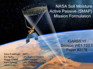
  • 1. NASA Soil Moisture Active Passive (SMAP) Mission Formulation Dara Entekhabi (MIT) Eni Njoku (JPL Caltech/NASA) Peggy O'Neill (GSFC/NASA) Kent Kellogg (JPL Caltech/NASA) Jared Entin (NASA HQ) IGARSS’11 Session WE1.T03.1 Paper #3178
  • 2.
  • 3.
  • 4. May 10 Dry soil, clear, mild winds. (LE≈H) May 18 90 mm Rain May 20 Moist soil, clear, mild winds. (LE>H) Pathways of Soil Moisture Influence on Weather and Climate CASES’97 Field Experiment, BAMS , 81(4), 2000. Dry Soil Moist Soil 5°C Dry Surface Moist Surface Deep Mixing up to 1.5 km Altitude Shallow Mixing to 1.0 km
  • 5. Source: Cahill et al., J. Appl. Met ., 38 Key Determinants of Land Evaporation Latent heat flux (evaporation) links the water , energy , and carbon cycles at the surface. Closure relationship, yet virtually unknown. Lack of knowledge of soil moisture control on surface fluxes causes uncertainty in weather and climate models.
  • 6. NOAH CLM What Do We Do Today? Dirmeyer et al., J. Hydromet., 7, 1177-1198, 2006 Atmospheric model representations of this function are essentially “guesses”, given scarcity of soil moisture and evaporation data.
  • 7. (*) % classification accuracy (binary Freeze/Thaw) (**) [cm 3 cm -3 ] volumetric water content, 1-sigma Science Requirements (1) North of 45N latitude Requirement Hydro-Meteorology Hydro-Climatology Carbon Cycle Baseline Mission Soil Moisture Freeze/Thaw Resolution 4–15 km 50–100 km 1–10 km 10 km 3 km Refresh Rate 2–3 days 3–4 days 2–3 days (1) 3 days 2 days (1) Accuracy 4–6% ** 4–6%** 80–70%* 4%** 80%* DS Objective Application Science Requirement Weather Forecast Initialization of Numerical Weather Prediction (NWP) Hydrometeorology Climate Prediction Boundary and Initial Conditions for Seasonal Climate Prediction Models Hydroclimatology Testing Land Surface Models in General Circulation Models Drought and Agriculture Monitoring Seasonal Precipitation Prediction Hydroclimatology Regional Drought Monitoring Crop Outlook Flood Forecast Improvements River Forecast Model Initialization Hydrometeorology Flash Flood Guidance (FFG) NWP Initialization for Precipitation Forecast Human Health Seasonal Heat Stress Outlook Hydroclimatology Near-Term Air Temperature and Heat Stress Forecast Hydrometeorology Disease Vector Seasonal Outlook Hydroclimatology Disease Vector Near-Term Forecast (NWP) Hydrometeorology Boreal Carbon Freeze/Thaw Date Freeze/Thaw State
  • 8. Sources: Global Forecast/Analysis System Bulletins http://www.emc.ncep.noaa.gov/gmb/STATS/html/model_changes.html The ECMWF Forecasting System Since 1979 http://ecmwf.int/products/forecasts/guide/The_general_circulation_model.html Trends in Short-Term Weather (0-14 Days) NWP Resolution Hydrometeorology Applications: NWP SMAP
  • 9. Operational Flood and Drought Applications Current : Empirical Soil Moisture Indices Based on Rainfall and Air Temperature ( By Counties >40 km and Climate Divisions >55 km ) Future : SMAP Soil Moisture Direct Observations of Soil Moisture at 10 km
  • 10.
  • 11. Data Products SMAP is Taking Aggressive Hardware & Softwate Measures to Detect & Partially Mitigate RFI Product Description Resolution Latency L1A_TB Radiometer Data in Time-Order - 12 hrs Instrument Data L1A_S0 Radar Data in Time-Order - 12 hrs L1B_TB Radiometer T B in Time-Order 36x47 km 12 hrs L1B_S0_LoRes Low Resolution Radar σ o in Time-Order 5x30 km 12 hrs L1C_S0_HiRes High Resolution Radar σ o in Half-Orbits 1-3 km 12 hrs L1C_TB Radiometer T B in Half-Orbits 36 km 12 hrs L2_SM_A Soil Moisture (Radar) 3 km 24 hrs Science Data (Half-Orbit) L2_SM_P Soil Moisture (Radiometer) 36 km 24 hrs L2_SM_A/P Soil Moisture (Radar+Radiometer) 9 km 24 hrs L3_F/T_A Freeze/Thaw State 3 km 50 hrs Science Data (Daily Composite) L3_SM_A Soil Moisture (Radar) 3 km 50 hrs L3_SM_P Soil Moisture (Radiometer) 36 km 50 hrs L3_SM_A/P Soil Moisture (Radar+Radiometer) 9 km 50 hrs L4_SM Soil Moisture (Surface and Root Zone ) 9 km 7 days Science Value-Added L4_C Carbon Net Ecosystem Exchange (NEE) 9 km 14 days
  • 12.
  • 13. L2_SM_AP Radar-Radiometer Algorithm Heterogeneity in Vegetation and Roughness Conditions Estimated by Sensitivities Γ in Radar HV Cross-Pol: T B ( M j ) is Used to Retrieve Soil Moisture at 9 km T B -Disaggregation Algorithm is: National Aeronautics and Space Administration Jet Propulsion Laboratory California Institute of Technology Pasadena, California Temporal Changes in T B and σ pp are Related. Relationship Parameter β is Estimated at Radiometer-Scale Using Successive Overpasses. Based on PALS Observations From: SGP99, SMEX02, CLASIC and SMAPVEX08
  • 14. SGP99, SMEX02, CLASIC and SMAPVEX08 WE2.T03.2 Paper #: 3398 Title: Evaluation of the SMAPCombined Radar-Radiometer Soil Moisture Algorithm Authors: N. Das, D. Entekhabi, S. Chan, S. Kim, E. Njoku, R. Dunbar, J.C. Shi Active-Passive Algorithm Performance Minimum Performance Algorithm RMSE: 0.055 [cm 3 cm -3 ] Active-Passive Algorithm RMSE: 0.033 [cm 3 cm -3 ]
  • 15.
  • 16. SMAP Algorithm Testbed TB (K) L2_SM_AP Combined Soil Moisture Product (9 km) L2_SM_P Radiometer Soil Moisture Product (36 km) L3_SM_A Radar Soil Moisture Product (3 km) L1C_TB Radiometer Brightness Temperature Product (36km) Simulated products generated with prototype algorithms on the SDS Testbed National Aeronautics and Space Administration Jet Propulsion Laboratory California Institute of Technology Pasadena, California WE2.T03.1 Paper #2069 Title: Utilization of ancillary data sets for SMAP Algorithm Development and Product Generation Authors: P. O'Neill, E. Podest, E. Njoku L1C_S0_Hi-Res Radar Backscatter Product (1-3 km)
  • 17.
  • 19.

Notas del editor

  1. Oct. 23, 2008