SlideShare a Scribd company logo
1 of 55
USING THE MILITARY LENSATIC COMPASS Module 1 Lensatic Compass PART 1  Basic Land Navigation
This presentation is intended as a quick summary, and not a comprehensive resource.  If you want to learn Land Navigation in detail, either buy a book; or get someone, who has the knowledge and skills, to teach you in person.  WARNING Module 1 Lensatic Compass PART 1  Basic Land Navigation
NOTE Module 1 Lensatic Compass PART 1  Basic Land Navigation To get the ideas across presented on these slides, many figures, pictures, and calculations may not be to scale and may be exaggerated for clarity.
Note: Prior to being issued any training  * equipment, you will be required to sign a “statement of liability” agreeing to pay for anything you damage or lose.  All items will be inspected and inventoried prior to your signature and at the end of the training day too.  If you do not intend to sign this statement, then you may be denied training.   *   You may use your own equipment. Module 1 Lensatic Compass PART 1  Basic Land Navigation
Any Questions? Module 1 Lensatic Compass PART 1  Basic Land Navigation
LAND NAVIGATION PRESENTATION PART 1 Module 1 Lensatic Compass Module 1 Lensatic Compass PART 1  Basic Land Navigation
PRESENTATION . . . and now on with the . . . Module 1 Lensatic Compass PART 1  Basic Land Navigation
LAND NAVIGATION WITH MAP AND   LENSATIC COMPASS Module 1 Lensatic Compass PART 1  Basic Land Navigation
LAND NAVIGATION  ,[object Object],[object Object],[object Object],[object Object],[object Object],[object Object],[object Object],[object Object],[object Object],[object Object],[object Object],[object Object],[object Object],(Where am  I  ?) (How far is it and am  I  there yet ?) (Where do  I  want to go and where am  I  actually going ?) (Do  I  understand the map ?) (What hill or river am  I  looking at ?) (Can  I  mentally visualize the landscape in 3D ?) (Take a long safe route or a short risky route ?) Training and practicing land navigation on foot provides the following everyday navigation (how not to get lost) benefits; Module 1 Lensatic Compass PART 1  Basic Land Navigation
[object Object],[object Object],[object Object],[object Object],[object Object],[object Object],[object Object],[object Object],[object Object],[object Object],[object Object],[object Object],[object Object],[object Object],[object Object],[object Object],[object Object],[object Object],Module 1 Lensatic Compass PART 1  Basic Land Navigation
THESE ARE THE TRAINING MODULES Module 1 Lensatic Compass –  parts and features, and how to sight the compass by two different methods. Module 2 Topo Map Margin –  what map margin data represents, map care, and how to properly fold a map. Module 3 Topo Map Scale –  map sizes and how it affects amount of detail that will be shown. Module 4 Topo Map Symbols –  you must understand them; to read and speak map language to others. Module 5 Terrain Relief –  shows elevation, indicates terrain features and heights of natural features. Module 6 Map Information –  what a protractor is for and how a map provides four kinds of information. Module 7 Sense of Direction –  lateral drift, current bearing, obstacles, back azimuth, deliberate offset. Module 8 Resection –  locate position with map only.  Modified resection is with a map or compass. Module 9 Intersection & Triangulation –  two methods to locate position by compass. Module 10 Map Speaks Compass Language -  there is no need to orient the map to find your position. Module 11 Plotting Position Coordinates –  exact positioning, used to communicate to others with a map. Module 12 Route Measure –  mapping straight-line distance, curvature distance, and slope distance. Module 13 Pace Count –  using ranger pacing beads and  estimating hiking speed. Module 14 Travel Distance Estimation –  estimating by 100 meter rule, rule-of-thumb, and by time. Module 15 Plan to Navigate –  in a group or alone, equipment, safety, responsibilities, route selection. Module 16 Stay on Course –  advance reference points and advance baselines. Module 17 Additional Land Navigation Skills –  estimate daylight, conserve energy, blisters, weather insight.  Module 18 Navigating Different Terrain –  special environments, featureless terrain, visibility, dense foilage. Module 19 Night Navigation –  night adaptation, protecting night vision, navigate with lensatic compass. Module 20 Sustainment –  maintaining skills, training others, setting up a land navigation course. Module 1 Lensatic Compass PART 1  Basic Land Navigation
Any Questions? Module 1 Lensatic Compass PART 1  Basic Land Navigation
PART 1 BASIC LAND NAVIGATION ,[object Object],[object Object],[object Object],[object Object],Module 1 Lensatic Compass PART 1  Basic Land Navigation
The genuine Lensatic compass differs from the type most hikers are familiar with, the traditional "orienteering" compasses.  The Lensatic, a design preferred by military forces for its precision and durability, is designed to take hyper-accurate bearings for land navigation and directing artillery fire! THE LENSATIC COMPASS Module 1 Lensatic Compass PART 1  Basic Land Navigation
LENSATIC COMPASS DESCRIPTION ,[object Object],[object Object],[object Object],[object Object],[object Object],[object Object],[object Object],[object Object],[object Object],[object Object],[object Object],Module 1 Lensatic Compass PART 1  Basic Land Navigation
LENSATIC COMPASS GENUINE or IMITATION Cheap Lensatic Copies When  someone  tried to buy a genuine CAMMENGA LENSATIC COMPASS from websites,  he  came across a whole raft of cheap imitations.  Most outlets tell you they are selling  ‘Military Style’  Lensatic compasses (fake, inaccurate, missing features) – but some claim to offer U.S. Government Military Lensatic compasses for just $14.95, which are also fake cheap imitations. Cheap copies break easily, are not accurate, have false features displayed on the compass glass face and will mislead you. The genuine lensatic compass used by the military is very durable, accurate, and easy to use.  It can survive rough handling and harsh environments. Buy the Genuine Article Purchasing a genuine CAMMENGA LENSATIC COMPASS is easy, go to  www.cammenga.com Click   on the article  to the right to read about the comparison of compasses… “ orienteering compass vs. lensatic compass”. Module 1 Lensatic Compass PART 1  Basic Land Navigation
Thumb Loop Lanyard Ring Sighting Slot Lens Luminous Bezel Line Luminous Magnetic Arrow Fixed Index Line Luminous Heading Luminous Sighting Dots Sighting Wire Graduated Straight Edge Floating Dial Bezel LENSATIC COMPASS   PARTS  and  Features  of a Lensatic compass Module 1 Lensatic Compass PART 1  Basic Land Navigation 1. COVER 2. BASE 3. LENS REAR SITE
[object Object],[object Object],[object Object],LENSATIC COMPASS   Cover   -  Protects the floating dial and other parts of the compass when closed.   Module 1 Lensatic Compass PART 1  Basic Land Navigation
LENSATIC COMPASS   Base  -  The main body of the compass.  If, for any reason, the lensatic compass were to malfunction, the base would be the piece that you would want to still work. ,[object Object],[object Object],[object Object],[object Object],[object Object],[object Object],[object Object],[object Object],Module 1 Lensatic Compass PART 1  Basic Land Navigation
FLOATING DIAL SCALE BLACK RING ,[object Object],[object Object],[object Object],[object Object],[object Object],[object Object],[object Object],[object Object],[object Object],[object Object],[object Object],LENSATIC COMPASS Module 1 Lensatic Compass PART 1  Basic Land Navigation
[object Object],[object Object],[object Object],[object Object],[object Object],[object Object],[object Object],[object Object],[object Object],BLACK RING RED RING FLOATING DIAL SCALE ,[object Object],[object Object],[object Object],[object Object],[object Object],[object Object],[object Object],[object Object],[object Object],[object Object],[object Object],Module 1 Lensatic Compass PART 1  Basic Land Navigation
Any Questions? Module 1 Lensatic Compass PART 1  Basic Land Navigation
Exactly 1 cm ( every 5 ticks) Approximately 1 inch (every 13 ticks) ZERO Used to take distance measurements from point “A” to point “B” on maps; in conjunction with the distance bar scales on the map. LENSATIC COMPASS   GRADUATED STRAIGHT EDGE Module 1 Lensatic Compass PART 1  Basic Land Navigation
[object Object],[object Object],[object Object],[object Object],[object Object],[object Object],[object Object],[object Object],[object Object],[object Object],[object Object],LENSATIC COMPASS   Lens Rear Site  - Sighting device.  Module 1 Lensatic Compass PART 1  Basic Land Navigation
LENSATIC COMPASS HANDLING A COMPASS ,[object Object],[object Object],[object Object],[object Object],[object Object],[object Object],[object Object],[object Object],[object Object],[object Object],[object Object],[object Object],[object Object],[object Object],[object Object],[object Object],[object Object],Module 1 Lensatic Compass PART 1  Basic Land Navigation
LENSATIC COMPASS INSPECTING A COMPASS Compasses are delicate instruments and should be cared for accordingly.  A detailed inspection is required when first obtaining and using a compass.  Important serviceability checks are outlined below: ,[object Object],[object Object],[object Object],[object Object],[object Object],[object Object],[object Object],[object Object],[object Object],[object Object],Module 1 Lensatic Compass PART 1  Basic Land Navigation
LENSATIC COMPASS CALIBRATION A compass in good working condition is very accurate, but it should be checked periodically on a known line of direction.  This process is called compass calibration. ,[object Object],[object Object],[object Object],[object Object],[object Object],[object Object],[object Object],[object Object],[object Object],Module 1 Lensatic Compass PART 1  Basic Land Navigation
HOW TO SIGHT  A  LENSATIC COMPASS Module 1 Lensatic Compass PART 1  Basic Land Navigation
Compass-to-Check method for taking a target azimuth bearing  ,[object Object],[object Object],SIGHTING A LENSATIC COMPASS Module 1 Lensatic Compass PART 1  Basic Land Navigation
SIGHTING A LENSATIC COMPASS Module 1 Lensatic Compass PART 1  Basic Land Navigation
65°  AZIMUTH (11.5m = 1,150mils) SIGHTING A LENSATIC COMPASS Module 1 Lensatic Compass PART 1  Basic Land Navigation
Compass-to-Check method for taking a target azimuth bearing  this is worth repeating ,[object Object],[object Object],SIGHTING A LENSATIC COMPASS Module 1 Lensatic Compass PART 1  Basic Land Navigation
R I G H T SIGHTING LENSATIC COMPASS Module 1 Lensatic Compass PART 1  Basic Land Navigation
W R O N G SIGHTING LENSATIC COMPASS Module 1 Lensatic Compass PART 1  Basic Land Navigation
R I G H T SIGHTING LENSATIC COMPASS Module 1 Lensatic Compass PART 1  Basic Land Navigation
W R O N G SIGHTING LENSATIC COMPASS Module 1 Lensatic Compass PART 1  Basic Land Navigation
R I G H T SIGHTING LENSATIC COMPASS Module 1 Lensatic Compass PART 1  Basic Land Navigation
W R O N G SIGHTING LENSATIC COMPASS Module 1 Lensatic Compass PART 1  Basic Land Navigation
SIGHTING A LENSATIC COMPASS Module 1 Lensatic Compass PART 1  Basic Land Navigation
Any Questions? Module 1 Lensatic Compass PART 1  Basic Land Navigation
Center-Hold method for taking a  target  azimuth bearing  ,[object Object],[object Object],[object Object],[object Object],[object Object],[object Object],[object Object],[object Object],LENSATIC COMPASS Module 1 Lensatic Compass PART 1  Basic Land Navigation
Any Questions? Module 1 Lensatic Compass PART 1  Basic Land Navigation
Center-Hold method for  following  an azimuth bearing  ,[object Object],[object Object],[object Object],[object Object],[object Object],LENSATIC COMPASS STEP 2 STEP 3 Module 1 Lensatic Compass PART 1  Basic Land Navigation
Any Questions? Module 1 Lensatic Compass PART 1  Basic Land Navigation
Note: Prior to being issued any training  * equipment, you will be required to sign a “statement of liability” agreeing to pay for anything you damage or lose.  All items will be inspected and inventoried prior to your signature and at the end of the training day too.  If you do not intend to sign this statement, then you may be denied training.   *   You may use your own equipment. Module 1 Lensatic Compass PART 1  Basic Land Navigation
[object Object],[object Object],[object Object],TESTING Module 1 Lensatic Compass PART 1  Basic Land Navigation
THE END OF LAND NAVIGATION PRESENTATION PART 1 Module 1 Lensatic Compass Module 1 Lensatic Compass PART 1  Basic Land Navigation

More Related Content

What's hot

Compass & Bearings
Compass & BearingsCompass & Bearings
Compass & Bearings
smsknight
 
Airborne Digital Data Capture Systems
Airborne Digital Data Capture SystemsAirborne Digital Data Capture Systems
Airborne Digital Data Capture Systems
gpetrie
 
basic geodesy.pdf
basic geodesy.pdfbasic geodesy.pdf
basic geodesy.pdf
ZhinoAli1
 

What's hot (20)

How to use a lensatic compass
How to use a lensatic compassHow to use a lensatic compass
How to use a lensatic compass
 
FCP 6 - Field Navigation - CFSGT Putland - Mar 10
FCP 6 - Field Navigation - CFSGT Putland - Mar 10FCP 6 - Field Navigation - CFSGT Putland - Mar 10
FCP 6 - Field Navigation - CFSGT Putland - Mar 10
 
Compass Navigation for Light Infantry Leaders
Compass Navigation for Light Infantry LeadersCompass Navigation for Light Infantry Leaders
Compass Navigation for Light Infantry Leaders
 
Map Reading
Map ReadingMap Reading
Map Reading
 
Military Map: Terrain features - with animations
Military Map: Terrain features - with animations Military Map: Terrain features - with animations
Military Map: Terrain features - with animations
 
Compass & Bearings
Compass & BearingsCompass & Bearings
Compass & Bearings
 
Real Time Corrections for GNSS Receivers
Real Time Corrections for GNSS ReceiversReal Time Corrections for GNSS Receivers
Real Time Corrections for GNSS Receivers
 
MAP PROJECTION
MAP PROJECTIONMAP PROJECTION
MAP PROJECTION
 
Geodesy md. yousuf gazi
Geodesy md. yousuf gaziGeodesy md. yousuf gazi
Geodesy md. yousuf gazi
 
Airborne Digital Data Capture Systems
Airborne Digital Data Capture SystemsAirborne Digital Data Capture Systems
Airborne Digital Data Capture Systems
 
Advanced Fieldcraft
Advanced FieldcraftAdvanced Fieldcraft
Advanced Fieldcraft
 
basic geodesy.pdf
basic geodesy.pdfbasic geodesy.pdf
basic geodesy.pdf
 
How to setup GPS Etrex 10 (English)
How to setup GPS Etrex 10 (English) How to setup GPS Etrex 10 (English)
How to setup GPS Etrex 10 (English)
 
Compass
CompassCompass
Compass
 
DEM generation, Image Matching in Aerial Photogrammetry.pptx
DEM generation, Image Matching in  Aerial Photogrammetry.pptxDEM generation, Image Matching in  Aerial Photogrammetry.pptx
DEM generation, Image Matching in Aerial Photogrammetry.pptx
 
Presentation1.1
Presentation1.1Presentation1.1
Presentation1.1
 
Generation of high resolution DSM using UAV Images
Generation of high resolution DSM using UAV Images  Generation of high resolution DSM using UAV Images
Generation of high resolution DSM using UAV Images
 
Aerial Photogrammetry
Aerial Photogrammetry Aerial Photogrammetry
Aerial Photogrammetry
 
Bunker
BunkerBunker
Bunker
 
Map And Compass
Map And CompassMap And Compass
Map And Compass
 

Similar to Landnav module 1

Similar to Landnav module 1 (8)

Silva navigation 2011
Silva navigation 2011Silva navigation 2011
Silva navigation 2011
 
Remote sensing
Remote sensingRemote sensing
Remote sensing
 
Livelox as a Training Aid
Livelox as a Training AidLivelox as a Training Aid
Livelox as a Training Aid
 
IAKM Wayfinding proposal
IAKM Wayfinding proposalIAKM Wayfinding proposal
IAKM Wayfinding proposal
 
Night vfr
Night vfrNight vfr
Night vfr
 
Introduction togps shsm
Introduction togps shsmIntroduction togps shsm
Introduction togps shsm
 
Geocaching citb mb presenatation day 2
Geocaching citb mb presenatation day 2Geocaching citb mb presenatation day 2
Geocaching citb mb presenatation day 2
 
Uwphoto Week3y Basic Rules
Uwphoto Week3y Basic RulesUwphoto Week3y Basic Rules
Uwphoto Week3y Basic Rules
 

Recently uploaded

The basics of sentences session 2pptx copy.pptx
The basics of sentences session 2pptx copy.pptxThe basics of sentences session 2pptx copy.pptx
The basics of sentences session 2pptx copy.pptx
heathfieldcps1
 
Russian Escort Service in Delhi 11k Hotel Foreigner Russian Call Girls in Delhi
Russian Escort Service in Delhi 11k Hotel Foreigner Russian Call Girls in DelhiRussian Escort Service in Delhi 11k Hotel Foreigner Russian Call Girls in Delhi
Russian Escort Service in Delhi 11k Hotel Foreigner Russian Call Girls in Delhi
kauryashika82
 
Ecosystem Interactions Class Discussion Presentation in Blue Green Lined Styl...
Ecosystem Interactions Class Discussion Presentation in Blue Green Lined Styl...Ecosystem Interactions Class Discussion Presentation in Blue Green Lined Styl...
Ecosystem Interactions Class Discussion Presentation in Blue Green Lined Styl...
fonyou31
 
1029 - Danh muc Sach Giao Khoa 10 . pdf
1029 -  Danh muc Sach Giao Khoa 10 . pdf1029 -  Danh muc Sach Giao Khoa 10 . pdf
1029 - Danh muc Sach Giao Khoa 10 . pdf
QucHHunhnh
 

Recently uploaded (20)

Z Score,T Score, Percential Rank and Box Plot Graph
Z Score,T Score, Percential Rank and Box Plot GraphZ Score,T Score, Percential Rank and Box Plot Graph
Z Score,T Score, Percential Rank and Box Plot Graph
 
SOCIAL AND HISTORICAL CONTEXT - LFTVD.pptx
SOCIAL AND HISTORICAL CONTEXT - LFTVD.pptxSOCIAL AND HISTORICAL CONTEXT - LFTVD.pptx
SOCIAL AND HISTORICAL CONTEXT - LFTVD.pptx
 
Disha NEET Physics Guide for classes 11 and 12.pdf
Disha NEET Physics Guide for classes 11 and 12.pdfDisha NEET Physics Guide for classes 11 and 12.pdf
Disha NEET Physics Guide for classes 11 and 12.pdf
 
Measures of Central Tendency: Mean, Median and Mode
Measures of Central Tendency: Mean, Median and ModeMeasures of Central Tendency: Mean, Median and Mode
Measures of Central Tendency: Mean, Median and Mode
 
Advance Mobile Application Development class 07
Advance Mobile Application Development class 07Advance Mobile Application Development class 07
Advance Mobile Application Development class 07
 
The basics of sentences session 2pptx copy.pptx
The basics of sentences session 2pptx copy.pptxThe basics of sentences session 2pptx copy.pptx
The basics of sentences session 2pptx copy.pptx
 
Mattingly "AI & Prompt Design: Structured Data, Assistants, & RAG"
Mattingly "AI & Prompt Design: Structured Data, Assistants, & RAG"Mattingly "AI & Prompt Design: Structured Data, Assistants, & RAG"
Mattingly "AI & Prompt Design: Structured Data, Assistants, & RAG"
 
microwave assisted reaction. General introduction
microwave assisted reaction. General introductionmicrowave assisted reaction. General introduction
microwave assisted reaction. General introduction
 
Russian Escort Service in Delhi 11k Hotel Foreigner Russian Call Girls in Delhi
Russian Escort Service in Delhi 11k Hotel Foreigner Russian Call Girls in DelhiRussian Escort Service in Delhi 11k Hotel Foreigner Russian Call Girls in Delhi
Russian Escort Service in Delhi 11k Hotel Foreigner Russian Call Girls in Delhi
 
Q4-W6-Restating Informational Text Grade 3
Q4-W6-Restating Informational Text Grade 3Q4-W6-Restating Informational Text Grade 3
Q4-W6-Restating Informational Text Grade 3
 
Explore beautiful and ugly buildings. Mathematics helps us create beautiful d...
Explore beautiful and ugly buildings. Mathematics helps us create beautiful d...Explore beautiful and ugly buildings. Mathematics helps us create beautiful d...
Explore beautiful and ugly buildings. Mathematics helps us create beautiful d...
 
Web & Social Media Analytics Previous Year Question Paper.pdf
Web & Social Media Analytics Previous Year Question Paper.pdfWeb & Social Media Analytics Previous Year Question Paper.pdf
Web & Social Media Analytics Previous Year Question Paper.pdf
 
The Most Excellent Way | 1 Corinthians 13
The Most Excellent Way | 1 Corinthians 13The Most Excellent Way | 1 Corinthians 13
The Most Excellent Way | 1 Corinthians 13
 
Introduction to Nonprofit Accounting: The Basics
Introduction to Nonprofit Accounting: The BasicsIntroduction to Nonprofit Accounting: The Basics
Introduction to Nonprofit Accounting: The Basics
 
Ecosystem Interactions Class Discussion Presentation in Blue Green Lined Styl...
Ecosystem Interactions Class Discussion Presentation in Blue Green Lined Styl...Ecosystem Interactions Class Discussion Presentation in Blue Green Lined Styl...
Ecosystem Interactions Class Discussion Presentation in Blue Green Lined Styl...
 
Accessible design: Minimum effort, maximum impact
Accessible design: Minimum effort, maximum impactAccessible design: Minimum effort, maximum impact
Accessible design: Minimum effort, maximum impact
 
Arihant handbook biology for class 11 .pdf
Arihant handbook biology for class 11 .pdfArihant handbook biology for class 11 .pdf
Arihant handbook biology for class 11 .pdf
 
fourth grading exam for kindergarten in writing
fourth grading exam for kindergarten in writingfourth grading exam for kindergarten in writing
fourth grading exam for kindergarten in writing
 
1029 - Danh muc Sach Giao Khoa 10 . pdf
1029 -  Danh muc Sach Giao Khoa 10 . pdf1029 -  Danh muc Sach Giao Khoa 10 . pdf
1029 - Danh muc Sach Giao Khoa 10 . pdf
 
Grant Readiness 101 TechSoup and Remy Consulting
Grant Readiness 101 TechSoup and Remy ConsultingGrant Readiness 101 TechSoup and Remy Consulting
Grant Readiness 101 TechSoup and Remy Consulting
 

Landnav module 1

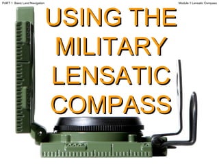
  • 1. USING THE MILITARY LENSATIC COMPASS Module 1 Lensatic Compass PART 1 Basic Land Navigation
  • 2. This presentation is intended as a quick summary, and not a comprehensive resource. If you want to learn Land Navigation in detail, either buy a book; or get someone, who has the knowledge and skills, to teach you in person. WARNING Module 1 Lensatic Compass PART 1 Basic Land Navigation
  • 3. NOTE Module 1 Lensatic Compass PART 1 Basic Land Navigation To get the ideas across presented on these slides, many figures, pictures, and calculations may not be to scale and may be exaggerated for clarity.
  • 4. Note: Prior to being issued any training * equipment, you will be required to sign a “statement of liability” agreeing to pay for anything you damage or lose. All items will be inspected and inventoried prior to your signature and at the end of the training day too. If you do not intend to sign this statement, then you may be denied training. * You may use your own equipment. Module 1 Lensatic Compass PART 1 Basic Land Navigation
  • 5. Any Questions? Module 1 Lensatic Compass PART 1 Basic Land Navigation
  • 6. LAND NAVIGATION PRESENTATION PART 1 Module 1 Lensatic Compass Module 1 Lensatic Compass PART 1 Basic Land Navigation
  • 7. PRESENTATION . . . and now on with the . . . Module 1 Lensatic Compass PART 1 Basic Land Navigation
  • 8. LAND NAVIGATION WITH MAP AND LENSATIC COMPASS Module 1 Lensatic Compass PART 1 Basic Land Navigation
  • 9.
  • 10.
  • 11. THESE ARE THE TRAINING MODULES Module 1 Lensatic Compass – parts and features, and how to sight the compass by two different methods. Module 2 Topo Map Margin – what map margin data represents, map care, and how to properly fold a map. Module 3 Topo Map Scale – map sizes and how it affects amount of detail that will be shown. Module 4 Topo Map Symbols – you must understand them; to read and speak map language to others. Module 5 Terrain Relief – shows elevation, indicates terrain features and heights of natural features. Module 6 Map Information – what a protractor is for and how a map provides four kinds of information. Module 7 Sense of Direction – lateral drift, current bearing, obstacles, back azimuth, deliberate offset. Module 8 Resection – locate position with map only. Modified resection is with a map or compass. Module 9 Intersection & Triangulation – two methods to locate position by compass. Module 10 Map Speaks Compass Language - there is no need to orient the map to find your position. Module 11 Plotting Position Coordinates – exact positioning, used to communicate to others with a map. Module 12 Route Measure – mapping straight-line distance, curvature distance, and slope distance. Module 13 Pace Count – using ranger pacing beads and estimating hiking speed. Module 14 Travel Distance Estimation – estimating by 100 meter rule, rule-of-thumb, and by time. Module 15 Plan to Navigate – in a group or alone, equipment, safety, responsibilities, route selection. Module 16 Stay on Course – advance reference points and advance baselines. Module 17 Additional Land Navigation Skills – estimate daylight, conserve energy, blisters, weather insight. Module 18 Navigating Different Terrain – special environments, featureless terrain, visibility, dense foilage. Module 19 Night Navigation – night adaptation, protecting night vision, navigate with lensatic compass. Module 20 Sustainment – maintaining skills, training others, setting up a land navigation course. Module 1 Lensatic Compass PART 1 Basic Land Navigation
  • 12. Any Questions? Module 1 Lensatic Compass PART 1 Basic Land Navigation
  • 13.
  • 14. The genuine Lensatic compass differs from the type most hikers are familiar with, the traditional "orienteering" compasses. The Lensatic, a design preferred by military forces for its precision and durability, is designed to take hyper-accurate bearings for land navigation and directing artillery fire! THE LENSATIC COMPASS Module 1 Lensatic Compass PART 1 Basic Land Navigation
  • 15.
  • 16. LENSATIC COMPASS GENUINE or IMITATION Cheap Lensatic Copies When someone tried to buy a genuine CAMMENGA LENSATIC COMPASS from websites, he came across a whole raft of cheap imitations. Most outlets tell you they are selling ‘Military Style’ Lensatic compasses (fake, inaccurate, missing features) – but some claim to offer U.S. Government Military Lensatic compasses for just $14.95, which are also fake cheap imitations. Cheap copies break easily, are not accurate, have false features displayed on the compass glass face and will mislead you. The genuine lensatic compass used by the military is very durable, accurate, and easy to use. It can survive rough handling and harsh environments. Buy the Genuine Article Purchasing a genuine CAMMENGA LENSATIC COMPASS is easy, go to www.cammenga.com Click on the article to the right to read about the comparison of compasses… “ orienteering compass vs. lensatic compass”. Module 1 Lensatic Compass PART 1 Basic Land Navigation
  • 17. Thumb Loop Lanyard Ring Sighting Slot Lens Luminous Bezel Line Luminous Magnetic Arrow Fixed Index Line Luminous Heading Luminous Sighting Dots Sighting Wire Graduated Straight Edge Floating Dial Bezel LENSATIC COMPASS PARTS and Features of a Lensatic compass Module 1 Lensatic Compass PART 1 Basic Land Navigation 1. COVER 2. BASE 3. LENS REAR SITE
  • 18.
  • 19.
  • 20.
  • 21.
  • 22. Any Questions? Module 1 Lensatic Compass PART 1 Basic Land Navigation
  • 23. Exactly 1 cm ( every 5 ticks) Approximately 1 inch (every 13 ticks) ZERO Used to take distance measurements from point “A” to point “B” on maps; in conjunction with the distance bar scales on the map. LENSATIC COMPASS GRADUATED STRAIGHT EDGE Module 1 Lensatic Compass PART 1 Basic Land Navigation
  • 24.
  • 25.
  • 26.
  • 27.
  • 28. HOW TO SIGHT A LENSATIC COMPASS Module 1 Lensatic Compass PART 1 Basic Land Navigation
  • 29.
  • 30. SIGHTING A LENSATIC COMPASS Module 1 Lensatic Compass PART 1 Basic Land Navigation
  • 31. SIGHTING A LENSATIC COMPASS Module 1 Lensatic Compass PART 1 Basic Land Navigation
  • 32. SIGHTING A LENSATIC COMPASS Module 1 Lensatic Compass PART 1 Basic Land Navigation
  • 33. SIGHTING A LENSATIC COMPASS Module 1 Lensatic Compass PART 1 Basic Land Navigation
  • 34. 65° AZIMUTH (11.5m = 1,150mils) SIGHTING A LENSATIC COMPASS Module 1 Lensatic Compass PART 1 Basic Land Navigation
  • 35.
  • 36. R I G H T SIGHTING LENSATIC COMPASS Module 1 Lensatic Compass PART 1 Basic Land Navigation
  • 37. R I G H T SIGHTING LENSATIC COMPASS Module 1 Lensatic Compass PART 1 Basic Land Navigation
  • 38. R I G H T SIGHTING LENSATIC COMPASS Module 1 Lensatic Compass PART 1 Basic Land Navigation
  • 39. W R O N G SIGHTING LENSATIC COMPASS Module 1 Lensatic Compass PART 1 Basic Land Navigation
  • 40. R I G H T SIGHTING LENSATIC COMPASS Module 1 Lensatic Compass PART 1 Basic Land Navigation
  • 41. R I G H T SIGHTING LENSATIC COMPASS Module 1 Lensatic Compass PART 1 Basic Land Navigation
  • 42. R I G H T SIGHTING LENSATIC COMPASS Module 1 Lensatic Compass PART 1 Basic Land Navigation
  • 43. W R O N G SIGHTING LENSATIC COMPASS Module 1 Lensatic Compass PART 1 Basic Land Navigation
  • 44. R I G H T SIGHTING LENSATIC COMPASS Module 1 Lensatic Compass PART 1 Basic Land Navigation
  • 45. W R O N G SIGHTING LENSATIC COMPASS Module 1 Lensatic Compass PART 1 Basic Land Navigation
  • 46. W R O N G SIGHTING LENSATIC COMPASS Module 1 Lensatic Compass PART 1 Basic Land Navigation
  • 47. SIGHTING A LENSATIC COMPASS Module 1 Lensatic Compass PART 1 Basic Land Navigation
  • 48. Any Questions? Module 1 Lensatic Compass PART 1 Basic Land Navigation
  • 49.
  • 50. Any Questions? Module 1 Lensatic Compass PART 1 Basic Land Navigation
  • 51.
  • 52. Any Questions? Module 1 Lensatic Compass PART 1 Basic Land Navigation
  • 53. Note: Prior to being issued any training * equipment, you will be required to sign a “statement of liability” agreeing to pay for anything you damage or lose. All items will be inspected and inventoried prior to your signature and at the end of the training day too. If you do not intend to sign this statement, then you may be denied training. * You may use your own equipment. Module 1 Lensatic Compass PART 1 Basic Land Navigation
  • 54.
  • 55. THE END OF LAND NAVIGATION PRESENTATION PART 1 Module 1 Lensatic Compass Module 1 Lensatic Compass PART 1 Basic Land Navigation