SlideShare una empresa de Scribd logo
1 de 13
Descargar para leer sin conexión
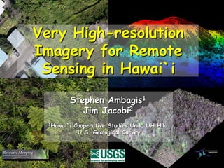
Very High-resolution
Imagery for Remote
 Sensing in Hawai`i
         Stephen Ambagis1
            Jim Jacobi2
  1Hawai`i   Cooperative Studies Unit, UH Hilo
              2U.S. Geological Survey
What happens in a vacuum
• Presently there are no local commercial aerial digital
  imagery providers
• Two systems are breaking onto the scene
• Both are focused on research and conservation
• No overlap in base products, complimentary systems
• Both systems are producing new products

This presents the user community with a very unique
  situation, one that could progress Hawaii’s
  conservation goals more than ever imagined
Carnegie Airborne
    Observatory
– Hyperspectral imagery,
  350 bands, 30 cm
– Full waveform LIDAR

Contact: Greg Asner
email gpa@stanford.edu
website- http://cao.stanford.edu/
Resource Mapping
   – Very high resolution
     multispecral, 4 bands,
     20 cm resolution
   – Ultra high resolution
     natural color, 3 bands,
     1 cm resolution
Contact: Dana Slaymaker
Email    info@resourcemappinggis.com
Web site http://resourcemappinggis.com/
Resource Mapping plane
CAO plane and system        and system
• Fist contracted through USGS to do pilot research
  for TNC, Army, and Fish & Wildlife lands.
• USGS funded development of next generation
  system that included image normalization for direct
  comparison and dual scale system
• Initial results were promising
• Recently TNCH has taken a leading role in
  implementation creating Resource Mapping Hawaii,
  local capacity
Matching multispectral and
natural color imagery over
the Hakalau National
Wildlife Reserve
This dual-scale approach is
especially helpful with
species like Australian tree
fern which is not
distinguishable from the
native fern species using
any spectral identifiers.
Resource Mappings goal is
usually to find the lowest
resolution adequate to a
specific mapping need to
reduce costs, but the dual
camera set up gives them
several options to meet
these needs.
A subsection of the natural color with it’s corresponding multispectral. The multispectral shows better spectral discrimination
between trees while the natural color has more detail. A three times increase in spatial resolution in the natural color was
sufficient to distinguish the tree species needed to map in the the Hakalau National Wildlife Reserve.
Example of Ultra High Resolution Image Interpretability


                                                     Psidum
                                                     cattelianum


                                                                       Pandanus
                                                         Psidum        tectorius
                                                         cattelianum


       Melastoma
       candidum                     Schefflera
                                   actinophylla

                                                                         Metrosideros
                                                                         polymorpha


                                                                                        Macaranga
                                                                                         mappa

                                                  Cecropia
                                                  obtusifolia


                                                                                                    Nephrolepis
                                                         Melochia                                    multiflora
                                                         umbellata
                                                                            Trema
                                                                            orentalis


2 cm resolution
Range of sub-sampling options, from 7 cm (above) to 1cm per pixel   Detail of a single fern at both resolutions
Current Status of Systems
• Current product lines
   – Resource mapping products are focused on very fine detailed image
     interpretation over small to moderate AOI’s.
   – CAO data is geared toward large scale, automated, image analysis.
• Availability
   – Resource Mapping will be local in June of this year with a dedicated
     plane, pilot, and processing facility
   – CAO is local but still in research phase of development from a large
     scale implementation perspective.
• Cost
   – Resource Mapping produces full coverage, 2 scale, ortho-imagery at
     less than $2.00 per acre.
   – CAO costs requests should be directed to Greg Asner of Carnegie.
Summary
• Carnegie Airborne Observatory
   – Huge potential for automated large scale mapping of certain species,
     vegetation structure, and physiology; high-resolution DEMs.
   – True costs still being determined; currently available with conditions;
     long term availability being determined.

• Resource Mapping
   – Straight forward approach to mapping and monitoring plant
     communities and species using image interpretation with ultra high
     resolution data
   – Known costs, fast and simple tasking ability.
Carnegie Airborne                                Resource Mapping
    Observatory                               – Very high resolution
– Hyperspectral                                 multispecral, 4 bands,
  imagery, 350 bands,                           20 cm resolution
  30 cm resolution                            – Ultra high resolution
– Full waveform                                 natural color, 3 bands,
  LIDAR                                         1 cm resolution


Contact: Greg Asner                         Contact: Dana Slaymaker
email gpa@stanford.edu                      Email    info@resourcemappinggis.com
website- http://cao.stanford.edu/           Web site http://resourcemappinggis.com/


Note: Any use of trade, product, or firm names in this presentation is for descriptive
    purposes only and does not imply endorsement be the U.S. Government.

Más contenido relacionado

Más de Hawaii Geographic Information Coordinating Council

Más de Hawaii Geographic Information Coordinating Council (20)

NOAA's Coastal Change Analysis Program
NOAA's Coastal Change Analysis ProgramNOAA's Coastal Change Analysis Program
NOAA's Coastal Change Analysis Program
 
Hawaii and US Pacific Basin Orthoimagery Update
Hawaii and US Pacific Basin Orthoimagery UpdateHawaii and US Pacific Basin Orthoimagery Update
Hawaii and US Pacific Basin Orthoimagery Update
 
The ArcGIS Platform: Appyling Geography Everywhere
The ArcGIS Platform: Appyling Geography EverywhereThe ArcGIS Platform: Appyling Geography Everywhere
The ArcGIS Platform: Appyling Geography Everywhere
 
Web based Data and Tools for Coastal Management
Web based Data and Tools for Coastal ManagementWeb based Data and Tools for Coastal Management
Web based Data and Tools for Coastal Management
 
Ecosystem Vulnerability and Cumulative Impacts on th eOceans of hawaii
Ecosystem Vulnerability and Cumulative Impacts on th eOceans of hawaiiEcosystem Vulnerability and Cumulative Impacts on th eOceans of hawaii
Ecosystem Vulnerability and Cumulative Impacts on th eOceans of hawaii
 
Using GIS to Connect Communities
Using GIS to Connect CommunitiesUsing GIS to Connect Communities
Using GIS to Connect Communities
 
Assessing Reef Health Using a Low Altitude Sensing Platform
Assessing Reef Health Using a Low Altitude Sensing PlatformAssessing Reef Health Using a Low Altitude Sensing Platform
Assessing Reef Health Using a Low Altitude Sensing Platform
 
Hawaii DOT Monitoring Stations Versus National Performance Measurement Resear...
Hawaii DOT Monitoring Stations Versus National Performance Measurement Resear...Hawaii DOT Monitoring Stations Versus National Performance Measurement Resear...
Hawaii DOT Monitoring Stations Versus National Performance Measurement Resear...
 
Use of GIS Technology to Inform Planning Efforts Through Visualization of Com...
Use of GIS Technology to Inform Planning Efforts Through Visualization of Com...Use of GIS Technology to Inform Planning Efforts Through Visualization of Com...
Use of GIS Technology to Inform Planning Efforts Through Visualization of Com...
 
Expanding GIS Access to Technical and Non-Technical Users to Enhance Project ...
Expanding GIS Access to Technical and Non-Technical Users to Enhance Project ...Expanding GIS Access to Technical and Non-Technical Users to Enhance Project ...
Expanding GIS Access to Technical and Non-Technical Users to Enhance Project ...
 
STEMworks: K12 Education in Hawaii in Science Technology Engineering and Math
STEMworks: K12 Education in Hawaii in Science Technology Engineering and MathSTEMworks: K12 Education in Hawaii in Science Technology Engineering and Math
STEMworks: K12 Education in Hawaii in Science Technology Engineering and Math
 
Planning for Technological Change
Planning for Technological ChangePlanning for Technological Change
Planning for Technological Change
 
Now & the Future of geodesy in Hawaii for the GIS Users
Now & the Future of geodesy in Hawaii for the GIS UsersNow & the Future of geodesy in Hawaii for the GIS Users
Now & the Future of geodesy in Hawaii for the GIS Users
 
314 woods- uav mapping history
314   woods- uav mapping history314   woods- uav mapping history
314 woods- uav mapping history
 
314 smith 2015 higicc-final
314  smith 2015 higicc-final314  smith 2015 higicc-final
314 smith 2015 higicc-final
 
Real Time Corrections for GNSS Receivers
Real Time Corrections for GNSS ReceiversReal Time Corrections for GNSS Receivers
Real Time Corrections for GNSS Receivers
 
Honolulu Board of Water Supply: Enterprise GIS
Honolulu Board of Water Supply: Enterprise GISHonolulu Board of Water Supply: Enterprise GIS
Honolulu Board of Water Supply: Enterprise GIS
 
State of Hawaii Digital Leveling Project
State of Hawaii Digital Leveling ProjectState of Hawaii Digital Leveling Project
State of Hawaii Digital Leveling Project
 
Urban Tree Canopy Change Assessment for Southern Oahu
Urban Tree Canopy Change Assessment for Southern OahuUrban Tree Canopy Change Assessment for Southern Oahu
Urban Tree Canopy Change Assessment for Southern Oahu
 
The Evolving GIS Enterprise
The Evolving GIS EnterpriseThe Evolving GIS Enterprise
The Evolving GIS Enterprise
 

Último

SAP Build Work Zone - Overview L2-L3.pptx
SAP Build Work Zone - Overview L2-L3.pptxSAP Build Work Zone - Overview L2-L3.pptx
SAP Build Work Zone - Overview L2-L3.pptxNavinnSomaal
 
"Subclassing and Composition – A Pythonic Tour of Trade-Offs", Hynek Schlawack
"Subclassing and Composition – A Pythonic Tour of Trade-Offs", Hynek Schlawack"Subclassing and Composition – A Pythonic Tour of Trade-Offs", Hynek Schlawack
"Subclassing and Composition – A Pythonic Tour of Trade-Offs", Hynek SchlawackFwdays
 
"ML in Production",Oleksandr Bagan
"ML in Production",Oleksandr Bagan"ML in Production",Oleksandr Bagan
"ML in Production",Oleksandr BaganFwdays
 
unit 4 immunoblotting technique complete.pptx
unit 4 immunoblotting technique complete.pptxunit 4 immunoblotting technique complete.pptx
unit 4 immunoblotting technique complete.pptxBkGupta21
 
SIP trunking in Janus @ Kamailio World 2024
SIP trunking in Janus @ Kamailio World 2024SIP trunking in Janus @ Kamailio World 2024
SIP trunking in Janus @ Kamailio World 2024Lorenzo Miniero
 
The State of Passkeys with FIDO Alliance.pptx
The State of Passkeys with FIDO Alliance.pptxThe State of Passkeys with FIDO Alliance.pptx
The State of Passkeys with FIDO Alliance.pptxLoriGlavin3
 
How AI, OpenAI, and ChatGPT impact business and software.
How AI, OpenAI, and ChatGPT impact business and software.How AI, OpenAI, and ChatGPT impact business and software.
How AI, OpenAI, and ChatGPT impact business and software.Curtis Poe
 
Use of FIDO in the Payments and Identity Landscape: FIDO Paris Seminar.pptx
Use of FIDO in the Payments and Identity Landscape: FIDO Paris Seminar.pptxUse of FIDO in the Payments and Identity Landscape: FIDO Paris Seminar.pptx
Use of FIDO in the Payments and Identity Landscape: FIDO Paris Seminar.pptxLoriGlavin3
 
TeamStation AI System Report LATAM IT Salaries 2024
TeamStation AI System Report LATAM IT Salaries 2024TeamStation AI System Report LATAM IT Salaries 2024
TeamStation AI System Report LATAM IT Salaries 2024Lonnie McRorey
 
A Deep Dive on Passkeys: FIDO Paris Seminar.pptx
A Deep Dive on Passkeys: FIDO Paris Seminar.pptxA Deep Dive on Passkeys: FIDO Paris Seminar.pptx
A Deep Dive on Passkeys: FIDO Paris Seminar.pptxLoriGlavin3
 
Tampa BSides - Chef's Tour of Microsoft Security Adoption Framework (SAF)
Tampa BSides - Chef's Tour of Microsoft Security Adoption Framework (SAF)Tampa BSides - Chef's Tour of Microsoft Security Adoption Framework (SAF)
Tampa BSides - Chef's Tour of Microsoft Security Adoption Framework (SAF)Mark Simos
 
DSPy a system for AI to Write Prompts and Do Fine Tuning
DSPy a system for AI to Write Prompts and Do Fine TuningDSPy a system for AI to Write Prompts and Do Fine Tuning
DSPy a system for AI to Write Prompts and Do Fine TuningLars Bell
 
Take control of your SAP testing with UiPath Test Suite
Take control of your SAP testing with UiPath Test SuiteTake control of your SAP testing with UiPath Test Suite
Take control of your SAP testing with UiPath Test SuiteDianaGray10
 
Moving Beyond Passwords: FIDO Paris Seminar.pdf
Moving Beyond Passwords: FIDO Paris Seminar.pdfMoving Beyond Passwords: FIDO Paris Seminar.pdf
Moving Beyond Passwords: FIDO Paris Seminar.pdfLoriGlavin3
 
New from BookNet Canada for 2024: Loan Stars - Tech Forum 2024
New from BookNet Canada for 2024: Loan Stars - Tech Forum 2024New from BookNet Canada for 2024: Loan Stars - Tech Forum 2024
New from BookNet Canada for 2024: Loan Stars - Tech Forum 2024BookNet Canada
 
Merck Moving Beyond Passwords: FIDO Paris Seminar.pptx
Merck Moving Beyond Passwords: FIDO Paris Seminar.pptxMerck Moving Beyond Passwords: FIDO Paris Seminar.pptx
Merck Moving Beyond Passwords: FIDO Paris Seminar.pptxLoriGlavin3
 
Generative AI for Technical Writer or Information Developers
Generative AI for Technical Writer or Information DevelopersGenerative AI for Technical Writer or Information Developers
Generative AI for Technical Writer or Information DevelopersRaghuram Pandurangan
 
Hyperautomation and AI/ML: A Strategy for Digital Transformation Success.pdf
Hyperautomation and AI/ML: A Strategy for Digital Transformation Success.pdfHyperautomation and AI/ML: A Strategy for Digital Transformation Success.pdf
Hyperautomation and AI/ML: A Strategy for Digital Transformation Success.pdfPrecisely
 
Passkey Providers and Enabling Portability: FIDO Paris Seminar.pptx
Passkey Providers and Enabling Portability: FIDO Paris Seminar.pptxPasskey Providers and Enabling Portability: FIDO Paris Seminar.pptx
Passkey Providers and Enabling Portability: FIDO Paris Seminar.pptxLoriGlavin3
 
New from BookNet Canada for 2024: BNC CataList - Tech Forum 2024
New from BookNet Canada for 2024: BNC CataList - Tech Forum 2024New from BookNet Canada for 2024: BNC CataList - Tech Forum 2024
New from BookNet Canada for 2024: BNC CataList - Tech Forum 2024BookNet Canada
 

Último (20)

SAP Build Work Zone - Overview L2-L3.pptx
SAP Build Work Zone - Overview L2-L3.pptxSAP Build Work Zone - Overview L2-L3.pptx
SAP Build Work Zone - Overview L2-L3.pptx
 
"Subclassing and Composition – A Pythonic Tour of Trade-Offs", Hynek Schlawack
"Subclassing and Composition – A Pythonic Tour of Trade-Offs", Hynek Schlawack"Subclassing and Composition – A Pythonic Tour of Trade-Offs", Hynek Schlawack
"Subclassing and Composition – A Pythonic Tour of Trade-Offs", Hynek Schlawack
 
"ML in Production",Oleksandr Bagan
"ML in Production",Oleksandr Bagan"ML in Production",Oleksandr Bagan
"ML in Production",Oleksandr Bagan
 
unit 4 immunoblotting technique complete.pptx
unit 4 immunoblotting technique complete.pptxunit 4 immunoblotting technique complete.pptx
unit 4 immunoblotting technique complete.pptx
 
SIP trunking in Janus @ Kamailio World 2024
SIP trunking in Janus @ Kamailio World 2024SIP trunking in Janus @ Kamailio World 2024
SIP trunking in Janus @ Kamailio World 2024
 
The State of Passkeys with FIDO Alliance.pptx
The State of Passkeys with FIDO Alliance.pptxThe State of Passkeys with FIDO Alliance.pptx
The State of Passkeys with FIDO Alliance.pptx
 
How AI, OpenAI, and ChatGPT impact business and software.
How AI, OpenAI, and ChatGPT impact business and software.How AI, OpenAI, and ChatGPT impact business and software.
How AI, OpenAI, and ChatGPT impact business and software.
 
Use of FIDO in the Payments and Identity Landscape: FIDO Paris Seminar.pptx
Use of FIDO in the Payments and Identity Landscape: FIDO Paris Seminar.pptxUse of FIDO in the Payments and Identity Landscape: FIDO Paris Seminar.pptx
Use of FIDO in the Payments and Identity Landscape: FIDO Paris Seminar.pptx
 
TeamStation AI System Report LATAM IT Salaries 2024
TeamStation AI System Report LATAM IT Salaries 2024TeamStation AI System Report LATAM IT Salaries 2024
TeamStation AI System Report LATAM IT Salaries 2024
 
A Deep Dive on Passkeys: FIDO Paris Seminar.pptx
A Deep Dive on Passkeys: FIDO Paris Seminar.pptxA Deep Dive on Passkeys: FIDO Paris Seminar.pptx
A Deep Dive on Passkeys: FIDO Paris Seminar.pptx
 
Tampa BSides - Chef's Tour of Microsoft Security Adoption Framework (SAF)
Tampa BSides - Chef's Tour of Microsoft Security Adoption Framework (SAF)Tampa BSides - Chef's Tour of Microsoft Security Adoption Framework (SAF)
Tampa BSides - Chef's Tour of Microsoft Security Adoption Framework (SAF)
 
DSPy a system for AI to Write Prompts and Do Fine Tuning
DSPy a system for AI to Write Prompts and Do Fine TuningDSPy a system for AI to Write Prompts and Do Fine Tuning
DSPy a system for AI to Write Prompts and Do Fine Tuning
 
Take control of your SAP testing with UiPath Test Suite
Take control of your SAP testing with UiPath Test SuiteTake control of your SAP testing with UiPath Test Suite
Take control of your SAP testing with UiPath Test Suite
 
Moving Beyond Passwords: FIDO Paris Seminar.pdf
Moving Beyond Passwords: FIDO Paris Seminar.pdfMoving Beyond Passwords: FIDO Paris Seminar.pdf
Moving Beyond Passwords: FIDO Paris Seminar.pdf
 
New from BookNet Canada for 2024: Loan Stars - Tech Forum 2024
New from BookNet Canada for 2024: Loan Stars - Tech Forum 2024New from BookNet Canada for 2024: Loan Stars - Tech Forum 2024
New from BookNet Canada for 2024: Loan Stars - Tech Forum 2024
 
Merck Moving Beyond Passwords: FIDO Paris Seminar.pptx
Merck Moving Beyond Passwords: FIDO Paris Seminar.pptxMerck Moving Beyond Passwords: FIDO Paris Seminar.pptx
Merck Moving Beyond Passwords: FIDO Paris Seminar.pptx
 
Generative AI for Technical Writer or Information Developers
Generative AI for Technical Writer or Information DevelopersGenerative AI for Technical Writer or Information Developers
Generative AI for Technical Writer or Information Developers
 
Hyperautomation and AI/ML: A Strategy for Digital Transformation Success.pdf
Hyperautomation and AI/ML: A Strategy for Digital Transformation Success.pdfHyperautomation and AI/ML: A Strategy for Digital Transformation Success.pdf
Hyperautomation and AI/ML: A Strategy for Digital Transformation Success.pdf
 
Passkey Providers and Enabling Portability: FIDO Paris Seminar.pptx
Passkey Providers and Enabling Portability: FIDO Paris Seminar.pptxPasskey Providers and Enabling Portability: FIDO Paris Seminar.pptx
Passkey Providers and Enabling Portability: FIDO Paris Seminar.pptx
 
New from BookNet Canada for 2024: BNC CataList - Tech Forum 2024
New from BookNet Canada for 2024: BNC CataList - Tech Forum 2024New from BookNet Canada for 2024: BNC CataList - Tech Forum 2024
New from BookNet Canada for 2024: BNC CataList - Tech Forum 2024
 

Progress on the CAO Hyperspectral / LIDAR Imagery Project

  • 1. Very High-resolution Imagery for Remote Sensing in Hawai`i Stephen Ambagis1 Jim Jacobi2 1Hawai`i Cooperative Studies Unit, UH Hilo 2U.S. Geological Survey
  • 2. What happens in a vacuum • Presently there are no local commercial aerial digital imagery providers • Two systems are breaking onto the scene • Both are focused on research and conservation • No overlap in base products, complimentary systems • Both systems are producing new products This presents the user community with a very unique situation, one that could progress Hawaii’s conservation goals more than ever imagined
  • 3. Carnegie Airborne Observatory – Hyperspectral imagery, 350 bands, 30 cm – Full waveform LIDAR Contact: Greg Asner email gpa@stanford.edu website- http://cao.stanford.edu/
  • 4. Resource Mapping – Very high resolution multispecral, 4 bands, 20 cm resolution – Ultra high resolution natural color, 3 bands, 1 cm resolution Contact: Dana Slaymaker Email info@resourcemappinggis.com Web site http://resourcemappinggis.com/
  • 5. Resource Mapping plane CAO plane and system and system
  • 6. • Fist contracted through USGS to do pilot research for TNC, Army, and Fish & Wildlife lands. • USGS funded development of next generation system that included image normalization for direct comparison and dual scale system • Initial results were promising • Recently TNCH has taken a leading role in implementation creating Resource Mapping Hawaii, local capacity
  • 7. Matching multispectral and natural color imagery over the Hakalau National Wildlife Reserve This dual-scale approach is especially helpful with species like Australian tree fern which is not distinguishable from the native fern species using any spectral identifiers. Resource Mappings goal is usually to find the lowest resolution adequate to a specific mapping need to reduce costs, but the dual camera set up gives them several options to meet these needs.
  • 8. A subsection of the natural color with it’s corresponding multispectral. The multispectral shows better spectral discrimination between trees while the natural color has more detail. A three times increase in spatial resolution in the natural color was sufficient to distinguish the tree species needed to map in the the Hakalau National Wildlife Reserve.
  • 9. Example of Ultra High Resolution Image Interpretability Psidum cattelianum Pandanus Psidum tectorius cattelianum Melastoma candidum Schefflera actinophylla Metrosideros polymorpha Macaranga mappa Cecropia obtusifolia Nephrolepis Melochia multiflora umbellata Trema orentalis 2 cm resolution
  • 10. Range of sub-sampling options, from 7 cm (above) to 1cm per pixel Detail of a single fern at both resolutions
  • 11. Current Status of Systems • Current product lines – Resource mapping products are focused on very fine detailed image interpretation over small to moderate AOI’s. – CAO data is geared toward large scale, automated, image analysis. • Availability – Resource Mapping will be local in June of this year with a dedicated plane, pilot, and processing facility – CAO is local but still in research phase of development from a large scale implementation perspective. • Cost – Resource Mapping produces full coverage, 2 scale, ortho-imagery at less than $2.00 per acre. – CAO costs requests should be directed to Greg Asner of Carnegie.
  • 12. Summary • Carnegie Airborne Observatory – Huge potential for automated large scale mapping of certain species, vegetation structure, and physiology; high-resolution DEMs. – True costs still being determined; currently available with conditions; long term availability being determined. • Resource Mapping – Straight forward approach to mapping and monitoring plant communities and species using image interpretation with ultra high resolution data – Known costs, fast and simple tasking ability.
  • 13. Carnegie Airborne Resource Mapping Observatory – Very high resolution – Hyperspectral multispecral, 4 bands, imagery, 350 bands, 20 cm resolution 30 cm resolution – Ultra high resolution – Full waveform natural color, 3 bands, LIDAR 1 cm resolution Contact: Greg Asner Contact: Dana Slaymaker email gpa@stanford.edu Email info@resourcemappinggis.com website- http://cao.stanford.edu/ Web site http://resourcemappinggis.com/ Note: Any use of trade, product, or firm names in this presentation is for descriptive purposes only and does not imply endorsement be the U.S. Government.