SlideShare una empresa de Scribd logo
1 de 47
Descargar para leer sin conexión
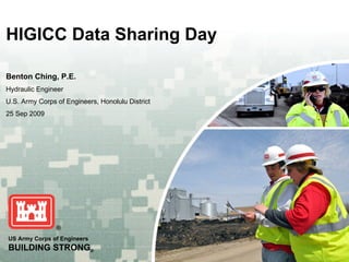
HIGICC Data Sharing Day

Benton Ching, P.E.
Hydraulic Engineer
U.S. Army Corps of Engineers, Honolulu District
25 Sep 2009


US Army Corps of Engineers
BUILDING STRONG®
Topics
U.S. Army Corps of Engineers Overview
Programs/Projects


                                        BUILDING STRONG®
Pacific Ocean Division


                              BUILDING STRONG®
       BUILDING STRONG   SM
Honolulu District (POH)
Objectives

  • Honolulu District (POH) Background ZonesMiles
                            12 Million Square
                                5 Time
                                         2 Congressional Districts
  • POH eGIS                                 3 U.S. Territories
                                                                           District Headquarters:
                            CNMI                                            •Fort Shafter Resident Office
                   Guam                                                     •Schofield Barracks Resident
  • CorpsMap       Office        3700 Miles                                     Office
                            3803 Miles

                                4596 Miles
                                                 2100 Miles
  • USACE and Palau Resident Office Geospatial Ties
              Marines Corps
         Equator                              Kwajalein                               Equator
                                              Resident
                                              Office          2600 Miles


                                                                   American Samoa


                                                                                  BUILDING STRONG®
Disclaimers
Project specific study areas
Data owned by customer/partner must be
requested through customer


                               BUILDING STRONG®
Corps of Engineers Programs
Military
Civil Works
Emergency Management
Environmental
Regulatory
Real Estate


                       BUILDING STRONG®
Military


           BUILDING STRONG®
1913 Mapping of Oahu


                  BUILDING STRONG®
Military


           BUILDING STRONG®
Military


           BUILDING STRONG®
BUILDING STRONG®
BUILDING STRONG®
Civil Works


              BUILDING STRONG®
Navigation


        BUILDING STRONG®
Navigation


     BUILDING STRONG®
BUILDING STRONG®
BUILDING STRONG®
Breakwater Photo


                   BUILDING STRONG®
BUILDING STRONG®
Shore Protection


                   BUILDING STRONG®
Flood Control


                BUILDING STRONG®
Inspections


              BUILDING STRONG®
BUILDING STRONG®
BUILDING STRONG®
WATERSHED PLANNING
West Honolulu Watershed Study
Ala Wai Watershed Analysis
Central O‘ahu Watershed Study
West Maui Watershed (FY08)
Hydropower Assessment (FY09)
Waialua-Kaiaka Watershed (FY10)
Maunalua Bay Watershed (FY10)
Waimea/Kekaha Watershed (FY10)
Anahola Watershed (FY10)


                                  BUILDING STRONG®
BUILDING STRONG®
CEPD


       BUILDING STRONG®
Emergency Management


     Typhoon Chata’an, Guam, July 2002


                                                     Damage from Supertyphoon Pongsona
                                                       Dededo, Guam, December 2002


                                                 Corps soldiers and civilians
                                                 work together to help the
                                                 people of Guam, CNMI,
                                                 and Chuuk devastating
                                                 typhoons.
Daily video teleconferences, connect Guam with
Honolulu and Corps-wide assets during the
Supertyphoon Pongsona response and recovery                                     BUILDING STRONG®
effort
BUILDING STRONG®
BUILDING STRONG®
Dam Inspection


                 BUILDING STRONG®
Dam Break
 Analysis


  BUILDING STRONG®
BUILDING STRONG®
Environmental


                BUILDING STRONG®
BUILDING STRONG®
Formerly Used Defense Sites
          (FUDS)


                       BUILDING STRONG®
Ecosystem Restoration


                   BUILDING STRONG®
Regulatory


             BUILDING STRONG®
BUILDING STRONG®
BUILDING STRONG®
BUILDING STRONG®
Support for Others


                     BUILDING STRONG®
12/26/2004
 Tsunami


     BUILDING STRONG®
BUILDING STRONG®
BUILDING STRONG®
Oahu 1927
 Aerials


  BUILDING STRONG®
Benton Ching, P.E.
Hydraulic Engineer
U.S. Army Corps of Engineers
Honolulu District
Bldg. 230, Room 209
Fort Shafter, HI 96858
Benton.Y.Ching@usace.army.mil
(808) 438-1157


                                BUILDING STRONG®

Más contenido relacionado

Más de Hawaii Geographic Information Coordinating Council

Más de Hawaii Geographic Information Coordinating Council (20)

Hawaii and US Pacific Basin Orthoimagery Update
Hawaii and US Pacific Basin Orthoimagery UpdateHawaii and US Pacific Basin Orthoimagery Update
Hawaii and US Pacific Basin Orthoimagery Update
 
The ArcGIS Platform: Appyling Geography Everywhere
The ArcGIS Platform: Appyling Geography EverywhereThe ArcGIS Platform: Appyling Geography Everywhere
The ArcGIS Platform: Appyling Geography Everywhere
 
Web based Data and Tools for Coastal Management
Web based Data and Tools for Coastal ManagementWeb based Data and Tools for Coastal Management
Web based Data and Tools for Coastal Management
 
Ecosystem Vulnerability and Cumulative Impacts on th eOceans of hawaii
Ecosystem Vulnerability and Cumulative Impacts on th eOceans of hawaiiEcosystem Vulnerability and Cumulative Impacts on th eOceans of hawaii
Ecosystem Vulnerability and Cumulative Impacts on th eOceans of hawaii
 
Using GIS to Connect Communities
Using GIS to Connect CommunitiesUsing GIS to Connect Communities
Using GIS to Connect Communities
 
Assessing Reef Health Using a Low Altitude Sensing Platform
Assessing Reef Health Using a Low Altitude Sensing PlatformAssessing Reef Health Using a Low Altitude Sensing Platform
Assessing Reef Health Using a Low Altitude Sensing Platform
 
Hawaii DOT Monitoring Stations Versus National Performance Measurement Resear...
Hawaii DOT Monitoring Stations Versus National Performance Measurement Resear...Hawaii DOT Monitoring Stations Versus National Performance Measurement Resear...
Hawaii DOT Monitoring Stations Versus National Performance Measurement Resear...
 
Use of GIS Technology to Inform Planning Efforts Through Visualization of Com...
Use of GIS Technology to Inform Planning Efforts Through Visualization of Com...Use of GIS Technology to Inform Planning Efforts Through Visualization of Com...
Use of GIS Technology to Inform Planning Efforts Through Visualization of Com...
 
Expanding GIS Access to Technical and Non-Technical Users to Enhance Project ...
Expanding GIS Access to Technical and Non-Technical Users to Enhance Project ...Expanding GIS Access to Technical and Non-Technical Users to Enhance Project ...
Expanding GIS Access to Technical and Non-Technical Users to Enhance Project ...
 
STEMworks: K12 Education in Hawaii in Science Technology Engineering and Math
STEMworks: K12 Education in Hawaii in Science Technology Engineering and MathSTEMworks: K12 Education in Hawaii in Science Technology Engineering and Math
STEMworks: K12 Education in Hawaii in Science Technology Engineering and Math
 
Planning for Technological Change
Planning for Technological ChangePlanning for Technological Change
Planning for Technological Change
 
Now & the Future of geodesy in Hawaii for the GIS Users
Now & the Future of geodesy in Hawaii for the GIS UsersNow & the Future of geodesy in Hawaii for the GIS Users
Now & the Future of geodesy in Hawaii for the GIS Users
 
314 woods- uav mapping history
314   woods- uav mapping history314   woods- uav mapping history
314 woods- uav mapping history
 
314 smith 2015 higicc-final
314  smith 2015 higicc-final314  smith 2015 higicc-final
314 smith 2015 higicc-final
 
Real Time Corrections for GNSS Receivers
Real Time Corrections for GNSS ReceiversReal Time Corrections for GNSS Receivers
Real Time Corrections for GNSS Receivers
 
Honolulu Board of Water Supply: Enterprise GIS
Honolulu Board of Water Supply: Enterprise GISHonolulu Board of Water Supply: Enterprise GIS
Honolulu Board of Water Supply: Enterprise GIS
 
State of Hawaii Digital Leveling Project
State of Hawaii Digital Leveling ProjectState of Hawaii Digital Leveling Project
State of Hawaii Digital Leveling Project
 
Urban Tree Canopy Change Assessment for Southern Oahu
Urban Tree Canopy Change Assessment for Southern OahuUrban Tree Canopy Change Assessment for Southern Oahu
Urban Tree Canopy Change Assessment for Southern Oahu
 
The Evolving GIS Enterprise
The Evolving GIS EnterpriseThe Evolving GIS Enterprise
The Evolving GIS Enterprise
 
Successes of the Certificate Competence in GIS in Ecosystem Management Program
Successes of the Certificate Competence in GIS in Ecosystem Management ProgramSuccesses of the Certificate Competence in GIS in Ecosystem Management Program
Successes of the Certificate Competence in GIS in Ecosystem Management Program
 

U.S. Army Corps of Engineers - Overview of Programs and Projects