The Ushahidi Story: Liberation Technology in Practice
•Descargar como PPTX, PDF•
0 recomendaciones•608 vistas

I gave this presentation at the Liberation Technology seminar in February. It includes an overview of the Ushahidi platform, and many examples of applications including Egypt and Sudan.

Recomendados
Recomendados
Más contenido relacionado
Más de Patrick Meier
Más de Patrick Meier (19)
Último
Último (20)
The Ushahidi Story: Liberation Technology in Practice
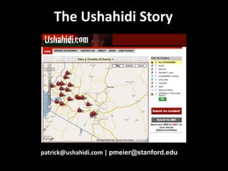
- 1. The Ushahidi Story patrick@ushahidi.com | pmeier@stanford.edu
- 15. Some Examples
- 40. Will the triangulated crisis map be regarded as the new first draft of history? -Anand, NYT
- 42. Marine Corps Haiti “Ushahidi-Haiti is saving lives every day”
- 43. What’s Next
- 50. Some Reflections
- 52. Don’t get too jazzed up! Ushahidi is only 10% of the solution
Notas del editor
- So Andrew very kindly invited Josh and I to share with you a story that has the potential to change the face of humanitarian response. This story actually begins in Kenya.
- during the post election violence 3 years ago. The government denied how widespread the violence was. International organizations that had a mandate to monitor the elections were refusing to share information. The mainstream media couldn’t be everywhere at the same time and could not report on all the killing and massive human rights abuses. But the crowd is always there.
- So 4 Kenyan friends launched Ushahidi—which means witness in Swahili-- to crowdsource the reporting of human rights abuses across Kenya. They set up a dedicated SMS number so that Kenyans could text in reports on human rights violations. By doing so, the crowd was able to document human rights violations that would otherwise have gone completely undocumented.Ushahidi means witness in Swahili So Ory, Erik, David and Juliana launched Ushahidi within a matter of days. Ushahidi means witness in Swahili and the platform allowed individual Kenyans to send in reports of human rights abuses via SMS. By crowdsourcing crisis information,
- Ushahidi is a free and open source platform from Africa which allows individuals to collaborate in producing live maps of the world around them. We’ve designed Ushahidi so that there is no one single point of failure when reporting to the map. Users can use SMS, voicemail, email, Twitter, dedicated smart phone apps, web-based forms, pictures, video footage and soon Facebook and Skype as well to submit information to the map.
- Ushahidi is a free and open source platform from Africa which allows individuals to collaborate in producing live maps of the world around them. We’ve designed Ushahidi so that there is no one single point of failure when reporting to the map. Users can use SMS, voicemail, email, Twitter, dedicated smart phone apps, web-based forms, pictures, video footage and soon Facebook and Skype as well to submit information to the map.
- Ushahidi is a free and open source platform from Africa which allows individuals to collaborate in producing live maps of the world around them. We’ve designed Ushahidi so that there is no one single point of failure when reporting to the map. Users can use SMS, voicemail, email, Twitter, dedicated smart phone apps, web-based forms, pictures, video footage and soon Facebook and Skype as well to submit information to the map.
- Ushahidi is a free and open source platform from Africa which allows individuals to collaborate in producing live maps of the world around them. We’ve designed Ushahidi so that there is no one single point of failure when reporting to the map. Users can use SMS, voicemail, email, Twitter, dedicated smart phone apps, web-based forms, pictures, video footage and soon Facebook and Skype as well to submit information to the map.
- Within a couple days, the number of reports on Haiti surged across the information ecosystem and we simply couldn’t keep up with all the information coming in.
- Which is exactly what happened in the Sudan when Sudanese civil society groups used Ushahidi to monitor the elections that took place just two weeks ago. The site was actually blocked by the Sudanese government for 48 hours. So our Sudanese colleagues got help from their tech-savvy friends to circumvent the censorship and continue mapping election irregularities. I expect that repressive regimes may eventually give up on blocking websites given the likely futility. Instead, they may try to game the platforms by falsifying crowdsourced information.
- Ten days later, Craig Fugate, the head of FEMA noted in a public statement or Tweet that the map was the most comprehensive and up-to-date map available. Lets think about that for a minute. This map was not launched by professional first-responders or humanitarian experts or search and rescue teams on the ground. It was launched and maintained by hundreds of student volunteers some 1,500 miles away from the disaster using a platform from Africa. None of them ever set foot in Haiti. We are entering a more multi-polar system of humanitarian response where students and universities stand to become a more important actors in crisis response regardless of geography.
- That evening, a dozen friends showed up in my living room. I’ve looked at this picture a hundred times but only yesterday did I realize the number of different nationalities represented: American, Iranian, Norwegian, British, French, Czech Republic. They stayed up all night with me, mapping while the snow fell quietly outside.
- The next day, two dozen more friends showed up in my living room. And dozens more showed up the day after that. By the end of the week, 5 days after the earthquake, we had trained over 150 students at Tufts University, the majority undergraduates. By the end of the following week, an additional 100 students in Montreal, Portland, Washington DC, Geneva and London had forms their own teams to help us out with the mapping. Now 99% of these students had never heard of Ushahidi or crisis mapping. But they wanted to help, an incredible example of what Clay Shirky calls Cognitive Surplus.But it wasn’t the technology that caused hundreds of volunteers to help, it was simply a basic human reaction to want to help others in need. That seemingly innate reflex to do something when we see others suffering. What the technology did was to manifest that human emotion; the technology made us more human by extending the emotions to actions.
- Between them, these volunteers mapped over 3,500 individual reports from hundreds of sources and you can see just how densely populated the map was. Not only that, but the map was being updated every 10-15 minutes with dozens of new dots, this map was truly alive.
- Events start “overlapping” and clustering, ie, on several occasions we get two or more text messages from different numbers reporting the same event. And then a Tweet with similar information, for example. The crowdsourcing of crisis information allows us to triangulate and validate information thanks to the reporting coming from a myriad of sources in near real-time. This would hardly have been possible in the 1930s, which is what prompted my colleague Anand at the NYT to write an article on our work and ask, “Will the triangulated crisis map be regarded as the new draft of history?” They say that history is written by the winners, will future history be written by the crowd?
- But we later found out that the Marine Corps was using the map to inform some of their operations, literally sending out choppers to rescue and evacuate people. According to the Marine Corps, the information mapped by hundreds of volunteers helped them save hundreds of lives. But there is a critical element to this story that made all this possible and that is what Josh is here to tell you about.
- Within a couple days, the number of reports on Haiti surged across the information ecosystem and we simply couldn’t keep up with all the information coming in.