1. T.Subramani, S.Nanda Kumar/ International Journal of Engineering Research and Applications
(IJERA) ISSN: 2248-9622 www.ijera.com
Vol. 2, Issue 4, July-August 2012, pp.427-436
National Highway Alignment Using Gis
T.Subramani1 S.Nanda Kumar2
1
Professor & Dean, Department of Civil Engineering, VMKV Engg. College, Vinayaka Missions University,
Salem, India.
2
PG Student of Environmental Engineering, Department of Civil Engineering,
VMKV Engg. College,Vinayaka Missions University, Salem, India
ABSTRACT
Planning a new road or highway can be 1.1 GENERAL
expensive and time consuming process. There are Remote sensing can be defined as the collection of
numerous environmental issues that need to be data about an object from a distance. Human and many
addressed. The problem is exacerbated where the other types of animals accomplish this task with aid of eyes
alignment is influenced by the location of services, or by the sense of smell or hearing. Geographers use the
existing roads and buildings, and the financial, social technique of remote sensing to monitor or measure of
and political costs of land resumption. GIS, a powerful phenomena found in the Earth‟s lithosphere, biosphere,
tool for the compilation, management and display data hydrosphere, and atmosphere. Remote of the environment
associated with geographic space, is used for the by the geographers is usually done with the help of
preparation of digital maps and analysis purposes. The mechanical devices known as remote sensors. These
conventional manual methods were difficult, time gadgets have a greatly improved ability to receive and
consuming and expensive. record information about an object without any physical
In this project the shortest and the economical contact. Often, these sensors are positioned away from the
path is identified using GIS software. The factors object of interest by using helicopters, planes and satellites.
considered are mainly related to the land use, geology, Most sensing devices record information about an object
land value and soil. The weights and ranks are assigned by measuring an object‟s transmission of electromagnetic
to each of the above themes, according to expert energy from reflecting and radiating surfaces.
opinions, for GIS analysis. After assigning weights and “Remote sensing is the science of making
ranks these themes are overlaid to get an overlaid map. inference about from measurements, made at a distance,
The final overlaid map has the most suitable area to without coming into physical contact with the object under
align the highway study”. That is, remote sensing refers to any method, which
can be used to gather information about an object without
KEYWORDS: National Highway, Remote sensing, actually coming in contact with it.
Alignment Using Gis, Shortest route
1.2 CONCEPT OF SIGNATURES
1. INTRODUCTION Electromagnetic radiation when incident on a
Determining the best route through an area is one surface, gets reflected, absorbed, re-emitted or transmitted
of the oldest spatial problems. This problem has recently through the material depending upon the nature of the
been solved effectively using GIS and Remote Sensing object and the wavelength of the incidence radiation.
technologies. During the last decade, a few attempts have
been made to automate the route-planning process using 1.3 MULTI-SPECTRAL CONCEPTS
GIS technology. Constructing a new road or railway, or Spectral variation is the most often used signature,
aligning an old one can be very expensive, with costs especially in the optical-IR region. The spectral variation
depending on the alignment selected. Costs are increased of some of the natural objects in the 0.4 to 2 µm range.
by long structures, by large volumes of cut and fill, and by However, it is not easy to generate continuous spectral for
unbalanced cut and fill were discrepancy has to be dumped identification objects. Therefore a practical solution is to
or borrowed. There are numerous environmental issues that make observance in a number of discrete spectral regions,
need to be addressed to ensure that the alignment does not usually referred as spectral bands.
reduce bio-diversity or degrade the environment. The first
step in producing high quality alignments depends on 1.4 REMOTE SENSING SYSTEM
obtaining suitable data on geology, land use, slope, soil and With the background treatise on remote sensing
drainage. In addition, there are issues such as land value we have made so far, it would now be easier to make an
and ownership, social and economic impact, and analysis of the different stages in remote sensing.
identifying environmentally sensitive areas. Origin of electromagnetic energy (sun,
transmitted carries by the sensor)
Transmission of energy
427 | P a g e
2. T.Subramani, S.Nanda Kumar/ International Journal of Engineering Research and Applications
(IJERA) ISSN: 2248-9622 www.ijera.com
Vol. 2, Issue 4, July-August 2012, pp.427-436
Intervening of energy or self emission extent resources related information either independently
or in combination with other data.
Detection of energy
1.9 VISUAL INTERPRETATIONS
Transmission or coding of the sensor output Visual interpretation has been the traditional
method for extracting information from a photograph based
Collection of ground truth on the characteristic such as tone, texture, shadow, shape,
size, association etc. Though the number of colour tones
Data analysis and interpretation recognized by human brain is large, it is still limited. When
photographic products are generated from digital data, the
Integration of interpretation images contrast is further degraded. Visual interpretation poses
serious limitation when we want to combine data from
We shall now briefly describe the various components of a various sources. Above all, when a large volume of data
remote sensing system. has to be analysed, it cannot meet the throughout
requirement.
1.5 REMOTE SENSORS
The instrument used to measure the 1.10 DIGITAL PROCESSING TECHNIQUES
electromagnetic radiation reflected or emitted by the target Digital techniques facilities quantitative analysis,
under study are usually referred to as remote sensors. make use of full spectral information and avoid individual
Sensors which sense natural radiation either emitted or bias. Simultaneous analysis of multi-temporal and multi-
reflected from the earth is called passive sensors, sensors, sensor facilitated in digital methods. In digital
which are, carry electromagnetic radiation of a specific classification, the computer analysis the signature, so as to
wavelength or band of wavelength to illuminates the associates each pixel with particular features of imagery.
earth‟s surface are called active sensors. The digital classification technique essentially partitions
The major parameters of a sensing system which this features space in some fashion so that each pixel in the
can be considered as indicators of the quality of data and feature space can be uniquely associated with one of the
which have bearing on optimum utilization for specific end classes.
users include spatial resolution, spectral resolution,
radiometric resolution and temporal resolution, these are
2. AIM AND SCOPE OF THE
four resolution are the most basis requirement of any
sensor system. INVESTIGATION
To establish shortest path for road network from
1.6 PLATFORMS palani to erode.
Sensor system needs to be placed on suitable To provide a better and comfortable base for
observation platforms and lifted to a pre-defined altitude. updating the traffic and other related information
Platforms can be stationary or mobile depending upon the in road administration.
needs of the observation mission and the constraints. Some To identify the short route for the vehicles
of platforms such as aircraft, balloons, etc. are used. For traveling from palani to erode. And to reduce the
the satellite their two types of platforms are considered time travel for the vehicles.
such as, geostationary, which are about 36000 km above Our main scope is to reduce the traffic and
earth. Second is sun-synchronous satellite, this type of travelling time in the roads.
satellites are nearer to earth like few km above. To prepare various thematic maps for analyzing
the environmental status.
1.7 DATA PRODUCT To find possible paths/routes/places for laying
Acquired data has number of errors due to eco-friendly highway.
Imaging characteristics of the sensors
Stability and orbit characteristic of the 3. STUDY AREA
platforms 3.1 ERODE
Scene/surface characteristic Erode is a city, a municipal corporation and the
Motion of the earth headquarters of Erode district in the South Indian state of
Atmospheric effect Tamil Nadu. It is situated at the centre of the South Indian
Data product are generated after correcting these error Peninsula, about 400 kilometres (249 mi) southwest from
so that the inherent quality of the original information of the state capital Chennai and on the banks of the rivers
the scene. The data product is generated in standardization Cauvery and Bhavani, between 11° 19.5" and 11° 81.05"
formats either in photographic or digital form to allow North latitude and 77° 42.5" and 77° 44.5" East longitude.
further analysis. As per Census 2011 alignments. It has population around
156,953.Erode Local planning Area extends up to 54sq.km.
1.8 DATA ANALYSIS Within the city, and will be extended to 109 km2. The
Visual interpretation and digital image processing roadway connects all the parts of the state and nearby states
are two important techniques of data analysis needed to such as Kerala, Karnataka and Andhra Pradesh with the
428 | P a g e
3. T.Subramani, S.Nanda Kumar/ International Journal of Engineering Research and Applications
(IJERA) ISSN: 2248-9622 www.ijera.com
Vol. 2, Issue 4, July-August 2012, pp.427-436
city. The City has both local (City) and mofussil (city-to- 3.4 PALANI
city) bus services with connections to nearby towns and Palani is a city and a municipality in the Dindigul
villages. Plenty of city buses are ply to connect all parts of district of the South Indian state of Tamil Nadu, located
the city. One can get buses from Erode to almost any part about 100 km South-east of Coimbatore City and 60 km
of the state. NH connecting Salem – Coimbatore – Cochin west of Dindigul. It is the location of the far-famed temple
passes through Erode and Bypasses the city via Bhavani of the god Kartikeya, resorted to by more than 7 million
(Lakshminagar by-pass), Chithode, Perundurai, which is devotees each year. It is situated at the South Indian
the major National Highway connectivity for the city.SH Peninsula.Its coordinates are 10°27′01″N 77°30′38″E
79 connecting Rasipuram - Tiruchengode - Pallipalayam - 10.45037°N77.510429°ECoordinates:10°27′01″N77°30′38
ErodeSH-15 connecting Erode – Gobi – Sathy – Ooty .NH- ″E / 10.45037°N 77.510429°E.Palani had a population of
67A connecting Karur – Erode – Sathy – MysoreAnother 67,175. Males constitute 51% of the population and
planned from Erode (Bhavani) – Anthiyur – Bangalore. females 49%. A Roadway NH209 connects Palani to
Coimbatore and Mysore. There are frequent buses to
3.2 KANGEYAM Dindigul, Coimbatore, Madurai, Erode, Tirupur, Pollachi,
Kangeyam is a Municipality in Tirupur district in Karur, Trichy. Many Omni buses are available to Chennai,
the Indian state of Tamil Nadu. Kangeyam was the capital Bangalore and Kodaikanal. Railways there was a meter
of Kongu Nadu for many centuries. Kangeyam is situated gauge line between Coimbatore and Dindigul via Palani,
in the heart of the Tirupur district. Kangeyam has a which is presently under gauge conversion. After the gauge
population of 38,862. Kangeyam is situated in the meeting conversion a Coimbatore-Madurai Intercity Express and
point of NH 67, SH 37 and SH 205.Kangeyamis located at Coimbatore-Rameshwaram Express are expected to ply the
11°00′19″N 77°33′43″E/11.0054°N route. Airways Palani is located equidistant from
coordinates77.5620°ECoordinates Coimbatore, Trichy and Madurai Airports.
11°00′19″N.77°33′43″E/11.0054°N77.5620°E. Access to
all main cities of Tamil Nadu like Coimbatore, Tirupur,
Tiruchy, Erode, Palani, Dharapuram, Tanjore, Karur,
Dindigul, Madurai, Chennai, Ooty, Theni, Kodaikanal, etc.
are available frequently.Kangeyam comes under Tirupur
District and Dharapuram revenue division.The town of
Kangayam is well connected by NH 67,which runs
between Mysore Viz. Gudalur, Ooty, Mettupalayam,
Coimbatore and Nagapattinam Via Thiruchirapalli,
Thanjavore. A major State Highway connecting Erode and
Palani runs through Kangeyam. The highways through
Kangeyam are NH67, SH37, SH81, SH96, SH172 and
SH189.
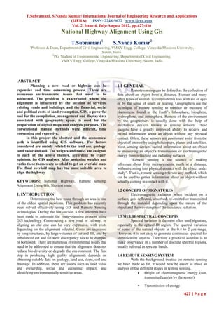
3.3 DHARAPURAM FIGURE.1 STUDY AREA TOPOSHEET
Dharapuram also known as Rajarajapuram and
a municipality in the Tirupur district of the South Indian
state of Tamil Nadu. Dharapuram is one of the Oldest
Town in Tirupur District. It has a population of
78,137.Dharapuram is located at 10°44′N77°31′E /
10.73°N 77.52°E. It has an average elevation of 245 metres
(803 feet). It is strategically located in the line of Palakkad
pass from where it gets lot of wind for its numerous
windmills. Water scarcity is high here. One side of it is
bordered by the Kodaikkanal mountain ranges. It stands on
the banks of the holy Amaravathi River, a tributary of the
Kaveri River. Dharapuram is the major junction point of
Roadways connecting major cities Coimbatore-Madurai,
Trichy-Cochin, Tirupur- Madurai, Palani - Salem (Via
Erode), Coimbatore - Theni, Dindigul-Tiruppur and Karur
-Pollachi, via road connects.Every 5 minutes once buses
available for Coimbatore, Tirupur, Erode, Palani and
Madurai, midnight time every 15 minutes once buses FIGURE.2 STUDY AREA MAP
available.78 km from Erode,34 km from Palani, 80 km
from Coimbatore,48 km from Tirupur, 150 km from TABLE.1 PROPOSED ROAD AREAS OF
Trichy, 72 km from Karur, 243 km from Neyveli, 118 km LONGITUDINAL AND LATITUDE
from Madurai. Buses are available to all these cities 24
hours.
429 | P a g e
4. T.Subramani, S.Nanda Kumar/ International Journal of Engineering Research and Applications
(IJERA) ISSN: 2248-9622 www.ijera.com
Vol. 2, Issue 4, July-August 2012, pp.427-436
earth and this soil can be used for the filling up the low
lying areas.
The roads in our country in plain areas, they have been
classified as National Highways, state Highways, Major
District Roads, and Other District Roads and Village Roads
according to specification, traffic needs, and socio
economic, administrative or strategic consideration. Some
National Highways are point to point which will connect
the state boundaries. State Highways will connect all the
National Highways. Major District Roads will connect all
the state Highways. Other District Roads and Village
Roads will connect the major district Roads however from
3.5 DATA COLLECTION topographical considerations; these can be broadly being
Survey of India Toposheet No. 58E/11, 58E/12, divided into arterial Roads and link roads. Arterial roads
58F/9, 58F/11 & 58F/10 on 1:50,000 will include national/state highways and major district
roads. Link roads take off from arterial roads to link
LAN SAT (MSS) DATA 2007 villages/production areas in small/sub-valleys. These will
Maps, field work and remote sensing techniques comprise other district roads and village roads.
are necessary for proposed road design and construction.
Topographic maps, geomorphology, Land use/Land Cover, 4.2 WIDTH OF ROAD LAND, ROADWAY,
Drainage, DEM, road, Slope and Contour maps were used CARRIAGEWAY AND SHOULDERS.
for this proposed route. The favourable path analysis, using Desirable widths of road land (right of way) for
various data and GIS analysis, was intended to confirm the various categories of roads are given in Table.2.
best transport route within this site.
4.3 HIGHWAY ALIGNMENT
3.6 DATA PROCESS AND ANALYSIS “The position or the layout of the centre line of
In this implementation, the best route is found for the highway on the ground is called alignment.”In general
a new road. The steps to find possible path are outlined alignment is of two types,
below. Path is identified by using ArcGIS 9. Spatial Horizontal alignment
Analysis Module. Vertical alignment
Create Source, Destination and Datasets
Generate different Thematic Maps (Classify and Weight
age)
Perform Weighted Distance
Create Direction Datasets
Identified Shortest Path with Distance and Direction
Datasets
FIGURE. 4 EXISTING ROAD NETWORK
4.3.1 Requirements
The basic requirements of ideal alignment
FIGURE.3 SATELLITE IMAGE FOR ERODE between two terminal stations are
Short- A straight line alignment would be the
4. DESIGN GUIDELINES shortest, though there may be several practical
4.1 PLANNING OF ROAD IN PLAIN AREAS considerations which would cause the deviation
Planning of roads in plain area is somewhat from the shortest path.
different from hill areas. In hill areas alignment of roads Easy - The alignment should be such that it is
has to be circuitous and is primarily governed by the easy to construct and maintain with minimum
topography. In the plain area we should find the elevation problems.
and depression by the surveying. The elevation areas Safe – The alignment should be safe enough for
should be levelled by removing the upper surface of the construction and maintenance from the view
430 | P a g e
5. T.Subramani, S.Nanda Kumar/ International Journal of Engineering Research and Applications
(IJERA) ISSN: 2248-9622 www.ijera.com
Vol. 2, Issue 4, July-August 2012, pp.427-436
point of stability of natural hill slopes, economics, the initial cost, operation cost, maintenance
embankments, cut slopes. cost is taken into account. The initial construction cost
Economical – The alignment is considered could be minimized by avoiding embankments and deep
economical only if the local cost including the cuttings and alignment is chosen in a manner to balance
initial cost, maintenance cost. cutting and filling.
TABLE.2 DESIRABLE WIDTHS OF ROAD LAND 4.3.6 Slope Stability
(RIGHT OF WAY) FOR VARIOUS CATEGORIES While aligning canal, special care should be
OF ROADS taken to align along the side of the hill which is stable. A
problem in doing this is that of the landslides. The cutting
and filling to construct the canal on the hill side causes
steepening of existing slopes and affect its stability.
4.3.7 Engineering Surveys for Highway Alignment
Before canal alignment, engineering surveys are
to be carried out. The surveys may be completed in four
stages; first three stages consider all possible alternate
4.3.2 Factors Controlling Alignment alignment keeping in view the various requirements.
For an alignment to be shortlisted, it would be Four stages of engineering surveys are,
straight between two terminals which are not always Map study
possible due to practical difficulties such as intermediate Reconnaissance
obstructions and topography. A shortest route may have Preliminary survey
very steep gradients and hence not easy for operations. Final location and detailed survey
Similarly, there will be construction and maintenance
problems along the route which may be otherwise short 4.4 Horizontal Alignment
and easy. Canals are often deviated from the shortest route The horizontal alignment should be fluent and
in order to cater for intermediate places of importance or blend well with the surrounding topography. The
obligatory points. horizontal alignment should be coordinate carefully with
A highway which is economical in its initial the longitudinal profile. Breaks in horizontal alignments at
construction cost need not be necessarily economically cross drainage structure and sharp curves at the end of
maintenance or operation cost. It may also happen that at long tangents/straight section should be avoided.
the shortest and the easiest route may work to be the Short curves give appearance of kinks,
costliest of different alternatives from construction point particularly for small deflections angles, and should be
of view. Thus it may be seen that an alignment can seldom avoided. The curves should be sufficiently long and have
fulfill all requirements simultaneously; hence a judicial suitable transitions to provide pleasing appearances. Curve
choice is made considering all factors. length should be at least 150 m for a deflection angle of 5
The various factor which control the canal alignment in degrees and this should be increased by 30 m for each
general may be listed as, degree deflection angle. For deflection angle less than one
degree, no curve is required to be designed.
4.3.3 Obligatory Points Reverse curves may be needed in difficult terrain
These are control points governing the alignment by very sparingly used. It should be ensured that there is
the canal. These control points may be broadly divided sufficient length between the two curves for introduction
into two categories, of requisite transition curves. Curves in the same direction
Points through which alignment is to pass. separated by short tangents, known as broken back curves,
Points through which alignment should not pass. should be avoided as far as possible in the interest of
„Obligatory points through which alignment has to pass aesthetics and safety and replaced by a single curve.
may cause alignment to often deviate from the shortest or Compound curves may be used in difficult
easiest path‟ topography but only when it is impossible to fit in a single
circular curve. To ensure safe and smooth transition from
4.3.4 Geometric Design on e curve to the other, the radius of the flatter curve
Geometric design factors gradient, radius of should not be disproportional to the radius of the sharper
curvature governs the final alignment. As far as possible curve. A ratio of 1:5:1 should be considered the limiting
while aligning a canal the gradient should be gradually value. Horizontal curves should consist of circular portion
increasing. It may be necessary to make adjustments in of the curve followed by the spiral transitions on both
horizontal alignment of canal keeping in view the sides. Design speed, super elevation and coefficient of
minimum radius of curvature and the gradient. friction affect the design of curves.
Length of transition curve is determined on the
4.3.5 Economic Considerations basis of change of centrifugal acceleration or the rate of
The alignment finalized based on the above the change of super elevation.
factors should also be economical. In working out
431 | P a g e
6. T.Subramani, S.Nanda Kumar/ International Journal of Engineering Research and Applications
(IJERA) ISSN: 2248-9622 www.ijera.com
Vol. 2, Issue 4, July-August 2012, pp.427-436
4.4.1 Minimum Curve Radii.
On a horizontal, the centrifugal force is balanced
b y the combined effect of super elevation and side friction.
Basic equation for this condition equilibrium is as follows:
v2/gR = e+f
R = V2/127(e+f)
Where v = vehicle speed in metre/second
V = vehicle speed in km/hr
g = acceleration due to gravity in metre/s2
e = super election in meter
f = coefficient of side friction between vehicles
tyre and
Pavements (taken as 0.15)
r = radius in meter FIGURE.5. DATA INTERPRETATION
based on the equation and maximum permissible understand the terrain condition, environmental factors and
value of super elevation, radii for horizontal curves social economic status in this study area. Finally,
corresponding to ruling minimum and absolute minimum possible/feasible route was identified based on various
design speeds are given in hill road manual IRC. physical and cultural parameters and their inherent
properties. The cost reduction analysis was also done for
4.5 VERTICAL ALIGNMENT substantiating the formation of national highway.
Broken back grade lines, i.e. two vertical curves Figure.5.shows data interpretation
in the same direction separated by a short tangent should be
avoided due to poor appearance, and preferably replaced 5.1 TOPOGRAPHY
by a single curve. Decks of small cross drainage structures Topographic and geologic data of the proposed
should follow the same profile as the flanking road section, road network area were prepares in a GIS ready format and
with no break in the grade line. used as input to the GIS data base. The location of roads,
railways, wetland, forest and drainage features are derived
4.6 CO-ORDINATION OF HORIZONTAL AND from the topographic map layer. The map that produced by
VERTICAL ALIGNMENT SOI is the base for national topographic database and has a
The overall appearance of a highway can be number of features for instance location of roads, railways,
enhanced by judicious combination of the horizontal and wetland, forest and drainage features. In this proposed
vertical alignment. Plan and profile of the road should not project, digital elevation model was prepared from
be designed interpedently but in unison so as to produce an elevation data. It was used as input to the least cost and
appropriate three dimensional effect. Proper co-ordination shortest pathway analysis.(Figure.6)
in this respect will ensure safety, improve utility of the
highway and contribute to overall aesthetics. Vertical
curvature superimposed upon horizontal curvature gives a
pleasing effect. As such the vertical and horizontal curves
should coincide as possible and their length should be more
or less equal. It is difficult for any reason; the horizontal
curve should be somewhat longer than the vertical curve.
5. METHEDOLOGY
The base (study area) map, Drainage, Slope and
Contour maps were repared with the help of SOI
Toposheet (on 1:50,000 scale). High resolution LANSAT
satellite data of 2009 was used and by using Digital Image
Processing techniques the following thematic maps such as
geomorphology, Land use/ Land Cover were generated. FIGURE.6 TOPOSHEET 58 E/12
The Digital Elevation Model (DEM) was generated using
various GIS based analysis, such as overlay, raster network 5.2 GEOMORPHOLOGY
analysis. The DEM is used in order to
432 | P a g e
7. T.Subramani, S.Nanda Kumar/ International Journal of Engineering Research and Applications
(IJERA) ISSN: 2248-9622 www.ijera.com
Vol. 2, Issue 4, July-August 2012, pp.427-436
Different landforms present in the area are
depicted in this geomorphic unit were extracted data from
the satellite image by digital interpretation and
incorporated into the GIS database. These geomorphic
units were classified into Plateau, Scarp face, Debris slope,
bazada, residual hill and pediments (deep, shallow &
moderate).( Figure.7)
FIGURE.9 WATERSHEDS MAP
FIGURE.7 GEOMORPHOLOGY MAP
FIGURE.10 DRAINAGE MAP
FIGURE.8 GEOLOGY MAP
Figure.8. Shows the geology map of study area. Figure.9.
Shows the watersheds map of study area. . Figure.10.
Shows the drainage map of study area.Figure.11 Shows the
waterbodies map of study area.
FIGURE.11 WATERBODIES MAP
5.3 Geographical Information System
Visualization is a form of communication, which
is universal and which has the ability to form an
abstraction of the real world into graphical representation.
Once a project proposal is developed, it is necessary to
communicate the effect of proposed changes to other
agencies and public review groups to facilitate decision
making. Some of the changes in the environment can be
modelled and visualized using GIS.
433 | P a g e
8. T.Subramani, S.Nanda Kumar/ International Journal of Engineering Research and Applications
(IJERA) ISSN: 2248-9622 www.ijera.com
Vol. 2, Issue 4, July-August 2012, pp.427-436
6. OVERVIEW OF SOFTWARE Once a statistical model has been developed, simulations of
6.1 INTRODUCTION TO ARCGIS the real life phenomena can be performed. The modeller
Arc GIS 9.2 is a product of ESRI. IT adds can construct a wide range of scenarios by changing the
topology for the geo database. You can choose which influential factors. The key advantage of conducting
feature classes in a feature dataset participate in a spatial simulations is that the phenomenon‟s predicted behaviour
relationship with other feature classes in that feature can be observed without placing the phenomena.
dataset or within themselves. Certain rules can be applied,
such as polygons cannot overlap one another, lines cannot 6.2 THE VECTOR MODEL
have dangling nodes, and points must be completely inside The vector model, the spatial locations of features
the bounds of a polygon. The number of spatial integrity is defined on the basis of coordinate pairs. These can be
rules offered for the geo database far exceeds those used in discrete, taking the form of points linked together to form
the Arc Info workstation coverage model, and are much discrete sections of line; linked together to form closed
more flexible. boundaries encompassing an area Attribute data pertaining
The editing abilities of Arc Map have been improved to the individual spatial features is maintained in an external
leverage these spatial integrity rules and to help find and database. In dealing with vector data any important concept
fix topological errors more easily and quickly. Arc Map is is that Topology. Topology derived from geometrical
the premier application for desktop GIS and mapping. Arc mathematics, is concerned with order, contiguity and
Map gives you the power to: relative position rather than with actual linear dimensions.
Topology is useful in GIS because many spatial modelling
6.1.1 Visualize: operations do not require coordinate locations, only
In no time you‟ll be working with your data topological information-for example to find an optimal
geographically; seeing patterns you couldn‟t see before, path between two points requires a list of the arcs or lines
revealing hidden trends and distributions, and gaining new that connect to each other and the cost to transverse them
insights. in each direction. It is also possible to perform the same
spatial modelling and interrogation processes without using
6.1.2 Create: stored topology, by processing the geometrical data
It‟s easy to create maps to convey your message. directly by generating topology on the fly or using vector
ArcMap provides all the tools you need to put your data on object model as and when it is required.
a map and display it in a effective manner.
6.3 THE RASTER MODEL
6.1.3 Solve: The spatial representation of an object of and its
Working geographically lets you answer questions related non-spatial attribute are merged into a unified data
such as “ Where is ...?,” “ How much...?,” and “ What file. In practice the area under study is covered by a fine
if...?,” Understanding these relationships will help you mesh or matrix of grid cells and particular ground surface
make better decisions. attribute value of interest occurring at the centre of each
cell point is recorded as the value for that cell. It should be
6.1.4 Present: noted that while some raster models support the assignment
Showing the results of your work is easy. You can of values to multiple attribute per discrete cell, other
make great-looking publication-quality maps and create strictly to a single attribute per cell structure.
interactive displace that link reports, graphs, tables, Within this model spatial data is not continuous
drawings, photographs and other elements to your data. but is divided into discrete units. In terms of regarding
You‟ll find that communicating geographically is a where individual cells are located in space, each is
powerful way to inform and motivate others. referenced according to its row and column position within
the overall grid. To fix the relative spatial according to its
6.1.5 Develop: row and column position within the overall grid. To fix the
The Arc Map customization environment lets you relative spatial position of the overall grid i.e. to
tailor the interface to suit your needs or the needs of your georeferance it, the four comers are assigned planer co-
organization, build new tools to automate your work, and ordinates. An important concept concerns the size of the
develop standalone applications based on aroma mapping component grid cell and referred to as grid-resolution.
components. See about customizing Arc Map and Arc The following information should always be
Catalog for more information. recorded when assembling, compiling and utilizing raster
data.
6.1.6 Modelling: Grid size (Number of rows and columns)
Statistical models allow life phenomena to be Grid resolution
represented in a mathematical or statistical way. The Geo referencing information e.g. comer co-
advantage of modelling real life phenomena include: ordinates, source projection
The determination of factors or variables which Data collection
most influence the behaviours of the phenomena; Topographic maps are collected to generate multi-
The ability to predict or forecast the long term layered, geo-referenced digital maps on a GIS platform,
behaviour of the phenomena.
434 | P a g e
9. T.Subramani, S.Nanda Kumar/ International Journal of Engineering Research and Applications
(IJERA) ISSN: 2248-9622 www.ijera.com
Vol. 2, Issue 4, July-August 2012, pp.427-436
with the basic inputs of available information. These Case 1: The alignment of highway was done
comprehensive maps shall cover the following aspects: based on the following criteria (Table.3)
Slope map TABLE.3 SLOPE WEIGHTAGE
Land use and land cover pattern
Population and settlement pattern
Study area
This done using SOI toposheet (58E/11, 58E/12, 58F/9,
58F/11, 58F/10 NW) in the scale of 1:50,000. The
boundary is traced over a tracing sheet. Traced boundary is
converted to digital format using digitization in ArcGIS‟9.2
6.4 RASTER CALCULATOR
Build expressions in the Raster Calculator by
using Map Algebra to weight raster and combine them as
part of a suitability model, to make selections on your data TABLE 4 LAND USE WEIGHTAGE
in the form of queries, to apply mathematical operators and
functions, or to type Spatial Analyst functions. Multiline
expressions can be typed into the raster calculator. It is
useful to build multiline expressions for complex
functions, such as cost path, or to chain processes together.
For example:
[Cost]= ([rlanduse] + [slope])
[Dist] = costdistance ([source], [cost], back link)
Path = costpath ([destination], [dist], back link)
The output dataset shows how suitable the each
location is for highway alignment, according to the criteria In this case, both the layers have an equal
set in the suitable model. A higher value indicates the influence on the alignment of the highway(Table.4). This is
locations that are more suitable. done using
theformula,(reclass_slope)*0.4+(reclass_landuse)*0.6
6.5 PERFORMING SHORTEST PATH
It is almost ready to find the shortest path from the 9. CONCLUSION
source. We have already performed cost weighted distance, The purpose of this study was to develop a tool to
creating a distance dataset and a direction dataset using the locate a suitable less route between two points. The GIS
source point. However it is necessary to decide on, and approach using ground parameters and spatial analysis
then create, the destination point for the road. Hence this provided to achieve this goal. Raster based map analysis
requires the creation of destination point on the Erode to provide a wealth of capabilities for incorporating terrain
Palani which is used in the calculation of shortest path to information surrounding linear infrastructure .Costs
the highway.The shortest path is calculated using the resulting from terrain, geomorphology, land use, drainage
function „shortest path‟ in the Spatial Analyst. Specifying and elevation resulting the shortest routes for the study
the destination point as input along with the distance and area. The existing road path was 90 km long from Erode to
direction theme, calculates the optimal path through which Palani (via Kangeyam, Dharapuram). Results indicate that
Highway has to run. It represents the least cost path-least the route which was designed applying GIS method is
cost meaning avoiding steep slopes and on land use types more environmentally effective and cheaper.This proposed
considered to be least costly for constructing the Highway- shortest route (Figure.12) provides traffic free, pollution
from source to destination. free, risk free, operating for movement of vehicle passing
from Erode to Palani. Time and consumption of fuel will
7. DISCUSSION also be reduced considerably. A important tourist spot cum
In general the results of the project can be discussed pilgrimage, Palani will approached without traffic
under two aspects, problems. This has shown a potential savings which can be
1. Geotechnical aspects obtained by automating the route selection process. GIS
2. Ecological aspects method can also be used for route determination for
Geotechnical Aspects: irrigation, drainage channels, power lines and railways.
435 | P a g e
10. T.Subramani, S.Nanda Kumar/ International Journal of Engineering Research and Applications
(IJERA) ISSN: 2248-9622 www.ijera.com
Vol. 2, Issue 4, July-August 2012, pp.427-436
FIGURE.12 PROPOSED SHORTEST ROUTE
10. REFERENCES
[1]. Harikumar, p.s (2001) “expressway alignment using remote sensing and Vol: 131, No.2, pp: 98-111.
[2]. Ranjani, s. and sowmya selvarajan, “evaluation of the alignment of outer ring road, GIS approach” journal of
alignment of ring road. Vol: 10, pp: 507-516.
[3]. Peter gipps, Alex held. Guy barnet, (2001) “new technologies for transport road selection” journal transport
research part C vol: 9, pp: 135-154.
[4]. Debashisbos, Niladrigupta, (2000) “GIS application in highway designing” vol: 21, pp: 24-38.
[5]. Pathan et al “highway alignment using GIS application”.
[6]. Shukti, shukula,(2002) “land use planning using GIS” vol:44, pp:949-962.
[7]. Jill McCoy and Kevin Johnston (2003) „using arc GIS spatial analyst', quick start tutorial.
[8]. Khanna (1999) “transportation engineering”.
[9]. Rodney Tolley and Brian Tutron (2001), „transportation systems policy and planning geographical approach‟.
436 | P a g e