TOD Honolulu
•
1 recomendación•3,176 vistas

Paper by the City and County of Honolulu regarding its TOD Vision and implementation.

Recomendados
Más contenido relacionado
La actualidad más candente
La actualidad más candente (20)
Similar a TOD Honolulu
Similar a TOD Honolulu (20)
Más de Jesse Souki
Más de Jesse Souki (20)
Último
Último (20)
TOD Honolulu
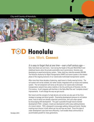
- 1. Honolulu It is easy to forget that at one time—over a half century ago— Oahu had street cars and trains. Even during the height of the post-World War II and statehood booms when the private automobile rose to prominence, Honolulu was developing an award-winning bus system. Today, daily bus ridership exceeds 200,000. The Honolulu Authority for Rapid Transportation (HART) rail transit system is the newest phase of the ongoing evolution of our island-wide multimodal transportation system. After more than three decades of planning, rapid transit is finally nearing fruition. The rail system will not be isolated, but rather closely integrated with our buses and roadway system. The rail component will serve as the spine of an island-wide multimodal transportation network that ushers mobility in the City and County of Honolulu into the 21st century. It will integrate with facilities in the Oahu Bike Plan and “complete streets” improvements. It will change the way we get around. Rail transit and the concept of a high-density rail corridor are also part of the City’s strategy to manage and direct growth. Channeling development pressure to rail station areas, most of which are already urbanized communities, will curb urban sprawl by encouraging infill development. This goal is possible through transit-oriented development (TOD) - compact, mixed-use development within easy walking distance of a transit station. TOD is designed to encourage walking, biking and transit, thereby creating more choices in both where we live and how we travel. Since this type of urban development uses land more efficiently, it will enable these communities to accommodate growth for many generations. City and County of Honolulu Live. Work. Connect October 2014
- 2. (cont’d) Thus, Honolulu’s rail transit system represents a quantum leap for our island, not only in the way we commute, but in the way we live. In the great cities of the world, mass transit—not the personal motor vehicle—is the primary means by which most people travel. Rail transit can become a modern-day catalyst for living, commerce, and other activities. The experience of other cities demonstrates that, in general, rail transit systems spur growth and neighborhood investment, particularly in the areas surrounding the stations. That’s why we’re committed to our TOD program. Rather than leave such growth to chance, we are working to ensure that growth proceeds in concert with community goals, as well as our long-term goals for the island. 2 Transit Stations Rail Route Route Extensions Park-n-Ride Locations Transit-orienteddevelopment(TOD)typicallyreferstodevelopmentwithineasywalkingdistanceofamajortransit stop that capitalizes on and supports transit ridership. The area where TOD typically occurs is the ¼- or ½-mile radius around the station (a five- or ten-minute walk). TOD may be redevelopment of existing facilities or new development and should be designed at the pedestrian scale, since all transit trips begin and end as walking trips. It typically means more compact development with a mix of residences, employment, and shopping, while allowing for better integration of open space. Higher densities allow for more housing choices, including a range of sizes and affordablility. TOD also encourages transit use, thereby reducing household transportation costs, and provides pedestrian- and bike-friendly routes to encourage people to“opt out” of using their cars for every trip. What is TOD?
- 3. ALA MOANA | NEIGHBORHOOD TRANSIT-ORIENTED DEVELOPMENT PLAN *Images and proposals are f ALTERNATIVE 2: MIXED USE AT KEY NODES* 0 0n ESTIMATED DEVELOPMENT POTENTIAL LAND USE & FAR LAND USE Sq. Ft % Retail 480K 10% Office 1M 20% Hotel 1M 20% Residential 2.4M (2400 DU) 50% TOTAL 4.8M 100% FAR Upzone at key nodes to 4.0 COMM RETAIL HOTELOFFICE RESIDENTIAL CIVIC • Redev • New c • Event • Bike la • Key in • Some • 2400 • Afford develo FixedGuid 0’ Ala Moana Center Station IF YOU LIKE THIS ALTERNATIVE, place dot here The vision for the 20-mile rail transit corridor—from East Kapolei to Ala Moana Center—is a series of diverse, walkable neighborhoods strung together like flowers of a lei. Each station area has its own unique identity, but they should all create a sense of place by celebrating historic and cultural assets, connect homes with major employment and education centers, and provide convenient access to goods, services, and recreation. These TOD areas will provide a high-quality urban lifestyle. Residents will enjoy walking to nearby restaurants and their neighborhood grocery store, biking along the waterfront, and taking the train to visit friends and family. Commuters will no longer need to worry about traffic and finding parking. Children will be able to ride their bikes safely to schools and neighborhood parks. Seniors will be able to walk or take transit to community centers and medical appointments. Even visitors will take the train to these communities and explore the attractions they have to offer. These healthy activities offer opportunities to run into acquaintances and neighbors— creating a strong sense of community and belonging. To make this vision possible, higher density and building heights will be encouraged in the areas immediately surrounding each station—roughly within a quarter-mile, or a five-minute walk. Development beyond this area, up to a ten-minute walk from a station, should also be dense and mixed-use in nature but should step down in height and intensity to be compatible with existing uses on the periphery. TOD is not “one size fits all.” Whereas high- rises may be appropriate in areas near Downtown, new development in other areas should fit the community’s context. TOD is more about the pedestrian orientation of buildings and streets, a rich mix of uses, and gathering places, than the height of buildings. With higher concentrations of jobs and housing in the corridor, other elements that complete neighborhoods— public and social services, parks, and open spaces—will be necessary and more easily financed and maintained. Taken all together, these station communities will become desirable areas for those seeking an alternative to suburban living - a growing national trend fueled by the urban preferences of the Millennial Generation, the aging baby boomer generation, and the dramatic decline in “nuclear families.” Increased interest in urban living is also growing due to ever rising traffic congestion levels and fuel costs. This vision for transit-oriented development will one day be expanded to all of urban Honolulu, with future extensions of the rail system to Kapolei and the University of Hawaii at Manoa. Honolulu’s TOD Vision 3
- 4. 4 GP Population Demand and Distribution Demand by 2035: 102,000 Net Additional Housing Units 46.0 PUC 17.0 Central Oahu 13.0 Ewa 11.5 Koolaupoko 5.3 E. Honolulu 4.0 Waianae 1.7 N. Shore 1.4 Koolau Loa PUC Central Oahu Koolaupoko GP Distribution Guidelines (%) Ewa The General Plan (GP) for the City and County of Honolulu is a comprehensive statement of objectives and policies which sets forth the long- range aspirations of island residents and shapes the strategies and actions needed to achieve them. It is a guide for all levels of government, private sector organizations, and individual citizens. Through the GP, the commitment was made to concentrate population growth mostly within urban Honolulu (Primary Urban Center or PUC) and a new “second city” in Ewa, and to “keep the country country” (see chart at right). There are a number of GP policies that support TOD, including the provision of a mass transit system within an exclusive right-of-way; an integrated transportation system that accommodates cars, bicycles and pedestrian, while reducing automobile usage; and the clustering of mixed-use development to reduce infrastructure costs. TOD also helps to achieve many of the GP objectives, such as reducing household energy consumption and transportation costs. Is TOD Consistent with our General Plan?
- 5. In accordance with City Ordinance 09-04, the Department of Planning and Permitting has been working with corridor communities to prepare Neighborhood TOD Plans for the station areas under City jurisdiction (the two station areas in Kakaako are the purview of the Hawaii Community Development Authority). These plans address opportunities for new development and holistically plan for orderly growth and improved accessibility around the stations. The plans cover one to three station areas—each addressing land use, circulation, urban design, housing, community facilities, parking, pedestrian amenities, historic and cultural enhancements, and infrastructure. Those that have been adopted by the City Council are indicated on the map below. The Neighborhood TOD Plans are prepared with extensive community engagement, including public workshops, advisory committee meetings, community needs surveys, and business outreach. The community gains a better understanding of the impacts and opportunities of TOD, how it can enhance their neighborhood, and how they can help shape its role in the corridor. TOD planning incorporates the five Ds of the built environment: density, diversity, design, distance (to transit), and destination accessibility. All the Neighborhood TOD Plans include some balance of these elements. Neighborhood TOD Planning 5 Density Design Diversity 5 Ds of the Built Environment Destination Accessibility Distance (to transit) Honolulu International Airport EAST KAPOLEI NEIGHBORHOOD TOD PLAN WAIPAHU NEIGHBORHOOD TOD PLAN AIEA-PEARL CITY NEIGHBORHOOD TOD PLAN KALIHI NEIGHBORHOOD TOD PLAN DOWNTOWN NEIGHBORHOOD TOD PLAN HCDA JURISDICTION ALA MOANA NEIGHBORHOOD TOD PLAN AIRPORT AREA TOD PLAN HALAWA MAKAI TOD PLAN Iwilei Kalihi Kakaako Downtown Kapalama Hoopili Ala Moana Chinatown West Loch (Farrington/Leoku) Pearlridge East Kapolei Lagoon Drive UH West Oahu Aloha Stadium Pearl Highlands Honolulu Airport Waipahu Transit Center (Farrington/Mokuola) Pearl Harbor Naval Base Leeward Community College Middle Street Center BLAISDELL CENTER MASTER PLAN P a c i f i c O c e a n Station Planning Area 0 1 20.5 Miles Proposed Rail Line NeighborhoodTOD Plans Civic Center Honolulu International Airport EAST KAPOLEI NEIGHBORHOOD TOD PLAN WAIPAHU NEIGHBORHOOD TOD PLAN AIEA-PEARL CITY NEIGHBORHOOD TOD PLAN KALIHI NEIGHBORHOOD TOD PLAN DOWNTOWN NEIGHBORHOOD TOD PLAN HCDA JURISDICTION ALA MOANA NEIGHBORHOOD TOD PLAN AIRPORT AREA TOD PLAN HALAWA MAKAI TOD PLAN Iwilei Kalihi Kakaako Downtown Kapalama Hoopili Ala Moana Chinatown West Loch (Farrington/Leoku) Pearlridge East Kapolei Lagoon Drive UH West Oahu Aloha Stadium Pearl Highlands Honolulu Airport Waipahu Transit Center (Farrington/Mokuola) Pearl Harbor Naval Base Leeward Community College Middle Street Center BLAISDELL CENTER MASTER PLAN P a c i f i c O c e a n Station Planning Area 0 1 20.5 Miles Proposed Rail Line NeighborhoodTOD Plans Civic Center Adopted TOD Plan ** *
- 6. While specific recommendations for each Neighborhood TOD Plan are based on its own community-based planning principles, each Plan should also reflect the following basic TOD principles: Planning Principles 1. Seamlessly integrate the roadway, transit, and trail network. Access to and from the stations should be efficient and comfortable whether one travels there by bus, car, bicycle, or on foot. Consideration should also be given to local options such as shuttles and trolleys and community programs such as car sharing and bike sharing. Complete streets are critical to achieving this principle. 2. Have a defined role within the overall regional transit corridor. The role and character of each station area depends on many things, including its location, history, resident’s desires, and opportunities for growth and investment. These factors contribute to a station area’s particular land use and character typology. Four general typologies are listed below and described in the Station Area Character section: • Major Urban Center • Urban Neighborhood • Mixed-Use Village • Major Destination/Employment Center 3. Encourage land uses that increase transit ridership. Higher-density residential developments, urban retail venues, educational institutions, and facilities that provide high levels of employment all support this principle. Each TOD Plan should encourage these uses within one-half mile of the stations. 4. Catalyze affordable housing development and preservation, and support local businesses. Rail provides an alternate, efficient, economical mode of travel. Affordable for-sale and rental housing should be promoted near the stations as this provides an option for residents to forego the expense of car ownership (gas, maintenance, parking, insurance, etc.). There should be a focus on both constructing new and preserving existing units. To ensure success, the baseline inventory of affordable housing in the transit corridor must be maintained and monitored. Small local businesses should also be encouraged to stay in the station areas. 5. Foster vibrant, mixed-use communities where the automobile is truly an option and not a necessity. The TOD Plans should promote a diversity of land uses that encourage activity during different times of the day and week and make a community a desirable place to live, work, play and visit. A wide variety of destinations should be within walking distance of the stations, including housing, shopping, services, dining, arts and entertainment, parks, schools, and other civic amenities—reducing the need to travel far distances to accomplish daily tasks. Within the TOD areas, there should be strong incentives to walk or bike to locations such as high- quality public spaces and direct connections between land uses. 6. Integrate new development with existing communities. TOD should reflect and build upon the existing context of each station area. While respecting the host community’s scale, building heights and densities should be highest near the stations and step down to meet the surrounding communities. 7. Promote community sustainability. Planned growth and development should respect and adhere to the principles of sustainability - balancing economic prosperity with the integrity of natural ecosystems and social equity. In addition to encouraging walking, biking and taking transit, the TOD Plans should support green infrastructure, climate resilience, energy efficiency, and urban food production strategies such as community gardens. 6
- 7. The potential for transit-oriented development depends on many factors and varies considerably among the 21 station areas. Because TOD projects must be financially viable and profitable for the private sector, key among these factors is the availability of land for development or redevelopment. TOD opportunities typically present themselves where there are large vacant or underutilized properties (including urban brownfields), preferably under consolidated ownership. This condition reduces the cost and difficulty of assembling development parcels. Conversely, single-family neighborhoods with small lot sizes, such as near the Kalihi station, are generally considered stable and not likely to change due to the introduction of rail transit nearby. Real estate market strength is another major determinant of where TOD will materialize. New rail transit service alone will not attract new development to a station area. Evidence of new development activity in a station area is usually indicative of favorable real estate market conditions. Station areas with proximity to major destinations such as shopping centers, and community amenities like schools, parks and grocery stores, often have stronger market dynamics. Certain new uses like housing and retail also perform better than others. TOD can be beneficial in places with weak real estate markets, but public sector investment is often needed to make these projects economically feasible. The chart on the right classifies the station areas based on these two factors—land capacity and market activity. Based on this simple analysis, the Ala Moana, Pearlridge and East Kapolei neighborhoods have the most potential for TOD in the short term. Another critical element to TOD is the lack of any major encumbrance to development. Major encumbrances TOD Potential could include inadequate utility infrastructure, flooding issues, or wetlands. Other factors influencing the attractiveness of TOD in a particular location include the connectivity of the station to places where people live and work, the severity of traffic congestion, and anticipated ridership at a station. Excessive regulatory requirements can also dampen development potential. TOD can provide many public benefits, including new housing and shopping choices, affordable housing, sidewalk and streetscape upgrades, communities facilities, new or improved parks, well-designed buildings, and new customers and transit riders. For projects that incorporate many of these elements but do not “pencil out,” the City may wish to use tools and incentives to overcome project challenges and maximize TOD potential. These range from assistance with land assembly to funding for infrastructure upgrades. There must be political consensus and support for the vision, goals and objectives of TOD for these tools and incentives to be successful. Additionally, the City must develop the skills to participate effectively as a development partner. Market Strength LandAvailability Low Activity Low Capacity High Activity High Capacity UH West OahuHo’opili Aloha Stadium Leeward CC East Kapolei Pearlridge Ala Moana West Loch Kalihi Lagoon Drive Middle Street Pearl Harbor Chinatown Airport Kapalama Downtown Pearl Highlands Iwilei Waipahu Low Capacity High Capacity 7
- 8. Functional Designation Proposed Future St Waipahu Transit Center (Mixed-Use Village) - The Farrington Highway/Mokuola Street station area will be a node for higher-intensity mixed-use development. The historic character of the Old Town will be retained and strengthened. West Loch (Mixed-Use Village) - It is the community’s vision that the Farrington Highway/Leoku Street area maintain its role as an employment center while attracting new commercial and residential uses. This neighborhood is the gateway to Waipahu for people coming from western Oahu. Hoopili (Mixed-Use Village) - The station area will be a local, mixed-use community with an active transit plaza and street-level retail, residences, and neighborhood mini parks. It will serve as a center for the surrounding development. UH-West Oahu (Mixed-Use Village) - As a gateway to the campus and a destination for students, faculty and staff, area employees, shoppers, and residents, student-oriented businesses and regional commercial uses are envisioned along with new housing choices. East Kapolei (Mixed-Use Village) - The station will draw ridership from the Kroc Community Center, nearby residences, and the planned bus transit center and park-and-ride facility. Station Area Character Neighborhood vision statements are being developed for each station area through the community-based TOD planning process. These share commonalities about the future character of these neighborhoods. This map shows a rough assignment of station area “typologies” that have been shaped by community visioning and local context. Understanding the existing and general desired character, as well as market strength, of a neighborhood determines what improvements, regulations, incentives, and partnerships will best contribute to the success of TOD, while also guiding infrastructure investments. The four envisioned station area character typologies are defined in the following manner: Pearlridge (Urban Neighborhood) - The area is a major urban center and regional destination with opportunities for new mixed-use development, the possible re-orientation of Pearlridge Center, and improved access to the Pearl Harbor Historic Trail and waterfront. Pearl Highlands (Urban Neighborhood) - The station will serve as a major intermodal facility and connection point for riders coming from ewa and mauka directions. Ongoing maturation of the commercial district, including the addition of new housing, can carefully balance the needs of passengers and shoppers arriving by transit, on foot, and by automobile. Leeward Community College (Mixed-Use Village) - The station area is envisioned as a college-oriented neighborhood catering to students and faculty, as well as new residents. 1. Major Urban Center: Place with high-density residential, office, retail and entertainment uses in the heart of urban Honolulu 2. Urban Neighborhood: Neighborhood with an integrated mix of medium-density housing, jobs, and neighborhood and regional retail Functional Designation Proposed Future Station Area Character Major Urban Center Urban Neighborhood Mixed-Use Village Major Destination/ Employment Center Functional Designation Proposed Future Station Area Character Major Urban Center Urban Neighborhood Mixed-Use Village Major Destination/ Employment Center 3. Mixed-Use Village: Walkable, lower-density community with neighborhood retail and a commercial or educational core near the station 4. Major Destination/Employment Center: Place with a single-use facility or high concentration of jobs Functional Designation Proposed Future Station Area C Major Urban Center Urban Neighborhood Mixed-Use Village Major Destination/ Employment CenterFunctional Designation Proposed Future Station Area C Major Urban Center Urban Neighborhood Mixed-Use Village Major Destination/ Employment Center 8
- 9. tation Area Character Iwilei (Urban Neighborhood) - Rail transit could be the impetus for a major transformation of Iwilei, becoming an extension of Downtown as a full-service urban neighborhood. Chinatown (Urban Neighborhood) - The historic area will retain its character and mix of uses, with improved access to the waterfront and parks, and a few key development opportunities on the periphery of the district. Downtown (Major Urban Center) - Downtown Honolulu will continue to be the region’s premier employment center and benefit from new pedestrian and bicycle improvements. A diversification of uses will activate the area during evenings and weekends, creating a more attractive destination. Aloha Stadium (Major Destination/ Employment Center) - The stop will provide access to events at the stadium, military uses on Ford Island, and the nearby residential neighborhood. The lands around Aloha Stadium could be used for a variety of more intensive uses should the National Park Service’s recreation limitation be lifted. Middle Street (Major Destination/Employment Center) - The major multimodal hub will enable passengers to transfer between bus and rail. In the long-term, a mixed-use district is envisioned, catalyzed by transformation of the OCCC site. Kalihi (Urban Neighborhood) - The scale and character of the Kalihi station area will be maintained. A greater mix of uses, infill residential development, and public realm improvements are desired near the station. Kapalama (Urban Neighborhood) - A high-intensity mixed- use district is envisioned, with new residences, Kapalama Canal improvements, neighborhood shopping, and close integration with Honolulu Community College. Ala Moana Center (Major Urban Center) - Ala Moana is envisioned as a livable urban community and a model for walking, biking, and transit usage. It will continue to serve as a regional retail destination and gathering place for locals and visitors alike. New development will improve the physical environment, safety, and mobility. As the terminal station for phase one, it will also continue to be a major transportation hub with transit links to Waikiki and the University of Hawaii at Manoa. 9 Pearl Harbor (Major Destination/Employment Center) - The station will provide access to nearby military uses, including employment and housing. The Navy plans to create a mixed-use node on base near the station. Honolulu International Airport (Major Destination/ Employment Center) - The airport station will serve travelers and airport employees. It may also create demand for more intense employment uses near the station. Lagoon Drive (Major Destination/Employment Center) - The industrial station area is a major employment center and commercial destination. Area improvements will include station access enhancements and select opportunities for new infill development and connections to Keehi Lagoon Park and waterfront. Civic Center & Kakaako (Major Urban Centers) - These 2 station areas are under the jurisdiction of the Hawaii Community Development Authority and are planned for high-rise mixed-use development.
- 10. 45-60’ 40-60’+ 40-150’+ 60-90’ 60-90’ 40-350’+ 25-150’ 25-90’ 45-200’ 25-300’ 25-350’ 30-450’ 45-400’ 60-90’ 60-90’ xx’ Once a Neighborhood TOD Plan is adopted by City Council, its recommendations are then translated into new ordinances and zoning regulations in the Land Use Ordinance (LUO). TOD zoning and land use regulations should be predictable - providing certainty to landowners and developers - while allowing for public review of major development projects. Adopted regulatons should result in quality projects that meet community needs. The TOD district boundaries and maximum allowable building heights in the TOD Plans prepared to date are shown on the map below. In some places, taller heights may be awarded for providing commensurate community benefits such as streetscape improvements, new parks, or affordable housing. The other elements that are anticipated to be regulated by the LUO and other City rules and regulations are listed below and at right. From Neighborhood Plans to Regulations 10 • Strong relationship between land uses and public realm (e.g., sidewalks and parks) • Emphasis on connectivity and walkability • Highest allowable building heights and densities (FAR) adjacent to the stations—gradually stepping down toward surrounding lower-intensity uses • A broad range of allowed uses through zoning designations similar to BMX-3 (community business mixed use), IMX-1 (industrial-commercial mixed use), and AMX (apartment mixed use) zoning districts • Limitations on auto-oriented and heavy industrial uses near stations, such as drive-thrus and waste processing • Affordable housing requirements for residential developments over a threshold number of units • Park dedication and publicly accessible open space requirements • Opportunities to create wider sidewalks by coordinating public right of ways and private frontages Summary of Proposed TOD Land Use Regulations xx’+ Rail Transit Stations Half-Mile Radius around Rail Stations TOD Plan Zoning Boundaries TOD Plan Maximum Height Limit TOD Plan Max. Height Limit w/Community Benefits
- 11. 11 Properties in the TOD areas will be regulated by a new TOD Special District within the City’s Land Use Ordinance that specifies requirements on site layout and ground-floor building design. The goal of these development standards is to improve the pedestrian experience around the rail stations, particularly along designated “key streets.” The TOD Special District may require that: ƒƒ Buildings will be placed close to the street and street corners; ƒƒ Buildingentranceswillfacethestreetorpedestrian plazas; ƒƒ Building façades will have transparent windows and doors at the ground level; ƒƒ Active uses, like retail shops, restaurants, services and galleries, will occupy ground floors; ƒƒ Front yards will be improved with pedestrian- friendlyamenitiesthatcreateseamlessconnections with public sidewalks; ƒƒ Pedestrian walkways will connect buildings, sidewalks, and parking areas; ƒƒ Short and long-term bicycle parking will be provided for commercial and residential projects; ƒƒ Parking will be set back at least 40 feet from all street-facing property lines in order to encourage the construction of buildings close to the sidewalk. The City is also proposing to relax several development standards to encourage compact, transit-oriented development that increases transit ridership and decreases the need for automobiles. These benefits allow property owners to make greater use of their land, and they include: ƒƒ Reduced or eliminated parking regulations; ƒƒ Opportunities to seek greater heights and densities in areas closest to the stations, in return for community benefits; ƒƒ Changes to existing height setbacks that currently limit development; ƒƒ Reduced required yards and greater allowable lot coverage in some zoning districts; ƒƒ Increased flexibility for required yard treatments; ƒƒ Increased flexibility for nonconforming structures and uses. Ultimately, the City is creating a system in which a developer who meets all the development standards in the Special District can proceed directly to a building permit, thereby streamlining the review process. Only those seeking modification of the standards and/or a height/density bonus would face a discretionary review process. For larger projects that seek more flexibility than the Special District permit can provide, the City plans to offer a Planned Development – Transit permit, which will function similarly to the existing Interim Planned Development – Transit permit that allows modified development standards for projects consistent with the applicable Neighborhood TOD Plan that provide more community benefits than required through a Special District permit. This permit would be approved by the City Council via resolution. TOD Special District VISION & PLAN Development Improved, Vibrant NEIGHBORHOODS ZONING & IMPLEMENTATION Sucessful TOD PROJECTSINFRASTRUCTURE Capacity COMMUNITY SUPPORT (State, Nonprofits, Residents, Neighborhood Groups)
- 12. City and County of Honolulu, Department of Planning and Permitting 650 South King Street, 7th Floor, Honolulu, Hawaii 96816 ~ (808) 768-8000 www.todhonolulu.org Paid for by the taxpayers of the City and County of Honolulu • Neighborhood TOD Plans are completed for fifteen station areas, with the rest in progress. The Waipahu and Aiea-Pearl City Plans have been adopted by the City Council. • Planning is under way for three catalytic projects: 1) a bus transfer station and mixed-use development at the Pearlridge station; 2) transformation of Kapalama Canal and the surrounding area; and 3) revitalization of Neal S. Blaisdell Center as a world- class cultural destination. All three projects will be developed through public-private partnerships. • An “asset optimization” approach is being used to evaluate City properties in TOD areas for potential redevelopment. This includes a new affordable housing project on River Street in Chinatown. • New TOD zoning and land use regulations for each station area are being developed as each TOD Plan is adopted. These will require affordable housing, active streetscapes, and usable open space. New complete streets and parklets standards are being developed. • Critical infrastructure are being evaluated to accommodate anticipated growth, including wastewater, streetscapes, utilities, broadband, and parks. The potential for districtwide funding and implementation is being explored. Making TOD Happen Rapid transit systems not only improve mobility and access, but are used internationally to catalyze economic growth and neighborhood revitalization. We have been engaging citizens, landowners, businesses, and community organizations since 2007 to develop inspiring visions and practical plans for each station area. We have consulted urban and community planners, economists, and local and mainland developers and designers to understand the market dynamics and potential of TOD. A TOD subcabinet of City managers meets weekly to coordinate complex projects, plans, policies, and programs that involve multiple departments and outside partners. The following tools and strategies are completed or in progress help make TOD happen. Implementation will continue to include extensive stakeholder involvement and collaboration. • A financial toolkit has been developed to stimulate private development investments in priority TOD areas. Options include property tax credits, GET credits, tax increment financing, investment huis, targeted state and federal funding, and other long-term funding mechanisms. • Partnerships have been formed with state agencies to identify and prioritize the potential for TOD on state lands. Redevelopment of Mayor Wright Housing has been initiated by the Hawaii Public Housing Authority. • A draft islandwide housing strategy has been developed to stimulate the production and retention of affordable and workforce housing, with a focus on rental housing and TOD areas. • The City has identified pedestrian, bicycle, and transit access improvements around every station. Planning and design of priority projects, as well as fundraising for the first phase of a bikeshare system, is underway. The City’s first “cycle track” is under construction on King Street. • An interdepartmental group is working to ensure seamless, safe connections between transit stations, bus stops, streets and sidewalks, and major activity nodes, including wayfinding signs and fare integration.