

Recomendados
Recomendados
Más contenido relacionado
Destacado
Destacado (20)
Similar a Tmpg Final Dbwmp Nov 30
Similar a Tmpg Final Dbwmp Nov 30 (20)
Más de city of dania beach
Más de city of dania beach (20)
Último
Último (20)
Tmpg Final Dbwmp Nov 30
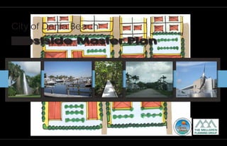
- 1. City of Dania Beach Westside Master Plan
- 2. TABLE OF CONTENTS TABLE OF CONTENTS PAGE 1. Executive Summary 1 2. Introduction 3 3. Existing Conditions 10 4. Regional Context 34 5. Public Participation 54 6. Master Plan 57 7. Recommendations 74 8. Conclusion 82 APPENDICES A. Economic Analysis B. Community Involvement Report D A N I A B E A C H W E S T S I D E M A S T E R P L A N
- 3. executive summary EXECUTIVE SUMMARY Chapter 1 While the plan recognizes that challenges may have to be addressed if the south runway expands, it strongly recommends Located on the west side of the City of Dania Beach, the Westside that the City place itself in an advantageous position by study area contains approximately 2,920 acres consisting of a encouraging redevelopment along the Griffin Road and Anglers variety of land uses. These include single family and multi-family Avenue/Ravenswood Road corridors. Doing so will not only help neighborhoods, some of which are waterfront communities; redevelopment efforts if and when the south runway expansion several mobile home parks; commercial and industrial uses; and, occurs, it also provides the existing businesses along these corridors parks and conservation land. The Westside study are is generally a much needed boost, thereby improving the over all appearance the area that is south of SR 84, east of SR 7, north of Stirling Road and economic health of the community while meeting the needs and west of I-95, although two neighborhoods to the east of I-95 of nearby neighborhoods. Marine and tourism related industry is are also included because of the noise impact of the south runway viewed as desired development along the Ravenswood Road/ expansion alternative. The Tri-rail station for the Fort Lauderdale/ Anglers Avenue. Along Griffin Road, offices and professional Hollywood International Airport is also located within the study establishments, and neighborhood serving retail mixed with area. Historically parts of Westside were annexed into the City over medium to high density residential are envisioned, with a focus on several years and development occurred in this area under different long term transit supportive infrastructure. sets of regulations. Some of the commercial and industrial areas of the Westside have experienced quality development, such as the areas along Anglers Avenue and State Road 84. The location of Westside, proximate to the airport and seaport, the interstate system, the tri-rail station and the inland waterway system, provides it with an incredible opportunity for economic growth. Existing assets in Westside While there is tremendous opportunity for economic development, there are also issues that must be addressed. These include declining businesses; underutilized land or marginal development; lack of In addition, neighborhood serving retail and community serving long term community vision; lack of community identity for the facilities are absent. Another major issue is that the Westside is nonresidential corridors; and, inadequate pedestrian infrastructure. the potential impact of noise contamination created by the Fort Lauderdale/Hollywood International Airport’s runway expansion project. The FAA issued its Record of Decision in December 2008, formally selecting Alternative B1b; the south runway expansion alternative. As of November 2009, however, noise mitigation policies had not been determined. Therefore, this plan focuses on providing development options for all affected areas. The plan is based on community input, tempered by sound planning principles where appropriate. The main focus of this plan is to improve the quality of life in the Westside while taking advantage of opportunities that the Westside has to offer in terms of economic development. As such, there are recommendations for those parts of the Westside Closed businesses and vacant pacels along corridors that are not affected by the airport at all, but which will benefit from the recommended projects and programs. Neighborhoods in Westside D A N I A B E A C H W E S T S I D E M A S T E R P L A N page 1
- 4. executive summary and State Road 7 to the west by modifying the function Chapter 1 Smart Growth of Griffin Road to reduce traffic speed and enhance and dignify it as a transit and pedestrian corridor The City of Dania Beach is committed to setting the framework for positive and sustainable redevelopment throughout the city. • Improve the appearance and function of the major In addition to being a signatory of the U.S. Conference of Mayors corridors within the Westside study area Climate Protection Agreement, the City has recently adopted a community redevelopment plan that includes sustainable initiatives • Encourage and promote logical development and and is based on smart growth principles. In addition, the City’s new redevelopment that meets a high standard of quality zoning code promotes sustainable building practices. To align with the City’s smart growth and sustainable development commitment, • Improve the Westside neighborhoods the Westside Master Plan is also based on smart growth principles. • Enhance opportunities for active and passive recreation Smart growth provides a means for communities to incorporate and community serving facilities within the Westside more compact building design as an alternative to conventional, neighborhoods land consumptive development. While the Westside Master Plan recommends deepening of the Griffin Road corridor to allow for a • Address noise contamination and the resulting economic more meaningful development, it does not preclude the concept impacts should the south runway be expanded of compact building design. Project Guiding Principles and Goals There are five principles that have guided the planning process throughout the preparation of the Westside Master Plan. These are: 1. Create the highest value for the city and property owners affected by the airport expansion 2. Encourage economic development 3. Enhance and support established neighborhoods not affected by the airport 4. Create a plan that seamlessly ties in with other plans in the region 5. Create a plan that promotes sustainability The resulting plan contains a number of goals, and numerous recommendations to achieve these goals. Some of the major goals are as follows: • Maximize the potential for east-west transit connections between the Community Redevelopment Area to the east D A N I A B E A C H W E S T S I D E M A S T E R P L A N page 2
- 5. Introduction INTRODUCTION Chapter 2 Background The Westside area of the City of Dania Beach is located east of State Road 7, and includes all of the area within the City from State Road 7 to Interstate 95. The Westside also includes residential areas east of Interstate 95 and immediately south of the airport, outside of the expanded Community Redevelopment Area (CRA). The Westside Master Plan has been prepared in response to plans by Broward County that would expand the runways at Fort Lauderdale- Hollywood International Airport. The Westside Master Plan has been prepared within the context of a number of plans or programs that affect the area. It has been designed to recognize existing planning efforts; economic, environmental, social and demographic conditions; and, to respond in a manner that will provide policy makers with a clear set of alternatives for the future. Those specific plans and programs are described below. Airport Expansion Plan The airport has a significant effect on the Westside. Any number of alternatives for expansion, and variations of these alternatives, have been considered. The various alternatives being considered for expansion of the Fort Lauderdale-Hollywood International Airport have the potential for adversely affecting the Westside, particularly if the south runway expansion plan is implemented. For the purposes of this study, the expansion plans that have been considered are the following: 1. No expansion 2. North runway expansion 3. South runway expansion The Federal Aviation Administration (FAA) has selected expansion of the south runway as the preferred alternative. Consideration of the two additional alternatives, however, and creating redevelopment concepts for the Westside under each of these alternatives places Dania Beach in a proactive position and readies the City for any future eventuality. Map 1: Westside study area boundary D A N I A B E A C H W E S T S I D E M A S T E R P L A N page 3
- 6. Introduction State Road 7 Master Plan Dania Beach Community Redevelopment Area Plan Chapter 2 The State Road 7 Master Plan is a plan that was created in 2004 for This plan, adopted in early 2009, expands the boundaries the Town of Davie, the City of Hollywood and the Seminole Nation. of the original Community Redevelopment Area (CRA) It envisions a number of changes along State Road 7 that, when and includes plans for upgrades to the downtown and four implemented, will affect the Westside. Although the westernmost residential areas. The CRA plan focuses on the retention and City limit is not contiguous to State Road 7, the City is separated expansion of the marine industry. This creates an opportunity from the arterial by a strip of property that has minimal depth. As for the Westside Master Plan to strengthen the link between are result, it is anticipated that any meaningful redevelopment the marine industry areas created by the CRA and Marina on State Road 7 will affect, if not include, the western edge of Mile/State Road 84, especially along the Ravenswood Road/ Westside. Anglers Avenue corridor and the Dania Cut-off Canal. It is anticipated that most of these impacts of the State Road 7 Master The CRA plan also includes recommendations for Plan will be positive. Redevelopment plans for the areas adjacent development of hotel and tourist related uses proximate to the intersections of Griffin and Stirling to Interstate 95 and in the Dania Beach Heights area. The Roads and Orange Drive; the North End Westside Master Plan takes those recommendations into Industrial area at Oakes Road; the C-11 consideration to ensure that hotel and tourist activities in the Canal/Griffin Road Marina neighborhood; Westside are coordinated with those of the CRA. the Seminole Nation neighborhood; and, the changes proposed along State Road 7 itself all present opportunities for the Westside Master Plan. The existence of these external plans provides a chance to develop a master plan that is consistent and complimentary with the “bigger picture”, and to take advantage of the housing, transportation, open space and business attraction opportunities they offer. SR 7 Master Plan Dania Beach CRA Plan graphics D A N I A B E A C H W E S T S I D E M A S T E R P L A N page 4