SlideShare una empresa de Scribd logo
1 de 10
Descargar para leer sin conexión
Автоматические
беспилотные летающие
роботы “Karlsson”
Leading edge aerial monitoring
solutions in construction
Karlsson autonomous
unmanned aerial robots
Overview: A modern approach for industrial monitoring
Traditional monitoring Smart monitoring
● Rigid plan execution without
possibility for last-minute changes
● Monitoring of construction takes long
time to be done
● Lack of accurate real-time data
showing construction progress
● Lack of individual approach to different
parts of construction
● Organized real time data
● Data is collected using various UAV-
mounted sensors (photo/video
camera, thermal imaging camera, IR
sensor)
● Use of predictive analytics and
specialized software allowing for
better operations planning and
adjustments
Overview: Using aerial monitoring in construction
● Gathering preliminary information
● Construction site preparation: orthophotography, DTM and DEM (3D mapping of the
area), determination of geophysical parameters
● Preparation of visual demonstration items for investors and clients (3D models,
"view out the window")
● Work progress control
● Workplace safety and security control and compliance supervision
● Additional source of data for decision making and improvement measures
● Prevention of and control over illegal construction
● Thermal imaging building inspection
● Creation of panoramic 3D views of streets, neighborhoods, and buildings
Advantages of aerial monitoring: ● real-time data
● advanced data processing
● fine-tuning of the construction
Application: 3D map creation (DTM and DEM)
● Aerial monitoring provides data for 3D object creation and area's
orthophotographic map
● Data is continuously updated and stored as an online map (see map.
karlssonproject.com)
● Interactive viewing of objects
Better control over the work progress and the ability to
provide investors and clients with the most recent visual
information.
Easier illegal construction detection for government
agencies.
Application: aerial photography and 3D scanning of
construction projects
● Aerial photo and video can be used to provide
clients with impressive visuals such as the view out
the future window at the earliest stages of
construction
● A clear demo view of a cottage community or
apartment complex being built, with additional
infographics directly on the map
● A 3D model of a construction project makes every
fine detail available for viewing online
● The model can be used in further planning,
including that of landscaping and interior design
Application: aerial thermal imaging
Aerial photography with a thermal imager allows to:
● Detect construction defects - substandard
welds, roof leaks, air and heat loss, etc.
● Inspect pipelines to identify stress points
wear, coolant leakage, faulty equipment and
insulation damage
● Identify even the defects hidden underground
● The data gathered using thermal imaging can
be added to an interactive online map with
regular updates
● Save time and effort required for thermal
inspection of buildings and communications
Karlsson Automated UAV network
Main goal: full autonomy and independence from humans.
Solution: autonomous wireless charging stations, mission control center,
client system.
UAVs and charging
station network
Mission control
Telemetry and data
3G/4G networks
Servers
UAV generated data
used for various
purposes
Mission control center
Max altitude 3000 m
Flight speed 0-65 km/h
Flight time 15-35 min
Max wind speed 25 m/s
Payload (up to 1.5 kg):
Camera Sony NEX-7 with diff. filters
Thermal camera FLIR Tau 640х480
Videocamera GoPro HERO4 FullHD
Technology platform: UAV and charging station
Autonomous wireless charging station with up to 500 W power.
Karlsson Project team
Position Education
Dmitry Korolev CEO / Co-founder MS in Physics MSU
Andrey Grunin CBDO / Co-founder MS in Physics MSU
Pavel Kapralov CTO / Co-founder PhD in Physics, MSU
Ilya Mukha Design Engineer MS in Physics MSU
Nikita Ushakov Business Development MS in Industrial Engineering, Columbia University
Alexander Solovyev Computer Vision Engineer MS in Computer Science BMSTU
Alexey Dolinenko Embedded Systems Engineer MS in Engineering PGTU
Vadim Stukalov Back End Engineer MS in Computer Science BelGU
Vladimir Khodakov Front End Engineer MS DonNACEA
Phone number: +1 (206) 973-99-58
+7 (926) 270-59-96
Email: info@karlssonproject.com
Website: karlssonproject.com
Youtube: youtube.com/karlssonproject
Vimeo: vimeo.com/karlssonproject

Más contenido relacionado

La actualidad más candente

Differential gps (dgps) 09 04-12
Differential gps (dgps) 09 04-12Differential gps (dgps) 09 04-12
Differential gps (dgps) 09 04-12Sumant Diwakar
 
Application of Drones for Mining Ooperations
Application of Drones for Mining OoperationsApplication of Drones for Mining Ooperations
Application of Drones for Mining OoperationsDr. Alex Vyazmensky
 
NDGeospatialSummit2019 - Drone Based Lidar and the Future of Survey/GIS
NDGeospatialSummit2019 - Drone Based Lidar and the Future of Survey/GISNDGeospatialSummit2019 - Drone Based Lidar and the Future of Survey/GIS
NDGeospatialSummit2019 - Drone Based Lidar and the Future of Survey/GISNorth Dakota GIS Hub
 
Dgps seminar
Dgps seminarDgps seminar
Dgps seminaranand0030
 
GPS system and its application in mining
GPS system and its application in miningGPS system and its application in mining
GPS system and its application in miningSHUBHAM KUMAR
 
Unmanned aerial vehicles UAVs for the Construction Industry
Unmanned aerial vehicles  UAVs for the Construction IndustryUnmanned aerial vehicles  UAVs for the Construction Industry
Unmanned aerial vehicles UAVs for the Construction IndustrySue McKinney
 
Application of gis and remote sensing in modern transport system
Application of gis and remote sensing in modern transport systemApplication of gis and remote sensing in modern transport system
Application of gis and remote sensing in modern transport systemSabhapathy Civil
 
DRONES FOR ENVIRONMENTAL MONITORING
DRONES FOR ENVIRONMENTAL MONITORINGDRONES FOR ENVIRONMENTAL MONITORING
DRONES FOR ENVIRONMENTAL MONITORINGSalvatore Manfreda
 
Application of gis and gps in civil engineering
Application of gis and gps in civil engineeringApplication of gis and gps in civil engineering
Application of gis and gps in civil engineeringAvinash Anand
 
Global positioning system (GPS)
Global positioning system (GPS)Global positioning system (GPS)
Global positioning system (GPS)Gautham Reddy
 
Remote Sensing fundamentals
Remote Sensing fundamentalsRemote Sensing fundamentals
Remote Sensing fundamentalsMohammed_82
 
Drone and its application
Drone and its applicationDrone and its application
Drone and its application14209276
 
Welcome to the presentation on ‘total station
Welcome to the presentation on ‘total stationWelcome to the presentation on ‘total station
Welcome to the presentation on ‘total stationShashank Javalagi
 

La actualidad más candente (20)

Differential gps (dgps) 09 04-12
Differential gps (dgps) 09 04-12Differential gps (dgps) 09 04-12
Differential gps (dgps) 09 04-12
 
Auto level
Auto levelAuto level
Auto level
 
Application of Drones for Mining Ooperations
Application of Drones for Mining OoperationsApplication of Drones for Mining Ooperations
Application of Drones for Mining Ooperations
 
NDGeospatialSummit2019 - Drone Based Lidar and the Future of Survey/GIS
NDGeospatialSummit2019 - Drone Based Lidar and the Future of Survey/GISNDGeospatialSummit2019 - Drone Based Lidar and the Future of Survey/GIS
NDGeospatialSummit2019 - Drone Based Lidar and the Future of Survey/GIS
 
Dgps seminar
Dgps seminarDgps seminar
Dgps seminar
 
GPS system and its application in mining
GPS system and its application in miningGPS system and its application in mining
GPS system and its application in mining
 
Unmanned aerial vehicles UAVs for the Construction Industry
Unmanned aerial vehicles  UAVs for the Construction IndustryUnmanned aerial vehicles  UAVs for the Construction Industry
Unmanned aerial vehicles UAVs for the Construction Industry
 
Application of gis and remote sensing in modern transport system
Application of gis and remote sensing in modern transport systemApplication of gis and remote sensing in modern transport system
Application of gis and remote sensing in modern transport system
 
Dgps
DgpsDgps
Dgps
 
Total Station surveying
Total Station surveyingTotal Station surveying
Total Station surveying
 
introduction-of-GNSS-1
introduction-of-GNSS-1introduction-of-GNSS-1
introduction-of-GNSS-1
 
GNSS
GNSSGNSS
GNSS
 
DRONES FOR ENVIRONMENTAL MONITORING
DRONES FOR ENVIRONMENTAL MONITORINGDRONES FOR ENVIRONMENTAL MONITORING
DRONES FOR ENVIRONMENTAL MONITORING
 
Gis in transportation
Gis in transportationGis in transportation
Gis in transportation
 
Application of gis and gps in civil engineering
Application of gis and gps in civil engineeringApplication of gis and gps in civil engineering
Application of gis and gps in civil engineering
 
Global positioning system (GPS)
Global positioning system (GPS)Global positioning system (GPS)
Global positioning system (GPS)
 
Remote Sensing fundamentals
Remote Sensing fundamentalsRemote Sensing fundamentals
Remote Sensing fundamentals
 
Drone and its application
Drone and its applicationDrone and its application
Drone and its application
 
Welcome to the presentation on ‘total station
Welcome to the presentation on ‘total stationWelcome to the presentation on ‘total station
Welcome to the presentation on ‘total station
 
GPS Surveying
GPS SurveyingGPS Surveying
GPS Surveying
 

Destacado

Intro to How Drones are Shaping the Future of Construction Sites
Intro to How Drones are Shaping the Future of Construction SitesIntro to How Drones are Shaping the Future of Construction Sites
Intro to How Drones are Shaping the Future of Construction SitesColin Snow
 
How Drones Reduce Construction Project Waste
How Drones Reduce Construction Project WasteHow Drones Reduce Construction Project Waste
How Drones Reduce Construction Project WasteU.S. CAD
 
Skycatch for Energy
Skycatch for EnergySkycatch for Energy
Skycatch for EnergyMark Heynen
 
Drones and their Increasing Number of Applications
Drones and their Increasing Number of ApplicationsDrones and their Increasing Number of Applications
Drones and their Increasing Number of ApplicationsJeffrey Funk
 
CD Sept 2015 (Tarmac) - Drones in Construction
CD Sept 2015 (Tarmac) - Drones in ConstructionCD Sept 2015 (Tarmac) - Drones in Construction
CD Sept 2015 (Tarmac) - Drones in ConstructionComit Projects Ltd
 
Professional Drone Manufacturer--MMC UAV
Professional Drone Manufacturer--MMC UAVProfessional Drone Manufacturer--MMC UAV
Professional Drone Manufacturer--MMC UAVCatherine Fred
 
Construction Tech Trends: Drones and UAV's
Construction Tech Trends: Drones and UAV'sConstruction Tech Trends: Drones and UAV's
Construction Tech Trends: Drones and UAV'sBridgit
 
GreenSight presentation v11 Crowd Funder
GreenSight presentation v11 Crowd FunderGreenSight presentation v11 Crowd Funder
GreenSight presentation v11 Crowd FunderJustin McClellan
 
C & d waste management in india
C & d waste management in indiaC & d waste management in india
C & d waste management in indiaRavi Kumar
 

Destacado (10)

Intro to How Drones are Shaping the Future of Construction Sites
Intro to How Drones are Shaping the Future of Construction SitesIntro to How Drones are Shaping the Future of Construction Sites
Intro to How Drones are Shaping the Future of Construction Sites
 
How Drones Reduce Construction Project Waste
How Drones Reduce Construction Project WasteHow Drones Reduce Construction Project Waste
How Drones Reduce Construction Project Waste
 
Skycatch for Energy
Skycatch for EnergySkycatch for Energy
Skycatch for Energy
 
Drones and their Increasing Number of Applications
Drones and their Increasing Number of ApplicationsDrones and their Increasing Number of Applications
Drones and their Increasing Number of Applications
 
Construction
ConstructionConstruction
Construction
 
CD Sept 2015 (Tarmac) - Drones in Construction
CD Sept 2015 (Tarmac) - Drones in ConstructionCD Sept 2015 (Tarmac) - Drones in Construction
CD Sept 2015 (Tarmac) - Drones in Construction
 
Professional Drone Manufacturer--MMC UAV
Professional Drone Manufacturer--MMC UAVProfessional Drone Manufacturer--MMC UAV
Professional Drone Manufacturer--MMC UAV
 
Construction Tech Trends: Drones and UAV's
Construction Tech Trends: Drones and UAV'sConstruction Tech Trends: Drones and UAV's
Construction Tech Trends: Drones and UAV's
 
GreenSight presentation v11 Crowd Funder
GreenSight presentation v11 Crowd FunderGreenSight presentation v11 Crowd Funder
GreenSight presentation v11 Crowd Funder
 
C & d waste management in india
C & d waste management in indiaC & d waste management in india
C & d waste management in india
 

Similar a Modern aerial monitoring for construction

Mekanchi - Work @ heights - Drone Services
Mekanchi - Work @ heights - Drone ServicesMekanchi - Work @ heights - Drone Services
Mekanchi - Work @ heights - Drone ServicesShashank Arya
 
Wearable Photogrammetry - What to Wear for Work #COMIT2017
Wearable Photogrammetry - What to Wear for Work #COMIT2017Wearable Photogrammetry - What to Wear for Work #COMIT2017
Wearable Photogrammetry - What to Wear for Work #COMIT2017Comit Projects Ltd
 
Introduction of construction management
Introduction of construction managementIntroduction of construction management
Introduction of construction managementrajlaxmipardeshi
 
Laser Scanning SOQ.PDF
Laser Scanning SOQ.PDFLaser Scanning SOQ.PDF
Laser Scanning SOQ.PDFVenugopal Raju
 
Internet of (weather) things on a grassroot LoRaWAN network
Internet of (weather) things on a grassroot LoRaWAN networkInternet of (weather) things on a grassroot LoRaWAN network
Internet of (weather) things on a grassroot LoRaWAN networkManolis Nikiforakis
 
bcm ppt basic civil and mechanical rough ppt.pptx
bcm ppt basic civil and mechanical rough ppt.pptxbcm ppt basic civil and mechanical rough ppt.pptx
bcm ppt basic civil and mechanical rough ppt.pptxCrescentEquipments1
 
Monitoring of construction sites with Unmanned Aerial Vehicle.pdf
Monitoring of construction sites with Unmanned Aerial Vehicle.pdfMonitoring of construction sites with Unmanned Aerial Vehicle.pdf
Monitoring of construction sites with Unmanned Aerial Vehicle.pdfGarud Survey Private Limited
 
PENANG ICSGRC2012 Pi_ALiRG_Abd Manan
PENANG ICSGRC2012 Pi_ALiRG_Abd MananPENANG ICSGRC2012 Pi_ALiRG_Abd Manan
PENANG ICSGRC2012 Pi_ALiRG_Abd MananDR_ABDMANANSAMAD
 
10 uses cases - Artificial Intelligence and Machine Learning in Construction ...
10 uses cases - Artificial Intelligence and Machine Learning in Construction ...10 uses cases - Artificial Intelligence and Machine Learning in Construction ...
10 uses cases - Artificial Intelligence and Machine Learning in Construction ...Victor John Tan
 
The Impacts.pptx
The Impacts.pptxThe Impacts.pptx
The Impacts.pptxKvmRaju
 
3d printer electronics engineering live projects abstracts @1000KV Technologi...
3d printer electronics engineering live projects abstracts @1000KV Technologi...3d printer electronics engineering live projects abstracts @1000KV Technologi...
3d printer electronics engineering live projects abstracts @1000KV Technologi...1000kv technologies
 
Design and Development of a Weather Drone Using IoT
Design and Development of a Weather Drone Using IoTDesign and Development of a Weather Drone Using IoT
Design and Development of a Weather Drone Using IoTIRJET Journal
 
RESUME Mohsen SADOK Engineer
RESUME Mohsen SADOK EngineerRESUME Mohsen SADOK Engineer
RESUME Mohsen SADOK EngineerMohsen Sadok
 
COMIT Community Day at O2 - September 2019, Full Slidedeck
COMIT Community Day at O2 - September 2019, Full SlidedeckCOMIT Community Day at O2 - September 2019, Full Slidedeck
COMIT Community Day at O2 - September 2019, Full SlidedeckComit Projects Ltd
 

Similar a Modern aerial monitoring for construction (20)

Mekanchi - Work @ heights - Drone Services
Mekanchi - Work @ heights - Drone ServicesMekanchi - Work @ heights - Drone Services
Mekanchi - Work @ heights - Drone Services
 
MNIR EN
MNIR ENMNIR EN
MNIR EN
 
Wearable Photogrammetry - What to Wear for Work #COMIT2017
Wearable Photogrammetry - What to Wear for Work #COMIT2017Wearable Photogrammetry - What to Wear for Work #COMIT2017
Wearable Photogrammetry - What to Wear for Work #COMIT2017
 
Introduction of construction management
Introduction of construction managementIntroduction of construction management
Introduction of construction management
 
Laser Scanning SOQ.PDF
Laser Scanning SOQ.PDFLaser Scanning SOQ.PDF
Laser Scanning SOQ.PDF
 
Internet of (weather) things on a grassroot LoRaWAN network
Internet of (weather) things on a grassroot LoRaWAN networkInternet of (weather) things on a grassroot LoRaWAN network
Internet of (weather) things on a grassroot LoRaWAN network
 
bcm ppt basic civil and mechanical rough ppt.pptx
bcm ppt basic civil and mechanical rough ppt.pptxbcm ppt basic civil and mechanical rough ppt.pptx
bcm ppt basic civil and mechanical rough ppt.pptx
 
EN_3DLS_Oil_Gas_Offshore
EN_3DLS_Oil_Gas_OffshoreEN_3DLS_Oil_Gas_Offshore
EN_3DLS_Oil_Gas_Offshore
 
Monitoring of construction sites with Unmanned Aerial Vehicle.pdf
Monitoring of construction sites with Unmanned Aerial Vehicle.pdfMonitoring of construction sites with Unmanned Aerial Vehicle.pdf
Monitoring of construction sites with Unmanned Aerial Vehicle.pdf
 
industrial_shed_en
industrial_shed_enindustrial_shed_en
industrial_shed_en
 
Eglise d'Hampigny EN
Eglise d'Hampigny ENEglise d'Hampigny EN
Eglise d'Hampigny EN
 
PENANG ICSGRC2012 Pi_ALiRG_Abd Manan
PENANG ICSGRC2012 Pi_ALiRG_Abd MananPENANG ICSGRC2012 Pi_ALiRG_Abd Manan
PENANG ICSGRC2012 Pi_ALiRG_Abd Manan
 
10 uses cases - Artificial Intelligence and Machine Learning in Construction ...
10 uses cases - Artificial Intelligence and Machine Learning in Construction ...10 uses cases - Artificial Intelligence and Machine Learning in Construction ...
10 uses cases - Artificial Intelligence and Machine Learning in Construction ...
 
The Impacts.pptx
The Impacts.pptxThe Impacts.pptx
The Impacts.pptx
 
3d printer electronics engineering live projects abstracts @1000KV Technologi...
3d printer electronics engineering live projects abstracts @1000KV Technologi...3d printer electronics engineering live projects abstracts @1000KV Technologi...
3d printer electronics engineering live projects abstracts @1000KV Technologi...
 
Design and Development of a Weather Drone Using IoT
Design and Development of a Weather Drone Using IoTDesign and Development of a Weather Drone Using IoT
Design and Development of a Weather Drone Using IoT
 
Scanning with drones
Scanning with dronesScanning with drones
Scanning with drones
 
RESUME Mohsen SADOK Engineer
RESUME Mohsen SADOK EngineerRESUME Mohsen SADOK Engineer
RESUME Mohsen SADOK Engineer
 
Drones in project management webinar
Drones in project management webinarDrones in project management webinar
Drones in project management webinar
 
COMIT Community Day at O2 - September 2019, Full Slidedeck
COMIT Community Day at O2 - September 2019, Full SlidedeckCOMIT Community Day at O2 - September 2019, Full Slidedeck
COMIT Community Day at O2 - September 2019, Full Slidedeck
 

Modern aerial monitoring for construction

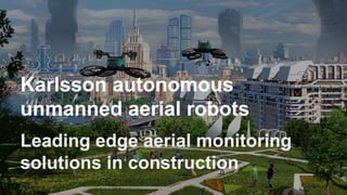
  • 1. Автоматические беспилотные летающие роботы “Karlsson” Leading edge aerial monitoring solutions in construction Karlsson autonomous unmanned aerial robots
  • 2. Overview: A modern approach for industrial monitoring Traditional monitoring Smart monitoring ● Rigid plan execution without possibility for last-minute changes ● Monitoring of construction takes long time to be done ● Lack of accurate real-time data showing construction progress ● Lack of individual approach to different parts of construction ● Organized real time data ● Data is collected using various UAV- mounted sensors (photo/video camera, thermal imaging camera, IR sensor) ● Use of predictive analytics and specialized software allowing for better operations planning and adjustments
  • 3. Overview: Using aerial monitoring in construction ● Gathering preliminary information ● Construction site preparation: orthophotography, DTM and DEM (3D mapping of the area), determination of geophysical parameters ● Preparation of visual demonstration items for investors and clients (3D models, "view out the window") ● Work progress control ● Workplace safety and security control and compliance supervision ● Additional source of data for decision making and improvement measures ● Prevention of and control over illegal construction ● Thermal imaging building inspection ● Creation of panoramic 3D views of streets, neighborhoods, and buildings Advantages of aerial monitoring: ● real-time data ● advanced data processing ● fine-tuning of the construction
  • 4. Application: 3D map creation (DTM and DEM) ● Aerial monitoring provides data for 3D object creation and area's orthophotographic map ● Data is continuously updated and stored as an online map (see map. karlssonproject.com) ● Interactive viewing of objects Better control over the work progress and the ability to provide investors and clients with the most recent visual information. Easier illegal construction detection for government agencies.
  • 5. Application: aerial photography and 3D scanning of construction projects ● Aerial photo and video can be used to provide clients with impressive visuals such as the view out the future window at the earliest stages of construction ● A clear demo view of a cottage community or apartment complex being built, with additional infographics directly on the map ● A 3D model of a construction project makes every fine detail available for viewing online ● The model can be used in further planning, including that of landscaping and interior design
  • 6. Application: aerial thermal imaging Aerial photography with a thermal imager allows to: ● Detect construction defects - substandard welds, roof leaks, air and heat loss, etc. ● Inspect pipelines to identify stress points wear, coolant leakage, faulty equipment and insulation damage ● Identify even the defects hidden underground ● The data gathered using thermal imaging can be added to an interactive online map with regular updates ● Save time and effort required for thermal inspection of buildings and communications
  • 7. Karlsson Automated UAV network Main goal: full autonomy and independence from humans. Solution: autonomous wireless charging stations, mission control center, client system. UAVs and charging station network Mission control Telemetry and data 3G/4G networks Servers UAV generated data used for various purposes Mission control center
  • 8. Max altitude 3000 m Flight speed 0-65 km/h Flight time 15-35 min Max wind speed 25 m/s Payload (up to 1.5 kg): Camera Sony NEX-7 with diff. filters Thermal camera FLIR Tau 640х480 Videocamera GoPro HERO4 FullHD Technology platform: UAV and charging station Autonomous wireless charging station with up to 500 W power.
  • 9. Karlsson Project team Position Education Dmitry Korolev CEO / Co-founder MS in Physics MSU Andrey Grunin CBDO / Co-founder MS in Physics MSU Pavel Kapralov CTO / Co-founder PhD in Physics, MSU Ilya Mukha Design Engineer MS in Physics MSU Nikita Ushakov Business Development MS in Industrial Engineering, Columbia University Alexander Solovyev Computer Vision Engineer MS in Computer Science BMSTU Alexey Dolinenko Embedded Systems Engineer MS in Engineering PGTU Vadim Stukalov Back End Engineer MS in Computer Science BelGU Vladimir Khodakov Front End Engineer MS DonNACEA
  • 10. Phone number: +1 (206) 973-99-58 +7 (926) 270-59-96 Email: info@karlssonproject.com Website: karlssonproject.com Youtube: youtube.com/karlssonproject Vimeo: vimeo.com/karlssonproject