SlideShare una empresa de Scribd logo
1 de 30
Models of the EarthModels of the Earth
Created by L. ZimmermanCreated by L. Zimmerman
Introduction to MapsIntroduction to Maps
Maps are an extremely useful tool forMaps are an extremely useful tool for
many science and non-sciencemany science and non-science
disciplines.disciplines.
They provide “pictures” ofThey provide “pictures” of
areas/regions/land surfaces!areas/regions/land surfaces!
Correct interpretation can tell you MANYCorrect interpretation can tell you MANY
things!things!
– MINGOMINGO!!
Created by L. ZimmermanCreated by L. Zimmerman
Location on EarthLocation on Earth
The earth is a sphere, soThe earth is a sphere, so
how do we describe where ahow do we describe where a
point is on its surface?point is on its surface?
The most common way toThe most common way to
locate points on the surfacelocate points on the surface
is by basic, geographicis by basic, geographic
coordinates: latitude andcoordinates: latitude and
longitude.longitude.
These coordinates valuesThese coordinates values
are measured in degrees,are measured in degrees,
and represent angularand represent angular
distances calculated from thedistances calculated from the
center of the Earth.center of the Earth.
Created by L. ZimmermanCreated by L. Zimmerman
Shape of the EarthShape of the Earth
 Earth is mostEarth is most
accuratelyaccurately
described as andescribed as an
oblate spheroidoblate spheroid
(almost a sphere).(almost a sphere).
Flattened at theFlattened at the
polespoles
1.1. Bulges at theBulges at the
equatorequator
NPSP
Created by L. ZimmermanCreated by L. Zimmerman
Determining Earth’s ShapeDetermining Earth’s Shape
1.1. Observation of the North Star, Polaris.Observation of the North Star, Polaris.
– Altitude is theAltitude is the heightheight, measured in, measured in degreesdegrees
above the horizon of the observer.above the horizon of the observer.
– The altitude of Polaris changes as anThe altitude of Polaris changes as an
observer moves north or south (in theobserver moves north or south (in the
Northern hemisphere); this is because EarthNorthern hemisphere); this is because Earth
isis sphericalspherical and its surface isand its surface is curvedcurved..
Created by L. ZimmermanCreated by L. Zimmerman
LatitudeLatitude Altitude ofAltitude of
PolarisPolaris
00oo
00oo
9090oo
9090oo
6565oo
6565oo
d. Summary: The altitude of Polaris (above the
horizon) is equal to the latitude of the observer on
the globe.
Created by L. ZimmermanCreated by L. Zimmerman
Locating the North Star -Locating the North Star - of course youof course you
would need to be in thewould need to be in the NorthernNorthern hemisphere!hemisphere!
•The North Star is located at the end of the handle of the Little Dipper.
•The North Star always points in the direction of True North. For this reason
it has been used as and aid to navigation for many centuries.
Finding LocationsFinding Locations
on the Earthon the Earth
There are three main reference points:There are three main reference points:
EquatorEquator
NorthNorth andand South Geographic PolesSouth Geographic Poles
Latitude (parallels)Latitude (parallels)
Describe positionsDescribe positions NorthNorth andand SouthSouth of theof the
equator. Parallels runequator. Parallels run easteast toto westwest around thearound the
world.world.
Parallels are measure inParallels are measure in degreesdegrees fromfrom 00 toto 9090..
Those that are above the equator are labeledThose that are above the equator are labeled
NorthNorth; those below are labeled; those below are labeled SouthSouth..
Each degree of latitude consists of 60 equalEach degree of latitude consists of 60 equal
parts calledparts called minutesminutes..
o Each minute is divided intoEach minute is divided into 60 seconds60 seconds
Example: 38Example: 38oo
53’ 51”53’ 51”
Created by L. ZimmermanCreated by L. Zimmerman
Longitude (meridians)Longitude (meridians)
Describes positionsDescribes positions EastEast andand WestWest of the Primeof the Prime
Meridian. Meridians runMeridian. Meridians run northnorth andand southsouth around thearound the
world.world.
The 0The 0oo
meridian is called themeridian is called the Prime MeridianPrime Meridian and runsand runs
directly throughdirectly through Greenwich, EnglandGreenwich, England..
LocationsLocations easteast of Prime Meridian have longitudesof Prime Meridian have longitudes
betweenbetween 0 and 1800 and 180oo
EE. Locations west of the Prime. Locations west of the Prime
Meridian have longitudes betweenMeridian have longitudes between 0 and 1800 and 180oo
WW..
Longitude can also be broken down intoLongitude can also be broken down into minutesminutes andand
secondsseconds..
Created by L. ZimmermanCreated by L. Zimmerman
Great Circles & Finding DirectionGreat Circles & Finding Direction
Great circles are used in navigation, generally byGreat circles are used in navigation, generally by
pilotspilots. A great circle is any circle that. A great circle is any circle that dividesdivides
the globe in halvesthe globe in halves..
Geomagnetic PolesGeomagnetic Poles – points on Earth directly– points on Earth directly
above imaginary magnetsabove imaginary magnets
Magnetic declinationMagnetic declination – angle between direction– angle between direction
of geographic poles and the compass needleof geographic poles and the compass needle
True NorthTrue North – the direction of the geographic North– the direction of the geographic North
PolePole
Mapping the Earth’s SurfaceMapping the Earth’s Surface
CartographyCartography – science of map making– science of map making
MapsMaps – flat representations of Earth– flat representations of Earth
The best representation of earth is aThe best representation of earth is a globeglobe..
No matter what type of map is made, someNo matter what type of map is made, some
portion is always distorted.portion is always distorted. CartographersCartographers
work to minimize the effects of thesework to minimize the effects of these
distortions.distortions.
Reading a MapReading a Map
LegendLegend - list of symbols and their meanings- list of symbols and their meanings
ScaleScale – indicates the relationship (a ratio)– indicates the relationship (a ratio)
between the distances on the map and thebetween the distances on the map and the
actual distanceactual distance
Created by L. ZimmermanCreated by L. Zimmerman
D. Position Characteristics –D. Position Characteristics – How can theHow can the
characteristics of a position be measured and described?characteristics of a position be measured and described?
1)1) Isolines –Isolines – lineslines
on a f ield mapon a f ield map
t hatt hat connectconnect
point s ofpoint s of equalequal
value.value.
Created by L. ZimmermanCreated by L. Zimmerman
Examples of isolines:Examples of isolines:
a)a) Contour LinesContour Lines (Topogr aphic) – lines t hat(Topogr aphic) – lines t hat
connect point s of equalconnect point s of equal ElevationElevation..
b)b) IsobarsIsobars – lines t hat connect point s of equal– lines t hat connect point s of equal
pressurepressure. Found on a. Found on a weather mapweather map..
c)c) IsothermsIsotherms – lines t hat connect point s of– lines t hat connect point s of
equalequal temperaturetemperature. Found on a. Found on a weatherweather
mapmap..
d)d) IsosurfaceIsosurface – A model that represents field– A model that represents field
characteristics in 3-D.characteristics in 3-D.
Topographic MapsTopographic Maps
http://www.rollanet.org/~conorw/cwome/hahatonka_topo_map.jpg
Features of Topographic MapsFeatures of Topographic Maps
ElevationElevation – height above sea level– height above sea level
Sea levelSea level – point between the highest and lowest tide– point between the highest and lowest tide
levels (elevation at sea level = 0)levels (elevation at sea level = 0)
Contour linesContour lines – used to show elevation and connect– used to show elevation and connect
all points on the map with equal elevationall points on the map with equal elevation
Contour intervalContour interval – difference in elevation between– difference in elevation between
one contour line and the nextone contour line and the next
ReliefRelief – difference in elevation between the highest– difference in elevation between the highest
and lowest pointsand lowest points
Index contourIndex contour – every 5– every 5thth
line is BOLD and itsline is BOLD and its
elevation is labeledelevation is labeled
Created by L. ZimmermanCreated by L. Zimmerman
Contour Lines:
Connect all points on
a map that have the
same elevation above
sea level.
Topographic MapsTopographic Maps
Colors on topographic maps:Colors on topographic maps:
– Blue:Blue: Water (rivers, lakes, streams, etc.)Water (rivers, lakes, streams, etc.)
– Green:Green: VegetationVegetation
– Red:Red: Contour LinesContour Lines
Topographic MapsTopographic Maps
There are many symbols used on theThere are many symbols used on the
map. These are explained in themap. These are explained in the
legendlegend..
Topographic MapsTopographic Maps
Contour lines spaced close together indicate aContour lines spaced close together indicate a steepsteep
slope.slope.
Contour lines spaced far apart indicate aContour lines spaced far apart indicate a gentlegentle
slopeslope..
Contour lines that form a closed loop indicate aContour lines that form a closed loop indicate a hillhill..
Contour lines that form a circle with dashed linesContour lines that form a circle with dashed lines
indicate a depressionindicate a depression..
V-shaped contour lines indicate aV-shaped contour lines indicate a valleyvalley and the “V”and the “V”
will pointwill point downstreamdownstream. (Rivers flow DOWNHILL). (Rivers flow DOWNHILL)
Topographic MapsTopographic Maps
Depression (shown using hachures)
Topographic MapsTopographic Maps
Advanced TechnologyAdvanced Technology: Gives us the: Gives us the
ability to measure and analyze theability to measure and analyze the
physical properties of Earth with muchphysical properties of Earth with much
greater precision.greater precision.
– Examples:Examples: GPSGPS andand Weather satellitesWeather satellites..
Created by L. ZimmermanCreated by L. Zimmerman
Features of Topographic Maps
Relationship between 3D and 2D representation
3D view
2D view
Created by L. ZimmermanCreated by L. Zimmerman
Contour lines
Relationship between topographic features and contour lines
Created by L. ZimmermanCreated by L. Zimmerman
Topographic Profile
Created by L. ZimmermanCreated by L. Zimmerman
The RESULT – a 3-D pictureThe RESULT – a 3-D picture

Más contenido relacionado

La actualidad más candente

La actualidad más candente (20)

Earth dynamic system
Earth  dynamic systemEarth  dynamic system
Earth dynamic system
 
Origin of earth
Origin of earthOrigin of earth
Origin of earth
 
Reasons for the seasons notes
Reasons for the seasons notesReasons for the seasons notes
Reasons for the seasons notes
 
Solar System and its Origin)
Solar System and its Origin)Solar System and its Origin)
Solar System and its Origin)
 
Module 1 origin and systems of earth
Module 1 origin and systems of earthModule 1 origin and systems of earth
Module 1 origin and systems of earth
 
Convection Currents
Convection CurrentsConvection Currents
Convection Currents
 
Introduction to Earth
Introduction to EarthIntroduction to Earth
Introduction to Earth
 
The Solar System
The Solar SystemThe Solar System
The Solar System
 
Weathering
Weathering Weathering
Weathering
 
PLATE TECTONIC
PLATE TECTONICPLATE TECTONIC
PLATE TECTONIC
 
Minerals and Rocks
Minerals and RocksMinerals and Rocks
Minerals and Rocks
 
Internal Structure of Earth
Internal Structure of EarthInternal Structure of Earth
Internal Structure of Earth
 
Geology of Earth
Geology of EarthGeology of Earth
Geology of Earth
 
Sea-Floor Spreading
Sea-Floor SpreadingSea-Floor Spreading
Sea-Floor Spreading
 
Chapter 1. Universe and the Solar System
Chapter 1. Universe and the Solar SystemChapter 1. Universe and the Solar System
Chapter 1. Universe and the Solar System
 
Seasons, Earth, Axial Tilt Lesson PowerPoint
Seasons, Earth, Axial Tilt Lesson PowerPointSeasons, Earth, Axial Tilt Lesson PowerPoint
Seasons, Earth, Axial Tilt Lesson PowerPoint
 
Earth earth-system
Earth earth-systemEarth earth-system
Earth earth-system
 
Tectonics: Plate tectonics Introduction
Tectonics: Plate tectonics IntroductionTectonics: Plate tectonics Introduction
Tectonics: Plate tectonics Introduction
 
Folding and faulting
Folding and faultingFolding and faulting
Folding and faulting
 
Ocean floor topography
Ocean floor topographyOcean floor topography
Ocean floor topography
 

Similar a Models and dimensions of earth

Topographic Maps for Earth Science
Topographic Maps for Earth ScienceTopographic Maps for Earth Science
Topographic Maps for Earth ScienceKolby Kirk
 
Maps as Models of Earth
Maps as Models of EarthMaps as Models of Earth
Maps as Models of Earthmlong24
 
Maps as Models of Earth
Maps as Models of EarthMaps as Models of Earth
Maps as Models of Earthmlong24
 
BASIC GEOGRAPHY 2011.ppt
BASIC GEOGRAPHY 2011.pptBASIC GEOGRAPHY 2011.ppt
BASIC GEOGRAPHY 2011.pptSatyavratDhull2
 
BASIC GEOGRAPHY 2011.ppt
BASIC GEOGRAPHY 2011.pptBASIC GEOGRAPHY 2011.ppt
BASIC GEOGRAPHY 2011.pptkirthick06K
 
ONTAP - Map and Compass
ONTAP - Map and CompassONTAP - Map and Compass
ONTAP - Map and CompassWRDSB
 
Maps And Globes Are Models Of The Earth
Maps And Globes Are Models Of The EarthMaps And Globes Are Models Of The Earth
Maps And Globes Are Models Of The Earthmrmartella
 
Unit 1.-Earth. Maps
Unit 1.-Earth. MapsUnit 1.-Earth. Maps
Unit 1.-Earth. MapsMencar Car
 
Physical Geography Lecture 03 - Maps 100316
Physical Geography Lecture 03 - Maps 100316Physical Geography Lecture 03 - Maps 100316
Physical Geography Lecture 03 - Maps 100316angelaorr
 
Basic topographic mapping
Basic topographic mappingBasic topographic mapping
Basic topographic mappingBhok Millare
 
maps & symbols which is use in india and other parts of world also
maps & symbols which is use in india and other parts of world alsomaps & symbols which is use in india and other parts of world also
maps & symbols which is use in india and other parts of world alsoLakshya Sharma
 

Similar a Models and dimensions of earth (20)

Unit1 160131210057
Unit1 160131210057Unit1 160131210057
Unit1 160131210057
 
Topographic Maps for Earth Science
Topographic Maps for Earth ScienceTopographic Maps for Earth Science
Topographic Maps for Earth Science
 
Maps as Models of Earth
Maps as Models of EarthMaps as Models of Earth
Maps as Models of Earth
 
Toposheet interpretation
Toposheet interpretationToposheet interpretation
Toposheet interpretation
 
Maps as Models of Earth
Maps as Models of EarthMaps as Models of Earth
Maps as Models of Earth
 
BASIC GEOGRAPHY 2011.ppt
BASIC GEOGRAPHY 2011.pptBASIC GEOGRAPHY 2011.ppt
BASIC GEOGRAPHY 2011.ppt
 
BASIC GEOGRAPHY 2011.ppt
BASIC GEOGRAPHY 2011.pptBASIC GEOGRAPHY 2011.ppt
BASIC GEOGRAPHY 2011.ppt
 
ONTAP - Map and Compass
ONTAP - Map and CompassONTAP - Map and Compass
ONTAP - Map and Compass
 
Projection
ProjectionProjection
Projection
 
Unit 1 geography
Unit 1 geographyUnit 1 geography
Unit 1 geography
 
Unit 1 geography
Unit 1 geographyUnit 1 geography
Unit 1 geography
 
Exploring geography
Exploring geographyExploring geography
Exploring geography
 
Map reading
Map readingMap reading
Map reading
 
Maps And Globes Are Models Of The Earth
Maps And Globes Are Models Of The EarthMaps And Globes Are Models Of The Earth
Maps And Globes Are Models Of The Earth
 
Unit 1.-Earth. Maps
Unit 1.-Earth. MapsUnit 1.-Earth. Maps
Unit 1.-Earth. Maps
 
Cartographic Projections
Cartographic ProjectionsCartographic Projections
Cartographic Projections
 
Physical Geography Lecture 03 - Maps 100316
Physical Geography Lecture 03 - Maps 100316Physical Geography Lecture 03 - Maps 100316
Physical Geography Lecture 03 - Maps 100316
 
Basic topographic mapping
Basic topographic mappingBasic topographic mapping
Basic topographic mapping
 
maps & symbols which is use in india and other parts of world also
maps & symbols which is use in india and other parts of world alsomaps & symbols which is use in india and other parts of world also
maps & symbols which is use in india and other parts of world also
 
Geography of microwave survey
Geography of microwave surveyGeography of microwave survey
Geography of microwave survey
 

Más de lorizimmerman

Models and dimensions of earth
Models and dimensions of earthModels and dimensions of earth
Models and dimensions of earthlorizimmerman
 
Energy resources ppt
Energy resources pptEnergy resources ppt
Energy resources pptlorizimmerman
 
NC Human Impact Unit
NC Human Impact UnitNC Human Impact Unit
NC Human Impact Unitlorizimmerman
 
Energy intro activity
Energy intro activityEnergy intro activity
Energy intro activitylorizimmerman
 
Energy resources unit powerpoint
Energy resources unit powerpointEnergy resources unit powerpoint
Energy resources unit powerpointlorizimmerman
 
Weathering, Erosion and Soils
Weathering, Erosion and SoilsWeathering, Erosion and Soils
Weathering, Erosion and Soilslorizimmerman
 
Mountain building ppt nc 13
Mountain building ppt nc 13Mountain building ppt nc 13
Mountain building ppt nc 13lorizimmerman
 
Geologic history academic
Geologic history academicGeologic history academic
Geologic history academiclorizimmerman
 
Earth history nc honors 13
Earth history nc honors 13Earth history nc honors 13
Earth history nc honors 13lorizimmerman
 
Earth/Environmental - Introduction
Earth/Environmental - IntroductionEarth/Environmental - Introduction
Earth/Environmental - Introductionlorizimmerman
 

Más de lorizimmerman (20)

Gel 111 intro ppt
Gel 111 intro pptGel 111 intro ppt
Gel 111 intro ppt
 
8 oceanography ppt
8  oceanography ppt8  oceanography ppt
8 oceanography ppt
 
Astronomy jeopardy
Astronomy jeopardyAstronomy jeopardy
Astronomy jeopardy
 
Models and dimensions of earth
Models and dimensions of earthModels and dimensions of earth
Models and dimensions of earth
 
Astronomy nc 2014
Astronomy nc 2014Astronomy nc 2014
Astronomy nc 2014
 
Energy resources ppt
Energy resources pptEnergy resources ppt
Energy resources ppt
 
Astronomy NC 2014
Astronomy NC 2014Astronomy NC 2014
Astronomy NC 2014
 
NC Human Impact Unit
NC Human Impact UnitNC Human Impact Unit
NC Human Impact Unit
 
Meteorology
MeteorologyMeteorology
Meteorology
 
GHHS Oceanography
GHHS Oceanography GHHS Oceanography
GHHS Oceanography
 
Freshwater
Freshwater Freshwater
Freshwater
 
Energy intro activity
Energy intro activityEnergy intro activity
Energy intro activity
 
Energy resources unit powerpoint
Energy resources unit powerpointEnergy resources unit powerpoint
Energy resources unit powerpoint
 
Weathering, Erosion and Soils
Weathering, Erosion and SoilsWeathering, Erosion and Soils
Weathering, Erosion and Soils
 
Rocks & minerals
Rocks & mineralsRocks & minerals
Rocks & minerals
 
Mountain building ppt nc 13
Mountain building ppt nc 13Mountain building ppt nc 13
Mountain building ppt nc 13
 
The dynamic crust
The dynamic crustThe dynamic crust
The dynamic crust
 
Geologic history academic
Geologic history academicGeologic history academic
Geologic history academic
 
Earth history nc honors 13
Earth history nc honors 13Earth history nc honors 13
Earth history nc honors 13
 
Earth/Environmental - Introduction
Earth/Environmental - IntroductionEarth/Environmental - Introduction
Earth/Environmental - Introduction
 

Último

DSPy a system for AI to Write Prompts and Do Fine Tuning
DSPy a system for AI to Write Prompts and Do Fine TuningDSPy a system for AI to Write Prompts and Do Fine Tuning
DSPy a system for AI to Write Prompts and Do Fine TuningLars Bell
 
Hyperautomation and AI/ML: A Strategy for Digital Transformation Success.pdf
Hyperautomation and AI/ML: A Strategy for Digital Transformation Success.pdfHyperautomation and AI/ML: A Strategy for Digital Transformation Success.pdf
Hyperautomation and AI/ML: A Strategy for Digital Transformation Success.pdfPrecisely
 
Unraveling Multimodality with Large Language Models.pdf
Unraveling Multimodality with Large Language Models.pdfUnraveling Multimodality with Large Language Models.pdf
Unraveling Multimodality with Large Language Models.pdfAlex Barbosa Coqueiro
 
From Family Reminiscence to Scholarly Archive .
From Family Reminiscence to Scholarly Archive .From Family Reminiscence to Scholarly Archive .
From Family Reminiscence to Scholarly Archive .Alan Dix
 
Merck Moving Beyond Passwords: FIDO Paris Seminar.pptx
Merck Moving Beyond Passwords: FIDO Paris Seminar.pptxMerck Moving Beyond Passwords: FIDO Paris Seminar.pptx
Merck Moving Beyond Passwords: FIDO Paris Seminar.pptxLoriGlavin3
 
Transcript: New from BookNet Canada for 2024: BNC CataList - Tech Forum 2024
Transcript: New from BookNet Canada for 2024: BNC CataList - Tech Forum 2024Transcript: New from BookNet Canada for 2024: BNC CataList - Tech Forum 2024
Transcript: New from BookNet Canada for 2024: BNC CataList - Tech Forum 2024BookNet Canada
 
Streamlining Python Development: A Guide to a Modern Project Setup
Streamlining Python Development: A Guide to a Modern Project SetupStreamlining Python Development: A Guide to a Modern Project Setup
Streamlining Python Development: A Guide to a Modern Project SetupFlorian Wilhelm
 
Take control of your SAP testing with UiPath Test Suite
Take control of your SAP testing with UiPath Test SuiteTake control of your SAP testing with UiPath Test Suite
Take control of your SAP testing with UiPath Test SuiteDianaGray10
 
Dev Dives: Streamline document processing with UiPath Studio Web
Dev Dives: Streamline document processing with UiPath Studio WebDev Dives: Streamline document processing with UiPath Studio Web
Dev Dives: Streamline document processing with UiPath Studio WebUiPathCommunity
 
TrustArc Webinar - How to Build Consumer Trust Through Data Privacy
TrustArc Webinar - How to Build Consumer Trust Through Data PrivacyTrustArc Webinar - How to Build Consumer Trust Through Data Privacy
TrustArc Webinar - How to Build Consumer Trust Through Data PrivacyTrustArc
 
TeamStation AI System Report LATAM IT Salaries 2024
TeamStation AI System Report LATAM IT Salaries 2024TeamStation AI System Report LATAM IT Salaries 2024
TeamStation AI System Report LATAM IT Salaries 2024Lonnie McRorey
 
DevoxxFR 2024 Reproducible Builds with Apache Maven
DevoxxFR 2024 Reproducible Builds with Apache MavenDevoxxFR 2024 Reproducible Builds with Apache Maven
DevoxxFR 2024 Reproducible Builds with Apache MavenHervé Boutemy
 
Commit 2024 - Secret Management made easy
Commit 2024 - Secret Management made easyCommit 2024 - Secret Management made easy
Commit 2024 - Secret Management made easyAlfredo García Lavilla
 
What's New in Teams Calling, Meetings and Devices March 2024
What's New in Teams Calling, Meetings and Devices March 2024What's New in Teams Calling, Meetings and Devices March 2024
What's New in Teams Calling, Meetings and Devices March 2024Stephanie Beckett
 
DevEX - reference for building teams, processes, and platforms
DevEX - reference for building teams, processes, and platformsDevEX - reference for building teams, processes, and platforms
DevEX - reference for building teams, processes, and platformsSergiu Bodiu
 
Tampa BSides - Chef's Tour of Microsoft Security Adoption Framework (SAF)
Tampa BSides - Chef's Tour of Microsoft Security Adoption Framework (SAF)Tampa BSides - Chef's Tour of Microsoft Security Adoption Framework (SAF)
Tampa BSides - Chef's Tour of Microsoft Security Adoption Framework (SAF)Mark Simos
 
Anypoint Exchange: It’s Not Just a Repo!
Anypoint Exchange: It’s Not Just a Repo!Anypoint Exchange: It’s Not Just a Repo!
Anypoint Exchange: It’s Not Just a Repo!Manik S Magar
 
Story boards and shot lists for my a level piece
Story boards and shot lists for my a level pieceStory boards and shot lists for my a level piece
Story boards and shot lists for my a level piececharlottematthew16
 
Advanced Test Driven-Development @ php[tek] 2024
Advanced Test Driven-Development @ php[tek] 2024Advanced Test Driven-Development @ php[tek] 2024
Advanced Test Driven-Development @ php[tek] 2024Scott Keck-Warren
 

Último (20)

DSPy a system for AI to Write Prompts and Do Fine Tuning
DSPy a system for AI to Write Prompts and Do Fine TuningDSPy a system for AI to Write Prompts and Do Fine Tuning
DSPy a system for AI to Write Prompts and Do Fine Tuning
 
Hyperautomation and AI/ML: A Strategy for Digital Transformation Success.pdf
Hyperautomation and AI/ML: A Strategy for Digital Transformation Success.pdfHyperautomation and AI/ML: A Strategy for Digital Transformation Success.pdf
Hyperautomation and AI/ML: A Strategy for Digital Transformation Success.pdf
 
Unraveling Multimodality with Large Language Models.pdf
Unraveling Multimodality with Large Language Models.pdfUnraveling Multimodality with Large Language Models.pdf
Unraveling Multimodality with Large Language Models.pdf
 
From Family Reminiscence to Scholarly Archive .
From Family Reminiscence to Scholarly Archive .From Family Reminiscence to Scholarly Archive .
From Family Reminiscence to Scholarly Archive .
 
Merck Moving Beyond Passwords: FIDO Paris Seminar.pptx
Merck Moving Beyond Passwords: FIDO Paris Seminar.pptxMerck Moving Beyond Passwords: FIDO Paris Seminar.pptx
Merck Moving Beyond Passwords: FIDO Paris Seminar.pptx
 
Transcript: New from BookNet Canada for 2024: BNC CataList - Tech Forum 2024
Transcript: New from BookNet Canada for 2024: BNC CataList - Tech Forum 2024Transcript: New from BookNet Canada for 2024: BNC CataList - Tech Forum 2024
Transcript: New from BookNet Canada for 2024: BNC CataList - Tech Forum 2024
 
Streamlining Python Development: A Guide to a Modern Project Setup
Streamlining Python Development: A Guide to a Modern Project SetupStreamlining Python Development: A Guide to a Modern Project Setup
Streamlining Python Development: A Guide to a Modern Project Setup
 
Take control of your SAP testing with UiPath Test Suite
Take control of your SAP testing with UiPath Test SuiteTake control of your SAP testing with UiPath Test Suite
Take control of your SAP testing with UiPath Test Suite
 
Dev Dives: Streamline document processing with UiPath Studio Web
Dev Dives: Streamline document processing with UiPath Studio WebDev Dives: Streamline document processing with UiPath Studio Web
Dev Dives: Streamline document processing with UiPath Studio Web
 
TrustArc Webinar - How to Build Consumer Trust Through Data Privacy
TrustArc Webinar - How to Build Consumer Trust Through Data PrivacyTrustArc Webinar - How to Build Consumer Trust Through Data Privacy
TrustArc Webinar - How to Build Consumer Trust Through Data Privacy
 
TeamStation AI System Report LATAM IT Salaries 2024
TeamStation AI System Report LATAM IT Salaries 2024TeamStation AI System Report LATAM IT Salaries 2024
TeamStation AI System Report LATAM IT Salaries 2024
 
DevoxxFR 2024 Reproducible Builds with Apache Maven
DevoxxFR 2024 Reproducible Builds with Apache MavenDevoxxFR 2024 Reproducible Builds with Apache Maven
DevoxxFR 2024 Reproducible Builds with Apache Maven
 
Commit 2024 - Secret Management made easy
Commit 2024 - Secret Management made easyCommit 2024 - Secret Management made easy
Commit 2024 - Secret Management made easy
 
DMCC Future of Trade Web3 - Special Edition
DMCC Future of Trade Web3 - Special EditionDMCC Future of Trade Web3 - Special Edition
DMCC Future of Trade Web3 - Special Edition
 
What's New in Teams Calling, Meetings and Devices March 2024
What's New in Teams Calling, Meetings and Devices March 2024What's New in Teams Calling, Meetings and Devices March 2024
What's New in Teams Calling, Meetings and Devices March 2024
 
DevEX - reference for building teams, processes, and platforms
DevEX - reference for building teams, processes, and platformsDevEX - reference for building teams, processes, and platforms
DevEX - reference for building teams, processes, and platforms
 
Tampa BSides - Chef's Tour of Microsoft Security Adoption Framework (SAF)
Tampa BSides - Chef's Tour of Microsoft Security Adoption Framework (SAF)Tampa BSides - Chef's Tour of Microsoft Security Adoption Framework (SAF)
Tampa BSides - Chef's Tour of Microsoft Security Adoption Framework (SAF)
 
Anypoint Exchange: It’s Not Just a Repo!
Anypoint Exchange: It’s Not Just a Repo!Anypoint Exchange: It’s Not Just a Repo!
Anypoint Exchange: It’s Not Just a Repo!
 
Story boards and shot lists for my a level piece
Story boards and shot lists for my a level pieceStory boards and shot lists for my a level piece
Story boards and shot lists for my a level piece
 
Advanced Test Driven-Development @ php[tek] 2024
Advanced Test Driven-Development @ php[tek] 2024Advanced Test Driven-Development @ php[tek] 2024
Advanced Test Driven-Development @ php[tek] 2024
 

Models and dimensions of earth

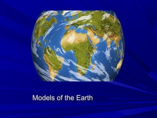
  • 1. Models of the EarthModels of the Earth
  • 2. Created by L. ZimmermanCreated by L. Zimmerman Introduction to MapsIntroduction to Maps Maps are an extremely useful tool forMaps are an extremely useful tool for many science and non-sciencemany science and non-science disciplines.disciplines. They provide “pictures” ofThey provide “pictures” of areas/regions/land surfaces!areas/regions/land surfaces! Correct interpretation can tell you MANYCorrect interpretation can tell you MANY things!things! – MINGOMINGO!!
  • 3. Created by L. ZimmermanCreated by L. Zimmerman Location on EarthLocation on Earth The earth is a sphere, soThe earth is a sphere, so how do we describe where ahow do we describe where a point is on its surface?point is on its surface? The most common way toThe most common way to locate points on the surfacelocate points on the surface is by basic, geographicis by basic, geographic coordinates: latitude andcoordinates: latitude and longitude.longitude. These coordinates valuesThese coordinates values are measured in degrees,are measured in degrees, and represent angularand represent angular distances calculated from thedistances calculated from the center of the Earth.center of the Earth.
  • 4. Created by L. ZimmermanCreated by L. Zimmerman Shape of the EarthShape of the Earth  Earth is mostEarth is most accuratelyaccurately described as andescribed as an oblate spheroidoblate spheroid (almost a sphere).(almost a sphere). Flattened at theFlattened at the polespoles 1.1. Bulges at theBulges at the equatorequator NPSP
  • 5. Created by L. ZimmermanCreated by L. Zimmerman Determining Earth’s ShapeDetermining Earth’s Shape 1.1. Observation of the North Star, Polaris.Observation of the North Star, Polaris. – Altitude is theAltitude is the heightheight, measured in, measured in degreesdegrees above the horizon of the observer.above the horizon of the observer. – The altitude of Polaris changes as anThe altitude of Polaris changes as an observer moves north or south (in theobserver moves north or south (in the Northern hemisphere); this is because EarthNorthern hemisphere); this is because Earth isis sphericalspherical and its surface isand its surface is curvedcurved..
  • 6. Created by L. ZimmermanCreated by L. Zimmerman LatitudeLatitude Altitude ofAltitude of PolarisPolaris 00oo 00oo 9090oo 9090oo 6565oo 6565oo d. Summary: The altitude of Polaris (above the horizon) is equal to the latitude of the observer on the globe.
  • 7. Created by L. ZimmermanCreated by L. Zimmerman Locating the North Star -Locating the North Star - of course youof course you would need to be in thewould need to be in the NorthernNorthern hemisphere!hemisphere! •The North Star is located at the end of the handle of the Little Dipper. •The North Star always points in the direction of True North. For this reason it has been used as and aid to navigation for many centuries.
  • 8. Finding LocationsFinding Locations on the Earthon the Earth There are three main reference points:There are three main reference points: EquatorEquator NorthNorth andand South Geographic PolesSouth Geographic Poles
  • 9. Latitude (parallels)Latitude (parallels) Describe positionsDescribe positions NorthNorth andand SouthSouth of theof the equator. Parallels runequator. Parallels run easteast toto westwest around thearound the world.world. Parallels are measure inParallels are measure in degreesdegrees fromfrom 00 toto 9090.. Those that are above the equator are labeledThose that are above the equator are labeled NorthNorth; those below are labeled; those below are labeled SouthSouth.. Each degree of latitude consists of 60 equalEach degree of latitude consists of 60 equal parts calledparts called minutesminutes.. o Each minute is divided intoEach minute is divided into 60 seconds60 seconds Example: 38Example: 38oo 53’ 51”53’ 51”
  • 10. Created by L. ZimmermanCreated by L. Zimmerman
  • 11.
  • 12. Longitude (meridians)Longitude (meridians) Describes positionsDescribes positions EastEast andand WestWest of the Primeof the Prime Meridian. Meridians runMeridian. Meridians run northnorth andand southsouth around thearound the world.world. The 0The 0oo meridian is called themeridian is called the Prime MeridianPrime Meridian and runsand runs directly throughdirectly through Greenwich, EnglandGreenwich, England.. LocationsLocations easteast of Prime Meridian have longitudesof Prime Meridian have longitudes betweenbetween 0 and 1800 and 180oo EE. Locations west of the Prime. Locations west of the Prime Meridian have longitudes betweenMeridian have longitudes between 0 and 1800 and 180oo WW.. Longitude can also be broken down intoLongitude can also be broken down into minutesminutes andand secondsseconds..
  • 13. Created by L. ZimmermanCreated by L. Zimmerman
  • 14. Great Circles & Finding DirectionGreat Circles & Finding Direction Great circles are used in navigation, generally byGreat circles are used in navigation, generally by pilotspilots. A great circle is any circle that. A great circle is any circle that dividesdivides the globe in halvesthe globe in halves.. Geomagnetic PolesGeomagnetic Poles – points on Earth directly– points on Earth directly above imaginary magnetsabove imaginary magnets Magnetic declinationMagnetic declination – angle between direction– angle between direction of geographic poles and the compass needleof geographic poles and the compass needle True NorthTrue North – the direction of the geographic North– the direction of the geographic North PolePole
  • 15. Mapping the Earth’s SurfaceMapping the Earth’s Surface CartographyCartography – science of map making– science of map making MapsMaps – flat representations of Earth– flat representations of Earth The best representation of earth is aThe best representation of earth is a globeglobe.. No matter what type of map is made, someNo matter what type of map is made, some portion is always distorted.portion is always distorted. CartographersCartographers work to minimize the effects of thesework to minimize the effects of these distortions.distortions.
  • 16. Reading a MapReading a Map LegendLegend - list of symbols and their meanings- list of symbols and their meanings ScaleScale – indicates the relationship (a ratio)– indicates the relationship (a ratio) between the distances on the map and thebetween the distances on the map and the actual distanceactual distance
  • 17. Created by L. ZimmermanCreated by L. Zimmerman D. Position Characteristics –D. Position Characteristics – How can theHow can the characteristics of a position be measured and described?characteristics of a position be measured and described? 1)1) Isolines –Isolines – lineslines on a f ield mapon a f ield map t hatt hat connectconnect point s ofpoint s of equalequal value.value.
  • 18. Created by L. ZimmermanCreated by L. Zimmerman Examples of isolines:Examples of isolines: a)a) Contour LinesContour Lines (Topogr aphic) – lines t hat(Topogr aphic) – lines t hat connect point s of equalconnect point s of equal ElevationElevation.. b)b) IsobarsIsobars – lines t hat connect point s of equal– lines t hat connect point s of equal pressurepressure. Found on a. Found on a weather mapweather map.. c)c) IsothermsIsotherms – lines t hat connect point s of– lines t hat connect point s of equalequal temperaturetemperature. Found on a. Found on a weatherweather mapmap.. d)d) IsosurfaceIsosurface – A model that represents field– A model that represents field characteristics in 3-D.characteristics in 3-D.
  • 20. Features of Topographic MapsFeatures of Topographic Maps ElevationElevation – height above sea level– height above sea level Sea levelSea level – point between the highest and lowest tide– point between the highest and lowest tide levels (elevation at sea level = 0)levels (elevation at sea level = 0) Contour linesContour lines – used to show elevation and connect– used to show elevation and connect all points on the map with equal elevationall points on the map with equal elevation Contour intervalContour interval – difference in elevation between– difference in elevation between one contour line and the nextone contour line and the next ReliefRelief – difference in elevation between the highest– difference in elevation between the highest and lowest pointsand lowest points Index contourIndex contour – every 5– every 5thth line is BOLD and itsline is BOLD and its elevation is labeledelevation is labeled
  • 21. Created by L. ZimmermanCreated by L. Zimmerman Contour Lines: Connect all points on a map that have the same elevation above sea level.
  • 22. Topographic MapsTopographic Maps Colors on topographic maps:Colors on topographic maps: – Blue:Blue: Water (rivers, lakes, streams, etc.)Water (rivers, lakes, streams, etc.) – Green:Green: VegetationVegetation – Red:Red: Contour LinesContour Lines
  • 23. Topographic MapsTopographic Maps There are many symbols used on theThere are many symbols used on the map. These are explained in themap. These are explained in the legendlegend..
  • 24. Topographic MapsTopographic Maps Contour lines spaced close together indicate aContour lines spaced close together indicate a steepsteep slope.slope. Contour lines spaced far apart indicate aContour lines spaced far apart indicate a gentlegentle slopeslope.. Contour lines that form a closed loop indicate aContour lines that form a closed loop indicate a hillhill.. Contour lines that form a circle with dashed linesContour lines that form a circle with dashed lines indicate a depressionindicate a depression.. V-shaped contour lines indicate aV-shaped contour lines indicate a valleyvalley and the “V”and the “V” will pointwill point downstreamdownstream. (Rivers flow DOWNHILL). (Rivers flow DOWNHILL)
  • 26. Topographic MapsTopographic Maps Advanced TechnologyAdvanced Technology: Gives us the: Gives us the ability to measure and analyze theability to measure and analyze the physical properties of Earth with muchphysical properties of Earth with much greater precision.greater precision. – Examples:Examples: GPSGPS andand Weather satellitesWeather satellites..
  • 27. Created by L. ZimmermanCreated by L. Zimmerman Features of Topographic Maps Relationship between 3D and 2D representation 3D view 2D view
  • 28. Created by L. ZimmermanCreated by L. Zimmerman Contour lines Relationship between topographic features and contour lines
  • 29. Created by L. ZimmermanCreated by L. Zimmerman Topographic Profile
  • 30. Created by L. ZimmermanCreated by L. Zimmerman The RESULT – a 3-D pictureThe RESULT – a 3-D picture

Notas del editor

  1. Cartographer=map maker
  2. Cartographer=map maker