Changes Over Time: GIS Project
•
0 likes•594 views

Using GIS in Education: 4th grade Project, Changes Over Time

Recommended
More Related Content
What's hot
What's hot (20)
Viewers also liked
Viewers also liked (15)
Similar to Changes Over Time: GIS Project
Similar to Changes Over Time: GIS Project (20)
Recently uploaded
Recently uploaded (20)
Changes Over Time: GIS Project
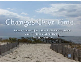
- 1. Changes Over Time Fourth Grade Project - Shields Elementary School! Cape Henlopen School District! Lewes, Delaware
- 2. Key Concepts Science - Land and Water ! •The flow of water and slope of the land affect erosion and depositon.! •Landforms, human activity and organisms can change the direction and flow of water.! Social Studies - Delaware History and Geography! •Use maps and other geo-graphics to interpret information about Delaware.! •Recognize •Describe regions of Delaware defined by physical factors! how a region can change over time.
- 3. Geography Standard One: Students will develop a personal geographic framework, or "mental map," and understand the uses of maps and other geo-graphics [MAPS]. Geography Standard Two: Students will develop a knowledge of the ways humans modify and respond to the natural environment [ENVIRONMENT].
- 4. Natural Transition •Constructing Drawing an aerial view a model stream table
- 7. Building Map Layers Community Experts! Teamwork! Analyzing Map Data
- 8. Using ArcExplorer •Importing Data Sets Analyzed Map Layers! Using the Pan and Zoom Setting map tips! Adding layer properties!
- 9. Analyzing our results Man vs Nature! Impacts on our geographical area! Examining our local watershed ! Stream study
- 10. Creating Data With ArcView
- 11. Watershed Analysis What is a watershed? ! A watershed is a specific land area that drains water into a river system or other body of water – elevation of the land determines this land area! Run ROBOCOW – http://www.agr.gc.ca/pfra/flash/robocow/en/robocow_e.htm!
- 12. Load local area map
- 13. Zoom into school area Shield’s Elementary School
- 14. Identify land use categories !
- 15. Examine creeks behind school
- 16. Create buffers in program
- 17. Community Projects What can we do to make a difference? Create awareness! GPS points along stream! Load into GIS! Cleanup! Planting to create natural buffers
- 18. GIS Resources all around us!
- 23. Lori Roe! Instructional Technology Specialist! Cape Henlopen School District! lori.Roe@cape.k12.de.us!