SlideShare una empresa de Scribd logo
1 de 266
Descargar para leer sin conexión
JICA GIS Training 2011 / Global Map


Power of NeoGeographer
     How to use map on the net?


      Taichi FURUHASHI
           (MAPconcierge Inc,)

                                           1
Today, I bring a new device
    for demonstration


                              2

                                  2
That name is

 “GigaPan”


               3

                   3
4

    4
I will explain about
this device in my presentation.


                                  5

                                      5
How to use map on the net?


                             6

                                 6
How to use map on the   net?


                               7

                                   7
the   net?


             8

                 8
digital


          9

              9
You are
  expert of GIS
in each countries.

                     10

                          10
You have
provider orientation
      thinking.

                   11

                        11
I want to explain about

user orientation
     thinking.

                          12

                               12
GIS Expert of JICA Alos4Amazon Project

                           President of MAPconcierge inc,

                           Researcher of CSIS, at the univ. of Tokyo.

                           Vise-President     of   OpenStreetMap foundation

                     japan

                           Director of OSGeo.JP foundation

                           Tech. Writer of GISNEXT Magazine

                           Evangelist of KML

                           Tree Climber


Taichi
@mapconcierge
           b y Ta i c h i F U R U H A S H I


                                                                              13
GIS Expert of JICA Alos4Amazon Project

                           President of MAPconcierge inc,

                           Researcher of CSIS, at the univ. of Tokyo.

                           Vise-President     of   OpenStreetMap foundation

                     japan

                           Director of OSGeo.JP foundation

                           Tech. Writer of GISNEXT Magazine

                           Evangelist of KML

                           Tree Climber


Taichi
@mapconcierge
           b y Ta i c h i F U R U H A S H I


                                                                              14
I’m a TreeClimber


       b y Ta i c h i F U R U H A S H I
                                          15

                                               15
Of course, I have

two licenses


        b y Ta i c h i F U R U H A S H I
                                           16

                                                16
Because,


  b y Ta i c h i F U R U H A S H I


                                     17
I        (we)

        have
        a TreeHouse
        in Japan.
        (made by ourself)


b y Ta i c h i F U R U H A S H I
                                   18

                                        18
That’s my hobby, but...


         b y Ta i c h i F U R U H A S H I


                                            19
It’s related
with the   Digital Map(GIS) tech.


                b y Ta i c h i F U R U H A S H I


                                                   20
It means...


   b y Ta i c h i F U R U H A S H I


                                      21
GIS can use
a lot of GeoSpatial Data

     as MODEL.


  We called   Feature.

              b y Ta i c h i F U R U H A S H I


                                                 22
You know,
“MODEL” is not “real”.


                                          ≒  Similar
                                                 but
                                            different
                                                                            From Wikipedia, the free encyclopedia
 From Wikipedia, the free encyclopedia


                                         b y Ta i c h i F U R U H A S H I


                                                                                                                    23
Every time
 we have to     compare
            between

 both information
using by   training data.

              b y Ta i c h i F U R U H A S H I


                                                 24
Field work is
very important for GIS tech.


            b y Ta i c h i F U R U H A S H I


                                               25
Agenda

     1: Project Haiti/sinsai.info

      2: Old/Neo Geographer

          3: Digital Earth

4: GIS forecast(UAV/Gigapan/GeoHex)


               b y Ta i c h i F U R U H A S H I


                                                  26
haiti / sinsai.info


                      27
12 Jan 2010


    by Taichi FURUHASHI


                          28
by Taichi FURUHASHI


                      29
We made
     high quality map
in   Haiti for a few days.


            by Taichi FURUHASHI


                                  30
How?


 by Taichi FURUHASHI


                       31
by Taichi FURUHASHI


                      32
Like the
wikipedia method!


       by Taichi FURUHASHI


                             33
GPS logging
by handyGPS


    by Taichi FURUHASHI


                          34
Draw map by paper.
And scan.


     by Taichi FURUHASHI


                           35
Digitizing
on Satellite images


    by Taichi FURUHASHI


                          36
"The OpenStreetMap community can               help the response

  by tracing Yahoo imagery and other data sources,....."
                        (13Jan2010)


                         by Taichi FURUHASHI


                                                                   37
OSM v.s. GoogleMaps v.s. YahooMap v.s. bing Map


There is no good map in Haiti.


                      by Taichi FURUHASHI


                                                    38
Start to making map!


on OSM community.


        by Taichi FURUHASHI


                              39
Before


 by Taichi FURUHASHI


                       40
After


by Taichi FURUHASHI


                      41
We plotted many    camp sites.


             by Taichi FURUHASHI


                                   42
How about
Google Maps ?


     by Taichi FURUHASHI


                           43
Google Maps


    by Taichi FURUHASHI


                          44
Low Quality.


    by Taichi FURUHASHI


                          45
And also,
we compare to


     by Taichi FURUHASHI


                           46
Google MapMaker


      by Taichi FURUHASHI


                            47
OpenStreetMap


     by Taichi FURUHASHI


                           48
ZOOM in!!


   by Taichi FURUHASHI


                         49
Google Maps


    by Taichi FURUHASHI


                          50
Google MapMaker


      by Taichi FURUHASHI


                            51
OpenStreetMap


     by Taichi FURUHASHI


                           52
Data quality and quantity
      are different.


           by Taichi FURUHASHI


                                 53
Why,
we could?


  by Taichi FURUHASHI


                        54
Some satellite image
companies provide
 to us, very quickly.


         by Taichi FURUHASHI


                               55
GeoEye   Resolution 40cm


                           56
QucikBird   Resolution 60cm


                              57
SPOT
Resolution 2m

                58
Of course,


   by Taichi FURUHASHI


                         59
ALOS   Resolution 2.5m


                         60
Those images
       are provided
with   Georeference
        meta data

           by Taichi FURUHASHI


                                 61
Collaborated with


JAXA and NIED

       by Taichi FURUHASHI


                             62
JAXA:
Japanese Space Org
    < Data Provider >


         by Taichi FURUHASHI


                               63
NIED:
  National research Institute
for Earth science and Disaster
          Prevention
    < Web GIS Server Hosting >


              by Taichi FURUHASHI


                                    64
That’s

   great
corroboration
    in Japan


      by Taichi FURUHASHI


                            65
JAXA → NIED → OSM
      by mapconcierge


                        66
Key Point is...


      by Taichi FURUHASHI


                            67
WMS
protocol


  by Taichi FURUHASHI


                        68
Others
                                                       (      OSM   )


      Potlatch                         JOSM
(OSM editor on WebBrowser)   (             OSM     )


                                 by mapconcierge


                                                                        69
We could

mashup to
many services


     by Taichi FURUHASHI


                           70
Especially,


 OSM can access to
Road lines as vector.


         by Taichi FURUHASHI


                               71
As a Result...


     by Taichi FURUHASHI


                           72
Support portal site used OSM data.


            by Taichi FURUHASHI


                                     73
Quick release as iPhone application


              by Taichi FURUHASHI


                                      74
Good point is,

  OpenStreetMap
has many experts
  for editing map


       by Taichi FURUHASHI


                             75
Over 100 people   includes japanese guys...

Mikel                                      Claudius Henrichs                             Axel von Matern
Harry Wood                                 pascal_n                                      MattD
Tim Waters                                 zvenzzon                                      David Fawcett
Simone Gadenz                              Dane Springmeyer                              torstiko
Mattia Giovannini                          Gianfra                                       Phono
Nicolas Chavent                            Dave Smith / DruidSmith                       Dankarran

                                                                                         tomoki
PB                                         Randal Hale
Andrew Turner                              Phil Shipley
Sam Larsen                                 Christopher Parker                            EdLoach
Robert Scott                               davespod                                      Seehundeführer
Esperanza
Adam Schreiber
                                           Mapconcierge                                  osmapb1
                                           Imapi                                         Flacus


ikiya
                                           Bikeman2000                                   Cohan
                                           Komяpa                                        Morten Jagd Christensen -
                                           XBear                                         Holly Glaser
                                           acdsig                                        Temporalista
Sergio Sevillano                           Divebalu                                      HB9DTX
Jeffrey Johnson                            StellanL                                      Andrew Allison
Jaakko Helleranta                          AssetBurned                                   Justin Houk
Andrzej Zaborowski                         Ceyockey                                      Luc Castera
FredB                                      Ævar Arnfjörð Bjarmason                       Michael Lane
harrierco                                  Ivansanchez                                   Mike Hogan
neuhausr                                   ALE!                                          David Runneals -
PaulY                                      Fabianos                                      Jarno Peschier -
Osbornec                                   Kevin                                         helmed,
Katie Filbert                              Julian                                        Boudewijn
Thea Clay                                  olvagor                                       Fil
Micha Ruh                                  Gubaer                                        Estela Llorente
SK53                                       UbuntuAcer                                    Kam
Jonas Krückel (John07)                     RatZillaS                                     Marc Schneider
Colin Marquardt                            Jean-Guilhem Cailton                          Rafa Gutierrez
Floris Looijesteijn                        clara                                         Samusz
AndyGates                                  steve8                                        Sean Bennett
Jean-Marc Liotier                          Gert Gremmen (cetest)                         Jarrattp
                                           Lübeck                                        Xapitoun
                                           sxpert                                        Pierre Beland


                          http://wiki.openstreetmap.org/wiki/WikiProject_Haiti/Who_is_helping


                                                          by Taichi FURUHASHI


                                                                                                                     76
Over 100 people   includes japanese guys...

Mikel                                      Claudius Henrichs                             Axel von Matern
Harry Wood                                 pascal_n                                      MattD
Tim Waters                                 zvenzzon                                      David Fawcett
Simone Gadenz                              Dane Springmeyer                              torstiko
Mattia Giovannini                          Gianfra                                       Phono
Nicolas Chavent                            Dave Smith / DruidSmith                       Dankarran

                                                                                         tomoki
PB                                         Randal Hale
Andrew Turner                              Phil Shipley
Sam Larsen                                 Christopher Parker                            EdLoach
Robert Scott                               davespod                                      Seehundeführer
Esperanza
Adam Schreiber
                                           Mapconcierge                                  osmapb1
                                           Imapi                                         Flacus


ikiya
                                           Bikeman2000                                   Cohan
                                           Komяpa                                        Morten Jagd Christensen -
                                           XBear                                         Holly Glaser
                                           acdsig                                        Temporalista
Sergio Sevillano                           Divebalu                                      HB9DTX
Jeffrey Johnson                            StellanL                                      Andrew Allison
Jaakko Helleranta                          AssetBurned                                   Justin Houk
Andrzej Zaborowski                         Ceyockey                                      Luc Castera
FredB                                      Ævar Arnfjörð Bjarmason                       Michael Lane
harrierco                                  Ivansanchez                                   Mike Hogan
neuhausr                                   ALE!                                          David Runneals -
PaulY                                      Fabianos                                      Jarno Peschier -
Osbornec                                   Kevin                                         helmed,
Katie Filbert                              Julian                                        Boudewijn
Thea Clay                                  olvagor                                       Fil
Micha Ruh                                  Gubaer                                        Estela Llorente
SK53                                       UbuntuAcer                                    Kam
Jonas Krückel (John07)                     RatZillaS                                     Marc Schneider
Colin Marquardt                            Jean-Guilhem Cailton                          Rafa Gutierrez
Floris Looijesteijn                        clara                                         Samusz
AndyGates                                  steve8                                        Sean Bennett
Jean-Marc Liotier                          Gert Gremmen (cetest)                         Jarrattp
                                           Lübeck                                        Xapitoun
                                           sxpert                                        Pierre Beland


                          http://wiki.openstreetmap.org/wiki/WikiProject_Haiti/Who_is_helping


                                                          by Taichi FURUHASHI


                                                                                                                     77
Actually,
over 300 or 400 users
       joined.

        Maybe...


         by Taichi FURUHASHI


                               78
I found
 this thing
in that experience.


       by Taichi FURUHASHI


                             79
Time difference


      by Taichi FURUHASHI


                            80
Usually,

Demerit.


   by Taichi FURUHASHI


                         81
But, NeoGeographer
    can connect
    in the world


       by Taichi FURUHASHI


                             82
It means

24hours editing.

      by Taichi FURUHASHI


                            83
That’s
Strong Point!!


     by Taichi FURUHASHI


                           84
In addition,


    by Taichi FURUHASHI


                          85
Tim. J Berners-Lee
      talked at


       by Taichi FURUHASHI


                             86
He said...


  by Taichi FURUHASHI


                        87
Raw Data Now!
OpenData will change the world


            by Taichi FURUHASHI


                                  88
Yes we can!


   by Taichi FURUHASHI


                         89
This is
NeoGeographer’s power


         by Taichi FURUHASHI


                               90
Crisis Mapping

Map   Crowd source
          UGC/CGM


       by mapconcierge


                         91
Google Maps/Earth Release in 2005


              by mapconcierge


                                    92
Finding Dr. Jim Gray in 2007


            by mapconcierge


                               93
Google MyMap since 2007


         by mapconcierge


                           94
by mapconcierge


                  95
2008
                  Kenya


by mapconcierge


                          96
Mexico


http://www.cuidemoselvoto.org/

                             by mapconcierge


                                               97
http://www.cuidemoselvoto.org/

                       by mapconcierge


                                         98
Washington


http://snowmageddoncleanup.com/

                                  by mapconcierge


                                                    99
2010 haiti


   by mapconcierge


                     100
2010 Chile


   by mapconcierge


                     101
by mapconcierge


                  102
2011 / NZ


   by mapconcierge


                     103
2011 / Libya


http://libyacrisismap.net/   by mapconcierge


                                               104
2 0 1 1


3/11

 by mapconcierge


                   105
by mapconcierge


                  106
sinsai.info Staff
Open Street Map Foundation Japan (NPO)


over 15 (Amazon,Yahoo, NTT, NTT Data, etc..)
                          by mapconcierge


                                               107
by mapconcierge


                  108
sample report


    by mapconcierge


                      109
We add on map


     by mapconcierge


                       110
sinsai.info work flow


        by mapconcierge


                          111
sinsai.info Result

•        10,000+

•1,000,000+ PV /
•650,000+
•500,000+
•
                   by mapconcierge


                                     112
sinsai.info joint to others
           by mapconcierge


                              113
Report
                               Report
                                               Report        Report
API


                 Crisis Mapping
                                                                         Map Trace


                                                             Map Donation
 GPS
                         UAV
      Gigapan                                A lot of Satellite images
                                  by mapconcierge


                                                                                     114
Old / Neo Geographer
           Next Generation of
                 GIS engineer


                                115
NEOGeographer
OLDGeographer

     b y Ta i c h i F U R U H A S H I


                                        116
What’s different?


       b y Ta i c h i F U R U H A S H I


                                          117
I was

OLDGeographer
   6 years ago.
       b y Ta i c h i F U R U H A S H I


                                          118
OLD                                                NEO
            Geographer                                    Geographer


Cartographer                                                   Hobby use
Surveyor                                                       Google Maps API
Scientist                                                      MashUp
Government                                                     UGC/CGM
Forester                                                       Social Network
              and more...                                                  and more...


                            b y Ta i c h i F U R U H A S H I


                                                                                         119
In 2005
Threshold


   b y Ta i c h i F U R U H A S H I


                                      120
b y Ta i c h i F U R U H A S H I
                                   121

                                         121
OLD                                            NEO
        Geographer                                Geographer


Before Google-Geo                              After Google-Geo
                                                                  Year


      2004     2005                   2006              2007


                     b y Ta i c h i F U R U H A S H I


                                                                         122
OLD                                              NEO
     Geographer                                  Geographer


SHP, MIF, GeoTIFF                       XML, DB, API
                                                              Year


   2004     2005                     2006              2007


                    b y Ta i c h i F U R U H A S H I


                                                                     123
Change to
NEOGeographer !


      b y Ta i c h i F U R U H A S H I


                                         124
OLD                                             NEO
              Geographer                                 Geographer

                                                                             Result
SHP                 SHP                                                    as Table
                                                                                       SHP
         Process                                                                         KML
                                                                     SQL                    GIS
                                                                                         Clients
GeoTIFF             GeoTIFF                                                WKT
                                                                    DB     WKTraster
          Process


      File orientation                                           API/DB orientation

                              b y Ta i c h i F U R U H A S H I


                                                                                                   125
b y Ta i c h i F U R U H A S H I
                                   126

                                         126
b y Ta i c h i F U R U H A S H I
                                   127

                                         127
“Digital Earth Browser”
means View/Share software by
             virtual globe.
  Those software delivers an easy-to-use way to
  view and share information geographically.


                                                  128
“Digital Earth” Keyword
      appeared since 2004.


              Google Earth v3
World Wind,
 Keyhole                        Google Earth v4


                  By http://www.google.com/trends (2007/11/30)


                                                                 129
“Digital Earth”

What is this?


                    130
131
Digital Earth


                132
133
“Digital Earth Browser” is
   not “web browser”.
   By Michael T. Jones(Google)


                                 134
Digital Earth Browser
            and Web Browser
   Digital Earth Browser                             Web Browser


                                                           Google (c) 2007
             Google (c) 2007


                               KML               HTML

Digital Earth Browser can access many spatial information(KML) in all over the
world. Like the Web Browser with HTML.

                                                                                 135
Major Digital Earth
                               Browsers
   Google Earth                    World Wind                        ArcGIS Explorer
(Google, since2005)             (NASA, since 2004)                     (ESRI, since
                                                                          2006)


         Google (c) 2007                   NASA (c) 2007                    ESRI (c) 2007


  http://earth.google.com/     http://worldwind.arc.nasa.gov   http://www.esri.com/software/arcgis/
                                                                            explorer/

All applications are provided as Free. And, Those
software can mapping a lot of satellite / airphoto
images all over the world as Free too.

                                                                                                      136
Characteristic
      of    KML
       Keyhole Markup Language


• Open format on the net.
• XML
• Zip Compression available
• Network Connectivity
• Multiply Data Type
• Time Stamp / Time Span

                                 137
KML Sample

<?xml version="1.0" encoding="UTF-8"?>
<kml xmlns="http://earth.google.com/kml/2.1">
<Folder>

          <name>cafe</name>

          <description><![CDATA[Created with <a href="http://sketchup.google.com/">Google
SketchUp 6.0.312</a>]]></description>

          <LookAt>

          
          <longitude>139.9366077796045</longitude>

          
          <latitude>35.90168740874968</latitude>

          
          <altitude>17.41304574400348</altitude>

          
          <range>104.3070304725559</range>

          
          <tilt>80.4794</tilt>

          
          <heading>141.932</heading>

          </LookAt>

          <Folder>

          
          <name>Tour</name>

          
          <Placemark>


          <name>Camera</name>


          <LookAt>


         <longitude>139.9366077796045</longitude>


         <latitude>35.90168740874968</latitude>


                                                                                             138
Data Type
    in KML
• Point
• Line
• Polygon (include Donuts Polygon)
• Image (Ground/Screen/Photo)
• 3D Object (with Texture, COLLADA)


                                      139
Line


               Polygon


       Point


                         140
3D
       Object


Line


                141
Image (Screen)


        Image (Ground)


                         142
Image (Ground)


Image (Screen)


                                  143
3D Object with Texture


                         144
Polygon with attributes
              and TimeScale


Image (Screen)


                                    145
Digital Earth
      Browser
• Low cost (almost free)
• No border (using by Lat/Lon coordinates)
• Free reference data set (Satellite/
 Airphoto)

• Multi data type (with Texture, COLLADA)
• Key data format is ”KML”


                                             146
OpenSource


    b y Ta i c h i F U R U H A S H I


                                       147
b y Ta i c h i F U R U H A S H I


                                   148
FOSS4G Tools relation map 2010

     uDig                 GeoServer                PostGIS     Spatialite                GRASS
                                                                                  QGIS

            Desktop
                                                                                                                                        OpenLayers

                                                   MappingServer        Geo Data Base    Desktop           MappingServer


                                                                                                                           Library
OpenGeoSuite

                                                         FOSS4G Tools
                                                                                                                                          OGR
                            Statistics
                                                                                                                                          FDO
   R Project Foundation
                                                                                                                                          GEOS
                                      Catalog
                                                                                                                                          PROJ4

                                                OpenStandard                GPS


               TC211

                                                                                                                                     Google Chrome OS


                                 GML
                                                                                                   Google Earth
                                                                                                                                        Android


                                                                                                                                                     149
Licenses

   b y Ta i c h i F U R U H A S H I


                                      150
b y Ta i c h i F U R U H A S H I


                                   151
There are

many type of licenses.


         b y Ta i c h i F U R U H A S H I


                                            152
License
Copy
Right                                                                                                FREE


             CC-by-NC-ND   CC-by-ND   CC-by-NC-SA                 CC-by-SA        CC-by-NC   CC-by


All Rights                                                                                           Public
Reserved                                                                                             Domain


                                               b y Ta i c h i F U R U H A S H I
                                                                                                              153

                                                                                                                    153
License
Copy
Right                                                                                                FREE


             CC-by-NC-ND   CC-by-ND   CC-by-NC-SA                 CC-by-SA        CC-by-NC   CC-by


All Rights                                                                                           Public
Reserved                                                                                             Domain


                                                                 mytext

                                               b y Ta i c h i F U R U H A S H I
                                                                                                              154

                                                                                                                    154
But, Geospatial data
has weak point of License


          b y Ta i c h i F U R U H A S H I


                                             155
Because,


  b y Ta i c h i F U R U H A S H I


                                     156
“GIS Tech.”

  like a   “Bridge” between
the   ITworld and the Realworld.


                b y Ta i c h i F U R U H A S H I


                                                   157
“GeoSpatial data”
made by “real data”.


                                         ≒
                                                                           From Wikipedia, the free encyclopedia
From Wikipedia, the free encyclopedia


                                        b y Ta i c h i F U R U H A S H I


                                                                                                                   158
It is not creative.
Just “fact                   data”.


        b y Ta i c h i F U R U H A S H I


                                           159
We called

“CC0”
Creative Commons Zero


       b y Ta i c h i F U R U H A S H I


                                          160
http://   goo.gl/Y8aH
            b y Ta i c h i F U R U H A S H I


                                               161
If you want to define
as license for spatial data,
       ex. you can choice to


  “ODbL”
     Open Database License


              b y Ta i c h i F U R U H A S H I


                                                 162
Open Data Commons


       b y Ta i c h i F U R U H A S H I


                                          163
OpenSource
   and
 FOSS4G


    b y Ta i c h i F U R U H A S H I


                                       164
About OSGeo


    b y Ta i c h i F U R U H A S H I


                                       165
What’s
OSGeo
  b y Ta i c h i F U R U H A S H I


                                     166
is
   supporter
for OpenSource
Geo Community

     b y Ta i c h i F U R U H A S H I


                                        167
is
   supporter
for OpenSource
Geo Community

     b y Ta i c h i F U R U H A S H I


                                        168
Geo

GeoSpatial Information


         b y Ta i c h i F U R U H A S H I


                                            169
Like the


 b y Ta i c h i F U R U H A S H I


                                    170
yes,
but little different.


       b y Ta i c h i F U R U H A S H I


                                          171
GoogleMaps is                            Free

but   not Open


       ≠                                  Open


       b y Ta i c h i F U R U H A S H I


                                                 172
Please click license at lower left.


              b y Ta i c h i F U R U H A S H I


                                                 173
Let’s read license of Google


          b y Ta i c h i F U R U H A S H I


                                             174
Google Maps

    can’t

use for print.


     b y Ta i c h i F U R U H A S H I


                                        175
We want to make
    Mapping Service
 like the Google Maps
based on OpenSource.


        b y Ta i c h i F U R U H A S H I


                                           176
That’s OSGeo!


   b y Ta i c h i F U R U H A S H I


                                      177
main streams


 OpenSource

OpenStandard

OpenContents

    b y Ta i c h i F U R U H A S H I


                                       178
Example

        Is there

  JavaScript library
like the Google Maps API?


          b y Ta i c h i F U R U H A S H I


                                             179
Yes we can!


          Google Maps API like
           JavaScript Library


   b y Ta i c h i F U R U H A S H I


                                      180
Example

        Is there

Mapping Server product
  like the Google Maps?


          b y Ta i c h i F U R U H A S H I


                                             181
Yes we can!


       WEB mapping
       Server


   b y Ta i c h i F U R U H A S H I


                                      182
Yes we can!


Mapguide OpenSource   WEB mapping
                      Server


                      b y Ta i c h i F U R U H A S H I


                                                         183
Yes we can!


       WEB mapping
       Server


   b y Ta i c h i F U R U H A S H I


                                      184
Example

          Is there

Database for Geospatial
      like the Oralce?


           b y Ta i c h i F U R U H A S H I


                                              185
Yes we can!


Geospatial Database


           b y Ta i c h i F U R U H A S H I


                                              186
Example

    Is there

Desktop GIS
like the ArcGIS?


     b y Ta i c h i F U R U H A S H I


                                        187
Yes we can!


               Standalone GIS

Q-GIS
        b y Ta i c h i F U R U H A S H I


                                           188
There are
  a lot of

Geo Tools


   b y Ta i c h i F U R U H A S H I


                                      189
FOSS4G Tool
Free   Open Source Software for Geospatial


                                                        and more…


                     b y Ta i c h i F U R U H A S H I


                                                                    190
Most popular
  Service
   using by
FOSS4G tools


     b y Ta i c h i F U R U H A S H I


                                        191
b y Ta i c h i F U R U H A S H I


                                   192
Open Contents

Commercial use OK
   2nd use OK


       b y Ta i c h i F U R U H A S H I


                                          193
Tokyo in 2009
         b y Ta i c h i F U R U H A S H I


                                            194
Hanno city in 2009
         b y Ta i c h i F U R U H A S H I


                                            195
Components
OpenLayers
Post-GIS
PostgreSQL
PHP5
Drupal6


             b y Ta i c h i F U R U H A S H I


                                                196
OpenSource
Geo Tools
  are growing...


      b y Ta i c h i F U R U H A S H I


                                         197
And
 We should share

FOSS4G                                   info.

on Conference.


      b y Ta i c h i F U R U H A S H I


                                                 198
That’s
FOSS4G
Conference


                                            OSGeo.JP
OSGeo


         b y Ta i c h i F U R U H A S H I


                                                       199
Sponsor of OSGeo


      b y Ta i c h i F U R U H A S H I


                                         200
If you want more details...


      OSGeo                                  Search


          b y Ta i c h i F U R U H A S H I


                                                      201
NEOGeographer

   Activity

      b y Ta i c h i F U R U H A S H I


                                         202
I love
OpenSource GIS
   (FOSS4G)


      b y Ta i c h i F U R U H A S H I


                                         203
b y Ta i c h i F U R U H A S H I
                                   204

                                         204
ESRI
  v.s
FOSS4G?

  b y Ta i c h i F U R U H A S H I


                                     205
ESRI
  v.s
FOSS4G?

  b y Ta i c h i F U R U H A S H I


                                     206
InteDevelopment Strategy
                    Functions
  201x


                                           2010
  2009


Proprietary Projects            FOSS4GProjects
                                             207

                                                   207
one more thing...


       b y Ta i c h i F U R U H A S H I


                                          208
GSI(GeoSpatial Information Authority of Japan)


                                                              FOSS4
cyberjapan
MappingSystem
                                                            cyberjapan
                                                            MappingSystem


                         b y Ta i c h i F U R U H A S H I


                                                                            209
GSI(GeoSpatial Information Authority of Japan)


                                                              FOSS4
cyberjapan
MappingSystem
                                                            cyberjapan
                                                            MappingSystem


                         b y Ta i c h i F U R U H A S H I


                                                                            210
OpenGov

  b y Ta i c h i F U R U H A S H I


                                     211
GIS forecast


               212
iPhone/Android
 with GIS


                         (http://www.apple.com)
        Apple (c) 2007


                                              213
by Alos4Amazon Project


                         214
for Geo tools on Google


Google Maps   Google Earth             Google SketchUp


              by Alos4Amazon Project


                                                         215
by Alos4Amazon Project


                         216
by Alos4Amazon Project


                         217
by Alos4Amazon Project


                         218
by Alos4Amazon Project


                         219
by Alos4Amazon Project


                         220
by Alos4Amazon Project


                         221
by Alos4Amazon Project


                         222
by Alos4Amazon Project


                         223
by Alos4Amazon Project


                         224
by Alos4Amazon Project


                         225
by Alos4Amazon Project


                         226
by Alos4Amazon Project


                         227
by Alos4Amazon Project


                         228
Simulation Story
                    How to use Android for your field work.
                     Deforestation Polygon: Made by PALSAR Viewer by manipulation as KML-Polygon.

                      ALOS-image: Made by PALSAR Viewer from ALOS-PALSAR as KML-GroundOverlay.

                     BackGround: Made by WMS from InteliGeo/Siscom as Cache.


                                                                      Before field
                                                                                                         PalserViewer
    KML/WMS
     Viewer                                                                               Polygon


                                                                                       GroundOverlay


          WMC


   GPS Tracker                                                                                          InteliGeo/Siscom


                           KM
                             L, G
                                  PX,
                                      and
                                                   SHP/GPX
                                          mo
        My Tracks                           re..                         Spatial
                                                                           DB

       Photo
                           X, Y, Z, D
                                                                                                         SHP
                                     irection
                                                       +Exif
                                                                          Spatialite

Camera with GeoTAG(Exif)                                                               SQL

Field                                                                                                  Office
                                                                      After field


                                                                 by Alos4Amazon Project


                                                                                                                           229
One Laptop
                    per Child
The mission of the OLPC Project is to develop a low-cost laptop(about $100) to revolutionize how to
educate the world's children. Goal is to provide children around the world with new opportunities to
explore, experiment, and express themselves.
Why do children in developing nations need laptops? Laptops are a window and a tool: a window into the
world and a tool with which to think. They are a wonderful way for all children to learn learning through
independent interaction and exploration.
OLPC espouses five core principles: (1) child ownership; (2) low ages; (3) saturation; (4) connection;
and (5) free and open source.
If all laptop has include the GIS application, they will become to good geo-spatial contents providers.


                                              OLPC (c) 2007
                                                                             http://www.laptop.org/

                                                                                                            230
MAP of OLPC


                                            OLPC (c) 2007


those countries we plan to pilot
those countries we plan to include in the post-launch phase
those countries who have expressed interest at the Ministry-of-Education level or higher
those countries who are currently seeking government support


                                                                                           231
The Green WiFi Mission
           http://www.green-wifi.org/
Green WiFi is committed to providing solar powered access to global
information and educational resources for developing regions and
K-12 school children striving for knowledge in a digitally divided
world. There are approximately 3 billion people under the age of 15
living in developing nations. 42 percent of the developing world's
population is below the age of 15. Green WiFi was founded on the
principle that the welfare of our world is dependent, in large part, on
providing these children with free and open access to the world's
information.


           Green WiFi (c) 2007


                                                                          232
GNSS   Global Navigation
Satellite System
                    Now, some GNSS
                    services provided by
                    U.S. , Russia, EU and
                    China. And Japan will
                    lunch the Quasi-Zenith
                    Satellites for GPS System.
                    We will be able to use a
                    more highly accurate
                    location information.


                                                 233
UAV
Unmanned aerial vehicle


                          234
by mapconcierge


                  235
(c) www.physorg.com


                      by mapconcierge


                                        236
http://www.youtube.com/watch?v=Fw8CqIwVa44


                 by mapconcierge


                                             237
by mapconcierge


                  238
by mapconcierge


                  239
by mapconcierge   2010.08.13, Gizmode Japan

                                              240
1st May, 2011
                                       Akahama area in Ohtsuchi, IWATE


                                                 CC-by-SA by mapconcierge


CC-by-SA by mapconcierge


                           by mapconcierge


                                                                            241
UAV at Akahama area in Ohtsuchi, IWATE. 1st May, 2011


                              CC-by-SA by mapconcierge


                              by mapconcierge


                                                         242
Tsunami destroyed
Akahama area.


                                      CC-by-SA by
                                      Univ.of Tokyo/ISTS/Bizworks/MAPconcierge


                    by mapconcierge


                                                                             243
The university of Tokyo, International ocean research center.


CC-by-SA by Univ.of Tokyo/ISTS/Bizworks/MAPconcierge   by mapconcierge


                                                                         244
A ship on the house.


                 CC-by-SA by Univ.of Tokyo / ISTS / Bizworks / MAPconcierge


                                      by mapconcierge


                                                                              245
CC-by-SA by
                  Univ.of Tokyo/ISTS/Bizworks/MAPconcierge


                  OrthoRectified
                  Mosaic data


by mapconcierge


                                                             246
Gigapan
360 panorama camera


                      247
248
G pixels


           =
1,000,000,000

           =
General DigitalCamera   x 100


                                249
250
251
252
253
254
255
Midtown in Ohtsuchi, IWATE


                                               CC-by-SA by Kaoru Saito

                             by mapconcierge


                                                                         256
View on Google Earth using by KML PhotoOverlay data


                             CC-by-SA by mapconcierge


                               by mapconcierge


                                                        257
Office of volunteer center in Tohno, IWATE(magokoronet)


                          CC-by-SA by Taichi


                            by mapconcierge


                                                          258
GigaPan can take


                   CC-by-SA by Taichi


                   by mapconcierge


                                        259
MapData
            OpenStreetMap


Panorama/StreetView                     Aerial Photo
    Gigapan                                UAV

                      by mapconcierge


                                                       260
Information Crawler


       by mapconcierge
                         261

                               261
Information Scooter


       by mapconcierge
                         262

                               262
by mapconcierge
                  263

                        263
NEOGeographer


     b y Ta i c h i F U R U H A S H I


                                        264
www.slideshare.net/
  mapconcierge


     @mapconcierge
       by mapconcierge


                         265
Together for the Earth !!


        @mapconcierge
          by mapconcierge


                            266

Más contenido relacionado

Destacado

Crisis Mapping Workshop @aoyamagakuinuniv
Crisis Mapping Workshop @aoyamagakuinunivCrisis Mapping Workshop @aoyamagakuinuniv
Crisis Mapping Workshop @aoyamagakuinunivTaichi Furuhashi
 
20110808 日本国際地図学会
20110808 日本国際地図学会20110808 日本国際地図学会
20110808 日本国際地図学会Taichi Furuhashi
 
20150303 Japan-Brazil Seminar by MAPconcierge
20150303 Japan-Brazil Seminar by MAPconcierge20150303 Japan-Brazil Seminar by MAPconcierge
20150303 Japan-Brazil Seminar by MAPconciergeTaichi Furuhashi
 
How tomakebuildingdataonosm
How tomakebuildingdataonosmHow tomakebuildingdataonosm
How tomakebuildingdataonosmTaichi Furuhashi
 
20150901 Keynote by MAPconcierge @ SotM Asia 2015 Jakarta
20150901 Keynote by MAPconcierge @ SotM Asia 2015 Jakarta 20150901 Keynote by MAPconcierge @ SotM Asia 2015 Jakarta
20150901 Keynote by MAPconcierge @ SotM Asia 2015 Jakarta Taichi Furuhashi
 
20130605 環境情報学実習 Nenv x OpenStreetMap
20130605 環境情報学実習 Nenv x OpenStreetMap20130605 環境情報学実習 Nenv x OpenStreetMap
20130605 環境情報学実習 Nenv x OpenStreetMapTaichi Furuhashi
 
20110520 gis上級技術者会議 PDF版
20110520 gis上級技術者会議 PDF版20110520 gis上級技術者会議 PDF版
20110520 gis上級技術者会議 PDF版Taichi Furuhashi
 
20110527 埼玉県GIS普及推進研究会
20110527 埼玉県GIS普及推進研究会20110527 埼玉県GIS普及推進研究会
20110527 埼玉県GIS普及推進研究会Taichi Furuhashi
 
FOSS4G Tokyo: SotM 2012 Tokyo 開催報告
FOSS4G Tokyo: SotM 2012 Tokyo 開催報告FOSS4G Tokyo: SotM 2012 Tokyo 開催報告
FOSS4G Tokyo: SotM 2012 Tokyo 開催報告Taichi Furuhashi
 
NENV Design Studio 2014 C - Gym.こもれび
NENV Design Studio 2014 C - Gym.こもれびNENV Design Studio 2014 C - Gym.こもれび
NENV Design Studio 2014 C - Gym.こもれびTaichi Furuhashi
 
20150709 青学 空間情報システム入門i_0709
20150709 青学 空間情報システム入門i_070920150709 青学 空間情報システム入門i_0709
20150709 青学 空間情報システム入門i_0709Taichi Furuhashi
 
20110627 横浜市立大学 李さん
20110627 横浜市立大学 李さん20110627 横浜市立大学 李さん
20110627 横浜市立大学 李さんTaichi Furuhashi
 
20160110 中崎町マッピングパーティー
20160110 中崎町マッピングパーティー20160110 中崎町マッピングパーティー
20160110 中崎町マッピングパーティーTaichi Furuhashi
 
Open Street Map4 National Park Eng
Open Street Map4 National Park EngOpen Street Map4 National Park Eng
Open Street Map4 National Park EngTaichi Furuhashi
 
2014 07-26 おがくずトイレくん
2014 07-26 おがくずトイレくん2014 07-26 おがくずトイレくん
2014 07-26 おがくずトイレくんTaichi Furuhashi
 
Sinsaiinfo4techlionAsKeynote
Sinsaiinfo4techlionAsKeynoteSinsaiinfo4techlionAsKeynote
Sinsaiinfo4techlionAsKeynoteTaichi Furuhashi
 
State of the OSM @ G-SPASE, 20150614
State of the OSM @ G-SPASE, 20150614State of the OSM @ G-SPASE, 20150614
State of the OSM @ G-SPASE, 20150614Taichi Furuhashi
 

Destacado (20)

Crisis Mapping Workshop @aoyamagakuinuniv
Crisis Mapping Workshop @aoyamagakuinunivCrisis Mapping Workshop @aoyamagakuinuniv
Crisis Mapping Workshop @aoyamagakuinuniv
 
20110808 日本国際地図学会
20110808 日本国際地図学会20110808 日本国際地図学会
20110808 日本国際地図学会
 
Jica global map_small
Jica global map_smallJica global map_small
Jica global map_small
 
20150303 Japan-Brazil Seminar by MAPconcierge
20150303 Japan-Brazil Seminar by MAPconcierge20150303 Japan-Brazil Seminar by MAPconcierge
20150303 Japan-Brazil Seminar by MAPconcierge
 
How tomakebuildingdataonosm
How tomakebuildingdataonosmHow tomakebuildingdataonosm
How tomakebuildingdataonosm
 
20150901 Keynote by MAPconcierge @ SotM Asia 2015 Jakarta
20150901 Keynote by MAPconcierge @ SotM Asia 2015 Jakarta 20150901 Keynote by MAPconcierge @ SotM Asia 2015 Jakarta
20150901 Keynote by MAPconcierge @ SotM Asia 2015 Jakarta
 
20130605 環境情報学実習 Nenv x OpenStreetMap
20130605 環境情報学実習 Nenv x OpenStreetMap20130605 環境情報学実習 Nenv x OpenStreetMap
20130605 環境情報学実習 Nenv x OpenStreetMap
 
20110520 gis上級技術者会議 PDF版
20110520 gis上級技術者会議 PDF版20110520 gis上級技術者会議 PDF版
20110520 gis上級技術者会議 PDF版
 
20110527 埼玉県GIS普及推進研究会
20110527 埼玉県GIS普及推進研究会20110527 埼玉県GIS普及推進研究会
20110527 埼玉県GIS普及推進研究会
 
FOSS4G Tokyo: SotM 2012 Tokyo 開催報告
FOSS4G Tokyo: SotM 2012 Tokyo 開催報告FOSS4G Tokyo: SotM 2012 Tokyo 開催報告
FOSS4G Tokyo: SotM 2012 Tokyo 開催報告
 
NENV Design Studio 2014 C - Gym.こもれび
NENV Design Studio 2014 C - Gym.こもれびNENV Design Studio 2014 C - Gym.こもれび
NENV Design Studio 2014 C - Gym.こもれび
 
20150709 青学 空間情報システム入門i_0709
20150709 青学 空間情報システム入門i_070920150709 青学 空間情報システム入門i_0709
20150709 青学 空間情報システム入門i_0709
 
惑星茶碗 V5
惑星茶碗 V5惑星茶碗 V5
惑星茶碗 V5
 
20110627 横浜市立大学 李さん
20110627 横浜市立大学 李さん20110627 横浜市立大学 李さん
20110627 横浜市立大学 李さん
 
Sinsaiinfo4UNforum
Sinsaiinfo4UNforumSinsaiinfo4UNforum
Sinsaiinfo4UNforum
 
20160110 中崎町マッピングパーティー
20160110 中崎町マッピングパーティー20160110 中崎町マッピングパーティー
20160110 中崎町マッピングパーティー
 
Open Street Map4 National Park Eng
Open Street Map4 National Park EngOpen Street Map4 National Park Eng
Open Street Map4 National Park Eng
 
2014 07-26 おがくずトイレくん
2014 07-26 おがくずトイレくん2014 07-26 おがくずトイレくん
2014 07-26 おがくずトイレくん
 
Sinsaiinfo4techlionAsKeynote
Sinsaiinfo4techlionAsKeynoteSinsaiinfo4techlionAsKeynote
Sinsaiinfo4techlionAsKeynote
 
State of the OSM @ G-SPASE, 20150614
State of the OSM @ G-SPASE, 20150614State of the OSM @ G-SPASE, 20150614
State of the OSM @ G-SPASE, 20150614
 

Similar a 20110725 Jica global map

JICA Training 2018, Power of NeoGeographer
JICA Training 2018, Power of NeoGeographerJICA Training 2018, Power of NeoGeographer
JICA Training 2018, Power of NeoGeographerTaichi Furuhashi
 
6 Stories of Maps and FOSS4G Korea
6 Stories of Maps and FOSS4G Korea6 Stories of Maps and FOSS4G Korea
6 Stories of Maps and FOSS4G KoreaSANGHEE SHIN
 
Intro to OpenStreetMap- UC Merced 4.22.09
Intro to OpenStreetMap- UC Merced 4.22.09Intro to OpenStreetMap- UC Merced 4.22.09
Intro to OpenStreetMap- UC Merced 4.22.09Sarah_Manley
 
20150430 HOTsummit 2015 mapconcierge
20150430 HOTsummit 2015 mapconcierge20150430 HOTsummit 2015 mapconcierge
20150430 HOTsummit 2015 mapconciergeTaichi Furuhashi
 
Activities of CrisisMappers Japan with Japanese students.
Activities of CrisisMappers Japan with Japanese students.Activities of CrisisMappers Japan with Japanese students.
Activities of CrisisMappers Japan with Japanese students.BeGood Cafe -NGO-
 
20110615 東京理科大学 建築学科「都市解析基礎」
20110615 東京理科大学 建築学科「都市解析基礎」20110615 東京理科大学 建築学科「都市解析基礎」
20110615 東京理科大学 建築学科「都市解析基礎」Taichi Furuhashi
 
20110520 gis上級技術者会議
20110520 gis上級技術者会議20110520 gis上級技術者会議
20110520 gis上級技術者会議Taichi Furuhashi
 
An introduction to OpenStreetMap (HUMBUG)
An introduction to OpenStreetMap (HUMBUG)An introduction to OpenStreetMap (HUMBUG)
An introduction to OpenStreetMap (HUMBUG)dbdean
 
20110527 埼玉県GIS普及推進研究会 資料 PDF版
20110527 埼玉県GIS普及推進研究会 資料 PDF版20110527 埼玉県GIS普及推進研究会 資料 PDF版
20110527 埼玉県GIS普及推進研究会 資料 PDF版Taichi Furuhashi
 
An Introduction to OpenStreetMap (UQ GIS Students)
An Introduction to OpenStreetMap (UQ GIS Students)An Introduction to OpenStreetMap (UQ GIS Students)
An Introduction to OpenStreetMap (UQ GIS Students)dbdean
 
Stanford Presentation to GISSIG
Stanford Presentation to GISSIGStanford Presentation to GISSIG
Stanford Presentation to GISSIGSarah_Manley
 
20130606 ISTS mapconcierge "Space/Geo x Innovation"
20130606 ISTS mapconcierge "Space/Geo x Innovation"20130606 ISTS mapconcierge "Space/Geo x Innovation"
20130606 ISTS mapconcierge "Space/Geo x Innovation"Taichi Furuhashi
 
070928 Collaborative Geospatial Mapping And Data Authorization
070928 Collaborative Geospatial Mapping And Data Authorization070928 Collaborative Geospatial Mapping And Data Authorization
070928 Collaborative Geospatial Mapping And Data Authorizationandrea huang
 
20140913 visions resilience forum
20140913 visions resilience forum20140913 visions resilience forum
20140913 visions resilience forumTaichi Furuhashi
 
ABCD-GIS_Seto_harvardCGA
ABCD-GIS_Seto_harvardCGAABCD-GIS_Seto_harvardCGA
ABCD-GIS_Seto_harvardCGAToshikazu Seto
 
20110712 国土交通大学校 地理空間情報活用〔産官学連携〕研修
20110712 国土交通大学校  地理空間情報活用〔産官学連携〕研修20110712 国土交通大学校  地理空間情報活用〔産官学連携〕研修
20110712 国土交通大学校 地理空間情報活用〔産官学連携〕研修Taichi Furuhashi
 
Web Mapping with Drupal
Web Mapping with DrupalWeb Mapping with Drupal
Web Mapping with DrupalRanel Padon
 

Similar a 20110725 Jica global map (20)

20131109 SotM Taiwan 2013
20131109 SotM Taiwan 201320131109 SotM Taiwan 2013
20131109 SotM Taiwan 2013
 
JICA Training 2018, Power of NeoGeographer
JICA Training 2018, Power of NeoGeographerJICA Training 2018, Power of NeoGeographer
JICA Training 2018, Power of NeoGeographer
 
6 Stories of Maps and FOSS4G Korea
6 Stories of Maps and FOSS4G Korea6 Stories of Maps and FOSS4G Korea
6 Stories of Maps and FOSS4G Korea
 
20130806 igu
20130806 igu20130806 igu
20130806 igu
 
Intro to OpenStreetMap- UC Merced 4.22.09
Intro to OpenStreetMap- UC Merced 4.22.09Intro to OpenStreetMap- UC Merced 4.22.09
Intro to OpenStreetMap- UC Merced 4.22.09
 
20150430 HOTsummit 2015 mapconcierge
20150430 HOTsummit 2015 mapconcierge20150430 HOTsummit 2015 mapconcierge
20150430 HOTsummit 2015 mapconcierge
 
Activities of CrisisMappers Japan with Japanese students.
Activities of CrisisMappers Japan with Japanese students.Activities of CrisisMappers Japan with Japanese students.
Activities of CrisisMappers Japan with Japanese students.
 
20110615 東京理科大学 建築学科「都市解析基礎」
20110615 東京理科大学 建築学科「都市解析基礎」20110615 東京理科大学 建築学科「都市解析基礎」
20110615 東京理科大学 建築学科「都市解析基礎」
 
20110520 gis上級技術者会議
20110520 gis上級技術者会議20110520 gis上級技術者会議
20110520 gis上級技術者会議
 
An introduction to OpenStreetMap (HUMBUG)
An introduction to OpenStreetMap (HUMBUG)An introduction to OpenStreetMap (HUMBUG)
An introduction to OpenStreetMap (HUMBUG)
 
20110527 埼玉県GIS普及推進研究会 資料 PDF版
20110527 埼玉県GIS普及推進研究会 資料 PDF版20110527 埼玉県GIS普及推進研究会 資料 PDF版
20110527 埼玉県GIS普及推進研究会 資料 PDF版
 
An Introduction to OpenStreetMap (UQ GIS Students)
An Introduction to OpenStreetMap (UQ GIS Students)An Introduction to OpenStreetMap (UQ GIS Students)
An Introduction to OpenStreetMap (UQ GIS Students)
 
Stanford Presentation to GISSIG
Stanford Presentation to GISSIGStanford Presentation to GISSIG
Stanford Presentation to GISSIG
 
20130606 ISTS mapconcierge "Space/Geo x Innovation"
20130606 ISTS mapconcierge "Space/Geo x Innovation"20130606 ISTS mapconcierge "Space/Geo x Innovation"
20130606 ISTS mapconcierge "Space/Geo x Innovation"
 
070928 Collaborative Geospatial Mapping And Data Authorization
070928 Collaborative Geospatial Mapping And Data Authorization070928 Collaborative Geospatial Mapping And Data Authorization
070928 Collaborative Geospatial Mapping And Data Authorization
 
20140913 visions resilience forum
20140913 visions resilience forum20140913 visions resilience forum
20140913 visions resilience forum
 
ABCD-GIS_Seto_harvardCGA
ABCD-GIS_Seto_harvardCGAABCD-GIS_Seto_harvardCGA
ABCD-GIS_Seto_harvardCGA
 
20110712 国土交通大学校 地理空間情報活用〔産官学連携〕研修
20110712 国土交通大学校  地理空間情報活用〔産官学連携〕研修20110712 国土交通大学校  地理空間情報活用〔産官学連携〕研修
20110712 国土交通大学校 地理空間情報活用〔産官学連携〕研修
 
Alos4 amazon 20110927
Alos4 amazon 20110927Alos4 amazon 20110927
Alos4 amazon 20110927
 
Web Mapping with Drupal
Web Mapping with DrupalWeb Mapping with Drupal
Web Mapping with Drupal
 

Más de Taichi Furuhashi

School of Global Studies and Collaboration 2019, AOYAMA GAKUIN UNIVERSITY
School of Global Studies and Collaboration 2019, AOYAMA GAKUIN UNIVERSITYSchool of Global Studies and Collaboration 2019, AOYAMA GAKUIN UNIVERSITY
School of Global Studies and Collaboration 2019, AOYAMA GAKUIN UNIVERSITYTaichi Furuhashi
 
情報社会論#10 "ソフトウェアのライセンス"
情報社会論#10 "ソフトウェアのライセンス"情報社会論#10 "ソフトウェアのライセンス"
情報社会論#10 "ソフトウェアのライセンス"Taichi Furuhashi
 
Git-it
 Getting started about GitHub
Git-it
 Getting started about GitHubGit-it
 Getting started about GitHub
Git-it
 Getting started about GitHubTaichi Furuhashi
 
20160327 龍野マッピングパーティー
20160327 龍野マッピングパーティー20160327 龍野マッピングパーティー
20160327 龍野マッピングパーティーTaichi Furuhashi
 
Ingressで地域活性 静岡市をHACKせよ! #静岡市xINGRESS
Ingressで地域活性 静岡市をHACKせよ! #静岡市xINGRESSIngressで地域活性 静岡市をHACKせよ! #静岡市xINGRESS
Ingressで地域活性 静岡市をHACKせよ! #静岡市xINGRESSTaichi Furuhashi
 
オープンストリートマップに続く、 新しいネオジオグラファーの胎動
オープンストリートマップに続く、 新しいネオジオグラファーの胎動オープンストリートマップに続く、 新しいネオジオグラファーの胎動
オープンストリートマップに続く、 新しいネオジオグラファーの胎動Taichi Furuhashi
 
Open or Die @ GitHub patchwork tokyo
Open or Die @ GitHub patchwork tokyoOpen or Die @ GitHub patchwork tokyo
Open or Die @ GitHub patchwork tokyoTaichi Furuhashi
 
20151211 未来研究トーク@Nii
20151211 未来研究トーク@Nii 20151211 未来研究トーク@Nii
20151211 未来研究トーク@Nii Taichi Furuhashi
 
DRONE WORKSHOP @ WEEK神山 #4K神山
DRONE WORKSHOP @ WEEK神山 #4K神山DRONE WORKSHOP @ WEEK神山 #4K神山
DRONE WORKSHOP @ WEEK神山 #4K神山Taichi Furuhashi
 
20151127 Wheelmap.org G空間EXPO SPACシンポジウム
20151127 Wheelmap.org G空間EXPO SPACシンポジウム20151127 Wheelmap.org G空間EXPO SPACシンポジウム
20151127 Wheelmap.org G空間EXPO SPACシンポジウムTaichi Furuhashi
 
災害ドローン救援隊 DRONE BIRD @ G空間EXPO
災害ドローン救援隊 DRONE BIRD @ G空間EXPO災害ドローン救援隊 DRONE BIRD @ G空間EXPO
災害ドローン救援隊 DRONE BIRD @ G空間EXPOTaichi Furuhashi
 
20151115 Open or Die @ G-SPASE
20151115 Open or Die @ G-SPASE 20151115 Open or Die @ G-SPASE
20151115 Open or Die @ G-SPASE Taichi Furuhashi
 
これからのドローンの話をしよう
これからのドローンの話をしようこれからのドローンの話をしよう
これからのドローンの話をしようTaichi Furuhashi
 
Safecast Class 2015 @ GSC, AGU "Mapping"
Safecast Class 2015 @ GSC, AGU "Mapping"Safecast Class 2015 @ GSC, AGU "Mapping"
Safecast Class 2015 @ GSC, AGU "Mapping"Taichi Furuhashi
 
20151030 富士通SS研 講演予定資料 @ 神戸
20151030 富士通SS研 講演予定資料 @ 神戸20151030 富士通SS研 講演予定資料 @ 神戸
20151030 富士通SS研 講演予定資料 @ 神戸Taichi Furuhashi
 
20151016 すごい地理教育トーク 古橋
20151016 すごい地理教育トーク 古橋20151016 すごい地理教育トーク 古橋
20151016 すごい地理教育トーク 古橋Taichi Furuhashi
 
Ingress x 国立・天下市
Ingress x 国立・天下市Ingress x 国立・天下市
Ingress x 国立・天下市Taichi Furuhashi
 
CrisisMappers Japan @ SotM Taiwan 2015
CrisisMappers Japan @ SotM Taiwan 2015CrisisMappers Japan @ SotM Taiwan 2015
CrisisMappers Japan @ SotM Taiwan 2015Taichi Furuhashi
 
20150903 サーベイアカデミー2015仙台 raw
20150903 サーベイアカデミー2015仙台 raw20150903 サーベイアカデミー2015仙台 raw
20150903 サーベイアカデミー2015仙台 rawTaichi Furuhashi
 

Más de Taichi Furuhashi (20)

School of Global Studies and Collaboration 2019, AOYAMA GAKUIN UNIVERSITY
School of Global Studies and Collaboration 2019, AOYAMA GAKUIN UNIVERSITYSchool of Global Studies and Collaboration 2019, AOYAMA GAKUIN UNIVERSITY
School of Global Studies and Collaboration 2019, AOYAMA GAKUIN UNIVERSITY
 
情報社会論#10 "ソフトウェアのライセンス"
情報社会論#10 "ソフトウェアのライセンス"情報社会論#10 "ソフトウェアのライセンス"
情報社会論#10 "ソフトウェアのライセンス"
 
Git-it
 Getting started about GitHub
Git-it
 Getting started about GitHubGit-it
 Getting started about GitHub
Git-it
 Getting started about GitHub
 
20160327 龍野マッピングパーティー
20160327 龍野マッピングパーティー20160327 龍野マッピングパーティー
20160327 龍野マッピングパーティー
 
Ingressで地域活性 静岡市をHACKせよ! #静岡市xINGRESS
Ingressで地域活性 静岡市をHACKせよ! #静岡市xINGRESSIngressで地域活性 静岡市をHACKせよ! #静岡市xINGRESS
Ingressで地域活性 静岡市をHACKせよ! #静岡市xINGRESS
 
20160115 つくたま塾
20160115 つくたま塾20160115 つくたま塾
20160115 つくたま塾
 
オープンストリートマップに続く、 新しいネオジオグラファーの胎動
オープンストリートマップに続く、 新しいネオジオグラファーの胎動オープンストリートマップに続く、 新しいネオジオグラファーの胎動
オープンストリートマップに続く、 新しいネオジオグラファーの胎動
 
Open or Die @ GitHub patchwork tokyo
Open or Die @ GitHub patchwork tokyoOpen or Die @ GitHub patchwork tokyo
Open or Die @ GitHub patchwork tokyo
 
20151211 未来研究トーク@Nii
20151211 未来研究トーク@Nii 20151211 未来研究トーク@Nii
20151211 未来研究トーク@Nii
 
DRONE WORKSHOP @ WEEK神山 #4K神山
DRONE WORKSHOP @ WEEK神山 #4K神山DRONE WORKSHOP @ WEEK神山 #4K神山
DRONE WORKSHOP @ WEEK神山 #4K神山
 
20151127 Wheelmap.org G空間EXPO SPACシンポジウム
20151127 Wheelmap.org G空間EXPO SPACシンポジウム20151127 Wheelmap.org G空間EXPO SPACシンポジウム
20151127 Wheelmap.org G空間EXPO SPACシンポジウム
 
災害ドローン救援隊 DRONE BIRD @ G空間EXPO
災害ドローン救援隊 DRONE BIRD @ G空間EXPO災害ドローン救援隊 DRONE BIRD @ G空間EXPO
災害ドローン救援隊 DRONE BIRD @ G空間EXPO
 
20151115 Open or Die @ G-SPASE
20151115 Open or Die @ G-SPASE 20151115 Open or Die @ G-SPASE
20151115 Open or Die @ G-SPASE
 
これからのドローンの話をしよう
これからのドローンの話をしようこれからのドローンの話をしよう
これからのドローンの話をしよう
 
Safecast Class 2015 @ GSC, AGU "Mapping"
Safecast Class 2015 @ GSC, AGU "Mapping"Safecast Class 2015 @ GSC, AGU "Mapping"
Safecast Class 2015 @ GSC, AGU "Mapping"
 
20151030 富士通SS研 講演予定資料 @ 神戸
20151030 富士通SS研 講演予定資料 @ 神戸20151030 富士通SS研 講演予定資料 @ 神戸
20151030 富士通SS研 講演予定資料 @ 神戸
 
20151016 すごい地理教育トーク 古橋
20151016 すごい地理教育トーク 古橋20151016 すごい地理教育トーク 古橋
20151016 すごい地理教育トーク 古橋
 
Ingress x 国立・天下市
Ingress x 国立・天下市Ingress x 国立・天下市
Ingress x 国立・天下市
 
CrisisMappers Japan @ SotM Taiwan 2015
CrisisMappers Japan @ SotM Taiwan 2015CrisisMappers Japan @ SotM Taiwan 2015
CrisisMappers Japan @ SotM Taiwan 2015
 
20150903 サーベイアカデミー2015仙台 raw
20150903 サーベイアカデミー2015仙台 raw20150903 サーベイアカデミー2015仙台 raw
20150903 サーベイアカデミー2015仙台 raw
 

Último

Judging the Relevance and worth of ideas part 2.pptx
Judging the Relevance  and worth of ideas part 2.pptxJudging the Relevance  and worth of ideas part 2.pptx
Judging the Relevance and worth of ideas part 2.pptxSherlyMaeNeri
 
Incoming and Outgoing Shipments in 3 STEPS Using Odoo 17
Incoming and Outgoing Shipments in 3 STEPS Using Odoo 17Incoming and Outgoing Shipments in 3 STEPS Using Odoo 17
Incoming and Outgoing Shipments in 3 STEPS Using Odoo 17Celine George
 
AUDIENCE THEORY -CULTIVATION THEORY - GERBNER.pptx
AUDIENCE THEORY -CULTIVATION THEORY -  GERBNER.pptxAUDIENCE THEORY -CULTIVATION THEORY -  GERBNER.pptx
AUDIENCE THEORY -CULTIVATION THEORY - GERBNER.pptxiammrhaywood
 
ECONOMIC CONTEXT - PAPER 1 Q3: NEWSPAPERS.pptx
ECONOMIC CONTEXT - PAPER 1 Q3: NEWSPAPERS.pptxECONOMIC CONTEXT - PAPER 1 Q3: NEWSPAPERS.pptx
ECONOMIC CONTEXT - PAPER 1 Q3: NEWSPAPERS.pptxiammrhaywood
 
FILIPINO PSYCHology sikolohiyang pilipino
FILIPINO PSYCHology sikolohiyang pilipinoFILIPINO PSYCHology sikolohiyang pilipino
FILIPINO PSYCHology sikolohiyang pilipinojohnmickonozaleda
 
Choosing the Right CBSE School A Comprehensive Guide for Parents
Choosing the Right CBSE School A Comprehensive Guide for ParentsChoosing the Right CBSE School A Comprehensive Guide for Parents
Choosing the Right CBSE School A Comprehensive Guide for Parentsnavabharathschool99
 
ANG SEKTOR NG agrikultura.pptx QUARTER 4
ANG SEKTOR NG agrikultura.pptx QUARTER 4ANG SEKTOR NG agrikultura.pptx QUARTER 4
ANG SEKTOR NG agrikultura.pptx QUARTER 4MiaBumagat1
 
Grade 9 Quarter 4 Dll Grade 9 Quarter 4 DLL.pdf
Grade 9 Quarter 4 Dll Grade 9 Quarter 4 DLL.pdfGrade 9 Quarter 4 Dll Grade 9 Quarter 4 DLL.pdf
Grade 9 Quarter 4 Dll Grade 9 Quarter 4 DLL.pdfJemuel Francisco
 
What is Model Inheritance in Odoo 17 ERP
What is Model Inheritance in Odoo 17 ERPWhat is Model Inheritance in Odoo 17 ERP
What is Model Inheritance in Odoo 17 ERPCeline George
 
GRADE 4 - SUMMATIVE TEST QUARTER 4 ALL SUBJECTS
GRADE 4 - SUMMATIVE TEST QUARTER 4 ALL SUBJECTSGRADE 4 - SUMMATIVE TEST QUARTER 4 ALL SUBJECTS
GRADE 4 - SUMMATIVE TEST QUARTER 4 ALL SUBJECTSJoshuaGantuangco2
 
Like-prefer-love -hate+verb+ing & silent letters & citizenship text.pdf
Like-prefer-love -hate+verb+ing & silent letters & citizenship text.pdfLike-prefer-love -hate+verb+ing & silent letters & citizenship text.pdf
Like-prefer-love -hate+verb+ing & silent letters & citizenship text.pdfMr Bounab Samir
 
Barangay Council for the Protection of Children (BCPC) Orientation.pptx
Barangay Council for the Protection of Children (BCPC) Orientation.pptxBarangay Council for the Protection of Children (BCPC) Orientation.pptx
Barangay Council for the Protection of Children (BCPC) Orientation.pptxCarlos105
 
ENGLISH6-Q4-W3.pptxqurter our high choom
ENGLISH6-Q4-W3.pptxqurter our high choomENGLISH6-Q4-W3.pptxqurter our high choom
ENGLISH6-Q4-W3.pptxqurter our high choomnelietumpap1
 
Difference Between Search & Browse Methods in Odoo 17
Difference Between Search & Browse Methods in Odoo 17Difference Between Search & Browse Methods in Odoo 17
Difference Between Search & Browse Methods in Odoo 17Celine George
 
4.16.24 21st Century Movements for Black Lives.pptx
4.16.24 21st Century Movements for Black Lives.pptx4.16.24 21st Century Movements for Black Lives.pptx
4.16.24 21st Century Movements for Black Lives.pptxmary850239
 
Culture Uniformity or Diversity IN SOCIOLOGY.pptx
Culture Uniformity or Diversity IN SOCIOLOGY.pptxCulture Uniformity or Diversity IN SOCIOLOGY.pptx
Culture Uniformity or Diversity IN SOCIOLOGY.pptxPoojaSen20
 
Student Profile Sample - We help schools to connect the data they have, with ...
Student Profile Sample - We help schools to connect the data they have, with ...Student Profile Sample - We help schools to connect the data they have, with ...
Student Profile Sample - We help schools to connect the data they have, with ...Seán Kennedy
 
Field Attribute Index Feature in Odoo 17
Field Attribute Index Feature in Odoo 17Field Attribute Index Feature in Odoo 17
Field Attribute Index Feature in Odoo 17Celine George
 
call girls in Kamla Market (DELHI) 🔝 >༒9953330565🔝 genuine Escort Service 🔝✔️✔️
call girls in Kamla Market (DELHI) 🔝 >༒9953330565🔝 genuine Escort Service 🔝✔️✔️call girls in Kamla Market (DELHI) 🔝 >༒9953330565🔝 genuine Escort Service 🔝✔️✔️
call girls in Kamla Market (DELHI) 🔝 >༒9953330565🔝 genuine Escort Service 🔝✔️✔️9953056974 Low Rate Call Girls In Saket, Delhi NCR
 

Último (20)

Judging the Relevance and worth of ideas part 2.pptx
Judging the Relevance  and worth of ideas part 2.pptxJudging the Relevance  and worth of ideas part 2.pptx
Judging the Relevance and worth of ideas part 2.pptx
 
Incoming and Outgoing Shipments in 3 STEPS Using Odoo 17
Incoming and Outgoing Shipments in 3 STEPS Using Odoo 17Incoming and Outgoing Shipments in 3 STEPS Using Odoo 17
Incoming and Outgoing Shipments in 3 STEPS Using Odoo 17
 
AUDIENCE THEORY -CULTIVATION THEORY - GERBNER.pptx
AUDIENCE THEORY -CULTIVATION THEORY -  GERBNER.pptxAUDIENCE THEORY -CULTIVATION THEORY -  GERBNER.pptx
AUDIENCE THEORY -CULTIVATION THEORY - GERBNER.pptx
 
ECONOMIC CONTEXT - PAPER 1 Q3: NEWSPAPERS.pptx
ECONOMIC CONTEXT - PAPER 1 Q3: NEWSPAPERS.pptxECONOMIC CONTEXT - PAPER 1 Q3: NEWSPAPERS.pptx
ECONOMIC CONTEXT - PAPER 1 Q3: NEWSPAPERS.pptx
 
FILIPINO PSYCHology sikolohiyang pilipino
FILIPINO PSYCHology sikolohiyang pilipinoFILIPINO PSYCHology sikolohiyang pilipino
FILIPINO PSYCHology sikolohiyang pilipino
 
Choosing the Right CBSE School A Comprehensive Guide for Parents
Choosing the Right CBSE School A Comprehensive Guide for ParentsChoosing the Right CBSE School A Comprehensive Guide for Parents
Choosing the Right CBSE School A Comprehensive Guide for Parents
 
ANG SEKTOR NG agrikultura.pptx QUARTER 4
ANG SEKTOR NG agrikultura.pptx QUARTER 4ANG SEKTOR NG agrikultura.pptx QUARTER 4
ANG SEKTOR NG agrikultura.pptx QUARTER 4
 
Grade 9 Quarter 4 Dll Grade 9 Quarter 4 DLL.pdf
Grade 9 Quarter 4 Dll Grade 9 Quarter 4 DLL.pdfGrade 9 Quarter 4 Dll Grade 9 Quarter 4 DLL.pdf
Grade 9 Quarter 4 Dll Grade 9 Quarter 4 DLL.pdf
 
What is Model Inheritance in Odoo 17 ERP
What is Model Inheritance in Odoo 17 ERPWhat is Model Inheritance in Odoo 17 ERP
What is Model Inheritance in Odoo 17 ERP
 
GRADE 4 - SUMMATIVE TEST QUARTER 4 ALL SUBJECTS
GRADE 4 - SUMMATIVE TEST QUARTER 4 ALL SUBJECTSGRADE 4 - SUMMATIVE TEST QUARTER 4 ALL SUBJECTS
GRADE 4 - SUMMATIVE TEST QUARTER 4 ALL SUBJECTS
 
Like-prefer-love -hate+verb+ing & silent letters & citizenship text.pdf
Like-prefer-love -hate+verb+ing & silent letters & citizenship text.pdfLike-prefer-love -hate+verb+ing & silent letters & citizenship text.pdf
Like-prefer-love -hate+verb+ing & silent letters & citizenship text.pdf
 
Barangay Council for the Protection of Children (BCPC) Orientation.pptx
Barangay Council for the Protection of Children (BCPC) Orientation.pptxBarangay Council for the Protection of Children (BCPC) Orientation.pptx
Barangay Council for the Protection of Children (BCPC) Orientation.pptx
 
ENGLISH6-Q4-W3.pptxqurter our high choom
ENGLISH6-Q4-W3.pptxqurter our high choomENGLISH6-Q4-W3.pptxqurter our high choom
ENGLISH6-Q4-W3.pptxqurter our high choom
 
Difference Between Search & Browse Methods in Odoo 17
Difference Between Search & Browse Methods in Odoo 17Difference Between Search & Browse Methods in Odoo 17
Difference Between Search & Browse Methods in Odoo 17
 
YOUVE_GOT_EMAIL_PRELIMS_EL_DORADO_2024.pptx
YOUVE_GOT_EMAIL_PRELIMS_EL_DORADO_2024.pptxYOUVE_GOT_EMAIL_PRELIMS_EL_DORADO_2024.pptx
YOUVE_GOT_EMAIL_PRELIMS_EL_DORADO_2024.pptx
 
4.16.24 21st Century Movements for Black Lives.pptx
4.16.24 21st Century Movements for Black Lives.pptx4.16.24 21st Century Movements for Black Lives.pptx
4.16.24 21st Century Movements for Black Lives.pptx
 
Culture Uniformity or Diversity IN SOCIOLOGY.pptx
Culture Uniformity or Diversity IN SOCIOLOGY.pptxCulture Uniformity or Diversity IN SOCIOLOGY.pptx
Culture Uniformity or Diversity IN SOCIOLOGY.pptx
 
Student Profile Sample - We help schools to connect the data they have, with ...
Student Profile Sample - We help schools to connect the data they have, with ...Student Profile Sample - We help schools to connect the data they have, with ...
Student Profile Sample - We help schools to connect the data they have, with ...
 
Field Attribute Index Feature in Odoo 17
Field Attribute Index Feature in Odoo 17Field Attribute Index Feature in Odoo 17
Field Attribute Index Feature in Odoo 17
 
call girls in Kamla Market (DELHI) 🔝 >༒9953330565🔝 genuine Escort Service 🔝✔️✔️
call girls in Kamla Market (DELHI) 🔝 >༒9953330565🔝 genuine Escort Service 🔝✔️✔️call girls in Kamla Market (DELHI) 🔝 >༒9953330565🔝 genuine Escort Service 🔝✔️✔️
call girls in Kamla Market (DELHI) 🔝 >༒9953330565🔝 genuine Escort Service 🔝✔️✔️
 

20110725 Jica global map

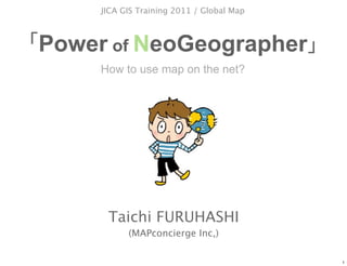
  • 1. JICA GIS Training 2011 / Global Map Power of NeoGeographer How to use map on the net? Taichi FURUHASHI (MAPconcierge Inc,) 1
  • 2. Today, I bring a new device for demonstration 2 2
  • 3. That name is “GigaPan” 3 3
  • 4. 4 4
  • 5. I will explain about this device in my presentation. 5 5
  • 6. How to use map on the net? 6 6
  • 7. How to use map on the net? 7 7
  • 8. the net? 8 8
  • 9. digital 9 9
  • 10. You are expert of GIS in each countries. 10 10
  • 11. You have provider orientation thinking. 11 11
  • 12. I want to explain about user orientation thinking. 12 12
  • 13. GIS Expert of JICA Alos4Amazon Project President of MAPconcierge inc, Researcher of CSIS, at the univ. of Tokyo. Vise-President of OpenStreetMap foundation japan Director of OSGeo.JP foundation Tech. Writer of GISNEXT Magazine Evangelist of KML Tree Climber Taichi @mapconcierge b y Ta i c h i F U R U H A S H I 13
  • 14. GIS Expert of JICA Alos4Amazon Project President of MAPconcierge inc, Researcher of CSIS, at the univ. of Tokyo. Vise-President of OpenStreetMap foundation japan Director of OSGeo.JP foundation Tech. Writer of GISNEXT Magazine Evangelist of KML Tree Climber Taichi @mapconcierge b y Ta i c h i F U R U H A S H I 14
  • 15. I’m a TreeClimber b y Ta i c h i F U R U H A S H I 15 15
  • 16. Of course, I have two licenses b y Ta i c h i F U R U H A S H I 16 16
  • 17. Because, b y Ta i c h i F U R U H A S H I 17
  • 18. I (we) have a TreeHouse in Japan. (made by ourself) b y Ta i c h i F U R U H A S H I 18 18
  • 19. That’s my hobby, but... b y Ta i c h i F U R U H A S H I 19
  • 20. It’s related with the Digital Map(GIS) tech. b y Ta i c h i F U R U H A S H I 20
  • 21. It means... b y Ta i c h i F U R U H A S H I 21
  • 22. GIS can use a lot of GeoSpatial Data as MODEL. We called Feature. b y Ta i c h i F U R U H A S H I 22
  • 23. You know, “MODEL” is not “real”. ≒ Similar but different From Wikipedia, the free encyclopedia From Wikipedia, the free encyclopedia b y Ta i c h i F U R U H A S H I 23
  • 24. Every time we have to compare between both information using by training data. b y Ta i c h i F U R U H A S H I 24
  • 25. Field work is very important for GIS tech. b y Ta i c h i F U R U H A S H I 25
  • 26. Agenda 1: Project Haiti/sinsai.info 2: Old/Neo Geographer 3: Digital Earth 4: GIS forecast(UAV/Gigapan/GeoHex) b y Ta i c h i F U R U H A S H I 26
  • 28. 12 Jan 2010 by Taichi FURUHASHI 28
  • 30. We made high quality map in Haiti for a few days. by Taichi FURUHASHI 30
  • 31. How? by Taichi FURUHASHI 31
  • 33. Like the wikipedia method! by Taichi FURUHASHI 33
  • 34. GPS logging by handyGPS by Taichi FURUHASHI 34
  • 35. Draw map by paper. And scan. by Taichi FURUHASHI 35
  • 36. Digitizing on Satellite images by Taichi FURUHASHI 36
  • 37. "The OpenStreetMap community can help the response by tracing Yahoo imagery and other data sources,....." (13Jan2010) by Taichi FURUHASHI 37
  • 38. OSM v.s. GoogleMaps v.s. YahooMap v.s. bing Map There is no good map in Haiti. by Taichi FURUHASHI 38
  • 39. Start to making map! on OSM community. by Taichi FURUHASHI 39
  • 40. Before by Taichi FURUHASHI 40
  • 42. We plotted many camp sites. by Taichi FURUHASHI 42
  • 43. How about Google Maps ? by Taichi FURUHASHI 43
  • 44. Google Maps by Taichi FURUHASHI 44
  • 45. Low Quality. by Taichi FURUHASHI 45
  • 46. And also, we compare to by Taichi FURUHASHI 46
  • 47. Google MapMaker by Taichi FURUHASHI 47
  • 48. OpenStreetMap by Taichi FURUHASHI 48
  • 49. ZOOM in!! by Taichi FURUHASHI 49
  • 50. Google Maps by Taichi FURUHASHI 50
  • 51. Google MapMaker by Taichi FURUHASHI 51
  • 52. OpenStreetMap by Taichi FURUHASHI 52
  • 53. Data quality and quantity are different. by Taichi FURUHASHI 53
  • 54. Why, we could? by Taichi FURUHASHI 54
  • 55. Some satellite image companies provide to us, very quickly. by Taichi FURUHASHI 55
  • 56. GeoEye Resolution 40cm 56
  • 57. QucikBird Resolution 60cm 57
  • 59. Of course, by Taichi FURUHASHI 59
  • 60. ALOS Resolution 2.5m 60
  • 61. Those images are provided with Georeference meta data by Taichi FURUHASHI 61
  • 62. Collaborated with JAXA and NIED by Taichi FURUHASHI 62
  • 63. JAXA: Japanese Space Org < Data Provider > by Taichi FURUHASHI 63
  • 64. NIED: National research Institute for Earth science and Disaster Prevention < Web GIS Server Hosting > by Taichi FURUHASHI 64
  • 65. That’s great corroboration in Japan by Taichi FURUHASHI 65
  • 66. JAXA → NIED → OSM by mapconcierge 66
  • 67. Key Point is... by Taichi FURUHASHI 67
  • 68. WMS protocol by Taichi FURUHASHI 68
  • 69. Others ( OSM ) Potlatch JOSM (OSM editor on WebBrowser) ( OSM ) by mapconcierge 69
  • 70. We could mashup to many services by Taichi FURUHASHI 70
  • 71. Especially, OSM can access to Road lines as vector. by Taichi FURUHASHI 71
  • 72. As a Result... by Taichi FURUHASHI 72
  • 73. Support portal site used OSM data. by Taichi FURUHASHI 73
  • 74. Quick release as iPhone application by Taichi FURUHASHI 74
  • 75. Good point is, OpenStreetMap has many experts for editing map by Taichi FURUHASHI 75
  • 76. Over 100 people includes japanese guys... Mikel Claudius Henrichs Axel von Matern Harry Wood pascal_n MattD Tim Waters zvenzzon David Fawcett Simone Gadenz Dane Springmeyer torstiko Mattia Giovannini Gianfra Phono Nicolas Chavent Dave Smith / DruidSmith Dankarran tomoki PB Randal Hale Andrew Turner Phil Shipley Sam Larsen Christopher Parker EdLoach Robert Scott davespod Seehundeführer Esperanza Adam Schreiber Mapconcierge osmapb1 Imapi Flacus ikiya Bikeman2000 Cohan Komяpa Morten Jagd Christensen - XBear Holly Glaser acdsig Temporalista Sergio Sevillano Divebalu HB9DTX Jeffrey Johnson StellanL Andrew Allison Jaakko Helleranta AssetBurned Justin Houk Andrzej Zaborowski Ceyockey Luc Castera FredB Ævar Arnfjörð Bjarmason Michael Lane harrierco Ivansanchez Mike Hogan neuhausr ALE! David Runneals - PaulY Fabianos Jarno Peschier - Osbornec Kevin helmed, Katie Filbert Julian Boudewijn Thea Clay olvagor Fil Micha Ruh Gubaer Estela Llorente SK53 UbuntuAcer Kam Jonas Krückel (John07) RatZillaS Marc Schneider Colin Marquardt Jean-Guilhem Cailton Rafa Gutierrez Floris Looijesteijn clara Samusz AndyGates steve8 Sean Bennett Jean-Marc Liotier Gert Gremmen (cetest) Jarrattp Lübeck Xapitoun sxpert Pierre Beland http://wiki.openstreetmap.org/wiki/WikiProject_Haiti/Who_is_helping by Taichi FURUHASHI 76
  • 77. Over 100 people includes japanese guys... Mikel Claudius Henrichs Axel von Matern Harry Wood pascal_n MattD Tim Waters zvenzzon David Fawcett Simone Gadenz Dane Springmeyer torstiko Mattia Giovannini Gianfra Phono Nicolas Chavent Dave Smith / DruidSmith Dankarran tomoki PB Randal Hale Andrew Turner Phil Shipley Sam Larsen Christopher Parker EdLoach Robert Scott davespod Seehundeführer Esperanza Adam Schreiber Mapconcierge osmapb1 Imapi Flacus ikiya Bikeman2000 Cohan Komяpa Morten Jagd Christensen - XBear Holly Glaser acdsig Temporalista Sergio Sevillano Divebalu HB9DTX Jeffrey Johnson StellanL Andrew Allison Jaakko Helleranta AssetBurned Justin Houk Andrzej Zaborowski Ceyockey Luc Castera FredB Ævar Arnfjörð Bjarmason Michael Lane harrierco Ivansanchez Mike Hogan neuhausr ALE! David Runneals - PaulY Fabianos Jarno Peschier - Osbornec Kevin helmed, Katie Filbert Julian Boudewijn Thea Clay olvagor Fil Micha Ruh Gubaer Estela Llorente SK53 UbuntuAcer Kam Jonas Krückel (John07) RatZillaS Marc Schneider Colin Marquardt Jean-Guilhem Cailton Rafa Gutierrez Floris Looijesteijn clara Samusz AndyGates steve8 Sean Bennett Jean-Marc Liotier Gert Gremmen (cetest) Jarrattp Lübeck Xapitoun sxpert Pierre Beland http://wiki.openstreetmap.org/wiki/WikiProject_Haiti/Who_is_helping by Taichi FURUHASHI 77
  • 78. Actually, over 300 or 400 users joined. Maybe... by Taichi FURUHASHI 78
  • 79. I found this thing in that experience. by Taichi FURUHASHI 79
  • 80. Time difference by Taichi FURUHASHI 80
  • 81. Usually, Demerit. by Taichi FURUHASHI 81
  • 82. But, NeoGeographer can connect in the world by Taichi FURUHASHI 82
  • 83. It means 24hours editing. by Taichi FURUHASHI 83
  • 84. That’s Strong Point!! by Taichi FURUHASHI 84
  • 85. In addition, by Taichi FURUHASHI 85
  • 86. Tim. J Berners-Lee talked at by Taichi FURUHASHI 86
  • 87. He said... by Taichi FURUHASHI 87
  • 88. Raw Data Now! OpenData will change the world by Taichi FURUHASHI 88
  • 89. Yes we can! by Taichi FURUHASHI 89
  • 90. This is NeoGeographer’s power by Taichi FURUHASHI 90
  • 91. Crisis Mapping Map Crowd source UGC/CGM by mapconcierge 91
  • 92. Google Maps/Earth Release in 2005 by mapconcierge 92
  • 93. Finding Dr. Jim Gray in 2007 by mapconcierge 93
  • 94. Google MyMap since 2007 by mapconcierge 94
  • 96. 2008 Kenya by mapconcierge 96
  • 98. http://www.cuidemoselvoto.org/ by mapconcierge 98
  • 100. 2010 haiti by mapconcierge 100
  • 101. 2010 Chile by mapconcierge 101
  • 103. 2011 / NZ by mapconcierge 103
  • 105. 2 0 1 1 3/11 by mapconcierge 105
  • 107. sinsai.info Staff Open Street Map Foundation Japan (NPO) over 15 (Amazon,Yahoo, NTT, NTT Data, etc..) by mapconcierge 107
  • 109. sample report by mapconcierge 109
  • 110. We add on map by mapconcierge 110
  • 111. sinsai.info work flow by mapconcierge 111
  • 112. sinsai.info Result • 10,000+ •1,000,000+ PV / •650,000+ •500,000+ • by mapconcierge 112
  • 113. sinsai.info joint to others by mapconcierge 113
  • 114. Report Report Report Report API Crisis Mapping Map Trace Map Donation GPS UAV Gigapan A lot of Satellite images by mapconcierge 114
  • 115. Old / Neo Geographer Next Generation of GIS engineer 115
  • 116. NEOGeographer OLDGeographer b y Ta i c h i F U R U H A S H I 116
  • 117. What’s different? b y Ta i c h i F U R U H A S H I 117
  • 118. I was OLDGeographer 6 years ago. b y Ta i c h i F U R U H A S H I 118
  • 119. OLD NEO Geographer Geographer Cartographer Hobby use Surveyor Google Maps API Scientist MashUp Government UGC/CGM Forester Social Network and more... and more... b y Ta i c h i F U R U H A S H I 119
  • 120. In 2005 Threshold b y Ta i c h i F U R U H A S H I 120
  • 121. b y Ta i c h i F U R U H A S H I 121 121
  • 122. OLD NEO Geographer Geographer Before Google-Geo After Google-Geo Year 2004 2005 2006 2007 b y Ta i c h i F U R U H A S H I 122
  • 123. OLD NEO Geographer Geographer SHP, MIF, GeoTIFF XML, DB, API Year 2004 2005 2006 2007 b y Ta i c h i F U R U H A S H I 123
  • 124. Change to NEOGeographer ! b y Ta i c h i F U R U H A S H I 124
  • 125. OLD NEO Geographer Geographer Result SHP SHP as Table SHP Process KML SQL GIS Clients GeoTIFF GeoTIFF WKT DB WKTraster Process File orientation API/DB orientation b y Ta i c h i F U R U H A S H I 125
  • 126. b y Ta i c h i F U R U H A S H I 126 126
  • 127. b y Ta i c h i F U R U H A S H I 127 127
  • 128. “Digital Earth Browser” means View/Share software by virtual globe. Those software delivers an easy-to-use way to view and share information geographically. 128
  • 129. “Digital Earth” Keyword appeared since 2004. Google Earth v3 World Wind, Keyhole Google Earth v4 By http://www.google.com/trends (2007/11/30) 129
  • 131. 131
  • 133. 133
  • 134. “Digital Earth Browser” is not “web browser”. By Michael T. Jones(Google) 134
  • 135. Digital Earth Browser and Web Browser Digital Earth Browser Web Browser Google (c) 2007 Google (c) 2007 KML HTML Digital Earth Browser can access many spatial information(KML) in all over the world. Like the Web Browser with HTML. 135
  • 136. Major Digital Earth Browsers Google Earth World Wind ArcGIS Explorer (Google, since2005) (NASA, since 2004) (ESRI, since 2006) Google (c) 2007 NASA (c) 2007 ESRI (c) 2007 http://earth.google.com/ http://worldwind.arc.nasa.gov http://www.esri.com/software/arcgis/ explorer/ All applications are provided as Free. And, Those software can mapping a lot of satellite / airphoto images all over the world as Free too. 136
  • 137. Characteristic of KML Keyhole Markup Language • Open format on the net. • XML • Zip Compression available • Network Connectivity • Multiply Data Type • Time Stamp / Time Span 137
  • 138. KML Sample <?xml version="1.0" encoding="UTF-8"?> <kml xmlns="http://earth.google.com/kml/2.1"> <Folder> <name>cafe</name> <description><![CDATA[Created with <a href="http://sketchup.google.com/">Google SketchUp 6.0.312</a>]]></description> <LookAt> <longitude>139.9366077796045</longitude> <latitude>35.90168740874968</latitude> <altitude>17.41304574400348</altitude> <range>104.3070304725559</range> <tilt>80.4794</tilt> <heading>141.932</heading> </LookAt> <Folder> <name>Tour</name> <Placemark> <name>Camera</name> <LookAt> <longitude>139.9366077796045</longitude> <latitude>35.90168740874968</latitude> 138
  • 139. Data Type in KML • Point • Line • Polygon (include Donuts Polygon) • Image (Ground/Screen/Photo) • 3D Object (with Texture, COLLADA) 139
  • 140. Line Polygon Point 140
  • 141. 3D Object Line 141
  • 142. Image (Screen) Image (Ground) 142
  • 144. 3D Object with Texture 144
  • 145. Polygon with attributes and TimeScale Image (Screen) 145
  • 146. Digital Earth Browser • Low cost (almost free) • No border (using by Lat/Lon coordinates) • Free reference data set (Satellite/ Airphoto) • Multi data type (with Texture, COLLADA) • Key data format is ”KML” 146
  • 147. OpenSource b y Ta i c h i F U R U H A S H I 147
  • 148. b y Ta i c h i F U R U H A S H I 148
  • 149. FOSS4G Tools relation map 2010 uDig GeoServer PostGIS Spatialite GRASS QGIS Desktop OpenLayers MappingServer Geo Data Base Desktop MappingServer Library OpenGeoSuite FOSS4G Tools OGR Statistics FDO R Project Foundation GEOS Catalog PROJ4 OpenStandard GPS TC211 Google Chrome OS GML Google Earth Android 149
  • 150. Licenses b y Ta i c h i F U R U H A S H I 150
  • 151. b y Ta i c h i F U R U H A S H I 151
  • 152. There are many type of licenses. b y Ta i c h i F U R U H A S H I 152
  • 153. License Copy Right FREE CC-by-NC-ND CC-by-ND CC-by-NC-SA CC-by-SA CC-by-NC CC-by All Rights Public Reserved Domain b y Ta i c h i F U R U H A S H I 153 153
  • 154. License Copy Right FREE CC-by-NC-ND CC-by-ND CC-by-NC-SA CC-by-SA CC-by-NC CC-by All Rights Public Reserved Domain mytext b y Ta i c h i F U R U H A S H I 154 154
  • 155. But, Geospatial data has weak point of License b y Ta i c h i F U R U H A S H I 155
  • 156. Because, b y Ta i c h i F U R U H A S H I 156
  • 157. “GIS Tech.” like a “Bridge” between the ITworld and the Realworld. b y Ta i c h i F U R U H A S H I 157
  • 158. “GeoSpatial data” made by “real data”. ≒ From Wikipedia, the free encyclopedia From Wikipedia, the free encyclopedia b y Ta i c h i F U R U H A S H I 158
  • 159. It is not creative. Just “fact data”. b y Ta i c h i F U R U H A S H I 159
  • 160. We called “CC0” Creative Commons Zero b y Ta i c h i F U R U H A S H I 160
  • 161. http:// goo.gl/Y8aH b y Ta i c h i F U R U H A S H I 161
  • 162. If you want to define as license for spatial data, ex. you can choice to “ODbL” Open Database License b y Ta i c h i F U R U H A S H I 162
  • 163. Open Data Commons b y Ta i c h i F U R U H A S H I 163
  • 164. OpenSource and FOSS4G b y Ta i c h i F U R U H A S H I 164
  • 165. About OSGeo b y Ta i c h i F U R U H A S H I 165
  • 166. What’s OSGeo b y Ta i c h i F U R U H A S H I 166
  • 167. is supporter for OpenSource Geo Community b y Ta i c h i F U R U H A S H I 167
  • 168. is supporter for OpenSource Geo Community b y Ta i c h i F U R U H A S H I 168
  • 169. Geo GeoSpatial Information b y Ta i c h i F U R U H A S H I 169
  • 170. Like the b y Ta i c h i F U R U H A S H I 170
  • 171. yes, but little different. b y Ta i c h i F U R U H A S H I 171
  • 172. GoogleMaps is Free but not Open ≠ Open b y Ta i c h i F U R U H A S H I 172
  • 173. Please click license at lower left. b y Ta i c h i F U R U H A S H I 173
  • 174. Let’s read license of Google b y Ta i c h i F U R U H A S H I 174
  • 175. Google Maps can’t use for print. b y Ta i c h i F U R U H A S H I 175
  • 176. We want to make Mapping Service like the Google Maps based on OpenSource. b y Ta i c h i F U R U H A S H I 176
  • 177. That’s OSGeo! b y Ta i c h i F U R U H A S H I 177
  • 178. main streams OpenSource OpenStandard OpenContents b y Ta i c h i F U R U H A S H I 178
  • 179. Example Is there JavaScript library like the Google Maps API? b y Ta i c h i F U R U H A S H I 179
  • 180. Yes we can! Google Maps API like JavaScript Library b y Ta i c h i F U R U H A S H I 180
  • 181. Example Is there Mapping Server product like the Google Maps? b y Ta i c h i F U R U H A S H I 181
  • 182. Yes we can! WEB mapping Server b y Ta i c h i F U R U H A S H I 182
  • 183. Yes we can! Mapguide OpenSource WEB mapping Server b y Ta i c h i F U R U H A S H I 183
  • 184. Yes we can! WEB mapping Server b y Ta i c h i F U R U H A S H I 184
  • 185. Example Is there Database for Geospatial like the Oralce? b y Ta i c h i F U R U H A S H I 185
  • 186. Yes we can! Geospatial Database b y Ta i c h i F U R U H A S H I 186
  • 187. Example Is there Desktop GIS like the ArcGIS? b y Ta i c h i F U R U H A S H I 187
  • 188. Yes we can! Standalone GIS Q-GIS b y Ta i c h i F U R U H A S H I 188
  • 189. There are a lot of Geo Tools b y Ta i c h i F U R U H A S H I 189
  • 190. FOSS4G Tool Free Open Source Software for Geospatial and more… b y Ta i c h i F U R U H A S H I 190
  • 191. Most popular Service using by FOSS4G tools b y Ta i c h i F U R U H A S H I 191
  • 192. b y Ta i c h i F U R U H A S H I 192
  • 193. Open Contents Commercial use OK 2nd use OK b y Ta i c h i F U R U H A S H I 193
  • 194. Tokyo in 2009 b y Ta i c h i F U R U H A S H I 194
  • 195. Hanno city in 2009 b y Ta i c h i F U R U H A S H I 195
  • 196. Components OpenLayers Post-GIS PostgreSQL PHP5 Drupal6 b y Ta i c h i F U R U H A S H I 196
  • 197. OpenSource Geo Tools are growing... b y Ta i c h i F U R U H A S H I 197
  • 198. And We should share FOSS4G info. on Conference. b y Ta i c h i F U R U H A S H I 198
  • 199. That’s FOSS4G Conference OSGeo.JP OSGeo b y Ta i c h i F U R U H A S H I 199
  • 200. Sponsor of OSGeo b y Ta i c h i F U R U H A S H I 200
  • 201. If you want more details... OSGeo Search b y Ta i c h i F U R U H A S H I 201
  • 202. NEOGeographer Activity b y Ta i c h i F U R U H A S H I 202
  • 203. I love OpenSource GIS (FOSS4G) b y Ta i c h i F U R U H A S H I 203
  • 204. b y Ta i c h i F U R U H A S H I 204 204
  • 205. ESRI v.s FOSS4G? b y Ta i c h i F U R U H A S H I 205
  • 206. ESRI v.s FOSS4G? b y Ta i c h i F U R U H A S H I 206
  • 207. InteDevelopment Strategy Functions 201x 2010 2009 Proprietary Projects FOSS4GProjects 207 207
  • 208. one more thing... b y Ta i c h i F U R U H A S H I 208
  • 209. GSI(GeoSpatial Information Authority of Japan) FOSS4 cyberjapan MappingSystem cyberjapan MappingSystem b y Ta i c h i F U R U H A S H I 209
  • 210. GSI(GeoSpatial Information Authority of Japan) FOSS4 cyberjapan MappingSystem cyberjapan MappingSystem b y Ta i c h i F U R U H A S H I 210
  • 211. OpenGov b y Ta i c h i F U R U H A S H I 211
  • 212. GIS forecast 212
  • 213. iPhone/Android with GIS (http://www.apple.com) Apple (c) 2007 213
  • 215. for Geo tools on Google Google Maps Google Earth Google SketchUp by Alos4Amazon Project 215
  • 229. Simulation Story How to use Android for your field work. Deforestation Polygon: Made by PALSAR Viewer by manipulation as KML-Polygon. ALOS-image: Made by PALSAR Viewer from ALOS-PALSAR as KML-GroundOverlay. BackGround: Made by WMS from InteliGeo/Siscom as Cache. Before field PalserViewer KML/WMS Viewer Polygon GroundOverlay WMC GPS Tracker InteliGeo/Siscom KM L, G PX, and SHP/GPX mo My Tracks re.. Spatial DB Photo X, Y, Z, D SHP irection +Exif Spatialite Camera with GeoTAG(Exif) SQL Field Office After field by Alos4Amazon Project 229
  • 230. One Laptop per Child The mission of the OLPC Project is to develop a low-cost laptop(about $100) to revolutionize how to educate the world's children. Goal is to provide children around the world with new opportunities to explore, experiment, and express themselves. Why do children in developing nations need laptops? Laptops are a window and a tool: a window into the world and a tool with which to think. They are a wonderful way for all children to learn learning through independent interaction and exploration. OLPC espouses five core principles: (1) child ownership; (2) low ages; (3) saturation; (4) connection; and (5) free and open source. If all laptop has include the GIS application, they will become to good geo-spatial contents providers. OLPC (c) 2007 http://www.laptop.org/ 230
  • 231. MAP of OLPC OLPC (c) 2007 those countries we plan to pilot those countries we plan to include in the post-launch phase those countries who have expressed interest at the Ministry-of-Education level or higher those countries who are currently seeking government support 231
  • 232. The Green WiFi Mission http://www.green-wifi.org/ Green WiFi is committed to providing solar powered access to global information and educational resources for developing regions and K-12 school children striving for knowledge in a digitally divided world. There are approximately 3 billion people under the age of 15 living in developing nations. 42 percent of the developing world's population is below the age of 15. Green WiFi was founded on the principle that the welfare of our world is dependent, in large part, on providing these children with free and open access to the world's information. Green WiFi (c) 2007 232
  • 233. GNSS Global Navigation Satellite System Now, some GNSS services provided by U.S. , Russia, EU and China. And Japan will lunch the Quasi-Zenith Satellites for GPS System. We will be able to use a more highly accurate location information. 233
  • 236. (c) www.physorg.com by mapconcierge 236
  • 240. by mapconcierge 2010.08.13, Gizmode Japan 240
  • 241. 1st May, 2011 Akahama area in Ohtsuchi, IWATE CC-by-SA by mapconcierge CC-by-SA by mapconcierge by mapconcierge 241
  • 242. UAV at Akahama area in Ohtsuchi, IWATE. 1st May, 2011 CC-by-SA by mapconcierge by mapconcierge 242
  • 243. Tsunami destroyed Akahama area. CC-by-SA by Univ.of Tokyo/ISTS/Bizworks/MAPconcierge by mapconcierge 243
  • 244. The university of Tokyo, International ocean research center. CC-by-SA by Univ.of Tokyo/ISTS/Bizworks/MAPconcierge by mapconcierge 244
  • 245. A ship on the house. CC-by-SA by Univ.of Tokyo / ISTS / Bizworks / MAPconcierge by mapconcierge 245
  • 246. CC-by-SA by Univ.of Tokyo/ISTS/Bizworks/MAPconcierge OrthoRectified Mosaic data by mapconcierge 246
  • 248. 248
  • 249. G pixels = 1,000,000,000 = General DigitalCamera x 100 249
  • 250. 250
  • 251. 251
  • 252. 252
  • 253. 253
  • 254. 254
  • 255. 255
  • 256. Midtown in Ohtsuchi, IWATE CC-by-SA by Kaoru Saito by mapconcierge 256
  • 257. View on Google Earth using by KML PhotoOverlay data CC-by-SA by mapconcierge by mapconcierge 257
  • 258. Office of volunteer center in Tohno, IWATE(magokoronet) CC-by-SA by Taichi by mapconcierge 258
  • 259. GigaPan can take CC-by-SA by Taichi by mapconcierge 259
  • 260. MapData OpenStreetMap Panorama/StreetView Aerial Photo Gigapan UAV by mapconcierge 260
  • 261. Information Crawler by mapconcierge 261 261
  • 262. Information Scooter by mapconcierge 262 262
  • 263. by mapconcierge 263 263
  • 264. NEOGeographer b y Ta i c h i F U R U H A S H I 264
  • 265. www.slideshare.net/ mapconcierge @mapconcierge by mapconcierge 265
  • 266. Together for the Earth !! @mapconcierge by mapconcierge 266