

Recomendados
Más contenido relacionado
La actualidad más candente
La actualidad más candente (20)
Destacado
Destacado (14)
Similar a Tides (2)
Similar a Tides (2) (20)
Más de Makati Science High School
Más de Makati Science High School (20)
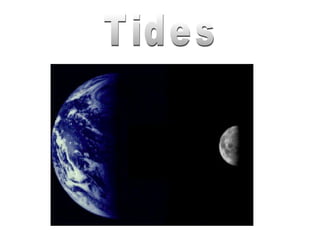
Tides (2)
- 2. Tides are generated by: 1.Gravitational pull of the moon and sun 2.Centripetal force of the rotating Earth
- 3. Tides are generated by: • the gravitational pull of the moon and sun - moon has 2x greater gravitational pull than the sun - sun is 10 million x more massive than the moon and is 390 times farther away
- 5. GRAVITATIONAL FORCE CENTRIPETAL GRAVITATIONAL & CENTRIPETAL
- 6. Tidal Cycles • Diurnal Tide: 24 hr 50 min cycle • Semi Diurnal Tide: 12 hr 25 min cycle • Mixed Tide: 12 hr 25 min cycle
- 7. Description of tides • High water: a water level maximum ("high tide") • Low water: a water level minimum ("low tide") • Tidal range: the difference between high and low tide • Spring Tide: full moon and new moon (14.77 days) • Neap Tide: 1st quarter and 3rd quarter (14.77 days) High tide Intertidal zone Low tide
- 8. The monthly tidal cycle (29½ days) • About every 7 days, Earth alternates between: – Spring tide • Alignment of Earth-Moon-Sun system (syzygy) • Lunar and solar bulges constructively interfere • Large tidal range – Neap tide • Earth-Moon-Sun system at right angles (quadrature) • Lunar and solar bulges destructively interfere • Small tidal range
- 9. Earth-Moon-Sun positions and the monthly tidal cycle Spring Tide Highest high tide and lowest low tide Neap Tide Moderate tidal range
- 12. Tidal Patterns Semidiurnal tides- two high and two low per day; Cape Cod, MA (high latitudes) Diurnal tides- one high and one low per day; Mobile, AL (low latitudes) Mixed pattern tides- Two high and two low tides per day BUT with successive high tide levels that are VERY DIFFERENT from each other; Hawaii (mid latitudes) Type of tide depends on: • Position on the globe • Water depth • Contour- shape of ocean basins
- 15. Tidal Range 56 ft 6 ft
- 16. The Bay of Fundy: Site of the world’s largest tidal range • Tidal energy is focused by shape and shallowness of bay • Maximum spring tidal range in Minas Basin = 17 meters (56 feet)
- 17. Alma at High Tide Alma at Low Tide
- 18. La Rance tidal power plant at St. Malo, France.
- 19. Tidal bore = a true tidal wave • Wall of water that moves upriver • Caused by an incoming high tide • Occurs in some low-lying rivers • Can be large enough to surf or raft
- 20. Corals exposed to air at extreme low tide
- 21. Tidal Information http://life.bio.sunysb.edu/marinebio/mbwe HAWAIIAN ISLANDS Mean Spring Mean Tide Station Latitude Longitude Range Range Level Predictions SAND ISLAND, MIDWAY ISLANDS 28° 12.7' 177° 21.6' 0.8 1.2 0.6 Predictions Laysan Island 25° 46' 171° 45' 0.7 1.0 0.4 Predictions East Island, French Frigate Shoals 23° 47' 166° 13' 0.9 1.4 0.6 Predictions Nonopapa, Niihau Island 21° 52' 160° 14' 1.0 1.6 0.7 Predictions Kauai Island Waimea Bay 21° 57' 159° 40' 1.0 1.6 0.7 Predictions Port Allen, Hanapepe Bay 21° 54' 159° 35' 1.1 1.7 0.7 Predictions NAWILIWILI 21° 57.4' 159° 21.6' Predictions Hanamaulu Bay 22° 00' 159° 20' 0.0 1.2 1.8 Predictions Hanalei Bay 22° 13' 159° 30' 1.3 1.8 0.8 Predictions Oahu Island Haleiwa, Waialua Bay 21° 36' 158° 07' - - 1.6 0.7 Predictions Waianae 21° 27' 158° 12' 1.2 1.8 0.8 Predictions HONOLULU 21° 18' 157° 52' 1.3 2.0 0.8 Predictions Hanauma Bay 21° 17' 157° 42' 1.3 1.9 0.8 Predictions Waimanalo 21° 20' 157° 42' 1.1 1.8 0.8 Predictions MOKUOLOE 21° 26.2' 157° 47.6' 1.2 2.0 1.0 Predictions Waikane, Kaneohe Bay 21° 30' 157° 51' 1.4 2.2 1.1 Predictions
- 22. Inquiry 1. Which has the greatest tidal effect– sun or moon? 2. Where is the greatest tidal range located? 3. Which lunar phase produces moderate tides? 4. How is a tidal bore created?
Notas del editor
- Gravity- pull or attraction between objects; varies with mass of object Centrifugal force- because the earth and moon are rotating simultaneously around a common center of mass, the water of the oceans shifts from the center of rotation, creating a 2 nd tidal bulge on the side of the earth that faces away from the moon
- TIDES: Tides are the slow, periodic vertical rise and fall of the sea surface. They are usually described as being either diurnal or semi-diurnal. Diurnal tides have one high water and one low water in each lunar day (about 24.8 hours), while semi-diurnal tides have two high and two low waters in the same time period. While these tidal changes are easier to observe where land and water meet, they exist everywhere -- even in the middle of the ocean. Tidal ranges along the shoreline vary by location. For example, the tides in Canada's Bay of Fundy, an Atlantic Ocean inlet west of Nova Scotia, rise and fall as much as 50 feet, while the tidal range in Lake Superior is measured in inches. High and low tides are the result of the attractive forces (gravitational pull) of the moon and sun on a rotating Earth.
- TIDES: Tides are the slow, periodic vertical rise and fall of the sea surface. They are usually described as being either diurnal or semi-diurnal. Diurnal tides have one high water and one low water in each lunar day (about 24.8 hours), while semi-diurnal tides have two high and two low waters in the same time period. While these tidal changes are easier to observe where land and water meet, they exist everywhere -- even in the middle of the ocean. Tidal ranges along the shoreline vary by location. For example, the tides in Canada's Bay of Fundy, an Atlantic Ocean inlet west of Nova Scotia, rise and fall as much as 50 feet, while the tidal range in Lake Superior is measured in inches. High and low tides are the result of the attractive forces (gravitational pull) of the moon and sun on a rotating Earth.
- Gravity Newton’s law states that all particles of mass have a gravitational attraction for all other particles, and that the gravitational force is proportional to the sum of the two masses and inversely proportional to the square of the distance between their centers of mass. The gravitational attraction between the moon and the Earth is very small compared to gravity felt by an object at the Earth’s surface due to the Earth itself. Although the sun has a much greater mass than the moon it is much further from the Earth and the gravitational attraction between the sun and the Earth is smaller than that between the moon and the Earth. Orbital Motions and Centripetal Force In any two body system, such as the Earth and moon or the Earth and sun, one body does not orbit around the other. Rather the two bodies orbit around a common balance point that is closer to the larger body. For the Earth and moon, this balance point is beneath the Earth’s surface but not at the Earth’s center, Similarly the common point of rotation between the Earth and sun is inside, but not at the center of, the sun Any body in orbit must be held in that orbit by a centripetal force that can be supplied by the gravitational attraction. Centripetal force varies with distance from the center of rotation. All points within each rotating body follow the same diameter circle of rotation, and centripetal force is the same at all points on and within each of two orbiting bodies. The gravitational force varies with the square of the distance and is slightly higher on the side of a body facing the other orbiting body and slightly lower on the opposite side. The Balance between Centripetal Force and Gravitational Force The small imbalance between centripetal force and gravity at different points on the Earth is responsible for tides. The Earth’s own gravity is millions of times larger than the gravitational attraction of the moon or sun at the Earth’s surface and, therefore, the imbalance between centripetal force and gravity can be compensated by an immeasurably small change in an object’s weight if the force imbalance is directed in the same direction as Earth’s gravity (vertically toward Earth’s center). Distribution of Tide-Generating Forces The moon’s gravitational attraction and the required centripetal force are exactly balanced at all points along a ring around the Earth drawn almost exactly midway between the point closest to and farthest away from the moon At the points directly toward the moon and directly on the opposite side of the Earth from the moon, Earth’s gravity and the imbalance between the moon’s gravitational attraction and the required centripetal force is completely compensated by an immeasurably small change in an object’s weight. At all other points on the Earth there is a component of the imbalance between the moon’s gravitational attraction and the required centripetal force that acts parallel to the Earth’s surface and so cannot be compensated. This component is the tidal force. The tidal force acts toward the moon on the moon’s side of the Earth and away from the moon on the opposite side. The tidal force is zero at the points directly toward and directly away from the moon, increases away from these points, and then decreases to zero again at points along the ring around the Earth drawn almost exactly midway between the point closest to and the point farthest away from the moon, where the moon’s gravitational attraction and required centripetal force are balanced.
- The closeness of the moon to Earth (238,857 miles), and the distance to the sun (92,955,770 miles), accounts for the moon having a tide-raising force nearly 2.5 times greater than the sun. The position of these celestial bodies results in significant variations in pulling forces causing above or below normal tidal ranges. The range between a high and a low tide is greatest when the sun, moon and Earth are in alignment. These are spring tides. When the sun and moon are at right angles to the Earth, their gravitational forces significantly reduce each other. This causes the neap tide, a period of decreased tidal range. The term neap is an acronym for near even as possible. Bulges are about the same size Tide-generating forces are a result of the gravitational attraction between the Earth, sun, and moon. It was not until Sir Isaac Newton (who lived from 1642-1727) discovered the law of gravity that the effect of the sun and the moon on the tides was fully understood. All surfaces of the Earth are pulled toward the moon and sun. This force has little effect on land masses, but it does have a very great and obvious effect on the water of the Earth's oceans. Twice each month the tidal range reaches a maximum and these large tides are called the spring tides. Halfway through the monthly cycle the range is much smaller, and these weak tides are called neap tides. As the moon rotates around the Earth, it pulls the water on the nearest side of the Earth outward into a bulge. A similar bulge on the opposite side of the Earth is caused by the water being thrown outward by the planet's spin. These two bulges travel around the globe, producing two high tides each day. During time of the new moon and full moon, when the sun and moon are in a straight line, their gravitational pull combine and produce spring tides; at this time the high tides are very high and the low tides are very low. When sun and moon are at right angles from the Earth, during the quarter phases of the moon, the gravitational pull on the oceans is less producing a smaller difference between high and low tide known as a neap tide. Some locations have much bigger tides than others. Tidal ranges are usually small in the middle of the ocean but can be very large where tidal waters are funneled into a bay or river estuary. Hawaii has hardly any tidal range at all while the water in the Bay of Fundy, in Canada, has a range of about 40 feet.
- TIDES: Tides are the slow, periodic vertical rise and fall of the sea surface. They are usually described as being either diurnal or semi-diurnal. Diurnal tides have one high water and one low water in each lunar day (about 24.8 hours), while semi-diurnal tides have two high and two low waters in the same time period. While these tidal changes are easier to observe where land and water meet, they exist everywhere -- even in the middle of the ocean. Tidal ranges along the shoreline vary by location. For example, the tides in Canada's Bay of Fundy, an Atlantic Ocean inlet west of Nova Scotia, rise and fall as much as 50 feet, while the tidal range in Lake Superior is measured in inches. High and low tides are the result of the attractive forces (gravitational pull) of the moon and sun on a rotating Earth.
- Flood tide directs water landward; Ebb tide directs water seaward TIDAL CURRENTS: The rise and fall of the tide is accompanied by the horizontal flow of water called a tidal current. The usual terms used to describe the direction of this horizontal movement are ebb and flood. Ebb currents occur when tidal currents are moving away from the coast. Flood currents move toward the coast. In a purely semi-diurnal current, the flood and ebb each last about 6 hours. Speed of tidal currents depends upon the shape and dimensions of the harbor, coastal areas and ocean bottom. The configuration also influences vertical range of the tide itself. Under certain conditions, tidal currents can move more than 10 knots.
- Countor- can distort the rotary motion of circular waves Additional distortions occur near the equator where coriolis deflection changes direction, and along continental margins around large islands, where the sea bottom is shallow and the water is lowed down. These combined effects result in considerable variation in the type of tide and the tidal range along the world’s coastlines Shouldn’t the tides be 12 and 24 hours? Explanation: after 1 earth day, the moon has moved slightly forward in its orbit, so an additional 50 minutes or so is necessary for a spot on the earth to region its postion relative to the moon each day.Hence, the high tide and low tide shift forward each day