SlideShare una empresa de Scribd logo
1 de 97
Plate Tectonics & Geology of the
Galápagos Archipelago
University Honors Program, UH 204D-002:
Great Expeditions Spring 2013
HMS Beagle
• HMS Beagle was a Cherokee-class 10-gun brig-sloop of the Royal
Navy
• She was launched on 11 May 1820 from the Woolwich Dockyard on
the River Thames, at a cost of £7,803 and named after the beagle
dog breed
• In July of that year she took part in a fleet review celebrating the
coronation of King George IV in which she was the first ship to sail
under the new London Bridge
• She was adapted as a survey barque (three or more masts) and
took part in three major surveying expeditions
• On the second survey voyage the young naturalist Charles Darwin
was on board, and his work would eventually make Beagle one of
the most famous ships in history
• 1870 – scrapped
Beagle: Vital Statistics
• 90.3-feet-long
• Beam  25-feet-wide
• Draught (draft)  12.5 feet
– Vertical distance from water line and bottom of the hull – keel
– Determines the minimum depth of water the vessel can safely
navigate, and the weight of cargo she can carry
• Tons burthen  235 bm; 242 for second voyage
• Initially outfitted as a 10-gun Brig
• 1825  re-rigged as a three-masted Barque (Bark) with
only 6-guns
• When she was in the Galapagos, she had 65 men on board
– very cramped living conditions!
Ship’s draught (draft)
Tons Burthen
• Builder's Old Measurement (BOM or bm) is the method of calculating the
cargo capacity of a ship used in England from approximately 1650 to 1849
• It estimated the “tonnage” of a ship based on length and maximum beam
• It is a volumetric measurement of cubic capacity and NOT of weight; it is
expressed in "tons burthen”
Sail plan of a three-masted barque:
HMS Beagle
HMS Beagle: Straits of Magellan
HMS Beagle
HMS Beagle
Beagle’s History
• First voyage (1826-1830)
– Hydrographic survey of Patagonia and Tierra del Fuego
• Second voyage (1831-1836) – Darwin’s voyage
– Extensive surveys in South America, returning via New
Zealand and Australia to England on 2 October 1836
• Third voyage (1837-1843)
– Survey large parts of the coast of Australia
• Final years
– In 1845 the Beagle was refitted as a static coastguard
watch vessel to control smuggling on the Essex coast in the
navigable waterways beyond the north bank of the
Thames Estuary
Second Voyage (1831-1836)
1. Fix the longitude of Rio de Janeiro, from
which all other distances would be measured
2. Make a hydrographic survey of the coast of
South America and other places visited
3. Make astronomical and tidal observations
4. Report on the geology, climate, natural
history, people and cultures of the places
visited  Darwin’s arena
Voyage of the HMS Beagle
27 December 1831 to 2 October 1836
A watercolour by HMS Beagle's draughtsman, Conrad
Martens. Painted during the survey of Tierra del
Fuego, it depicts native Fuegians hailing the Beagle.
HMS Beagle
Darwin’s Beagle Experience
(1831-1836)
• The Beagle set sail from England on December
27, 1831 when Darwin was 22 years old; he
would not see England again for almost five years
• Living quarters = one corner of the ship’s chart
room in the stern (“poop cabin”)
– 3 x 3.5m and 1.813m high (5.95 ft.)
– 250 books, wash stand, chest of drawers, instrument
cabinet, two hammocks, and a large central chart
table
– Shared the room with midshipman Philip Gidley King
and Ship’s Mate John Lort Stokes (who slept in a small
annex to the cabin)
Darwin’s Quarters: Chart Room
HMS Beagle, 1832. Interior layout memory sketch by Philip Gidley
King, midshipman during the second voyage, prepared in 1897.
The C&GS Ship Pioneer passing under the Golden Gate Bridge. The first towed marine
magnetometer, which was invented at the Scripps Institution of Oceanography, was first
deployed on this ship beginning in August 1955. (NOAA Photo Library)
Eltanin
Glomar Challenger
Deep Sea Drilling Project – DSDP
1968 – 1983 (NSF funded)
JOIDES / Resolution
Joint
Oceanographic
Institutions
for
Deep Earth Sampling
ODP
Ocean
Drilling
Program
Integrated Ocean Drilling Program (IODP)
Scientific deep sea drilling vessel
Chikyu has set a new world record
by drilling down and obtaining rock
samples from deeper than 2,111
meters below the seafloor off the
Shimokita Peninsula of Japan
Alfred Wegener Institute
for Polar & Marine Research
http://www.awi.de/en/home/
Russian ship: Arctic coring expedition
Galápagos Archipelago
• Spanish names:
– Archipiélago de Colón
– Islas de Colón
– Islas Galápagos
• Archipelago  island group, island chain, cluster of islands, or a sea containing a large number of
scattered islands
• Derived from the Greek ἄρχι- – arkhi- ("chief") and πέλαγος – pélagos ("sea")
• Types of archipelagos:
– Continental fragments (tectonically rifted continental margins) – active margin
– Continental islands (“drowned” margins – Scotland) – passive margin
– Oceanic islands
• Volcanic arcs – subduction zones
• Island chains – Hawaiian Islands (hot spots)
• The Galápagos consists of 13 main islands, 3 smaller islands, and 107 rocks and islets
• Located at the confluence of three ocean currents, the Galápagos are a “melting pot” of marine species
Location
• 973 km (525 nmi; 605 mi) west of continental Ecuador
• 1°40'N–1°36'S, 89°16'–92°01'W
– Volcán Wolf and Volcán Ecuador on Isla Isabela lie directly on the equator
• The first crude navigation chart of the islands was made by the buccaneer
Ambrose Cowley in 1684 (??); he named the individual islands after some
of his fellow pirates, or after the British noblemen who helped the
privateer's cause
– English pirates pilfered Spanish galleons carrying gold and silver from South
America to Spain
• More recently, the Ecuadorian government gave most of the islands
Spanish names, but many biological researchers still use the older English
names because those were used by Darwin
Galápagos
1684 Map
Ambrose Cowley
Waved Albatross
Galápagos
Marine Iguana
The Black Pearl
Isabela – SPOT Satellite
Galápagos Geology
• The Galápagos Islands are:
– An active group of basaltic volcanoes
– Located near two seafloor spreading ridges
– Part of a west-ward propagating seafloor
spreading ridge
– Sitting on top of a mantle hotspot
– Site of the first discovery of seafloor hydrothermal
vents on a spreading ridge (“Black Smokers”)
Name Last Eruption
Darwin Island Extinct
Fernandina 2009
Ecuador (volcano) 1150
Wolf Island Extinct
Cerro Azul 2008
Wolf (volcano) 1982
Darwin (volcano) 1813
Alcedo 1993
Sierra Negra 2005
Santiago Island 1906
Pinta Island 1928
Marchena Island 1991
Santa Cruz Island Unknown
Floreana Island Extinct
Genovesa Island Unknown
San Cristóbal Island Unknown
Geology Overview
• The islands are located at the Galápagos triple junction
• The archipelago is located on the north margin of the Nazca
Plate, which is moving ESE and diving under the South
American Plate at a rate of 2.5 inches (6.4 cm) per year
• It is also atop the Galápagos volcanic hotspot (mantle
plume)
• The islands have a volcanic legacy going back 10s of millions
of years
Morgan, 1972
Seafloor Morphology
• Complex interplay of N-S trending structures associated with the
EPR and E-W trending structures associated with the Galápagos
Ridge
• EPR changes from fast spreading to intermediate spreading and
develops an axial rift valley
• Galápagos Ridge develops an axial graben that deepens
westward, reaching >4000m in the Hess Deep
• West of the Hess Deep there is no clear expression of the
Galápagos Ridge
– Gap of 25-km between the spreading centers
– Magmatic gap?
Professor Harry Hess
Princeton University
The first guyot - discovered by Harry Hess of Princeton University
(guy-ot [gee-o ])
Guyot
• (guy-ot [gee-o ])
• Flat-topped submarine seamount, the summit of which lies l000-2000 m below
the ocean surface
• Seamount is a mountain rising from the ocean seafloor that does not reach to the
water's surface (sea level) and thus is not an island
• The term “guyot” is named after Arnold Guyot (1807-1884), 19th century Swiss-
American geologist
Rodriguez Seamount/Guyot
Progressive evolution:
Galápagos Hotspot
• Responsible for the creation of the Galápagos Islands
and three major aseismic ridges
– Carnegie Ridge
– Cocos Ridge
– Malpelso Ridge
• Hotspot is complicated by its proximity to the
Galápagos triple junction (i.e., relative motion of three
plates, not just simple divergent seafloor spreading)
• Unlike many hotspots, the magmatic system is
heterogeneous – evidence of four major reservoirs
feeding the hotspot
World-Wide Distribution of Hotspots
Calculated absolute velocity vectors relative to fixed hot-spot frame
Bathymetry around the Galápagos
Galapagos Bathymetry by William Chadwick, University of Oregon
Isla Isabela
Seafloor Spreading
Nikon D70S
Ridge topography
Hydrothermal circulation
Black Smokers
• Hydrothermal vent fields at or near ridge crests
• Vent fluids = up to 400oC
• Fluid chemistry from different spreading centers is
remarkably similar despite big differences in
spreading rates
• vent fluids have equilibrated with greenschist
assemblage of minerals
• Metalliferous deposits are common
– Hot, acidic, sulfide-rich solutions
– Base metals are precipitated when vent fluids come in
contact with cold seawater
Galápagos Black Smokers
• The first warm springs to be found on the mid-ocean ridge were
discovered in 1977 on the Galápagos spreading center
• Astonishing communities of animals around them, but they were weakly-
flowing vents emitting room-temperature fluids into the frigid surrounding
bottom waters
• In 1979, scalding hot “black smokers” jetting from the seafloor were
discovered elsewhere on the global mid-ocean ridge system
• Since 1977, additional exploration of the eastern Galápagos spreading
center located a few more diffuse vents populated by animals, but did not
succeed in finding any black smokers; some workers suggest that the
influence of the Galápagos hotspot on the Galápagos spreading center
may inhibit formation of cracks required to provide deep, hot fluid
pathways for black smokers, making smokers rare and hard to find
Fast Spreading
9-18 cm/yr
Intermediate
Spreading
5-9 cm/yr
Slow Spreading
1-5 cm/yr
“Rise”
Spreading rates versus topography
Ridge versus Rise
Fast Spreading--
Southern East Pacific
Rise from 13 to 23°S
Upper crustal structure of a fast spreading ridge
•Broad arch with small axial graben
•Melt lens beneath rise
•Broad low-velocity zone
East Pacific Ridge/Rise
Intermediate Spreading--Juan de Fuca Ridge near 48°N
Simplified view of a slow spreading ridge & axial graben
Discontinuous axial volcanic ridge
Slow Spreading--Mid Atlantic Ridge near 22°N
Transform faults
Seafloor Spreading Rates
• Pacific-Cocos spreading rate  137 mm/yr
• Pacific-Nazca spreading rate  135 mm/yr
• Galápagos Ridge spreading rate  41 mm/yr
• Galápagos tip  propagates westward at 66 mm/yr
Galápagos Triple Junction
• RRR triple junction that separates the Nazca, Cocos and
Pacific seafloor plates
• The fast-spreading East Pacific Rise trends N-S in this
region and continues without offset past the triple
junction
– Smooth topography across the rise
• Galápagos Ridge  E-W trending and slow-spreading
– Separates the Cocos and Nazca plates, to the north and
south, respectively
– Rough, more faulted topography across the ridge
Triple Junctions
• The Earth’s lithosphere comprises a mosaic of
interlocking plates
• There are several places on the planet where three
plates come together - these are called triple junctions
• Triple junctions mark the intersection of combinations
of:
– Rifts or ridges (spreading centers)
– Transform fault boundaries
– Convergent boundaries (subduction zones)
120o
120o
120o
Plate APlate B
Plate C
Classic RRR
East African
Rift & Afar
Triangle
•Gulf of Aden
•Red Sea
•East African rift
Afar Triangle
Mendocino
Rivera
Mendocino Triple Junction
Punta Gorda, CA
RRR Triple Junction
- Velocity Triangle Space -
Galápagos Gore
• Intersection of EPR & GR  V-
shaped, triangular, faulted region called the
Galápagos Gore
– “V” opens to the east
– Older crust in the east than the west based on
magnetic anomalies
– The Galápagos Ridge has propagated from east-to-
west as it developed
Carnegie Ridge
Charles Darwin
(1809 – 1882)

Más contenido relacionado

Similar a Plate Tectonics & Geology of the Galapagos Archipelago

Introduction marine geology
Introduction marine geologyIntroduction marine geology
Introduction marine geologyDedy Aslam
 
Different Expeditions and their contribution in ocean science
Different Expeditions and their contribution in ocean scienceDifferent Expeditions and their contribution in ocean science
Different Expeditions and their contribution in ocean scienceKunal Sinha
 
Sea-Floor Spreading Notes - Jenny
Sea-Floor Spreading Notes - JennySea-Floor Spreading Notes - Jenny
Sea-Floor Spreading Notes - JennyJenny Dixon
 
Plate tectonics
Plate tectonicsPlate tectonics
Plate tectonicsChay Kung
 
The Geology of the south Cardigan Bay coast.
The Geology of the south Cardigan Bay coast.The Geology of the south Cardigan Bay coast.
The Geology of the south Cardigan Bay coast.Prof Simon Haslett
 
History slideshowonline
History slideshowonlineHistory slideshowonline
History slideshowonlineLynnCorliss
 
Sea floor spreading
Sea floor spreadingSea floor spreading
Sea floor spreadingJenny Dixon
 
History of oceanography: origin and development
History of oceanography: origin and developmentHistory of oceanography: origin and development
History of oceanography: origin and developmentShoaibe H T Shefat
 
Origin and developmental history of oceanography
Origin and developmental history of oceanographyOrigin and developmental history of oceanography
Origin and developmental history of oceanographyShoaibe H T Shefat
 
Inside the Earth.pptx
Inside the Earth.pptxInside the Earth.pptx
Inside the Earth.pptxYomaBey
 
CONTINENTAL DRIFT HYPOTHESIS
CONTINENTAL DRIFT HYPOTHESIS CONTINENTAL DRIFT HYPOTHESIS
CONTINENTAL DRIFT HYPOTHESIS THILAKAR MANI
 
Ancient Peoples of the Channel Islands – West of the West
Ancient Peoples of the Channel Islands – West of the WestAncient Peoples of the Channel Islands – West of the West
Ancient Peoples of the Channel Islands – West of the WestChatsworth Historical Society
 
Evidences of Plate Movements 2.pptx
Evidences of Plate Movements 2.pptxEvidences of Plate Movements 2.pptx
Evidences of Plate Movements 2.pptxRyeAguirre
 
Evidences of Plate Movements 2.pptx
Evidences of Plate Movements 2.pptxEvidences of Plate Movements 2.pptx
Evidences of Plate Movements 2.pptxRyeAguirre
 

Similar a Plate Tectonics & Geology of the Galapagos Archipelago (20)

Introduction marine geology
Introduction marine geologyIntroduction marine geology
Introduction marine geology
 
2019 tg lithosphere1 earth
2019 tg lithosphere1 earth2019 tg lithosphere1 earth
2019 tg lithosphere1 earth
 
3 history of oceanography
3 history of oceanography3 history of oceanography
3 history of oceanography
 
Plate Tectonics I
Plate Tectonics IPlate Tectonics I
Plate Tectonics I
 
Serc 1 introd ocean
Serc 1 introd oceanSerc 1 introd ocean
Serc 1 introd ocean
 
Different Expeditions and their contribution in ocean science
Different Expeditions and their contribution in ocean scienceDifferent Expeditions and their contribution in ocean science
Different Expeditions and their contribution in ocean science
 
Sea-Floor Spreading Notes - Jenny
Sea-Floor Spreading Notes - JennySea-Floor Spreading Notes - Jenny
Sea-Floor Spreading Notes - Jenny
 
Plate tectonics
Plate tectonicsPlate tectonics
Plate tectonics
 
The Geology of the south Cardigan Bay coast.
The Geology of the south Cardigan Bay coast.The Geology of the south Cardigan Bay coast.
The Geology of the south Cardigan Bay coast.
 
Plate tectonics
Plate tectonicsPlate tectonics
Plate tectonics
 
History slideshowonline
History slideshowonlineHistory slideshowonline
History slideshowonline
 
Voyage of darwin
Voyage of darwinVoyage of darwin
Voyage of darwin
 
Sea floor spreading
Sea floor spreadingSea floor spreading
Sea floor spreading
 
History of oceanography: origin and development
History of oceanography: origin and developmentHistory of oceanography: origin and development
History of oceanography: origin and development
 
Origin and developmental history of oceanography
Origin and developmental history of oceanographyOrigin and developmental history of oceanography
Origin and developmental history of oceanography
 
Inside the Earth.pptx
Inside the Earth.pptxInside the Earth.pptx
Inside the Earth.pptx
 
CONTINENTAL DRIFT HYPOTHESIS
CONTINENTAL DRIFT HYPOTHESIS CONTINENTAL DRIFT HYPOTHESIS
CONTINENTAL DRIFT HYPOTHESIS
 
Ancient Peoples of the Channel Islands – West of the West
Ancient Peoples of the Channel Islands – West of the WestAncient Peoples of the Channel Islands – West of the West
Ancient Peoples of the Channel Islands – West of the West
 
Evidences of Plate Movements 2.pptx
Evidences of Plate Movements 2.pptxEvidences of Plate Movements 2.pptx
Evidences of Plate Movements 2.pptx
 
Evidences of Plate Movements 2.pptx
Evidences of Plate Movements 2.pptxEvidences of Plate Movements 2.pptx
Evidences of Plate Movements 2.pptx
 

Último

social pharmacy d-pharm 1st year by Pragati K. Mahajan
social pharmacy d-pharm 1st year by Pragati K. Mahajansocial pharmacy d-pharm 1st year by Pragati K. Mahajan
social pharmacy d-pharm 1st year by Pragati K. Mahajanpragatimahajan3
 
Measures of Central Tendency: Mean, Median and Mode
Measures of Central Tendency: Mean, Median and ModeMeasures of Central Tendency: Mean, Median and Mode
Measures of Central Tendency: Mean, Median and ModeThiyagu K
 
BAG TECHNIQUE Bag technique-a tool making use of public health bag through wh...
BAG TECHNIQUE Bag technique-a tool making use of public health bag through wh...BAG TECHNIQUE Bag technique-a tool making use of public health bag through wh...
BAG TECHNIQUE Bag technique-a tool making use of public health bag through wh...Sapna Thakur
 
Key note speaker Neum_Admir Softic_ENG.pdf
Key note speaker Neum_Admir Softic_ENG.pdfKey note speaker Neum_Admir Softic_ENG.pdf
Key note speaker Neum_Admir Softic_ENG.pdfAdmir Softic
 
Call Girls in Dwarka Mor Delhi Contact Us 9654467111
Call Girls in Dwarka Mor Delhi Contact Us 9654467111Call Girls in Dwarka Mor Delhi Contact Us 9654467111
Call Girls in Dwarka Mor Delhi Contact Us 9654467111Sapana Sha
 
Student login on Anyboli platform.helpin
Student login on Anyboli platform.helpinStudent login on Anyboli platform.helpin
Student login on Anyboli platform.helpinRaunakKeshri1
 
Explore beautiful and ugly buildings. Mathematics helps us create beautiful d...
Explore beautiful and ugly buildings. Mathematics helps us create beautiful d...Explore beautiful and ugly buildings. Mathematics helps us create beautiful d...
Explore beautiful and ugly buildings. Mathematics helps us create beautiful d...christianmathematics
 
Unit-IV- Pharma. Marketing Channels.pptx
Unit-IV- Pharma. Marketing Channels.pptxUnit-IV- Pharma. Marketing Channels.pptx
Unit-IV- Pharma. Marketing Channels.pptxVishalSingh1417
 
Arihant handbook biology for class 11 .pdf
Arihant handbook biology for class 11 .pdfArihant handbook biology for class 11 .pdf
Arihant handbook biology for class 11 .pdfchloefrazer622
 
Paris 2024 Olympic Geographies - an activity
Paris 2024 Olympic Geographies - an activityParis 2024 Olympic Geographies - an activity
Paris 2024 Olympic Geographies - an activityGeoBlogs
 
Grant Readiness 101 TechSoup and Remy Consulting
Grant Readiness 101 TechSoup and Remy ConsultingGrant Readiness 101 TechSoup and Remy Consulting
Grant Readiness 101 TechSoup and Remy ConsultingTechSoup
 
The Most Excellent Way | 1 Corinthians 13
The Most Excellent Way | 1 Corinthians 13The Most Excellent Way | 1 Corinthians 13
The Most Excellent Way | 1 Corinthians 13Steve Thomason
 
Introduction to Nonprofit Accounting: The Basics
Introduction to Nonprofit Accounting: The BasicsIntroduction to Nonprofit Accounting: The Basics
Introduction to Nonprofit Accounting: The BasicsTechSoup
 
fourth grading exam for kindergarten in writing
fourth grading exam for kindergarten in writingfourth grading exam for kindergarten in writing
fourth grading exam for kindergarten in writingTeacherCyreneCayanan
 
Measures of Dispersion and Variability: Range, QD, AD and SD
Measures of Dispersion and Variability: Range, QD, AD and SDMeasures of Dispersion and Variability: Range, QD, AD and SD
Measures of Dispersion and Variability: Range, QD, AD and SDThiyagu K
 
General AI for Medical Educators April 2024
General AI for Medical Educators April 2024General AI for Medical Educators April 2024
General AI for Medical Educators April 2024Janet Corral
 
Presentation by Andreas Schleicher Tackling the School Absenteeism Crisis 30 ...
Presentation by Andreas Schleicher Tackling the School Absenteeism Crisis 30 ...Presentation by Andreas Schleicher Tackling the School Absenteeism Crisis 30 ...
Presentation by Andreas Schleicher Tackling the School Absenteeism Crisis 30 ...EduSkills OECD
 

Último (20)

social pharmacy d-pharm 1st year by Pragati K. Mahajan
social pharmacy d-pharm 1st year by Pragati K. Mahajansocial pharmacy d-pharm 1st year by Pragati K. Mahajan
social pharmacy d-pharm 1st year by Pragati K. Mahajan
 
Mattingly "AI & Prompt Design: The Basics of Prompt Design"
Mattingly "AI & Prompt Design: The Basics of Prompt Design"Mattingly "AI & Prompt Design: The Basics of Prompt Design"
Mattingly "AI & Prompt Design: The Basics of Prompt Design"
 
Measures of Central Tendency: Mean, Median and Mode
Measures of Central Tendency: Mean, Median and ModeMeasures of Central Tendency: Mean, Median and Mode
Measures of Central Tendency: Mean, Median and Mode
 
BAG TECHNIQUE Bag technique-a tool making use of public health bag through wh...
BAG TECHNIQUE Bag technique-a tool making use of public health bag through wh...BAG TECHNIQUE Bag technique-a tool making use of public health bag through wh...
BAG TECHNIQUE Bag technique-a tool making use of public health bag through wh...
 
Key note speaker Neum_Admir Softic_ENG.pdf
Key note speaker Neum_Admir Softic_ENG.pdfKey note speaker Neum_Admir Softic_ENG.pdf
Key note speaker Neum_Admir Softic_ENG.pdf
 
Call Girls in Dwarka Mor Delhi Contact Us 9654467111
Call Girls in Dwarka Mor Delhi Contact Us 9654467111Call Girls in Dwarka Mor Delhi Contact Us 9654467111
Call Girls in Dwarka Mor Delhi Contact Us 9654467111
 
Student login on Anyboli platform.helpin
Student login on Anyboli platform.helpinStudent login on Anyboli platform.helpin
Student login on Anyboli platform.helpin
 
INDIA QUIZ 2024 RLAC DELHI UNIVERSITY.pptx
INDIA QUIZ 2024 RLAC DELHI UNIVERSITY.pptxINDIA QUIZ 2024 RLAC DELHI UNIVERSITY.pptx
INDIA QUIZ 2024 RLAC DELHI UNIVERSITY.pptx
 
Explore beautiful and ugly buildings. Mathematics helps us create beautiful d...
Explore beautiful and ugly buildings. Mathematics helps us create beautiful d...Explore beautiful and ugly buildings. Mathematics helps us create beautiful d...
Explore beautiful and ugly buildings. Mathematics helps us create beautiful d...
 
Unit-IV- Pharma. Marketing Channels.pptx
Unit-IV- Pharma. Marketing Channels.pptxUnit-IV- Pharma. Marketing Channels.pptx
Unit-IV- Pharma. Marketing Channels.pptx
 
Arihant handbook biology for class 11 .pdf
Arihant handbook biology for class 11 .pdfArihant handbook biology for class 11 .pdf
Arihant handbook biology for class 11 .pdf
 
Paris 2024 Olympic Geographies - an activity
Paris 2024 Olympic Geographies - an activityParis 2024 Olympic Geographies - an activity
Paris 2024 Olympic Geographies - an activity
 
Grant Readiness 101 TechSoup and Remy Consulting
Grant Readiness 101 TechSoup and Remy ConsultingGrant Readiness 101 TechSoup and Remy Consulting
Grant Readiness 101 TechSoup and Remy Consulting
 
The Most Excellent Way | 1 Corinthians 13
The Most Excellent Way | 1 Corinthians 13The Most Excellent Way | 1 Corinthians 13
The Most Excellent Way | 1 Corinthians 13
 
Mattingly "AI & Prompt Design: Structured Data, Assistants, & RAG"
Mattingly "AI & Prompt Design: Structured Data, Assistants, & RAG"Mattingly "AI & Prompt Design: Structured Data, Assistants, & RAG"
Mattingly "AI & Prompt Design: Structured Data, Assistants, & RAG"
 
Introduction to Nonprofit Accounting: The Basics
Introduction to Nonprofit Accounting: The BasicsIntroduction to Nonprofit Accounting: The Basics
Introduction to Nonprofit Accounting: The Basics
 
fourth grading exam for kindergarten in writing
fourth grading exam for kindergarten in writingfourth grading exam for kindergarten in writing
fourth grading exam for kindergarten in writing
 
Measures of Dispersion and Variability: Range, QD, AD and SD
Measures of Dispersion and Variability: Range, QD, AD and SDMeasures of Dispersion and Variability: Range, QD, AD and SD
Measures of Dispersion and Variability: Range, QD, AD and SD
 
General AI for Medical Educators April 2024
General AI for Medical Educators April 2024General AI for Medical Educators April 2024
General AI for Medical Educators April 2024
 
Presentation by Andreas Schleicher Tackling the School Absenteeism Crisis 30 ...
Presentation by Andreas Schleicher Tackling the School Absenteeism Crisis 30 ...Presentation by Andreas Schleicher Tackling the School Absenteeism Crisis 30 ...
Presentation by Andreas Schleicher Tackling the School Absenteeism Crisis 30 ...
 

Plate Tectonics & Geology of the Galapagos Archipelago

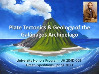
  • 1. Plate Tectonics & Geology of the Galápagos Archipelago University Honors Program, UH 204D-002: Great Expeditions Spring 2013
  • 2. HMS Beagle • HMS Beagle was a Cherokee-class 10-gun brig-sloop of the Royal Navy • She was launched on 11 May 1820 from the Woolwich Dockyard on the River Thames, at a cost of £7,803 and named after the beagle dog breed • In July of that year she took part in a fleet review celebrating the coronation of King George IV in which she was the first ship to sail under the new London Bridge • She was adapted as a survey barque (three or more masts) and took part in three major surveying expeditions • On the second survey voyage the young naturalist Charles Darwin was on board, and his work would eventually make Beagle one of the most famous ships in history • 1870 – scrapped
  • 3. Beagle: Vital Statistics • 90.3-feet-long • Beam  25-feet-wide • Draught (draft)  12.5 feet – Vertical distance from water line and bottom of the hull – keel – Determines the minimum depth of water the vessel can safely navigate, and the weight of cargo she can carry • Tons burthen  235 bm; 242 for second voyage • Initially outfitted as a 10-gun Brig • 1825  re-rigged as a three-masted Barque (Bark) with only 6-guns • When she was in the Galapagos, she had 65 men on board – very cramped living conditions!
  • 5. Tons Burthen • Builder's Old Measurement (BOM or bm) is the method of calculating the cargo capacity of a ship used in England from approximately 1650 to 1849 • It estimated the “tonnage” of a ship based on length and maximum beam • It is a volumetric measurement of cubic capacity and NOT of weight; it is expressed in "tons burthen”
  • 6. Sail plan of a three-masted barque:
  • 7.
  • 9. HMS Beagle: Straits of Magellan
  • 12. Beagle’s History • First voyage (1826-1830) – Hydrographic survey of Patagonia and Tierra del Fuego • Second voyage (1831-1836) – Darwin’s voyage – Extensive surveys in South America, returning via New Zealand and Australia to England on 2 October 1836 • Third voyage (1837-1843) – Survey large parts of the coast of Australia • Final years – In 1845 the Beagle was refitted as a static coastguard watch vessel to control smuggling on the Essex coast in the navigable waterways beyond the north bank of the Thames Estuary
  • 13. Second Voyage (1831-1836) 1. Fix the longitude of Rio de Janeiro, from which all other distances would be measured 2. Make a hydrographic survey of the coast of South America and other places visited 3. Make astronomical and tidal observations 4. Report on the geology, climate, natural history, people and cultures of the places visited  Darwin’s arena
  • 14. Voyage of the HMS Beagle 27 December 1831 to 2 October 1836
  • 15.
  • 16. A watercolour by HMS Beagle's draughtsman, Conrad Martens. Painted during the survey of Tierra del Fuego, it depicts native Fuegians hailing the Beagle.
  • 18.
  • 19.
  • 20.
  • 21. Darwin’s Beagle Experience (1831-1836) • The Beagle set sail from England on December 27, 1831 when Darwin was 22 years old; he would not see England again for almost five years • Living quarters = one corner of the ship’s chart room in the stern (“poop cabin”) – 3 x 3.5m and 1.813m high (5.95 ft.) – 250 books, wash stand, chest of drawers, instrument cabinet, two hammocks, and a large central chart table – Shared the room with midshipman Philip Gidley King and Ship’s Mate John Lort Stokes (who slept in a small annex to the cabin)
  • 22. Darwin’s Quarters: Chart Room HMS Beagle, 1832. Interior layout memory sketch by Philip Gidley King, midshipman during the second voyage, prepared in 1897.
  • 23.
  • 24. The C&GS Ship Pioneer passing under the Golden Gate Bridge. The first towed marine magnetometer, which was invented at the Scripps Institution of Oceanography, was first deployed on this ship beginning in August 1955. (NOAA Photo Library)
  • 26. Glomar Challenger Deep Sea Drilling Project – DSDP 1968 – 1983 (NSF funded)
  • 27. JOIDES / Resolution Joint Oceanographic Institutions for Deep Earth Sampling ODP Ocean Drilling Program
  • 28.
  • 29.
  • 30. Integrated Ocean Drilling Program (IODP) Scientific deep sea drilling vessel Chikyu has set a new world record by drilling down and obtaining rock samples from deeper than 2,111 meters below the seafloor off the Shimokita Peninsula of Japan
  • 31. Alfred Wegener Institute for Polar & Marine Research http://www.awi.de/en/home/
  • 32. Russian ship: Arctic coring expedition
  • 33. Galápagos Archipelago • Spanish names: – Archipiélago de Colón – Islas de Colón – Islas Galápagos • Archipelago  island group, island chain, cluster of islands, or a sea containing a large number of scattered islands • Derived from the Greek ἄρχι- – arkhi- ("chief") and πέλαγος – pélagos ("sea") • Types of archipelagos: – Continental fragments (tectonically rifted continental margins) – active margin – Continental islands (“drowned” margins – Scotland) – passive margin – Oceanic islands • Volcanic arcs – subduction zones • Island chains – Hawaiian Islands (hot spots) • The Galápagos consists of 13 main islands, 3 smaller islands, and 107 rocks and islets • Located at the confluence of three ocean currents, the Galápagos are a “melting pot” of marine species
  • 34. Location • 973 km (525 nmi; 605 mi) west of continental Ecuador • 1°40'N–1°36'S, 89°16'–92°01'W – Volcán Wolf and Volcán Ecuador on Isla Isabela lie directly on the equator • The first crude navigation chart of the islands was made by the buccaneer Ambrose Cowley in 1684 (??); he named the individual islands after some of his fellow pirates, or after the British noblemen who helped the privateer's cause – English pirates pilfered Spanish galleons carrying gold and silver from South America to Spain • More recently, the Ecuadorian government gave most of the islands Spanish names, but many biological researchers still use the older English names because those were used by Darwin
  • 36.
  • 37. 1684 Map Ambrose Cowley Waved Albatross Galápagos Marine Iguana
  • 39. Isabela – SPOT Satellite
  • 40.
  • 41.
  • 42.
  • 43. Galápagos Geology • The Galápagos Islands are: – An active group of basaltic volcanoes – Located near two seafloor spreading ridges – Part of a west-ward propagating seafloor spreading ridge – Sitting on top of a mantle hotspot – Site of the first discovery of seafloor hydrothermal vents on a spreading ridge (“Black Smokers”)
  • 44. Name Last Eruption Darwin Island Extinct Fernandina 2009 Ecuador (volcano) 1150 Wolf Island Extinct Cerro Azul 2008 Wolf (volcano) 1982 Darwin (volcano) 1813 Alcedo 1993 Sierra Negra 2005 Santiago Island 1906 Pinta Island 1928 Marchena Island 1991 Santa Cruz Island Unknown Floreana Island Extinct Genovesa Island Unknown San Cristóbal Island Unknown
  • 45.
  • 46. Geology Overview • The islands are located at the Galápagos triple junction • The archipelago is located on the north margin of the Nazca Plate, which is moving ESE and diving under the South American Plate at a rate of 2.5 inches (6.4 cm) per year • It is also atop the Galápagos volcanic hotspot (mantle plume) • The islands have a volcanic legacy going back 10s of millions of years
  • 48.
  • 49.
  • 50. Seafloor Morphology • Complex interplay of N-S trending structures associated with the EPR and E-W trending structures associated with the Galápagos Ridge • EPR changes from fast spreading to intermediate spreading and develops an axial rift valley • Galápagos Ridge develops an axial graben that deepens westward, reaching >4000m in the Hess Deep • West of the Hess Deep there is no clear expression of the Galápagos Ridge – Gap of 25-km between the spreading centers – Magmatic gap?
  • 51.
  • 53. The first guyot - discovered by Harry Hess of Princeton University (guy-ot [gee-o ])
  • 54. Guyot • (guy-ot [gee-o ]) • Flat-topped submarine seamount, the summit of which lies l000-2000 m below the ocean surface • Seamount is a mountain rising from the ocean seafloor that does not reach to the water's surface (sea level) and thus is not an island • The term “guyot” is named after Arnold Guyot (1807-1884), 19th century Swiss- American geologist Rodriguez Seamount/Guyot
  • 56. Galápagos Hotspot • Responsible for the creation of the Galápagos Islands and three major aseismic ridges – Carnegie Ridge – Cocos Ridge – Malpelso Ridge • Hotspot is complicated by its proximity to the Galápagos triple junction (i.e., relative motion of three plates, not just simple divergent seafloor spreading) • Unlike many hotspots, the magmatic system is heterogeneous – evidence of four major reservoirs feeding the hotspot
  • 57.
  • 59. Calculated absolute velocity vectors relative to fixed hot-spot frame
  • 60. Bathymetry around the Galápagos Galapagos Bathymetry by William Chadwick, University of Oregon
  • 61.
  • 64.
  • 65.
  • 67. Black Smokers • Hydrothermal vent fields at or near ridge crests • Vent fluids = up to 400oC • Fluid chemistry from different spreading centers is remarkably similar despite big differences in spreading rates • vent fluids have equilibrated with greenschist assemblage of minerals • Metalliferous deposits are common – Hot, acidic, sulfide-rich solutions – Base metals are precipitated when vent fluids come in contact with cold seawater
  • 68. Galápagos Black Smokers • The first warm springs to be found on the mid-ocean ridge were discovered in 1977 on the Galápagos spreading center • Astonishing communities of animals around them, but they were weakly- flowing vents emitting room-temperature fluids into the frigid surrounding bottom waters • In 1979, scalding hot “black smokers” jetting from the seafloor were discovered elsewhere on the global mid-ocean ridge system • Since 1977, additional exploration of the eastern Galápagos spreading center located a few more diffuse vents populated by animals, but did not succeed in finding any black smokers; some workers suggest that the influence of the Galápagos hotspot on the Galápagos spreading center may inhibit formation of cracks required to provide deep, hot fluid pathways for black smokers, making smokers rare and hard to find
  • 69.
  • 70. Fast Spreading 9-18 cm/yr Intermediate Spreading 5-9 cm/yr Slow Spreading 1-5 cm/yr “Rise” Spreading rates versus topography
  • 72. Fast Spreading-- Southern East Pacific Rise from 13 to 23°S
  • 73. Upper crustal structure of a fast spreading ridge •Broad arch with small axial graben •Melt lens beneath rise •Broad low-velocity zone
  • 75. Intermediate Spreading--Juan de Fuca Ridge near 48°N
  • 76. Simplified view of a slow spreading ridge & axial graben Discontinuous axial volcanic ridge
  • 77. Slow Spreading--Mid Atlantic Ridge near 22°N
  • 79.
  • 80. Seafloor Spreading Rates • Pacific-Cocos spreading rate  137 mm/yr • Pacific-Nazca spreading rate  135 mm/yr • Galápagos Ridge spreading rate  41 mm/yr • Galápagos tip  propagates westward at 66 mm/yr
  • 81. Galápagos Triple Junction • RRR triple junction that separates the Nazca, Cocos and Pacific seafloor plates • The fast-spreading East Pacific Rise trends N-S in this region and continues without offset past the triple junction – Smooth topography across the rise • Galápagos Ridge  E-W trending and slow-spreading – Separates the Cocos and Nazca plates, to the north and south, respectively – Rough, more faulted topography across the ridge
  • 82.
  • 83. Triple Junctions • The Earth’s lithosphere comprises a mosaic of interlocking plates • There are several places on the planet where three plates come together - these are called triple junctions • Triple junctions mark the intersection of combinations of: – Rifts or ridges (spreading centers) – Transform fault boundaries – Convergent boundaries (subduction zones)
  • 85. East African Rift & Afar Triangle •Gulf of Aden •Red Sea •East African rift
  • 91.
  • 92.
  • 93.
  • 94. Galápagos Gore • Intersection of EPR & GR  V- shaped, triangular, faulted region called the Galápagos Gore – “V” opens to the east – Older crust in the east than the west based on magnetic anomalies – The Galápagos Ridge has propagated from east-to- west as it developed
  • 95.