Philippine Biodiversity Conservation Priorities Terrestrial and Inland Water Areas

The following maps were produced by the Philippine Biodiversity Conservation Priority-setting Program (PBCPP). This program ‘mobilized over 300 local and international scientists from more than 100 institutions from the government, the NGO community, the academia, the people’s organizations, donor communities, and the private sector’. It held regional consultation ‘where local experts validated preliminary data gathered’ and a follow up national consultation with ‘more than 200 experts from 70 institutions’. The outcome of this extensive and valuable exercise was published in the Philippine Biodiversity Conservation Priorities ‘A Continuing Challenge for the Filipino Peoples, A Second Iteration of the National Biodiversity Strategy and Action Plan, Final Report’.

Recomendados
Recomendados
Más contenido relacionado
Similar a Philippine Biodiversity Conservation Priorities Terrestrial and Inland Water Areas
Similar a Philippine Biodiversity Conservation Priorities Terrestrial and Inland Water Areas (20)
Más de No to mining in Palawan
Más de No to mining in Palawan (20)
Último
Último (20)
Philippine Biodiversity Conservation Priorities Terrestrial and Inland Water Areas
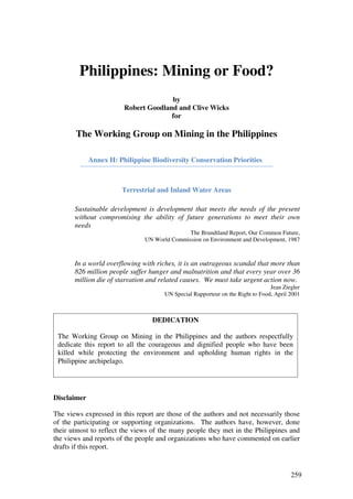
- 1. Philippines: Mining or Food? by Robert Goodland and Clive Wicks for The Working Group on Mining in the Philippines Annex H: Philippine Biodiversity Conservation Priorities Terrestrial and Inland Water Areas Sustainable development is development that meets the needs of the present without compromising the ability of future generations to meet their own needs The Brundtland Report, Our Common Future, UN World Commission on Environment and Development, 1987 In a world overflowing with riches, it is an outrageous scandal that more than 826 million people suffer hunger and malnutrition and that every year over 36 million die of starvation and related causes. We must take urgent action now. Jean Ziegler UN Special Rapporteur on the Right to Food, April 2001 DEDICATION The Working Group on Mining in the Philippines and the authors respectfully dedicate this report to all the courageous and dignified people who have been killed while protecting the environment and upholding human rights in the Philippine archipelago. Disclaimer The views expressed in this report are those of the authors and not necessarily those of the participating or supporting organizations. The authors have, however, done their utmost to reflect the views of the many people they met in the Philippines and the views and reports of the people and organizations who have commented on earlier drafts if this report. 259
- 2. Annex H: Philippine Biodiversity Conservation Priorities The following maps were produced by the Philippine Biodiversity Conservation Priority-setting Program (PBCPP). This program ‘mobilized over 300 local and international scientists from more than 100 institutions from the government, the NGO community, the academia, the people’s organizations, donor communities, and the private sector’. It held regional consultation ‘where local experts validated preliminary data gathered’ and a follow up national consultation with ‘more than 200 experts from 70 institutions’. The outcome of this extensive and valuable exercise was published in the Philippine Biodiversity Conservation Priorities ‘A Continuing Challenge for the Filipino Peoples, A Second Iteration of the National Biodiversity Strategy and Action Plan, Final Report’. The Authors have selected a subset of maps to provide a flavor this outstanding biodiversity hotspot consisting of over 7,000 Islands containing 52,177 species many of which are not found elsewhere in the world. Super imposing a map of the mining operations and applications on any of these maps would show that many of the most fragile tropical ecosystems are directly threatened by large scale mining projects. The six areas visited by the Authors are indicative of this. Areas are numbered and the sites visited or areas in their immediate vicinity can be indentified in the maps as follows: Midsalip: 155, Libay 154, Tampakan 144, 146; Pujada Bay 142; Mindoro 61 – 69; Sibuyan Island 82 These six locations feature in all most all of the priority areas identified in the maps below. Mining at any of these sites would directly impact on these priority biodiverse rich ecosystems. The following maps are included: 1) Terrestrial and inland waters conservation priority areas 2) Terrestrial and inland water areas of biological importance 3) Conservation and Research Priority Areas for Arthropods 4) Conservation Priority Areas for Terrestrial Mammals 5) Conservation Priority Areas for Birds 6) National Integrated Protected Area System (NIPAS) Components vis-a-vis Integrated Terrestrial and Inland Water Priority Areas Map 7) Marine Conservation Priority Areas 8) Conservation Priority Areas for reef fishes, corals molluscs and mangroves 9) Conservation Priority Areas for dugongs, cetaceans, seagrasses and seaweeds This output of the ‘Philippine Biodiversity Conservation Priority-setting Program’ the National Biodiversity Strategy and Action Plan should become the cornerstone of the National Sustainable Development Strategy. It should consequently inform all plans, programs, policies and standards of all government departments, bodies and agencies. It should inform all multilateral and bilateral investment in the Philippines. The promotion of mining has seriously undermined this program and immanently threatens the very sustainability of the Philippine Archipelago. 260
- 3. Biological diversity – or “biodiversity” for short – is a general term for the diversity of genes, species and ecosystems that constitute life on planet Earth. It is defined as "the variability among living organisms from all sources including, inter alia, terrestrial, marine and other aquatic ecosystems and the ecological complexes of which they are part; this includes diversity within species, between species and of ecosystems”.. .and .. “In-situ conservation means the conservation of ecosystems and natural habitats and the maintenance and recovery of viable populations of species in their natural surroundings and, in the case of domesticated or cultivated species, in the surroundings where they have developed their distinctive properties.” (Article 2 of the Convention on Biological Diversity) Terrestrial and Inland Water Areas and Location Index / Code T e rre s t ria l & In la n d Wa t e r P rio rit y A re a C o de T e rre s t ria l & In la n d Wa t e r P rio rit y A re a Co de B a ta ne s Is la nds P ro te c te d La nds c a pe a nd M t. Ha lc o n 63 S e a s c a pe 1 Na uja n La ke Na tio na l P a rk 64 B a buya ne s 2 Ka lba rio - P a ta pa t Na tio na l P a rk 3 S a bla ya n 65 Apa ya o Lo wla nd F o re s t 4 lglit a nd B a c o M o unta ins 66 Abulo g R ive r 5 M a lpa lo n 67 B ugue y We tla nds 6 B o gbo g, B o nga bo ng a nd M t. Hitding 68 C a ga ya n R ive r 7 M t. Hinundua ng 69 M t. C a gua 8 S o uth M indo ro Is la nds (S e m ira ra Is la nd Gro up) 70 B a lba la s a ng - B a lba la n Na tio na l P a rk 9 C o ro n La ke s 71 M t. C e ta c e o 10 C uyo Is la nd Gro up 72 Abra R ive r 11 El Nido 73 P e a ks o f C e ntra l C o rdille ra (a bo ve 1000 m a s l) 12 La ke M a ngua o 74 P e ña bla nc a P ro te c te d La nds c a pe 13 S a n Vic e nte - Ta yta y - R o xa s F o re s t 75 P ue rto P rinc e s a S ubte rra ne a n R ive r Na tio na l No rthe rn S ie rra M a dre Na tura l P a rk 14 P a rk (C le o pa tra ’s Ne e dle ) 76 Agno / Am bura ya n R ive r 15 Vic to ria a nd Ana pa la n R a nge s 77 C a ra ba llo - P a la li M o unta in R a nge 16 M t. M a nta linga ja n 78 C e ntra l S ie rra M a dre M o unta ins 17 Urs ula Is la nd 79 C a s e c na n R ive r B a s in 18 B a la ba c Gro up o f Is la nds 80 Auro ra Na tio na l P a rk 19 B uria s Is la nd 81 Za m ba le s M o unta in R a nge (M t. Ta pula o a nd M t. S ibuya n Is la nd 82 High P e a k) 20 B a lo go Wa te rs he d 83 C a m p O’Do nne l 21 Tic a o 84 M t. Ara ya t Na tio na l P a rk 22 No rthwe s t P a na y P e nins ula 85 Anga t Wa te rs he d F o re s t R e s e rve 23 C e ntra l P a na y M o unta ins : M a dja a s -B a lo i S ie rra M a dre P o rtio n a lo ng B ula c a n, Nue va Ec ija C o m ple x 86 a nd Que zo n bo rde r 24 J a la ud R ive r 87 Um ira y R ive r 25 No rthe a s te rn P a na y - Giga nte s 88 M t. Irid - M t. Ange lo 26 M t. Villio n - M a pili 89 C a nda ba S wa m p 27 M o bo - Us o n 90 B a ta a n Na tura l P a rk a nd S ubic B a y F o re s t M a lbug 91 R e s e rve 28 Da ra ga - P la c e r – M a la tugo n 92 M a rive le s M o unta ins 29 M t. S ila y - M t. M a nda la ga n 93 M a nila B a y 30 M t. C a nla o n Na tio na l P a rk 94 M t. B inua ng a nd vic inity 31 B a n-ba n 95 Ka liwa -Ka na n R ive r 32 Ilo g R ive r 96 UP La nd Gra nts (P a kil a nd R e a l) 33 B a s a y - Hino ba -a n 97 P o lillo Is la nd 34 M a ns a nga ba n 98 P a s ig R ive r 35 C ue rno s de Ne gro s (M t. Ta linis ) 99 La guna de B a y 36 Twin La ke s 100 Ta dla k La ke 37 C a tm o n / C a rm e n 101 M t. M a kiling F o re s t R e s e rve 38 Ta buna n F o re s t 102 7 La ke s o f S a n P a blo C ity 39 M t. B a na ha w - S a n C ris to ba l -Luc ba n C o ne M a c ta n, Ka la wis a n, C a ns a fa B a y 103 C o m ple x 40 Ola ngo Is la nd 104 M t. P a la y-P a la y - M t. M a ta a s na Gulo d Na tio na l Arga o 105 P a rk 41 M t. M a la ra ya t R a nge 42 Nug-a s a nd M t. La nto y 106 Ta a l La ke 43 M t. Ka ngbula ging a nd M t. La na ya 107 M t. C a ba la ntia n - M t. C a po to a n C o m ple x 108 P a ns ipit R ive r 44 S o uthe rn S a m a r M o unta ins 109 Que zo n Na tio na l P a rk 45 B ilira n a nd M a ripipi Is la nds 110 P a gbila o a nd Ta ya ba s B a y 46 J e ta fe Gro up o f Is la nds (C a lituba n a nd Ta ho ng- La la guna M a rs h 47 ta ho ng Is la nd) 111 R a ga y Gulf 48 R a ja h S ika tuna Na tio na l P a rk 112 B o ndo c P e nins ula 49 M t. P a nga s uga n (No rthe rn Le yte M o unta in M t. La bo 50 R a nge ); La ke M a ha gna o 113 C a ra m o a n P e nins ula 51 Ano na ng - Lo bi R a nge 114 C a ta ndua ne s Is la nd 52 M t. Na c o lo d - C a ba lia n Are a 115 M t. Is a ro g Na tio na l P a rk 53 P a na o n Is la nd 116 La ke Na bua 54 Ho m o nho n Is la nd 117 La ke B uhi / La ke M a na pa o / La ke Ka tugda y 55 Dina ga t (M t. Ka m binllo & M t. R e do ndo ) 118 La ke B a to 56 S ia rga o Is la nd 119 B a c o n-M a nito 57 La ke M a init 120 M t. B ulus a n Na tio na l P a rk 58 M im bilis a n P ro te c te d La nds c a pe 121 M a rinduque 59 M t. B a la to c a n 122 Luba ng Is la nd 60 M t. Hilo ng-hilo ng (Urda ne ta ), Agus a n de l No rte 123 M t. C a la vite 61 Agus a n R ive r 124 P ue rto Ga le ra 62 261
- 4. Terrestrial and Inland Water Areas and Location Index / Code (contd) T e rre s t ria l & In la n d Wa t e r P rio rit y A re a C o de T e rre s t ria l & In la n d Wa t e r P rio rit y A re a C o de No rthe rn Que zo n (C e ntra l S ie rra M a dre ) 223 No rth Diwa ta (B is lig, M t. Agtuuga no n -M t. P a s ia n) 125 S o uthe rn S ie rra M a dre 224 Agus a n M a rs h 126 P o lillo Wa te rs he d a re a 225 M t. Ka lua ya n - Kina ba lia n (Kim a ngkil R idge ), S o uthe rn Que zo n (S o uthe rn S ie rra M a dre ) 226 B ukidno n - Agus a n de l No rte bo rde r 127 Ala ba t Is la nd 227 M t.Ta go R a nge 128 C a m a rine s No rte 228 M t. Kita ngla d 129 B ic o l Na tio na l P a rk - M t. La bo 229 Ka la tunga n R a nge 130 M t. Kula s i 230 Ola ngui R ive r 131 Is a ro g - C a ra m o a n 231 M una i Ta m bo C o m ple x (Ko la m buga n upla nds & M t. M a lina o 232 a s s o c ia te d m o unta ins ) 132 B ulus a n La ke 233 La ke La na o 133 M indo ro M o unta ins 234 La ke Na pa lit 134 La ke Na uja n 235 M t. P ia ga yunga n (R a ga ng) C o m ple x 135 M t. B utig / La ke B utig Na tio na l P a rk 136 Apo R e e f M a rine Na tura l P a rk 236 P ula ngi R ive r 137 Ilin Is la nds 237 C a la m ia ne s 238 M t.S ina ka 138 C a la uit Is la nd 239 M a rilo g F o re s t R e s e rve , B ukidno n – Da va o B us ua nga Is la nd 240 bo unda ry 139 C ulio n Is la nd 241 S o uth Diwa ta M o unta in R a nge s 140 No rthe rn P a la wa n 242 P a ntuka n M a bini - M a c o Are a 141 P ue rto P rinc e s a S ubte rra ne a n R ive r a nd Uluga n Tum a dgo P e a k 142 Bay 243 M t. Apo R a nge 143 C e ntra l P a la wa n 244 Liga wa s a n M a rs h 144 S o uthe rn P a la wa n inc luding B a la ba c Gro up o f S o uth C o ta ba to I S ulta n Kuda ra t (M t. Da gum a ) 145 Is la nds 245 M t. M a tutum 146 S o uthe rn P a la wa n 246 La ke S e bu a nd M t. Thre e Kings 147 M t. M a nta linga ja n - S o uthe rn P a la wa n 247 M t. B us a - Kia m ba 148 M t. Guiting-guiting Na tura l P a rk 248 M t. P a rke r 149 Ta bla s 249 La ke M a ugha n 150 R o m blo n Is la nd 250 M t. La tia n C o m ple x (S a ra nga ni M o unta ins ) 151 M a s ba te 251 La ke Dum ina ga t 152 Ea s te rn P a na y 252 M t. M a linda ng a nd La ke Dum ina ga t 153 Guim a ra s Is la nd 253 M t. Da pia k - M t. P a ra ya 154 S o uthe rn Ne gro s - B a s a y C a ve s 254 M t. S uga rlo a f 155 Hino ba -a n 255 M t. Tim o la n 156 C ue rno s de Ne gro s R e gio n 256 Lituba n - Quipit Wa te rs he d 157 Alc o y Wa te rs he d 257 P a s o na nc a Wa te rs he d 158 Samar 258 B a s ila n 159 C e ntra l S a m a r - C a po to a n C o m ple x 259 C a m o te s Is la nd 160 S o ho to n - Lo quilo c o n a re a 260 S iquijo r 161 M t. Ya c gun - M t. S o ho to n C o m ple x 261 C a m iguin Is la nd 162 La ke Da na o 262 S ulu 163 M t. P a nga s uga n & Ano na ng - Lo bi R a nge M t. Da jo Na tio na l P a rk 164 (No rthe rn Le yte M t R a nge ); La ke M a ha gna o 263 No rthe rn Le yte 264 Ta wi.-ta wi Is la nd 165 Ea s te rn Le yte 265 M a nuk-m a nka Is la nds 166 S ibutu a nd Tum inda o Is la nds 167 Ea s te rn M inda na o (fro m M t. S ina ka , M t. Ka lua ya n - M t. Kina ba lia n, M t. Hilo ng¬hilo ng, B is lig, M t. B utig - C a ga ya n Is la nds 168 Ka m pa lili - M a yo -Tum a dgo P e a k 266 Tubba ta ha R e e f Na tio na l M a rine P a rk 169 M t. B a la to c a n - Kina ba lia n R a nge 267 C a ga ya n de S ulu 170 M t. Diwa ta R a nge 268 B a ta ne s Is la nds P ro te c te d La nds c a pe a nd B is lig 269 S e a s c a pe , a nd B a buya ne s 207 M t. Agtuuga no n - M t. P a s ia n 270 Ilo c o s M o unta in R a nge 208 B ukidno n / La na o de l S ur 271 No rthe rn C o rdille ra 209 La na o de l No rte 272 Ka linga - Apa ya o 210 M t. P uting B a to - Ka m pa lili - M a yo C o m ple x 273 No rthe rn S ie rra M a dre 211 M t. P uting B a to 274 C e ntra l C o rdille ra 212 M t. M a linda ng a nd La ke Dum ina ga t - M t. Da pia k - C o rdille ra 213 M t. P a ra ya 275 M t. P ula g Na tio na l P a rk 214 C e ntra l Za m bo a nga 276 S o uthe rn C o rdille ra 215 We s t Za m bo a nga 277 Is a be la - S ie rra M a dre 216 M t. B a ndila -a n 278 Auro ra - S ie rra M a dre 217 M t. Hibo k-hibo k 279 Auro ra Wa te rs he d Are a s 218 S ulu - Ta wi-ta wi 280 M t. Dinga la n 219 Ta wi-ta wi 281 M a ria Auro ra M e m o ria l P a rk -M inga n M o unta ins 220 S im unul a nd M a nuk-m a nka Is la nds 282 Za m ba le s - B a ta a n 221 Turtle Is la nd 283 M t.Ta pula o 222 262
- 5. Marine Areas and Location Index / Code M a rin e P rio rit y A re a C o de M a rin e P rio rit y A re a Co de M a rin e P rio rit y A re a Co de B o lina o 171 F uga Is la nd 308 Guim a ra s Is la nd 369 Za m ba le s C o a s t 172 Ilo c o s - B a buya n - B a ta ne s 309 C a m o te s Is la nd 370 El Nido to Uluga n B a y 173 B a buya n - B a ta ne s 310 B a is B a y 371 Ka la ya a n Is la nd Gro up 174 We s t M indo ro 311 No rth B o ho l 372 B a ta ne s 175 P a la wa n 312 We s te rn B o ho l 373 B a buya n Is la nds 176 S o uth P a la wa n 313 C a bla o B a y 374 B ugue y 314 S o go d B a y 375 Ve rde Is la nd P a s s a ge - B a ta nga s 177 P a la ui Is la nd 315 S o uthe rn Le yte 376 C a la m ia ne s 178 No rthe a s t Luzo n 316 P a ngla o 377 Ta yta y - Dum a ra n B a y 179 Divila c a n - C a s a ps a pa n B a y Are a 317 S iquijo r 378 B a la ba c Is la nd 180 Divila c a n 318 C a m iguin 379 Ta pa l - S a nta Ana - Va lle y P o int 181 Auro ra -Que zo n 319 Da pita n 380 P a la na n - Divila c a n B a y Are a 182 C a s a ps a pa n - Dila s a g - C a s igura n 320 B a lia nga o 381 P o lillo Is la nd 183 C a s igura n S o und Auro ra 321 P a nguil B a y 382 C a la ua g B a y 184 P o lillo Is la nd - C a m a rine s No rte 322 Antique – S e m ira ra 383 Tic a o - S a n B e rna rdino S tra it - La m o n - C a la ua g - Lo pe z - B a s ia d La go no y Gulf 185 B a ys 323 S o uth Ne gro s - S um ilo n Is la nd 384 S o uth Le yte 186 La m o n B a y 324 Ne gro s – Za m bo a nga 385 Lia nga B a y 187 C a m a rine s No rte 325 S o uth M indo ro 386 S ia rga o - Dina ga t 188 C a ra m o a n C o a s t 326 S e m ira ra Is la nds 387 We s t S a m a r 189 C a ta ndua ne s 327 We s t P a na y - Ne gro s 388 Vis a ya n S e a 190 Gigm o to 328 We s t P a na y (Antique ) 389 Ta ño n S tra it 191 La go no y - Alba y Gulf 329 Ea s t C o a s t o f P a la wa n 390 Da na jo n R e e f 192 S o uthe a s t B ic o l C o a s t 330 No rthe a s t P a la wa n 391 S uriga o 193 B a c o n, S o rs o go n 331 Ea s t o f C e ntra l P a la wa n 392 B o ho l Tria ngle 194 No rthe rn S a m a r 332 P ue rto P rinc e s a 393 Ta bla s S tra it 195 Guba t 333 Na rra - B ro o ke s P o int 394 P a na y Gulf- Guim a ra s S tra it 196 No rth S a m a r 334 S o uthe a s t P a la wa n 395 S o uth Ne gro s 197 B in Is la nd - B a lic ua tro Is la nds 335 S o uthwe s t Ne gro s 396 Za m bo a nga de l No rte 198 Tikling Is la nds 336 S o uthe rn Ne gro s C o a s t 397 C uyo Is la nds 199 Ea s t S a m a r 337 Tubba ta ha R e e fs - C a ga ya n Ho nda B a y 200 Ora s B a y 338 Is la nds 398 Tubba ta ha R e e fs 201 Guiua n 339 C a ga ya n Is la nds 399 C a ga ya n de Ta wi-ta wi - Turtle Ea s t M inda na o 340 We s t S ulu S e a 400 Is la nd 202 S uriga o de l S ur 341 C a ga ya n R idge 401 S ulu Arc hipe la go 203 Da va o Orie nta l 342 Turtle Is la nd 402 M o ro Gulf 204 P uja da B a y 343 Za m bo a nga de l S ur – M a lita , Da va o de l S ur 205 S ia rga o Is la nd 344 Za m bo a nga de l No rte 403 S a ra nga ni B a y 206 Go ve rno r Ge ne ro s o 345 P ila s Is la nd 404 Linga ye n Gulf 284 P a gbila o B a y 346 S o uth M inda na o 405 Za m ba le s - P a nga s ina n 285 B o ndo c P e nins ula 347 S ta . C ruz 406 Za m ba le s C o a s t a nd Offs ho re 286 R a ga y Gulf - M a s ba te - S a m a r S e a 348 Dum a nquilla s B a y 407 S ubic - B a ta a n 287 R a ga y - Tic a o - B uria s 349 Da va o Gulf 408 M a nila B a y 288 B uria s - La go no y Gulf - No rthe rn S a m a l Is la nd 409 Luba ng Is la nd 289 Samar 350 S ulta n Kuda ra t 410 Lia n - C a la ta ga n 290 B uria s - Tic a o Are a 351 S ulta n Kuda ra t - 411 Ve rde Is la nd P a s s a ge 291 Te m plo Is la nd, B uria s P a s s 352 S o uth C o ta ba to 412 P ue rto Ga le ra B a y 292 S o rs o go n B a y 353 Apo R e e f 293 M a rinduque - 354 We s t P a la wa n 294 R o m blo n - S ibuya n 355 P o rt B a rto n 295 M a s ba te - R o m blo n - S ibuya n S e a 356 El Nido 296 S ibuya n Is la nd 357 No rthwe s t P a la wa n 297 B o ngs a ngla 358 Ta yta y B a y 298 S o uth M a s ba te 359 M a la m pa ya 299 Samar Sea 360 We s t o f C e ntra l P a la wa n 300 We s te rn S a m a r 361 S o uthwe s t P a la wa n 301 Iba ja y 362 Ka la ya a n / No rthe a s t Inve s tiga to r 302 No rthe a s t P a na y 363 B a ngui 303 Es ta nc ia 364 Ilo c o s 304 Guim a ra s S tra it 365 M a s inlo c 305 C a diz-S ila y 366 M a s inlo c - Da s o l B a y 306 S a ga y 368 S c a rbo ro ugh S ho a l 307 263
- 6. Terrestrial and inland waters conservation priority areas 264
- 7. Terrestrial and inland water areas of biological importance 265
- 8. Conservation and Research Priority Areas for Arthropods 266
- 9. Conservaton Priority Areas for Terrestrial Mammals 267
- 10. Conservation Priority Areas for Birds Midsalip, Pujada Bay, Mindoro, Sibuyan Island, Sibutad Identified 268
- 11. National Integrated Protected Area System (NIPAS) Components vis-a-vis Integrated Terrestrial and Inland Water Priority Areas Map Areas in or close to Midsalip, Tampakan, Mindoro, Sibuyan Island, Pujada Bay all identified as integrated inland water priority areas 269
- 12. Marine Conservation Priority Areas Area 204 Impacted by Midsalip and Tampakan; Area 198 Impacted by Midsalip and Libay; Area 195 Impacted by Mindoro and Sibuyan Island 270
- 13. Conservation Priority Areas for reef fishes, corals molluscs and mangroves 271
- 14. Conservation and Research Priority Areas for Inland Waters 272
- 15. Conservation Priority Areas for dugongs, cetaceans, seagrasses and seaweeds 273