
Recomendados
Recomendados
Más contenido relacionado
La actualidad más candente
La actualidad más candente (20)
Similar a 2013: Designing Dredge Studio Toledo
Similar a 2013: Designing Dredge Studio Toledo (20)
Último
Último (20)
2013: Designing Dredge Studio Toledo
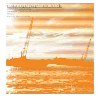
- 1. designing dredge studio: toledo pennsylvania state university department of landscape architecture fall 2012 instructor: sean burkholder Department of Landscape Architecture College of Arts and Architecture
- 2. special thanks to: Joe Cappel and the Toledo Port Authority Kristin Gardner and Hull and Associates Sandy Bihn and the Lake Erie Water Keeper / Toledo Lighthouse Society Robin Whitney and the City of Toledo document prepared by: Sean Burkholder Assistant Professor of Landscape Architecture slb59@psu.edu in collaboration with: students enrolled in PSU LARCH 414 Studio Fall 2012 image: toledo port authority
- 3. image: noaa
- 4. The United States Army Corps of Engineers and its associated contractors annually dredge over 4 million cubic yards of material from Great Lakes navigation channels. Half of this material is placed within confined disposal areas (CDF) while the other half is open-water disposed or re-used for other purposes such as habitat creation or as a supplemental construction material. This process thus converts over half of the material dredged from the Great Lakes back into new land in some form; unfortunately at first glance this newly configured land is much less productive and valuable than its non-eroded past life. These undervalued sediment-scapes are however some of the most dramatic and biologically diverse landscapes in the city and are laden with potential if correctly considered. Of that 4 million cubic yards of dredged material, about 1/4 of it is pulled from the harbor in the city of Toledo, Ohio. The USACE map on the facing page shows the 20-mile federally-managed shipping channel cut into three pieces to fit on the page. The USACE map below indicate the critical condition present in Toledo, in terms of quantity and placement options. With a depth rarely exceeding 10 feet, the western basin of Lake Erie require Dredged Material Management constant management in order to provide adequate shipping draft depths. The complexity in moving this large volume of material is compounded by the speculated (but highly likely) environmental issues associated with its Current Conditions The GLNS is facing within the lake. While many challenges. Figure 10 the open placement many dredged material managementother states within belowGreat Lakes Basin do not permit open water illustrates status dredged material disposal, the current Lakes. ofHarbors designatedmanagement at eachEngineers have established several agreements that The state of Ohio and the U.S. as “red”Corpsdredged material Army have of commercial harbor on the Great permit this placement while satisfying the general concernsnavigation management issues that could limit the ability of USACE to maintain federal of the Ohio Department of Natural Resources. It is channels and therefore this channel availability within five years. Yellow harbors assumed that while restrictarrangement is not ecological optimal, it is the only feasible method of addressing the would be affected within 10 years, and green harbors are expected to have no pressing large volume of material within the navigation channel. a critical open water disposal may always be a reality for the issues within the next ten years. Additional details on harbors with While dredged material management status are included in the sought Sheets Appendix D. city, alternatives are constantly being CDF Fact to minimize it. DREDGED MATERIAL MANAGEMENT STATUS Figure 10: The dredged material management status for all GLNS commercial harbors has been identified by the GLNS Team. Harbor status was determined by factors including, but not limited to, remaining CDF capacity, annual dredging requirements and material disposal options; Cleveland and Toledo are cross-hatched to indicate the criticality of DMM issues in those harbors. image: u.s. army corps of engineers The studio itself was broken into two projects. The first of which (Project 1) studied the site scale interventions that would be made possible with a large influx of dredge material. The redevelopment of parks and residential neighborhoods with new dredge-infused topography was the primary outcome of many projects. While this scale of projects served a significant social function, even the largest of projects could only manage a year or two of dredge material before reaching capacity. The second project of the studio, was aimed at dealing with much larger volumes of material by considering the entire Maumee Bay.
- 5. While issues of dredge management were a primary topic of focus, there were many interrelated issues. The most important of these issues is the environmental health of Lake Erie. As the most ecologically productive of the Great Lakes, it is also the most shallow. This condition makes it very susceptible to ecological stresses such as pollution and invasive species. Another factor in the Maumee Bay is the historic Toledo Harbor Lighthouse. This structure was built in 1904 and exists as a valuable piece of cultural infrastructure. Its location also marks the north extent of what is considered the Maumee Bay. Many of the projects looked to take on both ecological issues and incorporate the Harbor Lighthouse. The conditions in Toledo are not fantasy. The same reality is true for the proposed projects. The situation is growing desperate and with it, the list of possible considerations becomes more fantastical. New island CDFs, submerged and emerged habitat restoration ares (HRU), upland farmland placement, existing habitat nourishment, abandoned mine disposal via rail and material recycling have all been considered with complete seriousness. While the management of this material appears to be placing an incredible burden on the region, an opportunity could be discovered in this process to completely reconsider the relationship between dredge and the city. In no place is this more possible than in the city of Toledo. image: u.s. army corps of engineers
- 6. project 1 image: sean burkholder
- 8. Gabriella Salvemini [independence park] Project Statement As dredging continues in the city of Toledo, there is a need for beneficial use of the abundant silts and clays taken out of the Maumee river and bay. Toledo is abundant in green space, and lacking verticality in the landscape. The purpose of this design is to introduce monumental landform that can be both a public amenity and a beneficial use of dredge material. Utilizing the idea of a canyon as inaccessible landform, three monumental mounds ranging in size from 40-60 feet in height rise above the river, containing about two years’ worth of dredge material. Inaccessible habitat creation in the form of retaining wall mounds form visual landscapes; the public experience the site through recreation trails and spaces that access the verticality of the tallest mound. The space is a place for containment of dredge, new habitat, and new forms of recreation for the city. It is the hope that this design can show how dredge material can inhabit a visible area of the city and enhance a public experience that sheds positive light on dredge in the Maumee. Canyon section 2’ gabion 1’ 10’ wide pathway 7’ 6’ segmented wall 5’ 4’ segmented wall 2’ gabion 120 layer 3 layer 2 dredge layer 1 1’ 3’ gravel setting bed 4 steel sheet piling to retain dredge gabion walls filled with reclaimed material 1.5’ 2.5’ NTS
- 9. 3 Site features River path Recreation path Accessibility: full Purpose: walking/running Materials: gravel base 10’ wide path highlights views to Toledo skyline, sheet pile retaining walls reflect history of the city 5 Public mound(s) 1 Accessibility: partial Purpose: recreation, views to skyline Materials: gabion retaining walls, dredge Amount of dredge contained: 158,336.5 y3 2 Elevated walkway 4 Accessibility: full Purpose: recreation, views to skyline Materials: concrete, steel I-beam support Aesthetic mound 2 Accessibility: none Purpose: visual interest, dredge retainment Materials: sheet pile retaining walls, dredge Amount of dredge contained: 156,832.3 y3 Natural Inspiration 3 Functional mound 3 Accessibility: none Purpose: dredge containment Materials: sheet pile retaining walls, dredge Amount of dredge contained: 381,724.3 y3 1 Total Contained Dredge Material: 696,893.1 y3 Dewatered Dredge volume/year: 360,000 y3 5 Bird’s eye view Public mound includes a 20’ high sledding hill at 20-30% slope with 10’ wide level space at top for further recreation Toledo, OH International Park 0 62.5 125 N Scale Mound creation Void spaces create mounds wa t abstracted er c Overall dimensions Acres: 42 o ur Height of mounds se 40’ public 60’ public 40’ functional 40’ functional 40’ functional 36’ functional ’ 360 8’ 28 305 40’ for combined sewer pipe as 5’ 4’ L 5’ 5’ 7’ 6’ 60’ mound 1 40’ mound 3 tp ha se e as st ph 0 20 40 7 layers maximum 1 Site section Fir Phasing For mounds 2 and 3, utilizing sheet pile retaining walls 40’ mound 2 12’ wide walkway allows access to the 45’ elevation on the public mound, providing sweeping views of downtown Toledo and the Maumee River One Sea Gate Building: 411’ Elevated walkway 8’ 2 3,750’ or 0.7 miles Comparison 80’ 250’
- 10. Matthew Chiampi [independence park] International Park Toledo, OH Eight billion gallons of sewage is dumped into the Maumee River and Lake Erie annually. Akron and Toledo contribute about almost 90% of that sewage pollution and Toledo itself accounts for 44%. The issue of sewage pollution and open-lake dredging are two of the main reasons for the declining of overall health of Lake Erie. Combined sewer systems are not an issue but in Toledo’s case, the problem lies in part with the combined sewer system overflow. The combined sewer transport both stormwater and sewage to eventually be treated in cdf containers calculations a treatment plant. When flows become too extreme for the system to handle, the overflow system is initiated pumping both stormwater and sewage into the Maumee River and Lake Erie. pedestrian access full containment cdf pedestrian walkway interaction cdf restored wetland open recreation cdf To help alleviate this issue, I propose tapping into existing stormwater systems and diverting it to be day-lighted 5,531,546.24 cu. institute delineation of the at International Park. This would produce a “stormwater watershed,” which wouldft. surrounding context where water would be harnessed and then transported to the site. Ideally, this system would be able to incorporate dredge material by creating containers (CDF’s) for dredge material and using dredge material to contain. A folded landscape along with underground cisterns would allow for flows of 1,423,650.98 cu. ft. stormwater to slow, filter through percolation, enter holding cisterns, and re-enter the system decreasing the frequency of combined sewer overflow polluting. Entirely new combined sewer systems may contain increased amounts of stormwater but still have the 2,548,322.29 cu. ft. possibility to pollute through overflows. Rather than raise the city’s storwmater budget on costly infrastructure improvements, Toledo can utilize the existing needed process of dredging to create landscapes that filter, slow, and decrease quantities of stormwater that enter the existing system. This can transform dredge material into a highly useful resource to not only the city of Toledo, but also to Lake Erie. meadow landscape 3,971,973.27 cu. ft. interaction cdf bio-filtration landscape dredged channel 0 0 400’ 35,417,159.31 cu. ft. = 48,892,652.09 cu. ft. of dredge site masterplan 50’ site details
- 11. 1 interaction 2 open recreation space 3 full containment + 1 containers 2 dump dredge 3 cap + finish site process 1 bio-filtration 2 meadow 1 landscape fold = 36,541,537 cub. ft. dredge material containers restored wetland pedestrian circulation cdf typologies folded landscape 3 restored wetland cs pipe + cisterns 4 light recreation site axonometric dredge typologies CDF PERSPECTIVE
- 12. Larch 414 International Park 11/2/2012 Thomas Kyd Master Plan Design Intent The 28 million dollar proposed pipeline is scheduled to be implemented in 2015. This pipe holds a storage volume of 4.9 million gallons (24,000 cubic yards), this cut sub terrain of the pipeline volume will be mixed with dredge material in order to create the landscape found thought the site. These large mounds contain a total volume of 57,050 cubic yards of dredge material and will create a rare landscape that defines the constructed environment. The undulating mounds will also give Toledo residents a space that cannot be found anywhere around the city. This dredge material will be taken from Confined Disposal Facilities (CDFs), and trucked to the site. The added commercial areas will attract additional visitors and allow for a diverse experience. Riparian buffer comprising of native species. These riparian areas will allow for a variety of plant species, reduction in pollution, and a diverse visual experience. Entrance path that leads to the main boardwalk. Entrance path that leads to both the bike and pedestrian paths. This path moves along a 10ft high mound with a volume of 850 cubic yards. Start of the main boardwalk that runs along the riverfront. Existing entrance road to site. Renovated parks and recreation building. Surrounded by a 1300 cubic yard mound. 4 Commercial Water Front An added architectural building design that features a restaurant in order to help attract more visitors and give an exclusive riverfront experience. Existing commercial buildings will remain. 2 Spiral Mound The largest dredge mound accompanied by a spiraling path that leads a visitor almost 30 ft above the existing grade. This elevated visual view will give the visitor a unique experience. The dredge mound has a volume of approximately 25,000 cubic yards. Docking area will expand in order to give additional space for visitors to come by boat. The site is defined by the landscape forms and thus constructed element revolve around the position of these forms. The existing parking lot will be utilized but 1/3 of the original parking area will be taken away. Landscape is built around proposed buildings to create a transition of hierarchy. Volleyball court area will be moved and downsized in order to make room for landscape features and additional commercial space. The surrounding three mounds hold a combined volume of 3500 cubic yards. These landforms not only hold 2500 cubic yards of dredge material but are also used to create a varied topography to create an interesting change that is found no where else in Toledo. This last commercial building is built into the landscape creating an inspirational ideology of designing within the dominant landscape. This landscape mound has a volume of approximately 2000 cubic yards. Riparian buffers will be included along the boardwalk to create a diverse number of species, allow for proper stormwater infiltration and give a change in the boardwalk experience. 1 The mounds also contain native species commonly found within a northern majestic forest. Another spiral path mound that holds 9500 cubic yards of dredge. These types of mounds contain ground flora and fauna for a more open experience, slope stabilization, and to deter visitors from diverging off the path. Boardwalk with Mound Existing trail head will be preserved and repaired if the pipeline has damaged it. 3 Connection between the main boardwalk and walking paths that move throughout the site. The remaining dredge mounds found above and below the connection consist of a combined 5000 cubic yards. The total volume of all of the mounds found throughout the site comprises of 57,050 cubic yards of dredge material. Forested areas will contain natural openings, allowing for a diverse set of species and a variety of experiences. This mound has a volume of 1800 cubic yards. Commercial Mound Existing road will change due to the landforms of the dredge material allowing for a unified hierarchy which is defined by the landscape. As a continued threshold from the more structured commercial area decreases, the amount of dredge mounds and forested area will increase. This mound holds 4600 cubic yards. Purposed E-3 Storage pipeline to be implemented in 2015.
- 13. Ashley Reed Table of Contents [edison park] Design Abstract Thomas Edison6 Park 2-5 Toledo Park Infrastructure Research Urban Entertainment Precedents 7 Site Plan 8 Park Features and Ampihtheatre CDF 9 Section A: Road to Stage 9 Section B: Marina to Rails to Trails 9 Elevation C: Boardwalk Bridge 10 Urban Camping 11 Toledo Park Infrastructure Research The Thomas Edison Park was designed to create an urban outdoor entertainment space for the city of Toledo. Toldeo’s greenspace infrastructure lacks natural areas, entertainment venues and a connection to surrounding areas and future development; this design brings these amenities together in a naturalistic urban entertainment park. The main feature of the park is the Edison Amphitheatre to hold weekly attractions such as concerts, speakers, movie nights, and other large events. The Forest Clearings are intimate flexible spaces that can act as picnic areas or be turned into campgrounds for large events bringing in revenue for the city. The Edison Boardwalk and Skyline Outlook bring visitors out to the Maumee River and also offer views of Toledo’s industrial infrastructure as well as the skyline and the bridge. The Boardwalk Bridge connects the site to the Maritime Museum and future development. The Event Lawn and Formal Welcome Area create open space to hold large community events such as farmer’s markets, snowball fights, carnivals and fairs, sporting events, and also can be converted to a large campground for events. Finally the Constructed Wetland creates a contrast in not only form but the environmental habitat on site. These features work together to create an urban entertainment park that will serve Toledo and the surrounding communities for years to come. Evening on the Boardwalk Ashley Reed The Pennsylvania State University Landscape Architecture 414 November 2012 Map and Table Data Source: The City of Toledo Division of Recreatio Recreation Thomas Edison Park Thomas Edison Park 2 1 Urban Entertainment Urban Entertainment Evening on the Boardwalk Thomas Edison Park 11 Urban Entertainment Urban Camping Thomas Edison Park 10 Urban Entertainment
- 14. Skyline Outlook Boardwalk Connection to Maritime Museum • Boater’s Entrace • Allows Boaters to Dock and Attend Events • Gathering Area for Campers • Views towards Downtown Toledo Boardwalk Bridge • Has 14’ Boat Clearance Constructed Wetland Skyway Stage Edison Boardwalk • Brings visitors to the water • Views of Bay, Bridge, and City • Natural Area • Maumee Fed • Dredge lined for nutrients • Variety of Events • Veterans’ Glass City Skyway as backdrop A Rails to Trails • Connection to City’s Existing Trail System • Entrance for Pedestrians and Cyclists C Maritime Museum Edison Amphitheater • Seating for Events • Mini-CDF for Dredge • Backside is a constructed grassland Park Trail System Maritime Museum Boat Docks • Extends, throughout the site, the City’s trail system B Separation Mound • Give’s site connection Boating community • Block’s site from road • Dredge Material • Constructed Grassland Formal Welcome Area • Entrance for Pedestrians and Cyclists Main Entrance Parking Lot • Driver’s Entrace • Existing Maritime Parking lot renovated with more spaces and a drop off Separation Mound Event Lawn • Block’s site from road • Renovation and Extension Forest Clearing • Dredge Material • Constructed of existing tree grove • Intimate Grassland • Natural Area Gathering Areas • Camping • Picnics Forest Connection to Front Street Park Features 32 16 64 Section B: Marina to Rails to Trails 0 32 16 64 Elevation C: Boardwalk Bridge 0 32 16 64 • Another Space with a variety of Events • Central Gathering Area 0 Thomas Edison Park 9 Urban Entertainment 64 32 128 5’ Contours Shown (Exceptions at the start of the landforms) Amphitheatre CDF Thomas Edison Park Natural Area’s • Forest • Wetland • Grassland • Connection to water • Heavily Planted Boat Connections 2’ Sheet Piles for Sitting Nooks • Maritime Museum Boat Docks • Boardwalk Bridge connecting Museum to site Forest Clearings 1.5’ Sitting Wall • Campgrounds for large events, brings in revenue to Toledo • Intimate Gathering Areas 6” Clean Soil Cap • Picnic Areas Trails • Network throughout site • Connection to Rails to Trails Lighting • Taking advantage of bridge and industrial lights on the river • Mimicking industrial lights with bulb lights on boardwalk Lawn Maintenance 7’ Drilled Sheet Pile • Main Gathering Lawn, Amphitheatre , and Forest Clearings needs maintained often for weekly use Entertainment Spaces • Gathering Lawn for recreation, but also farmers’ markets, carnivals, winter events, fairs, more campground, and block parties. • Amphitheatre for concerts, plays, speakers, shows, benefits, and summer movie nights. • Also designed for everyday use. Dredge Material • Mini Combined Disposal Facility in Amphitheatre, sheet pile used to create terraces • All mounds are constructed out of dredge • 6” soil cap on dredge to control phragmites and promote healthy vegetative growth • Layer of dredge on bottom of wetland, nutrients in dredge helps establish a healthy wetland • Site holds 918,513.41yd³ of dredge material which is about 2.5 years of Toledo’s dredge production (after drying) Section A: Road to Stage 0 • Entrance for Pedestrians and Cyclists • Connection to major intersection • Connection to Tribute Park Grass Covered 7 Terraces for Seating Urban Entertainment Filled with Dried Dredge Material Not to a Scale Thomas Edison Park 8 Urban Entertainment
- 15. Griffen Galante [edison park] Project Description: Create a contemplative destination for the Business Leaders Meeting at the future marina docks project site of Chinese investors Yuan Xiaohona and Wu Kin Hung. This design will be a park for industry and business leaders to meet with clients and co-workers. This space will create a stress-free experience of inspiration and creativity. It will also bring the hard, industrious city closer to the natural landscape. The design elements of this project focus on the symbolic and metaphorical meanings behind rocks and mountains. A vertical element is created by layering dredge material until a karst topographical mountain develops on the site. Pedestrians will experience this mountain on two different levels: above being the surface level of movement, and below in the tunnel being the meditative experience. The site will host many different activities, including contemplative experiences, recreational, business meetings, picnics for local residents, and exercise zones. The site will use roughly 300,000 cubic yards of dredge material in the construction of this project. TOLEDO, OHIO : Modern Industrial Leader Design Intent Griff Galante Dredge Studio - Sean Burkholder Toledo, Ohio Create a Contemplative Destination for Business Leaders Meeting at the Future Marina Docks Project of Chinese Investors Yuan Xiaohona and Wu Kin Hung. This Design Will Be a Park for Industry and Business Leaders to Meet With Clients and Co-workers. This Space Will Create a Stress-Free Experience of Inspiration and Creativity. It Will Also Bring the Hard, Industrious City Closer to the Natural Landscape. The Chinese believed that somewhere in the highest mountains there was a cave that was an exact representation of the world outside. In its center was a stalactite that gave off the milk of contentment. Any rock that suggests a mountain, cave or stalactite became symbolically important. This idea is reinforced by the Chinese notion that in addition to north and south, east and west, the most important orientation was ‘in’. It is because of this inward focus that Chinese culture looked for paradise inside of things, just as western culture looked upward and outside. In Chinese art, this orientation caused a search for ‘a world within a world’, for imagery in surprising and unpredictable places.v Thomas Edison Park [”The Most Important Orientation, Was IN”] Let us imagine that early Chinese lived in limestone caves. We know that karst limestone caves are common in China, and that among their characteristics are endlessly winding tunnels. They have underground streams and lakes, skylights, even fish. The geography of this world was so complex, that people would not be able to explore and map them in a dozen lifetimes. Paradoxically, when they emerged from these caves, they could readily see and walk around the small mountains that contained these ‘worlds within worlds’. bridge and main access road. These roads allow for intriguing views for drivers. This path is the mirror opposite of the “Above World” level of movement. The lower bath involves the experience of “Self-Awareness.” It is a literal metaphor for meditation and the journey to your inner-self. The lower gathering space will spot a pedestrians 50 feet below the “Overlook,” gazing in awe at the fact that they have walked on a normal path, into a winding tunnel, and reached the water’s edge with a mountain standing tall behind them. Pedestrians can enjoy the end of their “Journey” into their own minds, by relaxing with friends to enjoy lunch with a cool breeze The “Above World” level of movement on the site. Here pedestrians have the full freedom allowed by their legs to roam the hill top. This movement is based on the concept of an “Unfocused Mind.” The “Overlook,” a balcony looking down upon the pedestrians who have arrived at the waterfront from the tunnel. This space adds a destination for the pedestrians walking above, as well becomes a relaxing place to sit and picnic in good weather conditions. Circulation Diagram, Points of Interest
- 16. TOLEDO, OHIO : Modern Industrial Leader TOLEDO, OHIO : Modern Industrial Leader Quarry Garden This Award WInning Design Led to the Design Element of the Tunnel, Ending With a Realisation That One Has Just Walked Through an Enormous Mountain Landscape. B Slot Canyons The Natural Erosion Created By Desert Winds Was the Inspiration for the Tunnel Designs. The Awe Inspiring Effect Caused By the Light Rays Shining Through the Crevasses in the Ceilings Became the Basis for the Tunnel Types. 6 Ceiling Types 5 The Tunnel Has Many Elements That Relate Closely to Slot Canyons Found in Popular Desert Locations Around The World. The Tunnel Will Have Varied Ceiling Types, Placed in Varied Integrals Along the Mountain Surface. The Types consist of an Open Path, Partially Closed, and Fully Closed Path. Each Type Creates a Different Experience Along the Tunnel, By Allow ing Varying Amounts of Sun Light to Shine Down. 4 Open Ceiling The Open Ceiling Is Located Along the Entrance Heading Into the Tunnel Itself. 3 1 Rendered Perspectives 2 Partially Closed Depending Upon the Location of This Ceiling, Fences Will Be Placed Around the Openings to Protect People From Falling In. If the Tunnel Is Shallow Enough, Pedestrians Will Be Able to Access the Edge and Watch People Walking Below. A Fully Closed This Type of Ceiling Provides Pedestrians Above a Connector Bridge to Pass Over the Tunnel Beneath. This Type Doesn’t Extend Far as It Will Create an Undesired Claustrophobic Experience for Pedestrians Within the Tunnels raffic 1 Parking Lot, One Way T Access Directly From Adjacent Park 2 The Fork The Choice to Walk Freely or Deliberately 3 The Tunnel Experience a Meditative Journey 4 Open Mind The Freedom to Walk Where You Please Tunnel Elements 5 The Overlook Experience Views of The River, Downtown, and The Bridge 6 The Waterfront Look Back in Awe at The Rising Mountain You Have T raversed Rendered Plan, Critical Points TOLEDO, OHIO : Modern Industrial Leader A B Rendered Sections, Critical Points
- 17. Matthew Moffitt [edison park] Very little sediment dredged from the Toledo Harbor is being beneficially re-used, remediated, or efficiently recycled. The Ohio EPA has expressed concern in the viability of open lake dredge placement and CDF dredge storage as practical sediment management strategies. In addition, Toledo residents lack the comprehension of dredge material as a functional element. This proposal illustrates Edison park as a catalyst for the interaction between dredge remediation and site user. Dredge will be exposed in various containers on-site. It’s performative processes of accretion, dewaterment, and succession are accelerated to yield various outputs for the city of Toledo. These in-situ functional processes are bordered by raised pedestrian circulation ‘ribs,’ inducing a dialectic interaction between site user and dredge remediation. Through efficient cycles of 2 weeks and 6 months, two classes of remediated dredge are shipped off-site for use by Toledo in both transportation and residential construction projects. Phasing | Site Process Cycles public shipping channel dredging projects Phasing | Site Construction Phasing | Site Process Cycles private environmental remediation dredging projects confined disposal facilities Hydraulic Dredge Material Dry Dredge Material via docked barge Initial Landform Construction via dump trucks hand + machine labor 2 week cycle | week 0 2 week cycle | week 2 + 6 month cycle| month 0 barge parks at loading dock, hydraulic dredge is pumped into container 1 dredge dewaterment process complete. water is released into container 5, 90% of dredge [class b] is shipped off-site*, 10% remains on-site for further remediation Construct Semi-Public Landforms fill: dry dredge material Dry dredge material is trucked on-site for construction of contained landforms that determine the spatial composition of public and private spaces. Dredge Dewatering Diffused Water Container 1 Container 5 Rhizofiltration Container 5 Construct Public Circulation Infrastructure materials: see structural rib axon continuous 2-3 weeks Class B Dredge Material output [water + plant remains] Containers 2+3+4 B Class B dredge material has been fully dewatered but not remediated. It is suitable for adaptive re-use as fill in transportation infrastructure projects as conducted by the city of Toledo Phytoremediation Containers 2+3 6 months output [class a dredge material] A Class B dredge material has been phytoremediated by introducted species, helianthus annuus. The majority of organic pollutants (PCBs, PAHs) have been removed. It is suitable for adaptive re-use as fill in residential and commercial projects as conducted by the city of Toledo + B output [class b dredge material] 6 months output [biofuel briquette] + + Diffused water is rhizofiltered by introduced species, typha latifolia. Water, having undergone two phases of remediation is released into the Maumee River. Typha latifolia is culled and shipped off-site for compositing and wetland mitigation projects. 6 month cycle | process 6 month cycle | month 6 rhizofiltration + phytoremediation + admixture sampling class a dredge + culled vegetation + admixture products shipped off-site* Admixture Sampling Container 4 varies + output [various construction materials] 5| Water Release Container Water diffused from the dredge dewatering process is piped into dredge container 5. Here, water is released into the container via one of 5 valved pipes. The idea of ‘containment’ will allow for the introduction of aquatic rhizomatous grasses. Introduced species such as typhus latifolia will perform rhizofiltration acting as a second filter for the diffused water from the original dredge input. The majority of organic pollutants leftover from the original hydraulic dredge input will be accumulated by these introduced species (PCBs, PAHs). Filtered water will then be releasedContainers + Viewing Nodes Construct Dredge over a constructed armor rock weir to the existing Maumee River. The materials: be terraced to promote the establishment of shallow photic zones where egress side of the weir is to steel + re-enforced concrete 5 submerged aquatic vegetation may grow. 1 output: rhizofiltered water [originally diffused from dredge dewaterment 2 in container 2] + mature wetland grasses for re-planting/composting 4 + + 3 Helianthus annuus may be culled and removed off-site after having accumulated a sufficient quantity of organic pollutants from class b dredge materials in containers 2 +3. The sunflowers may be re-used in biofuel generation on or off-site Container Typology Perspective 2| Additional Remediation of Released Water from Container 1 Container Typology Perspective 1| Functional Remediation of Hydraulic Dredge Material Container Perspectives| Legend [correspond with container typology perspectives 1+2] input trans outpu fer t outpu t rele 1| Dredge Dewatering Container Dredge is pumped into container 1 via a valved line that attaches to the hydraulic dredge unit upon arrival at the dock. The 50% water, 50% solid dredge input is capped with a reusable polymer membrane and vacuum pressure is applied via an adjacent tank. Pressure is applied with the most force above infiltration beams, where water migrates to a coarse aggregate layer. Here, water percolates to one of several perforated pipelines, which directs the water towards dredge container 5 (see container typology perspective 2), for further remediation and release into the river. output: class b dredge material [suitable for transportation infrastructure projects], removed at 2-3 week intervals B 2+3| Phytoremediation Containers Dewatered dredge from container 1 is removed in 2 week cycles. The majority of this output is shipped off-site for use in infrastructure projects directed by the Ohio Department of Transportation. Priority access to this dewatered dredge material will be awarded to the city of Toledo for urban renewal projects. Containers 2, 3, and 4 will receive the remainder of the output from container 1’s two week cycles. Phytoremediation processes will be applied to this material, via the use of sunflowers and the introduction of microbial populations. Sunflowers will be culled and harvested upon seasonal cycles. output: class a dredge material [suitable for residential, commercial + fill projects] + biofuel briquette [suitable for industrial use as a substitute for other fossil fuels], removed at 6 month intervals 4| Admixture Application Container Less than 5% of class b dredge is moved to container 4 at the end of each biweekly cycle. Various aggregates, reinforcement elements, and chemical admixtures may be applied to class b dredge within various holding cells. output: construction materials [suitable for a wide range of projects and research based on the success of the applied admixture] ase input rele ase A + ase rele infiltr ate infiltr ate infiltr ate infiltr ate infiltr ate infiltr ate trans outpu fer t 3 2 h 4 a e b d c 1 d c g b a f 5| Water Release Container Water diffused from the dredge dewatering process is piped into dredge container 5. Here, water is released into the container via one of 5 valved pipes. The idea of ‘containment’ will allow for the introduction of aquatic rhizomatous grasses. Introduced species such as typhus latifolia will perform rhizofiltration acting as a second filter for the diffused water from the original dredge input. The majority of organic pollutants leftover from the original hydraulic dredge input will be accumulated by these introduced species (PCBs, PAHs). Filtered water will then be released over a constructed armor rock weir to the existing Maumee River. The egress side of the weir is to be terraced to promote the establishment of shallow photic zones where submerged aquatic vegetation may grow. output: rhizofiltered water [originally diffused from dredge dewaterment + in container 2] + mature wetland grasses for re-planting/composting a sealed drainage mat with polymer membrane e here, vacuum pressure is applied from a vacuum pump in order to accelerate the dredge dewatering process, the drainage mat is dark black to intercept and contain heat during summer months, speeding up the dewatering process b dredge slurry input [rapid dewatering] c geotextile filter fabric d coarse drainage aggregate e perforated drainage pipe removed water is relocated to dredge container 5 where further infiltration and release into constructed remediation wetlands occurs f hydraulic dredge pipe a valved pipe connects to the site dock extension where hydraulic dredge is released into container 1 g internal water infiltration beams h dump truck/crane dewatered dredge is transported from container 1 to containers 2-4 a diffused water is piped inward directly from container 1 b five valved secondary pipes collect water from the entry line and release water into container 5 via a slow and controlled process in order to inhibit microecosystem disturbance c typhus latifolia and other rhizomatous wetland grasses are introduced to rhizofiltrate the remainder of organic pollutants within the introduced water flow d armor stone control weir e water is released back into the Maumee River, having undergone two remediation processes. The pier extends into the river and uses varying size stones to promote the establishment of aquatic ecosystems adjacent to the river release point.
- 18. Structural Rib Axon| Circulation Infrastructure for the Viewing of Research Containers as ‘Theatre’ Plan Render | Site Interactions • rib enclosure railing • modular pre-cast concrete ‘cap’ 8 • structural steel deck • steel truss bearing structure • initial phase constructed landform 7 6 9 5 1 10 2 4 3 Site Section Perspective| Visual Interaction with the Maumee River 11 6 13 14 12 Site Process Sections | Hydraulic Dredge Remediation +Excavation Infrastructure Site Process Sections | Hydraulic Dredge Remediation +Excavation Infrastructure 2-3 WEEKS EA DEWATER + TRANSFER + REMOVE [CLASS B DREDGE] CYCLE 2 | 6 MONTHS EA REMOVE [CLASS A DREDGE] + HARVEST [CROP FOR BIOFUEL] Cycle 1 Processes i. A barge docks at the proposed landing point, via a new extension to the existing Maumee River shipping channel. A valved attachment pumps hydraulic dredge into dredge container 1 with the appropriate volume and velocity. ii. A control valve releases hydraulic dredge into container 1 at a controlled rate. During each 2-3 week cycle, enough hydraulic dredge is released to retain a consistent dewatering process. iii. Water diffused from dredge container 1 is piped into a release cistern attached to container 5. A series of pipes control the release of water from the cistern into container 5 at a velocity harmless to the succession of aquatic vegetation. iv. Content threshold weir: dewatering process is separated (with some transparency) from the class b dredge collection process. v. Water infiltration lines: spread across the base of the container, additional diffused water is collected and output towards container 5 vi. Dewatered class b dredge is removed from container 1. The majority of class b dredge is shipped off-site in trucks and used for transportation infrastructure projects in Toledo. 5-10% of class b dredge is removed during each biweekly cycle and dumped into containers 2 and 3 for cycle 2 phytoremediation processes or dumped into container 4 for material testing. CLASS B DREDGE DEWATERED,TRANSFERED OFF-SITE Cycle 2 Processes i. A barge docks at the proposed landing point, via a new extension to the existing Maumee River shipping channel. A valved attachment pumps hydraulic dredge into dredge container 1 with the appropriate volume and velocity. ii. Introduced typhus latifolia is removed from container 5 and shipped off-site. It may be used in sustainable composting projects conducted by the city of Toledo. iii. Water diffused from dredge container 1 is piped into a release cistern attached to container 5. iv. Dewatered class b dredge is removed from containers 2 and 3. Introduced helianthus annuus is removed from container 5 and shipped off-site. It may be used as biofuel during renewable energy generation testing. CULLED TYPHA LATIFOLIA TRANSFERED OFF-SITE ii iii. 5 water [release!] river i input [hydraulic dredge] ii iv 1 slurry [dewater]_water v CLASS A DREDGE + CULLED HELIANTHUS ANNUUS TRANSFERED OFF-SITE i iii iv vi slurry [dewater]_dewatered dredge 1 2 site dewatered dredge [phytoremediate] 5 water + vegetation river input [hydraulic dredge] 1 slurry [dewater]_water slurry [dewater]_dewatered dredge 1 2 site remediated dredge + vegetation
- 19. project 2 image: andy turner via panoramio
- 21. Gabriella Salvemini Connective Landscape The dredging industry is necessary to the city of Toledo, connecting the city to other large cities and the United States Interior by allowing freighters to carry their cargo from port to port. This idea of connection is the basis for design. By connecting people to the physical manifestations of dredge, they can understand why this process performs a positive function. Focusing on freighters as a direct result of dredging and invasive species as the indirect result of these activities, purposeful design moves help people recognize hidden connections and become further informed on how dredging fits in to their contemporary landscape. 10’ deep concrete rhizome barriers extend across the lowlands around water bodies. They serve two purposes, functioning to restrict rhizome growth of phragmites and reed canary grass, and acting as pathways across the island. The barriers vary in width; 6’ wide, 3’ wide, and 2’ wide. The widest are for people to move across, the smallest is functional. In order to explore beneficial uses of invasive species, a series of control devices are implemented within a portion of the third island. The remainder of the island serves as disturbed habitat for comparison of growth patterns. By preventing rhizome growth, fragment movement, and seed movement, the goal is to provide control methods for invasive species, allowing them to take on a new role in the contemporary landscape. Rhizome barriers Landform is arranged in 15’ high ridges to prevent the movement of purpleloosestrife seeds via wind. The ridges are oriented to block seeds moving with the summer wind directions. Seed barrier Dense mesh is stationed at the entrance to the interior waterway as well as the entry and exit of each of the 3 ponds. This is to prevent movement of aquatic plant fragments from water body to water body. Aquatic invasives will be planted on the outer waterways, with the hope that fragments will be stopped by the mesh and limited invasives found in the t interior of the waterway. Jan. Bow Aquatic barrier Feb . c. De Rifle No rch v. Ma rch sea Re April Oct. Ma pt. Se e Au Jun g. y July To gain funds for the construction and maintenance of the island, hunting will be promoted as the main use of the island. Restrictions on hunting season, bag limit, and spread of invasives off the island provide structure to an otherwise open landscape. The island will be open to researchers during the off-season to gather data on control methods. Connections between people, freighters, and invasive species converge at Toledo Harbor Light 3 : forest Deer habitat Upland habitat is meant for deer, with landform designed around a series of ‘pinch points’ that function as places where deer congregate. Species like oak, wild grape, and clover will be planted for forage. 2 : pond Monitoring The series of ponds have nets installed to prevent plant fragment movement at each end, and through monitoring scientists can see any relationship between nutrient levels on interior water versus lake water to see if methods in the bay are working. 1: bay Filtration The bay is planted with phragmites australis, and has nets for zebra mussels in the water. This arrangement is meant to help filter nitrogen and phosphorus out of the water that enters into the stream. Micro habitat relationships 1: bay 2 : pond 3 : forest
- 22. Primary Reproduction Method e om rhiz d see t men frag ers velig Habitat atic aqu and wetl Nutrient Absorbtion atic aqu ts ma r izeGrowth th row id g rap olon ed c rad deg Pattern high sity den bility d via see Accessible to the public, this island includes boat docks so people can visit the historic Toledo Harbor Light and experience native plant communities via raised boardwalk that traverses the island. A 30’ high viewing deck allows the public to visually interact with passing freighters utilizing the dredge channel. The viewing deck also allows views to the existing Toledo Harbor Lighthouse, and constructed wetlands beneath. Characteristics of invasive species are drawn upon in the design to create a space that investigates positive effects and higher control of their spread. Deer are included in this investigation since they can become an invasive species themselves, and often create the degraded landscapes that invasive species thrive on. escape routes surrounding elevation sun exposure open area to bed Design of the islands are very user specific; spanning the dredge channel they each hold a different vegetative context for people to experience. The smallest is designed to show anthropogenic influences on native plant communities and provide interactions with freighters in the channel. At the center, an island is dedicated to native plant communities accessed only by researchers for monitoring purposes. The largest island houses invasive species, with one half exercising control over them, and the other left for colonization so that growth habits may be compared. The largest island is designed with respect to environmental conditions and deer habitat requirements. Wind and lake currents inform the location of a bay and stream with a series of ponds that cuts across the island. A portion of the island implements a series of control devices meant to stop rhizome growth, fragment, and seed movement. Site Plan 3 : controlled invasive Phasing 3 : invasive ISLAND 1 : Public + native species 2 1 ISLAND 2 : Research + native species Lak e summer wind curre nt ISLAND 3 : Hunters and researchers + invasive species
- 23. Emma Hahn Harborlands The exchange of ballast water is a stabilization mechanism necessary to the shipping industry. The rocess, which maintains buoyancy after changes in cargo weight, also has some serious ramifications for the ecology of the Great Lakes. When ballast water is taken up, aquatic organisms, seeds, and microbes that reside in the water column are taken in as well. Ideally, most of these species will expire during the voyage but, some survive and are released with the ballast water at the destination port. This process has led to the introduction of a wide range of non-native and invasive species, such as sea lamprey and zebra mussels, where the ballast water acts as the conduit for this exchange. Ballast water system as stabilizing mechanism Ballast water as conduit for invasive/non-native flora and fauna Cargo unloaded Native organisms captured Cargo loaded Empty cargo hold Ballast tanks 1 >>Source port 2 >>In transit Some species die off Full cargo hold Full ballast Nearly empty ballast Ballast tanks 3 Non-native organisms expelled 4 >>Destination >>In transit 1 >>Source port 2 >>In transit 3 >>Destination 4 >>In transit = SEVERE ecologic / eco``nomic costs to Lake environment and associated industries (750 mil to 1 bil in one decade for zebra mussels alone)* *”Progress and Challenges in Preventing introduction into U.S. Waters Via the Ballast Water in Ships,” U.S. GOA, 9/2005 In reaction to this, the Coast Guard has implemented the “Final Rule,” a set of laws that dictate that all ballast water exchange occur 200 nautical miles from shoreline and at a depth of 2000 meters, effectively making the Great Lakes a no exchange zone. The final rule is a short term solution lacking alternate exchange zones and proving to be largely ineffective. The UN set forth a series of recommendations as a result of a convention held on the topic that demand a set of standards for ballast water to be put in place and for the ballast water capacity of ships to be enlarged, a process viewed as unattractive to the shipping industry as it diminishes cargo space on board a vessel. This design proposes an approach that forms a break between the input and output of ballast water, creating a treatment system contained by dredge material that serves to mediate the exchange process. “The Final Rule” regulations and United Nations IMO requirements Mediate inputs and outputs through alternate method Lack of exchange zones Released foreign ballast water >>Shortcomings - Exemptions 200 nautical mi. >> 2000 m. mi. >> 2000 m. depth 200 nautical depth - Lack of altnative exchange zones - Ineffective containment of invasive species - SHORT-term solution >>UN requirements - Development of alternate methods - Increase in ship ballast capacity bal- cargo + - Exchanged lake ballast water
- 24. The system establishes Toledo as a hub for ballast water exchange within the Great Lakes. The first element, the alternate exchange zone is located along the shipping channel for ease of accessibility and provides exchange services, treatment of ballast water, and defouling maintenance. The second element, the existing Ironhead Marine Inc. graving dock will become the headquarters in expertise for the enhancement of ship ballast capacity. Coupled, the system will allow the region to meet UN standards while provide options for exchange without the sacrifice of cargo space. The proposed alternate exchange zone features a dry dock and treatment island. The dry dock enables vessels to release ballast water into the treatment sequence and to intake sanitized water, as well as receiving defouling services, through which algae, mussels, etc. are removed from the vessel before going to port. Once ballast water is released, it is piped into the treatment sequence present on the island. Floating dry dock Lake Erie Bath house 1 >> Ballast management island alternate exchange zone + ballast water treatment + defouling Shipping channel 2 Shipping channel Surplus holding cell 2 >> public hot springs Cooling run >> holding cell 1 Viewing platform 2 >> Ironhead High Bay Filtration system and heat treatment sequence Defouling + ballast capacity mitigation Sterilized water does not provide any particular ecological benefit if released into the lake, so treated ballast is maintained on the island and used both as a bank from which vessels may take in water and as a public amenity. The heated water flows out of treatment into the initial holding cell which acts to slightly cool water and contain a capacity equal to average ballast. Once this cell is overwhelmed, water overflows into the surplus holding cell, cell 2, which takes the form of a public hot springs. The heated, purified water provides an amenity for the Toledo community, allowing visitors to be part of an essential industrial process innately related to the shipping industry and legacy of the Toledo harbor. Once piped, the ballast water flows through the primary filtration system, a series of high capacity filters that extract most organisms. From there, the water passes through a heat exchanger, which increases water temperatures to roughly 110 degrees Fahrenheit, effectively removing microbial life and seeds. At this point, the water is sterilized. I Floating dry dock + Ships exchange ballast through treatment sequence prior to docking at port + Fouling is removed to reduce transport risks The treatment island structure accommodates 33,706,282 cubic ft. of dredge material, further addressing issues perpetuated by, yet necessary to the shipping industry, along the axis of the shipping channel. II Primary Filtration 3 + 100,000 m / hr capability + Removes majority of species in released ballast III Heat Exchanger + Brings water to roughly 110 degrees F + Removes microbial biomass in ballast water IV Cooling Run / Holding cell 1 + Holds freshly santized water until backflowed + Lowers temperature of heat treated water V holding cell 2 Public hot springs / Overflow holding cell 2 Floating dry dock implementation + Quantities that overwhelm cell 1 are directed into cell 2 until backflowed + Purified water provides public amentity and social space for community are directed into mentity and social + Requires limited dredging (in comparison to graving dock) + Located along shipping channel to maximize accessibility Dredge disposal containment + Structure accomodates 33,706,282 cubic ft. of dredge material
- 25. Alex Marchinski OVERALL PROCESS BACKGROUND 1 CONCENTRATE poin ts through farmland. s rce ou Point Source vs Nonpoint Source Phosphorus Contributions M AU M EE R TOUSSAINT CR PUMP STATION 55% 3 TRANSFER 4 RECEIVE Material is evenly dispersed directly from the main pipe. A wheel line system travels up and down the field spraying the slurry. Dredged slurry is pumped onto shore. PUMP STATION BOOSTER STATION nd 6 TREAT & TEST 5 CONSOLIDATE Water from dredge and runoff enter the treatment center and are cleansed and tested. Toledo citizens also visit the facility to learn about the processes involved in cleaning the river. sand usk yr iv 7 RELEASE 8 FARM After one year of spread and another for consolidation, land crop may be planted. Once fully cleansed and phosphorus is removed from water, it can then be released back into the bay. Once this process was solidified, I determined the two most crucial components that I could continue my studies on for the rest of the project. I decided I would figure out how the farming system would work and how the water would be treated before entering back into the lake. er While researching the different issues associated with the Maumee Bay, I discovered that most of them result from the poor water quality that is caused by the phosphorus deposition into the lake. Ultimately trying to track the direct source of the phosphorus, I found that most of the contaminated input is coming from nonpoint sources, or runoff. To track the source even further, more research proved the Maumee River as one of the biggest contributors of Phosphorus runoff along with the Sandusky River, combining a total of 55% of all phosphorus entering the lake. Because a good majority of the land use around the Maumee River is agricultural, it became clear that much of the contamination came from these farm fields. Dredged slurry is hauled to a pump connected to a scow near the center of gravity. isla Dredge dewaters in a year-long process and is either infiltrated into underground pipes or is collected with runoff in a canal that both run to the treatment facility. maumee rive r OTTAWA CR 2 COLLECT n sources int po on RUNOFF in stormwater runoff after running Phosphorus is collected Dredge is concentrated at the lake channel center of gravity. An island is constructed to aid in the collection of the dredge slurry. + Phosphorus Contributions among Lake Erie Tributaries AGRICULTURAL FIELD DESIGN BACKGROUND CONTAMINATION resulting in Phosphorus creates eutrophication, dredge field dike wall stream bike path algal bloom creation existing irrigation tiles 0 5 10 25 feet 50 intersection tunnel dredge distribution Dredge is piped up through the distribution pipes where it is taken up by the spraying irrigation systems that apply the dredge to the farm fields. Once it dewaters, water is collected through existing drainage tiles and sent to the stream or through runoff flow directly from the fields and into the stream. Water from the stream flows directly to the treatment center, running through intersection tunnels along the way. DREDGE 3,000 acres @ 4’ depth 19,340,640 cubic yards 4.14 years of dredge material MAUMEE BAY After gathering all of this research, I decided that main goal would be in finding a strategy to reform farming practices in a way that controlled the runoff before it entered the lake. Hull & Associates had already done some research in this area that laid out a general plan for applying dredge to agricultural fields and direct its draining back into the lake. I looked closer into the land around the Maumee Bay and the process that could take place in this new application process. REQUIRED DEWATER HOLDING 11,604,384 cubic yards 1 year of dredge 600,000 cubic yards The amount of dredge that is utilized was calculated using the 3,000 acre requirement at 4’ of improvement height. The dewatering calculations took the 60% drainage requirement from the dredge volume to describe the amount of water collected throughout the entire year of the dewatering process. It was then determined to only provide enough volume space to hold one year of dredge dewatering material, anticipating the fact that the facility would not be holding the entire cumulative volume at one time.
- 26. AGRICULTURAL FIELD DESIGN TREATMENT FACILITY DESIGN Various types of water treatment were then taken into account before these three types were determined most useful for conducting this specific treatment. The artificial aeration & circulation treatment and ARTIFICIAL AERATION & CIRCULATION Can use plant photosynthesis to catch oxygen High levels of dissolved oxygen create a competition for nutrients between algae and natural occurring aerobic bacteria Phosphorus precipitates out with natural iron, binding it up, unavailable to plants and algae contact tanks would be placed throughout the facility while the wetland would exist throughout the rest of the space. Each of these treatment methods would run independently and eventually drain directly back into the lake. WETLAND Plants need phosphorus as an essential macronutrient Plants postpone phosphorus saturation of the sediments CONTACT TANK Introduces aluminum sulfate, benodite clay, and other polymers to water Aluminum ions react with phosphate to create insoluble aluminum phosphate Carex lacustris Scirpus longii Phalaris arundinacea Typha latifolia 0 25 50 100 feet 0 200 500 1000 2000 5000 feet The existing intersections in this area don’t include any sidewalks or setbacks off of the road; the agricultural fields are directly next to the streets. A new design needed to be implemented that took into account both underground piping and also the proposed water channel. This entirely new streetscape would serve as a corridor to the treatment center in which the public would have access to. Therefore, a bike path is implemented that exists across the street from the water channel that also uses piping segments that run under the streets upon arriving to the different intersections. AGRICULTURAL FIELD DESIGN TREATMENT FACILITY DESIGN dredge dewater inlet water runs out treated water outlets dredge pumps in Understanding the landform and available technologies, the general path of the dredge would be pumped uphill where it would drain on the agricultural fields, dewater, and flow downhill using a channel system. AGRICULTURAL FIELD DESIGN PARAMETERS 3,000 acres required 4’ dredge height improvement 60% dewatered assumed electric pumping operations pumping & piping design needed Using the research from Hull & Associated, I pulled general parameters from their study to set guidelines for my project. Two test agricultural plots were determined as well was a general location for the treatment center. 0 0.5 1 2 3 4 miles 0 0.5 1 2 0 100 200 400 1000 feet Miles 4 3 TREATMENT FACILITY DESIGN treatment center location sampled agricultural location 0 0.5 1 2 miles 3 4 Although primarily serving the purposes of treating and testing the water, the treatment facility becomes a public space where local residents and farmers can access and understand these new water treatment methods.
- 27. Gina Montecallo Due to climate change, Lake Erie water levels can drop as much as 6 feet in the next 100 years. The Current Harbour will be 9.3 Miles inland in 100 years. Toledo ~73 Square Miles of lake bed will be exposed in the Maumee Bay Lake Erie Bathymetry A 6 Foot drop will be extremely significant for the shallow Western Basin of Lake Erie Lake Erie Profile 2012 2052 2112
- 28. Land Use Of the area surrounding the western basin Wetland Filtration System 100 Years Ago Currently 100 Years From Now (proposed) Developed As the lake level recedes, a series of “ridges” will be created that integrates agriculture and wetlands. Agriculture Un-Developed Wetlands will be found in the low points where run off from surrounding agricultural fields will be directed. The series of wetlands will filter the contaminated water as it travels back into the lake. Dredging: “Cut/Fill” Method Social + Environmental Integration 10,404,599,040 --Dredge Material is used to form the ridges along the exposed lake bed. --The silty nature of the dredged material makes an ideal substrate for holding water and acting as the base for wetlands. Ft --Wetland benefits include: Rich Species Habitat High Bio-diversity Carbon Sequestration Environmental Reducing Eutrophication Water Filtration Social Nutrient Rich Soils Flood Control Recreation 3 Amount of Dredge Used In The Site --The material is dredged from the shipping channel + directly behind the previously formed ridge. New Fill Original Lake Bed Dredged Area Lake Bed Receding Water --Agriculture in the flood plain can occur without draining and habitat loss. Farming with waterlog tolerant crops promotes minimal impact and a successful yield. These crops include: Oat cultivar Barley cultivar Wheat cultivar Wild Rice Maize Triticale --Farming on the high points of the “ridges” will avoid flooding crops as frequently. --Minimizing use of pesticides and fertilizers can aid the wetlands in run off filtration Old Lake Bed Dredge Cut Old Lake Level Dredge Fill
- 29. Matthew Chiampi INDUSTRIAL PROPERTY INDUSTRIAL PROPERTY SALE PRICES SALE PRICES MULTI-FAMILY PROPERTY SALE PRICES MANUFACTURING JOBS MANUFACTURING JOBS TOLEDO LOST 40% SINCE TOLEDO LOST 40% SINCE 2000 2000 MULTI-FAMILY PROPERTY SALE PRICES PROJECT STATEMENT ECO TOURISM AS NEW INDUSTRY Toledo is The ciTy iT is Today because of iTs manufacTuring hisTory. ever since The ciTies fruiTion, iT has had This idenTiTy of a producTion ciTy. however, Toledo’s manufacTuring indusTry has seen a 40% decrease in recenT years, parTially due To The auTomobile indusTry issues. even Though There exisTs This decline, The processes of dredging are always consTanT creaTing This comparable dredge idenTiTy. The 750,000 cu. yds. of dredged maTerial removed annually is by far The mosT in comparison wiTh oTher dredge ciTies in The greaT lakes region. This enormous amounT of maTerial removed is perceived as a wasTe producT and is disposed Through open waTer placemenT in lake erie, wiTh less Than 1% of This maTerial being recycled. here lies a conTradicTion wiThin Toledo; lake erie exisTs as a huge asseT for The ciTy’s economy. specifically, The ciTy receives 10.7 billion dollars from lake erie Tourism; 1 billion from The lake erie fishing indusTry alone. economic experTs suggesT ThaT Toledo do whaT They do besT; diversify by looking inTo new susTainable indusTry and uTilize Their already exisTing innovaTive Techniques. Thus, work wiTh susTainable ideals and recycle dredge To halT polluTion of lake erie while reinvenTing The Tourism indusTry. The reuse of dredge for lake erie Tourism benefiT can raise awareness of The possible socioeconomic benefiTs while decreasing The negaTive percepTions making dredge an asseT wiThin Toledo. . DREDGE COMPARISON CDF PLACEMENT OPEN-WATER PLACEMENT NEAR SHORE PLACEMENT DREDGE THREATENING HARBOR ACCESS IN 5 YRS 50K-95K BUFFALO, NY 100K-250K 100K-250K CLEVELAND birding Tourism is a very profiTable and popular indusTry. specifically, norThwesT ohio is seen as one of The mosT popular birding 2 major migraTory flyways. wiThin These flyways exisT prioriTy birds species This allows The possibiliTy of observing exisTing sTopover habiTaTs for These species along wiTh birding Tourism desTinaTions To implemenT an improved birding “circuiT” wiTh an iniTial inTervenTion happening aT The famous Toledo harbor lighThouse. DETROIT 800K desTinaTions in The naTion due To The inTersecTion of wiTh specific sTopover habiTaT needs. TOLEDO NEGATIVE DREDGE PERCEPTION This proposal calls for The use of 3 differenT Types of dredge disposal Typologies creaTed around The lighThouse-- upland, near shore, and confined aquaTic. These differenT conTainmenT Types inTroduces a Terraced landscape ThaT would harbor differenT Types of environmenTs caTering To The prioriTy bird species. dumping The dredge inTo These habiTaT zones would Take The process of TradiTional dredge dumping and make iT an orchesTraTed The form of The siTe is based on The radius of a Tower crane. This Tower crane would remove The dredge from The barge, roTaTe, and place iT inTo The conTainers. These cranes would be funcTional for boTh dredge removal buT also, when noT in use, for addiTional bird habiTaT simulTaneously becoming a symbol for The new indusTry of Toledo--dredge producing Tourism. This synergy creaTed Through The juxTaposiTion of dredge, habiTaT, and Tourism can reesTablish Toledo as The producTion ciTy iT has always been. producTion for people To wiTness during allocaTed Time periods. UNDEVELOPD LAND COASTAL AREAS EMERGENT INLAND WETLANDS AMERICAN OYSTERCATHCER BROWN PELICAN COMMON TERN ARTIC TERN BALD EAGLE GOLDEN-WINGED WARBLER BLACK SKIMMER GRASSHOPPER SPARROW RED KNOT ROSEATE TERN REDDISH EGRET RUDDY TURNSTONE PROTHONOTARY WARBLER ROSEATE SPOONBILL TOLEDO WOOD STORK EASTERN MEADOWLARK WILSON’S PLOVER WESTERN SANDPIPER BOBOLINK SEASIDE SPARROW CERULEAN WARBLER CLAPPER RAIL LITTLE BLUE HERON HENSLOW’S SPARROW SHORT-BILLED DOWITCHER MOTTLED DUCK UPLAND SANDPIPER SWALLOW-TAILED KITE GRASSLAND + PASTURE
- 30. PONTE MOUILLE STATE PARK 1 2 PEDESTRIAN ACCESS 3 WATERFOWL HABITAT 4 STERLING STATE PARK TOWER CRANE PEDESTALS SHOREBIRD HABITAT 5 LANDBIRD HABITAT LANDBIRD + RAPTOR STOPOVERS SHOREBIRD STOPOVERS WATERFOWL STOPOVERS SITE INTERVENTION TOLEDO HARBOR LIGHTHOUSE CEDAR POINT WILDLIFE REFUGEE + MAUMEE BAY STATE PARK STOPOVER HABITAT CIRCUIT OTTAWA NATIONAL WILDLIFE REFUGEE CONNECT DIFFERENT STOPOVER HABITATS AND EXISTING TOURISM 0 150’ 300’ 600’ N EXISTING WATERFOWL STOPOVER SITES MIXED EMERGENT WETLANDS > 40 ACRES + > 2.5 ACRES OF OPEN WATER. OTHER WETLANDS IN CLOSE PROXIMITY 01 DREDGE AWARENESS 02 WALLEYE SPAWNING 03 04 DREDGING BIRD MIGRATION 05 06 07 08 09 10 11 12 1 ALLOCATE TIME PERIODS FOR DREDGE REUSE AWARENESS 2 CONSTRUCT CDF DIKE WALLS FOR DREDGE CONTAINMENT ALONG WITH CRANE PEDESTALS 3 UTILIZE TOWER CRANE RADIUS FOR EASY DREDGE REMOVAL 4 THE DESIGN ALLOWS FOR A MODULAR PROGRAMMATIC SPACE CATERING TO CRANE MOVEMENT.
- 31. Avery Sell BY EMBRACING A NATIVE PLANT OF A DISAPPEARING ECOSYSTEM, TOLEDO CAN UTILIZED DREDGE MATERIAL AS A PRODUCTIVE RESOURCE FOR SOCIAL BENEFIT. DREDGE USE SITE CONTEXT PLAN THE DEPTH OF DREDGE MATERIAL USED IS A RESULT OF THE WATER DEPTH OF THE LAKE. PLACED WITHIN A DEPTH OF 12-16’, THE ISLAND COULD HOLD 12-14’ OF DREDGE MATERIAL. 1.5’ - 2’ WATER LEVEL 12’ - 14’ DREDGE MATERIAL N 41 MILLION CUBIC YARDS OF DREDGE MATERIAL N 0 4000 8000 12000 SITE PHASING COMMERCIAL RICE FIELD CONTAINMENT WALL Rip Rap Stone Underlayer Stone Prepared Limestone 9 Sheet Piling Geo-textile Fabric PHASE THREE COMMERCIAL FARMING ZONE PHASE TWO COMMERCIAL FARMING ZONE Dredge Material 9 Lake Erie PHASE FOUR COMMERCIAL FARMING ZONE PHASE ONE PUBLIC AREA AND HARBOR WALKING TRAIL CONTAINMENT WALL Rip Rap Stone Underlayer Stone 10 Sheet Piling Structural Soil 14 Prepared Limestone Geo-textile Fabric Lake Erie 0 10 20 30 THE SITE HAS BEEN BROKEN INTO FOUR PHASES TO ALLOW THE COLLECTION OF DREDGE NECESSARY FOR CONSTRUCTION. THE FIRST PHASE IS THE HARBOR AND THE PUBLIC RICE FIELD AREA. THIS PHASE IS IMPORTANT IN CREATING AWARENESS OF THIS SITE AND BEGINNING THE EDUCATION PROCESS. THE SUBSEQUENT PHASES ARE THE COMMERCIAL FARMING ZONES WHICH WILL THEN PROVIDE THE ECONOMIC CAPITAL FOR CREATING A SUSTAINABLE RICE HARVESTING EDUCATION PROGRAM. WILD RICE CAN SERVE AS STARTING PLACE TO EDUCATE THE PUBLIC ON THE REGION AND CREATE A LANDSCAPE NO LONGER FOUND IN TOLEDO OR THE REST OF NORTH WESTERN OHIO. AVERY S COMMERCIAL RICE FIELDS COMMERCIAL DIKE WALL VIEW POINT BREAK WATER COMMERCIAL DOCKS PROCESSING FACILITY VISITOR DOCK VISITOR CENTER WALKING TRAIL WALKING TRAIL VIEW POINT SOCIAL RICE FIELD N 0 650 1300 1950
- 32. VISITOR CENTER Of the original 1500 square miles of the Great Black Swamp, only 5 percent remains. Within this fading ecosystem Zisania palustris, commonly known as wild rice, was found on the marshes of the Lake Erie shore. This species is not only native and used for remediate processes but is also an important food source for humans and wild life. REGION ONLY 5% REMAINS GREAT BLACK SWAM REAT SWAMP WHY WILD RICE? ZIZANIA PALUSTRIS NATIVE REMEDIATIONS PRODUCTIVE PART OF GREAT BLACK SWAMP ECOSYSTEM FILTERS POLLUTANTS AND NUTRIENTS SOURCE OF FOOD FOR HUMANS AND ANIMALS HARVEST HARVESTING VIA CANOE PUBLIC RICE FIELD HARVESTING VIA AIR-BOAT AND THRESHER MORE THAN RICE THE WAY IN WHICH WILD RICE IS HARVESTED REVEALS A SOCIAL OR ECONOMIC FUNCTION. EDUCATION BOTH OF THESE REVEALED FUNCTIONS CAN BE PART OF THE SAME SYSTEM. THE SOCIAL FUNCTION BECOMES A SOURCE OF EDUCATION WHILE THE ECONOMIC FUNCTION FUNDS THE SOCIAL. RECREATION HABITAT SOCIAL EDUCATION CAN BE CREATED THROUGH THE PROCESSES OF HARVEST. RECREATION AND INTERACTION CREATES AN UNDERSTANDING OF AN IMPORTANT PLANT SPECIES AND OF THE REGION. PRODUCTION ECONOMY EDUCATION THROUGH EXPERIENCE RECREATION WITHIN CONSTRUCTED ISLANDS LIFE CYCLE AND CULTURE OF WILD RICE INTERACTION WITH NATIVE LANDSCAPES UNDERSTANDING OF REGION TIME LINE OF ACTIVITY FISHING ICE FISHING SWIMMING KAYAKING CANOING BIRDWATCHING SIGHTSEEING WINTER SEED BED VISITORS ARRIVE AT AN EDUCATION CENTER SITUATED AT THE HARBOR AND THE BEGINNING OF THE CONTAINMENT WALL WALKING TRAIL. FROM THE TRAIL VISITORS ARE ABLE TO VIEW NOT ONLY THE RICE FIELDS BUT DIFFERENT VIEW POINTS OF LAKE ERIE. FROM THE WATER VISITORS CAN INTERACT WITH THE RICE AND TAKE PART IN THE SOCIAL ACT OF HARVEST. SPRING SEEDLINGS SITE LOCATION ECO SITE SOCIAL SITE THE ISLANDS SHOULD BE SITUATED TO CREATE A CONNECTION BETWEEN ALREADY VISITED ECOLOGICAL SITES SUCH AS THE CEDAR POINT NATIONAL WILDLIFE PRESERVE AND WEST SISTER ISLAND NATURE RESERVE. IT SHOULD ALSO BE LOCATED NEAR SOCIAL SITES LIKE PUBLIC MARINAS AND CAMPGROUNDS. SUMMER SHOOTS HARVEST AUTUMN DIE BACK
- 33. Matthew Moffitt Dredge Catalysis Catalysis, a process of accelerating a chemical change, may be applied to a regional scale as a design intervention strategy. Lake Erie’s health has significantly decreased over the past century; it has lost 50% of its coastal wetlands. Sediment dredged from shipping channels has unlimited potential as a catalyst for the revitalization of the health of Lake Erie. Dredge Catalysis introduces a system that re-structures the extraction of dredge material as a machine in constant flux. Dredge is removed from the shipping channel and brought to the Edison Park site where it is de-watered and remediated. Dredge is then extracted from Edison Park, in various pulses throughout the year, and used for the construction of wetlands at the Harborlands site, adjacent to the Toledo Harbor Lighthouse. At both sites, a dialectic social agenda is apparent. The ephemeral form and malleability of dredge become a theatre for the site user. The form and function of the Harborlands site is a reflection of two variables. First, the constant input of remediated dredge material from Edison Park defines site access points such as dredge dumping nodes. Second, localized regional avian migration routes between existing stopover sites define wetland typologies and orientation. The Harborlands site is constantly growing and evolving as remediated dredge is brought to the site during 10 months out of the year. Dredge is brought to the Harborlands site, located 5 miles off-shore from the port of Toledo, in three different classes. Each class of dredge performs a unique function in the construction of wetlands, based upon the extent to which it has been remediated of harmful organic pollutants. The highest quality dredge is used to cap emergent wetlands, providing the highest suitability nesting and breeding sites for shorebirds and waterfowl. Two variables, dredge and avian migration, define site form and program. A stage for the increase of social understanding of the importance of wetland restoration has been set. Visitors to the Harborlands site will watch the reintroduction of endangered and distant migratory birds to the western basin of Lake Erie as it unfolds. Site users of all varieties to the Harborlands site will be inspired to return to their communities and pursue further ecological conservation projects. A dialect between city and lake, society and ecology, has been set, catalyzed by a unique flux of dredge material. Dredge Input Cycles [Edison Park _Harborlands] CLASS C [HYDRAULIC] ber CLASS C Branta Bernicla [Brant] w1 Aytha Valisineria [Canvasback] w2 Melanitta Perspicillata [Surf Scooter] w3 Podilymbus podiceps [Pied-Billed Grebe] w4 Highest Frequency of Rainfall Events [6 mo.] C1 Highest Recorded Winds Speeds [Knots] on Lake Erie [6 mo.] C2 Highest Frequency of Lake Effect Storms [6 mo.] C3 2 Oc ary Oc ry tobe r ry tobe brua r Fe brua ary Fe Janu mber Nove December nu r r CLASS B [dewatered] December be be Octo uary ber Febr A2 September CLASS B September March st March s1 s2 s3 s4 C1 C2 C3 A1 September March w1 w2 w3 w4 C1 C2 C3 April May July Augu Ap ary December Ja nu March st Ap y Ma July Augu riil st Ap gu ly ly Au y Ma CLASS A ril June June mber Nove ary bru Fe ber y Ma 3 Octo Ju June + CLASS A [phytoremediated] MAY + JUNE [@ 1ST MONDAY] September st gu Au Ju + MARCH 1 - DECEMBER 31 [@ 1 MONTH] Ja vem vem Ju e June No y No Ma July riil nu ary March Ap Ja mber ary bru Fe Octo Regional Flyway Analysis overlay annual waterfowl migration upon Lake Erie annual climate trends, extract times most suitable for on-site events Arenaria Interpres [Ruddy Turnstone] s1 Tryngites Subruficollis [Buff-breasted Sandpiper] s2 Chlidonais Niger [Black Tern] s3 Botarus Lentiginosus [American Bittern] s4 Highest Frequency of Rainfall Events [6 mo.] C1 Highest Recorded Winds Speeds [Knots] on Lake Erie [6 mo.] C2 Highest Frequency of Lake Effect Storms [6 mo.] C3 Ja nu ary Nove December Regional Flyway Analysis overlay annual shorebird migration upon Lake Erie annual climate trends, extract times most suitable for on-site events 1 JULY 1 - OCTOBER 15 [DAILY] December + ril Ju e June
- 34. WETLAND TYPOLOGIES Lake Erie Systems Analysis Matrix: Targeted Trends i. isolated wetlands ii. mixed emergent wetlands iii. submerged/ephemeral wetlands iv. transition wetlands [capped to pedestrian spaces] identify pressure points for design intervention 10 YR 1 YR 1 YR 100 YR Threshold for Social Acceptance = Incolvement in Ecological Change PRESENT Implement Change SOCIAL PERCEPTION [OF ECOLOGICAL CHANGE] MICRO-ORGANISM LIFECYCLES PRESENCE OF INVASIVE SPECIES [NO.] PURPLE LOOSESTRIFE Restore Coastal Priority Wetlands for Migrating Birds PRESENCE OF ENDANGERED AQUATIC SPECIES [NO.] PRESENCE OF ENDANGERED AVIAN SPECIES [NO.] Expand Upon Existing Avian Flyways OVERALL AVIAN MIGRATION ! ALGAE/HYPOXIA [LAKE ERIE WESTERN BASIN] FISH SPAWNING CYCLES FLUCTUATION IN LAKE ERIE WATER LEVELS 180’ STORM EVENTS [50+ YR] ESTIMATED 2030 ESTIMATED 2030 OVERALL CLIMATE CHANGE STORM EVENTS [10 YR] Determine Site Infrastructure Re-Route for Beneficial Re-use LATE SUMMER TOLEDO SHIPPING CANAL DREDGING EARLY SPRING EARLY SPRING HIGH FREQUENCY LAKE WIND CURRENTS Remediate + Recycle LATE SUMMER STORM EVENTS [1 YR] 400’ OPEN LAKE DREDGE DUMPING CDF DREDGE PLACEMENT TOXIN LEVELS PCBS+ PAHS] [NO. OF Determine Site Infrastructure WINTER TO EARLY SPRING LAKE FREEZE Mitigate + Enhance USCG WEAPONS FIRING WINTER TO EARLY SPRING ! TEMPORARILY HALTED 120’ TOLEDO WATERFRONT FESTIVALS [>1000 PPL] i + CLASS C [HYDRAULIC] 1 JULY 1 - OCTOBER 15 [DAILY] Oc tob er CLASS C September st gu Jul y Au + CLASS B [dewatered] 2 ry ua r be Jan vem No December i MARCH 1 - DECEMBER 31 [@ 1 MONTH] Oc tob er CLASS B September March st Ap gu ril Jul y Ma y Au June Toledo Harbor Lighthouse Festival + CLASS C [phytoremediated] MAY + JUNE [@ 1ST MONDAY] ry ua Ja n December i 3 r be vem No Oc tob bru Fe er March st Ap gu rill y Ma Jul y Au ary CLASS C September J June i Eco-Gadget Symposium
- 35. Department of Landscape Architecture College of Arts and Architecture image: sean burkholder