Chattanooga to the netherlands
•Download as PPTX, PDF•
1 like•909 views

2014 Park Pride Parks and Greenspace Conference Presenters are Anwer Ahmed, Carol Berz, Andrew Walter,Edgar Westerhof, & Peter Yakimowich

Recommended
Recommended
More Related Content
What's hot
What's hot (20)
Viewers also liked
Viewers also liked (20)
Similar to Chattanooga to the netherlands
Similar to Chattanooga to the netherlands (20)
More from Park Pride
More from Park Pride (20)
Recently uploaded
Recently uploaded (20)
Chattanooga to the netherlands
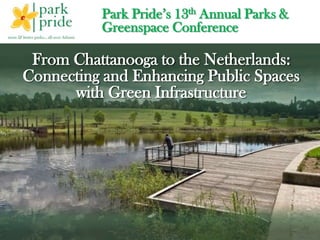
- 1. Park Pride’s 13th Annual Parks & Greenspace Conference From Chattanooga to the Netherlands: Connecting and Enhancing Public Spaces with Green Infrastructure
- 2. Introduction Panelists • Carol Berz, LCSW, JD, PhD, Councilwoman – City of Chattanooga • Andrew Walter, RLA, Green Infrastructure Project Manager – City of Atlanta • Edgar J. Westerhof, Senior Planner – ARCADIS • Pete Yakimowich, PE, Senior Consultant – ARCADIS • Fernando Pasquel, PE, National Technical Director, Stormwater and Watersheds – ARCADIS • Anwer Ahmed, PE, DWRE, Stormwater Practice Technical Leader – ARCADIS
- 3. Chattanooga –Vision to Reality
- 4. Green Clean Inviting Chattanooga’s Strategic Plan for Green Infrastructure Clean our water Revitalize our neighborhoods & business districts Add value Hard Dirty Hostile
- 5. The midTown Plan CONNECTIVITY Airport + Interstates + Street grid Strategic location – Midtown Creek and Greenway trail systems COMMUNITY Identity & History Engagement DIVERSITY Rich mixture of uses Demographics Biodiversity DURABILITY Stewardship Sustainability Resilience
- 6. I‐75 to AtlantaI‐24 to Nashville Golf Course Airport Golf Course Eastgate Town Center Brainerd Village
- 8. Community revitalization ideas Connectivity Gateway Complete Streets Landmarks Open Spaces
- 9. Brainerd Road at Pisgah Avenue (looking east) – Before
- 10. Brainerd Road at Pisgah Avenue (looking east) – Vision
- 11. Brainerd Road at Eastgate Loop (looking east) – Before
- 12. Brainerd Road at Eastgate Loop (looking east) – Vision
- 13. Flooding
- 14. Impervious Open Space Trees Project Area: 357 Acres Total Impervious: 228 ac. (64%) Total Parking: 140 ac. (39%) % Parking: 61.2% Opportunities to make a big difference
- 15. Strategy + Opportunity = Success
- 16. Opportunistic Solutions More than water! • Clear zone needed • Unoccupied auto dealership • Localized flooding • City compliance Issues • Public safety concerns
- 17. Opportunity
- 18. A Keystone Site
- 19. Original Plan
- 20. Original Plan
- 21. Final Plan
- 22. Clean, Green & Safe
- 23. Notable Accomplishments Area flooding reduced … site handles a 3-inch rainfall Concrete, brick were crushed on site and used at the airport Demolition material was repurposed, reused, or recycled On-site soils were reconditioned Native vegetation planted Airport has a safe clear zone Site transformed into a passive park
- 24. Awards Governors Award for Environmental Stewardship Jay Hollingsworth Speas Airport Award for 2014
- 25. Transformation
- 26. Repurposing masonry and paving
- 27. Funding- A Public Private Partnership Airport Authority City of Chattanooga Volunteers
- 28. Keys to Success Vision + Opportunity Collaboration + Transparency Inclusiveness + Shared success Networking + Champions Funding ... yes but only with above
- 30. Atlanta – McDaniel Branch, South River A Transformative Journey
- 31. It started with a highly degraded stream and surrounding land "We forget that the water cycle and the life cycle are one.” – Jacques Cousteau
- 32. Many storm sewers terminate at the site
- 33. A degraded and wasted resource or … ?
- 34. The transformation started as little shapes on a map Pilot Watershed Improvement Plan (WIP) identifying several potential stream restoration and BMP projects Atlanta Beltline and other Greenspace Initiatives
- 35. We have a vision Improve water quality and aquatic habitat Educate Atlanta’s citizens on factors affecting urban watersheds Showcase feasibility of urban stream restoration Provide amenities for the community that compliment existing and planned green spaces
- 36. Vision turning into reality
- 37. Vision turning into reality
- 38. The stream has been restored
- 39. Stormwater ponds and wetlands are being finished
- 40. Unexpected benefits Projects spurred revitalization of Arthur Langford Park Neighborhood views Beltline connection in new light
- 41. What made this project successful… Vision Funding Partnerships
- 42. Atlanta City Council Office of Watershed Protection Georgia EPD – 319(g) Grant Funds US Army Corps of Engineers Highpoint Estates Neighborhood Association Atlanta Beltline Atlanta Parks Department Champions and partners
- 43. Rotterdam to New York: Living and Thriving with Water
- 44. • Introduction • The multi-layered strategy in practice • Challenges from the City of Zutphen • Challenges from the City of Rotterdam • Conclusion Urban Flood Protection as part of a Multi-Layered Strategy
- 45. Introduction • Engineering Degree, Land & Water Management • Post Graduate Degree, Urban Planning • >15 years experience in water management Edgar Westerhof Schiermonnikoog 1977
- 46. Rietmolen, City of Berkelland Wadi in Dutch countryside Introduction
- 47. 19% Top to bottom – 12th century terps, agricultural development of countryside and closing of IJsselmeer Netherlands in the 1st Century The Roots of the Multi-Layered Strategy
- 48. 19% Virtual coastline with 1 meter sea level rise The Roots of the Multi-Layered Strategy Netherlands in the 1st Century
- 49. Rotterdam Amsterdam Zutphen The Multi-Layered Strategy in Practice City of Zutphen
- 51. 1. Planning of a residential area 2. Re-structuring and re-planning 3. Improving public space and accessibility 4. Ambitious sustainability goals 5. Re-development of the landfill area Overall goal: A second life for the 500-acre area Top five development goals:
- 52. The River IJssel Delta City of Zutphen
- 53. City of Zutphen
- 54. City of Zutphen • Urgency to improve public space • Dangerous crossings • Main infrastructure in bad condition • Collapsing 60-year-old sewers • Water system causing problems • Insufficient capacity of sewage treatment plant A dysfunctional system!
- 55. Results after 4 years: • 4 miles of roads and sewers reconstructed • Optimization of water system • Most public and private properties connected to clean storm water sewer • First steps to implementation of “water tax” • Structural collaboration city and local waterboard • A Dutch best practice for process innovation Total investment: € 10,000,000 50% EU subsidy 50% city and private industry Key to Success: collaborating authorities City of Zutphen
- 56. City of Zutphen Development goals: • 1100 houses on 12 acres • Public Private Development • Top level sustainability goals • Bringing dynamics of the river to the residential area • “Water-neutral” footprint
- 57. City of Zutphen
- 58. City of Rotterdam Connecting Water Opportunities to Enhance Open Space
- 61. 19%
- 62. Water Quality & Public Space
- 63. Create a robust and flexible system that allows for adaptation: using public space in the most effective way! Rotterdam Adaptation Strategy Levees + flexible constructions Drainage pipes + water squares Barriers + local green solution Robust and adaptable Protect and be flexible Integrated solutions, all scale! Technical and natural solutions Pumps + green berms
- 64. 19% Water Storage and… • Residential areas • Ecological corridors • Attractive public area • Recreation / sport facilities • Underground parking garage • … BLUE SOLUTIONS: multifunctional
- 65. MORE SPACE FOR WATER
- 67. Multi-functional use of space Success Museumpark Parking: 13.000 yd3 inner city water storage
- 70. Keys to success: multi-layered strategy with new financial arrangements & new governance FLOOD MANAGEMENT Keys to success: Multi-layered strategy with new financial arrangements & new governance
- 72. 19% Measure sustainability progress PREVENTION REDUCING EFFECTS RECOVERY REGION CITY DISTRICT/ STREET BUILDING Back up systems Adapatation Toolkit Serious Gaming by Tygron Innovation “instruments” CBA
- 73. Multiple Lines of Defense 3 2 1 Outer Layer of Defense (Regional) – Larger, engineered solutions Middle Layer of Defense – Connecting “transition” zone Inner Layer of Defense (Local) – Smaller-scale solutions
- 74. Integration brings Collaboration brings Innovation!
- 76. Panel Discussion – Lessons learned and Questions
- 77. Park Pride’s 13th Annual Parks & Greenspace Conference THANK YOU For further information, please contact: Anwer Ahmed 404.952.1643 anwer.ahmed @arcadis-us.com
Editor's Notes
- Carol & Pete’s slides
- Background, NL - US
- My first project, design and engineering of Wadi in 1998 in Dutch countryside including “community outreach”. GI did not exist those days, but common sense did
- 1. Netherlands in 1stcenture, unlivable, mud, water, fully exposed … farmers starting to organize in 800, waterboards start, collective responsibility, start shaping the landscape, integrating water questions in settlments, polders and terpen, first “urban areas” ---- more images / extra slide (rural development, water management 18th century)2. What if statistics proof right, sealevel goes up and rivers reach peak levels – are we going back to 1st century? How do we manage. 2 examples, city of Zutphen and City of Rotterdam. ADD animation
- 1. Netherlands in 1stcenture, unlivable, mud, water, fully exposed … farmers starting to organize in 800, waterboards start, collective responsibility, start shaping the landscape, integrating water questions in settlments, polders and terpen, first “urban areas” ---- more images / extra slide (rural development, water management 18th century)2. What if statistics proof right, sealevel goes up and rivers reach peak levels – are we going back to 1st century? How do we manage. 2 examples, city of Zutphen and City of Rotterdam.
- Edgar’s slides