Nov2008 board meeting_presentation_draft_11192008_1045
•
1 like•1,443 views

The document summarizes the minutes from the November 20, 2008 meeting of the WCB Board. It discusses several items including land management plans in Tehama and Shasta Counties, expansions of ecological reserves and wildlife areas, habitat restoration projects, and a revised conservation easement monitoring policy which establishes requirements for grantees to monitor properties and report any violations.

Recommended
More Related Content
What's hot
Viewers also liked
Viewers also liked (20)
Similar to Nov2008 board meeting_presentation_draft_11192008_1045
Similar to Nov2008 board meeting_presentation_draft_11192008_1045 (20)
More from California Wildlife Conservation Board
More from California Wildlife Conservation Board (9)
Nov2008 board meeting_presentation_draft_11192008_1045
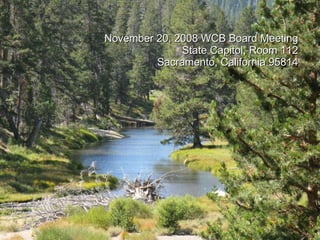
- 1. November 20, 2008 WCB Board Meeting State Capitol, Room 112 Sacramento, California 95814
- 12. 9 San Joaquin River Parkway, River West-Madera Restoration, Planning and Environmental Review Madera County
- 18. 10 Shaver Lake Boat Launch Boarding Float Fresno County Existing floats are disintegrating.
- 19. 10 Shaver Lake Boat Launch Boarding Float Fresno County Decking is worn out.
- 20. 10 Shaver Lake Boat Launch Boarding Float Fresno County The transition plates are not to ADA standards.
- 21. 10 Shaver Lake Boat Launch Boarding Float Fresno County All the boarding floats are warped and in need of replacement.
- 22. 10 Shaver Lake Boat Launch Boarding Float Fresno County The 6-foot wide abutment will be replaced to match the new 8-foot wide floats.
- 23. 10 Shaver Lake Boat Launch Boarding Float Fresno County Even at low water levels, the lake is accessible.
- 24. Working and Learning Among the Oaks/Phase II San Luis Obispo County
- 35. 12 Burton Mesa Ecological Reserve, Expansion 1 Santa Barbara County Subject Parcel with Burton Mesa ER in Background.
- 36. 12 Burton Mesa Ecological Reserve, Expansion 1 Santa Barbara County Subject Parcel with Burton Mesa ER to Left and Across Road.
- 37. 12 Burton Mesa Ecological Reserve, Expansion 1 Santa Barbara County Burton Mesa ER interior.
- 38. 12 Burton Mesa Ecological Reserve, Expansion 1 Santa Barbara County Burton Mesa ER interior .
- 40. 13 Western Riverside County MSHCP, Expansions 4 and 5 Riverside County Forested canyon on north side of property – Expansion 4
- 41. 13 Western Riverside County MSHCP, Expansions 4 and 5 Riverside County Chaparral covered south-facing hillside, Expansion 4
- 42. 13 Western Riverside County MSHCP, Expansions 4 and 5 Riverside County Looking northwest along the southern boundary of Expansion 5
- 43. 13 Western Riverside County MSHCP, Expansions 4 and 5 Riverside County Steep south-facing slope, Expansion 5
- 45. 14 Whitewater Canyon, MacKenzie Ranch Riverside County View of subject properties looking easterly. Whitewater River near toe of hill in background. Note substantial riparian forest..
- 46. 14 Whitewater Canyon, MacKenzie Ranch Riverside County View looking southerly to the subject properties.
- 47. 14 Whitewater Canyon, MacKenzie Ranch Riverside County View of Whitewater River that flows south to the subject properties.
- 48. 14 Whitewater Canyon, MacKenzie Ranch Riverside County View of upland portion of subject properties looking north along Whitewater Canyon Road. Properties are on both sides of the roadway. Whitewater River to the right side of picture.
- 50. 15 Crestridge Preserve, South Crest, Expansion 3 San Diego County View to northeast.
- 51. 15 Crestridge Preserve, South Crest, Expansion 3 San Diego County View to southeast.
- 53. 17 Habitat Restoration, Mill Creek Watershed, Phase II Del Norte County View of property looking west from Childs Hill.
- 54. 17 Habitat Restoration, Mill Creek Watershed, Phase II Del Norte County
- 55. 17 Habitat Restoration, Mill Creek Watershed, Phase II Del Norte County Road and restored road in distance.
- 56. 17 Habitat Restoration, Mill Creek Watershed, Phase II Del Norte County This was a road that has been removed in Phase 1.
- 57. 17 Habitat Restoration, Mill Creek Watershed, Phase II Del Norte County
- 58. 17 Habitat Restoration, Mill Creek Watershed, Phase II Del Norte County
- 59. 17 Habitat Restoration, Mill Creek Watershed, Phase II Del Norte County
- 60. 17 Habitat Restoration, Mill Creek Watershed, Phase II Del Norte County Large woody debris placed in the stream to improve fish habitat (Phase 1).
- 61. 17 Habitat Restoration, Mill Creek Watershed, Phase II Del Norte County Another shade house like this one will be built to enhance the nursery capacity.
- 63. 17 Habitat Restoration, Mill Creek Watershed, Phase II Del Norte County Culverts to be removed along with road.
- 65. 18 Honey Lake Wildlife Area Pipeline Lassen County
- 66. 18 Honey Lake Wildlife Area Pipeline Lassen County Existing weed choked ditch will be replaced with a pipeline.
- 67. 18 Honey Lake Wildlife Area Pipeline Lassen County Previous pipeline work results in few weeds and better managed uplands.
- 68. 18 Honey Lake Wildlife Area Pipeline Lassen County Recently restored wetland from earlier WCB project will be tied into the new pipeline.
- 69. 18 Honey Lake Wildlife Area Pipeline Lassen County With better water management, DFG can provide high value upland habitat with much less water and fewer staff.
- 70. 18 Honey Lake Wildlife Area Pipeline Lassen County Installation of pipeline and structures in previous WCB project on the Area.
- 71. 18 Honey Lake Wildlife Area Pipeline Lassen County Honey Lake wetlands provide habitat for a wide range of waterfowl and other species.
- 73. 19 Daugherty Hill Wildlife Area, Expansion 11 Butte County Perennial stream in lower portion of property.
- 74. 19 Daugherty Hill Wildlife Area, Expansion 11 Butte County Portion of the upper meadow looking at high point of property.
- 75. 19 Daugherty Hill Wildlife Area, Expansion 11 Butte County Looking southwest at the forested foothills of Yuba County.
- 76. 19 Daugherty Hill Wildlife Area, Expansion 11 Butte County California Buckeye (Aesculus californica) in full flower.
- 78. 20 Daugherty Hill Wildlife Area, Expansion 12 Yuba County Looking southwest at Daugherty Hill.
- 79. 20 Daugherty Hill Wildlife Area, Expansion 12 Yuba County Blue Oak (Quercus douglasii), Manzanita (sp), and Gray Pine (Pinus sabiniana).
- 80. 20 Daugherty Hill Wildlife Area, Expansion 12 Yuba County In the canyon of Dry Creek.
- 81. 20 Daugherty Hill Wildlife Area, Expansion 12 Yuba County Valley Oak (Quercus lobata) in one of the large meadows.
- 83. 21 Truckee Basin (Perazzo Meadows) Sierra County Timber stands with meadow and Little Truckee River in foreground.
- 84. 21 Truckee Basin (Perazzo Meadows) Sierra County Little Truckee River swimming hole at Old Logging Camp.
- 85. 21 Truckee Basin (Perazzo Meadows) Sierra County Timber stands with meadow and Little Truckee River in foreground.
- 86. 21 Truckee Basin (Perazzo Meadows) Sierra County Timber stands with meadow and Little Truckee River in foreground.
- 88. 22 Elkhorn Basin Ranch Yolo County View of the Walnut orchards on the farm side of the Sacramento River levee.
- 89. 22 Elkhorn Basin Ranch Yolo County View of the Sacramento River side of the levee – Riparian area shelf.
- 90. 22 Elkhorn Basin Ranch Yolo County View of the walnut orchards from levee looking westerly.
- 91. 22 Elkhorn Basin Ranch Yolo County View of row crop areas and orchards in distance from Yolo Bypass levee looking southeasterly.
- 93. 23 Dry Creek Oak Woodland Corridor Yolo County Aerial view of Dry Creek passing through an existing orchard.
- 94. 23 Dry Creek Oak Woodland Corridor Yolo County Current farming practices go right to the green-line of the creek, this project will set back the farming and restore the riparian corridor.
- 95. 23 Dry Creek Oak Woodland Corridor Yolo County Evidence of scouring and sedimentation loss along Dry Creek.
- 96. 23 Dry Creek Oak Woodland Corridor Yolo County This project will help stabilize the channel through revegetation. These undercut trees are all that remain of the riparian habitat on this farm.
- 98. 24 Watsonville Slough Conservation Area, and Expansion 1 Santa Cruz County Looking south across Hanson Slough.
- 99. 24 Watsonville Slough Conservation Area, and Expansion 1 Santa Cruz County View of Hanson Slough and agricultural fields.
- 100. 24 Watsonville Slough Conservation Area, and Expansion 1 Santa Cruz County Pond containing reg-legged frogs.
- 101. 24 Watsonville Slough Conservation Area, and Expansion 1 Santa Cruz County Pelicans in Hanson Slough.
- 102. 24 Watsonville Slough Conservation Area, and Expansion 1 Santa Cruz County Riparian corridor along agricultural fields.
- 104. 25 East Merced Vernal Pool Grassland Preserve, Expansion 6 Merced County Monkey Paw Blossoms in Dry Vernal Pool.
- 105. 25 East Merced Vernal Pool Grassland Preserve, Expansion 6 Merced County Representative Grassland – Large Vernal Pool in Background
- 106. 25 East Merced Vernal Pool Grassland Preserve, Expansion 6 Merced County Biologist John Vollmar (photo permission granted) Trolling Large Vernal Pool.
- 107. 25 East Merced Vernal Pool Grassland Preserve, Expansion 6 Merced County Vernal Pool–Tiger Salamander Larvae, Tree Frog Tadpoles, and Fairy Shrimp
- 108. 25 East Merced Vernal Pool Grassland Preserve, Expansion 6 Merced County Tiger Salamander Larva
- 110. 26 Midland School Oak Woodlands Conservation Easement Santa Barbara County Representative Oak Forest
- 111. 26 Midland School Oak Woodlands Conservation Easement Santa Barbara County Grassy Mountain to Right; Mixed Oak Woodland
- 112. 26 Midland School Oak Woodlands Conservation Easement Santa Barbara County Buck in Oak Woodland
- 113. 26 Midland School Oak Woodlands Conservation Easement Santa Barbara County Representative Oak Savannah
- 115. 27 Palo Verde Ecological Reserve, Expansion 1 Riverside County View of slough looking south, subject on both sides of water.
- 116. 27 Palo Verde Ecological Reserve, Expansion 1 Riverside County View of slough looking south. Colorado River in distance on left side of picture.
- 117. 27 Palo Verde Ecological Reserve, Expansion 1 Riverside County View of eastern edge of subject property looking south. Colorado River in left center of picture.
- 118. 27 Palo Verde Ecological Reserve, Expansion 1 Riverside County View of slough looking north, subject on both sides of water.
- 119. 27 Palo Verde Ecological Reserve, Expansion 1 Riverside County View of subject farmland looking northwest.
- 120. 27 Palo Verde Ecological Reserve, Expansion 1 Riverside County View of farmland looking southeast.
- 121. 27 Palo Verde Ecological Reserve, Expansion 2 Riverside County View of subject looking north.
- 122. 27 Palo Verde Ecological Reserve, Expansion 2 Riverside County View of subject looking northeasterly.
- 123. 27 Palo Verde Ecological Reserve, Expansion 2 Riverside County View of subject looking west.
- 124. 27 Palo Verde Ecological Reserve, Expansion 2 Riverside County View of slough looking southeast.
- 126. 28 Upper Newport Bay Ecosystem Restoration Orange County Tractor grading sand on nesting island for California least tern.
- 127. 28 Upper Newport Bay Ecosystem Restoration Orange County Hydraulic dredge working to deepen channel (see excavation of side walls).
- 128. 28 Upper Newport Bay Ecosystem Restoration Orange County Larger clamshell dredge pulling up sediment from floor of upper bay.
- 129. 28 Upper Newport Bay Ecosystem Restoration Orange County Terns and great egrets show their interest in what the hydraulic dredge is bringing up.
- 130. Revised Conservation Easement Monitoring Policy November 20, 2008
Editor's Notes
- Notes: I added a period to end of 2 nd sentence.
- Note: I changed text.
- Note: I changed text.
- Note: Changed words in sentence.
- Note: Changed sentence.