Mayo Clinic Rochester's 5-year plan
•
1 recomendación•2,928 vistas

Mayo Clinic Rochester's 5-year plan presented to the Rochester City Council.

Recomendados
Recomendados
Más contenido relacionado
La actualidad más candente
La actualidad más candente (20)
Similar a Mayo Clinic Rochester's 5-year plan
Similar a Mayo Clinic Rochester's 5-year plan (20)
Más de Post-Bulletin Co.
Más de Post-Bulletin Co. (20)
Último
Último (20)
Mayo Clinic Rochester's 5-year plan
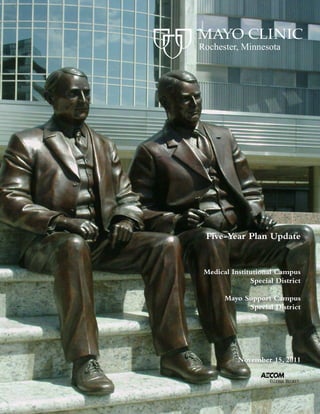
- 1. Rochester, Minnesota Five-Year Plan Update Medical Institutional Campus Special District Mayo Support Campus Special District November 15, 2011
- 2. Mayo Clinic Five-Year Plan Update November 15, 2011 Table of Contents Introduction 1.0 Medical Institutional Campus Special District Sub-District Definitions and Boundaries Mayo Support Campus Special District 2.0 Mayo Property Ownership and Property Acreage 3.0 Building Square Footage 4.0 Mayo Employee Distribution 5.0 Campus Parking and Vehicular Circulation 6.0 Materials Handling and Distribution, Subways and Service Docks 7.0 Utility Infrastructure 8.0 Urban Green Space 9.0 Potential Projects in the Central Sub-District and West Sub-District Mayo Support Campus Special District Outside the Medical Institutional and Special Districts 10.0 Appendix City Plat Block Numbers Central Development Core and Medical Campus Overlay Zones Central Development Core Zoning District Regulations Medical Institutional Campus Special District: Zoning Ordinance #2726 & #3669 Mayo Support Campus Special District: Zoning Ordinance #3534
- 3. Mayo Clinic Five-Year Plan Update November 15, 2011 Introduction This document is being submitted by Mayo Clinic in fulfillment of the provision in Chapter 64D of the Rochester, Minnesota, Code of Ordinances requiring Five-Year Document Updates for the Medical Institutional Campus Special District and Chapter 64N requiring 5 year updates for the Mayo Support Campus Special District. These updated narratives and graphics demonstrate the continued support by Mayo Clinic for the central idea of the Special District land use and zoning controls. Mayo Clinic facilities and operations are organized around the concept of integrated multi-campus wide operations and functional inter-relationships. Specific sections address the 2011 updates to the 1991 Medical Institutional Special District Master Plan Documents and to the 2002 Mayo Support Campus Master Plan: 1. Campus boundary plans and sub-district boundaries 2. Mayo property ownership 3. Building floor area 4. Employee distribution 5. Comprehensive transportation and parking strategies and plan 6. Loading and materials handling programs and enclosed pedestrian circulation plans 7. Utility infrastructure 8. Campus landscape and green space plans 9. Potential projects in the next five-year period 10. Additional supporting documents November 15, 2011
- 4. Part 1.0 Medical Institutional Campus Special District Sub-District Definitions and Boundaries Mayo Support Campus Special District
- 5. Mayo Clinic Five-Year Plan Update November 15, 2011 1.0 Medical Institutional Campus Special District Sub-District Definitions and Boundaries Mayo Support Campus Special District District Boundaries This Five-Year Plan Update addresses three distinct zones for accommodating Mayo Clinic Rochester functions: 1. Primary Medical-Institutional 2. Transition 3. Non-Contiguous Support The Medical-Institutional Special District was created in 1991 to assist and encourage the development of medical institutional land uses in a campus setting at the Mayo Clinic Downtown and St. Marys Hospital Campuses. Primary Medical-Institutional and Transition areas are defined and mapped as part of the Special District, while Non-Contiguous Support properties are not defined or mapped as part of the Special District but are included here for purposes of illustration in support of the concept of integrated campus wide operations, except those functions in the Mayo Support Campus Special District, which are defined separately. District Descriptions The functional areas related to the Special District are defined as follows: Primary Medical-Institutional – The two areas, which correspond to the Mayo Clinic and Rochester Methodist Hospital (“Central Sub-District”) and Saint Marys Hospital (“West Sub-District”) campuses, create a Medical Institutional Special District with two sub- districts, each with their own zoning constraints. These two areas include the core of Mayo Clinic institutional uses, In-Patient and Out- Patient Medical Care as well as Education and Research functions and related medical support functions. November 15, 2011 1.1
- 6. 1.0 Sub-District & District Definitions and Boundaries (continued) Transition – Transition Areas are located at the periphery of both the Central and West Primary Medical-Institutional Sub-Districts. These are intended to provide a buffer, or physical transition, between large-scale, active uses and adjacent neighborhood residential. Some Primary Medical-Institutional uses may occur in transition areas, which will have more zoning restrictions, although the emphasis in such areas will be Extended-Care, Housing and Support Functions. Non-Contiguous Support – To minimize congestion and other potential impacts, Mayo Clinic has decentralized many Support Facilities to dispersed sites outside the Primary Medical-Institutional areas where possible. Buildings on these non-contiguous parcels are subject to underlying, existing zoning code provisions. Uses on Non-Contiguous parcels may include Parking, Receiving and Warehousing, Waste Management and other Support Functions, such as Administration and Research Support, that can functionally be located on dispersed sites. Primary Care Facilities are now located and are being planned outside the primary and transition zones relieve congestion and provide convenience for patients from the Rochester community. The Mayo Support Center Special District was created in 2003 to allow contiguous growth of certain decentralized administrative and support functions and thereby to relieve congestion in the Primary Medical Institutional District. Administrative and Support Functions – Administrative and support functions not needing direct adjacency to primary medical areas may be relocated to this campus. This strategy is intended to relieve the Primary Medical District. November 15, 2011 1.2
- 7. 1.0 Sub-District & District Definitions and Boundaries (continued) Proposed Modifications and Additions to the Medical Institutional Campus Special District While the City of Rochester has grown significantly in population and area through the past quarter-century, Mayo Clinic Rochester has seen an even greater rate of growth. The Campus Special District proposed in 1985, and established in 1991, has effectively allowed both the City and Mayo Clinic to plan infrastructure and facility investment to enable and accommodate this growth, while achieving community goals for growth and vitality of the City and medical campus. It is expected that Mayo Clinic will have continued growth in order to remain at the cutting edge of its global mission in Patient Care, Education and Research. Looking ahead to the next 25 years, this continued growth has created a need to re-align the boundaries, resulting in this proposal to modify the current Central Sub-District as well as add the Second Street Sub- District. The Central Sub-district, with the hub of Mayo Clinic outpatient Practice north of 2nd street SW, has no growth potential toward the East and limited growth potential to the North and South, leaving the West as the only practical area for growth. Growth to the South will be primarily Research and Education. 6th Avenue creates the west boundary for the Sub-district, but only north to 1st Street NW. Since the 2006 Five-Year Update, Mayo has purchased Block 5 north of 1st Street NW between 5th and 6th Avenues NW. We are proposing to continue the boundary north on 6th Avenue from 1st Street NW to Civic Center Drive, which incorporates this property into the Sub-District and more closely aligns to the City’s CDC-Medical zone. This would establish the Sub-district boundary that is 2 blocks in either direction from the 3rd and 4th Avenue pair. With the purchase agreement for the Lourdes properties between 6th and 7th Avenue NW and Center Street W and 2nd Street NW, it also makes sense to include these properties with the Mayo owned property on the SW corner of Center Street West and 6th Avenue, in the Primary Medical Institutional Central Sub-District, as illustrated on 1.6. Second Street Southwest is a key element in the City - as a gateway and transportation corridor, as a transition into the adjacent Kutzky and Historic Southwest Neighborhoods and as a link between Mayo Central and West Campuses. In as much as the Central and West Sub-Districts have different uses, densities and character, and therefore have different zoning constraints, it is logical that the 2nd Street corridor should have a different set of goals and requirements for development. However, current zoning makes it difficult for anyone to develop projects of suitable use and character, particularly on ½ block deep parcels, given current setback, parking and area requirements. At this time, Mayo owns about 42% of the total front footage on 2nd Street SW between the two Primary Medical Institutional Sub-Districts. Creating a Special District or CDC Fringe overlay zone to foster a mix of uses such as housing, low density administrative, appropriate retail, parking and medical support functions such as Gift of Life and Ronald McDonald House, would serve to facilitate sustainable development and pedestrian scale of this corridor. The proposed Second Street Sub-District is shown in the graphic on 1.6. November 15, 2011 1.2.1
- 8. 52 63 MAYO SUPPORT CAMPUS SPECIAL DISTRICT 14 CENTRAL WEST SUBDISTRICT SUBDISTRICT MEDICAL INSTITUTIONAL 14 CAMPUS SPECIAL DISTRICT 52 63 CITY OF ROCHESTER MAYO CAMPUS OVERVIEW November 15, 2011 PRIMARY MEDICAL MAYO SUPPORT CAMPUS LARGE SCALE CAMPUS INSTITUTIONAL SUBDISTRICTS SPECIAL DISTRICT VIEWPORTS N 1.3
- 9. WEST CENTRAL SUBDISTRICT BOUNDARIES November 15, 2011 TRANSITION ZONES PRIMARY MEDICAL INSTITUTIONAL SUBDISTRICTS N 1.4
- 10. WEST CENTRAL SUBDISTRICT BOUNDARIES WITH CURRENT ZONING & PROPERTY OWNERSHIP November 15, 2011 TRANSITION ZONES PRIMARY MEDICAL INSTITUTIONAL SUBDISTRICTS MAYO PROPERTY N 1.5
- 11. WEST CENTRAL PROPOSED SUBDISTRICT BOUNDARIES - Central Subdistrict Modification & Second Street Subdistrict Addition November 15, 2011 TRANSITION ZONES PRIMARY MEDICAL INSTITUTIONAL SUBDISTRICTS SECOND STREET SUBDISTRICT MODIFIED MAYO PROPERTY N 1.6
- 12. NORTHWEST DISTRICT BOUNDARY November 15, 2011 MAYO SUPPORT CAMPUS LEASED CAMPUS SPECIAL DISTRICT OUTSIDE OF DISTRICT N 1.7
- 13. Part 2.0 Mayo Property Ownership and Property Acreage
- 14. Mayo Clinic Five-Year Plan Update November 15, 2011 2.0 Mayo Property Ownership and Property Area The accompanying drawings & charts illustrate current property owndership by Mayo Clinic within and adjacent to the Primary Medical-Institutional Sub-Districts, within the Mayo Support Campus Special District as well as properties outside the Districts. Special District Area Primary Medical Insitutional Districts 1/1/2006 1/1/2011 Central Sub-District 58.41 acres* 56.41 acres West Sub-District 53.00 acres* 52.49 acres 111.41 acres* 108.90 acres Mayo Support Campus Special District 1/1/2006 1/1/2011 Mayo Support Center 57.14 acres 57.14 acres 57.14 acres 57.14 acres Non-Contiguous Support Area Mayo Clinic owned property outside of the Sub-Districts but within Rochester city limits. 1/1/2006 1/1/2011 Out of District 311.00 acres 313.39 acres 311.00 acres 313.39 acres The boundaries as shown are approximate and are intended for illustrative purposes only. These boundaries are intended to delineate the amount of Mayo-owned property within the scope of this mapping project and were obtained from Mayo, and McGhie & Betts. *In 2010 and 2011 a detailed inventory of Mayo Buildings and Property Area was completed. The 2011 areas above reflect these calculations and are more accurate than what was recorded in the 2006 Five-Year Plan Update. November 15, 2011 2.1
- 15. Mayo Clinic Rochester PROPERTY AREA SUMMARY (as of 12/31/10) November 15, 2011 CENTRAL SUB-DISTRICT (Downtown Campus) TOTAL AREA (acres) LOT 2006 2011 Baldwin Building/Parking Ramp/Traveler's Hotel 2.18 Charlton/ Eisenberg/ Charlton North/Colonial/ Parking Lot #14 9.18 Charter House 2.23 Dan Abraham Healthy Living Cent 1.17 Damon Patient-Visitor Parking Ramp/Statuary Park, including street 1.36 Employee Parking Ramp - East 0.65 Employee Parking Ramp - West 1.57 First Street Ramp 0.88 FranklinStation/Parking Lot #19 1.00 Graham Parking Ramp 0.86 Graham Building and Parking Lot #1 0.99 Guggenheim/ Hilton/ Mitchell Student Center Building 2.03 Gonda /Mayo Building, including vacated street 4.14 Harwick/Medical Science Building/Parking Lot #5, including vacated street 2.17 Hope Lodge 1.80 Johnson Building / Prospect Utility Plant/ Parking Lot #20 1.75 Opus /MRI Research Building/Parking Lots #3 and #3A 2.20 2 20 Ozmun Parking Ramp/Ozmun East/Center/West Building 3.62 Plummer/Siebens/Annenberg Plaza 1.33 RMH Maintenance Garage/Parking Lot #22 0.72 Parking Lot #6 (South of Guggenheim) 2.90 Parking Lots #2 and #7 / 428 Building 2.77 Parking Lot #10 1.38 Parking Lot #11 1.38 Parking Lot #15 1.12 Parking Lot #28 0.43 Gift of Life - Phase 1 (in Transition Zone) 1.06 Parking Lot #17 (in Transition Zone) 0.51 *In 2010 and 2011 a detailed inventory of Mayo Buildings and Property Area was completed. The 2011 areas above reflect these calculations and are more accurate than what was recorded in the 2006 Five-Year Plan Update. November 15, 2011 2.2
- 16. Parking Lot #26 (in Transition Zone) 0.46 Parking Lot #27 (in Transition Zone) 0.65 Parking Lot #29 (in Transition Zone) 1.92 CENTRAL SUBTOTAL 58.41 56.41 WEST SUB-DISTRICT (Saint Mary's Campus) TOTAL AREA (acres) LOT 2006 2011 West Sub-District 53.00 52.49 West Sub-District Transition Zone WEST SUBTOTAL 53.00 52.49 MAYO SUPPORT CAMPUS SPECIAL DISTRICT (Northwest Campus) TOTAL AREA (acres) LOT 2006 2011 SN Mayo Support Center 57.14 57.14 MSC SUBTOTAL 57.14 57.14 MAYO SPECIAL DISTRICT ACREAGE TOTAL 168.55 168 55 166.04 166 04 *In 2010 and 2011 a detailed inventory of Mayo Buildings and Property Area was completed. The 2011 areas above reflect these calculations and are more accurate than what was recorded in the 2006 Five-Year Plan Update. November 15, 2011 2.3
- 17. OUTSIDE DISTRICT (Mayo Owned) TOTAL AREA (acres) LOT 2006 2011 Archive Warehouse 1.08 Development Project Support 3.10 East Shuttle lot #35/South Warehouse 9.45 Facilities Warehouse 4.09 Foundation/Walter /Damon Houses 3.20 Gift of Life - Phase 2 0.84 Gold Cross North 1.15 Incinerator/Gold Cross South 37.88 Institute Hills 192.09 Lots on West of SMH on 14th Avenue 0.88 Mayo Empl. Federal Credit Union - Cascade Lake 3.45 Mayo Family Clinic NE 9.94 Mayo Family Clinic site SW 6.82 Mayo Inventory Center 8.16 North Warehouse 2.39 Parking Lot 16 (Foundation House West) 0.35 Parking Lot #31 and 2nd Street Inn & Suites 2.01 Parking Lot #32 1.07 Parking Lot #33 (part that is outside of Sub-district) 1.92 Franklin Warehouse 0.94 Ronald McDonald House 0.77 Rosa Parks Pavilion 0.30 Stabile Building 0.47 201 Building 0.49 0 49 Technology Drive Center 8.52 West Shuttle Lot #36 12.06 MAYO-OWNED OUTSIDE SUBTOTAL 311.00 313.39 OUTSIDE DISTRICT ACREAGE TOTAL 311.00 313.39 *In 2010 and 2011 a detailed inventory of Mayo Buildings and Property Area was completed. The 2011 areas above reflect these calculations and are more accurate than what was recorded in the 2006 Five-Year Plan Update. November 15, 2011 2.4
- 18. SUMMARY OF TOTALS: TOTAL AREA (acres) LOT 2006 2011 Central Sub District Area Total 58.41 56.41 West Sub District Area Total 53.00 52.49 Mayo Special Sub District Area Total 57.14 57.14 Outside District Area Total 311.00 313.39 MAYO ROCHESTER ACREAGE TOTAL 479.55 * 479.43 * *In 2010 and 2011 a detailed inventory of Mayo Buildings and Property Area was completed. The 2011 areas above reflect these calculations and are more accurate than what was recorded in the 2006 Five-Year Plan Update. November 15, 2011 2.5
- 19. WEST CENTRAL MAYO / PROPERTY OWNERSHIP November 15, 2011 MAYO PROPERTY MAYO BUILDING NON-MAYO BUILDING N 2.6
- 20. NORTHWEST MAYO / PROPERTY OWNERSHIP November 15, 2011 MAYO PROPERTY MAYO BUILDING NON-MAYO BUILDING N 2.7
- 21. 52 63 MAYO NORTHWEST SUPPORT CLINIC CENTER SITE NORTHEAST MAYO TECHNOLOGY CLINIC SITE INVENTORY CENTER DRIVE FACILITIES WAREHOUSE ARCHIVE DEVELOPEMENT WAREHOUSE PROJECT SUPPORT GOLD CROSS NORTH NORTH 14 WAREHOUSE WEST EMPLOYEE SHUTTLE LOT EAST EMPLOYEE SHUTTLE LOT AND FOUNDATION SOUTH WAREHOUSE 14 HOUSE SOUTHWEST CLINIC SITE FRANKLIN MAINTENANCE FACILITY INSTITUTE HILLS FARM 52 WASTE MANAGEMENT FACILITY & GOLD CROSS SOUTH 63 CITY OF ROCHESTER MAYO / PROPERTY OWNERSHIP November 15, 2011 NON-CONTIGUOUS PRIMARY MEDICAL MAYO SUPPORT CAMPUS LARGE SCALE CAMPUS MAYO PROPERTY INSTITUTIONAL SUBDISTRICTS SPECIAL DISTRICT VIEWPORTS N 2.8
- 22. Part 3.0 Building Square Footage
- 23. Mayo Clinic Five-Year Plan Update November 15, 2011 3.0 Building Square Footage The charts on the following pages summarize total Mayo building square footage within Central and West Sub-Districts, as well as the Mayo Support Campus Special District. Description of Building Area Summary The spread sheet and drawings show total building area distributed in each Sub- and Special District. Area for Support Functions such as Utility Plants, Parking and ancillary space within Sub-Districts, Warehouses outside the Sub-District, and leased space for Support in the Central Development Core are listed separately. Floor Area Ratio Central Sub-District (Downtown Campus): Maximum Floor Area Ratio (F.A.R.) allowable – 6.0 1/1/2006 1/1/2011 Total Area in Structures 9,103,578 SF 9,513,389 SF Total Parking Structure Area - 1,951,383 1 951 383 SF - 2,371,282 2 371 282 SF Total Building Area 7,152,195 SF 7,142,107 SF Total Land Area* ÷ 2,544,340 SF ÷ 2,457,220 SF Actual F.A.R. 2.81 2.91 *In 2010 and 2011 a detailed inventory of Mayo Buildings and Property Area was completed. The 2011 areas above reflect these calculations and are more accurate than what was recorded in the 2006 Five-Year Plan Update. November 15, 2011 3.1
- 24. West Sub-District (Saint Marys Campus): Maximum Floor Area Ratio (F.A.R.) allowable – 4.0 1/1/2006 1/1/2011 Total Area in Structures 3,663,107 SF 3,649,033 SF Total Parking Ramp Area - 972,902 SF - 972,902 SF Total Building Area 2,690,205 SF 2,676,131 SF Total Land Area* ÷ 2,308,680 SF ÷ 2,286,464 SF Actual F.A.R. 1.17 1.17 Mayo Support Campus Special District: Maximum Floor Area Ratio (F.A.R.) allowable – 0.5 1/1/2006 1/1/2011 Total Area in Structures 249,708 SF 249,708 SF Total Parking Ramp Area - 0 SF - 0 SF Total Building Area 249,708 SF 249,708 SF Total Land Area* ÷ 2,489,018 SF ÷ 2,489,018 SF Actual F.A.R. 0.10 0.10 *In 2010 and 2011 a detailed inventory of Mayo Buildings and Property Area was completed. The 2011 areas above reflect these calculations and are more accurate than what was recorded in the 2006 Five-Year Plan Update. November 15, 2011 3.2
- 25. Mayo Clinic Rochester BUILDING SQUARE FOOTAGE SUMMARY (as of 12/31/10) November 15, 2011 CENTRAL SUB-DISTRICT (Downtown Campus) TOTAL GROSS SQ. FT. CODE BUILDING 2006 2011 BA Baldwin Building 226,710 225,734 CH Charlton Building 305,092 307,500 CN Charlton North Building 64,730 64,730 CO Colonial Building 65,300 63,620 CR Charter House 517,616 517,616 DA Dan Abraham Healthy Living Center (DAHLC) 0 124,483 DR Damon Parking Ramp 0 3,568 EI Eisenberg Building 808,337 764,515 FK Franklin Heating Station 173,329 173,329 GN Generator Building - Methodist 2,087 2,087 GO Gonda Building 1,576,029 1,535,988 GR Graham Building 18,272 18,439 GU Guggenheim Building 545,847 545,070 HA Harwick Building 178,500 181,731 HI Hilton Building 417,771 405,802 JP Johnson Building 0 14,360 MA Mayo Building 1,132,843 1 132 843 1,141,370 1 141 370 MI Mitchel Student Center 31,596 31,596 MR Connelly Building 17,228 9,723 MS Medical Sciences Building 164,988 164,988 OC OE OW Ozmun Buildings 240,495 240,495 OP OPUS Building 0 39,251 PL Plummer Building 257,659 257,659 PR Prospect Utility Plant 34,174 34,174 RE East Employee Parking Ramp - Aux. Space 4,110 4,110 RW West Employee Parking Ramp - Aux. Space (#9) 6,600 6,600 TL Travelers Hotel 30,000 30,000 SI Siebens Building (& Kahler Plaza Subway) 241,852 228,969 VN 428 Building 0 4,600 November 15, 2011 3.3
- 26. CA College Apartments 48,000 0 - 4th Street Motel 15,000 0 CI Colonial Inn 28,000 0 CENTRAL SUBTOTAL 7,152,165 7,142,107 WEST SUB-DISTRICT (Saint Mary's Campus) TOTAL GROSS SQ. FT. CODE BUILDING 2006 2011 AL Alfred Building 205,008 205,008 CL Chapel 41,134 41,134 CT Convent 46,155 46,155 DO Domitilla Building 291,047 291,047 ER SMH East Employee Ramp - Aux. Space (#34) 2,467 2,467 FR Francis Building 330,340 326,751 GE Generose Building 237,544 237,544 JO Joseph Building 278,129 281,919 LY SMH Laundry Building 46,097 46,097 MB Mary Brigh Building 987,782 988,581 MH OL Marian Hall (Old & New) 106,754 91,680 PP SMH Power Plant 107,198 107,198 SE SMH Service Building 8,321 8,321 WR SMH West Employee Ramp - Aux. Space 2,229 2,229 WEST SUBTOTAL 2,690,205 2,676,131 November 15, 2011 3.4
- 27. MAYO SUPPORT CAMPUS SPECIAL DISTRICT (Northwest Campus) TOTAL GROSS SQ. FT. CODE BUILDING 2006 2011 SN Mayo Support Center 249,708 249,708 MSC SUBTOTAL 249,708 249,708 MAYO SPECIAL DISTRICT SQUARE FOOTAGE TOTAL 10,092,078 10,067,946 OUTSIDE DISTRICT (Mayo Owned) TOTAL GROSS SQ. FT. CODE BUILDING 2006 2011 AW Archive Warehouse 28,716 28,716 CF Cliff House 10,000 10,000 CU Mayo Empl. Federal Credit Union - Cascade Lake - 35,503 DH Damon House 9,652 9,652 DP Development Project Support Services 30,062 30,062 FH Foundation House (Incl. Apartments & Garage) 20,794 20,794 F1 Franklin Warehouse 5,000 5,000 FW Facilities Warehouse - NW 87,692 178,120 GC Gold Cross North 13,906 13,906 GD Gold Cross South 6,142 6,142 IC Mayo Inventory Center Warehouse 69,596 93,678 IH Institute Hills Farm 65,500 65 500 65,500 65 500 IN Incinerator - Medical Waste Facility 33,372 33,372 NE Mayo Family Clinic NE 50,889 50,889 NO North Warehouse 114,573 140,435 PB Pavilion Building 106,680 106,678 ST Stabile Building 210,880 210,880 SW South Warehouse 41,950 41,950 TD Technology Drive Center 0 41,887 TO 201 Building 70,728 70,728 WH Walters House 7,469 7,369 - Credit Union - 41st Street 0 6,079 MAYO-OWNED OUTSIDE SUBTOTAL 983,601 1,207,340 Note: 2006 Total above is different from original 2006 Update Report by 26,812 SF due to erroneously including the 100 1st Ave. Bldg and Kasson Clinic. November 15, 2011 3.5
- 28. NON-OWNED (Leased) TOTAL GROSS SQ. FT. CODE BUILDING 2006 2011 AB Associated Bank 8,671 13,322 AH Assisi Heights 0 18,704 AI Rochester International Airport - - BB Minnesota Bio Business Center 0 69,840 BK Brackenridge Square - MMV 21,746 26,772 BL Blakely Building 5,832 5,832 CE Centerplace 71,111 71,111 FF 41st Street Professional Building (NW Clinic) 80,675 105,631 HO 7th Street NE Professional Buildings (50) 2,600 2,600 IB IBM - Building 20 0 2,700 KA Kahler Grand Hotel 10,947 18,739 KE Kersten Building 1,000 1,670 KP Marriot Hotel (Subway) 440 4,619 LC Landmark Center 32,174 32,987 MY Massey Building 17,739 23,837 N2 40th Avenue Warehouse 9,600 57,502 NX North Mayo Express Care 0 2,500 OG 1937 Building 13,827 17,231 OO 100 First Avenue Building 6,050 6,050 SC 7th Street NE Professional Buildings (112) 4,800 9,843 SU Superior Drive Support Center (Celestica) 208,030 227,866 TT 3033 41st Street 0 9,284 SX South Mayo Express Care 0 546 VH Valley High Business Center 0 22,897 22 897 WF Wells Fargo Building 39,066 39,066 WT Warehouse 2535 0 10,000 NON-OWNED LEASED SUBTOTAL 534,308 801,149 Note: 2006 Total above is different from original 2006 Update Report by 6,050 SF due to erroneously excluding the 100 1st Ave. Bldg. OUTSIDE DISTRICT SQUARE FOOTAGE TOTAL 1,517,909 2,008,489 November 15, 2011 3.6
- 29. PARKING STRUCTURES: CENTRAL SUB-DISTRICT (Downtown Campus) TOTAL GROSS SQ. FT. CODE BUILDING 2006 2011 BR Baldwin Parking Ramp - 8 202,122 202,122 ? Charter House Parking Ramp 63,819 63,819 DR Damon Parking Ramp 299,115 302,683 GP Graham Parking Ramp 229,615 377,753 OR Ozmun Parking Ramp w/ Dock & Link (Lot 21) 200,157 200,157 RE Employee Ramp (East) 246,550 246,550 RW Employee Ramp (West) 710,005 710,005 12 First Street Ramp - 12 (Employee Ramp Block 4) 0 268,193 CENTRAL SUBTOTAL 1,951,383 2,371,282 WEST SUB-DISTRICT (Saint Mary's Campus) TOTAL GROSS SQ. FT. CODE BUILDING 2006 2011 34 SMH East Employee Ramp - Lot 34 379,430 379,430 VR SMH Parking Ramp - West Mary Brigh Ramp 181,950 181,950 WR SMH Parking Ramp - West (Generose) Ramp 411,522 411,522 WEST SUBTOTAL 972,902 972,902 MAYO SPECIAL DISTRICT SQUARE FOOTAGE TOTAL #REF! #REF! NON-OWNED (Leased) TOTAL GROSS SQ. FT. CODE BUILDING 2006 2011 TR * Third Street Ramp (Rental Spaces) 0 171,794 *Not included in 2006 NON-OWNED LEASED SUBTOTAL 0 171,794 PARKING STRUCTURE SQUARE FOOTAGE TOTAL 2,924,285 3,515,978 November 15, 2011 SUMMARY OF TOTALS: 3.7
- 30. TOTAL GROSS SQ. FT. DISTRICT TOTAL 2006 2011 Central Sub District Area Total 9,103,548 9,513,389 West Sub District Area Total 3,663,107 3,649,033 Mayo Special Sub District Area Total 249,708 249,708 Outside District Area Total 1,517,909 2,180,283 MAYO ROCHESTER SQUARE FOOTAGE TOTAL 14,534,272 15,592,413 November 15, 2011 3.8
- 31. WEST CENTRAL MAYO BUILDING AREA November 15, 2011 SAINT MARYS CAMPUS DOWNTOWN CAMPUS OUT OF DISTRICTS LEASED SPACE N Building Square Footage Building Square Footage Building Square Footage Building Square Footage Parking Square Footage Parking Square Footage 3.9
- 32. NORTHWEST MAYO BUILDING AREA November 15, 2011 NORTHWEST CAMPUS OUT OF DISTRICT LEASED SPACE Square Footage Square Footage Square Footage N 3.10
- 33. Part 4.0 Mayo Employee Distribution
- 34. Mayo Clinic Five-Year Plan Update November 15, 2011 4.0 Mayo Employee Distribution The accompanying graphic shows employee distribution by building and Sub-District. Employee Summary At year-end 2010, Mayo Clinic and Mayo Foundation employed 32,349 people. This included 31,363 regular employees and 986 temporary employees. 1/1/2006 1/1/2011 Physicians & Scientists (Consultants) 1,630 2,016 Students, Residents, Fellows 2,796 2,789 Allied Health 24,788 27,544 Total 29,214 32,349 Primary Location of Employees: Central Sub-district 15,577 16,419 West Sub-district 8,537 8,689 MSC District 776 974 Outside of Districts Mayo-Owned 1,315 1,784 Non Mayo-Owned 2,221 4,483 Total Employees excluding Temporaries 28,426 Temporary Employees 788 986 Total Employees 29,214 32,349 November 15, 2011 4.1
- 35. Mayo Clinic Rochester EMPLOYEE DISTRIBUTION SUMMARY (as of 12/31/10) November 15, 2011 CENTRAL SUB-DISTRICT (Downtown Campus) EMPLOYEES CODE BUILDING 2006 2011 BA Baldwin Building 639 696 CH Charlton Building 989 1,012 CN Charlton North Building 73 88 CO Colonial Building 69 68 CR Charter House 378 366 DA Dan Abraham Healthy Living Center (DAHLC) 0 76 DR Damon Parking Ramp 0 14 EI Eisenberg Building 2,413 2,258 FK Franklin Heating Station 31 45 GN Generator Building - Methodist 0 0 GO Gonda Building 1,855 2,877 GP Graham Parking Ramp 0 0 GR Graham Building 98 67 GU Guggenheim Building 914 845 HA Harwick Building 407 379 HI Hilton Building 1,700 1,840 JP Johnson Building 0 2 MA Mayo Building 3,518 3,196 MI Mitchel Student Center 118 47 MR Connelly Building 34 20 MS Medical Sciences Building 228 205 OC OE OW Ozmun Buildings 989 1,030 OP OPUS Building 0 52 PL Plummer Building 583 672 PR Prospect Utility Plant 4 4 RE East Employee Parking Ramp - Aux. Space 0 0 RW West Employee Parking Ramp - Aux. Space (#9) 0 0 SI Siebens Building (& Kahler Plaza Subway) 537 560 VN 428 Building 0 0 CENTRAL SUBTOTAL 15,577 16,419 November 15, 2011 4.2
- 36. WEST SUB-DISTRICT (Saint Mary's Campus) EMPLOYEES CODE BUILDING 2006 2011 AL Alfred Building 458 562 CL Chapel 0 0 CT Convent 0 0 DO Domitilla Building 964 1,051 ER SMH East Employee Ramp - Aux. Space (#34) 0 0 FR Francis Building 1,071 1,073 GE Generose Building 597 648 JO Joseph Building 1,322 1,061 LY SMH Laundry Building 132 132 MB Mary Brigh Building 3,653 3,711 MH OL Marian Hall (Old & New) 320 431 PP SMH Power Plant 20 20 SE SMH Service Building 0 0 WR SMH West Employee Ramp - Aux. Space 0 0 WEST SUBTOTAL 8,537 8,689 MAYO SUPPORT CAMPUS SPECIAL DISTRICT (Northwest Campus) EMPLOYEES CODE BUILDING 2006 2011 SN Mayo Support Center 776 974 MSC SUBTOTAL 776 974 MAYO SPECIAL DISTRICT EMPLOYEE TOTAL 24,890 26,082 November 15, 2011 4.3
- 37. OUTSIDE DISTRICT (Mayo Owned) EMPLOYEES CODE BUILDING 2006 2011 AW Archive Warehouse 8 13 CF Cliff House 0 0 CU Mayo Empl. Federal Credit Union - Cascade Lake 0 54 DH Damon House 0 0 DP Development Project Support Services 6 0 FH Foundation House (Incl. Apartments & Garage) 39 31 F1 Franklin Warehouse 0 0 FW Facilities Warehouse - NW 2 3 GC Gold Cross North 28 101 GD Gold Cross South 64 (Inc. Above) IC Mayo Inventory Center Warehouse 49 66 IH Institute Hills Farm 15 15 IN Incinerator - Medical Waste Facility 10 10 NE Mayo Family Clinic NE 91 168 NO North Warehouse 8 18 PB Pavilion Building 443 343 ST Stabile Building 191 541 SW South Warehouse 19 17 TD Technology Drive Center 0 50 TO 201 Building 342 354 WH Walters House 0 0 OUTSIDE OF DISTRICT (MAYO-OWNED) SUBTOTAL 1,315 1 315 1,784 1 784 November 15, 2011 4.4
- 38. NON-OWNED (Leased) EMPLOYEES CODE BUILDING 2006 2011 AB Associated Bank 0 50 AH Assisi Heights 0 0 AI Rochester International Airport 30 28 BB Minnesota Bio Business Center 0 0 BK Brackenridge Square - MMV 105 124 BL Blakely Building 21 26 CE Centerplace 386 325 - Credit Union - 41st Street 0 8 FF 41st Street Professional Building (NW Clinic) 189 337 FM Federal Medical Center 1 2 HO 7th Street NE Professional Buildings (50) 41 35 IB IBM - Building 20 0 0 KA Kahler Grand Hotel 50 50 KE Kersten Building 10 11 KP Marriot Hotel (Subway) 4 4 LC Landmark Center 163 157 MY Massey Building 76 69 N2 40th Avenue Warehouse 0 4 NX North Mayo Express Care 0 13 OG 1937 Building 0 0 OO 100 First Avenue Building 10 12 PH Olmsted Co. Pulic Health Services 1 1 SC 7th Street NE Professional Buildings (112) 10 13 SU Superior Drive Support Center (Celestica) 921 943 TT 3033 41st Street - - SX South Mayo Express Care 0 - VH Valley High Business Center ? 88 WF Wells Fargo Building 203 198 WT Warehouse 2535 - - Other Locations - 1,985 OUTSIDE OF DISTRICT (NON-OWNED) SUBTOTAL 2,221 4,483 OUTSIDE OF DISTRICT EMPLOYEE TOTAL 3,536 6,267 November 15, 2011 4.5
- 39. SUMMARY OF TOTALS: EMPLOYEES DISTRICT TOTAL 2006 2011 Central Sub District Employee Distribution Total 15,577 16,419 West Sub District Employee Distribution Total 8,537 8,689 Mayo Special Sub District Employee Distribution Total 776 974 Outside District Employee Distribution Total 3,536 6,267 MAYO ROCHESTER - EMPLOYEE TOTAL 28,426 32,349 November 15, 2011 4.6
- 40. WEST CENTRAL EMPLOYEE DISTRIBUTION November 15, 2011 SAINT MARYS CAMPUS DOWNTOWN CAMPUS OUT OF DISTRICTS LEASED SPACE N Employees Employees Employees Employees 4.7
- 41. NORTHWEST EMPLOYEE DISTRIBUTION November 15, 2011 NORTHWEST CAMPUS OUT OF DISTRICT LEASED SPACE Employees Employees Employees N 4.8
- 42. 52 63 MAYO FAMILY CLINIC NE 168 EMPLOYEES 14 14 INSTITUTE HILLS FARM ? EMPLOYEES 52 WASTE MANAGEMENT FACILITY 10 EMPLOYEES GOLD CROSS SOUTH (101 ROTATING ROCHESTER EMPLOYEES) AIRPORT 63 28 EMPLOYEES CITY OF ROCHESTER EMPLOYEE DISTRIBUTION November 15, 2011 N 4.9
- 43. Part 5.0 Campus Parking and Vehicular Circulation
- 44. Mayo Clinic Five-Year Plan Update November 15, 2011 5.0 Campus Parking and Vehicular Circulation Philosophy It is the intent and policy of Mayo Clinic to continue to provide a comprehensive transportation program to meet the needs of its patients, staff and paramedical employees. In the Rochester setting, patient and employee transportation needs represent a dynamic situation necessitating constant balancing and adjustment. Mayo’s committed goal is to meet those needs, providing a viable option for all. The integration of Saint Marys Hospital, Rochester Methodist Hospital and Mayo Clinic, has allowed better flexibility in meeting the goal by generating a larger critical mass of operation and providing the opportunity for cross-utilization of many Rochester campus resources. In 2010, Mayo Clinic received the Gold Award for the “Best Workplace for Commuters.” This program serves to recognize employers offering commuter benefits and alternatives to drive- alone commuting. In addition to shuttles, Mayo offers charitable Parking to the Ronald McDonald House and the Gift of Life Transplant House. Transportation and Parking Patients – Once patients and visitors have arrived in Rochester, hotel/motel courtesy vans and the Mayo Patient Shuttle significantly reduce the need for individual vehicles. The Mayo Patient Shuttle carries approximately 600 people per day between Downtown and Saint Marys. Downtown patient parking needs are met by 2,097 spaces located in four parking ramps and one surface lot, including spaces for handicapped. The visitor/patient parking ramps at Saint Marys provide 628 spaces for patient use, including 29 designated for Emergency Room use and designated handicapped spaces. November 15, 2011 5.0 5.1
- 45. Campus Parking and Vehicular Circulation (continued) Staff and Paramedical Employees – Currently Mayo Clinic Rochester has 13,493 staff, resident, employee and student parking spaces. The Charter House ramp with 6 spaces for medical staff and contractors is included in this total. Central Campus - 6,723 West Campus - 2,246 Mayo Support Campus - 700 Outside Special Districts - 3,864 including five off-site locations: (1) West Shuttle Lot located at 24th Avenue and Second Street Southwest (2) East Shuttle Lot located at 1st Avenue and 6th Street Southeast (3) Leased spaces in the Third Street City Ramp at 3rd Street and 1st Avenue Southwest (4) 110 spaces at the Northeast Clinic (5) 815 spaces at Superior Drive Support Center Historically, the estimated demand for and provision of employee parking has been about 50% of total employee FTEs on the downtown and Saint Marys campuses. Mayo encourages individuals to use alternate means of transportation so as to not further contribute to the downtown traffic congestion and pollution, and to assist in energy conservation. This is accomplished through: 1. The subsidized bus program, utilized by over 12,000 employees, offers convenient routes, and monthly discount passes. Employees depend upon this service which includes: Commuter service to surrounding communities, and transit city bus service throughout the city of Rochester with designated park and ride locations for Mayo Clinic. These include: Shopko North, Wal-mart North, Target South, Bethel Lutheran Church, and Cub Foods. 2. Use of carpool vehicles, bicycles and motorcycles as alternatives have been encouraged with special parking privileges. Currently, Mayo Clinic Rochester has 820 individual car pool riders. Mayo provides parking for up to 850 individual bicycles and motorcycle parking for approximately 300 motorcycles per day. Bicycle and motorcycle parking is easily expanded when demand requires. 3. The employee shuttle service carries over 4,000 employees daily between the campuses to meet business needs and to reduce the number of vehicles traveling between sites during the workday. 4. Approximately 900 to 1,000 employees utilize the park and ride lots daily, located at Wal- mart, Bethel Lutheran, Cub, Shopko North and the Shops on Maine (Target). 5. Approximately 50% of employees who qualify and accept campus parking privileges (Saint Marys or downtown) utilize parking on any given day. This is due to varying shift schedules, vacations, education and meeting absences, as well as general business needs outside of Rochester. November 15, 2011 5.2
- 46. Mayo Clinic Rochester VISITOR PARKING CAPACITY SUMMARY (as of 12/31/10) November 15, 2011 CENTRAL SUB-DISTRICT (Downtown Campus) PARKING STALLS CODE PARKING RAMP 2006 2011 BR Baldwin Parking Ramp - 8 151 151 ? Charter House Parking Ramp 0 178 DR Damon Parking Ramp 800 774 RE Employee Ramp (East) 0 0 RW Employee Ramp (West) 0 0 GP Graham Parking Ramp 406 927 OR Ozmun Parking Ramp w/ Dock & Link (Lot 21) 0 0 12 First Street Ramp - 12 (Employee Ramp Block 4) 0 0 CENTRAL RAMP SUBTOTAL 1,357 2,030 PARKING STALLS CODE PARKING LOT 2006 2011 1 Graham Building - Lot 1 0 0 2 Parking Lot 2 0 0 3 Parking Lot 3 0 47 4 Parking Lot 4 0 0 5 Parking Lot 5 0 0 6 Parking Lot 6 0 0 7 Parking Lot 7 0 0 10 Parking Lot 10 0 0 11 Parking Lot 11 0 0 12 Parking Lot 12 0 0 13 Parking Lot 13 0 0 14 Staff Consultant - Parking Lot 14 0 0 15 Parking Lot 15 0 0 18 Christ United Methodist Church 0 0 19 Staff Consultanting / Blood Bank 0 19 20 Parking Lot 20 0 0 November 15, 2011 5.3
- 47. 22 Parking Lot 22 0 0 24 Parking Lot 24 (Closed 7-01-2009) 0 0 25 Parking Lot 25 0 0 28 Parking Lot 28 0 0 29 Brentwood - Parking Lot 29 0 0 37 Parking Lot 37 0 0 24A North of Ozmun 0 1 CENTRAL LOT SUBTOTAL 0 67 CENTRAL DISTRICT VISITOR PARKING TOTAL 1,357 2,097 WEST SUB-DISTRICT (Saint Mary's Campus) PARKING STALLS CODE PARKING RAMP 2006 2011 34 SMH East Employee Ramp - Lot 34 0 0 WR SMH Parking Ramp - West (Generose) Ramp 242 249 VR SMH Parking Ramp - West Mary Brigh Ramp 288 337 WEST RAMP SUBTOTAL 530 586 PARKING STALLS CODE PARKING LOT 2006 2011 33 SMH Parking - Parking Lot 33 0 0 ? SMH ER Parking 28 29 ? SMH West Door Surface Lot 0 13 WEST LOT SUBTOTAL 28 42 WEST DISTRICT VISITOR PARKING TOTAL 558 628 November 15, 2011 5.4
- 48. MAYO SUPPORT CAMPUS SPECIAL DISTRICT (Northwest Campus) PARKING STALLS CODE PARKING LOT 2006 2011 MSC Mayo Support Center Parking 9 9 MAYO SPECIAL DISTRICT LOT SUBTOTAL 9 9 MAYO SPECIAL DISTRICT VISITOR PARKING TOTAL 9 9 OUT OF DISTRICT (Mayo Owned or Leased) PARKING STALLS CODE PARKING RAMP / LOT 2006 2011 TR Third Street Ramp (Rental Spaces) 0 0 35 Off-Site East Shuttle Lot - Lot 35 0 0 NE Northeast Clinic Building Parking 89 188 NW Northwest Clinic Parking Lot 145 75 16 West Foundation House - Parking Lot 16 0 0 17 East Foundation House - Parking Lot 17 0 0 26 Parking Lot 26 0 0 27 B'nai Synagogue 0 0 30 Lourdes - DAHLC - Parking Lot 30 0 0 31 SMH Parking - Parking Lot 31 0 0 32 SMH Parking - Parking Lot 32 0 0 SDSC Superior Drive Support Center Parking 0 0 36 Off-Site West Shuttle Lot - Lot 36 0 0 CU(1) 2nd Street Credit Union 0 0 CU(2) 41st Street Credit Union 0 0 MAYO OWNED SUBTOTAL 234 263 OUTSIDE DISTRICT VISITOR PARKING TOTAL 234 263 November 15, 2011 5.5
- 49. SUMMARY OF TOTALS: PARKING STALLS CODE PARKING RAMP 2006 2011 Central Sub District Visitor Parking Total 1,357 2,097 West Sub District Visitor Parking Total 558 628 Mayo Special Sub District Visitor Parking Total 9 9 Outside District Visitor Parking Total 234 263 MAYO ROCHESTER - VISITOR PARKING TOTAL 2,158 2,997 November 15, 2011 5.6
- 50. WEST CENTRAL VISITOR PARKING & CIRCULATION (Central & West Subdistricts) November 15, 2011 SAINT MARYS CAMPUS DOWNTOWN CAMPUS SURFACE RAMP CAR CIRCULATION N Parking Stalls Parking Stalls BUS CIRCULATION OUT OF DISTRICTS LEASED SPACE Parking Stalls Parking Stalls 5.7
- 51. NORTHWEST VISITOR PARKING & CIRCULATION (Northwest Area) November 15, 2011 NORTHWEST CAMPUS OUT OF DISTRICT SURFACE RAMP CIRCULATION Parking Stalls Parking Stalls LEASED SPACE Parking Stalls N 5.8
- 52. Mayo Clinic Rochester EMPLOYEE PARKING CAPACITY SUMMARY (as of 12/31/10) November 15, 2011 CENTRAL SUB-DISTRICT (Downtown Campus) PARKING STALLS CODE PARKING RAMP 2006 2011 BR Baldwin Parking Ramp - 8 583 540 ? Charter House Parking Ramp 184 6 DR Damon Parking Ramp 0 26 RE Employee Ramp (East) 623 628 RW Employee Ramp (West) 2,315 2,266 GP Graham Parking Ramp 162 0 OR Ozmun Parking Ramp w/ Dock & Link (Lot 21) 498 492 12 First Street Ramp - 12 (Employee Ramp Block 4) 0 828 CENTRAL RAMP SUBTOTAL 4,365 4,786 PARKING STALLS CODE PARKING LOT 2006 2011 1 Graham Building - Lot 1 125 124 2 Parking Lot 2 147 288 3 Parking Lot 3 51 123 4 Parking Lot 4 125 0 5 Parking Lot 5 19 14 6 Parking Lot 6 328 328 7 Parking Lot 7 32 0 10 Parking Lot 10 58 58 11 Parking Lot 11 149 141 12 Parking Lot 12 140 0 13 Parking Lot 13 18 0 14 Staff Consultant - Parking Lot 14 76 80 15 Parking Lot 15 105 105 18 Christ United Methodist Church 87 159 19 Staff Consultanting / Blood Bank 11 0 20 Parking Lot 20 63 97 November 15, 2011 5.9
- 53. 22 Parking Lot 22 60 60 24 Parking Lot 24 (Closed 7-01-2009) 0 0 25 Parking Lot 25 57 55 28 Parking Lot 28 48 48 29 Brentwood - Parking Lot 29 32 140 37 Parking Lot 37 100 106 24A North of Ozmun 0 11 CENTRAL LOT SUBTOTAL 1,831 1,937 CENTRAL DISTRICT EMPLOYEE PARKING TOTAL 6,196 6,723 WEST SUB-DISTRICT (Saint Mary's Campus) PARKING STALLS CODE PARKING RAMP 2006 2011 34 SMH East Employee Ramp - Lot 34 1,158 1,158 WR SMH Parking Ramp - West (Generose) Ramp 922 793 VR SMH Parking Ramp - West Mary Brigh Ramp 125 120 WEST RAMP SUBTOTAL 2,205 2,071 PARKING STALLS CODE PARKING LOT 2006 2011 33 SMH Parking - Parking Lot 33 151 175 ? SMH ER Parking 0 0 ? SMH West Door Surface Lot 0 0 WEST LOT SUBTOTAL 151 175 WEST DISTRICT EMPLOYEE PARKING TOTAL 2,356 2,246 November 15, 2011 5.10
- 54. MAYO SUPPORT CAMPUS SPECIAL DISTRICT (Northwest Campus) PARKING STALLS CODE PARKING LOT 2006 2011 MSC Mayo Support Center Parking 654 700 MAYO SPECIAL DISTRICT LOT SUBTOTAL 654 700 MAYO SPECIAL DISTRICT EMPLOYEE PARKING TOTAL 654 700 OUT OF DISTRICT (Mayo Owned or Leased) PARKING STALLS CODE PARKING RAMP / LOT 2006 2011 TR Third Street Ramp (Rental Spaces) 247 346 35 Off-Site East Shuttle Lot - Lot 35 905 909 NE Northeast Clinic Building Parking 72 110 NW Northwest Clinic Parking Lot 165 288 16 West Foundation House - Parking Lot 16 30 26 17 East Foundation House - Parking Lot 17 37 38 26 Parking Lot 26 28 47 27 B'nai Synagogue 20 47 30 Lourdes - DAHLC - Parking Lot 30 46 32 31 SMH Parking - Parking Lot 31 42 53 32 SMH Parking - Parking Lot 32 98 99 SDSC Superior Drive Support Center Parking 747 815 36 Off-Site West Shuttle Lot - Lot 36 974 946 CU(1) 2nd Street Credit Union 0 83 CU(2) 41st Street Credit Union 0 25 MAYO OWNED SUBTOTAL 3,411 3,864 OUTSIDE DISTRICT EMPLOYEE PARKING TOTAL 3,411 3,864 November 15, 2011 5.11
- 55. SUMMARY OF TOTALS: PARKING STALLS CODE PARKING RAMP 2006 2011 Central Sub District Employee Parking Total 6,196 6,723 West Sub District Employee Parking Total 2,356 2,246 Mayo Special Sub District Employee Parking Total 654 700 Outside District Employee Parking Total 3,411 3,864 MAYO ROCHESTER - EMPLOYEE PARKING TOTAL 12,617 13,533 November 15, 2011 5.12
- 56. WEST SHUTTLE LOT WEST CENTRAL EMPLOYEE PARKING & CIRCULATION (Central & West Subdistricts) November 15, 2011 SAINT MARYS CAMPUS DOWNTOWN CAMPUS SURFACE RAMP CAR CIRCULATION N Parking Stalls Parking Stalls BUS CIRCULATION OUT OF DISTRICTS LEASED SPACE Parking Stalls Parking Stalls 5.13
- 57. NORTHWEST EMPLOYEE PARKING & CIRCULATION (Northwest Area) November 15, 2011 NORTHWEST CAMPUS OUT OF DISTRICT SURFACE RAMP CIRCULATION Parking Stalls Parking Stalls LEASED SPACE Parking Stalls N 5.14
- 58. 52 63 WAL MART PARK & RIDE MAYO SUPPORT NORTH CENTER SHOPKO PARK & RIDE NE CLINIC 14 WEST EMPLOYEE SHUTTLE LOT EAST EMPLOYEE SHUTTLE LOT CUB FOODS 14 BETHEL LUTHERAN PARK & RIDE PARK & RIDE SHOPKO PARK & RIDE 52 63 CITY OF ROCHESTER MAYO PARKING November 15, 2011 MAYO DISTRICTS PARK & RIDE SHUTTLE LOT N 5.15
- 59. Part 6.0 Materials Handling and Distribution, Subways and Service Docks